Fen Drayton Villa Investigations
|
|
|
- Abner Richard
- 5 years ago
- Views:
Transcription


1 Fen Drayton Villa Investigations Excavation Report No. 2 CAMBRIDGE ARCHAEOLOGICAL UNIT
2 OUSE WASHLAND ARCHAEOLOGY Fen Drayton Villa Investigations (Excavation Report No. 2) Leanne Robinson Zeki, MPhil With contributions by Emma Beadsmoore, Chris Boulton, Vicki Herring, Andrew Hall, Francesca Mazzilli, Vida Rajkovaca, Val Fryer, Simon Timberlake Illustrations by Jon Moller and Andy Hall Principal photography by Dave Webb CAMBRIDGE ARCHAEOLOGICAL UNIT UNIVERSITY OF CAMBRIDGE March 2016/ Report No HER Event Number: ECB4702
3 PROJECT SUMMARY An archaeological excavation was undertaken by volunteers and the Cambridge Archaeological Unit as a part of the Ouse Washes Landscape Partnership at the site of a possible Roman Villa at the RSPB s Fen Drayton Lakes reserve, near Cambridge. The fieldwork comprised two 5m x 10m trenches, which were targeted to expose the northern extent of the proposed Roman Villa and southern extent of a potential bathhouse. Excavations revealed additional evidence of Roman occupation, indications of small industry and high-status artefacts. ACKNOWLEDGEMENTS The project was funded by the Ouse Washes Landscape Partnership Project via the Heritage Lottery Fund, for which particular thanks are conveyed to Mark Nokkert of Cambridge Acre. Permission to excavate on the land was provided by the land owner, the RSPB, which was principally overseen by Robin Standring, and the tenant farmer, Chris Wissen. The volunteering was coordinated by Rachael Brown of Cambridgeshire Acre with Grahame Appleby of the CAU. Dr Keith Haylock, University of Aberystwyth undertook the pxrf measurements. Figure 3 s photographs were produced by Emma Harper. Christopher Evans (CAU) was the Project Manager and work on site was completed by volunteers supervised by Jonathan Tabor, Leanne Robinson Zeki and Francesca Mazzilli of the CAU. ii
4 CONTENTS 1. INTRODUCTION 1 Methodology 1 Archaeological and Historical Background 5 2. RESULTS 6 Trench Excavation 6 Trench 1 7 Trench 2 10 Environment and Economic Data 11 Environmental Data 11 Animal Bone 14 Shell 17 Material Culture 17 Worked Flint 17 Roman Pottery 17 Roman Tile 22 Medieval Pottery 23 Fired Clay 24 Burnt, Utilised and Worked Stone 24 Iron Slag 27 Glass Slag or Glaze 27 Glass 29 Roman Coins 29 Metalwork DISCUSSION REFERENCES APPENDICES 34 Outreach 34 Volunteering 34 Public Visits and Open Day 37 Press and Online Presence 37 Volunteer Feedback Form 39 Context Summary 41 Oasis Form 42 iii
5 LIST OF FIGURES Figure 1 Location plan and surrounding archaeology 2 Figure 2 Excavation plan and geophysics results 3 Figure 3 Volunteers completing site tasks 4 Figure 4 Trench 1: Plan and photographs 8 Figure 5 Trench 2: Plan and photographs 9 Figure 6 Recovered artefacts 16 Figure 7 Visitors receiving site tours 36 Figure 8 Site Open Day 37 LIST OF TABLES Table 1 Finds totals 6 Table 2 Summary of Trench 1 features 7 Table 3 Summary of Trench 2 features 11 Table 4 Summary of environmental data 12 Table 5 Summary of faunal data from Trench 1 14 Table 6 Summary of faunal data from Trench 2 15 Table 7 Summary of faunal data from Feature 6 15 Table 8 Flint totals by feature and type 17 Table 9 Romano-British pottery by fabric type 19 Table 10 Romano-British pottery by form 20 Table 11 Catalogue of Roman tile 23 Table 12 Catalogue of burnt, utilised and worked stone data 26 Table 13 pxrf analysis of glass and glaze samples 28 iv
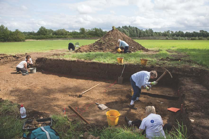
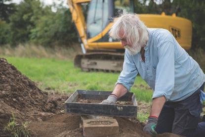
6 1. INTRODUCTION The Cambridge Archaeological Unit (CAU) oversaw a trench-based excavation for volunteers on land situated on the southern edge of the Fen Drayton Lakes RSPB reserve, Fen Drayton, Cambridgeshire (TL352680). The site had been previously evaluated in 1992 (Wait 1992) and using geophysical survey in conjunction with crop marks, as well as the evidence from archaeological trial trenching, a Roman Villa site was proposed. The planned development of the land for aggregate quarrying was never enacted, and instead passed into use by the Royal Society for Preservation of Birds (RSPB). Over the course of two weeks in August 2015, two 5m x 10m trenches were opened in an attempt to expose the northern extent of the villa and the southern end of a proposed bathhouse. The principle research objective of the archaeological evaluation process was to determine the presence or absence of archaeological remains (particularly in regard to a proposed later Roman settlement) and to establish their character and the site s depositional history. Furthermore, the site s potential local, regional and national significance was assessed. However, in terms of providing an experience for the volunteers and visitors the project had much wider objectives of encouraging inclusivity and participation in voluntary projects, arousing an interest in local archaeology and providing an appropriate teaching environment so that volunteers left site with feelings of contribution, accomplishment and increased knowledge. The site s current land-use is for pasture on the southern edge of a RSPB reserve which comprises lakes and wetland areas created by aggregate quarrying. The site itself has not been quarried, and previous landuse appears to have been a combination of pasture with occasional short episodes of cultivation. The site is located on the north/northwest edge of Fen Drayton village (Figure 1). Directly to the east of the site, within the same field boundaries, is a modern lagoon; to its immediate west is a modern reservoir. The ground surface is slightly undulating at approximately 12m OD. The underlying geology is 3 rd river terrace deposits of mainly sand and gravel over Oxford Clay (BGS GeoIndex). Methodology The trenching programme comprised two 5m x 10m trenches covering a total area of 100m 2 (Figure 2). The trenches were targeted in an attempt to expose the proposed Roman Villa and a potential bathhouse area based on location data produced in previous investigations. The trenches were excavated using a tracked 360 excavator fitted with a 2.0m toothless ditching bucket and operated under direct supervision by an experienced archaeologist at all times. Trenches were located using GPS with Ordnance Datum (OD) heights obtained. The spirit of the Ouse Washes Landscape Partnership is to provide experience for volunteer participants (Figure 3). Twenty-nine volunteers took part in the two-week fieldwork programme, collectively totalling 150 days on site; in the CAU s Cambridge office a number of other volunteers engaged in the washing and cataloguing of the finds collected from the excavations. 1


7 The Fens King s Lynn Nene Peterborough Norwich Ely Huntingdon Fen Drayton Ouse Cambridge Ipswich Royston Colchester 0 50 Kilometres metres Reservoir Villa Planting Beds Excavation Areas (FND15) Evaluation Trenches (FDR92) & Excavation Areas (FDR95) Area of Geophysics Test Pits Cropmarks metres Figure 1. Site location plan showing completed archaeological investigations

8 Evaluation Trenches (FDR92) Limits of excavation Excavated Slot Archaeological Feature Cropmarks Tr2 Tr1 N Area of Geophysical Survey 0 20 metres Figure 2. Trench plan showing approximate location of trenches on geophysics results and cropmarks
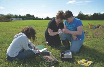
9 Figure 3. Volunteers completing site tasks.
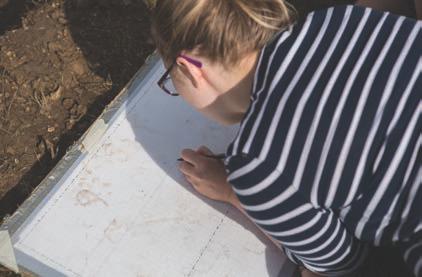
10 A base plan of potential archaeological features was drawn at a scale of 1:50 and subsequently sample excavated with all sediment sieved through a 50mm mesh and all archaeological finds retained. A written record of archaeological features was created using the CAU recording system (a modification of the MoLAS system), features were digitally photographed and sections drawn at a 1:10 scale. Bagged sampling of the archaeological deposits was strategically conducted for wet sieving and flot processing towards the retrieval of environmental data. Information detailing the character of the trenches was recorded on a data sheet that, along with the digital photographic record, has been catalogued together within an archive following the procedures outlined in MoRPHE (English Heritage 2006). These are being stored with the processed material finds record at the CAU offices, under the site code FND15. Archaeological and Historical Background The site is in a landscape of known archaeological activity, evidence for which is provided by previous archaeological investigations as well as cropmarks and aerial photography. The following provides a summary background in order to place the site within its wider context, and since the results of the excavations were exclusively later Roman, detail is focused upon the first few centuries AD. Four evaluation trenches and a geophysical survey completed in 1992 focused on the field in which the current project was located. While the two eastern trenches (oriented north-south where the present lagoon is sited) found no evidence of archaeology, the two cross trenches were positioned to examine the previously identified crop marks and found evidence of what may be the core of a late 4 th century AD settlement (Wait 1992). When combined with the geophysical survey, it was strongly inferred that this settlement consisted of small rectilinear enclosures aligned northwest-southeast and timber structures (see Wait 1992; Figure 1); the apsidal layout at the southern extent of the geophysics results was interpreted to be a possible bathhouse (Evans et al. 2013, 476). Excavations by the CAU during 1993 on the land to the northwest of the site, and west of the modern reservoir, found that during the Iron Age/Romano-British period the field boundaries were slightly remodelled from a landscape of earlier Bronze Age land division. This formed a pasture field and/or water meadow enclosed by a droveway along the western side, a drainage ditch along the north and east and a fence/hedge line on the south (Lucas & Wait 1996) (Figure 1). The pottery assemblage, although small, was early Roman, with the exception of a single sherd of the 3 rd 4 th century AD, and it was suggested that the site was in use throughout the Roman period (Lucas & Wait 1996). Further to the west a major droveway with associated paddocks has been identified from aerial photography referred to as Site III (Wait 1992; Mortimer 1995; and Lucas & Wait 1996). This droveway is purported to be Roman, and appears to turn at its northern end, possibly to join up with the droveway that partially enclosures the pasture field/water meadow identified in the 1993 investigations. 5
11 Additional work by the CAU in 1995 investigated the field to the northeast of the present site (Mortimer 1995). Excavations revealed an Iron Age enclosure with later Roman features superimposed. A single phase of Roman activity was reported, although was not securely dated, and consisted of mainly parallel linear ditches c. 0.70m wide and 0.30m deep situated on three different alignments at intervals of c. 4m (Figure 1). These were interpreted to be an arrangement of planting beds, possibly for vines (Mortimer 1995). Further evidence of the Roman occupation of this locality is apparent from metal detecting finds, including Roman coins found at Fenstanton (CB14761) and a probable Roman grave site at Middleton s Farm, Fen Drayton (CHER03330) that contained two adults and one child with a Roman pot sherd. The wider image of the Roman landscape is perhaps more significant. Though incomplete, the cropmark evidence suggests a close network of small hamlets/farmsteads each between 0.5-l.0km apart along the floodplain (see Wait 1992, Figure l). Even accepting that they may not all be contemporary, this pattern strongly mirrors the girdle pattern of settlement characteristic of the Roman Fenland (Hingley 1989). No other evidence for any Roman building is recorded within a 1.0km radius suggesting that the potential villa in the current project would have been without near neighbours. However, further afield near Godmanchester is a reported villa site (Green 1978), while Late Roman settlement at Fen Drove, Earith (Green & Henig 1988), Knobb s Farm, Somersham (Collins 2011) and Colne Fen, Earith (Evans et al. 2013) all demonstrate smaller fen edge settlements with evidence for buildings strung out along a droveway or alignment. 2. RESULTS Trench Excavation Trench Feature Burnt/worked/ utilised stone Bone Worked flint Finds type by weight (g) Burnt Pottery Metal clay Glass Brick or tile Total T > Total T Total % of Total Table 1. Finds totals by trench, feature and category Total 6 % of Total
12 Thirteen archaeological features were identified, seven in Trench 1 and six in Trench 2 (Figure 4a & Figure 5a), of which eleven were dateable to the Later Roman period (3 rd 4 th century AD), and the remaining two features were likely to be Roman in date. Feature types ranged from small postholes, larger structural postholes, boundary ditches, a gully and linears with a potentially structural function. All features produced finds of various categories, totalling to 84,552g. Finds were almost exclusively from the Roman period, with two Medieval pot sherds and some residual prehistoric flint. The highest concentration of finds, excluding packing stone, occurred in the two larger boundary ditches: F.1 in Trench 1 and F.6 in Trench 2 (Table 1). Trench 1 Oriented approximately north-south, Trench 1 (Table 2) was cut to a length of 10m and a width of 5m (Figure 4a). Seven features were identified, two of which, F.5 and F10, were shallow linears which may represent structural walls or beam slots, the supporting footings having either rotted in situ or been robbed for use elsewhere. F.5 was oriented north-south and terminated 2.75m before reaching F.10, which lay perpendicular on an east-west alignment. The artefacts recovered from these include a pottery assemblage (121g in total) dominated by Late Roman vessel fragments (3 rd 4 th century) and tile fragments (438g) from hypocaust pila and box flue (Timberlake, below). These also suggest a high status structure with the tile supporting the hypothesis of a bathhouse in or near to this trench. Features F.7 and F.8 were shallow postholes containing similar mid Late Roman pottery (Mazzilli, below) and may also be interpreted as structural elements to the north of F.10 and possibly related to construction of the same building. Length (m) 10 Topsoil (m) Width (m) 5 Subsoil (m) 0.15 Orientation N-S Interface [101] (m) n/a Length (m) Width (m) Depth (m) Feature Type Fill Cut Shape Description 1 Ditch NE/SW U-shaped ditch associated - > Linear with bathhouse V-shaped profile. Possibly 5 Gully N/S gully for construction of bath house. 7 Posthole Sub-circular Shallow posthole. 8 Posthole Sub-circular Shallow posthole. 10 Ditch Shallow ditch associated with E/W Linear bathhouse. 12 Linear Irregular/ > Trample or spread at spread Linear >1.2 > northern edge of F Linear NE/SW Shallow wide ditch > Spread Linear associated with bathhouse. Date Late Roman Late Roman Late Roman Late Roman Late Roman Late Roman Late Roman Table 2. Summary of Trench 1 features 7
 F.8 [117] [122] F.10 F.")
![12 [135] [125] F.1 [137] F.](/docs-images/88/116111643/images/13-1.jpg "5 [109] c) d) 2 0 centimetres Figure 4.")
 Plan of Trench 1, b) Photograph showing features at the")
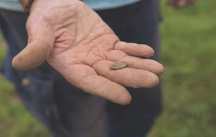
13 Excavated Slot 5 0 a) Archaeological Feature metres F.7 [115] F.13 [140] F.14 [142] b) F.8 [117] [122] F.10 F.12 [135] [125] F.1 [137] F.5 [109] c) d) 2 0 centimetres Figure 4. Trench 1 a possible bathhouse? a) Plan of Trench 1, b) Photograph showing features at the southern extent of Trench 1, c) Photograph of F.1 & F.12 in pro le, d) Late 4th Century coin recovered from F.1

![9 [119] [123] F.2 [103] F.11 [126] c) d) Figure 5.](/docs-images/88/116111643/images/14-1.jpg "Trench 2 a potential Villa a) Plan of Trench 2,")
 Photograph of F.")
14 a) b) Excavated Slot 0 5 Archaeological Feature metres [110] F.4 [106] F.6 F.3 [105] F.9 [119] [123] F.2 [103] F.11 [126] c) d) Figure 5. Trench 2 a potential Villa a) Plan of Trench 2, b) Photograph showing northern end of Trench 2, c) Photograph of F.6 in pro le, d) Photograph of F.2 in pro le.
15 In the southern half of Trench 1 were three linear features. Feature 1 was a welldefined ditch oriented slightly northeast-southwest, and was much deeper than any other feature in the trench (Figure 4b). Features 12 and 13 were wide, flat linears, less well defined and shallower than F.1, and situated on its northern edge to the east and west respectively. All three features contained 3 rd 4 th century pottery, and from F.1 a range of Late Roman artefacts, including imbrex and tegula roof tile, box flue tile, and a late 4 th century coin (Figure 4d; also see Hall, below), were also recovered. Of notable interest was a fragment of tile that had partially split due to exposure to extreme heat. This displayed a vitrified coating on the unbroken surfaces which seems to have result from it having been a part of, or at least present in, a glassworking furnace. While no other direct evidence for a glass-working furnace was found in either of the trenched areas it is worth noting that much of the stone recovered from the postholes and other features was severely burnt, thereby indicating its use in a flue or kiln/furnace structure. Iron-working evidence in the form of slag and a smithy hearth base (SHB) fragment was also found both in this phase of trenching as well as the previous evaluation in It therefore seems likely that some small industrial processes took place somewhere on this site. From a reading of the geophysics results it was expected that the trenching might encounter an apsidal end of a bathhouse. Unfortunately this was not forthcoming. This could mean that the apsidal end is located outside of the trenched area, or that the geophysics results instead represent F.1 in combination with shallower linear features F.12 and F.13 which run on the same orientation on the northern edge of F.1. The relationship between F.1 and these other linear features is difficult to determine due to the small scale of the excavations. The similarity of contexts within these three features suggests that they may be contemporary. It is possible that the shallower features in the north half of the trench represent the northern extent of the potential structure evidenced by F.5 and F.10. Together, these four features could illustrate three sides of a bathhouse or other high status Roman building. Feature 1 may also be related to the construction of this potential building, but may equally be a field boundary connected to a system of pastures, for which there are hints of a trace in the results of the geophysical survey, slightly outside of the potential building, with primary silting also sometime in the later 4 th century. Trench 2 Trench 2 was oriented approximately north-south and cut to a length of 10m and a width of 5m (Figure 5a). Six features were identified in this trench (Table 3). Two large postholes, F.2 and F.4 were each approximately 0.9m x 0.4m and ovoid in shape and contained substantial amounts (10,374g and 24,732g respectively) of large burnt stone (Timberlake, below), used as packing around large wooden posts. These features were aligned on an east-west orientation, had shallow flat-bottomed profiles (Figure 5d) and contained pottery sherds dated to 3 rd 4 th century AD along with both residual and intrusive wares. F.4 also contained a small bronze coin dating to the second half of the 4 th century AD. To the north of these large postholes was a smaller posthole, F.3. Again, slightly ovoid in shape (c. 0.45m x 0.25m) and containing heat-affected packing stones, but lacking any ceramics. 10
16 In the southern half of the trench were three additional features. Feature 11 was masked by the trench edge, but from what could be excavated it appeared to be a shallow pit or posthole, and contained a sherd of 3 rd 4 th century pottery. A very narrow and shallow possible gully feature, F.9, projected northeast-southwest to the north of F.11, and joined ditch F.6 (Figure 5a). No dateable material was recovered from this feature. Ditch F.6 was oriented approximately east-west, and varied in width between 1.35m and 1.6m with a U-shaped profile (Figure 5c). This was filled with a mixture of deposits slumping from the sides, with additional silting episodes and dumped lenses of charcoal-rich hearth-derived sediments [114] and [133] that also contained relatively high concentrations of animal bone and pottery, again mostly dating to the 3 rd 4 th century AD. Amongst the other finds recovered from F.6 were a fragment of glazing glass, a further fragment of glass (see Herring, below), and three iron nails. These contexts may suggest that a midden was situated nearby. Length (m) 10 Topsoil (m) 0.3 Width (m) 5 Subsoil (m) 0.15 Orientation N-S Interface [101] (m) Feature Type Fill Cut Shape 2 Large posthole Length (m) Width (m) Depth (m) Sub-oval Posthole Sub-oval Large posthole 6 Ditch Sub-oval , 112, 113, , 129, 130, 131, 132, 133, 134, 138, Gully? Pit/ Posthole? Table 3. Summary of Trench 2 features E/W Linear NE/SW Linear Description Shallow posthole. Possibly for structural posts. Shallow posthole. Possibly for structural posts. Shallow posthole. Possibly for structural posts. U-shaped ditch associated with high status occupation. Date Late Roman Roman? Late Roman Late Roman Shallow, narrow gully? Roman? Sub-oval Shallow pit/posthole? Late Roman Environment and Economic Data Environmental Data Val Fryer Samples for the retrieval of the plant macrofossil assemblages were taken from ditch and gully fills and from distinct spreads of charred material and a total of eight were submitted for assessment. The samples were bulk floated by CAU and the flots were collected in a 300 micron mesh sieve. The dried flots were scanned under a binocular microscope at magnifications up to x16 and the plant macrofossils and other remains noted are listed in Table 4. Nomenclature within the table follows Stace (2010). All plant remains were charred. Modern fibrous roots were also recorded. 11
17 Results Cereal grains/chaff and seeds of common weeds are present at a low to moderate density within all eight assemblages. Preservation is moderately good, although some grains are puffed and distorted, probably as a result of combustion at very high temperatures. Sample No Context No Feature No. F6 F10 F5 F12 F1 F13 Feature type Ditch Ditch Ditch Ditch Gully Spread Ditch Spread Cereals Hordeum sp. (grains) x xx x x (rachis nodes) x x Hordeum/Secal e cereal e type (rachis nodes) xx Triticum sp. (grains) x x x x x (glume bases) (spikelet bases) (rachis internodes) T. spelta L. (glume bases) x x x Cereal indet. (grains) x xx x xfg x xx x (detached embryos) (basal rachis node) Her bs x x Anthemis cotula L. x x x x Bromus sp. xcf x xcf x Centaurea cyanus L. C. nigra L. x Chenopodiaceae indet. Fabaceae indet. x x Fallopia convolvulus (L.)A.Love xx x Hyoscyamus niger L. x Small Poaceae indet. x x x Rumex sp. x xcf Other plant macrofossils Charcoal <2mm xxx x xx x x x xx x Charcoal >2mm xx x x x x Charcoal >5mm x x x Charcoal >10mm x Charred root/stem x Indet, culm node x Indet. seeds x x x x Other remains Black porous 'cokey' material x x x x x Black tarry material x Fish bone x Small coal frags. x x Vitreous material x x Sample volume (litres) Volume of flot (litres) <0.1 <0.1 <0.1 <0.1 <0.1 <0.1 <0.1 <0.1 % flot sorted 100% 100% 100% 100% 100% 100% 100% 100% Table 4. Summary of environmental data Key to Table x = 1 10 specimens xx = specimens xxx = specimens fg = fragment cf = compare x x x x 12
18 Barley (Hordeum sp.) and wheat (Triticum sp.) grains are recorded, with barley occurring marginally more frequently than wheat. Chaff is generally scarce, but barley and barley/rye-type rachis nodes are recorded along with spelt wheat (T. spelta) glume bases. Weed seeds are scarce, with most occurring as single specimens within an assemblage. All are of common segetal weeds, with taxa noted including stinking mayweed (Anthemis cotula), brome (Bromus sp.), cornflower/knapweed (Centaurea sp.), black bindweed (Fallopia convolvulus), small grasses (Poaceae) and dock (Rumex sp.). Charcoal/charred wood fragments are present throughout, with the highest density occurring within the assemblage from Sample 1 (ditch F.6 [133]). Much of the material appears rounded and abraded, possibly suggesting that it was exposed to the elements for some period prior to incorporation within the feature fills. Other remains are very scarce. However, black porous and tarry residues are recorded along with small spherules of vitreous material, and it is thought most likely that all are derived from the high temperature combustion of organic remains (including cereal grains) and straw/grass or silica rich ash. In summary, although all eight assemblages are small (i.e. <0.1 litres in volume), cereals and seeds are recorded throughout, albeit at a low density. It would appear most likely that the remains are largely derived from burnt cereal processing waste, much of which was probably accidentally incorporated within the feature fills. Although these remains could suggest that cereal processing was occurring within the near vicinity, it should be noted that processing waste was also frequently used as tinder/kindling/fuel for a range of both domestic and light industrial purposes. The slight predominance of barley within the assemblages may be of note, as this was a grain that was little favoured for human consumption during the Roman era, so may be indicative of cereal destined for use as animal fodder. Whatever the source of this material, the presence of seeds of stinking mayweed would appear to suggest that at least some of the cereals were being grown on the clay rich soils which surround the Fen Drayton area. As none of the assemblages contain a sufficient density of material for quantification (i.e specimens), no further analysis is recommended. However, a summary of this assessment should be included within any publication of data from the site. Animal Bone Vida Rajkovaca Recovered from two trenches, the assemblage had a raw count of 336 fragments and a total weight of 2663g. Following the analysis, some 209 assessable specimens were recorded, less than a third of which was identified to species level (67 specimens or 32% of the assemblage). Bone came from a number of contexts, all dated to the later Roman period. Only bone recovered from the hand excavation and sieving processes have been assessed here. Processing of environmental bulk samples did not result in the recovery of any microfauna, avian fauna or fish bone and the unidentifiable mammalian bone crumbs recovered are not included in this assessment. Based on the chronology of the material, the assemblage will be considered as a whole, with division only being made between the two trenches. 13
19 The assessment gives basic consideration of the assemblage in terms of quantity and the character of faunal material. Identification, quantification and ageing The zooarchaeological investigation followed the system implemented by Bournemouth University with all identifiable elements recorded (NISP: Number of Identifiable Specimens) and diagnostic zoning (amended from Dobney and Reilly 1988) used to calculate MNE (Minimum Number of Elements) from which MNI (Minimum Number of Individuals) was derived. Identification of the assemblage was undertaken with the aid of Schmid (1972), and reference material from the Cambridge Archaeological Unit. Taphonomic criteria including indications of butchery, pathology, gnawing activity and surface modifications as a result of weathering were also recorded when evident. Undiagnostic fragments were assigned to a size category. Preservation, fragmentation and taphonomy The overwhelming majority of the assemblage was recorded with moderate level of preservation (193 specimens/92%). Some twenty specimens showed severe exfoliation, erosion and weathering. There were no complete specimens available for measurement, apart from four carpals and phalanges. Gnawing was recorded on ten specimens and only four had cut marks. Trench 1 Bone was dominated by the medium-sized domesticates, especially ovicapra (Table 5). The main difference in the faunal signature between the two trenches was the presence here of fish: a single vertebra fragment from F.1. This feature was the largest bone deposit from site, with 122 assessable specimens and a weight of 1731g (58% of the assemblage y count and 65% by weight). One of the two ageable mandibles came from F.1, suggesting the animal was slaughtered in its second year. Some of the cruder chop marks were recorded from this feature, especially on larger elements. A final point to note is the presence of later intrusive material, based on the general appearance of bone and the size of animals recovered from F.1. F.1 F.5 F.7 F.10 F.13 Total Taxon [100] [108] [116] [124] [141] NISP Cow Sheep/ goat Pig Horse Sub-total to species Cattle-sized Sheep-sized Mammal n.f.i Bird n.f.i Fish n.f.i Total Table 5 Number of Identified Specimens for all species from Trench 1; the abbreviation n.f.i. denotes the specimen could not be further identified. 14
20 Trench 2 With the exception of F.6, features recorded in Trench 2 contained very little animal bone waste. Sheep/goat was the dominant species, followed by pig (Table 6 and 7). Larger domesticates like cow and horse were also recorded, in small numbers. The unidentified bone count also seems to suggest ovicapra were the most common than cattle. A look at the distribution of skeletal elements, though small, shows a prevalence of skull, mandibular (loose teeth) and lower limb elements. Bearing in mind low numbers, this near absence of meat-bearing elements is usually taken to suggest on-site rearing and an export of meat. Taxon [101] F.2 F.4 F.9 F.11 [102] [107] [120] [127] Total NISP Sheep/ goat Sub-total to species Cattle-sized Sheep-sized Total Table 6. Number of Identified Specimens for all species from Trench 2 by feature. Taxon F.6 [111] [112] [113] [128] [130] [131] [132] [133] Total NISP Cow Sheep/ goat Pig Horse Chicken Sub-total to species Cattle-sized Sheep-sized Total Table 7. Number of identified Specimens for all species from F.6 in Trench 2 only. In an assemblage of later Roman date, a prevalent sheep component certainly stands out. It is commonly accepted that across the country cattle were the dominant species in the period, associated with the preference for beef believed to have been imported from the Continent by Roman legions. The prevalent cattle component is what traditionally characterises Romanised settlements, making the prominence of sheep in the current project slightly unusual. Some authors argue that the higher numbers of sheep reflect a continuation with Iron Age tradition (e.g. King 1999), which is a very unlikely scenario here, due to a lack of Iron Age and early Roman evidence suggesting the site was not continually occupied throughout the transition period. If it was not the cultural preference influencing the choice of animals, then we could look for answers in the environment. Given that sheep are more dominant on well-drained highlands, and tend to be much more prone to foot rot than cattle, the low-lying wetland of the Fen edge may not have been an environment especially suitable for sheep herding. It is perhaps possible that, although Roman, the settlement utilised the essences of the Iron Age economy for a long time into the Roman period. 15

")
")
 box flue fragment")
21 centimetres Figure 6. Recovered artefacts a) red-slipped flagon, b) painted bowl fragments with spiral motif, c) refitted whetstone, and d) box flue fragment with straight comb decoration.
22 Although the assemblage is small, and thereby quantitatively insignificant, and bearing in mind that the ratio of species is not the definitive sign of a site s economy practices, further study on fauna from Fen Drayton could perhaps give us a slightly different interpretation of Romano-British husbandry practices in the Fens to what we currently know. Shell Christopher Boulton The site s small shell assemblage consisted of 12 fragments of the European Flat oyster family (Ostrea edulis) which weighed a total of 25g. Examination was by eye, paying particular attention to identifying right or left valves, evidence of infestation or indicators of human consumption. The identification of organisms infesting oyster shell can provide information about the local and regional environment and may be used to identify origins of cultivation (Claassen 1998). However, only a single small fragment of oyster shell with a calcareous worm-tube possibly from a Pomatoceros triqueter (Winder 2011) was found in F.1. The assemblage contains one small almost complete shell that can be identified as a right valve (F.3), with the majority of the 12 pieces of oyster shell being too fragmented and worn to accurately identify signs of human consumption. The majority of the assemblage is associated with Late Roman features that also contained amounts of domestic materials. The low frequency of the assemblage suggests that oyster was not being consumed in large quantities, but their deposition with other detritus may indicate the presence of a nearby midden. Material Culture Worked Flint Emma Beadsmoore A total of ten (24g) flints were recovered from the site: eight of which were unburnt and worked, whilst two (4g) were burnt and unworked. The flints are listed by type and feature in Table 8. The assemblage recovered from the site comprises flint-working waste and tools. Two of the waste flakes, recovered from F.1 and F.6, are comparable to material recovered from Late Mesolithic/Early Neolithic assemblages. The tools comprise two Early Bronze Age thumbnail scrapers, from F.2 and F.13 and a retouched flake from F.6, also potentially dated to the Early Bronze Age. The material therefore provides evidence, albeit limited, of background prehistoric activity on site. No further work is required on the limited flint assemblage. Feature Secondary flake Tertiary flake Finds type by quantity Thumbnail scraper Retouched flake Unworked, burnt fragment Total Total Table 8. Flint totals by feature and type 17
23 Roman Pottery Francesca Mazzilli A small assemblage of 423 sherds of Romano-British pottery weighing 4134g (mean sherd weight 9.77g; 2.33 EVEs) was recovered. Although not particularly large, this represents the first assemblage recovered from a relatively more extended excavation in Fen Drayton if we combine it with earlier work. Prior to this, trial trenches of a total of c. 1600m (3040m 2 ) produced less than 5kgs of Roman pottery (Going in Wait 1992). The pottery was examined and details of fabric, form, decoration, use-ware and date were recorded in accordance with the guidelines set out by the Study Group for Roman Pottery (Darling 1994) and the National Roman Fabric Reference Collection (Tomber & Dore 1998). The only difference between this and the fabric system used by the previous CAU specialist (Katie Anderson) is that the former provides nomenclatures for each fabric, such as Q from 1 to 9, whereas the current report explicitly names the type of fabric depending on if it is coarse or fine, the inclusions and the firing technique (e.g. oxidised and reduced wares) (see Table 9). All percentages in this report are based on sherd counts. The mean sherd weight of 9.77g is a relatively low value and is the result of several factors. Firstly, the pottery sherds were retrieved via sieving through a 5mm mesh. Secondly, this low value is the result of the lack of storage vessel sherds, with only one Horningsea sherd (15g) recovered. Small values of mean sherd weight can be an indicator of soil disturbance, which might also be suggested by the absence of semi-complete vessels and the low percentage of the pottery rims recovered. The exception to this is the recovery of 50% of the rim of a Hadham red-slipped flagon with handle (Figure 6a). Assemblage composition The assemblage presented a wide variety of fabrics (Table 9): unsourced local Romano-British coarse and fine wares, local wares from Verulamium/Godmanchester whiteware and Horningsea, coarse and fine wares from further afield in Britain including Black Burnished 1 from Dorset, Nene Valley, Hadham, Oxford, plus imports from Gaul (Samian ware). The dating of the assemblage spans the late 1 st 4 th centuries. A large percentage can be more precisely dated (278 sherds, 2651g; 65.72%), including both fine wares Samian, Nene Valley, Hadham and Oxfordshire red slipped wares and coarse wares such as roughly second-century Verulamium/Godmanchester and Black-Burnished 1 wares, late Roman shell-tempered and grogtempered wares. These can be broadly divided into phases. There is no Late Iron Age or Roman Conquest material. A very low percentage dates from the late 1 st century/2 nd century (2.51%) (seven sherds, 183g) and an extremely small quantity can be dated specifically to the 2 nd /3 rd century (1.76%) (five sherds, 110g). The majority of the pottery is therefore from the mid-3 rd /4 th century (93.88%; 261 sherds, 2332g). As is typical of Romano-British assemblages in Cambridgeshire, unsourced local wares dominate (73.28%; 310 sherds, 3194g). These are: buff sandy wares, grog-tempered and shell-tempered wares, coarse and fine sandy micaceous or non-micaceous greywares, coarse and fine sandy micaceous or non-micaceous oxidised wares, black-slipped wares, reduced coarse sandy ware, shell-tempered and grog-tempered ware and coarse granular greyware with quartz, (Table 9). Amongst this group Late Roman cooking wares predominate (shell-tempered and grog-tempered wares) comprising 53.87% of unsourced local coarse wares (167 sherds 2085g). This suggests the presence of a domestic settlement dating to the Late Roman period (3 rd /4 th century). Sourced coarse wares are recovered in extremely small percentages. Only a small fragment (1g) of Horningsea oxidised ware was recovered. Seven small fragments of Black-Burnished 1 from the second century were recovered, as well as nine Verulamium/Godmanchester whiteware fragments (nine sherds, 81g). 18
24 In spite of the predominance of unsourced local Romano-British coarse wares, the high percentage of fine wares and its variety is remarkable: 21.74% of the whole assemblage (92 sherds 945g). This suggests the high status of the settlement. As is typical of Romano-British assemblages from this area, Nene Valley colour-coated wares dominate, in this case they represent almost the entirety of fine ware sherds recovered (84.78% of the fine wares; 78 sherds, 707g). There are only a few sherds from other sourced fine wares from the mid/late 3 rd and 4 th century: six Oxfordshire red-slipped and Oxfordshire reduced ware sherds (56g), and 22 Hadham red-slipped ware sherds (94g). This indicates the predominant use of tableware from the local area (i.e. the Nene Valley industry) and it can imply that the site was a medium-wealthy settlement due to the scarcity of imported fine wares from more distant production centres (i.e. Oxford and Hadham). Fine ware sherds mostly date from the Late Roman period. Amongst the jars and bowls or dishes are examples with linear painted decoration or rouletting patterns. Amongst this group are fragments of a bowl with a carinated profile and handles presenting a white painted spiral motif (Figure 6b). This form and decoration have parallel examples recovered in a Roman small town of Durobrivae, in Water Newton, Cambridgeshire, in extremely Late Roman contexts (4 th /5 th century; Perrin 1999 N ). The example from Fen Drayton has additional rouletting patterns on the body sherd. Fabric No. Wt. (g) Black-Burnished Black-slipped ware unsourced Buff sandy ware unsourced 1 8 Coarse sandy greyware unsourced Coarse granular greyware (limestone & quartz inclusions) unsourced 1 2 Coarse sandy micaeous greyware - unsourced 6 34 Coarse sandy oxidised ware - unsourced 4 38 Coarse sandy micaeous oxidised ware - unsourced Fine sandy greyware unsourced Fine sandy micaeous greyware - unsourced Fine sandy oxidised ware unsourced 5 9 Fine sandy micaeous oxidised ware - unsourced 4 80 Grog-tempered ware Hadham Red-slipped ware Horningsea oxidised ware 1 15 Nene Valley colour-coated ware Nene Valley whiteware 1 42 Oxfordshire red-slipped ware 5 52 Oxfordshire reduced ware 1 4 Reduced sandyware unsourced 1 4 Samian ware (Central Gaul) 1 5 Samian ware (South Gaul) 1 83 Shell-tempered ware Verulamium/Godmanchester whiteware 9 81 TOTAL g Table 9: Romano-British pottery by fabric type 19
25 Contrary to other Roman assemblages in Cambridgeshire, Samian ware from Gaul was represented in very small quantities: a small fragment of body sherd (5g), most likely of Samian ware from the centre of Gaul, and a base of a dish from the South of Gaul (83g), were recovered. The unusual scarcity of this ware may be due to the predominance of later Roman pottery suggesting that the site was uninhabited during the 1 st and 2 nd centuries. The high quantity of sourced Late Roman fine wares reinforces the late date of the site suggested by unsourced local wares. Although 56.73% of the assemblage is comprised of non-diagnostic body sherds (236 sherds, 2140g) a variety of vessel forms were identified (Table 10). The most common vessel form was jars, representing 67.75% of all diagnostic sherds (124 sherds, 950g). They occur in shell-tempered and Nene Valley colour-coated wares and mostly present everted rims. Bowl sherds (25.13%, 46 sherds, 683g) occur in local oxidised wares, greywares, Nene Valley colour-coated wares and an imitation Samian bowl in Oxfordshire red slipped ware. Only four sherds from dishes were recovered (136g); three were Nene Valley colour-coated ware and one Samian ware. The latter was form Drag.18/31R, which is a common form in Britain (Webster 1996). Six Hadham red-slipped sherds belong to a single flagon with a handle (61g). The quantity of storage vessels and mortaria was low in this assemblage compared with other sites in Cambridgeshire consisting of one Horningsea oxidised ware fragment, one mortarium rim of the Nene valley whiteware and one mortarium rim of Oxfordshire red-slipped ware. Form No. Wt. (g) Bowl Dish Flagon 6 61 Jar Mortarium 2 88 Storage vessel 1 15 Unknown TOTAL Table 10. Romano-British pottery by form Feature Analysis All the features seem to date to the late Roman period; 2 nd century pottery sherds are occasionally recorded together with 3 rd 4 th century pottery as elucidated below. Trench 1 F.1 - Ditch In terms of the quantity of finds, this is the richest feature in Trench 1 containing a relatively large quantity of 2 nd 4 th century pottery. This consists mostly of 3 rd 4 th century pottery: shell-tempered, grog-tempered wares, Hadham and Oxfordshire red-slipped wares and late Roman Nene Valley coloured-coated ware and also includes 4 th century Nene Valley coloured-coated ware with white painted decoration. 2 nd 4 th century unsourced local wares were also present (greyware, oxidised ware and black-slipped ware) along with a few 2 nd century pottery sherds. The last group comprises two sherds of Verulanium/Godmanchester whiteware, 6 small sherds of Black Burnished 1 and one small fragment of Samian ware from the centre of Gaul. It also includes one small fragment of mortarium rim from Oxfordshire (2 nd 4 th century) and one from Nene Valley (3 rd century). The late date of this feature is supported by the recovery of a mid-4 th century coin. F.10 - Shallow ditch Late Roman feature on the basis of four 3 rd 4 th century shell-tempered sherds. It contains unsourced greyware and oxidised ware mainly dating from the 2 nd to the 4 th century. 20
26 F.5 - Gully and F.7 & F.8 - postholes These features present only few fragments of 2 nd 4 th century unsourced greyware and oxidised ware. In addition, a sandy buff sherd and an intrusive Pink shelly-ware sherd from the 13 th century have been recovered from F.5. Trench 2 F.6 - Ditch In terms of the quantity of finds this is the richest feature in Trench 2 containing pottery dating to between the 2 nd and 4 th centuries, much of which is 3 rd /4 th century pottery: shell and grog-tempered wares, Hadham red-slipped ware and Late Roman Nene Valley coloured-coated ware. All of the sherds of the flagon and the Nene Valley coloured-coated ware with white painted decoration were recovered from this feature. The latter vessel dates from the 4 th 5 th century (Figure 6a). This feature also contains unsourced local Romano-British greyware and 7 sherds of Verulanium/Godmanchester whiteware with combing decoration. F.2 - Post-pad Similar to F.6, F.2 presents Late Roman pottery including 3 rd 4 th century shell-tempered, grogtempered wares and 4 th century Nene Valley coloured-coated ware with white painted linear decorations. In addition, an intrusive Pink shelly-ware sherd from the 13 th century was recovered. F.4 - Post-pad Similar to both F.2 and F.6, the majority of pottery in F.4 is Late Roman consisting of 3 rd 4 th century shell-tempered ware. It also contains a late 1 st century Samian bowl base and fine sandy oxidised sherds. F.11 - Pit This feature produced a 3 rd 4 th century shell-tempered sherd. This small assemblage of Romano-British pottery represents a significant addition to the known material from immediately northwest of Fen Drayton village. It also reiterates the clay plain north of Cambridge as being a fully Romanized productive countryside as suggested by excavations on the Earith/Colne/Somersham fen-edge (Evans et al. 2013, ) and recognised in the claylands of Bedfordshire, Cambridgeshire and the Midlands (Mills 2007; Abrams & Ingham 2008; Wright et al. 2009). Although deriving from two small trenches, the assemblage can make an important contribution to our understanding of this settlement, as only trial trenching had previously been undertaken (Wait 1992). Overall, the pottery complements the assemblage recovered in the trial trenching programme. Late Roman materials predominate in both assemblages, but it is difficult to compare the two assemblages as the report of the trial trenches does not provide information about the quantity of pottery recovered (Going, in Wait 1992). Therefore, this site and its quantified assemblage could also form a key-component for comparisons with other rural settlements in Cambridgeshire. At a broad level this assemblage presents a wide variety of pottery from the late 1 st century to the 4 th century, including the predominance of Romano-British coarse wares from the 2 nd to the 4 th century, as is expected from Romano-British assemblages in Cambridgeshire. Since 93.88% of the pottery from the whole assemblage is from the mid-3 rd and 4 th century we can confidently date the settlement to the Late Roman period. Despite the presence of 2 nd century Verulamium/Godmanchester whiteware and Black Burnished 1 sherds, there are 21
27 no features containing only 2 nd or 3 rd century pottery, which suggests that it may be a single phase settlement dating to the mid- 3 rd 4 th century. Two late Roman glass fragments and two mid-fourth century Roman coins recovered (see Herring below and Hall below) reinforce the late date of the settlement provided by the pottery assemblage. The Fen Drayton assemblage consists of quantified stratified materials which provide the following evidence that supports the hypothesis of a late Roman villa site at Fen Drayton suggested by previous investigations (Evans et al. 2013, 474). Firstly, although caution is warranted on account of the scale of the assemblage, the high percentage of fine wares (21.74% of the whole assemblage) suggests this to be a high status settlement, which is uncommon for a typical rural site in Cambridgeshire. For instance, fine wares constitute only 5% of the whole assemblage at North West Cambridge (Anderson, in Cessford & Evans 2014, 195). Secondly, the high percentage of large Late Roman cooking vessels (shell-tempered and grog-tempered wares; 53.87% of unsourced local coarse wares; 167 sherds 2085g) suggests mainly domestic activities at this site. In comparing the pottery assemblage retrieved from this investigation with the pottery from the trial trenches excavated in 1992, some minor differences are revealed. The former contains mostly Late Roman Nene Valley sherds with a small percentage of other imported Romano-British fine wares (six Oxfordshire redslipped and reduced ware sherds and 16 Hadham red-slipped ware sherds), whereas the latter seems to have more than just a couple of Oxfordshire red-slipped and Hadham red-slipped ware sherds (Going, in Wait 1992). The current assemblage, moreover, does not include Alice Holt and Harrold wares (Beds), examples of which were recovered in the trial trenches. Only a single Horningsea ware fragment is recorded in the current project, whereas more than a couple of fragments of this ware were recovered in 1992 (ibid. 1992). These differences of composition from 1992 and the current programme do not significantly alter the understanding of the site as a high-status building; however, less variety in the wares may imply a mixed economy of local and imported vessels, which may indicate that whilst of high local status, the status of the site s occupants may not be comparable to more richly endowed villas in the area Only further excavation in the proximity of the two trenches will allow a clearer understanding of the building and its significance within the fully Romanized productive countryside in Cambridgeshire. Roman Tile Simon Timberlake A total of 2.992kg of tile was recovered, all of it Roman in date (Table 11). Of this, 0.722kg consisted of imbrex (0.412kg) and tegula (0.310kg) roof tile with 1.116kg of box-flue tile and 0.414kg of pilae hypocaust tile. What remained consisted of undiagnostic tile pieces. Almost the entire assemblage of roof tile came from the single context in F.1, and most of the box-flue and pilae from F.2 and from F.4-6. The presence of broken but unburnt clay roof tile within F.1 (Trench 1) supports the contention that this was roof tile used within the (presumed) bathhouse building, 22
28 given that all of the slate recovered from this area was burnt, suggesting it had been used within flues or hearths. Furthermore, the dominance of clay box-flue and pilae tile fragments supports the theory of either a bathhouse or other villa building onsite or nearby. Four different tile fabrics were identified. The roof tiles were made from well-fired fine grained clay (Fabrics 1 + 2), whilst the hypocaust tiles were made from Fabrics Fabric type Fabric 1 Fabric 2 Fabric 3 Fabric 4 hard-fired brick red clay with occasional small burnt-out organic (<5mm) grey/pink-grey well-fired silty clay with some flow texture + burnt-out organic (<5mm) occ burnt flint (<10mm) and rare grit pink-red silty clay fabric with abundant shell grit (<2mm) throughout, occasional flow texture, with reduced grey centre softer brick-red clay tile/brick and or burnt clay with burnt-out organic voids traces of a glass or salt glaze/ vitrification on surface Cat no. Trench Feature Context No. pieces Weight (g) Size (mm) largest 100x70x x80x (20-30mm thick) x45x Fabric x30x30 1? x75x x70x x90x20 1? x60x x65x Notes many small fragments incl x3 with traces of vitrification incl. 1 imbrex (Fabric 2) 25-30mm thick many non-diagnostic frags incl. tile wasters re-use of tile poss in furnace for glass or faience? edge box flue with diagonal straight comb décor (Figure 6d) edge box flue tile with diagonal straight comb edge of box-flue with semi-circular arc comb x80x22 2 x2 pieces from edge of box flue with straight comb décor non-diagnostic frag non-diagnostic tile Table 11. Catalogue of Roman tile Tile type x3 tegula? roof tile frags (310g) + x2 imbrex (92g) x2 types imbrex (278g) + box flue (86g) frag x1 imbrex? frag (42g) originally a brick /pila tile re-used with slag x1 box flue (366g) + flat tile pila? (194g) x1 box flue (260g) box flue (218g) thick flat square tile pila (220g) box flue (266g) + tile 23
29 Medieval Pottery Leanne Zeki Two sherds (43g) of 13 th century Medieval pottery were recovered, one from F.5 in Trench 1 and one from F.2 in Trench 2. These are both body sherds of a pink shelly ware. Their date may indicate medieval looting of this Roman site for building materials. This may be the reason why relatively little in the way of upstanding architecture or building materials remains on site (see Timberlake, below). Alternatively, they may just be intrusive via ploughing or other use of the land for agriculture in the medieval or post-medieval periods. These two sherds are the only artefacts that can be assigned a date that is not within the Romano-British era. Fired Clay Simon Timberlake Just 54g of burnt clay was recovered from Trenches 1 and 2. Some of this may well have been associated with the construction of a glassmaking furnace (see Glass Slag report, below) given that it came from the same feature/context as this slag, and some presented tiny drips of glass glaze on the surface. Fabric type Fabric 1 Fabric 2 a grey to brick red gritty and sandy clay fabric with occasional larger angular flint inclusions (<5mm), moderately friable a brick red soft clay fabric with few inclusions, but with voids of small (<3mm) burntout organic Seven pieces of amorphous and weathered burnt clay (Fabric 1) were recovered from F.6 [128] and [131] within Trench 2. These may all be pieces of a sandy-type daub, perhaps from a wall or oven (weight 34g). In addition, several small pieces (20g) of soft burnt and reddened clay (Fabric 2), some of them with small patches of a white/yellow glaze or vitrification, were recovered from F.1 [100] in Trench 1 (see also Glass Slag report, below). Burnt, Utilised and Worked Stone Simon Timberlake A total of 46.6kg of burnt stone was recovered from this site, of which 44kg consisted of lightly burnt building stone ; this included 17.14kg of ( mm x mm x mm) roughly-squared equidimensional wall stone, 20.68kg of rough split limestone slab walling stone, and 6.6kg of smaller equidimensional stone, perhaps pieces broken off during the shaping of slabs, or as a result of the burning (Table 12). None of this rough constructional stone appeared to have been mortared, and this mostly consists of just a few characteristic quarried building stone types typical of the Cambridgeshire/Lincolnshire/Northants region during the Roman period; it includes +20.9kg (47%) Barnack Stone (Lincolnshire Limestone), 16kg (36%) of another oolite (possibly a Lincolnshire Limestone?), and +3.5kg of an oolitic sandy limestone or pendle (Northamptonshire Sandstone Formation; see English Heritage 2011). Also identified were a few pieces (i.e. c. 700g) of similarly burnt and brokenup Collyweston Slate, a very typical roofing material associated with moderately 24
30 high-status local stone or wooden construction Roman buildings, such as might be found in villa estates. The small amount of Collyweston Slate is perhaps surprising in view of the amount of constructional stone recovered, yet this may be an artefact of the location and quite limited nature of the sampling exercise (two trenches only). The recovery of roughly-shaped (thus presumably neither external nor conspicuous) building stone from this site, all of which shows evidence of light burning, seems interesting. One explanation for this is that this comes from a robbed-out flue system, perhaps a hypocaust system or else a flue/hearth associated with a bathhouse. This may explain the use of rough slab as well as equidimensional stone, none of which appears to have been mortared. A Roman lime mortar would most likely have calcined and fallen out if used as a bonding between stone within flues or fire boxes; a rather more practical filler within a drystone flue wall would be earth and/or small broken-up packstone material. This may explain the presence of a smaller broken-up size fraction composed of these same building stones, some of which may have been intentionally heat-fractured for this purpose. Two artefacts of worked stone were recovered. A slate whetstone found in two pieces in the same context in Trench 2 and a fragment of a lava quern from Trench 1. Whetstone A complete whetstone (depositied in two halves) made from a re-used Collyweston Slate and weighing 274g (120mm in length, 70-80mm wide and 12mm thick) was recovered from F.6 in Trench 2 (Figure 6c). This has been extensively used for sharpening on the top face and two side edges, and to a lesser extent on the bottom edge and underside. The wear on both side edges was quite deep, such that the tabular whetstone appeared to be gently waisted around the mid-point, as well as being slightly concave in the middle of the upper face. Similarly the side edges were slightly bevelled a typical wear pattern on a well-used whetstone. The polished wear suggests its use for sharpening relatively soft metal, possibly knives or a scythe. Under 10x magnification a number of faint knife cuts were visible towards the top around the perforation. The perforation which had been made probably for the purposes of hanging this whetstone from a belt or a hook was wider at the top (8mm diameter) than the bottom (7mm), and was also hour-glass in shape, suggesting that it had been bored with a hand-held drill or else metal point operated in a reciprocating motion. On the underside a small trial hole had been started approximately 1cm off-set from the centre, presumably to test the effectiveness of the drill bit on the rock prior to drilling it. Similar examples of perforated Roman whetstones are illustrated on the Portable Antiquities Scheme website, Quern A single fragment of very weathered and burnt lava quern weighing 16g was recovered from F.1, Trench 1. This was a non-diagnostic fragment from a probably discarded and subsequently burnt and broken-up imported lava quern hand mill from Mayen in the Rhineland. 25
31 Cat. No. Feature (Trench) Context Nos. frags Size (mm) Weight (kg) Geology Notes Period 156 F.1 (Tr1) x60x Collyweston Slate + sstn broken slate frag (burnt) Roman 164 F.1 (Tr1) Collyweston Slate (x2 adjoining pieces + 1) + Lincs Lmstn oolitic limestone + split pebble of phyllite/ mica schist all burnt: frags of oolitic limst may be facing or burning/ cracking of larger pieces + Collyweston from old roofing slate Roman 163 F.1 (Tr1) sandy oolitic lmstn + Barnack stone/ oolitic lmstn + sstn pebble small burnt frags Roman F.2 (Tr2) x190x shelly oolitic limestone (Barnack) rough split/ hewn slab - slightly burnt Roman F.2(Tr2) x 220 x Barnack ditto but traces of facing 5 90 along one edge Roman 20-70mm chalk (70%) + Barnack Stone crushed rock to size useful 105 F.2(Tr2) diameter (av fragments (25%) + flint for post-packing: burnt Roman 40 mm) and unburnt F.3(Tr2) x230 x Barnack rough slab (burnt) Roman F.3(Tr2) x220 x Barnack rough slab (burnt) Roman F.4(Tr2) oolitic limestone + sandy oolitic limestone F.4(Tr2) x120x Barnack a sandy oolitic limestone F.4(Tr2) x150x (Inferior Oolite?) a cream-coloured oolitic F.4(Tr2) x110x limestone with minor shell debris (Lincolnshire Limestone not Barnack) F.4(Tr2) x125x a sandy oolitic limestone (same as 113.4) oolitic limestone (same as F.4(Tr2) x150x ) oolitic limestone (same as F.4(Tr2) x100x ) smaller equidimensional pieces (burnt) Roman rough slab (burnt) Roman crudely squared rough building/ cobble stone Roman subsequently burnt ditto Roman ditto Roman ditto pickwork traces on one face sides are differentially weathered Roman smooth burnt crudely squared rough building/ cobble Roman stone F.4(Tr2) x130x ditto ditto Roman oolitic limestone + sandy burnt and broken-up F.4 (Tr2) oolitic limestone slightly smaller size than Roman 116 F.6 (Tr2) Collyweston Slate (smaller roof slate fragment 120x piece) + sandy Jurassic 180x100 limestone Roman 118 F.6(Tr2) iron concretion Roman Table 12. Summary of the burnt stone and building stone catalogue 26
32 Iron Slag Simon Timberlake Some two thirds of a small smithing hearth base (SHB) recovered from F.1 in Trench 1, exhibiting a dense crystalline structure (fayalite + wustite), but poorly magnetic. The base (diam. 80mm, thickness 28mm, weight 258g), which could easily be Roman in date, has been broken in half, and is accompanied by small pieces of (perhaps associated) vitrified hearth lining. The whole assemblage is of quite weathered appearance, suggesting exposure at surface before re-deposition within the feature. This suggests the presence of a small smithy/workshop in the near vicinity. Glass Slag or Glaze Simon Timberlake This consisted of a 72g piece of Roman roof tile (or possibly pila hypocaust tile) which had been partially split by extreme re-heating and the surface of this then corroded along one outside edge due to its possible use as lining or as kiln support furniture within what may have been a glazing, enamelling or glass-melting furnace. The fragment was recovered from F.1 [100] in Trench 2. The vitrified coating along the outside edge of this tile consists of glazed sand grains and glass drips presenting the typical turquoise blue colour of cupric (Cu2+ copper salt) pigmented glass overlying more persistent drips of brown-dark green glass (such as might be tinted mainly by the addition of lead oxide). These particular colorations indicate that glazing was carried out under oxidising conditions within a glazing/ enamelling or a glass furnace (Henderson 2000, 32). This tile may have formed part of a shelf within a pot furnace used for melting glass, the latter structure perhaps made of stone and also re-used clay roof tile, possibly with a daub superstructure on top (see for the authentic reconstruction and use of Roman glass furnaces). The glass frit or cullet may have been melted within crucibles in this furnace. Alternatively we may be looking at the melting of glaze(s). Three of the burnt clay fragments <156> recovered from this feature also had traces of glaze or vitrification on them. This suggests that these represent debris associated with glassmaking or the making of glazes, the furnace sites for which may be located somewhere in the near vicinity. The remains of small Roman glass furnaces (perhaps for the making of just single glass vessels) have been excavated at Mancetter, Leicester and Caistor near Norwich (see Herring, below). A much larger sample is needed to confirm the suggestion of glassmaking; however, the penetration of glaze into the heat-cracked tile as well as the spillage is expected from artefacts within a furnace, rather than just as a result of glass melting inside a very hot fire. Analytical Results Using a Niton pxrf, the results of the spot analyses measured against a quartz (silica) control blank confirm the above interpretation, suggesting the use of composite metal oxide colorants, possibly even two different glazes of slightly different composition mixing, perhaps on different occasions (Table 13). 27
33 Sample Sb err Sn err Pb err As err Cu err Fe err Mn err Tile Tile % Blue glaze % % % % % 0.01% 0.04% 667 Green glaze % 0.04% 17.5% 0.49% 0.4% 0.04% 0.31% 0.01% 1.03% 0.04% 0.07% 0.02% Green glaze % 0.06% 37% 1.42% 0.8% 0.07% 0.5% % 0.05% 0.01% 0.02% LMG glass A % 0.01% % % 0.04% 0.71% 0.05% LMG glass B % 0.01% 0.08% 0.01% % % 0.04% 0.71% 0.05% Quartz standard Table 13. pxrf analyses of tile, blue and green glaze drips on tile surface, and LMG type Roman glass samples (all results in ppm unless indicated as %). The blue glaze drip represents a slightly enhanced copper-rich glaze (1.6% Cu) with up to 14.5% lead in it, high iron (4.9% Fe), and relatively higher arsenic (0.9% As) and also antimony (1834 ppm Sb). This compares with a relatively richer lead glaze coating (green glaze 1+2) containing between 17-37% Pb, but significantly lower copper ( % Cu) and iron (c. 1% Fe). This could be a drip from a copper-rich glaze overlying an earlier lead glaze, the analysis of the spot sampling being a combined result of the two (n.b. x-ray penetration and elemental spectral emission may occur to depth of 5mm). Comparing this data with the analyses for the aquamarine coloured Roman vessel glass fragments found on site (i.e. glass samples A+B: Table 13) shows that the latter are unrelated to the former in composition, the highest metal content being manganese (0.7%), with some iron (0.55%) and just 0.1% lead. Where lead is present at this concentration in glass it may still considered a pigment (ibid., 70). These pieces of glass present a composition very different from that of the glaze, and the glass seems likely to be of the low magnesia soda-lime (LMG) type which is the standard composition for Roman glass vessels (ibid., 68). Henderson (2000) notes that Late Roman glass from the 4 th 5 th century AD typically contains low but variable levels of lead oxide and cupric oxide, with Late Roman bowls not above 1.7% lead. However, lead was also used in levels up to 12% to make opaque white glass, (e.g. the Portland Vase (ibid., 62)), and copper oxide was also added under reducing conditions to make red glass or enamel, sometimes with lead oxide added to precipitate it out. Just as relevant perhaps was the use of both copper and lead glazes to make red glass tesserae, something which might help to explain the very high lead content (up to 37%) demonstrated. A chemical reaction between fuel ash, silica and metallurgical spillage within a metalworking hearth used for both lead and copper melting is another possible way of producing the glass/glaze, but the clarity of the colour suggests that this fusion is more likely to have been intentional, thus representing spillage of a metal-rich glass/glaze. 28
34 Glass Vicki Herring The glass from Fen Drayton consists of an undiagnostic blue/green fragment, and a small shard of window glass from F.6 in Trench 1, and a Roman roof tile from F.1 in Trench 2 with vitrified glass-coating indicating its use as part of a glass furnace. The window glass fragment is a pale green edge fragment of 27 x 27mm and is relatively thin at 3mm. It has one matt side typical of cast window glass of the 1 st 3 rd centuries AD, and would most likely have been locally made (Allen 1998; Price & Cottam 1991). The Roman tile with vitrified glass-coating suggests possible evidence of glass working nearby and has been covered in more detail by Simon Timberlake above. As mentioned in that section, there is evidence of small-scale glass production in the Roman period in Britain, furnaces having been excavated in Caistor (Norwich), Caster (Water Newton), Leicester, London, Mancetter and Silchester (Price & Cool 1991). Further to this, waste materials associated with glass production have been found in excavations in Wroxeter, York, Worcester and Colchester (ibid.; Cool & Price 1995). Roman Coins Andrew Hall Two coins both dated to the second half of the 4 th century were recovered from Trenches 1 and 2. Trench 1 F.1 [100] <180> From F.1 in Trench 1, a small bronze coin (nummus) 18mm in diameter and weighing 8g was recovered (<180>). This coin dates to the second half of the 4 th century AD and is in good condition showing Victory walking and holding a wreath to the reverse (Figure 4d). Trench 2. F.4 [107] <184> From F.4 in Trench 2, a small bronze Roman coin (nummus), 13mm in diameter and weighing 3g was recovered (<184>). This coin dates to the second half of the 4th century AD and shows Standing Victory to the reverse though the portrait on the obverse is heavily worn. Metalwork Leanne Zeki The assemblage consists of three hand-made rectangular-topped iron nails <185> (20g), <186> (6g) and <187> (6g) from contexts [111], [112] and [130] respectively in F.6, Trench 2. The feature has been dated via its large pottery assemblage to be Late Roman; therefore it is assumed that the nails may well also be Roman in date. 29
35 3. DISCUSSION The project has demonstrated that archaeological features continue in areas identified via aerial photography and geophysical survey as potential villa and bathhouse structures. F.5, F.10, F.12 and F.13 may have had a structural function, either as beam slots or as robbed-out wall foundations and the post holes containing post-packing stone, F.2 and F.4, indicate the presence of a separate post-built structure. The general finds assemblage of fine-wares, glazing glass and roof, hypocaust and pila tile also indicate the possibility of a high status structures and the quantities of reused un-mortared burnt stone hint at furnaces that may have powered a hot-water system, although this is one of many possible scenarios. The absence of any indications of architecture e.g. in situ building stone and floor surfaces and the lack of definition of structural layout pose difficulties for expansive discussion on the buildings dimensions and purpose. However, there is no evidence to contradict the idea that these features represent the remains of a Roman bathhouse and villa. The larger ditch features, F.1 and F.6, are oriented east-west and most likely represent boundary ditches in a field system of small paddocks; this is further supported by the geophysics results. The Roman features from areas surrounding the site are largely agricultural or horticultural ditches or droveways (see Mortimer 1995; Wait & Lucas 1996), which would be consistent with an interpretation of a farming estate possibly administered by a villa settlement similar to that found at Rectory Farm near Godmanchester (Green 1978) or at Ailsworth (Wild 1978). The quantities of late 4 th century material in these features demonstrates that they are contemporary with other features uncovered in the current project, indeed it seems likely that F.6 especially contains discrete dumps of domestic refuse consisting of hearth material, animal bone waste, pottery sherds, tile and small quantities of iron, glass and worked stone from some form of settlement nearby. Finds such as the smithing hearth base and the fragment of tile covered with glassworking slag in combination with large amounts of burnt un-mortared stone and evidence for an in situ box flue system found in the 1992 evaluation (Wait 1992) demonstrate the likelihood of some small industry on site. This is in keeping with the hypothesis of a villa-estate in this area as small industries were often attached to villa complexes, for example at Lynch Farm (Wild 1978), Darenth (Applebaum 1972) or Winterton (Goodburn 1978), if only for maintenance. While there is no direct evidence for a furnace or kiln, the glass-working slag recovered from F.1 is unusual and very likely to have been produced inside a furnace. This opens up the possibility that a rare glass-working site lay somewhere in the vicinity. While this is an exciting prospect, it should be noted that there are several possible explanations for the production of this one piece of slag and it may indicate the more common occurrence of working with glazes or enamels (see Timberlake, above). The pottery assemblage consisted of a high proportion of fine wares but was lacking in the variety and quantity that one might expect for an elite status residence (see Mazzilli, above). Taken together with the faunal remains (see Rajkovaca, above), this shows an unusual local economy for a high status Roman villa, and indicates that 30
36 while the occupants of the site may well have been of an elevated local status they may not have achieved the wealth and status of other villa-estates (e.g. Rectory Farm at Godmanchester). The occurrences of glass-working slag, sheep remains and a pottery assemblage lacking in some variety of fine wares combine to make this site unusual and intriguing within the local cohort. It seems that this particular settlement site may have been short-lived with a finds assemblage dominated by artefacts assigned to the latter half of 4 th century and little direct evidence for continued occupation before or after this period. However, the limited nature of the investigations in the area may be a factor here and further excavation may develop this understanding. In the wider fen-edge landscape this site is one of many small Late Roman settlements within short distances from each other. This reinforces the view that far from a hinterland of barely settled countryside the land around the southern Ouse Washes was part of a connected landscape of Roman communities living within horticultural and agricultural areas with some evidence of middle-higher class living alongside small local industry (see Evans et al. 2013; Evans et al. 2008). 5. REFERENCES Abrams, J., & D. Ingham Farming on the Edge: Archaeological Evidence from the Clay Uplands to the West of Cambridge. East Anglian Archaeological Report No Bedford: Albion Archaeology. Allen, D Roman Glass in Britain. Buckingham: Shire Archaeology. Allen, J.L. & A. Holt Health and Safety in Field Archaeology. London: SCAUM. Applebaum, S Roman Britain. In H.P.R. Finberg (ed.), The Agrarian History of England and Wales. Cambridge: Cambridge University Press, BGS (British Geological Survey) GeoIndex. Geology of Britain Map Viewer. Available at (Accessed September 2015). Cessford, C. & C. Evans North West Cambridge Archaeology, Report No.3. Cambridge Archaeological Unit Report No Claassen, C., Shells. Cambridge Manuals in Archaeology series. Cambridge: Cambridge University Press. Cool, H.E.M. & J. Price, Colchester Archaeological Report 8: Roman vessel glass from excavations in Colchester. Colchester: Colchester Archaeological Trust Ltd, Darling, M.J Guidelines for the Archiving of Roman Pottery. London: Study Group for Roman Pottery. 31
37 Dobney, K. & K. Reilly A method for recording archaeological animal bones: the use of diagnostic zones. Circaea 5 (2), English Heritage Management of Research Projects in the Historic Environment. The MoRPHE Project Managers Guide. Swindon: English Heritage. English Heritage Strategic Stone Study: A building Stone Atlas for Northamptonshire. London: English Heritage Evans, C., Chadburn, A., Challands, A., Dickinson, B., Haselgrove, C., Hill, J.D., Lucas, G., Mackreth, D.F., & R. Reece Britons and Romans at Chatteris: Investigations at Langwood Farm, Cambridgeshire. Britannia 34, Evans, C., Mackay, D. & L. Webley Borderlands: The Archaeology of the Addenbrooke s Environs, South Cambridge. CAU Landscape Archives: New Archaeologies of the Cambridge Region 91. Cambridge: Cambridge Archaeological Unit. Evans, C. with G. Appleby, S. Lucy & R. Regan Process and History. Romano- British Communities at Colne Fen, Earith. Cambridge Landscape Archives: the Archaeology of the Lower Ouse Valley, Volume II. Cambridge: Cambridge Archaeological Unit. Goodburn, R Winterton: some villa problems. In M. Todd (eds.), Studies in Romano-British Villas. Leicester: Leicester University Press, Green, H.J.M A villa estate at Godmanchester. In M. Todd (eds.), Studies in Romano-British Villas. Leicester: Leicester University Press, Green, H.J.M. & M. Henig A Roman Figurine from Earith, Cambridgeshire. Journal of the British Archaeological Association 141, Henderson, J The Science and Archaeology of Materials an investigation of inorganic materials. London: Routledge. Hingley, R Rural Settlement in Roman Britain. London: Seaby. King, A Diet in the Roman world: A regional inter-site comparison of the mammal bones. Journal of Roman Archaeology. 12, Mills, J Surveying the Claylands: combining aerial survey and fieldwalking methods in identifying archaeological sites on difficult soils. In J. Mills & J. Palmer (eds.), Populating Clay Landscapes. Stroud: Tempus, Percival, J The Roman villa: an historical introduction. London: Batsford. Perrin, J. R Roman pottery from excavations at and near to the Roman small town of Durobrivae, Water Newton, Cambrigeshire, Journal of Roman Pottery Studies. 8,
38 Price, J. & H.E.M. Cool The evidence for the production of glass in Roman Britain. In D. Foy and G. Sennerquier (eds.), Ateliers de verriers de l antiquité à la période préindustrielle. Rouen: Association Francaise pour l Archéologie du Verre, Price, J. & S. Cottam Romano-British Glass Vessels: A Handbook. Practical Handbook in Archaeology 14. York: Council for British Archaeology. Schmid, E Atlas of Animal bones. Amsterdam: Elsevier. Spence, C Archaeological Site Manual. London: Museum of London. Stace, C New Flora of the British Isles. 3 rd edition. Cambridge: Cambridge University Press. Todd, M Studies in Romano-British Villas. Leicester: Leicester University Press. Tomber, R. & Dore, J National Roman Fabric Reference Collection handbook. London: Museum of London Archaeology Service. Wait, G. A Archaeological investigation at Fen Drayton Reservoir, Fen Drayton, Cambridgeshire. Cambridge Archaeological Unit Report No.73. Webster, P Roman Samian pottery in Britain. York: Council for British Archaeology. Williams, B Life in a Roman Villa: From the 1st to the 5th centuries AD. Andover: Pitkin. Wild, J.P Villas in the lower Nene Valley. In M. Todd (eds.), Studies in Romano-British Villas. Leicester: Leicester University Press, Winder, J.M Oyster Shells from Archaeological Sites: a brief illustrated guide to basic processing. Available at (Accessed February 2016). Wright, J., Leivers, M., Seager Smith, R., & C.J. Stevens Cambourne New Settlement: Iron Age and Romano-British Settlement on the Clay Uplands of West Cambridgeshire. (Wessex Archaeology Report 23). Salisbury: Wessex Archaeology. 33
39 7. APPENDICES Outreach The success of this trench-based investigation cannot be fully measured by the archaeological conclusions. The aim of a community project such as this is to introduce members of the general public with an interest in the past to archaeological methods and practice with an emphasis on inclusivity. This was completed via a programme of volunteering, an open-site policy to accommodate drop-in visitors, an advertised public open day and filming by the Ouse Washes Landscape Partnership to open the site s investigation to an online audience via YouTube. Volunteering It was accepted that with such a limited area of investigation that numbers of working volunteers must necessarily be capped. The project was advertised locally and to existing members of historical or archaeological societies, and many volunteers reported that they heard of the project via social media. The project, as expected, was highly over-subscribed in terms of volunteers, who were eventually chosen to cover a range of ages and experience and an ability to devote several days to the project, due to which people took time off from their jobs and away from their families in order to participate. This process of advertising, gathering expressions of interest and selection was overseen by Cambridgeshire Acres with the CAU. Over the two week project, 29 volunteers completed 150 person-days on site. The volunteers completed all of the hand-excavation, planning, drawing and recording with teaching and supervision from CAU staff (Figure 3). They learned the basics of excavation techniques and finds recognition during the sieving process, and were rewarded with a large number of interesting discoveries which fuelled their images of the past and challenged their preconceptions of Roman life in the Ouse Washes area. Of the volunteers that had little or no experience of archaeological sites or processes, all reported that the project taught them both practical skills and knowledge. Those that had already accumulated archaeological experience via other volunteering projects said that the project taught them about specific sites rather than the generalities they already knew, and that the project was a, valuable way to reinforce and consolidate previous experience. Of the volunteers that returned feedback forms (see Appendix), 100% considered themselves to have contributed to our understanding of the archaeology and therefore the interpretation of the Ouse Washes and Roman period. On a scale of 1-5, where 1=poor and 5=excellent, all but one respondent rated the teaching they received as 5 excellent (the other rated teaching as 4/5 ). When asked to describe their experiences the most common words used were rewarding and tiring. Other words used included absorbing, inspiring, comradely, fun, stimulating and wet! With the unavoidable exception of the latter of these, every other descriptor was positive and can be considered a reflection on how successful the project was in engaging volunteers with a wide range of ages and experience. Several volunteers 34
40 even returned for a team photograph on the last day of excavation (Figure 7), gave up more time to work during a long, hot Open Day, and all asked to be kept informed of any future opportunities in local archaeology. Public Visits and Open Day It was originally envisaged that the site would hold daily site tours for casual dropin visitors at a specific time. Owing to designated access points from the public footpaths which run alongside the site and through the RSPB s reserve, and their relatively high volume of pedestrian traffic, the site actually drew many more casual visitors than expected. These were not restricted to the planned daily tour times so engagement with drop-in visitors became much more flexible. No figures were officially recorded but it is estimated that the number of additional visitors who underwent tours of site (Figure 7) during the two week project reached above 100, at an average of approximately eight people each day. The public Open Day, which saw approximately 400 people visit the site, was held on Saturday 29 th August between 10am and 4pm. This was advertised via a press release to local news carriers and a small number of posters in prominent locations in the village. The planned activities were designed to provide an overview of the archaeological investigations with site tours to both trenches detailing their specific features and the relation of these features to the previous work on the site and the context of the wider Late Roman landscape in the fen edge area. The tours were also completed while volunteers continued working so that archaeological skills and techniques, learned over the preceding weeks, could be observed by the visitors providing a very real picture of archaeological work. A manned information and artefacts table was also available and proved to be popular with visitors (Figure 8). Press and Online Presence A press release and interview with Christopher Evans (CAU) was covered by local newspaper Cambridge News. This also provided the details of how to visit the site as well as arrangements concerning the public Open Day. The story of the Ouse Washes Landscape Partnership archaeology programme was also covered by another local paper, the Wisbech Standard detail/story.html use_washes_dig_1_ Advertising on the RSPB and Ouse Washes websites and Facebook pages, as well as the Cambridge News reporter s Twitter feed provided a social media presence along with a filmed documentary for the Ouse Washes Landscape Partnership which has had more than 400 views. 35
 and local people and")

41 Figure 7. The site team (top) and local people and visitors to the Fen Drayton RSPB reserve receiving site tours from CAU archaeologist Francesca Mazzilli (bottom).

42 Figure 8. A tour group during the site open day receiving information about the artefacts recovered from the site from Grahame Appleby of Cambridge Archaeological Unit.
43 Although difficult to quantify, there is no doubt that use of these traditional and contemporary media has helped increase the wider impact of the project in both the local community and the global online community. It can be seen from the numbers of participants that this project was highly successful in terms of impact and outreach with volunteers and visitors drawn from a wide range of ages, backgrounds and localities. Learning objectives were completed to an excellent standard and volunteers reported on enjoyable experiences too. The large visitor numbers demonstrate the engagement of causal passers-by, families, local societies and communities. It is hoped that many were inspired to continue an interest in local heritage. It should be noted that the CAU staff who participated in the field excavation hope that this kind of project may be repeated, both to extend our knowledge of this interesting site and to benefit and educate those volunteers and visitors interested in the Roman archaeology of Fen Drayton and Cambridgeshire. 38
.")

44 ARCHAEOLOGY FEEDBACK FORM This form is designed to see how well the Cambridge Archaeology Unit did and how we could improve volunteer participation in archaeological digs and finds processing. It is not in anyway a judgement on you (and it will be anonymous anyway only your responses will be sent to the Cambridge Archaeology Unit and not any contact or identifying details). We will be very grateful for your feedback. Please fill it in and return by to rachael.brown@cambsacre.org.uk. 1. What type of archaeological features did you dig, or what type of finds did you help clean and process? 2. What was their significance? 3. Did you get to record the features and were the recording methods adequately explained? 4. On a scale of 1-5, where 1= poor and 5 = excellent, how was the quality of the teaching? Do you feel that you have contributed to our understanding of the archaeology and therefore the interpretation of the Ouse Washes and Roman period? 6. What have you learnt about the heritage and knowledge of the Ouse Washes by spending time with us? 7. Have you learnt any new skills during the time spent excavating with us? 39
Colchester Archaeological Trust Ltd. A Fieldwalking Survey at Birch, Colchester for ARC Southern Ltd
 Colchester Archaeological Trust Ltd A Fieldwalking Survey at Birch, Colchester for ARC Southern Ltd November 1997 CONTENTS page Summary... 1 Background... 1 Methods... 1 Retrieval Policy... 2 Conditions...
An archaeological evaluation at 16 Seaview Road, Brightlingsea, Essex February 2004
 An archaeological evaluation at 16 Seaview Road, Brightlingsea, Essex February 2004 report prepared by Kate Orr on behalf of Highfield Homes NGR: TM 086 174 (c) CAT project ref.: 04/2b ECC HAMP group site
Test-Pit 3: 31 Park Street (SK )
") -Pit 3: 31 Park Street (SK 40732 03178) -Pit 3 was excavated in a flower bed in the rear garden of 31 Park Street, on the northern side of the street and west of an alleyway leading to St Peter s Church,
-Pit 3: 31 Park Street (SK 40732 03178) -Pit 3 was excavated in a flower bed in the rear garden of 31 Park Street, on the northern side of the street and west of an alleyway leading to St Peter s Church,
39, Walnut Tree Lane, Sudbury (SUY 073) Planning Application No. B/04/02019/FUL Archaeological Monitoring Report No. 2005/112 OASIS ID no.
 Planning Application No. B/04/02019/FUL Archaeological Monitoring Report No. 2005/112 OASIS ID no.") 39, Walnut Tree Lane, Sudbury (SUY 073) Planning Application No. B/04/02019/FUL Archaeological Monitoring Report No. 2005/112 OASIS ID no. 9273 Summary Sudbury, 39, Walnut Tree Lane, Sudbury (TL/869412;
39, Walnut Tree Lane, Sudbury (SUY 073) Planning Application No. B/04/02019/FUL Archaeological Monitoring Report No. 2005/112 OASIS ID no. 9273 Summary Sudbury, 39, Walnut Tree Lane, Sudbury (TL/869412;
3. The new face of Bronze Age pottery Jacinta Kiely and Bruce Sutton
 3. The new face of Bronze Age pottery Jacinta Kiely and Bruce Sutton Illus. 1 Location map of Early Bronze Age site at Mitchelstown, Co. Cork (based on the Ordnance Survey Ireland map) A previously unknown
An archaeological evaluation at the Lexden Wood Golf Club (Westhouse Farm), Lexden, Colchester, Essex
, Lexden, Colchester, Essex") An archaeological evaluation at the Lexden Wood Golf Club (Westhouse Farm), Lexden, Colchester, Essex January 2000 Archive report on behalf of Lexden Wood Golf Club Colchester Archaeological Trust 12 Lexden
An archaeological evaluation at the Lexden Wood Golf Club (Westhouse Farm), Lexden, Colchester, Essex January 2000 Archive report on behalf of Lexden Wood Golf Club Colchester Archaeological Trust 12 Lexden
Fieldwalking at Cottam 1994 (COT94F)
") Fieldwalking at Cottam 1994 (COT94F) Tony Austin & Elizabeth Jelley (19 Jan 29) 1. Introduction During the winter of 1994 students from the Department of Archaeology at the University of York undertook
Fieldwalking at Cottam 1994 (COT94F) Tony Austin & Elizabeth Jelley (19 Jan 29) 1. Introduction During the winter of 1994 students from the Department of Archaeology at the University of York undertook
Cambridge Archaeology Field Group. Fieldwalking on the Childerley Estate, Cambridgeshire. Autumn 2014 to Spring Third interim report
 Cambridge Archaeology Field Group Fieldwalking on the Childerley Estate, Cambridgeshire Autumn 2014 to Spring 2015 Third interim report Summary Field walking on the Childerley estate of Martin Jenkins
New Composting Centre, Ashgrove Farm, Ardley, Oxfordshire
 New Composting Centre, Ashgrove Farm, Ardley, Oxfordshire An Archaeological Watching Brief For Agrivert Limited by Andrew Weale Thames Valley Archaeological Services Ltd Site Code AFA 09/20 August 2009
Lanton Lithic Assessment
 Lanton Lithic Assessment Dr Clive Waddington ARS Ltd The section headings in the following assessment report refer to those in the Management of Archaeological Projects (HBMC 1991), Appendix 4. 1. FACTUAL
An archaeological evaluation in the playground of Colchester Royal Grammar School, Lexden Road, Colchester, Essex
 An archaeological evaluation in the playground of Colchester Royal Grammar School, Lexden Road, Colchester, Essex February 2002 on behalf of Roff Marsh Partnership CAT project code: 02/2c Colchester Museum
Suburban life in Roman Durnovaria
 Suburban life in Roman Durnovaria Additional specialist report Finds Ceramic building material By Kayt Brown Ceramic building material (CBM) Kayt Brown A total of 16420 fragments (926743g) of Roman ceramic
2 Saxon Way, Old Windsor, Berkshire
 2 Saxon Way, Old Windsor, Berkshire An Archaeological Watching Brief For Mrs J. McGillicuddy by Pamela Jenkins Thames Valley Archaeological Services Ltd Site Code SWO 05/67 August 2005 Summary Site name:
Cambridge Archaeology Field Group. Fieldwalking on the Childerley Estate Cambridgeshire
 Cambridge Archaeology Field Group Fieldwalking on the Childerley Estate Cambridgeshire 2009 to 2014 Summary Fieldwalking on the Childerley estate of Martin Jenkins and Family has revealed, up to March
ARCHAEOLOGICAL EVALUATION AT BRIGHTON POLYTECHNIC, NORTH FIELD SITE, VARLEY HALLS, COLDEAN LANE, BRIGHTON. by Ian Greig MA AIFA.
 ARCHAEOLOGICAL EVALUATION AT BRIGHTON POLYTECHNIC, NORTH FIELD SITE, VARLEY HALLS, COLDEAN LANE, BRIGHTON by Ian Greig MA AIFA May 1992 South Eastern Archaeological Services Field Archaeology Unit White
Evidence for the use of bronze mining tools in the Bronze Age copper mines on the Great Orme, Llandudno
 Evidence for the use of bronze mining tools in the Bronze Age copper mines on the Great Orme, Llandudno Background The possible use of bronze mining tools has been widely debated since the discovery of
SALVAGE EXCAVATIONS AT OLD DOWN FARM, EAST MEON
 Proc. Hants. Field Club Archaeol. Soc. 36, 1980, 153-160. 153 SALVAGE EXCAVATIONS AT OLD DOWN FARM, EAST MEON By RICHARD WHINNEY AND GEORGE WALKER INTRODUCTION The site was discovered by chance in December
Neolithic and Roman remains on the Lufkins Farm reservoir site, Great Bentley, Essex October-November 2007
 Neolithic and Roman remains on the Lufkins Farm reservoir site, Great Bentley, Essex report prepared by Howard Brooks and Ben Holloway on behalf of A O Poole & Sons and George Wright Farms NGR: TM 0975
ARCHAEOLOGICAL MONITORING REPORT
 ARCHAEOLOGICAL MONITORING REPORT SCCAS REPORT No. 2009/324 Thorington Hall, Stoke by Nayland SBN 087 HER Information Date of Fieldwork: November 2009 - January 2010 Grid Reference: TM 0131 3546 Funding
Former Whitbread Training Centre Site, Abbey Street, Faversham, Kent Interim Archaeological Report Phase 1 November 2009
 Former Whitbread Training Centre Site, Abbey Street, Faversham, Kent Interim Archaeological Report Phase 1 November 2009 SWAT. Archaeology Swale and Thames Archaeological Survey Company School Farm Oast,
Church of St Peter and St Paul, Great Missenden, Buckinghamshire
 Church of St Peter and St Paul, Great Missenden, Buckinghamshire An Archaeological Watching Brief for the Parish of Great Missenden by Andrew Taylor Thames Valley Archaeological Services Ltd Site Code
Chapter 2: Archaeological Description
 Chapter 2: Archaeological Description Phase 1 Late Neolithic, c 3000-2400 BC (Figs 6-9) Evidence of Neolithic activity was confined to pits dug across the southern half of the site (Fig. 6). Eighteen pits
Silwood Farm, Silwood Park, Cheapside Road, Ascot, Berkshire
 Silwood Farm, Silwood Park, Cheapside Road, Ascot, Berkshire An Archaeological Watching Brief For Imperial College London by Tim Dawson Thames Valley Archaeological Services Ltd Site Code SFA 09/10 April
An archaeological watching brief and recording at Brightlingsea Quarry, Moverons Lane, Brightlingsea, Essex October 2003
 An archaeological watching brief and recording at Brightlingsea Quarry, Moverons Lane, Brightlingsea, Essex commissioned by Mineral Services Ltd on behalf of Alresford Sand & Ballast Co Ltd report prepared
Control ID: Years of experience: Tools used to excavate the grave: Did the participant sieve the fill: Weather conditions: Time taken: Observations:
 Control ID: Control 001 Years of experience: No archaeological experience Tools used to excavate the grave: Trowel, hand shovel and shovel Did the participant sieve the fill: Yes Weather conditions: Flurries
Former Filling Station, High Street, Dorchester-on-Thames, Oxfordshire
 Former Filling Station, High Street, Dorchester-on-Thames, Oxfordshire An Archaeological Evaluation for Country Visions OK Limited by Sarah Coles Thames Valley Archaeological Services Ltd Site Code HSD01/36
An archaeological evaluation by trial-trenching at Playgolf, Bakers Lane, Westhouse Farm, Colchester, Essex
 An archaeological evaluation by trial-trenching at Playgolf, Bakers Lane, Westhouse Farm, Colchester, Essex commissioned by Mr Stephen Belchem on behalf of ADP Ltd. report prepared by Chris Lister Planning
Chapter 2. Remains. Fig.17 Map of Krang Kor site
 Chapter 2. Remains Section 1. Overview of the Survey Area The survey began in January 2010 by exploring the site of the burial rootings based on information of the rooted burials that was brought to the
Essex Historic Environment Record/ Essex Archaeology and History
 Essex Historic Environment Record/ Essex Archaeology and History CAT Report 578 Summary sheet Address: Kingswode Hoe School, Sussex Road, Colchester, Essex Parish: Colchester NGR: TL 9835 2528 Type of
7. Prehistoric features and an early medieval enclosure at Coonagh West, Co. Limerick Kate Taylor
 7. Prehistoric features and an early medieval enclosure at Coonagh West, Co. Limerick Kate Taylor Illus. 1 Location of the site in Coonagh West, Co. Limerick (based on the Ordnance Survey Ireland map)
Moray Archaeology For All Project
 School children learning how to identify finds. (Above) A flint tool found at Clarkly Hill. Copyright: Leanne Demay Moray Archaeology For All Project ational Museums Scotland have been excavating in Moray
Greater London GREATER LONDON 3/606 (E ) TQ
 TQ") GREATER LONDON City of London 3/606 (E.01.6024) TQ 30358150 1 PLOUGH PLACE, CITY OF LONDON An Archaeological Watching Brief at 1 Plough Place, City of London, London EC4 Butler, J London : Pre-Construct
GREATER LONDON City of London 3/606 (E.01.6024) TQ 30358150 1 PLOUGH PLACE, CITY OF LONDON An Archaeological Watching Brief at 1 Plough Place, City of London, London EC4 Butler, J London : Pre-Construct
Fort Arbeia and the Roman Empire in Britain 2012 FIELD REPORT
 Fort Arbeia and the Roman Empire in Britain 2012 FIELD REPORT Background Information Lead PI: Paul Bidwell Report completed by: Paul Bidwell Period Covered by this report: 17 June to 25 August 2012 Date
A Fieldwalking Project At Sompting. West Sussex
 by John Funnell Introduction A Fieldwalking Project At Sompting. West Sussex During March -and April 1995 the Brighton and Hove Archaeological Society conducted fie1dwa1king in a field at Sompting West
16 members of the Fieldwalking Group met York Community Archaeologist Jon Kenny at Lou Howard s farm, Rose Cottage Farm, at
 Terrington History Group Fieldwalking Group Field 1 Final report 21 October 2011 - fieldwalking 16 members of the Fieldwalking Group met York Community Archaeologist Jon Kenny at Lou Howard s farm, Rose
MARSTON MICHAEL FARLEY
 MARSTON MICHAEL FARLEY On 9 March agricultural contractors, laying field drains for Bucks County Council Land Agent's Department, cut through a limestone structure at SP 75852301 in an area otherwise consistently
1 The East Oxford Archaeology and History Project
 1 The East Oxford Archaeology and History Project EXOP TEST PIT 72 Location: Bartlemas Chapel, Cowley Date of excavation: 6-8 November 2013. Area of excavation: 0.8m x 1.2m, at the eastern end of the chapel.
Grim s Ditch, Starveall Farm, Wootton, Woodstock, Oxfordshire
 Grim s Ditch, Starveall Farm, Wootton, Woodstock, Oxfordshire An Archaeological Recording Action For Empire Homes by Steve Ford Thames Valley Archaeological Services Ltd Site Code SFW06/118 November 2006
Wantage County Primary School, Garston Lane, Wantage, Oxfordshire
 Wantage County Primary School, Garston Lane, Wantage, Oxfordshire An Archaeological Evaluation for Oxfordshire County Council by Erlend Hindmarch Thames Valley Archaeological Services Ltd Site Code GLW
LAND WEST OF ELM GROVE, EBRINGTON, GLOUCESTERSHIRE. NGR: SP (centred) ARCHAEOLOGICAL EVALUATION
 ARCHAEOLOGICAL EVALUATION") LAND WEST OF ELM GROVE, EBRINGTON, GLOUCESTERSHIRE. NGR: SP 1892 4012 (centred) ARCHAEOLOGICAL EVALUATION Report No. 640 May 2009 1q LAND WEST OF ELM GROVE, EBRINGTON, GLOUCESTERSHIRE. NGR: SP 1892 4012
LAND WEST OF ELM GROVE, EBRINGTON, GLOUCESTERSHIRE. NGR: SP 1892 4012 (centred) ARCHAEOLOGICAL EVALUATION Report No. 640 May 2009 1q LAND WEST OF ELM GROVE, EBRINGTON, GLOUCESTERSHIRE. NGR: SP 1892 4012
Archaeological trial-trenching evaluation at Chappel Farm, Little Totham, Essex. April 2013
 Archaeological trial-trenching evaluation at Chappel Farm, Little Totham, Essex April 2013 report prepared by Ben Holloway commissioned by Tim Harbord Associates on behalf of Mr Tom Howie Planning reference:
Archaeological. Monitoring & Recording Report. Fulbourn Primary School, Cambridgeshire. Archaeological Monitoring & Recording Report.
 Fulbourn Primary School, Cambridgeshire Archaeological Monitoring & Recording Report October 2014 Client: Cambridgeshire County Council OA East Report No: 1689 OASIS No: oxfordar3-192890 NGR: TL 5190 5613
CEMEX WANGFORD QUARRY, COVERT EXTENSION (1st Phase) WNF 023
 WNF 023") ARCHAEOLOGICAL INTERIM REPORT CEMEX WANGFORD QUARRY, COVERT EXTENSION (1st Phase) WNF 023 AN INTERIM REPORT ON THE ARCHAEOLOGICAL EXCAVATION AND MONITORING, 2008 Jezz Meredith Field Team Suffolk C.C. Archaeological
ARCHAEOLOGICAL INTERIM REPORT CEMEX WANGFORD QUARRY, COVERT EXTENSION (1st Phase) WNF 023 AN INTERIM REPORT ON THE ARCHAEOLOGICAL EXCAVATION AND MONITORING, 2008 Jezz Meredith Field Team Suffolk C.C. Archaeological
Undley Hall, Lakenheath LKH 307
 ARCHAEOLOGICAL EVALUATION AND MONITORING REPORT SCCAS REPORT No. 2010/005 Undley Hall, Lakenheath LKH 307 E. Muldowney SCCAS January 2010 www.suffolkcc.gov.uk/e-and-t/archaeology Lucy Robinson, County
An archaeological evaluation at Dry Street, Basildon, Essex May-June 2006
 An archaeological evaluation at Dry Street, Basildon, Essex May-June 2006 report prepared by Howard Brooks commissioned by Entec on behalf of English Partnerships CAT project ref: 06/5c Site code: BADS
An archaeological evaluation at the Blackwater Hotel, Church Road, West Mersea, Colchester, Essex March 2003
 An archaeological evaluation at the Blackwater Hotel, Church Road, West Mersea, Colchester, Essex report prepared by Laura Pooley on behalf of Dolphin Developments (U.K) Ltd NGR: TM 0082 1259 CAT project
Excavations at Shikarpur, Gujarat
 Excavations at Shikarpur, Gujarat 2008-2009 The Department of Archaeology and Ancient History, the M. S. University of Baroda continued excavations at Shikarpur in the second field season in 2008-09. In
Excavation of Iron-Age and Roman Occupation at Coln Gravel, Thornhill Farm,Fairford, Gloucestershire, 2003 and 2004.
 From the Transactions of the Bristol and Gloucestershire Archaeological Society Excavation of Iron-Age and Roman Occupation at Coln Gravel, Thornhill Farm,Fairford, Gloucestershire, 2003 and 2004. by Dan
Grange Farm, Widmer End, Hughenden, Buckinghamshire
 Grange Farm, Widmer End, Hughenden, Buckinghamshire An Archaeological Evaluation for British Flora by Andy Taylor Thames Valley Archaeological Services Ltd Site Code GFH 05/63 July 2005 Summary Site name:
St Germains, Tranent, East Lothian: the excavation of Early Bronze Age remains and Iron Age enclosed and unenclosed settlements
 Proc Soc Antiq Scot, 128 (1998), 203-254 St Germains, Tranent, East Lothian: the excavation of Early Bronze Age remains and Iron Age enclosed and unenclosed settlements Derek Alexander* & Trevor Watkinsf
FURTHER MIDDLE SAXON EVIDENCE AT COOK STREET, SOUTHAMPTON (SOU 567)
") Roc. Hampshire Field Club Archaeol. Soc 52,1997, 77-87 (Hampshire Studies 1997) FURTHER MIDDLE SAXON EVIDENCE AT COOK STREET, SOUTHAMPTON (SOU 567) By M F GARNER andj VINCENT with a contribution byjacqueline
Roc. Hampshire Field Club Archaeol. Soc 52,1997, 77-87 (Hampshire Studies 1997) FURTHER MIDDLE SAXON EVIDENCE AT COOK STREET, SOUTHAMPTON (SOU 567) By M F GARNER andj VINCENT with a contribution byjacqueline
Archaeological Material From Spa Ghyll Farm, Aldfield
 Archaeological Material From Spa Ghyll Farm, Aldfield Introduction Following discussions with Linda Smith the Rural Archaeologist for North Yorkshire County Council, Robert Morgan of 3D Archaeological
Cetamura Results
 Cetamura 2000 2006 Results A major project during the years 2000-2006 was the excavation to bedrock of two large and deep units located on an escarpment between Zone I and Zone II (fig. 1 and fig. 2);
Archaeological evaluation at the Onley Arms, The Street, Stisted, Essex
 Archaeological evaluation at the Onley Arms, The Street, Stisted, Essex November 2014 report by Pip Parmenter and Adam Wightman with a contribution from Stephen Benfield and illustrations by Emma Holloway
Archaeological trial-trenching evaluation at Dale Hall, Cox s Hill, Lawford, Essex
 Archaeological trial-trenching evaluation at Dale Hall, Cox s Hill, Lawford, Essex Fieldwork directed by Ben Holloway report prepared by Howard Brooks with a contribution by Stephen Benfield on behalf
A Middle-Late Iron Age field system and post-medieval garden features at Stedlyn Retreat, Lynsted, Kent
 A Middle-Late Iron Age field system and post-medieval garden features at Stedlyn Retreat, Lynsted, Kent Wessex Archaeology, Portway House, Old Sarum Park, Salisbury SP4 6EB tel: 01722 326867 fax: 01722
Moated Site at Manor Farm, Islip, Oxfordshire
 Moated Site at Manor Farm, Islip, Oxfordshire An Archaeological Excavation By Jo Pine Site Code MFI05 December 2007 Summary Site name: Moated Site at Manor Farm, Islip, Oxfordshire Grid reference: SP 5298
NOTE A THIRD CENTURY ROMAN BURIAL FROM MANOR FARM, HURSTBOURNE PRIORS. by. David Allen with contributions by Sue Anderson and Brenda Dickinson
 Proc. Hampsh. Field Club Archaeol. Soc. 47, 1991, 253-257 NOTE A THIRD CENTURY ROMAN BURIAL FROM MANOR FARM, HURSTBOURNE PRIORS Abstract by. David Allen with contributions by Sue Anderson and Brenda Dickinson
Phase 2 Urban consolidation AD
 Phase 2 Urban consolidation AD 1250-1350 The second recognised phase of activity at Rådhuspladsen corresponded approximately to the High medieval period (c. AD 1250 1350), and saw consolidation of the
THE RAVENSTONE BEAKER
 DISCOVERY THE RAVENSTONE BEAKER K. J. FIELD The discovery of the Ravenstone Beaker (Plate Xa Fig. 1) was made by members of the Wolverton and District Archaeological Society engaged on a routine field
Limited Archaeological Testing at the Sands House Annapolis, Maryland
 Limited Archaeological Testing at the Sands House Annapolis, Maryland Report Submitted to Four Rivers Heritage Area by John E. Kille, Ph.D., Shawn Sharpe, and Al Luckenbach, Ph.D February 10, 2012 In May-June
North West Cambridge, University of Cambridge Archaeological Evaluation Fieldwork
 North West Cambridge, University of Cambridge Archaeological Evaluation Fieldwork Christopher Evans & Richard Newman With contributions by Katie Anderson, Grahame Appleby, Emma Beadsmoore, Lawrence Billington,
ST PATRICK S CHAPEL, ST DAVIDS PEMBROKESHIRE 2015
 ST PATRICK S CHAPEL, ST DAVIDS PEMBROKESHIRE 2015 REPORT FOR THE NINEVEH CHARITABLE TRUST THE UNIVERSITY OF SHEFFIELD AND DYFED ARCHAEOLOGICAL TRUST Introduction ST PATRICK S CHAPEL, ST DAVIDS, PEMBROKESHIRE,
Intermediate School Gym RAF Lakenheath, Eriswell ERL 214
 Intermediate School Gym RAF Lakenheath, Eriswell ERL 214 Archaeological Excavation Report SCCAS Report No. 2012/017 Client: Defence Infrastructure Organisation Author: Andrew Vaughan Beverton 06/2012 Intermediate
Archaeological trial-trenching evaluation on land west of Hams Farmhouse, Back Road, Trimley St Martin, Suffolk
 Archaeological trial-trenching evaluation on land west of Hams Farmhouse, Back Road, Trimley St Martin, Suffolk Fieldwork date: January 2014 report prepared by Ben Holloway and Howard Brooks with contributions
Whitton Church Lane (Recreation Ground) WHI 014
 WHI 014") ARCHAEOLOGICAL EVALUATION REPORT Whitton Church Lane (Recreation Ground) WHI 014 A REPORT ON THE ARCHAEOLOGICAL EVALUATION, 2008 (Planning app. no. 1362/05/FUL) Jezz Meredith Field Team Suffolk C.C. Archaeological
ARCHAEOLOGICAL EVALUATION REPORT Whitton Church Lane (Recreation Ground) WHI 014 A REPORT ON THE ARCHAEOLOGICAL EVALUATION, 2008 (Planning app. no. 1362/05/FUL) Jezz Meredith Field Team Suffolk C.C. Archaeological
Latest archaeological finds at Must Farm provide a vivid picture of everyday life in the Bronze Age 14 July 2016
 Latest archaeological finds at Must Farm provide a vivid picture of everyday life in the Bronze Age 14 July 2016 Simplified schematic representation of a typical house at the Must farm settlement. The
Excavations of Late Iron Age and Roman features and a Roman road north of Gosbecks Archaeological Park, Colchester, Essex
 Excavations of Late Iron Age and Roman features and a Roman road north of Gosbecks Archaeological Park, Colchester, Essex 1995-1996 report by Stephen Benfield with contributions from Justine Bailey, Peter
The lithic assemblage from Kingsdale Head (KH09)
") 1 The lithic assemblage from Kingsdale Head (KH09) Hannah Russ Introduction During excavation the of potential Mesolithic features at Kingsdale Head in 2009 an assemblage of flint and chert artefacts were
1 The lithic assemblage from Kingsdale Head (KH09) Hannah Russ Introduction During excavation the of potential Mesolithic features at Kingsdale Head in 2009 an assemblage of flint and chert artefacts were
Foreign Whaling in Iceland Archaeological Excavations at Strákatangi in Hveravík, Kaldrananeshreppi 2007 Data Structure Report
 Foreign Whaling in Iceland Archaeological Excavations at Strákatangi in Hveravík, Kaldrananeshreppi 2007 Data Structure Report Caroline Paulsen, Magnús Rafnsson and Ragnar Edvardsson February 2008 NV nr.
Excavation. Post-Medieval Ditches. Land off Norwich Common Road Wymondham Norfolk. Excavation. Client: November 2013
 Land off Norwich Common Road Wymondham Norfolk. Excavation November 2013 Client: OA East Report No: 1546 OASIS No: oxfordar3-163105 NGR: TG 12770 02684 Excavation Post-Medieval Ditches Post-Medieval Ditches
An archaeological watching brief on one section of an Anglian Water main Spring Lane, Lexden, Colchester
 An archaeological watching brief on one section of an Anglian Water main Spring Lane, Lexden, Colchester April-September 2001 on behalf of Breheny Contractors CAT project ref.: 01/4D Colchester Museum
A NEW ROMAN SITE IN CHESHAM
 A NEW ROMAN SITE IN CHESHAM KEITH BRANIGAN AND MICHAEL KIRTON THE site under discussion was first noted in 1958 and since that time several discoveries have been made. Its investigation has been pursued
Burrell Orchard 2014: Cleveland Archaeological Society Internship Amanda Ponomarenko The Ohio State University June - August 2014
 1 Burrell Orchard 2014: Cleveland Archaeological Society Internship Amanda Ponomarenko The Ohio State University June - August 2014 Selected for the 2014 Cleveland Archaeological Society Internship in
An archaeological watching brief at Sheepen, Colchester, Essex November-December 2003
 An archaeological watching brief at Sheepen, Colchester, Essex November-December 2003 report prepared by Ben Holloway on behalf of Colchester Borough Council CAT project ref.: 03/11c Colchester Museums
This is a repository copy of Anglo-Saxon settlements and archaeological visibility in the Yorkshire Wolds.
 This is a repository copy of Anglo-Saxon settlements and archaeological visibility in the Yorkshire Wolds. White Rose Research Online URL for this paper: http://eprints.whiterose.ac.uk/1172/ Book Section:
Tell Shiyukh Tahtani (North Syria)
") Tell Shiyukh Tahtani (North Syria) Report of the 2010 excavation season conducted by the University of Palermo Euphrates Expedition by Gioacchino Falsone and Paola Sconzo In the summer 2010 the University
Tell Shiyukh Tahtani (North Syria) Report of the 2010 excavation season conducted by the University of Palermo Euphrates Expedition by Gioacchino Falsone and Paola Sconzo In the summer 2010 the University
Bronze-Age and Romano-British Sites South-East of Tewkesbury: evaluations and excavations
 From the Transactions of the Bristol and Gloucestershire Archaeological Society Bronze-Age and Romano-British Sites South-East of Tewkesbury: evaluations and excavations 1991-7 by G. Walker, A. Thomas
Hembury Hillfort Lesson Resources. For Key Stage Two
 Hembury Hillfort Lesson Resources For Key Stage Two 1 Resource 1 Email 1 ARCHAEOLOGISTS NEEDED Dear Class, I recently moved to Payhembury and I have been having fun exploring the beautiful Blackdown Hills.
Archaeological sites and find spots in the parish of Burghclere - SMR no. OS Grid Ref. Site Name Classification Period
 Archaeological sites and find spots in the parish of Burghclere - SMR no. OS Grid Ref. Site Name Classification Period SU45NE 1A SU46880 59200 Ridgemoor Farm Inhumation Burial At Ridgemoor Farm, on the
THE UNFOLDING ARCHAEOLOGY OF CHELTENHAM
 THE UNFOLDING ARCHAEOLOGY OF CHELTENHAM The archaeology collection of Cheltenham Art Gallery & Museum contains a rich quantity of material relating to the prehistoric and Roman occupation of the North
Monitoring Report No. 99
 Monitoring Report No. 99 Enniskillen Castle Co. Fermanagh AE/06/23 Cormac McSparron Site Specific Information Site Name: Townland: Enniskillen Castle Enniskillen SMR No: FER 211:039 Grid Ref: County: Excavation
Changing People Changing Landscapes: excavations at The Carrick, Midross, Loch Lomond Gavin MacGregor, University of Glasgow
 Changing People Changing Landscapes: excavations at The Carrick, Midross, Loch Lomond Gavin MacGregor, University of Glasgow Located approximately 40 kilometres to the south-west of Oban, as the crow flies
An archaeological watching brief and evaluation at Great Notley business park, near Braintree, Essex June-September 2005
 An archaeological watching brief and evaluation at Great Notley business park, near Braintree, Essex report prepared by Kate Orr commissioned by Andrew Martin Associates Ltd on behalf of Countryside Properties
Human remains from Estark, Iran, 2017
 Bioarchaeology of the Near East, 11:84 89 (2017) Short fieldwork report Human remains from Estark, Iran, 2017 Arkadiusz Sołtysiak *1, Javad Hosseinzadeh 2, Mohsen Javeri 2, Agata Bebel 1 1 Department of
ARCHAEOLOGICAL EXCAVATION REPORT: THE PADDOCK, HIGH DIKE, NAVENBY, LINCOLNSHIRE
 ARCHAEOLOGICAL EXCAVATION REPORT: THE PADDOCK, HIGH DIKE, NAVENBY, LINCOLNSHIRE NGR: 499398, 357274 AAL Site Code: NAPA 13 OASIS Reference Number: allenarc1-205997 Report prepared for Navenby Archaeology
By Lisa Brown. Trench 1. Residual pottery. 4.1 The later prehistoric pottery
 4.1 The later prehistoric pottery By Lisa Brown 4.1.9 Introduction What follows are detailed trench by trench descriptions of the pottery, complementing the discussions in the Alfred s Castle monograph.
Advanced archaeology at the archive. Museum of London Support materials AS/A2 study day
 Advanced archaeology at the archive Support materials AS/A2 study day Contents National Curriculum links and session description 1-2 Example timetable 3 Practical guidelines 4 Visit preparation and pre-visit
ROMAN AND MEDIEVAL ACTIVITY IN THE UPPER WALBROOK VALLEY: EXCAVATIONS AT MOORGATE, CITY OF LONDON, EC2, 1997
 ROMAN AND MEDIEVAL ACTIVITY IN THE UPPER WALBROOK VALLEY: EXCAVATIONS AT 12 18 MOORGATE, CITY OF LONDON, EC2, 1997 Graham Bruce, Dominic Perring, Tim Stevens and Melissa Melikian SUMMARY In January and
Greater London Region GREATER LONDON 3/567 (E.01.K099) TQ BERMONDSEY STREET AND GIFCO BUILDING AND CAR PARK
 TQ BERMONDSEY STREET AND GIFCO BUILDING AND CAR PARK") GREATER LONDON 3/567 (E.01.K099) TQ 33307955 156-170 BERMONDSEY STREET AND GIFCO BUILDING AND CAR PARK Assessment of an Archaeological Excavation at 156-170 Bermondsey Street and GIFCO Building and Car
GREATER LONDON 3/567 (E.01.K099) TQ 33307955 156-170 BERMONDSEY STREET AND GIFCO BUILDING AND CAR PARK Assessment of an Archaeological Excavation at 156-170 Bermondsey Street and GIFCO Building and Car
ARCHAEOLOGICAL EVALUATION REPORT. Home Farm, Woolverstone
 ARCHAEOLOGICAL EVALUATION REPORT Home Farm, Woolverstone WLV 047 A REPORT ON THE ARCHAEOLOGICAL EVALUATION, 2007 Kieron Heard Field Team Suffolk County Council Archaeological Service December 2007 Lucy
A Sense of Place Tor Enclosures
 A Sense of Place Tor Enclosures Tor enclosures were built around six thousand years ago (4000 BC) in the early part of the Neolithic period. They are large enclosures defined by stony banks sited on hilltops
THE PRE-CONQUEST COFFINS FROM SWINEGATE AND 18 BACK SWINEGATE
 THE PRE-CONQUEST COFFINS FROM 12 18 SWINEGATE AND 18 BACK SWINEGATE An Insight Report By J.M. McComish York Archaeological Trust for Excavation and Research (2015) Contents 1. INTRODUCTION... 3 2. THE
EXCAVATION AT ST MARY'S ROAD, SOUTHAMPTON (SOU 379 AND SOU 1112)
") Proc. Hampshire Field Club Archaeol. Soc. 58, 2003, 106-129 (Hampshire Studies 2003) EXCAVATION AT ST MARY'S ROAD, SOUTHAMPTON (SOU 379 AND SOU 1112) By M F GARNER With contributions ^DM GOODBURN and L
Proc. Hampshire Field Club Archaeol. Soc. 58, 2003, 106-129 (Hampshire Studies 2003) EXCAVATION AT ST MARY'S ROAD, SOUTHAMPTON (SOU 379 AND SOU 1112) By M F GARNER With contributions ^DM GOODBURN and L
The Bridge School, Sprites Lane, Ipswich, Suffolk BSD 018
 The Bridge School, Sprites Lane, Ipswich, Suffolk BSD 018 Client: Concertus Design and Property Ltd. Date: April 2015 Archaeological Excavation Report SACIC Report No. 2015/12 Author: Linzi Everett SACIC
Rectory Farm Great Gransden
 Rectory Farm Great Gransden Archaeological Evaluation Report October 2012 Client: Complete Fabrications OA East Report No: 1395 OASIS No: oxfordar3-132075 NGR: 527147 255584 Archaeological Evaluation Report
Hadleigh Quarry (Phase 2), Peyton Hall Farm Hadleigh, Suffolk
, Peyton Hall Farm Hadleigh, Suffolk") Hadleigh Quarry (Phase 2), Peyton Hall Farm Hadleigh, Suffolk Client: J.T. Few Ltd. Date: March 2016 HAD 145 Archaeological Excavation Report SACIC Report No. 2015/088 Author: M. Sommers SACIC Hadleigh
Hadleigh Quarry (Phase 2), Peyton Hall Farm Hadleigh, Suffolk Client: J.T. Few Ltd. Date: March 2016 HAD 145 Archaeological Excavation Report SACIC Report No. 2015/088 Author: M. Sommers SACIC Hadleigh
Unit 3 Hair as Evidence
 Unit 3 Hair as Evidence A. Hair as evidence a. Human hair is one of the most frequently pieces of evidence at the scene of a violent crime. Unfortunately, hair is not the best type of physical evidence
AN EARLY MEDIEVAL RUBBISH-PIT AT CATHERINGTON, HAMPSHIRE Bj>J. S. PILE and K. J. BARTON
 AN EARLY MEDIEVAL RUBBISH-PIT AT CATHERINGTON, HAMPSHIRE Bj>J. S. PILE and K. J. BARTON INTRODUCTION THE SITE (fig. 21) is situated in the village of Catherington, one mile north-west of Horndean and 200
Archaeological Report
 A late Iron Age and Roman settlement at Leybourne Grange West Malling Kent Archaeological Report July 2017 Client: Taylor Wimpey SW Thames Archaeological Report Issue No: 3 OA Job No: 4875 NGR: TQ 678