Earthworks at Glebe Farm, Tilshead
|
|
|
- Rodger Fisher
- 5 years ago
- Views:
Transcription

1 Earthworks at Glebe Farm, Tilshead Site Code TL004 Archaeological Field Evaluation And Post-Excavation Assessment Report No Report date November 2011 Authors R.Holley & L.Amadio 1
2 Earthworks at Glebe Farm, Tilshead Site Code TL004 Archaeological Field Evaluation And Post-Excavation Assessment Contents 1 List of Figures, Illustrations and Tables 1.1 Summary 1.2 Acknowledgements 1.3 List of Abbreviations 2 Introduction 2.1 The Site and Location 2.2 Description of the Site 2.3 Geology and Soils 2.4 Site Location Map 2.5 Location of Study Area 2.6 Research Aims and Objectives 2.7 Previous Investigation at or in the Vicinity of Glebe Farm, Tilshead 3 The Earthwork Survey 3.1 The Geophysical Survey 4 Excavation Methods and Techniques 5 The Recorded Archaeology from the Trenches 5. 1 Trench Trench Trench Trench Trench Trench Trench Trench Trench 9 2
3 5.10 Trench 10 6 Finds 6.1 Bone Objects 6.2 Ceramic Building Material, Stone and Stone Objects 6.3 Clay pipes 6.4 Copper Alloy Objects 6.5 Daub 6.6 Flint Report 6.7 Glass Report 6.8 Iron Objects and Slag 6.9 Lead Objects 7 Pottery 7.1 Neolithic 7.2 Bronze Age 7.3 Iron Age 7.4 Romano-British 7.5 Medieval 7.6 Post Medieval 7.7 Conclusion 8 Animal and Bird Bones 9 Human Remains 10 Environmental Samples 10.1 Methodology 10.2 Charred Plant Remains 10.3 Charcoal 11 Discussion 12 Bibliography 13 Project Archive 3
4 Figure, Illustrations & Table Numbers Fig. 1 1 List of Figures, Illustrations and Tables. Description Page Numbers Report Front Cover Photograph of the northern area of the site, showing large ditch running east west. Fig. 2 Site Location maps 9 Fig. 3 Location of study area in Tilshead 9 Fig. 4 Summary of Previous Investigation at or in the Vicinity of Glebe Farm and the Entries from Historic Environment Record-Tilshead Fig. 5 Joint Magnetometer and Resistance Printout 15 Fig. 6 Plan showing Location of the 10 Trenches 17 Fig. 7 Photograph of Trench 1, under excavation 19 Fig. 8 Photograph of Post Hole, Trench 1 19 Fig. 9 Photograph of Canine Skeleton, Trench 1 20 Fig. 10 Photograph of Canine Skull, Trench 1 20 Fig. 11 Photograph of Trench 1, Excavated 21 Fig. 12 Plan of Trench 1 22 Fig. 13 Section Drawing, Bank and Ditch Trench 1 22 Fig. 14 Photograph of Excavated Trench 2 23 Fig. 15 Section Drawing of Ditch, Trench 3 25 Fig. 16 Photograph of Equine Skull, Trench 3 25 Fig. 17 Photograph of Equine Skeleton, Trench 3 26 Fig. 18 Photograph of Equine Skeleton, Trench 3 26 Fig. 19 Plan of Terminal end of Ditch, Trench 4 28 Fig. 20 Section Drawing of Enclosure Ditch, Trench 4 28 Fig. 21 Plan of Trench 5 29 Fig. 22 Plan of Trench 6 31 Fig. 23 Section Drawing of Enclosure Ditch, Trench 6 31 Fig. 24 Plan of Trench 7 32 Fig. 25 Plan of Trench8 34 Fig. 26 Section of Trench 8, west facing 35 Fig. 27 Photograph of Roundhouse Drainage Gully and 35 Linear Ditch, West Facing, Trench 8 Fig. 28 Photographs showing running across Trench 8 36 Fig. 29 Photographs of Ditch and Posthole Trench 8 37 Fig. 30 Photograph of Child s Skeleton, Trench 8 37 Fig. 31 Photograph of Child s Skeleton, Trench 8 38 Fig. 32 Photograph of Child s Skull, Trench 8 39 Fig. 33 Photograph of Fossilised Sea Urchin, Trench 8 39 Fig. 34 X-Ray of Metal Object, found with Child s 40 Skeleton, Trench 8 Fig. 35 Illustration of Bow Brooches similar to Fig Trench 8 Fig. 36 Photograph of Trench 9 41 Fig. 37 Photograph of Trench 9, showing Posthole 42 4
5 Fig. 38 Photograph of Posthole Trench List of Figures, Illustrations and Tables. Figure, Illustrations & Table Numbers Description Page Numbers Fig. 39 Plan of Trench 9 43 Fig. 40 Section of Posthole Trench 9 43 Fig. 41 Photograph of Bone Pins Trench 1 45 Table. 42 Table of Ceramic Building Materials 46 Table. 43 Table of Stone Objects 46 Fig. 44 Copper alloy, notched lip, looped buckle Tr2. 47 Fig. 45 Copper alloy Iron Age Brooch 48 Fig. 46 X-Ray photograph of Copper alloy Bow Brooch 48 Table. 47 Table of Flints recovered 49 Table. 48 Table of Iron Objects recovered 50 Fig. 49 Childs Iron Bracelet Trench 4 50 Fig. 50 Illustration of Medieval Horseshoe Trench 3 51 Fig. 51 Lead and Glass Tablet Trench 8 51 Table. 52 Master Pottery Table 52 Table. 53 Neolithic Pottery Table 53 Table. 54 Beaker Pottery Table 53 Table. 55 Bronze Age Pottery Table 53 Table. 56 Iron Age Pottery Table 54 Table. 57 Romano-British Pottery Table 54 Fig. 58 Illustration of Terra Sigillata Pottery 55 Table. 59 Saxon Pottery Table 55 Table. 60 Medieval Pottery Table 56 Table. 61 Post Medieval Pottery Table 56 Table. 62 Table of Animal and Bird Bones 59 Fig. 63 Photograph of Childs Skull and upper parts of 61 body Trench 8 Fig. 64 Photograph of Childs Skeleton Trench 8 61 Table. 65 Table of Environmental Samples 62 Fig. 66 Map of Tilshead, showing enclosures 64 Fig.67 Master Context sheet Trench 1 67 Fig.68 Master Context sheet Trench 2 67 Fig.69 Master Context sheet Trench 3 68 Fig.70 Master Context sheet Trench 4 68 Fig. 71 Master Context sheet Trench 5 69 Fig.72 Master Context sheet Trench 6 69 Fig.73 Master Context sheet Trench 7 70 Fig.74 Master Context sheet Trench 8 70 Fig.75 Master Context sheet Trench 9 71 Fig.76 Master Context sheet Trench
6 1.1 Summary Earthworks on land to the North of Glebe Farm at Tilshead came to the attention of the field group due to the observation and interest by AFG members Michael and Sue Teale who live very close. During July of 2004 Roy Canham, Tom Blake and AFG members met at the site to discuss the best way forward, he suggested two distant lines of enquiry. The bank of the enclosure is reminiscent of enclosures associated with late Bronze Age and Iron Age farming settlements on Salisbury plain. But it could also have been a medieval or later sheep enclosure, due to its proximity to the drove way across Salisbury plain, which is immediately to the north of the site. Excavation has shown that both of these assumptions were correct, a Late Prehistoric settlement enclosure was used in later periods as an enclosure for animals. From secure contexts Late Prehistoric pottery was recovered and probably indicates a settlement. Evidence from the banks suggests that in later times the enclosure was fenced to form an animal holding pen. 1.2 Acknowledgements The authors would like to thank, and is indebted to the late Mr Tom Blake, who gave the Archaeology Field Group permission to enter onto his land to carry out an earthwork and geophysical survey, followed by the excavation of ten trenches. Despite his failing health his daily visits to the site, and his in-depth historical knowledge of the Tilshead area, gave great encouragement to everyone involved in these excavations. The author s would also like to thank the following: We would also like to thank Bill Blake to allow us to continue the excavation at Glebe farm after the death of his brother Tom. Michael and Sue Teale for their generosity in allowing access to their home and garden and for providing the excavators with refreshments. Stella Maddock and Jean Martin for undertaking a desk-based study of the area, which will become an important framework around which this report will be based. Members of WANHS, Archaeological field group who undertook the field walking and post analysis/assessment. Former Wiltshire County Archaeologist Roy Canham for his advice, encouragement and assistance is gratefully acknowledged. 6
7 1.3 List of Abbreviations A.F.G. H.E.R. N.G.R. N.M.R S.M.R. W.A.N.H.S. Archaeological Field Group [WANHS] Historic Environment Record [Wiltshire] National Grid Reference National Monuments Record [English Heritage] Sites and Monument Records [Wiltshire] Wiltshire Archaeological and Natural History Society 7
8 2 Introduction This report constitutes the findings from the earthwork, geophysical survey, excavations and post analysis/assessment of the finds recovered. The earthwork and geophysical survey was undertaken in 2004 and a series of excavations were carried out over 3 bank holiday weekends, 25 th -28 th March th -28 th August 2005 and 15 th - 18 th April The Site and Location The site is located immediately towards the north of Glebe Farm at Tilshead, northwest of the church and west of the school (SU ). Tilshead is located on the south western corner of Salisbury Plain in a valley see figure 1. The Till valley like other rivers in the area (Avon and Chiterne Brook) drain roughly north to south. The Village is situated at approximately 100m OD; the land to the northeast and southwest rises to over 150m. Tilshead is approximately 10.5km from Stonehenge to the southeast. 2.2 Description of the Site The earthworks are located in a small pasture field of approximately 0.6ha. The field slopes towards the south in the direction of brick barns belonging to Glebe Farm and a wall forming part of the Vicarage boundary. Mixed hedgerows form Land boundaries on the remaining sides. At the southern end of the field there are rubble remains and other agricultural debris associated with former barns and farm activities. The earthworks under study consist of banks and ditches orientated, north south, with a secondary larger bank and ditches running through the northern part of the site, this suggests two separate enclosures. 2.3 Geology and Soils The underlying geology consists of chalk (British Geological Survey South Sheet, 3 rd Edition 1979). The soils are known as Andover 1 and Coombe 1, which consist of brown rendzinas and brown calcareous earths respectively. These soils are well drained and occur on chalk slopes and near valley bottoms; the depth of soil tends to increase significantly down-slope. 8


9 2.4 Site Location Map Fig Location of Study Area Fig Research Aims and Objectives The function and date of the earthworks are at present unknown and as suggested above may be consistent with prehistoric or medieval features. In order to attempt to better understand the origin of the monument a programme of surveying and excavation is necessary. Specifically the aims of the works will be to discover the function, date of construction, period of use and size of the earthworks. 9
10 2.7 History of the site, Summary of Previous Investigation at or in the Vicinity of Glebe Farm Tilshead and Entries from Historic Environment Record. The first step was to be familiar with the history of Tilshead in general by reading the parish history in Vol. 15 of the Victoria County History. Initially the research entailed visits to the Wiltshire Record Office (WRO) and the Archaeology Department to look at maps, WRO catalogues and the Sites and Monuments Record (HER). What follows is a summary of the findings as they relate to the archaeological feature under investigation. The linear feature was located by the Royal Commission in the mid-1990s through aerial photography; and the feature is recorded on the County SMR. This database also records details of Neolithic and Bronze Age monuments in the surrounding area, including an early medieval entombment within a Neolithic barrow. Records for Tilshead are sparse. In the 1940s separate discoveries were made in Tilshead churchyard of crouched burial, skulls, and pottery fragments allegedly Late Bronze Age. Unfortunately we were unable to trace any corroborating evidence, artefacts, or find any professional validations of these finds. Reports from the nineteenth century details skeleton, some without coffins, being found in, or in the vicinity of the churchyard, but there is no dating evidence. Various maps were studied including OS, Andrews and Dury, tithe and enclosure awards. The most useful was a local map made in 1808, a few years prior to enclosure, which detailed the properties within the village, owners and occupiers. Comparing this with later maps showed that the linear feature had formed the western and northern boundaries to the Parsonage Orchard, research into the parish records at the record office revealed that this area was part of the vicarage lands sold in the early 20 th century. The earliest reference to a vicarage was to a division of income by the Bishop between the rector and vicar in 1319; and this may well have initiated a division of land between the two parties. This information was contained in a contemporary Bishop s Register (transcribed and translated in the early 19 th century). The directive by the Bishop included a description of property boundaries; but we were unable to correlate these to the nineteenth century Parsonage boundary; and without subsequent documentation to aid this process, cannot say with any certainty that the feature formed an ecclesiastical boundary in the fourteenth century. One of the major problems associated with this research has been trying to differentiate between the various parsonages and vicarages. According to the VCH the earliest historical record for Tilshead is the Domesday Survey showing Tilshead as a royal estate in the eleventh century. Shortly afterwards the northern part of what is now the present village became the property of Holy Trinity, Caen. An eleventh century custumal stated that the Church of Tilshead was in feudo domine, which meant that the church was the property of the Abbey. The North Manor buildings are listed in a lease agreement of 1299, but there were no details of demesne boundaries. It is probable that the Vicarage land had already devolved from the Manor by this date. The Royal Commission s Survey of Salisbury Plain concluded that the linear feature might have formed the western boundary of an enclosure, with a corresponding boundary on the eastern side of the church. An analysis of the property boundaries on the early nineteenth century map would indicate a boundary further east so forming a sub-circular enclosure centred on the churchyard. But there is little detail specifically 10
11 relating to the site under investigation. No excavation or detailed survey work is known to have been carried out on the site. Basic topographical analysis of the earthworks suggests that the archaeological potential of the site may be high. The earthworks very likely belong to a former enclosure, which has similar characteristics, in terms of size and shape, to prehistoric enclosure sites located elsewhere on Salisbury Plain. Fig. 4 Description Our source Original source Comments 1. North Tilshead Linear feature "undated earthworks perhaps associated with the medieval settlement of Tilshead." (This is our bank and ditch) 2. Tilshead churchyard a. 5 undated human skulls were found in 1947 when digging a grave. b. "A crouched burial was also found" on digging a grave. "Over 40 coffins-less E/W burials found to the north of the church in the past." See also 5 below Sites & Monuments Record SU04NW636 Sites & Monuments Record SU04NW551 RCHME Aerial photo a. and b. Rev. W. Freeman, Vicar of Tilshead reported by Guy Underwood in WAM Vol p.392 which adds that they were arranged in a ring facing inwards. One skull with a small round hole in it was retained. The crouched burial was on a piece of land east of the church formerly part of a farmyard "recently added to the churchyard". c. SMR gives sources as 'Tom Blake, Glebe Farm, and 'Guide to Tilshead Church (anon). We have found these burials referred to elsewhere d. See 3 below I wonder if it should have said west not east and the land referred to is the land taken into the churchyard when the path/track was moved further to the west (from OS maps this was between 1900 and 1939). 3. Tilshead Churchyard Late Bronze Age pottery fragments found while digging a grave in c.1947 Sites & Monuments Record SU04NW150 Rev. W. Freeman, Vicar of Tilshead, reported by Guy Underwood in WAM Vol p.392 Enquiries at Devizes and Salisbury Museums have failed to locate the pottery 11
12 Description Our source Original source Comments 4. Skeleton found whilst digging the foundations of the school 5. "Many" skeletons north of the church described as "some. Without coffins" found when earth removed for the enlargement of the north aisle. One was found under the buttress, which was being underpinned. SEE ALSO 2 ABOVE. a. Miss L.H Johnson, (daughter of Rev. J.H. Johnson, vicar of Tilshead), c.1900 as recorded by C.V. Goddard in 'Wiltshire Notes & Various' Book 22 in WANHS Library Ref. DM (58). J. G. Mavrogordato in 'Notes on the medieval history of Tilshead' 196? Referring to Miss L.H. Johnson's notes he'd seen in WAS library. a. Rev. J.H. Johnson 'Notes on Tilshead' 1866 in WANHS Library Box 8 Mss 936 b. Miss L.H Johnson, (daughter of Rev. J.H. Johnson, vicar of Tilshead), c.1900 as recorded by C.V. Goddard in 'Wiltshire Notes' Book 22 in WANHS Library Ref. DM (58). c. J. Mavrogordato in 'Notes on the medieval history of Tilshead' 196? Referring to Miss L.H. Johnson's notes he'd seen in WAS library. He says '40' not 'many'. AND SEE 2 ABOVE Miss Louisa Holden Johnson, (daughter of Rev. J.H. Johnson, vicar of Tilshead). She sent her notes to C.V. Goddard in 1900 and he recorded them in 'Wiltshire Notes' Book 22 in WANHS library. She described her notes to Goddard as being information from her father. Not clear which school she was referring to. She describes the skeleton as being "with iron and nails". Mavrogordato says this burial wasn't properly recorded or investigated. a. Rev. J.H. Johnson in a handwritten manuscript notebook entitled 'Notes on Tilshead' 1866 in WANHS library. It reads: " when the earth was moved for the enlargement of the north aisle where it was supposed no interments had ever taken place, many skeletons were found some appeared to have been buried without coffins, the chalk being cut out to the form of the bodies. One was found under the buttress." ALSO: b. Miss Louisa Holden Johnson, (daughter of Rev. J.H. Johnson, vicar of Tilshead). She sent her notes to C.V. Goddard in 1900 and he recorded them in 'Wiltshire Notes' Book 22 in WANHS library. She described her notes to Goddard as being information from her father. They read "In digging the new foundations they came upon several skeletons of very tall men buried without coffins and apparently at the same time." Date of discovery? 1900 or before. Which school? b. Louisa Johnson also says Before this time it was believed that no burials had ever taken place north of the church with the exception of those unbaptised. When the vicar decided it was necessary to begin interments there, the feeling amongst the poor was very bitter and the opposition at first was great. They said they would rather bury their dead in their gardens than on the north side of the church. It was thought that the objection arose from some criminals having been executed and ignominiously buried without a service. 12
13 Description Our source Original source Comments 6. Traces of interments under the kitchen floor of the old Parsonage (which was situated to the west of the church and is no longer there). 7. Bronze Age crouched inhumation and an Early Medieval inhumation cemetery containing circa 40 individuals, were discovered in 1947 in a field to the east of the church. The excavations suggest that there were both Pagan Saxon and Christian Saxon cemeteries. The Saxon finds suggest that Tilshead had a Saxon church or chapel. Two handwritten manuscripts by Rev J.H. Johnson one is in a notebook about the parish included in WSRO 823/16, the other in a notebook entitled 'Notes on Tilshead' dated 1866 in WANHS Library Box 8 Mss 936 NMR SU 04 NW 22 as shown on the English Heritage Web site Pastscape ( Two handwritten manuscripts by Rev J.H. Johnson one is in a notebook about the parish included in WSRO 823/16, the other in a notebook entitled 'Notes on Tilshead' dated 1866 in WANHS library. (Miss L.H. Johnson's notes (see above) describe this as a skull.) Field Investigators Comments and WAM Vol p.392 G. Underwood. A very misleading mixes up of dates, finds, and locations leading to a totally unsubstantiated interpretation. They need telling! 3 The Earthwork Survey References to the site held at the Wiltshire Sites and Monuments Record office show the feature has been mapped from air photo reconnaissance carried out by English Heritage across Salisbury Plain. No evidence for a function and date of construction for the earthworks exists. The earthworks are clearly visible on the ground and on aerial photographs, consisting of large banks and ditch running east to west across the northern part of the site; this appeared to continue into the neighbouring properties. This feature can be seen in the school grounds to the east and on aerial photographs continuing for at least 400m. A further set of banks and ditch leave this feature in a southerly direction for a length of 60 metres and then turning 90 degrees and running for 45 metres in an easterly direction, thus forming 3 sides of an enclosure. 13
14 3.1 The Geophysical Survey As a preliminary to the evaluation work at Glebe farm, Tilshead a geophysical survey was undertaken, greatly helped by personnel from the 9 th regiment RLC. Conditions for the geophysical survey were not conjunctive for good results. The ground cover consisted of medium length grass, interspersed with clumps of stinging nettles, thistles, brambles as well as large amount of rotting wood. The areas to be surveyed were divided into 8 x 20 metre squares; grids were laid out using tapes and triangulation. Two types of geophysical survey were carried out. Resistance Twin-prod resistance Geoscan RM15 meter was used in all the 8 squares. The meter was set to take 2 readings per metre along traverses I metre apart. Magnetometer The magnetometer used was a Bartington twin fluxgate gradiometer. This machine has two separated detectors 1m apart, so allowing two traverses to be done at the same time. It was set to take 4 Readings per metre at a pace of 1.0 m/s lines spaced at 1m intervals. Conclusion The results of the geophysical survey have confirmed an extensive and complex series of anomalies that confirms the existence of linear ditches, pits and curvilinear features. It was also apparent from the results that these anomalies probably carry on into the adjacent properties. Early indications from these geophysics anomalies suggest occupation of the site for a considerable length of time. The layout compares with early mapping and aerial photography and evidence seen on the ground. 14

, Pits or burnt areas, and other curvilinear and linear features also the entrance into the")
15 Fig. 5. Print out of the Amalgamated Magnetometer and Resistance Results This geophysics print out clearly shows the large ditch running east to west, the ditches of the rectilinear enclosure to the south of the large feature are visible. Other features apparent are Round features (Houses), Pits or burnt areas, and other curvilinear and linear features also the entrance into the rectilinear enclosure is clear at the bottom of the print out. Most of the features were visible on the resistance print out, caused by levelling of the ditches by back filling of this feature with flint nodules and other stones. 15
16 4 Excavation Methods and Techniques To achieve the research aims it was decided to lay out ten trenches across the main areas, where the geophysical survey suggested ditches and other features might be located. Trenches of varying sizes were excavated by hand and were dug down to the uppermost surviving levels of archaeological significance, or until natural deposits were reached. The trench locations are marked on figure 6 and are identified by their trench numbers 1 to 10. All discrete features were excavated to a degree sufficient to establish the extent, character and where possible to date the feature. An appropriately qualified archaeologist monitored all intrusive groundwork s. A unique site code (TL004) was agreed with Wiltshire County Archaeological department prior to the commencement of the excavation. All features and deposits were recorded using The Archaeological Field Group pro forma recording systems, with all features and deposits being assigned a unique number. All archaeological features and deposits were planned at a scale of 1:20 with sections drawn at 1:10. The Ordnance Datum (OD) height of all principal features and levels was calculated, and all plans and sections were annotated with OD heights. A full photographic record of the investigations and individual featured was maintained throughout the excavations using a digital camera. Finds were treated in accordance with the principles and practices set out by the Institute of Field Archaeologists Standards and guidance for Archaeological Excavation (revised 2001). All archives and all artefacts will be deposited at the Wiltshire Heritage Museum, Devizes as requested by the landowners. At the completion of the work, all trenches will be reinstated using the excavated soil. 16
17 Fig. 6 Location of Trenches Glebe Farm, Tilshead Plan of location of trenches Drawn by Lynn Amadio 17
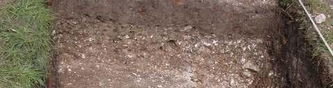
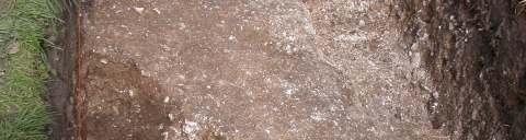
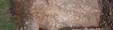
18 5 The Recorded Archaeology from the Trenches 5. 1 Trench 1 Trench 1 measured 8 metres in length and was originally 1.0 metre in width, the eastern side of the trench was increased by 0.50 metres to facilitate better understanding of the bank and ditch construction. This trench was located mid-way along the western side of the rectilinear enclosure and was positioned across the bank and ditch of this feature. After the removal of the turf, the overburden was revealed (101), which was a friable brown silty soil, containing numerous pieces of flint, chalk and fine gravel. Finds recovered from this context were all post-medieval in date, which included pottery, roof tile and iron objects. Directly under the topsoil, two ditches and a bank were revealed. The ditch [102] on the western side of the bank ran in a north to south direction. This feature [102] appeared to be medieval in date but was re-cut probably in the early post-medieval period, it was 1.78 metres in wide and 1.43 metres in depth, with sharp sloping sides and a flat base, it was filled by two distinct individual fills, (103) was a thick layer of mid-brown silty clay, with contained the occasional sherds of medieval and postmedieval pottery sherds, iron objects, animal and bird bones including, 2 complete canine skeletons (see figures 8 and 9). The bottom was filled with a thin deposit (104) of chalk and pea gravel, which is likely to be derived from hill-wash and represents a colluvial action; it contained only 4 sherds of medieval pottery. The surface of the ditch had a narrow depression cut into the underlying chalk; this feature is likely to be water-formed, rather than man-made. The bank [105] was composed of chalk blocks, flint nodules interspersed with a chalky soil (106), and the surface was covered with a compacted layer of flint, pebbles and fine dark greyish gravel, which had been deliberately laid to strengthen the bank. A posthole [107] was found on the top of the bank, measuring 0.25 metres x 0.34 metres in depth, it contained only 1 fill (108) which was a greyish - brown silty clay interspersed with CBM, stones and flint. This posthole was not precisely datable but was probably medieval or post medieval in origin, it might relate to a fence or hurdles which could have been built on the top of the bank to keep sheep from escaping from the enclosure. The second ditch [109] on the eastern side of the bank was not apparent on the ground or from aerial photographs, but geophysics showed this second ditch as a separate linear feature running parallel to the bank. This ditch was 1.23 metres wide and 1.23 metres in depth, the side were sloping and the base flat, it contained three fills (110) was composed of a friable silty clay, dark brown in colour, with burnt flints, flint flakes also a possible blade, animal bones and sherds of Iron age pottery were also recovered. (111) Was a firm chalky sandy clay, dark grey in colour, with numerous flecks of charcoal, fragments of burnt flint and animal bones, a shaped bone tool, 5 sherds of prehistoric pottery was also recovered which included early Neolithic and fragments of Beaker pottery. (112) The floor or base of the ditch appeared to have a diagonal spread of gravel, which appears to have been deliberately laid. 18


19 Fig. 7. Trench 1, under excavation. Fig. 8. Post hole [107] Trench 1 19


20 Fig. 9. Canine skeleton Trench 1 Fig. 10 Canine skull Trench 1 20

21 Fig. 11. Trench 1, showing both excavated ditches. 21
22 Fig. 12. Plan of Trench 1 Fig. 13. Section of Ditches and Bank, Trench 1 22

23 5. 2 Trench 2 This trench was located on the western side of the site, midway between trench 1 and the larger ditch on the northern side. This position was chosen because the geophysics suggested a different method of construction and to sample the ditch fill and not the bank See figure 7. The trench was 4 metres in length and 1.5 metres in width. After the removal of the turf, the overburden (201), was a friable brown silty soil and contained numerous pieces of flint and chalk. Finds recovered from this context were all post-medieval in date, which included pottery, bone and iron objects. Directly under the topsoil, a ditch cut [202] was revealed; this was the same ditch as [102] in trench 1. This feature [202] appeared to be medieval in date, and steps had been cut into the natural chalk to form the western side of the ditch, it was 1.29 metres in width and 0.54 metres in depth, with uneven sides and a flat base, there was only 1 fill to this ditch (203) a friable grey/brown sandy chalky soil containing flints and pieces of chalk. This ditch produced very few artefacts, mainly animal bone and the occasional sherd of pottery from the Iron Age, Roman and Medieval period. Fig. 14. West Facing. Trench 2 23
24 5. 3 Trench 3 Trench 3, Located at the eastern end of the northern bank and ditch. As with trench 2, this trench did not investigate the bank and was concerned only with the ditch see figure 13. The original trench measured 3 metres in length x 1.00 metres width. The first year excavation only partially revealed the true extent of the ditch, but a portion of a skeleton of a horse was found, with no time to complete the excavation the remains were covered and the trench back filled. The following year the trench was widened to 1.50 metres and lengthened to 4.00 metres, careful re-excavated of the 4 layers revealed more of the horse skeleton and the skull was found see figures 11 and 12. When the turf was removed a stiff mid- brown sandy clay (301) was exposed throughout trench, up to 20 cms in depth with inclusions of small pieces of flint and stone, finds recovered from the topsoil include pottery, glass and metal objects all datable to the post-medieval period. After the removal of topsoil (301) the profile of the ditch [303] was revealed. This ditch had 4 fills or deposits; the top layer was soft slightly tenacious dark greyish brown silty clay (303) with an average depth of 32 cms, which contained animal bones, iron objects, slag and medieval pottery. Directly below (303) was a layer (304) of yellowish-brown clay colluvium containing small to medium sized pieces of flint and stone, finds include 6 sherds of Iron Age pottery, worked flint objects, daub and bones, overall depth of this deposit (304) was 43 cms. Directly overlying the primary fill was (305) friable dark grey silty clay with moderate amounts of burnt flint, flint nodules, and lumps of chalk, bones, daub and charcoal, 29 cms in depth. Finds recovered were prehistoric pottery (Neolithic), also Bronze Age flint tools were recovered The primary fills (306) brown silty sand with large chalk inclusions and the occasional pieces of sarsen, 18 cms in depth, artefacts recovered from this deposit were Neolithic and Bronze Age in date. This ditch when fully excavated was 2.83 metres in width and 1.42 in depth, the sides were stepped on the northern side and slopping to vertical on the southern side, the base was slopping to the south. Dating of this east west linear ditch is problematic and still open to discussion, what is known is that this ditch appears to circumvallate parts of the village of Tilshead, more section need to be excavated at different location around Tilshead to properly ascertain the date of construction of this feature, but finds recovered from this ditch suggest that it is late Neolithic or early Bronze Age in its construction. 24

25 Fig. 16. Equine skull, Trench 3 25

26 Fig. 17. Skeleton of an Equine, Trench 3 Fig. 18. Skeleton of an Equine, Trench 3 26
27 5. 4 Trench 4 Trench 4 measured 4 metres in length and 1.50 metres in width, and was sited across the western side of a possible entrance to the enclosure. After removal of the turf, and dark grey/brown friable topsoil (401), which containing large amount of wood charcoal and other burnt vegetation, this material probably originated from bonfires or dumping of household fire waste. Finds from this context contained iron objects, CBM, glass, clay pipes and pottery sherds all dateable to post medieval period. After the removal of this overburden the profile of the ditch [402] was apparent, it measures 1.25 metres wide; and when fully excavated was 0.48 metres in depth, with uneven sloping sides and a concave base. This enclosure ditch contained three fills (403) which was dark grey/brown clayey silt, containing copious amounts of burnt flint nodules, chalk, small pieces of sarsen and other stones were also present, this deposit was 21 cms in depth. Context (404) the lower fill was completely different, consisting of yellow/brown clay up to 27 cms in depth, which extended to the roundended terminal of the enclosure. At the terminal end, pieces of sarsen stone and flint nodules (405) had been place deliberately, possibly to hold a gate post, under these stones, a child s iron bracelet, bone pins and a horse scapula were recovered, which could represent a placed deposit, fragments of Iron Age pottery, burnt clay or daub and burnt flint were also found. The internal bank [406] was mostly constructed from the soil excavated from the enclosure ditch, the bank surfaces was covered with a compacted layer of flint, pebbles and fine dark greyish gravel (407), which had been deliberately laid to strengthen the bank, this was similar to what was found on the bank in trench 1. The bank was 1.60 metres wide and was 30 cms in-depth, but evidence from other places on the bank suggest that this bank was considerably higher, finds recovered from the fill of the bank ranged in date from the Iron Age to the early Romano-British period. 27
28 Fig. 19. Plan of Terminal end to Ditch [402] Trench 4 Fig. 20. Section through Enclosure Ditch [402] and Bank [406] Trench 4 28
29 Trench 5 A small trench measuring 2.00 metre x 2.00 metre was located over a geophysical anomaly situated within the rectilinear enclosure. This feature was thought to be a pit. Once the turf and overburden (501) had been removed an ovoid shape [502] was observed cut into the natural chalk geology. This feature measure 1.23 metres in length x 0.92 metres in width, and was filled by a single deposit (503) a stiff greyishbrown clayey-silt with orange mottling up to 45 cms thick. The sides of this feature were sloping with an uneven base. No archaeological components were recovered from the fill of this pit, which remains, essentially, undated, though it is likely to be Iron Age by association. In the northeast corner of the trench was a small area of laid flint and stone [504], perhaps a floor, which might be associated with the round house. Fig. 21. Plan of Trench 5, showing ovoid pit [502]. 29
30 Trench 6 Trench 6, orientated east-west and measured 4 metres in length x 1.50 metres in width, was excavated through the north western section of the rectilinear enclosure ditch, where it joined the larger ditch which ran in an east-west direction across the northern part of the site This was to determine the original form, sequence and construction date of this ditch and its relationship to the larger east-west ditch. The turf line and topsoil (601), which was a friable brown/greyish silty soil and contained pieces of flint and chalk. Finds recovered from this context were all medieval and post-medieval in date, which included pottery, bone and iron objects. Directly under the topsoil, a ditch cut [602] was revealed; this was the same ditch as sampled [102] in trench 1 and [202] in trench 2. This ditch measured 1.11 metres in width and was 0.42 metres in depth, with uneven sloping sides and a flat base. There were only 2 fill to this ditch (603) a grey/brown sandy clay loam with small amounts of flint and chalk, this deposit produced only animal bone and the occasional sherds of Saxon pottery and pottery from the medieval period. The lower fill (604) a stiff yellowish/brown silty clay, finds recovered from this context include 3 sherds of Iron Age and a single sherd of Roman Samian pottery also very fragmented animal bones were recovered which showed signs of being burnt. In the western end of the trench there was a post hole, oval in shape, and measured 28 cms in length by 21 cms in width and 18 cms in depth with a concave base, this feature had 1 fill a very dark brown/black silty loam containing small amounts of burnt bone. When the ditch and bank was fully excavated it became clear that this enclosure ditch had truncated the older larger ditch, which ran across the northern edge of the site. 30
31 31
32 Trench 7 Trench 7 Measured 4 metres in length x 1.50 metres wide, and was positioned across the eastern side of the putative entrance to the enclosure. After the removal of the turf, the overburden (701), which on average was up to 31 cms deep, but considerably different to the overburdens in other trenches, and consisted of a friable dark brown/black silty soil, heavily contaminated with burnt material, mostly ash and charcoal, interspersed with burnt flint and the occasional fragments of ceramic building material. Directly below the topsoil was the outline of the terminal of the enclosure ditch [702], which had 2 deposits, (703) was a thin layer of yellowish brown silty clay, which contained occasional sherds of medieval pottery, possible from a jug or pitcher, with green glaze, and a handle from a different vessel with incised decorations of ring and dots, other objects recovered were unidentified iron objects and animal bones. The bottom fill was a thin deposit (704) of chalk, flint, medium sized stones and small amounts of pea gravel, parts of this context is likely to have been derived from hill-wash and represents colluvial action, no finds were recovered from this context, and the environmental sample taken was devoid of any charred plant remains and no pollen was noted. Unlike the trench over the western terminal, no Iron Age artefacts were found. Fig. 24. Plan of Trench 7 32
33 Trench 8 Trench 8 measured 6 metres in length x 1.50 metres in width. This trench was positioned to the middle, but eastern side of the site across a linear ditch which ran from the east side of the site, and circular anomaly to the north thought to be the remains of a round house, both these features were apparent from the magnetometer and resistance survey. After the removal of the turf line, the topsoil (801) a mid - brown, silty loam up to 23 cms in depth, this deposit contained pottery, metal objects and glass all datable to the post-medieval period. There was another intriguing object recovered from this context, it was made of lead and although it has been shown to experts at several museums, no-one has been able to identify it, (see Fig.51). Directly below the topsoil there was a deposit of (802) friable chalky sandy soil, greyish to light brown in colour with moderate amounts of fragmented stone, chalk and flint nodules, this deposit measured up to 29 cms in depth, finds recovered included, a sherd of Iron Age pottery, bones and fragments of unidentifiable iron and flecks of copper alloy. After the removal of (802) a series of features was observed (See Fig. 22), [803] was a laid chalk floor which covered the middle to northern areas of the trench, the fill of floor (804) was constructed from chalk, trampled down hard to form the surface, this floor was on average up to 18 cms in depth, there were 2 small separate areas, greyish to black in colour, possible caused by burning, also noted was a possible entrance to the south-east, Parker Pearson has postulated that entrances of roundhouses in the Iron Age predominately face east to south east, this reflects the daily movement of the sun and the circle of life. The doorway faces the rising sun (birth), the space within the house (moving clockwise) is for the living, working at weaving, grinding and potting, often where refuse is found; then comes the space for eating, then sleeping, followed by storage and finally an area for offerings (death) reaching the door again (Pryor 2004). Curving around the south and west of the floor [803] was a ditch [805] which was interpreted as the drainage gully for the round house, it measured 0.52 metres wide by 0.23 in depth, this feature contained 2 fills, the upper fill of this gully (806) was a friable orangey brown sandy loam with occasional pieces of flint, finds from this fill included Bronze Age, Beaker and Iron Age pottery, animal bones, a Neolithic scraper also burnt flint was recovered. The primary fill was (807) a loose deposit of red brown sandy loam colluvium interspersed by fragments of chalk. In between this deposit and (806) were the skeletal remains of a child, with its head to the North West, (see Fig s 29, 30, 31) (also 9 Human Remains report.). Finds from the primary fill and within the skeletal remains, included a fossilised sea urchin Fig. 32, metal object see figures 33 and 34, Neolithic flint blade and Core, burnt flint and Neolithic pottery, also recovered was a small quantity of animal bones red deer, pole cat and sheep. Further excavations to the south of the roundhouse gully, revealed a linear ditch [808] running east-west which abutted and truncated [805] part of the roundhouse gully suggesting a later date for its construction. This feature had been cut into the natural chalk, this linear ditch measured 0.82 metres wide x 0.36 metres in depth and had 3 distinctive layers, the top fill (809) was a friable orangey brown sandy loam, similar to (806) in the drainage gully, no artefacts were recovered from this fill. 33
34 The middle layer (810) stiff greyish-brown silty clay, with moderate amounts of charcoal flecking and small fragments of chalk and stone, finds recovered were two sherds of Iron Age pottery and animal bones. Direct below the central layer was the primary fill (811), a yellowish-brown silty clay colluvium containing small fragments of flint, chalk and sherds of prehistoric pottery Only one posthole, [812] was identified towards the south end of the trench which measured 0.21 metres in width x 0.32 metres in depth with vertical sides and concave base, it contained a single sandy loam fill (813), dark brown in colour possibly caused by decaying wood. This posthole may represent part of the structure of the roundhouse, the other postholes being beyond the limits of the trench. In the southwest corner of the trench was a small pit [814], which contained a friable dark grey/black soil with copious amounts of charcoal; this pit was thought to contain the remains of a fire. Fig. 25 Plan of Trench 8 34


35 Fig. 26 Section of Trench 8, West Facing. Fig.27. Photograph of Roundhouse Drainage Gully and Linear Ditch, West Facing, Trench 8 35

36 Fig. 28 Photograph, Showing Ditches running across Trench 8. 36

37 Fig.29 Photograph, Showing Ditch and Post Hole, Trench 8 Fig. 30. Photograph of Child s skeleton 37
38 Fig. 31. Photograph of Child s Skeleton 38


39 Fig. 32. Photograph of Child s Skull Fig. 33. A fossilised sea urchin was discovered at the bottom of the ditch, whilst common within the chalk, it seemed to have been deliberately placed. 39

40 Fig.34. The metal object found with the child s skeleton was X-rayed revealing it to be a bow shaped brooch similar to Fig. 35, Trench 8. Fig. 35. Bow brooches similar to Fig
, which was a friable dark brown silty soil, up to 30cms in depth, and contained small pieces of broken bone and post medieval pottery sherds.")
41 Trench 9 A small 1m x 1m test trench was excavated over one of the anomalies seen on the geophysics as an oval shape. The turf was removed, and the overburden (901), which was a friable dark brown silty soil, up to 30cms in depth, and contained small pieces of broken bone and post medieval pottery sherds. Directly below (901) was context (902), a flinty gravel layer up to 6 cms in depth, only one artefact was recovered, a neck of a vessel in a sandy coarse fabric, light brown in colour with a grey/black interior finish, thought to be early medieval in date. Context (903) was a cobbled stone surface arrangement of larger flint nodules, but only on the western side, on the eastern side was a deliberately laid cobbled chalk surface (904), finds included worked flint tools, animal bone and Iron Age pottery. Between (903) and (904) was a small area of chalky grey/brown soil (905), in which a post hole had been dug [906] measured 28 cms in diameter and up to 35 cms in depth, this feature contained 1 fill (907), which was a yellow brown clay, mixed with chalk and sandy material and the occasional fragment of charcoal, finds recovered were worked flint tools, burnt flint, daub and Bronze and Iron Age pottery. The features located in this trench possibly relates to a circular structure seen on the geophysics, which is likely to be a round house. Fig.36 Showing posthole and neck of a vessel, Trench 9 41


42 Fig. 37 Posthole [906] Trench 9. Fig. 38, Posthole [906] Trench 9 42
43 43
44 5.10 Trench 10 Trench 10, measured 1m x 1m and was positioned to the west of trench 9, after the turf was removed, the overburden (1001), was a friable brown silty soil and contained numerous pieces of flint and chalk. This test pit was excavated down until natural geology was encountered, no archaeological features were found, only a very small amount of fragmented bone, burnt flint, iron fragments and three tiny pieces of abraded pottery were recovered, none could be positively dated to a specific period. 44
45 6 Finds Finds are described and shown in tables set out below, apart from pottery and bones very few artefacts were recovered; they range in date from the Neolithic to modern times. Finds comprised Bone objects, Ceramic building material, Clay pipes, Copper Alloy Objects, Daub or burnt clay, Flint, Glass, Iron Objects and Slag and Lead Objects 6.1 Bone Objects Included 2 bone pins, one with decoration along its spine, and a carved bone use unknown, all thought to be early Bronze Age in date. Fig. 41. Photograph and Drawing of Bone Pins, Trench 1 45
46 6.2 Ceramic Building Material, Stone and Stone Objects 16, Fragments of Ceramic Building Material were recovered, from only two trenches. All appear to be medieval to post-medieval in date and included fragments of unfrogged brick and roof tiles. The roof tiles and the fragments of brick show signs of over firing with a vitrified surface. Two fragments of green glazed roof tile was recovered and dated to the later medieval period. Fig.42. Table of Ceramic Building Material Trench No s Context No s Number Weight/gms Description Age T Red brick Post-medieval T Roof tile Post-medieval T Roof tile Medieval T Roof tile Post-medieval T Red brick Post-medieval T Roof tile Post-medieval Total Fig.43. Table of Stone Objects Trench Context Number Material Description Age No s No s T1 1 Limestone, broken Loam weight Medieval T4 1 White Lias stone Spindle whorl Iron Age T8 1 Limestone, broken Loam weight Bronze or Iron Age T4 1 Sandstone Whetstone Iron Age, Roman T8 1 Sandstone, broken Whetstone Iron Age, Roman T8 1 Sandstone stone, Saddle Quern Iron Age broken T3 2 Sarsen stone?? T4 1 Sarsen stone Polishing stone Neolithic T8 1 Sarsen stone Worked, use? unknown T8 2 Sarsen stone Burnt?? 6.3 Clay Pipes 14 pieces of clay pipe were recovered, all from the topsoil, no maker s marks were found on the stems or the bowl, judging by the size of the stems of the pipes they are all late 18 th or early 19 th century in date. 6.4 Daub or Burnt Clay 52 pieces of daub or fired clay were recovered from trench 3, 4, 8 and 9. Wattle/twig/stick impressions were found on some of the daub or fired clay, and this may represent structural material from a building with walls made of this material or the remains of an oven. 46


47 6.5 Copper Alloy Objects Cast copper alloy circular buckle with the pin missing, 13 th or 14 th century. Tr1. Cast copper alloy, notched lip, and looped buckle 14 th or 15 th century. Tr2. Fig. 44. Copper alloy pin from a Ring brooch 14 th century Tr6 Copper alloy, openwork button, and Tudor period. Tr7 Copper alloy Brooch, La Tene 1, type. Late Iron Age. Tr4, Fig.45. Copper alloy Colchester bow brooch of late Iron Age to Roman Date. Tr8 see Figures 34, 35 and 46 Fig.44. Cast copper alloy, notched lip, looped buckle 14 th or 15 th century. Tr2. 47
48 Fig.45 Iron Age Brooch of round-copper alloy wire, with bilateral spring of four turns; the chord is exterior, not by the bow, which is a flat curve is reminiscent of a La Tene 1, type characteristic of Britain. Trench 4. Fig.46. Heavily corroded cast copper alloy Colchester bow brooch of late Iron Age to early Roman in date. The brooch has short, flat rectangular wings, pin missing, Trench 8, and see also see Figures 34 and
49 6.6 Flint Report The flint assemblage of 23 pieces of worked flint consisting of tools and cores possibly suggests a small-scale settlement or camp, only 15 pieces from the collection have patina development and the others have a thin cortex suggesting a local chalk source for the flint. The collection is largely Neolithic (17) and the remaining 6 items are Bronze Age in date. The flint assemblage was recovered from a comparative small number of trenches (5). 37 pieces from the collection show various degrees of thermal damage by fire, the recovery of this burnt flint is of interest, but not datable and was subsequently discarded. Fig.47. Table Flint Report Description Period Remarks Trench Numbers Arrow Neolithic Part of a leaf shaped Context Number Totals Tr Blade Neolithic All damaged Tr Blade Bronze Age Leaf shape damaged Tr Borer Neolithic Complete Tr Core Bronze Age Complete Tr Core Neolithic Complete Tr Fabricator Neolithic All damaged T r Fabricator Bronze Age Complete Tr Flake Neolithic Waste Tr Flake Neolithic Worked Tr Scraper Neolithic End Tr Scraper Bronze Age Large Tr Burnt Flint Not Datable Small size Tr Burnt Flint Not Datable Medium size Tr Burnt Flint Not Datable Medium size Tr Burnt Flint Not Datable Medium size Tr Burnt Flint Not Datable Small size Tr Burnt Flint Not Datable Medium size Tr Burnt Flint Not Datable Small size Tr Burnt Flint Not Datable Small size Tr Total Glass Report 21 pieces of glass from window and vessels were recovered from the topsoils, all Georgian and Victorian in date. 49
50 6.8 Iron Objects and Slag Reports The assemblage is varied and the objects quite diverse in date and function. Many of the iron pieces were unrecognisable and have been record in the Fig. 46 (Table of Iron Objects as Unidentifiable). The collection of nails include a large head typical of medieval door nails and roves, other nails include narrow rectangular head form, that did not appear until the later medieval period, other nails are post-medieval in date, other items recovered appear to be of agricultural origin. Fig.48 Table of Iron Objects Trench Numbers Tr1 Tr2 Tr3 Tr4 Tr5 Tr6 Tr7 Tr8 Tr9 Tr10 Total Blades Bracelet Badge Hasp Horse shoes Knife handle Nails Stylus fragment Unidentfiable Total
51 Fig.49 Child s Bracelet The metal object found, in the terminal of the enclosure ditch Trench 4 at the entrance was x-rayed and was revealed to be a child s bracelet (bangle) with slightly splayed, flat terminals, heavily and compact corrosion, dating to the Iron Age Slag A small amount of slag (5 pieces) was recovered from trenches 3 and 5, but there is little evidence of iron working on this site. 51

52 6.9 Lead Objects Fragments of this metal were found during the course of the excavations. All fragments and objects made from lead, occurred in layers associated with the medieval or post-medieval period. The lead was used for various purposes; including window furniture, nails with pieces of lead adhering to them, large calibre musket ball, part of a medieval mount, medieval token with incised cross and several unidentifiable round objects perhaps gaming tokens. Fig.51. Lead and Glass Tablet now thought to be part of a battery. Trench 8. Introduction 7 Pottery An assemblage of some 143 sherds of pottery weighing 2.979Kg was recovered Of the 143 sherds of pottery recovered 13 (9%) weighing 223gms could not be placed into a specific time period and therefore have been categorised under unidentifiable. The system used to classify the sherds was based on identifying known wares first; the material was then looked at in terms of its date, origin and any evidence of function, a reference collection was also employed to assist in this process. The assemblage was quantified by weight and shard count and individual sherds were checked by the use of a hand lens (X10) to identify the principal fabric types; the results are shown in Table 52. Almost all the pottery was derived from stratified contexts. The pottery provides the primary dating evidence for the site; nine of the ten trenches produced pottery. The majority of this assemblage is in a good condition but some of the Romano-British sherds were probably residual to the site. The pottery assemblage includes diagnostic sherds from the early Neolithic through to the post medieval period. 52
An archaeological evaluation at 16 Seaview Road, Brightlingsea, Essex February 2004
 An archaeological evaluation at 16 Seaview Road, Brightlingsea, Essex February 2004 report prepared by Kate Orr on behalf of Highfield Homes NGR: TM 086 174 (c) CAT project ref.: 04/2b ECC HAMP group site
Church of St Peter and St Paul, Great Missenden, Buckinghamshire
 Church of St Peter and St Paul, Great Missenden, Buckinghamshire An Archaeological Watching Brief for the Parish of Great Missenden by Andrew Taylor Thames Valley Archaeological Services Ltd Site Code
39, Walnut Tree Lane, Sudbury (SUY 073) Planning Application No. B/04/02019/FUL Archaeological Monitoring Report No. 2005/112 OASIS ID no.
 Planning Application No. B/04/02019/FUL Archaeological Monitoring Report No. 2005/112 OASIS ID no.") 39, Walnut Tree Lane, Sudbury (SUY 073) Planning Application No. B/04/02019/FUL Archaeological Monitoring Report No. 2005/112 OASIS ID no. 9273 Summary Sudbury, 39, Walnut Tree Lane, Sudbury (TL/869412;
39, Walnut Tree Lane, Sudbury (SUY 073) Planning Application No. B/04/02019/FUL Archaeological Monitoring Report No. 2005/112 OASIS ID no. 9273 Summary Sudbury, 39, Walnut Tree Lane, Sudbury (TL/869412;
2 Saxon Way, Old Windsor, Berkshire
 2 Saxon Way, Old Windsor, Berkshire An Archaeological Watching Brief For Mrs J. McGillicuddy by Pamela Jenkins Thames Valley Archaeological Services Ltd Site Code SWO 05/67 August 2005 Summary Site name:
New Composting Centre, Ashgrove Farm, Ardley, Oxfordshire
 New Composting Centre, Ashgrove Farm, Ardley, Oxfordshire An Archaeological Watching Brief For Agrivert Limited by Andrew Weale Thames Valley Archaeological Services Ltd Site Code AFA 09/20 August 2009
ARCHAEOLOGICAL EVALUATION AT BRIGHTON POLYTECHNIC, NORTH FIELD SITE, VARLEY HALLS, COLDEAN LANE, BRIGHTON. by Ian Greig MA AIFA.
 ARCHAEOLOGICAL EVALUATION AT BRIGHTON POLYTECHNIC, NORTH FIELD SITE, VARLEY HALLS, COLDEAN LANE, BRIGHTON by Ian Greig MA AIFA May 1992 South Eastern Archaeological Services Field Archaeology Unit White
An archaeological evaluation at the Lexden Wood Golf Club (Westhouse Farm), Lexden, Colchester, Essex
, Lexden, Colchester, Essex") An archaeological evaluation at the Lexden Wood Golf Club (Westhouse Farm), Lexden, Colchester, Essex January 2000 Archive report on behalf of Lexden Wood Golf Club Colchester Archaeological Trust 12 Lexden
An archaeological evaluation at the Lexden Wood Golf Club (Westhouse Farm), Lexden, Colchester, Essex January 2000 Archive report on behalf of Lexden Wood Golf Club Colchester Archaeological Trust 12 Lexden
Test-Pit 3: 31 Park Street (SK )
") -Pit 3: 31 Park Street (SK 40732 03178) -Pit 3 was excavated in a flower bed in the rear garden of 31 Park Street, on the northern side of the street and west of an alleyway leading to St Peter s Church,
-Pit 3: 31 Park Street (SK 40732 03178) -Pit 3 was excavated in a flower bed in the rear garden of 31 Park Street, on the northern side of the street and west of an alleyway leading to St Peter s Church,
An archaeological watching brief and recording at Brightlingsea Quarry, Moverons Lane, Brightlingsea, Essex October 2003
 An archaeological watching brief and recording at Brightlingsea Quarry, Moverons Lane, Brightlingsea, Essex commissioned by Mineral Services Ltd on behalf of Alresford Sand & Ballast Co Ltd report prepared
3. The new face of Bronze Age pottery Jacinta Kiely and Bruce Sutton
 3. The new face of Bronze Age pottery Jacinta Kiely and Bruce Sutton Illus. 1 Location map of Early Bronze Age site at Mitchelstown, Co. Cork (based on the Ordnance Survey Ireland map) A previously unknown
Fieldwalking at Cottam 1994 (COT94F)
") Fieldwalking at Cottam 1994 (COT94F) Tony Austin & Elizabeth Jelley (19 Jan 29) 1. Introduction During the winter of 1994 students from the Department of Archaeology at the University of York undertook
Fieldwalking at Cottam 1994 (COT94F) Tony Austin & Elizabeth Jelley (19 Jan 29) 1. Introduction During the winter of 1994 students from the Department of Archaeology at the University of York undertook
Colchester Archaeological Trust Ltd. A Fieldwalking Survey at Birch, Colchester for ARC Southern Ltd
 Colchester Archaeological Trust Ltd A Fieldwalking Survey at Birch, Colchester for ARC Southern Ltd November 1997 CONTENTS page Summary... 1 Background... 1 Methods... 1 Retrieval Policy... 2 Conditions...
Cambridge Archaeology Field Group. Fieldwalking on the Childerley Estate Cambridgeshire
 Cambridge Archaeology Field Group Fieldwalking on the Childerley Estate Cambridgeshire 2009 to 2014 Summary Fieldwalking on the Childerley estate of Martin Jenkins and Family has revealed, up to March
Greater London GREATER LONDON 3/606 (E ) TQ
 TQ") GREATER LONDON City of London 3/606 (E.01.6024) TQ 30358150 1 PLOUGH PLACE, CITY OF LONDON An Archaeological Watching Brief at 1 Plough Place, City of London, London EC4 Butler, J London : Pre-Construct
GREATER LONDON City of London 3/606 (E.01.6024) TQ 30358150 1 PLOUGH PLACE, CITY OF LONDON An Archaeological Watching Brief at 1 Plough Place, City of London, London EC4 Butler, J London : Pre-Construct
Archaeological sites and find spots in the parish of Burghclere - SMR no. OS Grid Ref. Site Name Classification Period
 Archaeological sites and find spots in the parish of Burghclere - SMR no. OS Grid Ref. Site Name Classification Period SU45NE 1A SU46880 59200 Ridgemoor Farm Inhumation Burial At Ridgemoor Farm, on the
Former Whitbread Training Centre Site, Abbey Street, Faversham, Kent Interim Archaeological Report Phase 1 November 2009
 Former Whitbread Training Centre Site, Abbey Street, Faversham, Kent Interim Archaeological Report Phase 1 November 2009 SWAT. Archaeology Swale and Thames Archaeological Survey Company School Farm Oast,
Cambridge Archaeology Field Group. Fieldwalking on the Childerley Estate, Cambridgeshire. Autumn 2014 to Spring Third interim report
 Cambridge Archaeology Field Group Fieldwalking on the Childerley Estate, Cambridgeshire Autumn 2014 to Spring 2015 Third interim report Summary Field walking on the Childerley estate of Martin Jenkins
Chapter 2. Remains. Fig.17 Map of Krang Kor site
 Chapter 2. Remains Section 1. Overview of the Survey Area The survey began in January 2010 by exploring the site of the burial rootings based on information of the rooted burials that was brought to the
An archaeological evaluation in the playground of Colchester Royal Grammar School, Lexden Road, Colchester, Essex
 An archaeological evaluation in the playground of Colchester Royal Grammar School, Lexden Road, Colchester, Essex February 2002 on behalf of Roff Marsh Partnership CAT project code: 02/2c Colchester Museum
An archaeological evaluation by trial-trenching at Playgolf, Bakers Lane, Westhouse Farm, Colchester, Essex
 An archaeological evaluation by trial-trenching at Playgolf, Bakers Lane, Westhouse Farm, Colchester, Essex commissioned by Mr Stephen Belchem on behalf of ADP Ltd. report prepared by Chris Lister Planning
7. Prehistoric features and an early medieval enclosure at Coonagh West, Co. Limerick Kate Taylor
 7. Prehistoric features and an early medieval enclosure at Coonagh West, Co. Limerick Kate Taylor Illus. 1 Location of the site in Coonagh West, Co. Limerick (based on the Ordnance Survey Ireland map)
Grim s Ditch, Starveall Farm, Wootton, Woodstock, Oxfordshire
 Grim s Ditch, Starveall Farm, Wootton, Woodstock, Oxfordshire An Archaeological Recording Action For Empire Homes by Steve Ford Thames Valley Archaeological Services Ltd Site Code SFW06/118 November 2006
Archaeological Material From Spa Ghyll Farm, Aldfield
 Archaeological Material From Spa Ghyll Farm, Aldfield Introduction Following discussions with Linda Smith the Rural Archaeologist for North Yorkshire County Council, Robert Morgan of 3D Archaeological
1 The East Oxford Archaeology and History Project
 1 The East Oxford Archaeology and History Project EXOP TEST PIT 72 Location: Bartlemas Chapel, Cowley Date of excavation: 6-8 November 2013. Area of excavation: 0.8m x 1.2m, at the eastern end of the chapel.
ARCHAEOLOGICAL MONITORING REPORT
 ARCHAEOLOGICAL MONITORING REPORT SCCAS REPORT No. 2009/324 Thorington Hall, Stoke by Nayland SBN 087 HER Information Date of Fieldwork: November 2009 - January 2010 Grid Reference: TM 0131 3546 Funding
Undley Hall, Lakenheath LKH 307
 ARCHAEOLOGICAL EVALUATION AND MONITORING REPORT SCCAS REPORT No. 2010/005 Undley Hall, Lakenheath LKH 307 E. Muldowney SCCAS January 2010 www.suffolkcc.gov.uk/e-and-t/archaeology Lucy Robinson, County
Monitoring Report No. 99
 Monitoring Report No. 99 Enniskillen Castle Co. Fermanagh AE/06/23 Cormac McSparron Site Specific Information Site Name: Townland: Enniskillen Castle Enniskillen SMR No: FER 211:039 Grid Ref: County: Excavation
FURTHER MIDDLE SAXON EVIDENCE AT COOK STREET, SOUTHAMPTON (SOU 567)
") Roc. Hampshire Field Club Archaeol. Soc 52,1997, 77-87 (Hampshire Studies 1997) FURTHER MIDDLE SAXON EVIDENCE AT COOK STREET, SOUTHAMPTON (SOU 567) By M F GARNER andj VINCENT with a contribution byjacqueline
Roc. Hampshire Field Club Archaeol. Soc 52,1997, 77-87 (Hampshire Studies 1997) FURTHER MIDDLE SAXON EVIDENCE AT COOK STREET, SOUTHAMPTON (SOU 567) By M F GARNER andj VINCENT with a contribution byjacqueline
Archaeological. Monitoring & Recording Report. Fulbourn Primary School, Cambridgeshire. Archaeological Monitoring & Recording Report.
 Fulbourn Primary School, Cambridgeshire Archaeological Monitoring & Recording Report October 2014 Client: Cambridgeshire County Council OA East Report No: 1689 OASIS No: oxfordar3-192890 NGR: TL 5190 5613
Is this the Original Anglo-Saxon period site of Weathercote?
 Is this the Original Anglo-Saxon period site of Weathercote? A Batty & N Crack 2016 Front Cover. Looking south east across proposed original site of Weathercote. Photograph A 2 3 Weathercote Anglo-Saxon
SALVAGE EXCAVATIONS AT OLD DOWN FARM, EAST MEON
 Proc. Hants. Field Club Archaeol. Soc. 36, 1980, 153-160. 153 SALVAGE EXCAVATIONS AT OLD DOWN FARM, EAST MEON By RICHARD WHINNEY AND GEORGE WALKER INTRODUCTION The site was discovered by chance in December
An archaeological evaluation at the Blackwater Hotel, Church Road, West Mersea, Colchester, Essex March 2003
 An archaeological evaluation at the Blackwater Hotel, Church Road, West Mersea, Colchester, Essex report prepared by Laura Pooley on behalf of Dolphin Developments (U.K) Ltd NGR: TM 0082 1259 CAT project
16 members of the Fieldwalking Group met York Community Archaeologist Jon Kenny at Lou Howard s farm, Rose Cottage Farm, at
 Terrington History Group Fieldwalking Group Field 1 Final report 21 October 2011 - fieldwalking 16 members of the Fieldwalking Group met York Community Archaeologist Jon Kenny at Lou Howard s farm, Rose
Silwood Farm, Silwood Park, Cheapside Road, Ascot, Berkshire
 Silwood Farm, Silwood Park, Cheapside Road, Ascot, Berkshire An Archaeological Watching Brief For Imperial College London by Tim Dawson Thames Valley Archaeological Services Ltd Site Code SFA 09/10 April
Grange Farm, Widmer End, Hughenden, Buckinghamshire
 Grange Farm, Widmer End, Hughenden, Buckinghamshire An Archaeological Evaluation for British Flora by Andy Taylor Thames Valley Archaeological Services Ltd Site Code GFH 05/63 July 2005 Summary Site name:
Essex Historic Environment Record/ Essex Archaeology and History
 Essex Historic Environment Record/ Essex Archaeology and History CAT Report 578 Summary sheet Address: Kingswode Hoe School, Sussex Road, Colchester, Essex Parish: Colchester NGR: TL 9835 2528 Type of
Archaeological trial-trenching evaluation at Chappel Farm, Little Totham, Essex. April 2013
 Archaeological trial-trenching evaluation at Chappel Farm, Little Totham, Essex April 2013 report prepared by Ben Holloway commissioned by Tim Harbord Associates on behalf of Mr Tom Howie Planning reference:
Cetamura Results
 Cetamura 2000 2006 Results A major project during the years 2000-2006 was the excavation to bedrock of two large and deep units located on an escarpment between Zone I and Zone II (fig. 1 and fig. 2);
Wantage County Primary School, Garston Lane, Wantage, Oxfordshire
 Wantage County Primary School, Garston Lane, Wantage, Oxfordshire An Archaeological Evaluation for Oxfordshire County Council by Erlend Hindmarch Thames Valley Archaeological Services Ltd Site Code GLW
LAND WEST OF ELM GROVE, EBRINGTON, GLOUCESTERSHIRE. NGR: SP (centred) ARCHAEOLOGICAL EVALUATION
 ARCHAEOLOGICAL EVALUATION") LAND WEST OF ELM GROVE, EBRINGTON, GLOUCESTERSHIRE. NGR: SP 1892 4012 (centred) ARCHAEOLOGICAL EVALUATION Report No. 640 May 2009 1q LAND WEST OF ELM GROVE, EBRINGTON, GLOUCESTERSHIRE. NGR: SP 1892 4012
LAND WEST OF ELM GROVE, EBRINGTON, GLOUCESTERSHIRE. NGR: SP 1892 4012 (centred) ARCHAEOLOGICAL EVALUATION Report No. 640 May 2009 1q LAND WEST OF ELM GROVE, EBRINGTON, GLOUCESTERSHIRE. NGR: SP 1892 4012
Moray Archaeology For All Project
 School children learning how to identify finds. (Above) A flint tool found at Clarkly Hill. Copyright: Leanne Demay Moray Archaeology For All Project ational Museums Scotland have been excavating in Moray
NOTE A THIRD CENTURY ROMAN BURIAL FROM MANOR FARM, HURSTBOURNE PRIORS. by. David Allen with contributions by Sue Anderson and Brenda Dickinson
 Proc. Hampsh. Field Club Archaeol. Soc. 47, 1991, 253-257 NOTE A THIRD CENTURY ROMAN BURIAL FROM MANOR FARM, HURSTBOURNE PRIORS Abstract by. David Allen with contributions by Sue Anderson and Brenda Dickinson
THE RAVENSTONE BEAKER
 DISCOVERY THE RAVENSTONE BEAKER K. J. FIELD The discovery of the Ravenstone Beaker (Plate Xa Fig. 1) was made by members of the Wolverton and District Archaeological Society engaged on a routine field
Archaeological Watching Brief (Phase 2) at Court Lodge Farm, Aldington, near Ashford, Kent December 2011
 at Court Lodge Farm, Aldington, near Ashford, Kent December 2011") Archaeological Watching Brief (Phase 2) at Court Lodge Farm, Aldington, near Ashford, Kent December 2011 SWAT. Archaeology Swale and Thames Archaeological Survey Company School Farm Oast, Graveney Road
Archaeological Watching Brief (Phase 2) at Court Lodge Farm, Aldington, near Ashford, Kent December 2011 SWAT. Archaeology Swale and Thames Archaeological Survey Company School Farm Oast, Graveney Road
A visit to the Wor Barrow 21 st November 2015
 A visit to the Wor Barrow 21 st November 2015 Following our exploration of Winkelbury a few weeks previously, we fast forwarded 12 years in Pitt Rivers remarkable series of excavations and followed him
Novington, Plumpton East Sussex
 Novington, Plumpton East Sussex The Flint Over 1000 pieces of flintwork were recovered during the survey, and are summarised in Table 0. The flint is of the same types as found in the previous survey of
AN EARLY MEDIEVAL RUBBISH-PIT AT CATHERINGTON, HAMPSHIRE Bj>J. S. PILE and K. J. BARTON
 AN EARLY MEDIEVAL RUBBISH-PIT AT CATHERINGTON, HAMPSHIRE Bj>J. S. PILE and K. J. BARTON INTRODUCTION THE SITE (fig. 21) is situated in the village of Catherington, one mile north-west of Horndean and 200
Moated Site at Manor Farm, Islip, Oxfordshire
 Moated Site at Manor Farm, Islip, Oxfordshire An Archaeological Excavation By Jo Pine Site Code MFI05 December 2007 Summary Site name: Moated Site at Manor Farm, Islip, Oxfordshire Grid reference: SP 5298
Archaeological evaluation at the Onley Arms, The Street, Stisted, Essex
 Archaeological evaluation at the Onley Arms, The Street, Stisted, Essex November 2014 report by Pip Parmenter and Adam Wightman with a contribution from Stephen Benfield and illustrations by Emma Holloway
A Fieldwalking Project At Sompting. West Sussex
 by John Funnell Introduction A Fieldwalking Project At Sompting. West Sussex During March -and April 1995 the Brighton and Hove Archaeological Society conducted fie1dwa1king in a field at Sompting West
Erection of wind turbine, Mains of Loanhead, Old Rayne, AB52 6SX
 Erection of wind turbine, Mains of Loanhead, Old Rayne, AB52 6SX Ltd 23 November 2011 Erection of wind turbine, Mains of Loanhead, Old Rayne, AB52 6SX CONTENTS 1 INTRODUCTION 3 2 ARCHAEOLOGICAL BACKGROUND
Monitoring Report No Sacred Heart Church Aghamore Boho Co. Fermanagh AE/10/116E. Brian Sloan L/2009/1262/F
 Monitoring Report No. 202 Sacred Heart Church Aghamore Boho Co. Fermanagh AE/10/116E Brian Sloan L/2009/1262/F Site Specific Information Site Address: Sacred Heart Church, Aghamore, Boho, Co. Fermanagh
Section Worked stone catalogue By Hugo Anderson-Whymark
 Section 4.11.2 Worked stone catalogue By Hugo Anderson-Whymark Table 4.67: Worked stone from Alfred s Castle. TR Ctxt SF No 1 1000 0 Weaponry Sling-shot Flint pebble 100 1 57 43 37 27 Iron Age 1 1160 0
The lithic assemblage from Kingsdale Head (KH09)
") 1 The lithic assemblage from Kingsdale Head (KH09) Hannah Russ Introduction During excavation the of potential Mesolithic features at Kingsdale Head in 2009 an assemblage of flint and chert artefacts were
1 The lithic assemblage from Kingsdale Head (KH09) Hannah Russ Introduction During excavation the of potential Mesolithic features at Kingsdale Head in 2009 an assemblage of flint and chert artefacts were
ARCHAEOLOGICAL S E R V I C E S. St Nicholas' Church, Barrack Hill, Nether Winchendon, Buckinghamshire. Archaeological Watching Brief.
 T H A M E S V A L L E Y ARCHAEOLOGICAL S E R V I C E S St Nicholas' Church, Barrack Hill, Nether Winchendon, Buckinghamshire Archaeological Watching Brief by Steven Crabb Site Code: STW17/229 (SP 7735
Excavation. Post-Medieval Ditches. Land off Norwich Common Road Wymondham Norfolk. Excavation. Client: November 2013
 Land off Norwich Common Road Wymondham Norfolk. Excavation November 2013 Client: OA East Report No: 1546 OASIS No: oxfordar3-163105 NGR: TG 12770 02684 Excavation Post-Medieval Ditches Post-Medieval Ditches
Chapel House Wood Landscape Project. Interim Report 2013
 Chapel House Wood Landscape Project Interim Report 2013 Chapel House Wood Landscape Project Interim Report 2013 The annual Dales Heritage Field School was held at Chapel House Wood again this year, and
An archaeological watching brief on one section of an Anglian Water main Spring Lane, Lexden, Colchester
 An archaeological watching brief on one section of an Anglian Water main Spring Lane, Lexden, Colchester April-September 2001 on behalf of Breheny Contractors CAT project ref.: 01/4D Colchester Museum
Chapter 2: Archaeological Description
 Chapter 2: Archaeological Description Phase 1 Late Neolithic, c 3000-2400 BC (Figs 6-9) Evidence of Neolithic activity was confined to pits dug across the southern half of the site (Fig. 6). Eighteen pits
Greater London Region GREATER LONDON 3/567 (E.01.K099) TQ BERMONDSEY STREET AND GIFCO BUILDING AND CAR PARK
 TQ BERMONDSEY STREET AND GIFCO BUILDING AND CAR PARK") GREATER LONDON 3/567 (E.01.K099) TQ 33307955 156-170 BERMONDSEY STREET AND GIFCO BUILDING AND CAR PARK Assessment of an Archaeological Excavation at 156-170 Bermondsey Street and GIFCO Building and Car
GREATER LONDON 3/567 (E.01.K099) TQ 33307955 156-170 BERMONDSEY STREET AND GIFCO BUILDING AND CAR PARK Assessment of an Archaeological Excavation at 156-170 Bermondsey Street and GIFCO Building and Car
1. Presumed Location of French Soundings Looking NW from the banks of the river.
 SG02? SGS SG01? SG4 1. Presumed Location of French Soundings Looking NW from the banks of the river. The presumed location of SG02 corresponds to a hump known locally as the Sheikh's tomb. Note also (1)
An archaeological watching brief at St Leonard s church, Hythe Hill, Colchester, Essex
 An archaeological watching brief at St Leonard s church, Hythe Hill, Colchester, Essex report prepared by Adam Wightman on behalf of Dorvell Construction CAT project ref.: 10/5d Colchester and Ipswich
THE UNFOLDING ARCHAEOLOGY OF CHELTENHAM
 THE UNFOLDING ARCHAEOLOGY OF CHELTENHAM The archaeology collection of Cheltenham Art Gallery & Museum contains a rich quantity of material relating to the prehistoric and Roman occupation of the North
An archaeological watching brief at Sheepen, Colchester, Essex November-December 2003
 An archaeological watching brief at Sheepen, Colchester, Essex November-December 2003 report prepared by Ben Holloway on behalf of Colchester Borough Council CAT project ref.: 03/11c Colchester Museums
THE PRE-CONQUEST COFFINS FROM SWINEGATE AND 18 BACK SWINEGATE
 THE PRE-CONQUEST COFFINS FROM 12 18 SWINEGATE AND 18 BACK SWINEGATE An Insight Report By J.M. McComish York Archaeological Trust for Excavation and Research (2015) Contents 1. INTRODUCTION... 3 2. THE
Excavation Report. Medieval Occupation at Challis Green Barrington Cambridgeshire. Excavation Report. Client: Hills Partnership Limited.
 Medieval Occupation at Challis Green Barrington Cambridgeshire Excavation Report Excavation Report April 2012 Client: Hills Partnership Limited OA East Report No: 1269 OASIS No: oxfordar3-102493 NGR: TL
Peace Hall, Sydney Town Hall Results of Archaeological Program (Interim Report)
") Results of Archaeological Program (Interim Report) Background The proposed excavation of a services basement in the western half of the Peace Hall led to the archaeological investigation of the space in
Results of Archaeological Program (Interim Report) Background The proposed excavation of a services basement in the western half of the Peace Hall led to the archaeological investigation of the space in
MARSTON MICHAEL FARLEY
 MARSTON MICHAEL FARLEY On 9 March agricultural contractors, laying field drains for Bucks County Council Land Agent's Department, cut through a limestone structure at SP 75852301 in an area otherwise consistently
Bronze-Age and Romano-British Sites South-East of Tewkesbury: evaluations and excavations
 From the Transactions of the Bristol and Gloucestershire Archaeological Society Bronze-Age and Romano-British Sites South-East of Tewkesbury: evaluations and excavations 1991-7 by G. Walker, A. Thomas
Small Finds Assessment, Minchery Paddock, Littlemore, Oxford (MP12)
") Small s Assessment, Minchery Paddock, Littlemore, Oxford (MP12) Introduction A total of 51 objects recovered from excavations at Minchery Paddock, Littlemore, Oxford (MP12) were submitted for dating and
Small s Assessment, Minchery Paddock, Littlemore, Oxford (MP12) Introduction A total of 51 objects recovered from excavations at Minchery Paddock, Littlemore, Oxford (MP12) were submitted for dating and
An archaeological watching brief and evaluation at Great Notley business park, near Braintree, Essex June-September 2005
 An archaeological watching brief and evaluation at Great Notley business park, near Braintree, Essex report prepared by Kate Orr commissioned by Andrew Martin Associates Ltd on behalf of Countryside Properties
Evidence for the use of bronze mining tools in the Bronze Age copper mines on the Great Orme, Llandudno
 Evidence for the use of bronze mining tools in the Bronze Age copper mines on the Great Orme, Llandudno Background The possible use of bronze mining tools has been widely debated since the discovery of
Tell Shiyukh Tahtani (North Syria)
") Tell Shiyukh Tahtani (North Syria) Report of the 2010 excavation season conducted by the University of Palermo Euphrates Expedition by Gioacchino Falsone and Paola Sconzo In the summer 2010 the University
Tell Shiyukh Tahtani (North Syria) Report of the 2010 excavation season conducted by the University of Palermo Euphrates Expedition by Gioacchino Falsone and Paola Sconzo In the summer 2010 the University
An archaeological excavation of test-holes at St Barnabas Church, Alphamstone, Essex March and May 2007
 An archaeological excavation of test-holes at St Barnabas Church, Alphamstone, Essex March and May 2007 report prepared by Kate Orr commissioned by David Whymark Building Design and Conservation on behalf
Foreign Whaling in Iceland Archaeological Excavations at Strákatangi in Hveravík, Kaldrananeshreppi 2007 Data Structure Report
 Foreign Whaling in Iceland Archaeological Excavations at Strákatangi in Hveravík, Kaldrananeshreppi 2007 Data Structure Report Caroline Paulsen, Magnús Rafnsson and Ragnar Edvardsson February 2008 NV nr.
St Germains, Tranent, East Lothian: the excavation of Early Bronze Age remains and Iron Age enclosed and unenclosed settlements
 Proc Soc Antiq Scot, 128 (1998), 203-254 St Germains, Tranent, East Lothian: the excavation of Early Bronze Age remains and Iron Age enclosed and unenclosed settlements Derek Alexander* & Trevor Watkinsf
Burrell Orchard 2014: Cleveland Archaeological Society Internship Amanda Ponomarenko The Ohio State University June - August 2014
 1 Burrell Orchard 2014: Cleveland Archaeological Society Internship Amanda Ponomarenko The Ohio State University June - August 2014 Selected for the 2014 Cleveland Archaeological Society Internship in
An archaeological evaluation at Thistle Hall, Mope Lane, Wickham Bishops, Essex July 2009
 An archaeological evaluation at Thistle Hall, Mope Lane, Wickham Bishops, Essex July 2009 report prepared by Howard Brooks and Ben Holloway on behalf of Clarity Ecoworks Ltd CAT project ref.: 09/1f ECC
Changing People Changing Landscapes: excavations at The Carrick, Midross, Loch Lomond Gavin MacGregor, University of Glasgow
 Changing People Changing Landscapes: excavations at The Carrick, Midross, Loch Lomond Gavin MacGregor, University of Glasgow Located approximately 40 kilometres to the south-west of Oban, as the crow flies
E x cav atio n R e p o r t
 Medieval Trackway on land at Ivy Farm Royston, Hertfordshire Excavation Report E x cav atio n R e p o r t October 2011 Client: CgMs Consulting OA East Report No: 1305 OASIS No: oxfordar3-112012 NGR: TL
ST PATRICK S CHAPEL, ST DAVIDS PEMBROKESHIRE 2015
 ST PATRICK S CHAPEL, ST DAVIDS PEMBROKESHIRE 2015 REPORT FOR THE NINEVEH CHARITABLE TRUST THE UNIVERSITY OF SHEFFIELD AND DYFED ARCHAEOLOGICAL TRUST Introduction ST PATRICK S CHAPEL, ST DAVIDS, PEMBROKESHIRE,
ROMAN AND MEDIEVAL ACTIVITY IN THE UPPER WALBROOK VALLEY: EXCAVATIONS AT MOORGATE, CITY OF LONDON, EC2, 1997
 ROMAN AND MEDIEVAL ACTIVITY IN THE UPPER WALBROOK VALLEY: EXCAVATIONS AT 12 18 MOORGATE, CITY OF LONDON, EC2, 1997 Graham Bruce, Dominic Perring, Tim Stevens and Melissa Melikian SUMMARY In January and
Oxfordshire. Wallingford. St Mary-le-More. Archaeological Watching Brief Report. Client: JBKS Architects and St Mary s Renewal Campaign.
 St Mary-le-More Wallingford Oxfordshire Archaeological Watching Brief Report February 2010 Client: JBKS Architects and St Mary s Renewal Campaign Issue No:1 OA Job No: 4432 NGR: SU 6071 8933 Archaeological
THE EXCAVATION OF A BURNT MOUND AT HARBRIDGE, HAMPSHIRE
 Proc Hampshire Field ClubArchaeolSoc5i, 1999,172-179 (Hampshire Studies 1999) THE EXCAVATION OF A BURNT MOUND AT HARBRIDGE, HAMPSHIRE by S J SHENNAN ABSTRACT A burnt mound of Late Brome Age date, as indicated
Control ID: Years of experience: Tools used to excavate the grave: Did the participant sieve the fill: Weather conditions: Time taken: Observations:
 Control ID: Control 001 Years of experience: No archaeological experience Tools used to excavate the grave: Trowel, hand shovel and shovel Did the participant sieve the fill: Yes Weather conditions: Flurries
Lanton Lithic Assessment
 Lanton Lithic Assessment Dr Clive Waddington ARS Ltd The section headings in the following assessment report refer to those in the Management of Archaeological Projects (HBMC 1991), Appendix 4. 1. FACTUAL
An archaeological evaluation by trial-trenching at Scotts Farm, Lodge Lane, Purleigh, Essex October 2011
 An archaeological evaluation by trial-trenching at Scotts Farm, Lodge Lane, Purleigh, Essex October 2011 report prepared by Adam Wightman on behalf of Richard Emans CAT project ref.: 11/10a NGR: TL 582719
Hayling School, Church Road, Hayling Island, Hampshire
 Hayling School, Church Road, Hayling Island, Hampshire An Archaeological Evaluation for George Wimpey Southern Ltd by Helen Moore Thames Valley Archaeological Services Ltd Site Code HSHI 03/46 July 2003
Excavations at Shikarpur, Gujarat
 Excavations at Shikarpur, Gujarat 2008-2009 The Department of Archaeology and Ancient History, the M. S. University of Baroda continued excavations at Shikarpur in the second field season in 2008-09. In
TA 04/15 OASIS ID
 River Tees Rediscovered Project Archaeological Excavations in Egglescliffe Stockton on Tees 2015 TA 04/15 OASIS ID 1-238455 River Tees Rediscovered Project Archaeological Excavations in Egglescliffe Stockton
S E R V I C E S. St John the Baptist Church, Penshurst, Kent. Archaeological Watching Brief. by Daniel Bray and James McNicoll-Norbury
 T H A M E S V A L L E Y ARCHAEOLOGICAL S E R V I C E S St John the Baptist Church, Penshurst, Kent Archaeological Watching Brief by Daniel Bray and James McNicoll-Norbury Site Code: JPK11/25 (TQ 5273 4385)
EVALUATION REPORT No. 273
 EVALUATION REPORT No. 273 Freeduff Presbyterian Church, 3 Oldtown road, Freeduff, Cullyhanna, County Armagh Licence No.: AE/13/133E Sapphire Mussen Report Date: 20/09/2013 Contents List of Figures... 2
ARCHAEOLOGICAL EXCAVATION REPORT: THE PADDOCK, HIGH DIKE, NAVENBY, LINCOLNSHIRE
 ARCHAEOLOGICAL EXCAVATION REPORT: THE PADDOCK, HIGH DIKE, NAVENBY, LINCOLNSHIRE NGR: 499398, 357274 AAL Site Code: NAPA 13 OASIS Reference Number: allenarc1-205997 Report prepared for Navenby Archaeology
YCCCART is very grateful to Richard Broomhead for permission to publish this report online.
 YCCCART 2017/Y2 Yatton & Congresbury Wildlife Action Group A Documentary & Archaeological Survey Of Two Moorland Sites In Yatton & Congresbury R.A.Broomhead BA Field Archaeologist RAB/15/9 YCCCART is very
17 Phase 5. High and Late medieval features and activities AD
 17 Phase 5. High and Late medieval features and activities 1200 1550 AD 17.1 Results This time phase is based on all findings that can be placed in the High and Late medieval period 1200 1550 AD based
Forteviot, Perthshire: Excavations at the Entrance Avenue of the Neolithic Palisaded Enclosure Interim Report and Data Structure Report
 Forteviot, Perthshire: Excavations at the Entrance Avenue of the Neolithic Palisaded Enclosure 2007 Interim Report and Data Structure Report by Gordon Noble and Kenneth Brophy Table of Contents Summary
EXCAVATION AT ST MARY'S ROAD, SOUTHAMPTON (SOU 379 AND SOU 1112)
") Proc. Hampshire Field Club Archaeol. Soc. 58, 2003, 106-129 (Hampshire Studies 2003) EXCAVATION AT ST MARY'S ROAD, SOUTHAMPTON (SOU 379 AND SOU 1112) By M F GARNER With contributions ^DM GOODBURN and L
Proc. Hampshire Field Club Archaeol. Soc. 58, 2003, 106-129 (Hampshire Studies 2003) EXCAVATION AT ST MARY'S ROAD, SOUTHAMPTON (SOU 379 AND SOU 1112) By M F GARNER With contributions ^DM GOODBURN and L
Phase 2 Urban consolidation AD
 Phase 2 Urban consolidation AD 1250-1350 The second recognised phase of activity at Rådhuspladsen corresponded approximately to the High medieval period (c. AD 1250 1350), and saw consolidation of the
TIPPERARY HISTORICAL JOURNAL 1994
 TPPERARY HSTORCAL JOURNAL 1994 County Tipperary Historical Society www.tipperarylibraries.ie/ths society@tipperarylibraries. ie SSN 0791-0655 Excavations at Cormac's Chapel, Cashel, 1992 and 1993: a preliminary
Suburban life in Roman Durnovaria
 Suburban life in Roman Durnovaria Additional specialist report Finds Ceramic building material By Kayt Brown Ceramic building material (CBM) Kayt Brown A total of 16420 fragments (926743g) of Roman ceramic