ARCHAEOLOGICAL FIELD NOTEBOOK 2009 A RECORD OF THE PROJECTS OF THE : BRIGHTON AND HOVE ARCHAEOLOGICAL SOCIETY FIELD UNIT
|
|
|
- Owen Burke
- 5 years ago
- Views:
Transcription
1 ARCHAEOLOGICAL FIELD NOTEBOOK 2009 A RECORD OF THE PROJECTS OF THE : BRIGHTON AND HOVE ARCHAEOLOGICAL SOCIETY FIELD UNIT
2 INTRODUCTION The new 2009 season of field work proved to be very active one with the BHAS Field Unit involved in excavations, field walking and geophysics. Once again Sussex University student projects were supported by the team with digs at Falmer and Plumpton. The main excavations were focused at Rocky Clump and Ovingdean with a small excavation on part of Hove lawns being part of a heritage week-end. Geophysics played a major part in the society activities this year with projects at Beacon Hill, Rottingdean investigating mounds observed by the Brighton rangers, a new survey at Ovingdean and an investigation in the medieval platform located at Piddingworth north of Stanmer. Field walking took place at Ovingdean in the field north of Roedean school. Once again the Young Archaeologists Club (YAC) joined the BHAS diggers at Ovingdean and training for new members of the BHAS field unit continued throughout the year. Finds processing and days schools have been a continuing part of the educational process and post excavation. Good numbers of people turned up for the finds processing at the Patcham Community Centre venue with finds from Peacehaven, Ovingdean and Rocky Clump being marked and catalogued. It has been an extremely eventful year for the BHAS Field Unit and 2010 promises to be just as interesting and active. Hard copies of this report are passed to Mr G.Bennett at Brighton and Hove Planning Department, Casper Johnson, the County Archaeologist, Brighton Museum, Barbican House, the East Sussex Records Office and the National Monuments Records Office at Swindon. CD-Rom copies are produced by the Society s web master Mr Martin Devereux and are made available to the field unit members and others who desire a copy. John Funnell 18th December 2010 Introduction Page 1 of 1
3 CONTENTS EXCAVATIONS 1. Rocky Clump, Stanmer, Brighton-A Romano-British Farmstead-Interim Report Ovingdean The Medieval Manorial Complex Interim Report Coldean Excavations of a Roman Ditch 4. Plumpton Excavations A student project 5. Falmer Excavations A student project GEOPHYSICS 1. Beacon Hill, Rottingdean 2. Ovingdean The Allotments 3. Piddingworth Manor, Stanmer FIELD WALKING 1. Field Walking at Roedean North Field MISCELLANEOUS 1. Barcombe A Find of a Palaeolithic Hand Axe ARCHAEOLOGICAL WATCHING BRIEFS Wolseley Road, Coldean 2. Bishopstone Brangwyn Avenue Grand Crescent, Satldean 5. Whitehawk Hill, Neolithic Causewayed Enclosure BHAS FIELD UNIT ATTENDANCE RECORD ACKNOWLEDGEMENTS INDEX UPDATED 2009 Contents Page 1 of 1
4 Introduction EXCAVATIONS AT ROCKY CLUMP, STANMER - INTERIM REPORT 2009 The excavations at Rocky Clump were quite limited this year due to other projects taking precedence (Fig 1). The site was visited for a number of weeks in the spring (April 4th - May 30th) and a return visit took place in the autumn (October 4th - December 8th). The focus of the excavations this season was in two locations, the main thrust was northwards from the Bones trench, and southwards and westwards in the east trench. A good number of diggers turned out and several new features were uncovered producing some interesting finds of metal work and glass. The Bones Trench In 2008 the excavations in the bones trench had developed an interesting deeper level as it progressed northwards, the depth of top soil being much more than the normal 200mm. At the end of that season a distinct number of stratigraphical layers could already be observed. The layers varied in colour and texture with interlaced layers of dark soil and flint lying over much lighter chalky deposits in the lower depths. The new area was divided out into 2 metre square grid squares that ran from west to east and given context numbers 917, 918, 919 and 920 (the latter being on the east side of the excavation.). Context 917 was expected to reveal another 2 metre length of the north/south ditch. Metal detecting immediately north of he new excavation section produced 2 Roman coins, both barbarous radiates. Roman pottery in several forms was recovered from the upper layers including several pieces of samian ware. The stratigraphical layers showed a distinct drop on the west side so that the lowest layer at the west end was much deeper than that on the east side (Fig 2.) On the west side of the section the base contour rose until it met with the junction of the large north/south ditch. The upper layer (a) produced several pieces of metalwork and an interesting amount of pottery. The finds varied from layer to layer with some of the middle layers producing very little, possibly indicating rapid back filling during ancient times. One layer produced a significant amount of snail shells probably suggesting that this layer bad lain open to elements for some time and that the filling in of the depression was undertaken at varying stages. The lower layers proved to be the most interesting. As the excavation progressed in depth various collections of butchered bone were found in differing locations, and while some of the lower fills were quite soft others were quite hard and difficult to excavate. Among the most interesting finds from the upper layers were a large piece of tegula roofing tile context 920C, a small piece of marble from context 925 and 4 pieces of samian ware from context 920D. The lower layers had a number of distinct concentrations of finds of butchered bone and among these were context 925 which was thought to be a possible pit, but this later proved to be a shallow deposit focused in one area. Other pit features, contexts 930 and 931 later proved to be one larger pit. Bone concentrations were also noted in contexts 933 and 935, which proved to be the south edge of a cobbled flint floor. Rocky Clump Page 1 of 6
5 Rocky Clump Page 2 of 6
6 The flint floor uncovered was littered with a number of areas of butchered bone and this cobbled floor dropped down in depth from the east end of the excavated trench as it progressed westwards. At the west end there was a rise in the chalk bottom layer lying beneath the floor which then opened onto the north/south ditch. The ditch in this area was given context number 926. As the floor was being excavated it became apparent that at the western end of the floor there was lodged a very large sarsen stone (context 919E). Other large blocks of iron stone were also incorporated as part of the flint floor surface. Among the finds lying on this cobbled. surface were a large piece of a Roman glass vessel, a zoomorphic brooch, and a child s spiral ring. These were found around the location of the base of the sarsen stone. The floor was later planned, photographed and fully recorded. The North/South Ditch (Context 926) The new section of north/south ditch proved to be as interesting as the previous sections. The upper layers produced barge amounts of animal bone, and the ribs from the carcass of another cow (Context 926B). (Report awaited from Carol White). A number of skulls were recovered and among the bone were other finds of marine mollusc (oyster) and several sherds of Roman pottery including samian ware. The ditch appears to be widening at this point, and is now a flat bottomed vee-shaped feature and appears to be curving towards the west. The lower fill comprised medium sized chalk nodules, possibly associated with frost damage, and as in the past very few artefacts. The East Trench Further explorations were made in the area to the east of the copse of trees at Rocky Clump. This location has proved quite enigmatic in the past with considerable finds of pottery and shell, but very little in the way of features. This season the shadow for one of Clive Cleggs sections was uncovered. His excavations consisted of a series of four, one metre square sections. These were designed to investigate the ditch that surrounds the clump. A new section of the ditch (context 927), described by Walter Gorton as being a temenos, was once again revealed and small section was cut into the feature. The section provided another opportunity to draw and photograph the vee-shaped ditch, but the location did appear to have been disturbed. The excavation was extended southwards by 2 metres in 2 areas (Contexts 916 and 924) and the west end of the excavation was cleaned back and revealed the edge of a circular cut (Context 928). The finds from this part of the excavation were quite prolific. Once the excavations had reached down onto the layer of the circular feature this proved to be yet another large solution hollow or geological rather than archaeological feature. There is a note from the records of the earlier excavations of Walter Gorton and Charlie Yeates about the finding of a pit which contained large amounts of animal bone. This feature was never given a location and back filled quickly without recording it. lt was hoped that the circular feature might be this pit, but proved not to be the case. Rocky Clump Page 3 of 6
7 The Bones Trench Extension (Fig 2.) In October 2009 the BHAS team returned to Rocky Clump and began a new extension to the bones trench. lt was now essential to find the north and east extents of the cobbled flint floor. New contexts of 2 metre square sections were set out and allocated context numbers inclusively. These areas were being excavated until the site closed down in December The new areas produced a small number of finds of pottery, but very little else. However, there is still much more fill to be removed before the floor level is reached in this location, but chalk is already appearing on the north side of the excavation which may indicate the extent of the north side of the floor. Rocky Clump Page 4 of 6
8 Conclusions The 2009 season of excavations at Rocky Clump has once again provided new information about low status Romano-British farmsteads. The small excavation in the bones trench provided more evidence for rural farming activity and possibly the location of a Roman butchery site, judging by the copious amounts of bone being recovered. The rare finds of brooches and Roman glass from the lower levels also show the potential for similar finds in the future. The richness of the finds and their rarity raises questions about life styles, trade and the quality of life for the humble people of this period. The flint cobbled floor with the large elevated sarsen stone at the west end and covered with butchered bone could, with imagination, been construed as a possible chopping block. The depression in the floor could be to dram the blood from such enterprises. There is a slight problem with the adjacent north/south ditch being used as a dram for this purpose as it is slightly higher than the floor level, so must have been created for some other purpose. There is no staining on the large sarsen stone providing evidence for such activities, although tool marks can be discerned. A chronological sequence has been determined by the various layers of chalk deposited. The digging of the north/south ditch overlay the lower fills above the flint floor, and these chalk upcasts were in turn covered later by the further in filling of the cobbled floor. The sunken floor surface was the earlier feature covered by the digging of the later north/south ditch. We still do not understand why the north/south ditch was being cut, but can assume that it was part of a newer field system. This raises the question about what was happening on the flint floor, were the activities associated with it no longer required and thus making it redundant, or was it's location moved elsewhere, only further investigations may provide answers. As the season progressed and the field unit returned to Rocky Clump in the autumn a number of changes had occurred to the features in the bones trench. Weathering over the summer had had some effect. The south edge of the cobbled floor now appeared to have change in configuration. Originally the floor was recorded to have a straight edge along the southern side, but now at the western end of the feature there now appeared to be a distinct curved area. The curvature was enhanced in definition by a number of the iron stones, which were mentioned earlier in the report as being part of the floor surface. The curved section had the large sarsen block at its western end with the cobbled floor continuing in a linear fashion eastwards under the baulk. David Rudling, our local Roman expert, visited the site in the autumn and suggested that the circular feature may be a Roman well. Excavations at Rocky Clump in 2010 The excavations will continue in 2010 seeking the north and east boundaries of the floor and possible well, and sections will then be cut to examine the features in more detail. The east trench continues to be enigmatic providing lots of finds and questions. Will we find that elusive pit full of animal bones noted in the archive of the early excavations? Or possibly more features associated with the possible shrine site. A small geophysical survey conducted north of the bones trench shows quite clearly that the north/south ditch continues for a further 40 metres and more, but more importantly a new area of low resistance. The new area of low resistance is once again located east of die large north/south ditch and appears rectangular in shape, only further investigations will reveal what these features are, and how they relate to the current known Roman landscape. Rocky Clump Page 5 of 6
9 The scale of the 2009 season of excavations has been enhanced by the adding of midweek digging. A number ofbi4as people have now retired and with Mark Gillingham and Brenda Collins leading and directing it has allowed more excavation and speedier progress. The author would like to thank all of the BHAS people who have turned out in all types of inclement weather, including snow showers. lt certainly shows the commitment of the BHAS membership John Funnell 10th January 2010 Rocky Clump Page 6 of 6
10 EXCAVATIONS AT OVINGDEAN INTERIM REPORT Introduction Early in 2009 a brief of work for a major archaeological undertaking at Hog Croft Field, Ovingdean was compiled and presented to Mr Casper Johnson, the County Archaeologist, and Mr Geoff Bennett of Brighton and Hove City Council. (Fig 1.) The plan was to uncover and reveal the complexity of features revealed in previous seasons (Funnell), extend the excavation northwards to reveal more archaeological remains and endeavour to discover their significance and purpose. A vast amount of information has been provided by the evidence from earlier investigations, but a more composite and extended excavation would bring together all these elements into a better understanding of the archaeological remains. The proposal was to start with a more detailed excavation of the manor house, and then excavate systematically northwards towards the location of the possible detached kitchen. Additional investigations would encompass the banks surrounding the medieval enclosure in an attempt to date them, and to examine a number of geophysical anomalies observed in resistivity surveys located outside of the medieval enclosure in areas to the west of the enclosure and down in the valley bottom. County Hall had also requested a possible intervention into an area where it is believed part of the film Oh What a Lovely War was recorded, in an attempt to find more contemporary archaeology. This section is located in the north east section of the field. The excavation was planned to be carried out over several years. The specification of the excavation was to remove the top soil, uncover the array of features and plan them. The plan was then with the minimum of intervention to seek out a chronological sequence and date range for the features, and hopefully understand the purpose for the various ditches, pits and earthen banks. It was early into the excavation that Brighton and Hove City Council changed the land usage at Ovingdean into a High Level Stewardship (HLS) Scheme. The County Archaeologist informed the society that this change would now restrict the excavation and only a focused investigation of the manor house would be allowed at this time. It was also proposed, after a site visit by the County Archaeologist, that sections of the house from turf level downwards should remain untouched, this would allow archaeologists in the future to further investigate the house at Ovingdean and be able to re-assess the findings from this season. A plan was made to cut sections that would effectively provide a detailed section through the house in both north/south and east/west directions (Fig 2.), (Fig 3.) and (Fig 3a.) The BHAS Field Unit returned to Ovingdean in May The area to be excavated, along with sufficient excess land for a spoil heap, was marked out and an electric fence was erected. The purpose of this fence was to keep the small herd of cows kept in the field away from deep sections that could cause them harm if they fell in to the sections. A further safety measure incorporated an inner fence of red and white tape around the boundaries of the excavation, to make people aware that they were entering a hazardous zone. The excavation then began in earnest with the removal and stacking of turf from above the house location. The house location had been well documented from the previous investigations in Once the area was open context numbers were allocated numbering from 200 in the south/west corner through to 234 in the south/west corner (Fig 4.). Each context section measured 2 metres by 2 metres, and finds collected from each section were given bags with these distinct numbers. The top soil was systematically removed until the walls underneath were revealed. Sections were then cut Ovingdean Page 1 of 35
11 in various locations to investigate the cellar below and the chalk surface surrounding the walls. Wherever possible the same context numbers were retained during the sections, but then more finely defined in chronological sequences by adding additional suffixes of a, b, c, with a being the upper layer and b and c lower levels. The upper top soil consisted of a very fine, light brown silty loam. Ovingdean Page 2 of 35
12 Ovingdean Page 3 of 35
13 Ovingdean Page 4 of 35
14 Ovingdean Page 5 of 35
15 Ovingdean Page 6 of 35
16 The Excavations The Manor House Walls (Fig 5.) The main purpose of the 2009 excavation had been prompted by the wall finds from the investigations in 2003, 2006 and The north/east corner of the house had been uncovered, possible steps into a cellar revealed inside the house, and a chronological sequence showing a number of stages or phases for building activity and renovation or regeneration. In 2008 the south/west corner of the house had been revealed and was quite different to the walls found in the north/east corner. It was an obvious requirement of the new investigation to find out when these changes had occurred and how or why they had happened. The walls were revealed and from the first outset it was visibly obvious that a number of changes had occurred to the original structure. The most significant wall was the one to the north. It was in the central region of the north wall that the wall achieved its maximum width of 1.4 metres and it was also in this area that a beam or door slot was located. This point is deemed to be the main upper entrance to the house. Post holes found during the 2006 excavations, in the chalk to the north of this door, may indicate that the building had a porch (Funnell). The North Wall The north wall is effectively divided into 3 sections. The central area, as previously described is the thickest part of the house, and it changes at both the west and east ends. The west end of the wall steps down to only 84cms in width, but is of the same material construction. The east end of the north wall is dramatically different. The thickness of the wall at the east end is only 58cms and along with a well constructed north/east corner is a well defined later construction. The wall in the north/east section is only 30cms deep and is constructed above a layer which is a combination of a flint rubble and chalk loam fill. The west end of this section of wall has been bonded into the thickest section of the north wall, utilising the door slot in this location as a key. The central thicker wall was excavated down to the cellar floor, but the west end of this wall was only partially excavated in depth down to just below a large flint, cobbled floor surface. All sections of the north wall used large flint nodules and mortar for their construction, although the later smaller thickness east end of the wall used more refined mortar and smaller pebble stones in the mortar mixture. The West Wall The west wall is quite solid in construction but varies along its full width from 85cms on the south side to 1.05 metres on the north side. The wall was fully exposed in contexts 200, 202 and 206 but only excavated to the top surface in context 204. The west wall has been partially removed in the south section, but at a lower depth the wall has an inner protruding ridge, also noted on the south wall, that could indicate a much wider original thickness. Ovingdean Page 7 of 35
17 The East Wall The east wall, like the north wall, has at least two phases. The earlier medieval thick wall was still retained on the south side and on the south/east corner. The wall at this point measured 1.0 metre in width. The north section leading to the north/east corner retained the same width as the east end of the north wall at 58cms. Both walls were of flint and mortar construction, but the feature was decidedly less stable than the walls on the north and west sides. The junction between the north and south section walls was not very sound with various sections of patching and repair using flint nodules (Contexts 241, 242, 243 and 244). Numerous amounts of loose flint nodules were found to the east of this wall. The junction of the two walls was not well constructed and the flint nodules could easily be prised out of position and the mortar was of very poor quality. The junction of the two sections of the east wall was marked with a brown stain on the flint nodules. This stain ran in conjunction with a shallow ditch noted on the inside of the wall running westwards for a short distance. Attached to the outside of the east wall was a small square walled feature, which is the location of a possible garderobe. The depth of wall on the north section measured only 30cms while the thicker wall on the south side carried on down to the cellar floor. The walls were chased down into the cellar depths in contexts 226, 227 and 233. The South Wall The south wall was a most curious collection of wall features. The width of the wall varied along its length from 1.11 metre at the west end to 90cms in the central section and to 64cms at the east end. The south east section was not well mortared, and the flint nodules appeared quite loose. The central and south west sections were very solid and well constructed with an inner ridge noted in context 219 at a lower depth similar to the one noted in context 202 on the west wall. The south wall had a curious outer ridge, on the south side of the wall that varied in width as it progressed eastwards. The west end of this ridge measured 33cms but that diminished to only 10cms in the south/west outer corner. A number of bricks of 18 th or 19 th century date (pers. Comm. Luke Barber) were cemented into the inner section of the south wall in a number of locations. The bricks were later removed at the suggestion of Luke Barber and proved to be the infill of a pair of south facing medieval windows (Fig 16. Profile R-R) Ovingdean Page 8 of 35
18 The Corners of the Building The North East Corner (Context 226) (Fig 5.) The north east corner of the building was the best preserved and youngest of the group. It was not substantial in thickness as mentioned but was well constructed. It overlay a lower fill of flint nodules and chalky loam, and this fill, in turn this fill overlay the thicker medieval walls that were still present at a lower depth. The deeper walls were well preserved on the east side of the building, but the north section had been robbed of much of the thicker older lower wall. The upper, later corner consisted of an outer corner block of Caen stone, while the inner section was constructed of a pair of carved chalk blocks. The north/east corner had been the first to be uncovered in the 2006 season of excavations. Ovingdean Page 9 of 35
19 The South West Corner (Context 203) The south west corner of the building was partially uncovered and excavated in 2008, and it was the dramatic difference to the north/east corner that prompted the 2009 investigations. In 2008 the corner was revealed and the interior of the wall excavated to a depth of 1 metre. The corner is of a solid flint and mortar build, but there were no interior cornerstones, only a rough circular pit remaining. The inside of the walls in this corner had been robbed, and it was obvious that the hole in the corner was used as a positional platform for robbing and prising out the flint nodules for re-use. The corner was excavated to a depth of 1.2 metres, but digging stopped as the loose fill proved to be unstable and health and safety issues arose. Among the new finds in this location was a coin of George III. The South East Corner (Context 228) This corner was untouched and was left in-situ for future archaeologists to investigate. A pair of 18 th of 19 th century bricks were noted embedded into the inner section of the corner, but are unlikely to be part of a bricked up window in that location. The North West Corner (Context 207) (Fig 18.) The north/west corner of the building was originally going to remain untouched. The excavations had revealed the junction of the north and west walls and it showed to be of flint and mortar construction. Adhering to the corner of both north and west walls was the remains of the later large beach pebbled cobbled floor, noted as a floor surface in varying locations around the building and also in the interior section. A change of policy was adopted when it was deemed possible that part of the original medieval corner may have been still preserved below that cobbled floor. After recording, photographing and drawing the corner a section of the flint cobbled floor was removed to investigate the layers below. As the excavation progressed a number of large carved chalk cornerstone blocks were uncovered. One of the blocks measured 33cms x 30cms x 14cms thick. All of the blocks had been prised away from the corner, and none were found in-situ. The excavation progressed down for only a small depth once several corner pieces had been found disturbed. The outer facing corner appeared to have a small buttress aligned against the north wall (Context 237), below context 209, but upon excavation proved to be a very shallow feature. Ovingdean Page 10 of 35
20 The Outer Fills (Fig 6 Sections P-P & Q-Q and Fig 18 Section H-H)) From the outset of the original excavations it was always suspected that the complex of buildings at Ovingdean, located within the medieval enclosure, were built on top of an artificially created chalk platform. The chalk for this platform is believed to have been derived from a quarry located on the east facing side of Cattle Hill. During previous digging seasons various features had been observed to have been cut into chalk, but in every case the chalk was not the solid natural geology known from this region. During the 2009 season the chalk was uncovered on both the west and north sides, with the deposit located on the outer side of the building walls. In the area surrounding the south/west corner of the house excavation showed steps and variations in depths to the chalk deposits. A number of sondages were sunk in the south/west corner of context 200 and either side of context 204 in contexts 202 and 206. The sondages revealed a number of vertical and vee-shaped ditches cut into the chalk, and the nature of the ditches showed elements of change, with a single ditch in context 206 becoming a double ditch in context 202. A step in the south/west corner revealed that the chalk in that area was part of a series of layers of chalk and loam like fills. The chalk was a succession of different layers cut by later ditches. The ditches (contexts 262 and 263) had several fills, with red roofing tile very noticeable in the upper fill tending to show association with later contemporary activities. However, it was a sondage cut into the chalk deposit on the north side of the building, context 210 that provided the most conclusive evidence. The 50cms wide sondage cut from the outer wall surface towards the excavation baulk produced finds in the fill of marine mollusc, medieval glazed pottery and a medieval metal plumb bob. Ovingdean Page 11 of 35
21 Ovingdean Page 12 of 35
22 The Garderobe (Context 273) (Fig 7. Section S-S) The east side of the building was quite enigmatic, with many large, loose flint nodules, especially around the junction of the two sections of poorly bonded walls. The fills to the east of the east wall had produced numerous flint nodules that had either been robbed or lay scattered during a demolition process. A small extension to the excavation boundary in that area was cut to seek evidence for a possible wall or buttress noted in the resistivity survey of It was during this process that a small square enclosure was found abutting the east wall. The small feature had curved corners on the south/west and north/east corners and it was constructed with a mixture of carved chalk blocks and large flint nodules. The walls were quite thin measuring only 10cms and the depth of the feature which was cut into the outer chalk deposits was 56cms. The feature aligned with a brown stain noted at the wall junction in this location. The South West Corner Sondage Context 203 (Fig 8.) and (Fig 9. Section C-C) The South west interior corner of the building had been partially excavated in the 2008 season, when it revealed the circular pit inside the corner, associated with possible stone robbing. The area had produced evidence for a Georgian and Victorian rubbish pit, with a coin of Charles II also being found in the layers. The back fill from the 2008 excavation was removed in 2009 and a deeper sondage excavated to a depth of 1.4 metres. The stratigraphy from 2008 was revealed once again, showing vestiges of an inner flint cobbled floor created from large blue beach pebbles. The lower depth being excavated revealed the inside face of the west wall as a distinct and clean face, with a disturbed flint layer above (Fig 8.) The upper fill in this context (Contexts 200/202) was clearly visible as an upper layer of chalk loam with numerous amounts of red roofing tile. The area was designated as a rubbish pit in earlier reports and was a deposit located above the large flint cobbled floor. Below the flint cobbled floor there was a layer of hard compressed chalk, and it appears that this was the bedding surface for the flint floor. Below the compressed chalk layer was a fill of loose rubble and mortar. It was the instability of the rubble layer that caused the excavation to cease at the level it did for health and safety reasons. The section did produce quite an interesting stratigraphy with a clear chronological sequence. There was a very odd pit/post hole cut into the wall in the south west corner (context 142) and it can only be assumed that this was associated with the demolition process or flint and stone removal in this corner, for there were no other similar features to suggest it was part of another structure. The Excavations of the Interior of the Building Permission was granted for several sondages to be cut into the cellar of the building. The objective of these interventions was to seek the depth of the medieval floor surface, reveal any possible dating evidence and to examine the interior of the walls. A sondage had been cut into the cellar during the 2006 excavations and this had revealed two in-situ sheep skeletons. One of the skeletons was removed and the other left in-situ for future reference and location. The new sondages would allow for sections to be drawn of the stratigraphical layers in both directions. The sondages were planned to be stepped for health and safety reasons and were restricted to 1 metre widths. Ovingdean Page 13 of 35
23 Ovingdean Page 14 of 35
24 Ovingdean Page 15 of 35
25 Ovingdean Page 16 of 35
26 Sondage Context 211 (Fig 10. Section I-I) and (Fig 11. Section J-J) The sondage in context 211 was restricted to a depth of only 80cms. It revealed the inner surface of the early medieval wall, and a ridge similar to ones found in other locations at context 200, 2002, and 219. The ridge in context 211 appeared to show that the upper thinner section of wall was actually not a robbed surface but a construction feature with the lower section much wider than the upper. Both sections of this wall were constructed together and there was no distinct separation of the two other than the stepping back. This particular sondage was stopped at a higher depth because of the restricted length of the excavation being only 1 metre, the same as the width and thus reducing the ability to dig down any deeper. Sondage Contexts 218, 219 and 223 (Figs 12 Section D-D & Fig 13 Section E-E) The sondage contexts 218, 219 and 223 were 1 metre in width, and were an L shaped configuration running along the west side of contexts 219 and 218 and along the north side of contexts 218 and 223. The sondage produced further evidence for the firm inner ridge on the medieval wall at a lower depth, similar to those found on contexts 200, 202 and 211. A pair of contemporary 18 th or 19 th century bricks appeared to form a possible step leading into the building, but at the suggestion of Luke Barber the bricks were removed using a mattock and this revealed the interior facets of a medieval south facing window. A similar set of bricks further to the east in context 224 proved to be a similar feature. The windows appear to be based centrally east to west in the building (Pers. Comm.. Keith Edgar). The sondages were cut using a stepped down method to the in-situ medieval floor. The fill consisted of demolition rubble consisting of a mixture of grit, mortar and large flint nodules, with occasional piece of dressed chalk. The sondage was completed once the firm nature of the adjacent demolition fills had been asserted, but even then safety officers were appointed above the deeper sections in case of emergency. The interior proved to be of a single fill, there was no evidence for any stratigraphical variations, clearly indicating that the demolition was a very rapid and speedy exercise. The fill did, however, reveal significant amounts of small rodent and bird bones and close to the level above the medieval floor other larger animal bones were found, vestiges of a large collection of animal bones found in sondages context numbers 222 and 227. This L shaped sondage revealed part of the interior of the south wall, while the remaining sections of the sondages were simply cuts through the fills of the cellar layers. Ovingdean Page 17 of 35
27 Ovingdean Page 18 of 35
28 Ovingdean Page 19 of 35
29 Ovingdean Page 20 of 35
30 Ovingdean Page 21 of 35
31 Sondage Contexts 217, 222 and 227 (Fig 14. Section F-F) This section of sondage numbers incorporated the section excavated earlier during the 2006 excavations. This 1 metre square section had been located in new context number 217. Using the information from the previous dig the fill was removed down till a plastic sheeting covering indicated the depth of the old excavation, and the location of the in-situ sheep burial. The sondage was extended eastwards into context location 227, but a 1 metre baulk was left between part of context 227 and the next eastward context number 232. Once the excavation had reached the level of the earlier excavation and started moving eastwards it quickly became apparent that there was an extremely large deposit of animals bones lying against the inside of the north wall of the cellar of the building. The animals were articulated burials, and were obviously piled one upon the other. The bone deposits were photographed and recorded. The animal remains consisted of a mixture of creatures which included horned sheep, possible goat, dog and a ferret or rodent like animal (Pers. Comm. Carol White). The bones are now being processed by the BHAS bones team and a report will be attached to any later publications. The medieval floor level had previously been found in context 226 so the depth of animal bone could be accurately gauged and removed with care down onto the medieval floor surface. A few sherds of medieval pottery were found among the lower bone deposits. Animal bone could still be observed in the baulks on the south side (context 222 south section) and in the baulk to the east between contexts 222 and 227. The 218/223 sondage had found only a few animal bones associated with this cluster and so we can confirm that because of the few noted in the 218/223 sondage the extent of the animal carcasses could be discerned. The south side of contexts 222 and 227 was partially excavated and stepped to a width of 50cms as a safety precaution. Sondage 227 (Fig 15. Sections N-N & O-O) The east side of the cellar was investigated by a 2 metre square sondage focused on context 227. This sondage traced the east wall down to the medieval floor level. The east wall of the building in this area was far from sound, and it was quite easy to prise large flint nodules away from the structure. A small area of loose rubble was noted in the north/east section of the upper wall, and this proved to have an alignment with the area of brown staining noted earlier across the junction of the two east wall sections. A small section of this rubble was removed but no finds were recovered. The north facing, east facing and south facing sections of this sondage consisted of cellar fills with only the west facing section being the medieval wall. There was some concern during the excavation about the floor as it appeared to be deeper in the adjacent context 226, but when a good selection of finds of medieval pottery were forthcoming it later proved to be a pit, (context 277), cut into the medieval floor. The pit was quite useful as it created a section showing the relationship of the wall to the floor, and provided a chronological sequence that meant that a new section did not have to be cut. The fill of this sondage proved to be exactly the same as the others, except 226 and consisted of grit, rubble, mortar and large flint nodules. Ovingdean Page 22 of 35
32 Ovingdean Page 23 of 35
33 Ovingdean Page 24 of 35
34 Pit Context 277 (Fig 16.) The pit found in the lower levels of context 227 was 1 metre wide and 1.4 metres in length going from the east wall westwards. The feature had rounded corners on the north/west and south/west side and was quite rounded all around except at the east wall where the cut was vertical and on the same alignment as the wall. The fill of the pit was a very dark silty substance and contained a considerable number of sherds of medieval pottery. Sondage 226 (Fig 17. Sections L-L & M-M) One of the first areas in the cellar to be investigated was sondage 226. The reason for this was a number of photographs from the 2006 excavation that tended to suggest that steps may have been partially revealed in that north/east corner which could possibly lead down to the cellar floor. Context 226 measured 2 metres square and the sound nature of the fill did not mean that the stepped excavation technique needed to be used. However, as the excavation progressed a large chunk of mortared and rendered masonry was uncovered. Originally the shape and vertical nature of the item suggested a possible corridor within the cellar, but as the depth increased voids appeared below the masonry and it proved to be the vestige of a wall, possibly from part of the upper building. The north section or south facing part of the north wall in this context also had a smaller section of mortared and rendered wall in the interior that had heightened the possibility of this possible corridor, but this vestige despite being in-situ and still held in position was quite small, and may indicate that some of the cellar wall was rendered. A metre width baulk was left between contexts 226, 221 and 222 to ensure that the large section of masonry was safely held in its place, as it would have been extremely heavy was considered too dangerous to move. The sondage was excavated down onto the medieval floor level. On the east wall the excavations clearly revealed a chronological sequence of walls. What had originally been perceived as cellar steps proved to be the lower, solid vestiges of the early medieval wall, with a later wall constructed above it. On the north side a similar chronological sequence could also be noted, but there was no trace of the larger medieval walls at the bottom. The medieval walls could also be observed as having been robbed on the north/east side, a metre or so to the west. What became noticeable was that while the upper and newer section was complete the lower medieval wall had been constructed quite differently. The early conclusions about the north/east corner were that it had not been a continuous wall, as in the other three corners, but was an abutted corner. This form of corner would have been quite an odd and unusual method of construction. The fill of this sondage was slightly different to the other cellar fills consisting still of grit, rubble and mortar but with a greater number of large flint nodules noticeably focused in that location. There were few finds in the rubble layer, with the exception of rodent and small bird bones, but from a few millimetres above the excavated floor surface was uncovered a 14 th century medieval dripping pan and a few other sherds of medieval pottery. Ovingdean Page 25 of 35
35 Ovingdean Page 26 of 35
36 Ovingdean Page 27 of 35
37 Ovingdean Page 28 of 35
38 The Medieval Cellar Floor The floor of the medieval building at Ovingdean proved to be constructed of a level and compact layer of chalk. The small pit in context 227, located up to and against the east wall, partially sectioned this floor, but no attempt was made to cut right through the floor into the possible natural chalk deposits. The floor remained relatively level throughout the various sondages created in the cellar interior at context numbers 218, 219, 222, 226, 227 and 232. The North/East Corner Excavations North of the Wall The north east corner of the building proved to be the most interesting feature to understand. The abutted method of east and north wall construction was considered unsound, even for medieval building construction. A small extension to the excavation was set up outside of the building and north of the north wall. The extension was restricted by the location of the spoil heap, but it was essential to understand what was happening in this north/east corner. It was decided that it was important to retain the in-situ later and upper walls as perfectly preserved as possibly. It was deemed unsatisfactory to try and undermine this less solid construction in that location, where there appeared to be no vestige of the earlier medieval wall in the lower depths. The narrow section was rapidly excavated down through a gritty fill down to a chalk level, which proved to be quite an odd section. As the excavation progressed a hard platform was revealed, about 1 metre in width and stepped in places. The entrance to the cellar had been found in the north east corner of the building. The north end of the east wall was not exposed as this would have undermined the later wall, but the concrete surface confirmed that the building did at one time have a door in this location. The cellar entrance would have been accessed by either series of steps (not found) or a possible vee shaped ramp going northwards. A ramp of this description was visible in the south facing section. The time restriction did not allow for the moving of the large spoil heap to examine the area further, but the vee-shaped section was quite distinct with a fill of grit cutting through chalk layers on the west and east sides. The Finds from the Excavations The small sections that had been cut in previous seasons into the cellar deposits had failed to recover anything dramatic, other than in the small later rubbish pit in the south/west corner of the building. This season proved to be no different. The upper layers produced an interesting collection of mother of pearl pieces and a vast collection of rodent and small bird bones. There were finds of dressed stone, a few pieces of medieval floor and roofing tile but very little pottery. The few sherds of pottery did come from well sealed stratigraphical deposits and may be used for some dating purposes, although the pottery found from the cellar floor could have come from a later date and will not effectively provide an accurate date for the house construction. The most useful finds were recovered from the chalk deposits surrounding the house. Pottery from the sondage fill to the north could give some dating as to when the platform was created. A fine whetstone was found in the pit context 273. The most interesting finds are obviously the collection of animal bones found from the cellar floor. The upper layers still abound with large quantities of contemporary red roofing tile, and an uplifted turf in context 222 uncovered a 20 th century charm bracelet. The finds will be the subject of a detailed study over the next few years and more detailed reports will be issued upon completion. During the excavation a number of thin bricks, some with glazed faces were recovered (contexts 219, 223 and 232), the Ovingdean Page 29 of 35
39 items are presently believed to be of Tudor date, and a visit to houses close by noted similar bricks in-situ in standing buildings. It may be possible to date when these buildings were constructed and perhaps add another phase to the chronological sequence already prepared. The Construction Materials The medieval building was constructed using a mixture of large flint nodules, smaller flint nodules, grit and mortar. The flints used in the wall construction were in the main unknapped, but a few had been knapped in some isolated locations. The floor was constructed of compact chalk. The upper, later walls in the north/east corner were different in using smaller flint nodules. The mortar did vary in constituents with finer material being used for the later walls in the north/east corner. A number different types of mortar, some being blue in colour or yellow were used during later renovations, but only an expert of the subject would possibly be able to give a more detailed analysis and possible dating for the works carried out using this material. Conclusions The medieval house at Hog Croft field Ovingdean has proved to be a fascinating study, of medieval archaeology. It is now possible to confirm details of what lies beneath the soil at Ovingdean and has answered some of the many questions raised by the previous incursions made by BHAS. The dimensions of the building have now been confirmed and the nature and variation in the wall construction gives some insight into the complexity of the chronological sequence. The archaeology has once again confirmed several phases of construction, with subtle interludes discerned by renovation work and later additional building materials. The excavation of several areas into the chalk deposits surrounding the building confirms what was previously suspected and that is that the enclosure is located on an artificially created platform of chalk. It is highly possible that the chalk comes from the chalk quarry located on the east facing side of Cattle Hill, but without further investigations in this area and subsequent dating material this can only be conjecture. The platform has had several interventions over the various small excavations conducted by BHAS from 2003 to 2009, and in each investigation the finds recovered from the fills has hinted at a number of layers of deposited chalk. Finds have been recovered from all of the chalk features excavated. This season glazed 13 th century pottery and metal plumb bob were found within the chalk contexts. The exposure of several layer of chalk and loamy soils in the south west corner of the excavation, outside of the south/west building, have supported the evidence for the chalk to be fills rather that natural. It was also observed how the chalk overlay various ditch features. All of those features excavated produced evidence for a complex series of activities during their deposition. It is impossible, without further investigations, to determine the precise plan of these features and the reason for their creation. The ditches could be associated with the original building construction or equally associated with later renovations, and possible attempts at some form of protective scaffolding when the building may have began to deteriorate and perhaps fall apart. The walls have always remained the key to the phasing at Ovingdean, tied in with the variations in methods of construction. There is still some element of uncertainty regarding the early dating of construction of the medieval phasing and subsequent demolition. The Ovingdean Page 30 of 35
40 renovations and use of later building materials is now well understood, although an accurate dating for the renovations is impossible to determine. The medieval walls are substantial, up to 1.4 metres in width, and this does suggest a large two storied building. The construction of a large cellar or undercroft tends to indicate a significant structure. It is difficult to determine the method of construction but the evidence does point to a visible sequence of events. The cellar floor of compact chalk would appear to be the foundation with the walls being constructed on top of this base. This is visible in the pit cut in medieval times or later exposing the floor underneath the east wall. It would appear that the surrounding fill may have been deposited first, but equally it could have been added later. The outside walls do not have any evidence for shuttering, but the controlled and consistently level faces of the inner walls do suggest either internal shuttering or experienced builders. The lower sturdy walls still remain in-situ on all sides with the exception of the area to the west of what would have been the cellar entrance. In this location the wall is very unsound and certainly the area excavated does suggest that some flint robbing had taken place, this is also supported by the evidence for the removal of large stone pieces in the south/west and north/west corners of the building. One feature of the building is the step or ridge found on both the west and south walls, but is noticeably missing on the north and east walls. The ridge on the south wall ties in with the bottom level of the medieval windows and suggests that the cellar was considerable taller. The ridges could have afforded a strong base for any timber supports for a wooden floor, but unless medieval buildings had carpentry methods that allowed for supports on only two adjacent sides, which is highly unlikely, means that certain construction elements are missing. Further research will be undertaken to study medieval structures and seek parallels for the methods found at Ovingdean. One of the peculiar aspects of the building is the outer ridge running along the outer face of the south wall. This lip or ridge is not consistent and varies in width along the whole length of the wall. The constructive method clearly shows that it is not a sequence but one and part of the same original wall. There is no additional outer ridge on any of the other sides. The windows in the south wall were solid pieces set into the basic flint nodule matrix and it is anticipated that they would have continued vertically upwards, but to what height cannot be known. The upper part of the walls is fairly consistent all around with the exception of the north/east corner, and it is the upper walls that show the most extensive evidence for stone robbing. There was some very ephemeral evidence for a possible putt log hole in the interior face of the north wall (context 281) but a single putt log hole is quite suspect and may be the feature of some later activity. The house has its maximum width on the north, along with the entrance or door cill. Once again further research will be required to study medieval dwellings as it is generally considered that medieval buildings had entrances on both the north and south sides. At Ovingdean there is no evidence for an entrance on the south side, and the height of the cellar window opening would tend to suggest that one in that location would have been in an elevated position. The entrance on the north side is supported by post hole evidence that does suggest a possible porch or timber cover over the door. The question that still remains is why is there no direct link from a south entrance of the house to the north entrance of the church. It would have been thought that the route from house to church would have been more direct. One possibility is that a timber framed exit from the south side of the house may have been constructed, only further investigations could confirm this. Ovingdean Page 31 of 35
41 The evidence for a large flint and stone building has been substantiated by additional finds of carved and dressed stone, mainly of chalk. Chalk is known as a soft stone and while easy to be shaped would not have a long life expectancy, or be particularly strong under stress, especially on a building that had more than one floors, but at Ovingdean it appears to have an important constituent of the building fabric. The north/east cellar entrance was excavated to a depth of 1.4 metres and at that depth clearly indicates that a solid wooden door and surrounding architraves and decoration would have made the cellar much higher and that much of the upper levels had been removed, this is also observed in the base facets of the windows in the south wall. The full height of the cellar or building will never be known. The north/east corner is alone in providing an early chronological sequence of construction, but it is the early phase that is really important. The north/east corner of the cellar consisted of a solid wall on the east wall, with no visible sign of a return towards the west. The wall came out straight northwards and terminated, although this was not confirmed by excavation due to concerns about undermining the later less substantial walls above. The entrance to the cellar was north facing and was an integral part of the north/east corner. The large, solid medieval walls then continued westwards expanding into the maximum width at the central area of the north wall, where the main north entrance to the house is deemed to be located. Some stone or flint nodules from the north wall had been removed in the north/east corner and had left this section unstable. This instability restricted further incursions to reveal the in-situ remains of the early wall. What the excavations did reveal was a solid flint and mortar constructed exit, with shallow, mortared steps leading out of the cellar going northwards. The section remaining in the south facing baulk showed a vee shaped cut into the chalk, but due to the spoil heap location it was not possible to the extend the excavation and seek out evidence for an entrance ramp or steps. The garderobe is believed to have been located abutting the east wall of the house. The evidence for this was in the square shaped feature constructed in that location sunk into the chalk below and against the east wall. The garderobe could have been utilised using an upper outflow, but no evidence for this remains. The brown staining found in this location could be associated with its use, and while the fluids would have drained away it would have required regular servicing to have removed any solids. There was no evidence for this, but soils samples have been taken away for further investigation and analysis. Throughout the excavation what has been noted is a comparison of areas of solid and robust walls combined with others alternatively weak and crumbling. The north, west and south walls are all very solid and robust, but the east wall is very weak and crumbly with poor mortar and a very weak north/east corner where the cellar entrance added to a weakness in the house design. The house was built upon a very unsound foundation on a less than solid base of imported chalk, and surrounded by a weak mixture of chalk and loamy fills. The east wall would have begun to crumble quite early on, and it was probably this unsound wall that precipitated the demolition of the house. The fill of the cellar is comprised almost completely of flint nodules, grit and mortar. The materials suggest that the construction of the house was similar to that of the adjacent church which still stands, but that structure was created on a solid surface comprised of natural chalk, not imported as with the house. The cellar fill contained numerous pieces of carved stone, mainly chalk and an extremely large chunk of masonry originally considered part of a corridor in the cellar. This very odd location could possibly be a local feature of the interior, associated with the large collection of animal bones, but upon reflection this is Ovingdean Page 32 of 35
42 highly unlikely being suspended as it were over a very unsound lower deposition of more of the demolition material, containing numerous voids. The most likely explanation for the large chunk of masonry is that it is a small vestige of one of the upper walls of the house cast down, but retaining its bonding and preserving the solid rendering of some of the flint nodules from that upper wall. It is pure coincidence that a small amount of similar rendering was revealed on the south facing interior wall in the same location, creating this illusion of a corridor. Among the other finds were copious amounts of rodent and small bird bone. It would be impossible to determine how and when they were there, but throughout the excavation and in all levels the small bones were recovered. It is possible that some derived from the medieval period living in the rafters and cellar. Those among the debris must be considered as creatures surviving among the building rubble after the demolition process. It was virtually impossible to determine which bones were from which period, other than those found at the extreme lower levels just above the floor surface, but even then there could be some doubt. The medieval cellar floor was found to be littered with animal remains lying against the north wall of the building. A total of 15 sheep burials, two dogs and a possible ferret were literally lying in one pile. The collection of animals is quite bizarre and raises a number of questions about why they are there. It is possible that disease is a factor, and the initial bone examination has noted some diseased bones among the finds, but would not the people of the house have dispersed such animals with either burning or burying them in some safer distant location? The bones may be an indication of possible food storage. In times of dire need dog meat would be just as important as any other. The collection of bone could be associated with hunting or for the gathering of animals from pasture. What is certain is that they were in the cellar when it was demolished and not added later. Why they were in the cellar will never be really answered. Wooden items would have been expected to be found in cellars, but no evidence in the form of metal banding for wine casks was found. It appears that anything of real value had been removed prior to the demolition process. There was very little pottery found other than the collection buried in a pit in context 227, again it begs the question why was a pit dug in this cellar. The only major recovery was of a medieval dripping pan close to the cellar entrance which at least provides an accurate date for when the building may have been demolished. The later phases can be broken down into several renovations and re-usage of what remained after demolition. The north/east corner indicates a period of activity when the newer thinner wall was being constructed to reform the house into a solid unit once again, but without using the cellar and lower levels. The thinner, but well constructed wall appears to be associated with the higher and later floor constructed of large blue/grey flint cobbles. A section of the central medieval door section was channelled out down to the level of the newer thinner wall to make them level with the new wall being constructed. In the south/west corner a linear flattened and smooth face close to the south/west corner is also probably associated with a later timber framed building or barn. The cobbled floor was constructed over another upper compact chalk floor similar to the earlier medieval one. This floor had the cobbles compressed against the higher thinner medieval walls, above the lower protruding ridges on the west and south faces. Vestiges of this floor have been left in-situ. A number of bricks of 18 th century dating, used for patching some walls, may be used to possibly date this phase of the building at Ovingdean. The mortar used during this period is a distinctive bright yellow. Another blue mortar appears to be associated with an even later renovation period when the walls were once again being patched up. Exactly when the later building went out of use is uncertain, or how long the timber building was used, or its purpose. It may also have been an animal shelter, but there is no Ovingdean Page 33 of 35
43 historical source to indicate anything about a building in Hog Croft period during the Georgian or Victoria periods when it is believed it may have been constructed. The south/west corner of the building possesses what can only be described as a rubbish pit, with material and coins from the Georgian, Victorian and Edwardian periods being recovered. Among other items collected from this same pit are 19 th century roofing tile, medieval floor tiles, bone, metalwork, a medieval bone comb along with several contemporary pieces which show a continuation of use over a long period. It is uncertain as to whether the pit was a factor within the building, or was used after the timber frame had been removed and any subsequent void used for depositing rubbish. The final phase is the field being used as work shop for when St Wulfran s church was re-roofed on several occasions. Several finds of contemporary artefacts including finger rings, boy scout badges, Shippam paste jars and other jewellery have been recovered from just below the turf. We do not know what type of roof the house had, but it can be assumed that it was probably Horsham slab. Several pieces of Horsham stone were recovered from the fill of the house, mainly in the upper layers, but the stone could equally have come from the church roof where vestiges of this stone still comprised part of the church roof and only later being changed to contemporary red tiles. The excavations at Ovingdean in 2009 have provided some extremely interesting finds that require greater study. The one frustrating factor was the complete lack of any medieval coinage in any of the fills, or indeed any of the earlier excavations. The finds have provided us with a little insight into the medieval diet, the stone tells us about some of the construction methods, and the collapse of the building raises some questions about medieval building integrity. We are now aware of the dimensions and depths of the remaining walls at Ovingdean. There is a striking similarity with another Godfrey de Pierrepoint manor house at Portslade. Both houses use the same materials and have similar wall thickness. It is possible that the same workmen constructed both buildings (Packham). The site at Ovingdean will never be fully understood unless the whole complex is uncovered and the copious features of pits, post holes and ditches investigated. The excavation of the house has allowed a more detailed appreciation of what lies below the turf at Ovingdean close to the cemetery wall at S Wulfran s church. However, exactly how the house and the church fits into the broader and more complex picture can only be known when details of the other timber framed buildings and suspected rubbish pits are examined. It is still not known whether the timber framed building found in the centre of the medieval complex, a building that produced some very fine metal finds, was being used while the stone building was being constructed, or used later when the stone building was being demolished. Ovingdean Page 34 of 35
44 Chronological Sequence based upon evidence so far recovered 1. Creation of the artificial chalk platform to house the medieval complex 2. The excavation of the pit for the house and cellar foundations - late 12 th century 3. The building of the house and the cellar, and a possible porch on the north side 4. Main occupation period 13 th century. 5. The demolition of the house, with the rubble being poured into the cellar. Early 14 th century 6. The creation of a smaller low key building or barn, requiring extensive renovation and new walls on the north/east corner. The creation of a large stone pebbled floor and a timber framed structure leaving few clues for dating, but supported by the levelling of some area to an even surface for such a wooden structure. 7. Subtle renovations in various locations noted by changes in the style of mortar. 8. Change of use to a rubbish pit, when the low status building was still in use, or after the timber frame hade been removed for use in other locations 19 th century 9. The use of Hog Croft field as a workshop for when the church was re-roofed. 19 th and early 20 th century. The excavations at Hog Croft Field, Ovingdean in 2009 have been successful in accurately planning the walls, understanding the phasing sequences, revealing the cellar floor and finding artefacts that effectively date the period of occupation. The pottery recovered this season still effectively dates the main occupation at Ovingdean to being during the 13 th century AD. The date of the demolition of the building is still debatable and may become clearer after a more detailed analysis of the finds. The reason for the large bone deposition in the cellar will no doubt provide interesting debate and the final phases of Georgian and Victorian depositions may be better understood after more detailed studies of historical records and ancient maps. The outstanding question is exactly when the building was constructed, and how it relates to the broader panoramic perspective of the whole of the medieval complex. The answer to this question will require further archaeological investigations. Acknowledgements The author would like to thank Mr Geoff Bennett of Brighton and Hove City Council and Mr David Carr tenant farmer at Ovingdean for allowing access to the lands, to Casper Johnson, Greg Chuter and Luke Barber for their support and recommendations during the excavation, to Norman Phippard, Mark Gillingham and Brenda Collins for their leadership during my absences and to Paul Collins for organising and assisting with the back filling, and finally to all the members of the Brighton and Hove Archaeological Society who undertook the digging and recording. References:- Funnell J.D Field Notebook of the Brighton & Hove Archaeological Society Funnell J.D Field Notebook of the Brighton & Hove Archaeological Society Funnell J.D Field Notebook of the Brighton & Hove Archaeological Society Funnell J.D Field Notebook of the Brighton & Hove Archaeological Society Packham A.B Portslade Manor House Sussex Arch Colls. 75, pp 1-18 Ovingdean Page 35 of 35
45 Introduction A ROMAN DITCH IN THE GARDEN OF 50 WOLSELEY ROAD. COLDEAN During a watching brief at 50 Wolseley Road, Coldean in January 2009 while no features were observed in a planned extension to the house, a ditch was noted in the soakaway, only a few metres away to the north/east (TQ328086). After a request was made to the house owner he allowed a small excavation in the garden to determine the date of the feature and the collection of any finds. The Excavation A small (2m x 1m) trench was dug adjacent to the soakaway to confirm and define the ditch. The overburden of garden loam was at a depth of approx 25 cm across the trench This was followed by approx 10 cm of loam mixed with a large number of chalk flecks which again was spread evenly across the trench. Below this and immediately above the ditch was a light loam chalk free fill up to a maximum depth of approx 15 cm. There was then a chalky fill of just under 40 cm (with some larger chalk pieces towards the base of the trench). The V shaped flat bottomed ditch had a width of 1.45 cm at the top and a width at its base of 20 cm. The Finds (from the excavation) Pottery Nineteen sherds were recovered during the excavation of this small trench. Two sherds were found in the upper layers, one being a piece of East Sussex ware and the other a sherd which appears to be fire damaged, 7 small sherds were recovered from the upper ditch fill, 4 of these being East Sussex ware. The other 3 were coarseware, one being a rim fragment. However, the remaining 12 sherds were all recovered from the chalky fill at a depth of approx 60/70 cm and were all of the same fine cream coloured fabric, possibly from the Wickham Barn pottery production site north of Lewes (G Chuter pers.comm). This site operated from approximately AD. Bone A single cattle vertebra was found at a depth of 70 cm at approx the same depth as the 12 pieces of fineware. It has been identified as the atlas vertebra from an adult animal (Carol White pers comm.). Flint Sixteen pieces of struck flint were found during the excavation. 7 flakes were found in the upper layers, 3 being hard hammer struck and 4 soft hammer. Six were white/grey patinated and the other blue/white patinated. The other 9 flakes were found in the ditch fill, 4 being hard hammer struck and 5 soft hammer. The 4 hard hammer flakes were all found in the lower ditch fill at a depth of approx 65/75 cm. All 9 pieces were white/grey patinated except for one soft hammer flake which was blue/white patinated. Coldean Roman Ditch Page 1 of 2
46 All 16 flakes, except 3 of the soft hammer ones, had some cortex remaining. None of the flakes were diagnostic and all appear residual to the site. It seems likely that all are likely to date to the late Neolithic/early Bronze Age. In addition to the flakes, 3 pieces of fire cracked flint were found in the upper layers and 5 pieces found in the ditch fill. Glass Part of the neck of a pale green coloured small glass bottle was found in the upper layers but has not yet been identified. Shell Although some fragments of oyster shell were found in the upper layers, these are likely to relate to relate comparatively recent use of the land. A limpet shell was also found in the upper layers. Conclusion Coldean has long been known as an area of Romano British activity with a number of finds discovered when the estate was built in the 1950 s. These included a 1 st or 2 nd century cremation urn found only two houses away at 54 Wolseley Road. A small scale excavation carried out two years ago by BHAS in nearby Nanson Road also revealed evidence of Romano British occupation. The Romano British farmstead site at Rocky Clump in Stanmer Park excavated over many years by BHAS is approxiamately 1km from Wolseley Road. Although of very limited scale, the Wolseley Road excavation clearly revealed a V shaped flat bottomed ditch which is typical of the Romano British period. If they are from the Wickham Barn pottery production site, the 12 pieces of fine ware in the early fill suggest that the ditch was still open in the3rd century. The ditch is located close to the site of other similar features and an examination of the site plan from the 1950 s plan (Funnell) clearly shows that it is part of a ditch found during the earlier excavations. Other right angled ditches in the same location may indicate the location of a Roman enclosure. The finds will form part of an exhibition at the Coldean Library being organised by Brighton Museum. The finds will return to the museum after the display has ended. Acknowledgements The Brighton and Hove Archaeological Society would like to thank the house owner Mr Jason Collins for allowing access to his garden and to those members of the BHAS Field Unit who conducted the excavation. Reference:- Funnell J.D., Excavations in Coldean 1950 (Forthcoming) Coldean Roman Ditch Page 2 of 2
47 PLUMPTON EXCAVATIONS 2009 Several members of the BHAS Field Unit joined David Millum, a student at Sussex University, for his excavations located west of the Plumpton race course in May 2009 A geophysical study had produced possible evidence for the location of a Roman road running down the hill towards the Roman villa site at Plumpton College. The excavation consisted of a single trench measuring approximately 12 metres long and 1 metre wide. The top soil was removed and finds of terraces of flint were found in the open trench, but not sufficient to prove that it was the location of a Roman road. The finds from the small excavation included Mesolithic flintwork, including a core, as well as a few sherds of Roman and possibly Saxo-Norman wares. A copy of the student dissertation has been passed to the County Archaeologist. A pfd copy of the report is on the CD version of the 2009 Brighton and Hove Archaeological Society Field Notebook. John Funnell 17 th May 2009 Plumpton Excavation Page 1 of 1
48 FALMER LANE EXCAVATIONS 2009 Several members of the BHAS Field Unit joined Vincenzo Poppito, a student at Sussex University, for his excavations across the lane that runs from Falmer village to St Mary Farm. The trackway is deemed to be of ancient origin and the excavation was an attempt to date the feature. The excavation, conducted in August of 2009, consisted of a single trench measuring approximately 6 metres long and 1 metre wide. The cut was made into the steep sided bank and the clay with flint bedrock proved to be quite sterile. Above this layer in the upper part of the trench, and overlaying the natural, was a deposit of chalk, which appears to be deliberately placed. A copy of the student dissertation has been passed to the County Archaeologist. A pfd copy of the report is on the CD version of the 2009 Brighton and Hove Archaeological Society Field Notebook. John Funnell 23 rd December 2010 Falmer Lane Page 1 of 1
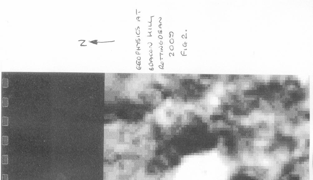
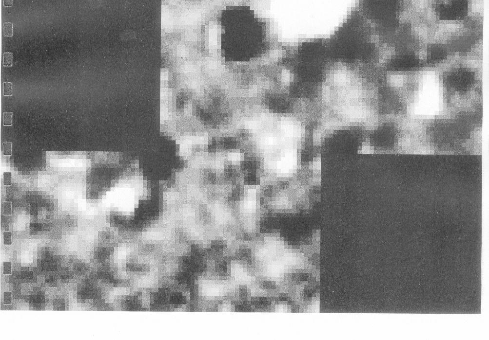
49 A GEOPHYSICAL SURVEY AT BEACON HILL, ROTTINGDEAN 2009 Introduction In March 2009 David Larkin one of the Brighton and Hove Countryside Rangers noted a shallow mound on Beacon Hill, Rottingdean. (TQ ). A flock of sheep that he had been tending had reduced the grass to a level which was unusual for this part of the hill. The circular mound was quite distinct and located close to one of the known Scheduled Neolithic long barrows. In late March 2009 the Brighton and Hove Archaeological Society Field Unit conducted a resistivity survey of the mound and the surrounding area. While the grids were being set out another slightly lower mound was also noted, immediately north/west of the first feature found. An additional 2 grids were set out to investigate both mounds. A total of 6 full grids measuring 20 x 20 metres square were surveyed. Methodology The centre of the first circular mound was used as the centre for the first four squares. (Fig.1 and 1.a). The machine used was an RM15 resistivity meter. The measurements were in Ohms and taken at 1 metre intervals. The results were downloaded using Snuffler data. (Fig 2.) Conclusions The results of the survey have produced images of a pair of distinct circular features identified as areas of high resistance (White in colour). The images do lack a circle of low resistance surrounding the mound. This would suggest that the mounds are not ancient barrows or burial mounds. A circular feature noted in an earlier survey on Beacon Hill in 2005 had a distinct tail, perhaps indicating that this could the location of an hitherto unknown windmill (Funnell). The new mounds do have associated areas of low resistance on their north/west and south/east sides respectively (Black in colour). The mounds, while being distinct landscape features, do lack evidence that could clearly identify them as prehistoric in origin. It is possible that the features have association with Second World War activities along this part of the south coast. A large mound located north of the disused dew pond on Beacon Hill was known at the gun pit by local youngsters. (Pers. Comm. Mark Gillingham). The only way to clearly date the features would be to conduct some small excavations in the hope of recovering some dateable material. The Brighton and Hove Archaeological Society have conducted several geophysical surveys at Beacon Hill, and on each occasion have revealed interesting anomalies. The Society is planning to return to Beacon Hill again in 2010 to continue their investigations. The areas will be focused on lands being used for sheep grazing. It is hoped the close cropping of the grass may reveal new contours and subtle earthworks. The various investigations will then be linked into one large panoramic landscape. Geophysics Rottingdean Page 1 of 5
50 Geophysics Rottingdean Page 2 of 5
51 Geophysics Rottingdean Page 3 of 5
52 Geophysics Rottingdean Page 4 of 5
53 Acknowledgements The author would like to thank Mr G.Bennett of the Brighton & Hove Planning Department for allowing access to the land, to David Larkin for bringing the features to the Society s attention and those members of the BHAS Field Unit who conducted the survey. References:- Funnell J.D. Beacon Hill Geophysics-2005 BHAS Field Notebook 2005 Funnell J.D. Beacon Hill Geophysics-2006 BHAS Field Notebook 2006 John Funnell 29 th March 2009 Geophysics Rottingdean Page 5 of 5
54 A GEOPHYSICAL SURVEY AT OVINGDEAN 2009 Introduction In February 2009 Brighton and Hove City Council allotments division made the Brighton and Hove Archaeological Society aware of the creation of a new series of allotments at Ovingdean. The new allotments are to be created west of the existing ones located immediately south of the village, adjacent to the Greenways Road. (TQ ) Ovingdean has been the subject of BHAS investigations over a number of years including excavation, field walking and resistivity surveying (Funnell). The village has produced finds from the prehistoric, Roman and medieval periods, focusing much on a medieval manorial complex located in the field immediately north of St Wulfran s church. The location of the medieval village, mentioned in Domesday is still unknown. A view eastwards from the top of Cattle Hill, located west of the allotments, has noted a number of crop marks, possible indicators of ground disturbance, fashioned in a village shaped configuration in the valley below. The new allotments are immediately east of these marks. John Davies, a local historian, has noted that when the adjacent field to the south of the allotments had been ploughed in the past, large quantities of oyster shells had been brought to the surface. It is possible that medieval, or even Roman rubbish pits may be located close by. Methodology A base line was set out along the fence line that is the south boundary of the new allotment area. The west boundary was an existing fence line. The first grid was located immediately east of the north/south fence line. A total of 4 grids were surveyed. The fourth grid was incomplete being only 18 metres in width, ending as it did at the west end of the existing allotment fence. (Fig 1.) The machine used was an RM15 resistivity meter. The measurements were in Ohms and taken at 1 metre intervals. The results were downloaded using Snuffler data. (Fig 2.) The survey was conducted in light drizzle. Conclusions The resistivity survey conducted at the allotment area in Ovingdean failed to produce evidence for any activity during any period. The images were completely bland with only the location of two trees being highlighted. Despite this lack of imagery the BHAS field unit will conduct a watching brief when the earth is turned to recover and record any archaeological features or artefacts that may noted. A member of the BHAS Field Unit conducted a metal detecting exercise in the ploughed field immediately south of the allotment area, while the resistivity was taking place, and noted within 40 metres of the field boundary a large concentration of oyster shell. His finds included a number of coins of near contemporary date. The field was used for sheep dog trials just after the Second World War and a number of marquees were frequently erected; it is possible that these coins are associated with theses events (Pers. Comm. M.Gillingham). Geophysics Ovingdean Page 1 of 3
55 Acknowledgements The author would like to thank Mr Tim Read the Brighton & Hove City Allotments Officer for bringing the development to the Society, Mr David Carr the tenant farmer for allowing access to his lands, Mr David Staveley for producing the images from the survey and those members of the BHAS Field Unit who conducted the survey. References:- Funnell J.D. BHAS Field Notebooks 1999, 2000, 2002, 2003, 2004 and 2006 John Funnell 27 th March 2009 Geophysics Ovingdean Page 2 of 3

56 Geophysics Ovingdean Page 3 of 3
57 A GEOPHYSICAL SURVEY AT PIDDINGWORTH Introduction Piddingworth is located in a small valley north of the Upper Lodge car park in Stanmer. (TQ ). The valley contains a number of earthworks and trackways that lead down from the Ditchling Road to an enclosure in the valley below. Piddingworth has quite a detailed history and notes about the medieval manor have been published (Christie et al) which includes the names of people associated with the manor and its surrounding area. The earliest references are the mention of a Martin de Piddingworth in 1201 and To the north of the medieval enclosure and trackway are the vestiges of a large barn, and a known water pipe line is capped here, which covers a large cistern. It is known that during the Second World War there were people living in houses located just north/west of the barn. These houses have subsequently been demolished and there is no evidence on the ground, other than old maps, of their exact location. (Pers. Comm. Jim Driver). In 2006 a visit was made to Piddingworth by the author and local retired woodsman Jim Driver in August. It had been a particularly dry summer. Looking down from the top of the hill, and just east of the Ditchling road, towards the enclosure, the clear imprint of a rectangular building was visible. The structure had dividing walls and it was visible on the south side of the enclosure. A series of crop marks also marked the location of two ditches, one going east/west the other north/south, the latter possibly being associated with the water tank known to be at the west end of the barn. Methodology The grid locations were set out using a total station with the first grid point located at the south/west corner of the survey and enclosure. A total of 9 grids, measuring 20 metres square were set out. The grids totalled 3 going from north to south and three going east to west (Fig 1.) The enclosure measures about 90 metres in length from the south edge of the enclosure and trackway up to almost the wall of the barn in the north. East/west the enclosure is about 42 metres in width, so that the final 18 metre or so to the east were outside of the actual enclosure boundary, which is indicated by a steep drop. The machine used was a TR Systems resistivity surveying meter. The measurements were in Ohms and taken at 1 metre intervals. The images were downloaded and created using Snuffler software. The weather during the week previous to the survey had been quite wet. Conclusions During the survey it was noted that there were several raised areas and a lack of vegetation in some locations exposed a variety of building materials. Other areas contained numerous mole hills, which were investigated during the surveying, but these simple manourves revealed not a single sherd of pottery. The only find was a single flint core, probably Mesolithic in date. The images produced on the survey are a mixture of high and low readings (Fig 2). However, the survey produced no evidence for either the building or ditches observed in that late summer a few years ago. The only clear definition is for a solid well defined edge Geophysics Piddingworth Page 1 of 4
58 along the east side of the enclosure. This is where the enclosure ends and drops down to the natural ground surface. There are areas of high resistance, notably in the north section of the enclosure, and not where the building was noted. During the survey building rubble was observed in a number of locations. Over the past year the field has been the location of feeding trays for quite a large herd of cattle. It is possible that extensive cattle disturbance has blurred the outline of the features. Any future investigations will have to be through excavation test pits to prove or disprove the possibility of vestiges of a building still remaining at Piddingworth. Acknowledgements The author would like to thank Mr G.Bennett of Brighton and Hove City Council, Tenant farmer Mr David Robinson for allowing access to their lands and David and Merryn Staveley, Maria Gardiner and Bill Santer who organised and assisted with the surveying. References:- Christie F.R., Hill A., Johnston B., & Pepler H.D.C Ditchling St Dominic s Press Ditchling, Hassocks, Sussex. Geophysics Piddingworth Page 2 of 4
59 Geophysics Piddingworth Page 3 of 4

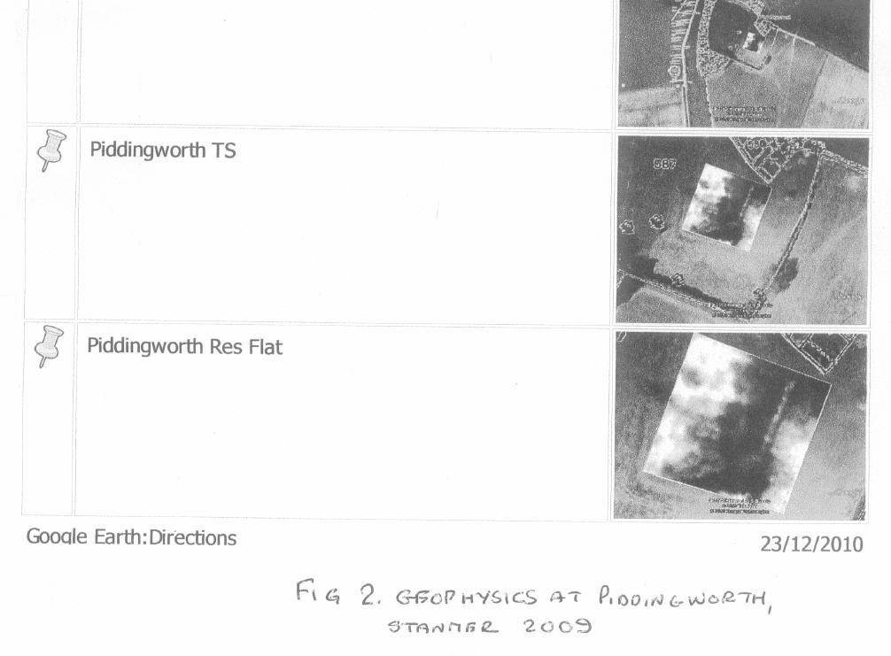
60 Geophysics Piddingworth Page 4 of 4
61 FIELD WALKING AT ROEDEAN NORTH FIELD - INTERIM REPORT Introduction During February and March of 2009 members the Brighton and Hove Archaeological Society Field Unit conducted field walking as part of an ongoing research programme focused on Ovingdean, Roedean and Beacon Hill, Rottingdean. The field walked is located immediately north of Roedean School (TQ ). The weather was sunny on the two occasions that the walking took place. The field had been ploughed in the late autumn and had been left over the winter. A tentative walk over survey of the field had been conducted late in 2007, as part of the investigations for an archaeological dissertation by a student at Sussex University. Some Roman pottery, including rim sherds, fire cracked flint and marine shell had been observed in the field. The new field walking is close to a number of other projects conducted in previous years and published in the BHAS Field Notebooks (Funnell). The finds from the previous field walking from fields located south/east of the new project, had produced significant finds of Roman and Iron Age pottery, flintwork and fire-cracked flint. Roedean School lies at the lower part of Cattle Hill, which is a prominent downland ridge located between the valleys of Roedean and Ovingdean. The field walking took place at the southern end of this hill, which has a gentle upward slope going north from the school boundary fence line. Methodology A base line was set up along the bottom, southern, edge of the field. The field curves down at both the west and east ends in an arc, so the base line being visible from east to west left small sections of the field below the base line to the south unexplored. A total of 16 lines (A-P) were set out 20 metres apart. The first line A was measured in 10 metres from the east side of the field. The lines were walked in 20 metre transects and finds collected for each interval. The walking was in an uphill direction. The number of transects in each line, except line A, was 12 complete 20 metre lengths, with the thirteenth being only a partial transect. The soil was extremely claylike to the east with a more predominant chalky loam texture to the west. The finds were collected and sorted. The results have now been transferred to dot density diagrams (Figs 1-5). Roedean Fieldwalking Page 1 of 9
62 The Finds Flint Work The field contained flintwork which consisted mainly of blue/grey or white patinated flint flakes. There were only a very few tools and cores. Most of the material consisted of primary flakes, with most pieces still retaining some cortex. Total Flakes 220 Retouched Flakes 3 Cores 4 Scraper 1 1 Piercer 1 1 Notched Flake 1 1 Hammerstone 1 1 Total Flint work Fire-Cracked Flint Total 548 Fire-Cracked Flint weight 10,062 (gms) Pottery The majority of sherds recovered from the walking were Roman and all were very abraded pieces. A few flint calcined Iron Age sherds were also found. The Roman fabrics were predominantly East Sussex wares, but with some coarse sand tempered wares. Sherds of Samian were recovered including a large, thick walled piece that was not decorated, but was probably part of a bowl. One of the thicker pieces of Roman pottery could possibly be part of an amphora. A number of sherds had a distinctly different fabric of coarse sand and flint temper and is considered to be medieval. Total Roman Sherds 132 (89.7%) 2 pieces were Samian (0.013%) Iron Age 5 (.034%) Medieval 10 (.068%) Total Sherds 147 Molluscs The field contained a scatter of badly damaged marine molluscs. These were mainly oyster with only three pieces of scallop being present. Marine Mollusc Oyster 26 Fragments Scallop 3 Fragments Total Collection 29 pieces. Roedean Fieldwalking Page 2 of 9
63 Miscellaneous Items The field contained numerous contemporary pieces of roofing tile, brick fragments and slate. Also present were a variety of glass fragments and some modern metalwork including a horseshoe, some chain, an unidentified buckle and a few modern nails. A single clay pipe stem was also found. There were considerable quantities of contemporary ceramics and some stoneware vessel fragments. A number of elongated beach pebbles were found and could possibly be rubbing stones, as several similar artefacts have been recovered from stratified Roman contexts. A single whetstone fragment was also found. Conclusions The field walking at Roedean has added important information to the broader panoramic picture being gradually produced at Ovingdean through the continuing research programme. The field walking over several years has brought together information that gives us a greater perspective of ancient times. Whilst the small field walked this year has not produced results of any great archaeological significance the general disposition of Roman and Iron Age pottery shows that there has been some ancient activity. The collection of struck flint and the large amount of fire-cracked flint, combined with the small quantity of marine shells, is perhaps the most visual anomaly indicating that this field may still possess some small vestiges of ancient settlement. The quantity of flint tools found is quite interesting, as most fields on the South Downs usually produce a percentage of such artefacts but this field produced very few completed artefacts. The fields south of Ovingdean village have generally produced large amounts of prehistoric flintwork, fire-cracked flint and Iron Age, Roman and medieval pottery. The field work is beginning to show that the concentration of finds from the Roman period tends to be focused around the central and eastern side of the field walked in previous years, located immediately south/east of this years project. The pottery recovered from the new project shows a distinct phasing out of ancient finds to the west of these fields. This is very noticeable when the results from all of the field walking projects are linked together. It is possible that there is a small outlying, house or presence focused on the locations of the fire-cracked flint and pottery, but only excavation could confirm this. The location of the Iron Age and Roman sites hinted at by the various field walking projects is still eluding the researchers. Subsequent resistivity studies within the areas of concentration have failed to produce any results to confirm the presence of Roman walls, ditches or pits. However, the large quantities of Roman coins found during the 1970 s and 1980 s clearly indicate that something important was located in lower Ovingdean. A recent study of aerial photographs on Google Earth has produced the image of a well defined enclosure in the lower field, opposite St Dunstans. Is this the location of this elusive site? The Brighton and Hove Archaeological Society are planning to conduct more resistivity surveys in this area once the crop has been removed. Hopefully geophysical anomalies will produce further evidence for Roman activity in this part of Sussex and some understanding of the scale and nature of the settlement or possible trading centre. The field walking in 2009 has produced an important addition to the archaeological record with the finds from the Roman period being fewer in quantity, suggesting that the western boundary of Roman influence in Ovingdean has been reached. Roedean Fieldwalking Page 3 of 9
64 Acknowledgements The author would like to thank Mr David Carr the tenant farmer for allowing access to his lands, Mr G.Bennett of Brighton and Hove City Council, Mr Mark Gillingham for reading and amending the written report, and to those members of the BHAS Field Unit who conducted the field walking. References:- Funnell J.D. Fieldwalking at Ovingdean 2000 BHAS Field Notebook 2000 Funnell J.D. Fieldwalking at Ovingdean 2003 BHAS Field Notebook 2003 Funnell J.D. Ovingdean Walkover Survey 2007 BHAS Field Notebook 2007 John Funnell 26 th March 2009 Roedean Fieldwalking Page 4 of 9
65 Roedean Fieldwalking Page 5 of 9
66 Roedean Fieldwalking Page 6 of 9
67 Roedean Fieldwalking Page 7 of 9
68 Roedean Fieldwalking Page 8 of 9
69 Roedean Fieldwalking Page 9 of 9
70 PALAEOLITHIC HAND AXE FOUND NEAR BARCOMBE. It was while Brighton author David Bangs was conducting research for his book about the freedom to roam guide in East Sussex that his girl friend, Jane Erin, noted an object in a ploughed field they were passing (TQ ). The ploughed field is on land to the east of Blunt s Wood, near Barcombe, north of the stream that runs across this particular field. The object proved upon examination to be a Palaeolithic bi-face axe. The bi-face has a mainly black/brown patination with a number of yellow/white striations. The axe was not complete, possibly having been broken in antiquity, but what remains measures 130mm in length and 95mm in width and about 25mm maximum in thickness. The axe is one of several recently found in this region. A very fine example, with a brown patination, was excavated from a palaeo-channel at the Barcombe villa site a few years ago. A similar object, with a blue/grey patination was found in a Roman context at Ringmer in 2007 (Chuter). The artefacts apparently derive from riverine gravel terraces that appear to have been exploited during this time of antiquity. (Pers. Comm.. Dr Matt Pope) Dr Matthew Pope has examined the bi-face and confirms, due to the lack of a sealed provenance, that it could be anywhere between 60,000 and 600,000 years old,. The Brighton and Hove Archaeological Society would like to thank Mr Bangs for bringing the object to their attention and to Jane Russell for illustrating the find. The bi-face has now been returned to Jane Erin. A report and drawing has been submitted to the Sussex Archaeological Society Collections. References:- Chuter G. Excavations of a Romano-British site at the Ringmer Gliding Club (Forthcoming) John Funnell 27 th December 2009 Palaeolithic Axe Page 1 of 1
71 BRIGHTON & HOVE ARCHAEOLOGICAL SOCIETY - WATCHING BRIEF Planning application no: BH2007/02975 Address: 50 Wolseley Road, Coldean, Brighton Planning Officer: Ms Liz Holt Name of Applicant: Mr Jason Collins Date of watching brief: 8 January 2009 BHAS officers conducting watching brief: M. Gillingham & B.Collins Results The above property was visited between 12 noon and 3 pm on the 8~ January The original garage had just been demolished to make way for a two storey extension. The foundation trench on the east side had been machined to a depth below the level of the natural chalk. Nothing was visible in the section except for an old sewer trench which was also visible in the west foundation trench when this was machined out during the site visit. The rear foundation trench was also dug during the site visit and showed no archaeological features in the section. However, two soakaway pits were dug in the rear garden and it appeared that the Western one had cut through a ditch running north east /south West. No features were revealed in the other soakaway. Finds There were very few as there was so much rubble on the site from the demolition of the old garage. lt was also not possible to have more than a cursory look at the builders spoil heaps as these were largely covered with chalk lumps and rubble. The only finds were 1 white patinated hard hammer struck flint flake with over 50% of cortex remaining. 1 piece of fire cracked flint. In view of the ditch revealed by the soakaway, the house owner very kindly agreed that a small scale excavation could be carried out by BHAS and this was carried out the following week. Watching Brief - Coldean Page 1 of 1
72 East Sussex County Council Archaeology Team - Watching Briefs Address of site: 3 ROSEMOUNT CLOSE, BISHOPSTONE Name of Owner of site: Mr & Mrs Shepherd Name of Architect/Building Contractor: County: East Sussex- Planning Ref: Planning Authority: Lewes District LW/08/ Fig OS Grid Ref: TQ: Date(s) of Watching Brief: 17 th February 2009 Name(s) of person(s) doing Watching Brief: Steve Corbett, Eva Corbett & Brenda Collins 100 word (maximum) summary: An archaeological planning condition was put in place on the construction of an extension on rear of the property. The site is situated close to an extensive multi period site previously excavated at Bishopstone. The foundation trenches were machine dug to a depth of 0.75metres and were 0.5metres wide cutting through an existing paved area. Adjacent to the house the foundation trenches were dug to a depth of 1.5metres over a length of 0.75metres. The trench section recorded a debris / hardcore layer below the former paved area c mm thick below which was a mixture of brown and blue clay tuning to a orange sandy clay at the bottom of the trench. A soak away was dug at the bottom of the garden 1.0metres by 1.0metres to a depth of 1.25metres The natural chalk geology was not exposed in either areas, the whole area appears to be made up ground, dating from the time of construction of the property. No archaeological features or deposits were observed and no archaeological artefacts recovered (although the spoil was not examined). Date: 26 th March 2009 Prepared by: Steve Corbett Copies to be sent to: The Planning Authority; The site owner, Historical Environment Record East Sussex County Council; Watching Brief Bishopstone Page 1 of 6


73 Finds Context Description Finds Comment 1 Loose hardcore layer, 100mm thick None Modern paving base 2 Brown/Blue clay None Made up ground Site Plans 1 Site location Watching Brief Bishopstone Page 2 of 6
74 Site Plan Watching Brief Bishopstone Page 3 of 6


75 Site Photos Hardcore surface under existing patio Footing trench looking north-west Watching Brief Bishopstone Page 4 of 6


76 Footing trench looking north-east South-east facing trench section Watching Brief Bishopstone Page 5 of 6


77 Soak away looking North-west Watching Brief Bishopstone Page 6 of 6
ARCHAEOLOGICAL FIELD NOTEBOOK 2008 A RECORD OF THE PROJECTS OF THE : BRIGHTON AND HOVE ARCHAEOLOGICAL SOCIETY FIELD UNIT
 ARCHAEOLOGICAL FIELD NOTEBOOK 2008 A RECORD OF THE PROJECTS OF THE : BRIGHTON AND HOVE ARCHAEOLOGICAL SOCIETY FIELD UNIT INTRODUCTION The 2007 season of field activities focused this year on Student projects.
ARCHAEOLOGICAL EVALUATION AT BRIGHTON POLYTECHNIC, NORTH FIELD SITE, VARLEY HALLS, COLDEAN LANE, BRIGHTON. by Ian Greig MA AIFA.
 ARCHAEOLOGICAL EVALUATION AT BRIGHTON POLYTECHNIC, NORTH FIELD SITE, VARLEY HALLS, COLDEAN LANE, BRIGHTON by Ian Greig MA AIFA May 1992 South Eastern Archaeological Services Field Archaeology Unit White
ARCHAEOLOGICAL FIELD NOTEBOOK 2011 A RECORD OF THE PROJECTS OF THE : BRIGHTON AND HOVE ARCHAEOLOGICAL SOCIETY FIELD UNIT
 ARCHAEOLOGICAL FIELD NOTEBOOK 2011 A RECORD OF THE PROJECTS OF THE : BRIGHTON AND HOVE ARCHAEOLOGICAL SOCIETY FIELD UNIT Introduction The new season of activities for the Brighton and Hove Archaeological
Greater London GREATER LONDON 3/606 (E ) TQ
 TQ") GREATER LONDON City of London 3/606 (E.01.6024) TQ 30358150 1 PLOUGH PLACE, CITY OF LONDON An Archaeological Watching Brief at 1 Plough Place, City of London, London EC4 Butler, J London : Pre-Construct
GREATER LONDON City of London 3/606 (E.01.6024) TQ 30358150 1 PLOUGH PLACE, CITY OF LONDON An Archaeological Watching Brief at 1 Plough Place, City of London, London EC4 Butler, J London : Pre-Construct
An archaeological evaluation at 16 Seaview Road, Brightlingsea, Essex February 2004
 An archaeological evaluation at 16 Seaview Road, Brightlingsea, Essex February 2004 report prepared by Kate Orr on behalf of Highfield Homes NGR: TM 086 174 (c) CAT project ref.: 04/2b ECC HAMP group site
Fieldwalking at Cottam 1994 (COT94F)
") Fieldwalking at Cottam 1994 (COT94F) Tony Austin & Elizabeth Jelley (19 Jan 29) 1. Introduction During the winter of 1994 students from the Department of Archaeology at the University of York undertook
Fieldwalking at Cottam 1994 (COT94F) Tony Austin & Elizabeth Jelley (19 Jan 29) 1. Introduction During the winter of 1994 students from the Department of Archaeology at the University of York undertook
An archaeological watching brief and recording at Brightlingsea Quarry, Moverons Lane, Brightlingsea, Essex October 2003
 An archaeological watching brief and recording at Brightlingsea Quarry, Moverons Lane, Brightlingsea, Essex commissioned by Mineral Services Ltd on behalf of Alresford Sand & Ballast Co Ltd report prepared
Control ID: Years of experience: Tools used to excavate the grave: Did the participant sieve the fill: Weather conditions: Time taken: Observations:
 Control ID: Control 001 Years of experience: No archaeological experience Tools used to excavate the grave: Trowel, hand shovel and shovel Did the participant sieve the fill: Yes Weather conditions: Flurries
Church of St Peter and St Paul, Great Missenden, Buckinghamshire
 Church of St Peter and St Paul, Great Missenden, Buckinghamshire An Archaeological Watching Brief for the Parish of Great Missenden by Andrew Taylor Thames Valley Archaeological Services Ltd Site Code
Colchester Archaeological Trust Ltd. A Fieldwalking Survey at Birch, Colchester for ARC Southern Ltd
 Colchester Archaeological Trust Ltd A Fieldwalking Survey at Birch, Colchester for ARC Southern Ltd November 1997 CONTENTS page Summary... 1 Background... 1 Methods... 1 Retrieval Policy... 2 Conditions...
39, Walnut Tree Lane, Sudbury (SUY 073) Planning Application No. B/04/02019/FUL Archaeological Monitoring Report No. 2005/112 OASIS ID no.
 Planning Application No. B/04/02019/FUL Archaeological Monitoring Report No. 2005/112 OASIS ID no.") 39, Walnut Tree Lane, Sudbury (SUY 073) Planning Application No. B/04/02019/FUL Archaeological Monitoring Report No. 2005/112 OASIS ID no. 9273 Summary Sudbury, 39, Walnut Tree Lane, Sudbury (TL/869412;
39, Walnut Tree Lane, Sudbury (SUY 073) Planning Application No. B/04/02019/FUL Archaeological Monitoring Report No. 2005/112 OASIS ID no. 9273 Summary Sudbury, 39, Walnut Tree Lane, Sudbury (TL/869412;
New Composting Centre, Ashgrove Farm, Ardley, Oxfordshire
 New Composting Centre, Ashgrove Farm, Ardley, Oxfordshire An Archaeological Watching Brief For Agrivert Limited by Andrew Weale Thames Valley Archaeological Services Ltd Site Code AFA 09/20 August 2009
Monitoring Report No. 99
 Monitoring Report No. 99 Enniskillen Castle Co. Fermanagh AE/06/23 Cormac McSparron Site Specific Information Site Name: Townland: Enniskillen Castle Enniskillen SMR No: FER 211:039 Grid Ref: County: Excavation
A Sense of Place Tor Enclosures
 A Sense of Place Tor Enclosures Tor enclosures were built around six thousand years ago (4000 BC) in the early part of the Neolithic period. They are large enclosures defined by stony banks sited on hilltops
Archaeological sites and find spots in the parish of Burghclere - SMR no. OS Grid Ref. Site Name Classification Period
 Archaeological sites and find spots in the parish of Burghclere - SMR no. OS Grid Ref. Site Name Classification Period SU45NE 1A SU46880 59200 Ridgemoor Farm Inhumation Burial At Ridgemoor Farm, on the
A Fieldwalking Project At Sompting. West Sussex
 by John Funnell Introduction A Fieldwalking Project At Sompting. West Sussex During March -and April 1995 the Brighton and Hove Archaeological Society conducted fie1dwa1king in a field at Sompting West
Grim s Ditch, Starveall Farm, Wootton, Woodstock, Oxfordshire
 Grim s Ditch, Starveall Farm, Wootton, Woodstock, Oxfordshire An Archaeological Recording Action For Empire Homes by Steve Ford Thames Valley Archaeological Services Ltd Site Code SFW06/118 November 2006
Chapter 2. Remains. Fig.17 Map of Krang Kor site
 Chapter 2. Remains Section 1. Overview of the Survey Area The survey began in January 2010 by exploring the site of the burial rootings based on information of the rooted burials that was brought to the
Former Whitbread Training Centre Site, Abbey Street, Faversham, Kent Interim Archaeological Report Phase 1 November 2009
 Former Whitbread Training Centre Site, Abbey Street, Faversham, Kent Interim Archaeological Report Phase 1 November 2009 SWAT. Archaeology Swale and Thames Archaeological Survey Company School Farm Oast,
1 The East Oxford Archaeology and History Project
 1 The East Oxford Archaeology and History Project EXOP TEST PIT 72 Location: Bartlemas Chapel, Cowley Date of excavation: 6-8 November 2013. Area of excavation: 0.8m x 1.2m, at the eastern end of the chapel.
Bronze Age 2, BC
 Bronze Age 2,000-600 BC There may be continuity with the Neolithic period in the Early Bronze Age, with the harbour being used for seasonal grazing, and perhaps butchering and hide preparation. In the
Moray Archaeology For All Project
 School children learning how to identify finds. (Above) A flint tool found at Clarkly Hill. Copyright: Leanne Demay Moray Archaeology For All Project ational Museums Scotland have been excavating in Moray
Archaeological. Monitoring & Recording Report. Fulbourn Primary School, Cambridgeshire. Archaeological Monitoring & Recording Report.
 Fulbourn Primary School, Cambridgeshire Archaeological Monitoring & Recording Report October 2014 Client: Cambridgeshire County Council OA East Report No: 1689 OASIS No: oxfordar3-192890 NGR: TL 5190 5613
7. Prehistoric features and an early medieval enclosure at Coonagh West, Co. Limerick Kate Taylor
 7. Prehistoric features and an early medieval enclosure at Coonagh West, Co. Limerick Kate Taylor Illus. 1 Location of the site in Coonagh West, Co. Limerick (based on the Ordnance Survey Ireland map)
A visit to the Wor Barrow 21 st November 2015
 A visit to the Wor Barrow 21 st November 2015 Following our exploration of Winkelbury a few weeks previously, we fast forwarded 12 years in Pitt Rivers remarkable series of excavations and followed him
An archaeological evaluation at the Lexden Wood Golf Club (Westhouse Farm), Lexden, Colchester, Essex
, Lexden, Colchester, Essex") An archaeological evaluation at the Lexden Wood Golf Club (Westhouse Farm), Lexden, Colchester, Essex January 2000 Archive report on behalf of Lexden Wood Golf Club Colchester Archaeological Trust 12 Lexden
An archaeological evaluation at the Lexden Wood Golf Club (Westhouse Farm), Lexden, Colchester, Essex January 2000 Archive report on behalf of Lexden Wood Golf Club Colchester Archaeological Trust 12 Lexden
THE PRE-CONQUEST COFFINS FROM SWINEGATE AND 18 BACK SWINEGATE
 THE PRE-CONQUEST COFFINS FROM 12 18 SWINEGATE AND 18 BACK SWINEGATE An Insight Report By J.M. McComish York Archaeological Trust for Excavation and Research (2015) Contents 1. INTRODUCTION... 3 2. THE
SALVAGE EXCAVATIONS AT OLD DOWN FARM, EAST MEON
 Proc. Hants. Field Club Archaeol. Soc. 36, 1980, 153-160. 153 SALVAGE EXCAVATIONS AT OLD DOWN FARM, EAST MEON By RICHARD WHINNEY AND GEORGE WALKER INTRODUCTION The site was discovered by chance in December
Moated Site at Manor Farm, Islip, Oxfordshire
 Moated Site at Manor Farm, Islip, Oxfordshire An Archaeological Excavation By Jo Pine Site Code MFI05 December 2007 Summary Site name: Moated Site at Manor Farm, Islip, Oxfordshire Grid reference: SP 5298
ARCHAEOLOGICAL FIELD NOTEBOOK 2004 A RECORD OF THE PROJECTS OF THE : BRIGHTON AND HOVE ARCHAEOLOGICAL SOCIETY FIELD UNIT
 ARCHAEOLOGICAL FIELD NOTEBOOK 2004 A RECORD OF THE PROJECTS OF THE : BRIGHTON AND HOVE ARCHAEOLOGICAL SOCIETY FIELD UNIT CONTENTS INTRODUCTION... 1 EXCAVATIONS Woodingdean Cemetery Project Interim Report
3. The new face of Bronze Age pottery Jacinta Kiely and Bruce Sutton
 3. The new face of Bronze Age pottery Jacinta Kiely and Bruce Sutton Illus. 1 Location map of Early Bronze Age site at Mitchelstown, Co. Cork (based on the Ordnance Survey Ireland map) A previously unknown
Cambridge Archaeology Field Group. Fieldwalking on the Childerley Estate, Cambridgeshire. Autumn 2014 to Spring Third interim report
 Cambridge Archaeology Field Group Fieldwalking on the Childerley Estate, Cambridgeshire Autumn 2014 to Spring 2015 Third interim report Summary Field walking on the Childerley estate of Martin Jenkins
Cetamura Results
 Cetamura 2000 2006 Results A major project during the years 2000-2006 was the excavation to bedrock of two large and deep units located on an escarpment between Zone I and Zone II (fig. 1 and fig. 2);
NOTE A THIRD CENTURY ROMAN BURIAL FROM MANOR FARM, HURSTBOURNE PRIORS. by. David Allen with contributions by Sue Anderson and Brenda Dickinson
 Proc. Hampsh. Field Club Archaeol. Soc. 47, 1991, 253-257 NOTE A THIRD CENTURY ROMAN BURIAL FROM MANOR FARM, HURSTBOURNE PRIORS Abstract by. David Allen with contributions by Sue Anderson and Brenda Dickinson
An archaeological evaluation in the playground of Colchester Royal Grammar School, Lexden Road, Colchester, Essex
 An archaeological evaluation in the playground of Colchester Royal Grammar School, Lexden Road, Colchester, Essex February 2002 on behalf of Roff Marsh Partnership CAT project code: 02/2c Colchester Museum
2 Saxon Way, Old Windsor, Berkshire
 2 Saxon Way, Old Windsor, Berkshire An Archaeological Watching Brief For Mrs J. McGillicuddy by Pamela Jenkins Thames Valley Archaeological Services Ltd Site Code SWO 05/67 August 2005 Summary Site name:
Monitoring Report No Sacred Heart Church Aghamore Boho Co. Fermanagh AE/10/116E. Brian Sloan L/2009/1262/F
 Monitoring Report No. 202 Sacred Heart Church Aghamore Boho Co. Fermanagh AE/10/116E Brian Sloan L/2009/1262/F Site Specific Information Site Address: Sacred Heart Church, Aghamore, Boho, Co. Fermanagh
Silwood Farm, Silwood Park, Cheapside Road, Ascot, Berkshire
 Silwood Farm, Silwood Park, Cheapside Road, Ascot, Berkshire An Archaeological Watching Brief For Imperial College London by Tim Dawson Thames Valley Archaeological Services Ltd Site Code SFA 09/10 April
Evidence for the use of bronze mining tools in the Bronze Age copper mines on the Great Orme, Llandudno
 Evidence for the use of bronze mining tools in the Bronze Age copper mines on the Great Orme, Llandudno Background The possible use of bronze mining tools has been widely debated since the discovery of
Suburban life in Roman Durnovaria
 Suburban life in Roman Durnovaria Additional specialist report Finds Ceramic building material By Kayt Brown Ceramic building material (CBM) Kayt Brown A total of 16420 fragments (926743g) of Roman ceramic
An archaeological evaluation at the Blackwater Hotel, Church Road, West Mersea, Colchester, Essex March 2003
 An archaeological evaluation at the Blackwater Hotel, Church Road, West Mersea, Colchester, Essex report prepared by Laura Pooley on behalf of Dolphin Developments (U.K) Ltd NGR: TM 0082 1259 CAT project
ARCHAEOLOGICAL MONITORING REPORT
 ARCHAEOLOGICAL MONITORING REPORT SCCAS REPORT No. 2009/324 Thorington Hall, Stoke by Nayland SBN 087 HER Information Date of Fieldwork: November 2009 - January 2010 Grid Reference: TM 0131 3546 Funding
FURTHER MIDDLE SAXON EVIDENCE AT COOK STREET, SOUTHAMPTON (SOU 567)
") Roc. Hampshire Field Club Archaeol. Soc 52,1997, 77-87 (Hampshire Studies 1997) FURTHER MIDDLE SAXON EVIDENCE AT COOK STREET, SOUTHAMPTON (SOU 567) By M F GARNER andj VINCENT with a contribution byjacqueline
Roc. Hampshire Field Club Archaeol. Soc 52,1997, 77-87 (Hampshire Studies 1997) FURTHER MIDDLE SAXON EVIDENCE AT COOK STREET, SOUTHAMPTON (SOU 567) By M F GARNER andj VINCENT with a contribution byjacqueline
STONE implements and pottery indicative of Late Neolithic settlement are known to
 Late Neolithic Site in the Extreme Northwest of the New Territories, Hong Kong Received 29 July 1966 T. N. CHIU* AND M. K. WOO** THE SITE STONE implements and pottery indicative of Late Neolithic settlement
BALNUARAN. of C LAVA. a prehistoric cemetery. A Visitors Guide to
 A Visitors Guide to BALNUARAN of C LAVA a prehistoric cemetery Milton of Clava Chapel (?) Cairn River Nairn Balnuaran of Clava is the site of an exceptionally wellpreserved group of prehistoric burial
Peace Hall, Sydney Town Hall Results of Archaeological Program (Interim Report)
") Results of Archaeological Program (Interim Report) Background The proposed excavation of a services basement in the western half of the Peace Hall led to the archaeological investigation of the space in
Results of Archaeological Program (Interim Report) Background The proposed excavation of a services basement in the western half of the Peace Hall led to the archaeological investigation of the space in
Greater London Region GREATER LONDON 3/567 (E.01.K099) TQ BERMONDSEY STREET AND GIFCO BUILDING AND CAR PARK
 TQ BERMONDSEY STREET AND GIFCO BUILDING AND CAR PARK") GREATER LONDON 3/567 (E.01.K099) TQ 33307955 156-170 BERMONDSEY STREET AND GIFCO BUILDING AND CAR PARK Assessment of an Archaeological Excavation at 156-170 Bermondsey Street and GIFCO Building and Car
GREATER LONDON 3/567 (E.01.K099) TQ 33307955 156-170 BERMONDSEY STREET AND GIFCO BUILDING AND CAR PARK Assessment of an Archaeological Excavation at 156-170 Bermondsey Street and GIFCO Building and Car
Cambridge Archaeology Field Group. Fieldwalking on the Childerley Estate Cambridgeshire
 Cambridge Archaeology Field Group Fieldwalking on the Childerley Estate Cambridgeshire 2009 to 2014 Summary Fieldwalking on the Childerley estate of Martin Jenkins and Family has revealed, up to March
Archaeological Watching Brief (Phase 2) at Court Lodge Farm, Aldington, near Ashford, Kent December 2011
 at Court Lodge Farm, Aldington, near Ashford, Kent December 2011") Archaeological Watching Brief (Phase 2) at Court Lodge Farm, Aldington, near Ashford, Kent December 2011 SWAT. Archaeology Swale and Thames Archaeological Survey Company School Farm Oast, Graveney Road
Archaeological Watching Brief (Phase 2) at Court Lodge Farm, Aldington, near Ashford, Kent December 2011 SWAT. Archaeology Swale and Thames Archaeological Survey Company School Farm Oast, Graveney Road
Excavations at Shikarpur, Gujarat
 Excavations at Shikarpur, Gujarat 2008-2009 The Department of Archaeology and Ancient History, the M. S. University of Baroda continued excavations at Shikarpur in the second field season in 2008-09. In
Tell Shiyukh Tahtani (North Syria)
") Tell Shiyukh Tahtani (North Syria) Report of the 2010 excavation season conducted by the University of Palermo Euphrates Expedition by Gioacchino Falsone and Paola Sconzo In the summer 2010 the University
Tell Shiyukh Tahtani (North Syria) Report of the 2010 excavation season conducted by the University of Palermo Euphrates Expedition by Gioacchino Falsone and Paola Sconzo In the summer 2010 the University
Undley Hall, Lakenheath LKH 307
 ARCHAEOLOGICAL EVALUATION AND MONITORING REPORT SCCAS REPORT No. 2010/005 Undley Hall, Lakenheath LKH 307 E. Muldowney SCCAS January 2010 www.suffolkcc.gov.uk/e-and-t/archaeology Lucy Robinson, County
Archaeological Material From Spa Ghyll Farm, Aldfield
 Archaeological Material From Spa Ghyll Farm, Aldfield Introduction Following discussions with Linda Smith the Rural Archaeologist for North Yorkshire County Council, Robert Morgan of 3D Archaeological
Fort Arbeia and the Roman Empire in Britain 2012 FIELD REPORT
 Fort Arbeia and the Roman Empire in Britain 2012 FIELD REPORT Background Information Lead PI: Paul Bidwell Report completed by: Paul Bidwell Period Covered by this report: 17 June to 25 August 2012 Date
MARSTON MICHAEL FARLEY
 MARSTON MICHAEL FARLEY On 9 March agricultural contractors, laying field drains for Bucks County Council Land Agent's Department, cut through a limestone structure at SP 75852301 in an area otherwise consistently
THE RAVENSTONE BEAKER
 DISCOVERY THE RAVENSTONE BEAKER K. J. FIELD The discovery of the Ravenstone Beaker (Plate Xa Fig. 1) was made by members of the Wolverton and District Archaeological Society engaged on a routine field
Essex Historic Environment Record/ Essex Archaeology and History
 Essex Historic Environment Record/ Essex Archaeology and History CAT Report 578 Summary sheet Address: Kingswode Hoe School, Sussex Road, Colchester, Essex Parish: Colchester NGR: TL 9835 2528 Type of
An archaeological watching brief at Sheepen, Colchester, Essex November-December 2003
 An archaeological watching brief at Sheepen, Colchester, Essex November-December 2003 report prepared by Ben Holloway on behalf of Colchester Borough Council CAT project ref.: 03/11c Colchester Museums
Chapel House Wood Landscape Project. Interim Report 2013
 Chapel House Wood Landscape Project Interim Report 2013 Chapel House Wood Landscape Project Interim Report 2013 The annual Dales Heritage Field School was held at Chapel House Wood again this year, and
T so far, by any other ruins in southwestern New Mexico. However, as
 TWO MIMBRES RIVER RUINS By EDITHA L. WATSON HE ruins along the Mimbres river offer material for study unequaled, T so far, by any other ruins in southwestern New Mexico. However, as these sites are being
AREA C. HENRY 0. THOMPSON American Center of Oriental Research Amman, Jordan
 AREA C HENRY 0. THOMPSON American Center of Oriental Research Amman, Jordan Of the 1971 work previously reported,' Squares 4,5, and 6 were not excavated in 1973, but work in Squares 1, 2, and 3 was continued.
Section Worked stone catalogue By Hugo Anderson-Whymark
 Section 4.11.2 Worked stone catalogue By Hugo Anderson-Whymark Table 4.67: Worked stone from Alfred s Castle. TR Ctxt SF No 1 1000 0 Weaponry Sling-shot Flint pebble 100 1 57 43 37 27 Iron Age 1 1160 0
Erection of wind turbine, Mains of Loanhead, Old Rayne, AB52 6SX
 Erection of wind turbine, Mains of Loanhead, Old Rayne, AB52 6SX Ltd 23 November 2011 Erection of wind turbine, Mains of Loanhead, Old Rayne, AB52 6SX CONTENTS 1 INTRODUCTION 3 2 ARCHAEOLOGICAL BACKGROUND
STONES OF STENNESS HISTORIC ENVIRONMENT SCOTLAND STATEMENT OF SIGNIFICANCE
 Property in Care (PIC) ID: PIC321 Designations: Scheduled Monument (SM90285); Taken into State care: 1906 (Guardianship) Last reviewed: 2003 HISTORIC ENVIRONMENT SCOTLAND STATEMENT OF SIGNIFICANCE STONES
Caistor Roman Project Interim Summary of 2015 Season of Test pits at Caistor Old Hall
 Caistor Roman Project Interim Summary of 2015 Season of Test pits at Caistor Old Hall Introduction This brief report summarises the first results of the 2015 campaign of test-pitting in the grounds of
AN EARLY MEDIEVAL RUBBISH-PIT AT CATHERINGTON, HAMPSHIRE Bj>J. S. PILE and K. J. BARTON
 AN EARLY MEDIEVAL RUBBISH-PIT AT CATHERINGTON, HAMPSHIRE Bj>J. S. PILE and K. J. BARTON INTRODUCTION THE SITE (fig. 21) is situated in the village of Catherington, one mile north-west of Horndean and 200
1. Presumed Location of French Soundings Looking NW from the banks of the river.
 SG02? SGS SG01? SG4 1. Presumed Location of French Soundings Looking NW from the banks of the river. The presumed location of SG02 corresponds to a hump known locally as the Sheikh's tomb. Note also (1)
St Germains, Tranent, East Lothian: the excavation of Early Bronze Age remains and Iron Age enclosed and unenclosed settlements
 Proc Soc Antiq Scot, 128 (1998), 203-254 St Germains, Tranent, East Lothian: the excavation of Early Bronze Age remains and Iron Age enclosed and unenclosed settlements Derek Alexander* & Trevor Watkinsf
A COIN OF OFFA FOUND IN A VIKING-AGE BURIAL AT VOSS, NORWAY. Bergen Museum.
 A COIN OF OFFA FOUND IN A VIKING-AGE BURIAL AT VOSS, NORWAY. BY HAAKON SCHETELIG, Doct. Phil., Curator of the Bergen Museum. Communicated by G. A. AUDEN, M.A., M.D., F.S.A. URING my excavations at Voss
Barnet Battlefield Survey
 In terim report on the progress of the Barnet Battlefield Survey December 2016 The Barnet Battlefield Survey is an archaeological investigation into the 1471 Battle of Barnet. It aims to define more accurately
TIPPERARY HISTORICAL JOURNAL 1994
 TPPERARY HSTORCAL JOURNAL 1994 County Tipperary Historical Society www.tipperarylibraries.ie/ths society@tipperarylibraries. ie SSN 0791-0655 Excavations at Cormac's Chapel, Cashel, 1992 and 1993: a preliminary
Test-Pit 3: 31 Park Street (SK )
") -Pit 3: 31 Park Street (SK 40732 03178) -Pit 3 was excavated in a flower bed in the rear garden of 31 Park Street, on the northern side of the street and west of an alleyway leading to St Peter s Church,
-Pit 3: 31 Park Street (SK 40732 03178) -Pit 3 was excavated in a flower bed in the rear garden of 31 Park Street, on the northern side of the street and west of an alleyway leading to St Peter s Church,
Advanced archaeology at the archive. Museum of London Support materials AS/A2 study day
 Advanced archaeology at the archive Support materials AS/A2 study day Contents National Curriculum links and session description 1-2 Example timetable 3 Practical guidelines 4 Visit preparation and pre-visit
Archaeological evaluation at the Onley Arms, The Street, Stisted, Essex
 Archaeological evaluation at the Onley Arms, The Street, Stisted, Essex November 2014 report by Pip Parmenter and Adam Wightman with a contribution from Stephen Benfield and illustrations by Emma Holloway
An archaeological evaluation by trial-trenching at Playgolf, Bakers Lane, Westhouse Farm, Colchester, Essex
 An archaeological evaluation by trial-trenching at Playgolf, Bakers Lane, Westhouse Farm, Colchester, Essex commissioned by Mr Stephen Belchem on behalf of ADP Ltd. report prepared by Chris Lister Planning
An archaeological watching brief on one section of an Anglian Water main Spring Lane, Lexden, Colchester
 An archaeological watching brief on one section of an Anglian Water main Spring Lane, Lexden, Colchester April-September 2001 on behalf of Breheny Contractors CAT project ref.: 01/4D Colchester Museum
Lanton Lithic Assessment
 Lanton Lithic Assessment Dr Clive Waddington ARS Ltd The section headings in the following assessment report refer to those in the Management of Archaeological Projects (HBMC 1991), Appendix 4. 1. FACTUAL
EVALUATION REPORT No. 273
 EVALUATION REPORT No. 273 Freeduff Presbyterian Church, 3 Oldtown road, Freeduff, Cullyhanna, County Armagh Licence No.: AE/13/133E Sapphire Mussen Report Date: 20/09/2013 Contents List of Figures... 2
Changing People Changing Landscapes: excavations at The Carrick, Midross, Loch Lomond Gavin MacGregor, University of Glasgow
 Changing People Changing Landscapes: excavations at The Carrick, Midross, Loch Lomond Gavin MacGregor, University of Glasgow Located approximately 40 kilometres to the south-west of Oban, as the crow flies
Centre for Archaeological Fieldwork School of Geography, Archaeology and Palaeoecology Queen s University Belfast
 Centre for Archaeological Fieldwork School of Geography, Archaeology and Palaeoecology Queen s University Belfast Data Structure Report: No. 053 Excavations at Dunseverick Cave, Feigh alias Dunseverick,
Forteviot, Perthshire 2008: Excavations of a henge monument and timber circle. Data Structure and Interim Report. by Gordon Noble and Kenneth Brophy
 Forteviot, Perthshire 2008: Excavations of a henge monument and timber circle Data Structure and Interim Report by Gordon Noble and Kenneth Brophy Summary This interim report will describe the provisional
[Type text] The Story So Far. Excavations at Chewton Mendip 2011 to nd edition. Pip Osborne. Community Archaeology on the Mendip Plateau CAMP
![[Type text] The Story So Far. Excavations at Chewton Mendip 2011 to nd edition. Pip Osborne. Community Archaeology on the Mendip Plateau CAMP](/thumbs/74/69847499.jpg "[Type text] The Story So Far. Excavations at Chewton Mendip 2011 to nd edition. Pip Osborne. Community Archaeology on the Mendip Plateau CAMP") [Type text] The Story So Far Excavations at Chewton Mendip 2011 to 2016 2 nd edition Pip Osborne Community Archaeology on the Mendip Plateau CAMP THE STORY SO FAR EXCAVATIONS AT CHEWTON MENDIP 2011 TO
[Type text] The Story So Far Excavations at Chewton Mendip 2011 to 2016 2 nd edition Pip Osborne Community Archaeology on the Mendip Plateau CAMP THE STORY SO FAR EXCAVATIONS AT CHEWTON MENDIP 2011 TO
The Jawan Chamber Tomb Adapted from a report by F.S. Vidal, Dammam, December 1953
 Figure 1 - The Jawan tomb as photographed from helicopter by Sgt. W. Seto, USAF, in May 1952 The Jawan Chamber Tomb Adapted from a report by F.S. Vidal, Dammam, December 1953 I. Description of work and
CHAPTER 14. Conclusions. Nicky Milner, Barry Taylor and Chantal Conneller
 PA RT 6 Conclusions In conclusion it is only fitting to emphasise that, useful though the investigations at Star Carr have been in helping to fill a gap in the prehistory of north-western Europe, much
Archaeological trial-trenching evaluation at Chappel Farm, Little Totham, Essex. April 2013
 Archaeological trial-trenching evaluation at Chappel Farm, Little Totham, Essex April 2013 report prepared by Ben Holloway commissioned by Tim Harbord Associates on behalf of Mr Tom Howie Planning reference:
16 members of the Fieldwalking Group met York Community Archaeologist Jon Kenny at Lou Howard s farm, Rose Cottage Farm, at
 Terrington History Group Fieldwalking Group Field 1 Final report 21 October 2011 - fieldwalking 16 members of the Fieldwalking Group met York Community Archaeologist Jon Kenny at Lou Howard s farm, Rose
Grange Farm, Widmer End, Hughenden, Buckinghamshire
 Grange Farm, Widmer End, Hughenden, Buckinghamshire An Archaeological Evaluation for British Flora by Andy Taylor Thames Valley Archaeological Services Ltd Site Code GFH 05/63 July 2005 Summary Site name:
Chapter 2: Archaeological Description
 Chapter 2: Archaeological Description Phase 1 Late Neolithic, c 3000-2400 BC (Figs 6-9) Evidence of Neolithic activity was confined to pits dug across the southern half of the site (Fig. 6). Eighteen pits
HANT3 FIELD CLUB AND ARCH^OLOGICAL SOCIETY, PLATE 4
 HANT3 FIELD CLUB AND ARCH^OLOGICAL SOCIETY, 1898. PLATE 4 VUU*. ilurti.14 HALF SIZE. BRONZE PALSTAVES, FOUND AT PEAR TREE GREEN. n BRONZE IMPLEMENTS FROM THE. NEIGHBOURHOOD OF SOUTHAMPTON, BY W. DALE,
The lithic assemblage from Kingsdale Head (KH09)
") 1 The lithic assemblage from Kingsdale Head (KH09) Hannah Russ Introduction During excavation the of potential Mesolithic features at Kingsdale Head in 2009 an assemblage of flint and chert artefacts were
1 The lithic assemblage from Kingsdale Head (KH09) Hannah Russ Introduction During excavation the of potential Mesolithic features at Kingsdale Head in 2009 an assemblage of flint and chert artefacts were
Life and Death on a Romano-British estate: Turnershall Farm in Hertfordshire
 Introduction Life and Death on a Romano-British estate: Turnershall Farm in Hertfordshire In 2002 metal detectorists discovered two of the most significant burials to come from Roman Britain. The objects
(photograph courtesy Earle Seubert)
") THE ARCHAEOLOGY OF A CEMETERY THE TRIALS AND TRIBULATIONS OF FINDING THE LOST GRAVES OF WOODMAN POINT QUARANTINE STATION This presentation is about a project initiated by the Friends of Woodman Point and
THE ARCHAEOLOGY OF A CEMETERY THE TRIALS AND TRIBULATIONS OF FINDING THE LOST GRAVES OF WOODMAN POINT QUARANTINE STATION This presentation is about a project initiated by the Friends of Woodman Point and
THE UNFOLDING ARCHAEOLOGY OF CHELTENHAM
 THE UNFOLDING ARCHAEOLOGY OF CHELTENHAM The archaeology collection of Cheltenham Art Gallery & Museum contains a rich quantity of material relating to the prehistoric and Roman occupation of the North
An early pot made by the Adena Culture (800 B.C. - A.D. 100)
") Archaeologists identify the time period of man living in North America from about 1000 B.C. until about 700 A.D. as the Woodland Period. It is during this time that a new culture appeared and made important
Archaeologists identify the time period of man living in North America from about 1000 B.C. until about 700 A.D. as the Woodland Period. It is during this time that a new culture appeared and made important
An archaeological watching brief at St Leonard s church, Hythe Hill, Colchester, Essex
 An archaeological watching brief at St Leonard s church, Hythe Hill, Colchester, Essex report prepared by Adam Wightman on behalf of Dorvell Construction CAT project ref.: 10/5d Colchester and Ipswich
ST PATRICK S CHAPEL, ST DAVIDS PEMBROKESHIRE 2015
 ST PATRICK S CHAPEL, ST DAVIDS PEMBROKESHIRE 2015 REPORT FOR THE NINEVEH CHARITABLE TRUST THE UNIVERSITY OF SHEFFIELD AND DYFED ARCHAEOLOGICAL TRUST Introduction ST PATRICK S CHAPEL, ST DAVIDS, PEMBROKESHIRE,
I MADE THE PROBLEM UP,
 This assignment will be due Thursday, Oct. 12 at 10:45 AM. It will be late and subject to the late penalties described in the syllabus after Friday, Oct. 13, at 10:45 AM. Complete submission of this assignment
Fieldwalk On Falmer Hill, Near Brighton - Second Season
 Fieldwalk On Falmer Hill, Near Brighton - Second Season by the Brighton and Hove Archaeological Society This report as well as describing the recent fieldwalks also includes descriptions of previous discoveries
Earthworks at Glebe Farm, Tilshead
 Earthworks at Glebe Farm, Tilshead Site Code TL004 Archaeological Field Evaluation And Post-Excavation Assessment Report No. 167.0801 Report date November 2011 Authors R.Holley & L.Amadio 1 Earthworks
Phase 2 Urban consolidation AD
 Phase 2 Urban consolidation AD 1250-1350 The second recognised phase of activity at Rådhuspladsen corresponded approximately to the High medieval period (c. AD 1250 1350), and saw consolidation of the