NORTH PENNINES ARCHAEOLOGY LTD
|
|
|
- Kristin McLaughlin
- 5 years ago
- Views:
Transcription
1 NORTH PENNINES ARCHAEOLOGY LTD Client Report No. CP/446/07 Planning Reference: NCCCT Reference: T13/23; 5982 OASIS Reference: northpen Tony Liddell B.Sc. Nenthead Mines Heritage Centre Nenthead Alston Cumbria CA9 3PD Tel: (01434) Fax: (01434) Thursday, 08 March 2007 is a wholly owned company of North Pennines Heritage Trust Company Registration No VAT Registration No
2 CONTENTS 1. INTRODUCTION Circumstances of the Project METHODOLOGY Project Design Historical Research Fieldwork Archive BACKGROUND Location, Topography and Geology Historical Background RESEARCH RESULTS Introduction Northumberland Record Office (Woodhorn) (NRO) Hexham Library Local Studies Section (HLLSS) Cartographic Sources FIELDWORK RESULTS Introduction Stage 1: Watching Brief Phase I Stage 2: The Excavation Methodology Building # Building # Road Building # Building # Horticultural area Building # Industrial Area (south end of site) Stage 3: Watching Brief Phase II Stage 4: Watching Brief Phase III Phasing/Interpretation ENVIRONMENTAL, FINDS AND HUMAN REMAINS Environmental Sampling Finds Analysis Human Remains Analysis CONCLUSIONS AND RECOMMENDATIONS Conclusions Recommendations...43 BIBLIOGRAPHY Primary Sources Secondary Sources...44 APPENDIX 1: CONTEXT LIST...46 APPENDIX 2: FINDS DATA...49 APPENDIX 3: POTTERY CATALOGUE...52 APPENDIX 4: FIGURES...59 Client Report for the use of SBD LLP i
3 LIST OF ILLUSTRATIONS Figure 1. Location of the site on a modern Ordnance Survey Map Figure 2. Corbridge Tithe Award, Figure 3. First Edition Ordnance Survey Mapping, Figure 4. Second Edition Ordnance Survey Mapping, Figure 5. Land Valuation Plan of Corbridge, Figure 6. Third Edition Ordnance Survey Mapping, Figure 7. Overall plan of Excavation Area Figure 8. Buildings by Area Figure 9. Overall plan of Watching Brief Areas Figure 10. East facing section of site excavated and recorded during demolition of western boundary wall Figure 11. Eastern extent of south-facing section across northern extent of site Figure 12. Elevations and Sections in the south-eastern section of the site Figure 13. Sections of Pads # Figure 14. Plan of southern section of site Client Report for the use of SBD LLP ii
4 LIST OF PLATES Plate 1. Skeleton #2, looking west. The skeleton had been cut through the wall.... v Plate 2. The Angel Inn, looking north from the main road... 4 Plate 3. Building #1 (103/104) looking north-east during the watching brief Plate 4. The remains of Building #1 (121/123) looking east. The rest of the building is presumably still under the tarmac to the west Plate 5. Building #2, looking south Plate 6. Road surface (148) showing stones (135) and bounded on the east by Building #1 and on the west by Building #2. The photograph was taken looking south Plate 7. Hearth (128) after excavation, looking north Plate 8. Floor (124) and wall section (125), looking west Plate 9. Building #3 looking south, showing bench (120), hearth (128) and related contexts Plate 10. Building #4, looking south Plate 11. View of the area in the foreground with wall (116) central indicating the edge of Buildings #4/# Plate 12. External face of bounding wall before demolition Plate 13. Pad #1 looking north west Plate 14. Sample of magnetic material recovered from (141) <19> Plate 15. The dog skull immediately after excavation Plate 16. Selection of metal finds from the assemblage Plate 17. Skin sample from (140), small find Plate 18. Skeleton #1 looking east Plate 19. Skeleton #2 looking west Client Report for the use of SBD LLP iii
5 LIST OF TABLES Table 1. Flot Data Table 2. Retent Data Table 3. Vertebrate remains recovered Table 4. Metal finds by context and date Table 5. Metal finds by small find number, context and date Table 6. Clay pipe remains by context number and date Table 7. Table of diagnostic pottery by date, including data from Jenny Vaughn s pottery report below Table 8. Table of non-pottery and non-medieval/post-medieval pottery remains by context Table 9. Composition of assemblage Table 10. Glass finds by context number and date Table 11. Misc finds by context number and date Table 12. Human Skin finds by small finds number, context and period Table 13. List of Archaeological Contexts Excavated on-site Table 14. List of finds by context Table 15. List of small finds Table 16. Abbreviations used in pottery catalogue Table 17. Catalogue of Medieval Pottery Client Report for the use of SBD LLP iv
.")
6 EXECUTIVE SUMMARY In February 2007, was commissioned by SBD LLP to undertake a watching brief on land north of the Angel Inn ( The Angel of Corbridge ), Main Street, Corbridge, Northumberland (NY ). The watching brief uncovered human remains and part of a medieval structure resulting in the contingency clause of the original Specification of Work produced by Karen Derham, Assistant County Archaeologist, Northumberland County Council, being invoked. An excavation of the development area to the depth required for the excavation of the foundations for the bistro took place uncovering a further human skeleton and the remains of five medieval buildings, a small horticultural plot dating from between the 12 th and 15 th centuries and numerous areas of metalworking, both iron and bronze and the latter of which can be regarded as being of national as well as local importance due to the small number of similar sites found across the United Kingdom. The western boundary wall was also removed on Health and Safety grounds and was subject to a watching brief in its own right. The excavation of four foundation pads to a depth greater than the rest of the site, as well as a trench for a service pipe was also required to be monitored, again showing evidence of industrial activity during the medieval period within the development area below the depth required to be excavated for the foundations of the new bistro. Plate 1. Skeleton #2, looking west. The skeleton had been cut through the wall. Client Report for the use of SBD LLP v
7 ACKNOWLEDGEMENTS would like to offer thanks to SBD LLP and John Gibson for commissioning the project. Thanks must also go to Karen Derham and Nick Best, Assistant County Archaeologists for Northumberland County Council; to Tina Jakob of the Department of Archaeology, Durham University, for undertaking the human remains analysis and to Jenny Vaughn, Northern Counties Archaeological Services, for analysis of the medieval pottery. The archaeological background research was undertaken by Cat Peters. The archaeological field excavation was led by Tony Liddell, Project Supervisor for NPA Ltd, with assistance from Jo Beaty. The excavation team consisted of Cat Peters, Nicky Gaskell, Martin Sowerby, Kevin Mounsey and Alan James. The report was written by Tony Liddell and Cat Peters, and the drawings were produced by Cat Peters, Kevin Mounsey and Tony Liddell. The environmental analysis was undertaken by Trish Shaw. The project was managed by Frank Giecco, Director of NPA Ltd. The report was edited by Frank Giecco, Director of NPA Ltd. Client Report for the use of SBD LLP vi
8 1. INTRODUCTION 1.1 CIRCUMSTANCES OF THE PROJECT This scheme of archaeological works was undertaken initially as a watching brief, as directed by a specification produced by Karen Derham of Northumberland County Council, on works at the Angel Inn, Main Street, Corbridge (NGR NY ) (Figure 1). The work followed an application for planning consent for a development consisting of the extension of the extant building, northwards to form a bistro. The strong history of the town in terms of its Roman past, and the location of the development site within the core of the medieval town, prompted Northumberland County Council to recommend an archaeological watching brief, with a contingency for further archaeological mitigation should evidence for activity on-site be encountered. As human remains were encountered, as well as the presence of wellpreserved wall foundations, a full archaeological excavation was undertaken to record and remove archaeological features due to be destroyed by the development. A rapid assessment of historical sources was undertaken to help to understand the archaeological features encountered The development site lies within an urban context at the centre of the small town of Corbridge (Figure 1). The site consisted of a grass garden area previously used as a beer garden associated with the Angel Inn Public House. The study area, the designated area targeted by the excavation and background study, consisted of the whole development site, outlined in red in Figure This report sets out the results of the work in the form of a short document outlining the findings of the watching brief, documentary search, and excavation. Client Report for the use of SBD LLP 1
9 2. METHODOLOGY 2.1 PROJECT DESIGN A project design was submitted to the Northumberland County Council Conservation team at the request of the client, SBD LLP. This was in accordance with a brief prepared by Karen Derham, Assistant County Archaeologist, Northumberland County Council. Following acceptance of the project design, was commissioned by the client to undertake the work. The project design was adhered to in full, and the work was consistent with the relevant standards and procedures of the Institute of Field Archaeologists (IFA), and generally accepted best practice. 2.2 HISTORICAL RESEARCH Several sources of information were consulted, in accordance with the project brief and project design. The study area consisted of a broad overall history of Corbridge, with an additional detailed area centred on the proposed development area, which was studied in more depth. The principal sources of information were the Historic Environment Record (HER), maps and secondary sources Northumberland Record Office (NRO): the Record Office of Northumberland, based at Woodhorn near Ashington, was accessed. This was in order to obtain information in the form of old mapping evidence to provide details on the history of the site in Corbridge. In addition, the collections of old photographs and published materials were searched Hexham Library Local Studies Section (HLLSS): the local studies section of Hexham Library was searched for relevant documentary material on the area. In particular, the First, Second and Third Editions of the Ordnance Survey mapping were checked, and a search was made of the local history books and pamphlets held within their collections (NPAL): various publications and unpublished reports on excavations and other work in the region are held within the North Pennines Archaeology library, and any undeposited archives of the sites themselves were examined. 2.3 FIELDWORK All fieldwork methodology was consistent with the relevant standards and procedures of the Institute of Field Archaeologists (IFA), and generally accepted best practice All fieldwork was done in accordance with the Archaeological Brief produced by Karen Derham, Assistant County Archaeologist for Northumberland County Council. 2.4 ARCHIVE A full professional archive has been compiled in accordance with the project design, and in accordance with current UKIC (1990) and English Heritage guidelines (1991). The paper and digital archive will be deposited in the Museum of Antiquities, Newcastle upon Tyne. The unique site identifier is NPA 07 AIC-A. Client Report for the use of SBD LLP 2
10 2.4.2 North Pennines Archaeology and NCCHES support the Online Access to the Index of Archaeological Investigations (OASIS) project. This project aims to provide an online index and access to the extensive and expanding body of grey literature created as a result of developer-funded archaeological fieldwork. As a result, details of the results of this evaluation will be made available by North Pennines Archaeology, as a part of this national project. Client Report for the use of SBD LLP 3

11 3. BACKGROUND 3.1 LOCATION, TOPOGRAPHY AND GEOLOGY The development site lies within an urban context on to the south of the centre of the small town of Corbridge The site is bounded to the north and the east by the Angel Inn car parking area, to the south by the Angel Inn Public House itself, and to the west by the southern part of Princes Street, a key route through the on-way system directing traffic through Corbridge The geology of the immediate area consists of stepped alluvial terraces which have been created by the River Tyne and its changing course. The underlying geology consists of the Stainmore Group of limestone and sandstone which contain thin coal seams overlain by glacial sands, gravel and boulder clay (Lovell 1981, 3-4). 3.2 HISTORICAL BACKGROUND Plate 2. The Angel Inn, looking north from the main road This historical background is compiled mostly from secondary sources, and is intended only as a brief summary of historical developments around the study area Early Medieval: the period immediately following the end of Roman administration from the 5 th century is little understood. The location of the development of early- Medieval Corbridge could have been due to the collapse of the Roman Bridge and its replacement by a fording point further to the east, or it could have been the need to found a new settlement for religious purposes (3.2.7). Craster indicates that it is likely that the bridge had fallen into disrepair by 1130 (Craster 1914, 14). The old Roman settlement was certainly robbed of its stone for the building of the new settlement. The location of the new settlement retained its importance as being at the junction of two Client Report for the use of SBD LLP 4
12 major roads, the Stanegate and Dere Street. The Stanegate survived into the early medieval period when it was known as Carelgate and it led east to Tynemouth (Harding 2001, 23). Dere Street was the main route southwards to York The earliest documentary evidence for Corbridge dates to 786 and is found in the Northumbrian Annals where it is referred to as Et Corabrige. It is in this document that a monastery at Corbridge is mentioned. Thus the new positioning of Corbridge may have been based on the need for a new religious foundation based on Christianity, and thus wishing to distance itself from the pagan Roman settlement, yet usurp its power by robbing its building materials. The Church of St. Andrew in Corbridge may have its origins in the 7 th century, based on architectural features and similarities with the churches at Jarrow and Monkwearmouth. No other monastic structures have been located in association with the church, and must lie nearby Later Medieval: the settlement of Corbridge had clearly become a successful one by the 12 th century, when the fayre at Stagshawn had become legendary from as far afield as Newbiggin-on-the-Sea, Northumberland, a place surely closer to market towns such as Newcastle and Hexham. The border disputes which plagued the area between the 14 th and 17 th centuries seem to have had a detrimental effect on the town The areas of settlement on Fryer s 1777 map include buildings on the street frontages and linear plots extending to the rear. These were called burgage plots, and are characteristic features of settlement of the medieval period. Fryer s map of 1777 shows the Angel Inn already occupying the development site. No earlier mapping was available The street names of medieval Corbridge indicate a settlement divided into area of specialised industrial function. Hill Street was known as Fishmarketgate, Horsemarket Street and Hidemarket. The discovery of tan pits and lime-burning confirms the latter use of the area. The iron industry was of particular importance to the town, as it was the most numerous commodity available at the local Stagshaw Fair. There were at least four forges at one stage of the town s development, but their precise location is not known. Main Street was formerly known as Smithgate, or Smithygate due to the number of iron working shops that were located there, so it is likely that evidence for these must survive sub-surface (Corbridge Village Trust 1983). A document of 1352, states that Thomas Fayt of Corbrig, to Thomas Crissar and Agnes his wife, daughter of the said Thomas Fayt, conveyance of a tenement in Corbrig in the Smithygat between a tenement of Sir Hugh de Roghsted, chaplain, and a tenement of Sir Gilbert de Mynsteracres, perpetual vicar of Bywell (Dixon 1912, 69). This is early proof of the street name usage of Smithygate, and is also interesting in that it refers to the properties either side of the land spoken of in the deed, as being owned by religious men Post-Medieval: a register document dating to 1676 mentions Charles Cutter. The descendants of Charles Cutter continued to reside in Corbridge until the beginning of the 18 th century. They were smiths, and are known for carrying out work on the church. Old records show that the vane on the church tower, made of iron with brass bushes, was made by them in 1767 (Dixon 1912, 69). The Cutter family held a freehold in the village, until The Division, or Act of Inclosure passed in 1776 and implemented by 1779 (Fowler 1881, 43), after which they held a portion of land on Corbridge South Common. It is likely that the Cutters resided on Main Street, as that was where the smiths in that period resided. Client Report for the use of SBD LLP 5
13 3.2.8 By the mid 18 th century, Corbridge had become quite unsanitary. Hutchinson, in 1765 or 1766 describes the settlement as follows, though the town makes a pretty appearance at the foot of the vale where you see it from Hexham, it disappoints the traveller greatly on his entrance to find it dirty and disagreeable (in Fowler 1881, 71). Hodgson similarly describes a visit to the town, Corbridge, 6 th May 1830, the town (for such its antiquity demands that it be styled) is dirty, and in all the streets except that through which the Newcastle and Carlisle Road passes, is filthy with middens and pigsties. The population seem half fed; the women sallow and thin armed, the men flabby, pot bellied and tender-footed; but still the place bears the appearance of being ancient. Many of the houses, even in the back streets, are large and should be carefully examined for arms etc. (in Fowler 1881, 69). By 1821 there were 230 houses in Corbridge and 1254 inhabitants. Many were employed in industry, particularly shoemaking, by this time having taken over in importance from iron-working The Coins, the narrow lane running to the west of the development site, and known as such on the First Edition Ordnance Survey Mapping of 1860, seen on Figure 3, was the shortened name for the Coin s Foot Parliament (Dixon 1912, 47). This was a place where the reapers met together to be hired and to arrange their wages. It was also where the news was read, from the doors of the Angel Inn, before newspapers (ibid). This was clearly an important focus for the people of Corbridge at this time The Angel Inn has Grade II Listed Building Status and dates to the 17 th century. It was extended during the 18 th century. It was formerly called the King s Head (Graham 1992, 47), or the Head Inn (Dixon 1912, 64), and from 1752 until the opening of the railway, it was the posting inn for Corbridge (Graham 1992, 47). The Walkers of Eastfield were considerable landowners in the region up until the 1890s, and as well as several farms, the Angel Inn &etc. in the village belonged to them (Dixon 1912, 73). Client Report for the use of SBD LLP 6
14 4. RESEARCH RESULTS 4.1 INTRODUCTION The results of the historical research are based on primary documents, most notably maps, and on the secondary sources used in Section 3.2. The results are presented according to the archive from which they were consulted. 4.2 NORTHUMBERLAND RECORD OFFICE (WOODHORN) (NRO) Northumberland Record Office provided the First, Second and Third Editions of the Ordnance Survey Mapping of the area, as well as the Corbridge Tithe Award of 1841 and the Land Valuation Plan of Corbridge in The earliest map provided was John Fryer s Plan of the Town of Corbridge based on surveys made in 1776 and Photographs and documentary sources referenced in the Bibliography were also utilised for this report. In addition several references to deeds in Corbridge were followed up, but none were cited from Main Street or Smithgate. 4.3 HEXHAM LIBRARY LOCAL STUDIES SECTION (HLLSS) Many of the relevant documentary records (e.g. county histories, local histories, trade directories etc.) were held at Hexham Library Local Studies Section. 4.4 CARTOGRAPHIC SOURCES A search of maps recording Corbridge was carried out. Only those of direct relevance have been included John Fryer s Plan of the Town of Corbridge based on surveys made in 1776 and 1777: this plan was located in the NRO, and was not available to be copied. Nonetheless, the plan showed the same buildings around the development site as the Corbridge tithe map of Corbridge Tithe Award, 1841 (Figure 2): the tithe award is very similar to Fryer s plan of The Angel Inn is depicted as an upside down T shaped building, and there is a small outbuilding depicted to the north. There are no buildings depicted within the development site First Edition Ordnance Survey Mapping, 1860 (Figure 3): extensions have been made to the Angel Inn and associated buildings. One of these is seen extending into the north of the development site Second Edition Ordnance Survey Mapping, 1897 (Figure 4): the Second Edition Ordnance Survey map shows the same layout of buildings as that seen on the First Edition Ordnance Survey mapping Land Valuation Plan of Corbridge, 1910 (Figure 5): this shows the same layout of buildings as both the Second and the First Edition Ordnance Survey maps. The lane running just to the west of the development site is now known as The Quoins Third Edition Ordnance Survey Mapping, 1920 (Figure 6): the Third Edition Ordnance Survey mapping shows the same layout in the vicinity of the development site as the earlier land valuation plan of Corbridge of Client Report for the use of SBD LLP 7

15 5. FIELDWORK RESULTS 5.1 INTRODUCTION The fieldwork at the Angel Inn was carried out in four stages: Stage 1 was the initial watching brief that turned into an excavation (Stage 2) after significant medieval remains as well as human remains were uncovered. Stage 3 occurred during the excavation and comprised a watching brief on the demolition of the western boundary wall of the site, as well as the excavation of foundations for the bistro along the line of the wall. Stage 4 occurred after the excavation was completed, and formed a watching brief to monitor the excavation of foundation pads along the eastern boundary as well as a service cut angling from the south of the site to the north-eastern extent. 5.2 STAGE 1: WATCHING BRIEF PHASE I Plate 3. Building #1 (103/104) looking north-east during the watching brief The watching brief took place between the 15th and 19 th of January, with Tony Liddell on site to supervise the stripping of topsoil, turf and subsoils to the depth required for the foundations and construction of the bistro The topsoil produced a number of interesting finds of mixed dates (as expected due to the disturbed nature of topsoil), including a fragment of a possible medieval chafing dish from the 14 th -15 th century. A chafing dish was used to keep food warm: the vessel was essentially the forerunner to modern warming stands, and operated by hot coals being fed into a lower chamber in the vessel, with the heat then rising from Client Report for the use of SBD LLP 8
16 smaller holes to keep dishes placed on the vessel warm. Pottery sherds on the whole dated from the 14 th -15 th centuries with two sherds from the 13 th century. There was also a number of post-medieval and modern sherds, as well as post medieval metalwork and two coins (see Section 6.2.2) The watching brief uncovered the remains of a medieval wall (104) running on a north-south alignment in the north east corner of the site. The wall section measured 3.9m in length, 0.42m wide and was constructed of sandstone. In the matrix of the wall (103), a number of medieval green glazed sherds were observed. To the east of the wall, post-medieval disturbance was seen in the form of a ceramic drain. A discussion of this wall can be seen in Section The watching brief uncovered human remains in the southern section of the site (Skeleton 1) and Assistant County Archaeologist Nick Best was informed. At this stage after consultation with the client, the watching brief was suspended and replaced with an excavation (see Section 5.4). 5.3 STAGE 2: THE EXCAVATION Methodology The excavation in the development area was undertaken due to the planning conditions imposed by Northumbria County Council s Assistant County Archaeologist Nick Best, upon the watching brief finding medieval wall remains as well as human remains on site. The work was done in consultation with Northumberland County Council, SBD LLP, and the owner of the Angel Inn, John Gibson All fieldwork methodology was consistent with the relevant standards and procedures of the Institute of Field Archaeologists (IFA), and generally accepted best practice All fieldwork was undertaken in accordance with the Archaeological Brief produced by Karen Derham, Assistant County Archaeologist for Northumberland County Council All fieldwork for the excavation took place between the 22 nd January and the 7 th February Building # Building #1 was located running approximately east-west across the northern half of the site (see Figures 7 and 8). The building wall was only partially excavated and visible with the presumed majority lying under the undisturbed tarmac outside the development area to the north. Client Report for the use of SBD LLP 9

17 Plate 4. The remains of Building #1 (121/123) looking east. The rest of the building is presumably still under the tarmac to the west The wall, (121) and (123), measured approximately 7.8m in length by 1.17m wide and the largest single stone excavated within the wall was 0.90m long by 0.46m wide, indicating a very substantial stone building. No artefactual dating evidence was found in direct relation to the wall remains, though it can be noted that Building #3 (Section 5.4.5) either butted up against, or keyed into the wall on its southern edge There was no evidence to support the nature or usage of this building as only the southern extent of it was within the development area, with the rest of the structure remaining undisturbed beneath the existing car park area to the north. It can only be noted that due to the size and construction of the wall, the building itself may have been of some local importance at the time of construction To the north of the wall was cut [132] which was filled by (133), a sandy silt containing burning and finds of a lead fragment and light buff and iron rich medieval pottery, indicating a medieval date between the 12 th -15 th centuries No significant environmental remains were found from samples taken associated with this wall or potentially related cut Cut [132] was not excavated due to the depth of the surface of the feature being at the excavation depth limit for the bistro foundations, so the nature of the feature was not ascertained Building # Building #2 is located in the north east section of the site (see Figures 7 and 8). The standing remains of the building consists of a north-south aligned wall (104), found initially in the watching brief. The wall section measured 3.9m in length, 0.42m wide and was constructed of sandstone. In the matrix of the wall (103), a number of medieval green glazed sherds were observed. To the east of the wall, post-medieval disturbance was seen in the form of a ceramic drain, obviously linked with the currently standing Angel Inn. Client Report for the use of SBD LLP 10
 is all of a 14 th - 15 th century date, and included sections of rim and base, including that of a lid seated jug base.")
18 Plate 5. Building #2, looking south The pottery assemblage associated with this wall, from context (104) is all of a 14 th - 15 th century date, and included sections of rim and base, including that of a lid seated jug base. The fabric types included iron-rich medieval and later reduced greenwares (see Section for more details) It is surmised that this is the western/south-western edge of a 14 th -15 th century dated building sitting under the foundations of the present building, with only this western extent showing in the development area. With only these remains showing, it is impossible to determine the nature and useage of this building Road To the west of Building #2 detailed above lay an open area of ground that appeared to form a road or alley. The soil type (148) was a compact reddish-brown sandy clay in north-eastern section of site, and was identified as potentially the remains of a yard/road. The matrix was set with a number of flattened stones (135) which seemed to be a robbed out road surface. Client Report for the use of SBD LLP 11

19 Plate 6. Road surface (148) showing stones (135) and bounded on the east by Building #1 and on the west by Building #2. The photograph was taken looking south There were a number of pottery sherds recovered from surface (148), all identified as of a medieval date, ranging from the 12 th -15 th centuries. This could indicate continuous trampling of sherds into the road surface over the period of time the road was in use between buildings in area. The deposit of flattened stones (135) interpreted as the remains of the last road surface in place before the road became disused produced one sherd of pottery between the stones, dated to the 14 th -15 th century. On the basis of the pottery dating, it could be surmised that the road was in use between the 12 th -15 th centuries Building # Building #3 was situated in the north-western extent of the development area, with walls comprised primarily of sandstone blocks. The building made up the northernmost workshop in the complex of buildings uncovered within the development area. The eastern wall of the building, (117) was either keyed into or butted against the remains of Building #1 (121/123) and ran 6.9m north-south before being cut by division wall (119). The foundation level of Building #1 was the same in size and construction as those of the foundations of Building #4 (see Section 5.3.6), indicating that the block was constructed together (or indeed that Building #3 and #4 are all one building with a dividing wall). A return east-west wall at the northern end of the building was in evidence, measuring 0.38m x 0.33m, though the remains were badly truncated and only area (122) remained. The internal dimensions of the building appear to have been approximately 6.4m x 3.4m The pottery associated directly with the eastern wall (117) of the building dates between the 12 th -15 th century, with the majority of sherds dating to the th century. (117) also produced one piece of metal slag and three pieces of waste iron. Client Report for the use of SBD LLP 12
20 At the depth required for the building of the bistro, the earliest surface of the building was a reddish-brown gritty deposit (138) that contained medieval pottery dating to between the 12 th -15 th centuries, including sherds of buff firing and iron-rich medieval ware. (138) also contained one fragment of metal slag A number of associated features lie within the area of Building #3, including a hearth, the foundations of a stone bench, an area of flagged floor and the remains of a section of wall The hearth (128) was situated in the northern end of the building area and measured 1.37m x 1.0m. It was constructed from a stone base with edging stones along the north, east and west edges (averaging a thickness of 0.02m). To the south of the hearth the stonework was less sound, and the remains of a sweeping area where the hearth waste was swept out lay to the south west. This was a dense, compact deposit (129), primarily composed of black ash and traces of charcoal. The hearth structure was set on a deposit of (141), black and red material that seemed to be surface (138) subject to the intense heat of the hearth. To the west of the hearth structure was a patch of yellow beaten clay (136), which could be interpreted as a patch for the floor next to the hearth, or as a support repair for that edge of the hearth itself. Plate 7. Hearth (128) after excavation, looking north To the west of the hearth lay the remains of a floor level (124), flat sandstone slabs that bore the evidence of industrial burning and iron staining, indicating industrial usage of the building. The remaining area measured 0.85m x 0.65m. A possible interpretation for this floor surface may be as a western entrance to the building off the main medieval throughfare: this interpretation was made due to the presence of a small section of surviving wall (125) directly to the north of the floor level (0.52m x 0.39m), which may have marked the western boundary of the building. Rubble from this wall (126) was also present, scattered northerly from the wall section. To the south of the hearth also lay the remains of a section of stone slabbed floor (137), again showing burning and industrial staining. This has been interpreted as the remains of the same floor as (124) due to its construction and depth. This area of flooring measured 1.45m x 0.74m. Client Report for the use of SBD LLP 13

. 5.3.5.8 Butting wall (117) in the eastern section of the building was the remains of a stone bench (120) 2.8m long x 0.")
21 Plate 8. Floor (124) and wall section (125), looking west Excavation of the wall rubble (126) to the west of the hearth associated with the wall stub (125) produced eleven dateable medieval pottery sherds from between the 13 th - 15 th centuries, putting the standing wall date in line with its opposite counterpart (117) Butting wall (117) in the eastern section of the building was the remains of a stone bench (120) 2.8m long x 0.33m wide. (120) was comprised of sandstone blocks within matrix (134). (134) was a brown sandy silt that contained a number of finds, including a medieval bronze cauldron handle (see Plate 16 and Section 6.2.2), fragments of copper alloy and two sherds of diagnostic medieval pottery, one dated to the 12 th century and the other between the 12 th -13 th centuries. Plate 9. Building #3 looking south, showing bench (120), hearth (128) and related contexts m from the north end of wall (117), cut [130] for Skeleton #2 (108) (see Section for more details) was found to be cutting through the wall. The cut, some 1.9m long and 0.5m wide was aligned east-west over the wall, and excavations revealed that the wall stones had been removed during the cutting of the grave. This indicates that Client Report for the use of SBD LLP 14

22 wall (117) was buried and forgotten about at the time of the grave being cut: only one sherd of dateable pottery was found in the grave soil (131), dated to the 13 th century. However this one sherd is not enough to date the burial, barring giving a broad terminus post-quem of being burial in the 13 th century or afterwards From the structural and artefactual evidence collected during the excavation, it can be concluded that Building #3 was part of a series of small workshops by the side of the north-south medieval road through Corbridge, potentially in use between the 12 th -15 th centuries, and used primarily for metalworking, with both iron and bronze being worked. Within the building was a stone flagged floor, a hearth with a sweeping area, and a stone bench: a possible entrance/exit was located in the western wall. This building fell out of use and into bad disrepair, eventually becoming a buried foundation, by the time Skeleton #2 was buried on the site Building # The backing eastern wall of this building is (117), of the same date and structure as Building #3, and it is likely that originally Buildings #3 and #4 were all one structure which then had dividing wall (119) added. The exact original nature of dividing wall (119) was not able to be ascertained from the excavation, as the wall exhibited 16 th - 17 th century alterations and additions (specifically the addition of a section of window moulding into the north-east corner, obviously the strengthen or repair the wall), indicating that there was a building standing in this area much later than its next door counterpart. The identification and dating of the window moulding was performed by building specialist Peter Ryder Building #4 was disturbed by Building #5 (see Section 5.4.8) cutting across its southern boundary (wall (116)), but due to the nature of soil change between the internal building context (137) and the relatively organic context of the soil south of wall (116), it can be surmised that the later addition of Building #5 used the same line of wall as (116), indicating that Building #4 measured some 4m in length internally. No evidence of a western boundary wall was found during the excavation, so a potential width can only be ascertained if the width was taken to be roughly the same dimension as its Building #3 counterpart (c.3.40m), which presumably it would have been due to the presence of the road running north-south to the west of the structures. Plate 10. Building #4, looking south. Client Report for the use of SBD LLP 15
23 The ground surface within the building at the depth needed for the bistro was a relatively even deposit of (106), the brown sandy silt that covered the entire site north of wall (116). (106) in this area contained a vast quantity of animal bones and pottery dating from early 13 th century glazed wares up to post-medieval pottery, including a sherd of Weser slipware imported from Germany in the 17 th century. This latter find also supports the theory that at least some of this building was still standing during the 17 th century In the north-eastern corner of the building, where dividing wall (119) met eastern wall (117), was a very localised dense section of rubble (c.1.7m long by 1m wide), probably demolition from wall (119). There was also a more widespread rubble area of (118) on the north-west corner of the building. Both deposits contained pottery dating from the 13 th -15 th centuries, as well as a good quantity of animal bones In the south-western corner of the building lay a cut [109] of a feature not excavated due to the required depth for the bistro foundations being reached. The surface fill (110) contained burnt material and metal slag/clinker, and the area around the feature was stained with degraded iron, which like Building #3 indicated industrial use within the building The excavation didn t produce as much diagnostic material for Building #4 as it did Building #3, but it can be surmised from the findings, especially the feature containing the burnt material and metal slag that again this was a workshop, only in this case the use of the building stretches from the 12 th -17 th centuries, though the use of the building during the 16 th -17 th century is unknown Horticultural area This area lay south of Buildings #4/#5, and was also bounded on its eastern edge by a narrow stone wall (142). (142) was on the same north-south alignment as (117) but only measured 0.54m in width, rather than (117) which measured up to 0.88m in width. This seems to be potentially an external garden wall rather than a building wall, and its cleaning up and excavation revealed one sherd of 13 th century early glazed ware Within this external area, lying to the west of wall (142) and south of wall (116), the soil was a great deal different to the light brown sandy silt that made up generally the rest of the site. Instead, the matrix (147) was a dark brown/grey almost black silty clay with a dank organic smell to it. The material excavated produced a number of finds, including 62 sherds of medieval pottery varying in date from the 12 th -15 th centuries, as well as 1 sherd of Roman samian ware To the western edge of this area was a near-circular area (0.59m x 0.62m) of potentially industrial burning (146), which consisted of mixed red and black burnt silts and sands. The context produced 18 sherds of medieval pottery, again dating from the 12 th through to the 15 th centuries as well as 4 fragments of bronze slag. The environmental sample taken from the context also produced charred chaff and grain indicating that grain could have been dried in the area Buried within soil (147) was the remains of a human skeleton (Skeleton #1/ (107)), which upon analysis proved to potentially be that of an adult male (see Section for more details). The preservation was poor due to repeated disturbance (again Client Report for the use of SBD LLP 16
 and a number of medieval pottery sherds were recovered from beneath the skeleton.")
24 indicating a potential horticultural plot), with mostly just the legs and feet remaining. However, a sample of leathered skin was recovered from the kneecap (see Section 6.3.2) and a number of medieval pottery sherds were recovered from beneath the skeleton. This pottery dated from both the 12 th and the 14 th -15 th centuries, giving a terminus post-quem for the skeleton as being buried during the 14 th century or afterwards. Interestingly, this skeleton was buried on a north-south alignment, and on his side, completely contrary to Christian church burials at the time. It is therefore likely that this unfortunate male was victim to an unlawful death and burial. Plate 11. View of the area in the foreground with wall (116) central indicating the edge of Buildings #4/# Building # Building #5 lies on a slightly different alignment (see Figures 7 and 8) to the rest of the building complex on the site, with its southern boundary wall (116) also acting as the southern extent of Building #4 (the excavation did not reveal enough to interpret this fully). (116) stood 0.5m high, 0.7m wide and measured 6m long on its east-west axis. A lot of the stone on its eastern extent had been robbed in antiquity, but upon careful examination it was possible to see it join wall (115), which aligned roughly northsouth and was 0.7m wide and 3.5m long. The wall could be seen to continue under the depth needed to excavate for the bistro, so its full extent could not be seen Pottery remains from (115) indicated 12 th -14 th century use, as did the remains from (116). With wall (115) running beneath the road and floor surfaces associated with Buildings #2, #3 and #4, it can be said that Building #5 predates those buildings and is perhaps associated instead with Building #1, though again it must be noted that the walls are of differing alignments. Client Report for the use of SBD LLP 17

25 5.3.9 Industrial Area (south end of site) In the south end of the site, the cut for the foundations of the bistro, specifically the stairwell from the main Inn, was cut 0.50m deeper than the rest of the site. This removed an in-situ toilet block and modern entrance to what had been the beer garden. Section drawings relating to this area can been seen in Figure 13, and a more detailed plan in Figure The excavation revealed a pit [112], 1.30m diameter at base and 1.03m deep onto natural sands (101). The pit contained two fills. The primary fill, (113), was a thin deposit of pinkish clay (0.07m thick) and the secondary fill (114) was a loosely compacted mid-brown/grey silty sand with sandstone inclusions some 0.94m thick. The pit contained no finds, but the environmental sampling did produce a metal droplets associated with industrial activity. The pit was stratigraphically situated below known medieval deposits, so the pit can be dated as being medieval or earlier The excavation also produced evidence of bronze-working. Figure 12a shows the eastfacing elevation against the side of the upstanding outhouse/boilerhouse. The area beneath the standing building to the northern half shows that medieval soil (147) still remains to a depth of c.0.89m before reaching natural subsoil, with dense charcoal deposits (152) and the remains of an industrial strata (150), a compact black and orange hard granular sandy material. This contained a large lump of copper alloy waste detailed as Small Find 22 in Section The south-facing section (Figure 12b) showed that the eastern side of the site is primarily covered in medieval silty sands (153) to a further depth of 0.24m below the level needed for the foundations of the bistro, with a number of medieval industrial strata (150, 161, 162) lying below that for a further 0.13m. 5.4 STAGE 3: WATCHING BRIEF PHASE II Plate 12. External face of bounding wall before demolition. Client Report for the use of SBD LLP 18

26 5.4.1 Phase II of the watching brief took place on the 24th and 25 th January with Assistant Supervisor Cat Peters monitoring the demolition of the western boundary wall, after the wall was deemed unsafe by structural engineers in consultation with SBD LLP. The purpose of this watching brief was to record the removal of the wall, and the cutting of new foundations for the bistro in line with the existing wall foundations. An east-facing section of the foundation trench can be found in Figure The wall in question was a listed structure, but after the client consulted with health and safety officials, structural engineers and the Assistant County Archaeologist for Northumberland, Nick Best, swift demolition was deemed the appropriate response due to the wall bounding both the site and a busy main road No finds were recovered from this watching brief barring a section of sheep jaw The wall was photographed using digital photography on both faces, including a two metre scale ranging rod, prior to demolition. 5.5 STAGE 4: WATCHING BRIEF PHASE III Plate 13. Pad #1 looking north west The watching brief took place between the 9th and 12 th of February, with Tony Liddell on site to supervise the excavation of four pads running north-south down the eastern side of the development area, a north-south trench cut through the site required for the foundations and construction of the bistro, as well as a service pipe Pad #1 (see Figure 9 and 13) was located on line with the edge of the existing outbuilding which marked the southernmost extent of the actual bistro building. The pad was 0.78m on a north-south axis, and 1.06m on the east-west axis. The overall depth of the pad down to natural subsoil, a pale yellow/brown sand was 0.36m (from the top of (153)) and was excavated a further 0.53m into the natural. Deposit (153), a compact clay-soil with frequent stone inclusions existed to a depth of 0.22m at the western extent of the trench, mixed with degraded red sandstone moving east. Beneath this was a shallow deposit of (161), a compact black charcoal layer averaging 0.10m Client Report for the use of SBD LLP 19
27 thick, below which was a 0.13m thick deposit of (150), a compact black and orange hard granular sandy material with evidence of burning. The western section of the pad also revealed more detail of cut [112] previously revealed during the excavation, showing that the medieval pit was most likely circular Pad #2 (see Figure 9 and 13) was 1.45m long in the north-south axis and 1.19m in the east-west axis. It was cut to 0.90m depth, and showed a 0.11m deep deposit of medieval sandy-silt (153), below which was a further 0.32m of (149), a heavy concentration of degraded iron mixed with stone and (161) a heavy dense charcoal dust deposit. Below this was natural subsoil Pad #3 (see Figure 9 and 13) was 1.60m long in the north-south axis and 1.51m in the east-west axis. It was cut to 0.84m, and showed a 0.57m deep fill of (149), below which was a further 0.26m of (162), a mixed coloured layer, with orange and brown sandy-silts, charcoal and rubble: the base of this rubble layer was not reached within the limits of the excavation. Lying beneath the base of the current standing wall was wall (167), heavily truncated and which would have aligned east-west. The remaining wall was 0.80m wide and 0.30m tall Pad #4 (see Figure 9 and 13) was 1.66m long in the north-south axis and 1.69m in the east-west axis. It was cut to 0.83m deep with a 0.18m deposit of medieval sandy-silt (153) below which was pit cut [168] containing fill (162). The base of this feature was not reached within the limits of the excavation The Service Trench (see Figure 9) was 8.26m long, 0.30m wide and aligned northsouth. The trench was cut to 0.25m deep in its southern extent, grading to 0.01m at its northern extent, and was cut through (153). The trench showed nothing of further archaeological interest This stage of the watching brief indicated that beneath the levels reached during the excavation was a number of areas of industrial activity, pre-dating the structures and road/alley areas. 5.6 PHASING/INTERPRETATION This interpretation is based on the evidence collected during the watching brief and excavation, though due to limits on the evidence collected it is impossible to fully understand the true nature of the site The evidence shown on the site indicates that initially, the development area was probably used as an iron and bronze manufacturing site during the early-medieval period (based on the evidence collected during Watching Brief Phase III and the Excavation's south-easternmost extent) In the c.12 th century, two buildings were constructed on the site, the most northerly being Building #1 (121/123) with perhaps Building #5 (115/116) lying just to the south In the 12 th -13 th centuries, the block comprised of Buildings #3 and #4 (117/118/122/125) was then constructed, set up along the edge of the north-south road through Corbridge, which was divided into two workshops. There was evidence for an entrance/exit to the road in the northernmost workshop, though there was no such evidence for the southernmost. To the south of these workshops was a small horticultural plot (142/147). These buildings worked iron and bronze, and in the grassy plot grain was dried. Client Report for the use of SBD LLP 20
28 5.6.5 Sometime perhaps in the 13 th century these buildings began to degrade, with the northernmost one falling into disuse and eventually being demolished: this area was then put to grass. Sometime during this period a body (Skeleton #1) was buried under the small horticultural plot, perhaps the result of murder. A body (Skeleton #2) was also buried over the easternmost wall of the area of Building #3 (presumed at this point to be under grass), indicated by the cut for the grave removing stone from the wall In the 14 th -15 th century, Building #2 (103/104) was constructed at the north-eastern edge of the development area, the westernmost wall being all that is visible now In the 17 th century, the structure standing in the area of Building #4 in the southernmost area was altered and strengthened, before falling into disuse soon afterwards. Whether this meant that part of the building was initially still standing, or merely the foundation was found and reused is uncertain. This also ties to the same approximate date for the construction of the Inn itself, so this activity can be seen as belonging to the arrival of the Inn, and ultimately the levelling of Building #2 and other standing remains. Client Report for the use of SBD LLP 21


29 6. ENVIRONMENTAL, FINDS AND HUMAN REMAINS 6.1 ENVIRONMENTAL SAMPLING Introduction: the site behind the Angel Inn, Corbridge provide conditions of various degrees in that some of the contexts are moist and some are dry. Preservation of the organic remains was then expected to be variable. Preservation of the bone was also thought to be subject to the soil conditions. Analysis of all the recovered material is skewed due to factors such as non-recovery of pertinent material, degradation of originally deposited material, degradation of material during processing, and differences between the preservation of the phases of occupation. Plate 14. Sample of magnetic material recovered from (141) <19> The Samples: Of the contexts excavated thirteen were considered worth sampling due to their organically rich content or for radio carbon dating. This number includes some removed from certain contexts as spot samples. Of the twenty eight samples taken, all the whole earth samples were selected for processing in order to assess their environmental potential (nineteen in all). Some contexts had multiple samples taken from them and in most cases these were amalgamated and treated as one sample (see contexts (138), (108/131), (141) and (146), samples <5>, <9>, <19> and <26> respectively). This analysis will help provide further information as to the depositional processes involved in their formation. The methodology employed required that the whole earth samples be broken down and split into their various different components. This was achieved by a combination of water washing and flotation Flotation: the process of flotation, by passing the sample through a flotation tank, serves to separate the matrix of the whole earth sample into the organic fraction and Client Report for the use of SBD LLP 22
30 the heavier mineral content of mainly sands, silts, clays and stones. The two resultant sub-samples are the flot and the retent or residue. The flot consists of the material that floats on water as the light or floating fraction. This produces mainly organic and charred remains. The heavy, retent fraction, consists of the denser material that usually sinks, including the waterlogged material. The method relies purely on the variation in density of the recovered material to separate it from the soil matrix, allowing for the recovery of ecofacts and artefacts from the whole earth sample. The recovered remains can then be assessed for content The more of the sample that can be processed the better the interpretation of the results from it. Both the retent and the flot residues were examined. The results of these appear in Tables 1 and 2. Sample number CONTEXT Charred grain Raspberry Nettle Sambucus nigra Pale persicaria Brassica Spergula arvensis Convolvulus Stellaria media Chenopodium Scirpus Flax Heather Woody plant parts Moss Fibres Textile Bone Burnt bone Fishbone Charred wood Cinders Coal Wood Larvae/insects Metal droplets Roots VOID / /131 VOID /131 VOID VOID VOID / /131 NOT ANALYSED - SAME AS SAMPLE /131 NOT ANALYSED - SAME AS SAMPLE VOID / CARBON DATING SAMPLE CARBON DATING SAMPLE CARBON DATING SAMPLE VOID VOID Table 1. Flot Data Client Report for the use of SBD LLP 23
31 Sample number CONTEXT Soil Condition Stones Gravel Quartz Fragments Pottery Metalwork Magnetic Charred wood Charred plant material Plant/animal fibres Bone Burnt bone Animal teeth Coal Wood Burnt clay Slag Cinders M M M M M M VOID M M M M VOID M VOID M M M M M M M M M VOID M M CARBON DATING SAMPLE M CARBON DATING SAMPLE M CARBON DATING SAMPLE M M VOID M VOID M Table 2. Retent Data The retent, like the residue from wet sieving, will contain any larger items of bone or artefacts. The flot or floating fraction will generally contain organic material such as plant matter, fine bones, cloth, leather and insect remains. A rapid scan at this stage will allow further recommendations to be made as to the potential for further study by entomologists, faunal specialists or palaeobotanists with a view to retrieving vital economic information from the samples. Favourable preservation conditions can lead to the retrieval of organic remains that may produce a valuable suite of information in respect of the depositional environment of the material, which may include anthropogenic activity, seasonality and climate and elements of the economy Remains Analysis: the samples recovered were deposits and fills. The fills were from grave cuts, a burnt feature containing slag, pit fills and other features. The retents from all the samples contained stones and gravel to some degree. There was also always an amount of magnetic material present as hammer scale or tiny metal droplets, sometimes both. A small amount of bone or burnt bone was found in all the samples except sample <3> (114) but the other two samples from this context both showed some bone material. The material is so small and fragmentary it is hard to say, without Client Report for the use of SBD LLP 24
32 specialist analysis, whether it was animal or human. Coal was recovered in some amounts from all the samples. Burnt clay and slag was also present in most. No seeds or nutshells were found in any of the retents. No shell, insects or textile material were recovered from any of the samples From the flots charred wood was present and dominant in all the samples except <13>. This was the fill of the grave cut for Skeleton #1 from which the recovery of charcoal would not be expected. It was however dominant in the other grave fill in samples <9>, <16> and <21> (108/131). Several of the flots (samples <3>, <4>, <5>, <7>, <12>, <13>, <19>, <21>, and <28>) contained a limited amount of charred grain as wheat, barley and/or oats. Sample <25> contained more grain and the charred wood was both large and small wood that, with further work, could be identified to species The charred grain recovered from samples <3>, <4>, <5>, <7>, <9>, <12>, <13>, <16>, <19>, <21> and <28> took the form of only one or two grains. These presented as barley, wheat and oats. Only sample <13> had no charred wood associated with it as well. Sample <25> (146) was however different. The association of the few charred grains with the contexts from which they came probably occurs either from cooking with grain or their being reworked from other areas of the site or the surrounding environs. There is no evidence to suggest the hearths or other features from which they arose were used specifically for the processing of grain at any stage The flot of sample <25> was dominated by charcoal. A small amount of cinders, wood, woody plant parts and metal droplets were also present. Charred moss was also recovered and a few charred seeds of the arable weed seed Chenopodium. The charred grain in this sample was associated with an amount of charred chaff. These chaff fragments suggest a different purpose, at least in part, to the feature from which they came (146), from which sample <25> came, was a Medieval burning area in the southwest corner of the site. This burnt red material included human bone but this may have been redepositted from the adjoining area where Skeleton #1 was buried. The feature may not have been fully excavated as the excavation was limited to the depth to which the foundations would be dug. Together the charred chaff and grain suggest that grain was dried in this feature. The context does not appear to be the draw out from another feature Metalwork: the suggestion of a major metal working site in this area is very interesting but the material recovered is limited. The excavation could not be completed as it was only dug to the depth required for the foundations for the extension. There may still be more archaeology under the levels at which excavation was terminated. As the information retrieved is limited it is advised that no further work be done on the material The Insect and Parasite Remains: no insect remains were present The Mollusc Remains: there were no mollusc remains recovered from the site The Vertebrate Remains: only small amounts of bone were recovered by hand during the excavation. The human bone is being assessed separately. The bone occurred in small amounts, sometimes in poor condition. The remains are recorded in Table 3 Client Report for the use of SBD LLP 25
33 below. Some of the fragments are so degraded they break up on handling. None of the bone is present in sufficient quantity or quality to form an assemblage worthy of study. The most significant assemblage recovered was from the deposit (106) which covered the entire site north of the wall. This material included a whole dog skeleton with only a few elements missing. There was no finds evidence to say what period this burial came from. There was also an amount of sheep and cattle sized fragments but the proportion of the elements was not significant enough to warrant studying. CONTEXT NUMBER OF FRAGMENTS PIG TYPE SHEEP SIZED TYPE CATTLE SIZED TYPE BIRD TYPE DOG TYPE UNIDENTIFIED Mi 8 Mi 2 L 70 Mi F Mi Mi 6 Mi T,J 29 Mi 63 Mi 6 L 52 Mi T Mi 12 Mi Mi T 1 T F Mi 1 F Mi 3 Mi F Mi Key to Bones Recovered R = rib T = tooth Mi = mixed F = foot L = limb J = jaw (B) = burnt U = unidentifiable Table 3. Vertebrate remains recovered. Client Report for the use of SBD LLP 26

34 Plate 15. The dog skull immediately after excavation Environmental Analysis Conclusion: the limited size of this assemblage along with its fragmentary nature proves it to be unworthy of further study. Nothing meaningful can be said of these remains Radiocarbon Dating and Other Scientific Dating Methods: the finds from the Angel of Corbridge were easily dateable by typology. Contexts were secure and there did not seem to be any mixing. The need for scientific dating methods is therefore unnecessary, following English Heritage Guidelines Environmental Analysis Recommendations: due to the limited information retrieved from the samples and the bone material recovered it is recommended that no further analysis be done on this material. As no more of the feature from which the charred grain and chaff came is to be excavated the same is recommended for this. 6.2 FINDS ANALYSIS Introduction: all finds were catalogued by type and context number, as presented in Appendix 2, table 15. A number of metallic small finds were also discovered, and were catalogued in Appendix 2, table 16. The following section details the finds analysis by type and includes the Specialist Pottery Report by Jenny Vaughn. Client Report for the use of SBD LLP 27
35 6.2.2 Metal Finds: the topsoil (100) contained four copper alloy fragments, which due to the mixed and historically contaminated nature of the context cannot be put down to any fixed date, along with one-hundred and fifty-seven degraded iron pieces. There were also a modern lead seal, a piece of previously cut lead and another thirteen lead wastes. There was a modern chrome plate button found in the topsoil as well as a penny from 1911 and a post-medieval coin from Twenty one pieces of metal slag was also recovered from this context indicating the disturbed but industrial nature of the area. Context Material Quantity Weight (kg) Period 100 Metal Post Medieval 100 Cu Alloy Post Medieval 100 Fe Post Medieval 100 Slag Post Medieval 100 Pb Post Medieval 106 Fe Post Medieval 106 Slag Post Medieval 107 Slag Post Medieval 115 Slag Medieval 117 Fe Medieval 117 Slag Medieval 131 Slag Medieval 133 Pb Medieval 138 Slag Post Medieval 148 Fe Medieval 149 Slag Medieval 160 Slag Medieval Table 4. Metal finds by context and date. SF No. Context Material Description Period Cu Alloy Cu Alloy Fragment Unknown Cu Alloy Cu Alloy Fragment Unknown Cu Alloy Cu Alloy Fragment Unknown Chrome plate Button Modern Pb Lead Seal Modern Cu Alloy Cu Alloy Fragment Medieval Bronze Penny Modern Bronze Coin Post-Medieval Cu Alloy Unknown Object Medieval Cu Alloy Possible Buckle Fragment Medieval Pb Unknown Medieval Client Report for the use of SBD LLP 28

36 Pb Unknown Previously Cut Unknown Cu Alloy Cu Alloy Button Medieval Cu Alloy Cu Alloy Fragments Medieval Cu Alloy Cu Alloy Pin Fragment Medieval Cu Alloy Cu Alloy Fragment Unknown Bronze Bronze handle and 2 Bronze Fragments Medieval Cu Alloy Cu Alloy Object Medieval Bronze 4 Fragments of Bronze Slag Medieval Bronze 1 large Bronze Slag Fragment Medieval Table 5. Metal finds by small find number, context and date From (106), a brown sandy soil covering the entire site north of wall (116) to a depth of c.0.25m and dated to the medieval period was a copper alloy pin fragment as well as an alloy fragment of unknown use From (131), a dark brown sandy loam with frequent stones which acted as grave fill for grave cut [130], one copper alloy fragment was found. (133), the fill of feature north of wall (121) contained a small lead lump of unknown use. (134), the soil matrix around stone bench (120) was found to contain two copper alloy fragments and one bronze handle, identified as belonging to a bronze cauldron or similar vessel. This can be seen in Plate 16. (138), a reddish-brown deposit covering most of the northern extent of the site, contained a medieval bronze button and copper alloy fragments From (140) which was the soil matrix surrounding Skeleton #1, one fragment of copper alloy was found. (143), sandstone rubble lying to the east and west edges of (142), contained one copper alloy fragment, again identified in context with other finds as medieval. (146), the content of cut [145] and comprised of mixed red and black burnt silt and soils, contained four fragments of bronze slag, indicative of bronze working directly on site in the area, a theory backed up by the large lump of bronze slag found in working strata (150). (147), a dark brown/black soil covering the area south of wall (116) contained a fragment of a medieval bronze buckle. Plate 16. Selection of metal finds from the assemblage. Client Report for the use of SBD LLP 29
37 6.2.6 Clay Pipe: the clay pipe fragments consisted of two lengths of stem, one from the topsoil (100) and one from the upper levels of (106), indicating contamination in the latter from the topsoil. The pipe stem assemblage indicated 18 th century useage, though the collection was not large enough to be classed as significant. Context Material Quantity Weight (kg) Period 100 Clay Pipe Post Medieval 106 Clay Pipe Post Medieval Table 6. Clay pipe remains by context number and date Ceramic Finds (ceramics report was produced by Jenny Vaughn) Context Period No. Description th C 2 Early glazed wares th -15 th C 37 Iron-rich part-oxidised wares; iron-rich medieval general; later reduced green wares; part-oxidised later reduced green wares. 100 Post-med /modern 15 Post-medieval and modern pottery sherds th -15 th C 1 Later reduced green ware 102 Post-med /modern 2 Post-medieval and modern pottery sherds th -15 th C 8 Iron-rich, part-oxidised ware and later reduced green ware. 105 Post-med /modern 2 Post-medieval and modern pottery sherds th C 6 Early glazed wares th -15 th C 137 Iron-rich medieval wares, full and part oxidised; later reduced green wares th C 1 Weser slipware imported from Germany 106 Post-med /modern 26 Post-medieval and modern pottery sherds th C 2 Orange/oxidised wares th -15 th C 2 Iron-rich medieval wares th -14 th C 1 Buff/light firing ware th C 1 Early glazed ware th -14 th C 2 Buff/light firing ware. Client Report for the use of SBD LLP 30
38 th C 1 Early glazed ware th C 1 Orange/oxidised ware th -13 th C 1 Coarse gritted ware th -14 th C 1 Buff/light firing ware th C 1 Early glazed ware th -15 th C 3 Iron-rich medieval and later reduced green ware th C 3 Early glazed ware th -15 th C 5 Later reduced green ware th -15 th C 1 Later reduced green ware th C 4 Early glazed ware th -15 th C 7 Iron-rich medieval and later reduced green wares th C 1 Early glazed ware th -14 th C 2 Buff/light firing ware th -15 th C 1 Iron rich medieval ware th -13 th C 1 Coarse gritted ware th C 1 Early glazed ware th -15 th C 1 Iron rich medieval ware th -14 th C 2 Buff/light firing ware th C 1 Early glazed ware th -15 th C 6 Iron rich medieval ware th C 1 Early glazed ware th -14 th C 4 Buff/light firing ware th C 1 Orange/oxidised ware th C 2 Early glazed ware th -15 th C 11 Iron rich medieval and later reduced green wares th -13 th C 3 Coarse gritted ware th -14 th C 8 Buff/light firing ware th C 5 Early glazed ware th -15 th C 46 Iron rich medieval and later reduced green wares. Client Report for the use of SBD LLP 31
39 th C 2 Orange/oxidised ware th C 3 Early glazed ware th -15 th C 8 Iron rich medieval and later reduced green wares th -13 th C 1 Coarse gritted ware th -15 th C 4 Iron rich medieval and later reduced green wares th C 1 Orange/oxidised ware th C 15 Early glazed ware th -15 th C 3 Later reduced green ware th -14 th C 1 Buff/light firing ware th -15 th C 3 Iron rich medieval ware th C 8 Early glazed ware. Table 7. Table of diagnostic pottery by date, including data from Jenny Vaughn s pottery report below. Context Material Quantity Weight (kg) Period 100 Drain Post Medieval 100 Tile Post Medieval 106 CBM Post Medieval 118 Drain Post Medieval 147 Samian Roman 147 Tile Post Medieval Table 8. Table of non-pottery and non-medieval/post-medieval pottery remains by context Quantity, distribution and provisional date: an assemblage of 378 sherds of pottery weighing just over 9 kgs was recovered from the site. Nearly 37% of sherds (and 45% of the assemblage by weight) came from the general garden soil deposit (106) covering the site. Context (147) produced 17% and (100) 10% of sherds but the majority of contexts produced less than ten sherds each. The bulk of the assemblage appears to be of late medieval (i.e. 14 th /15 th century) date but there was a single fragment of 17 th century pottery from (106) and a few possible 13 th century fragments Range and Variety: the assemblage was dominated by the Reduced Green Glazed wares (RG) of Fabric Groups (FG) 7 and 8, some of which were partly oxidised (see Fabric Notes). The fabrics varied from mid to dark grey and from very sandy to a hard and fine fabric like the Reduced Greenware type 4 found in Newcastle. A number of bases and handles were present but very few rims. Two of these were possibly from dripping pans. Three others were from jugs, one of which though smoothly glazed was quite crudely made, with a rod handle. The size of the strap handles present indicated both quite small and much larger jugs, possibly cisterns, Client Report for the use of SBD LLP 32
40 although only one bung hole was present. Two fully glazed (i.e. inside and outside) joining fragments (from (100) and (106)) were possibly from a chafing dish and there was the base of a small unglazed oxidised vessel, probably a drinking jug. Composition of assemblage 60% 50% 40% 30% 20% 10% 0% Fabric Groups sherds weight Table 9. Composition of assemblage A rather smaller group (FG6) were broadly comparable to the early glazed wares of Tyneside. A few handles (mostly rod) and bases were present but the only rim in this fabric group, angular and out turned, was from a jar with strap handle (in (106) with sherds from the same vessel in (153)). The fabric of this vessel was rough and coarse with brown surfaces and patchy iron stained green glaze Light firing wares (FG4: white, buff or pink) were present in small numbers. About half the sherds were quite coarse and gritty and included two simple rims with rod handles and a lower strap handle attachment. The only form element amongst the finer sherds was a rim with strap handle springing from the top of the rim, as is common on jars. The fabric of this was buff with pink margins and surfaces, and a light green glaze (orange at edges). The precise forms of none of these vessels could be established Quantities of other types were small (see Appendix 3). There was an unusual broad strap handle in a coarse fabric (included in FG3) with green glazed upper surface decorated with impressed dots. Also unusual was a rim and tubular spout surmounted by two applied overlapping hands in a sandy white, grey cored, fabric with glossy light green glaze (included in FG10). Unfortunately the diameter could not be reliably measured and the precise form of this vessel could not be determined. It was a first thought that it might be a spouted pitcher, a form rarely found in this region, but applied hands are not found on this type of vessel (Alan Vince pers comm.). The only identifiable post medieval fragment was the hammerhead rim of a Weser dish from (106) Methodology: fabric types present in each context have been recorded (by count and weight) in an Access database table using a system of Fabric Group numbers and names. Most records have sherds from more than one vessel but some of the larger groups of pottery have been re-bagged to keep sherd families (i.e. groups of sherds from one vessel) together to facilitate any further analysis. Because the pottery was not marked, and there was thus a danger of muddling sherds, only a limited amount of inter-context comparisons was carried out. This may have resulted in some inconsistencies in fabric naming, particularly between Fabric Groups 7 and 8. Client Report for the use of SBD LLP 33
41 Discussion/Potential: the activity represented by the bulk of the assemblage appears to have been of a fairly narrow time span. Although the RG fabrics varied, the size and condition of sherds from, for example, the large general soil deposit (106), suggested a fairly contemporary deposit with little residual material present. The few contexts which did not produce any pottery assigned to FGs 7 and 8 (eg. (115), (116) and (131)) contained so few sherds that they cannot be confidently assumed to be earlier, though it may well be the case that they represent undisturbed 12 th /13 th century activity The overall pattern of the composition of the assemblage illustrated in the chart does, however, present some problems for interpretation. Most noticeable are the relatively small quantities of light firing wares (half of these were also quite coarsely gritted) particularly compared to the early glazed wares of FG6. On Tyneside this pattern would be taken to indicate early 13 th century but very little later 13 th to early 14 th century activity. Elsewhere in the region the pattern is not so clear but light firing wares are generally speaking common throughout the 13 th century. They were certainly found in some numbers at Prudhoe Castle (Bown forthcoming) The Reduced Greenware tradition is also observable across the whole of the North East region (including Yorkshire). As the majority of pottery in use will not have travelled very far from its production site, actual fabrics vary from area to area. In north Northumberland much of this type of pottery appears to be quite coarse compared to most of that found in Newcastle. It would appear that this is also the case in Corbridge. This gives rise to a degree of uncertainty regarding some of the material assigned here to the early glazed group (FG6), which though coarsely gritted may in fact belong with the later groups. If this is the case the quantity of 12 th /13 th century material in the assemblage would be so small that there would be little or no significance in the relative proportions of FGs 4 and 6, as commented on above. The resulting pattern would then point to a small amount of 13 th century activity on an essentially late medieval site This assemblage, though small, has potential to clarify some of the issues outlined above based on a search for sherd links between contexts and a closer study of the fabrics to refine the groupings. Apart from the unpublished assemblage from Prudhoe Castle, there is little known about the medieval pottery used in the Tyne Valley outside the main urban area of Tyneside. That being the case, even a small assemblage can help to expand the current picture of the distribution and consumption of medieval pottery on Tyneside and in Northumberland Fabric Notes for use with Appendix 3: Catalogue FG3 Coarse gritted wares: coarsely or abundantly gritted wares, i.e. at least a proportion of inclusions are large than 0.5mm. This is a small miscellaneous group. Although on Tyneside a date range of broadly 12th to 13th century would be assigned to these types this may not be applicable here. FG4 Buff/light firing wares: wares made in buff or white firing clay. The pottery assigned to this group in this assemblage covers a range of fabrics from gritty to quite fine. The date range usually assigned to these types is broadly 12th to early 14th century. FG 5 Orange/oxidized wares: this category covers wares using a more iron-rich Client Report for the use of SBD LLP 34
42 clay than the buff wares, i.e. firing orange or light red. Some of these have also been found associated with 12 th century pottery at the Castle and so we are currently unsure of the dating of some of these types. ob = orange buff FG 6 Early glazed wares (egw): these are dark firing fabrics with green glaze. They used to be called early reduced green glazed wares and appear as such in reports published to date. However, the fabrics of these wares are not generally speaking (though some may be) made from reduced iron rich clays; the grey colour being due to carbon unburnt during the firing process. These date broadly speaking to the first three quarters of the 13 th century. A few other fragments have been provisionally included in this group though they are not typical. FG 7 Iron rich medieval general (rg and oxir): this group includes reduced greenwares which do not have all the later rg characteristics (see below); fabrics may be slightly gritty or sandy, or glaze may be patchy. Oxidised (oxir) and part oxidised wares (r/og) with same characteristics may be included. This group overlaps with the types in FG8 and the observed differences may be related to clay source and manufacture rather than chronological. FG 8 Later reduced green wares (lrg): the classic RG4 type found on Tyneside is a hard dark grey fabric with few if any visible inclusions and usually with a good glaze cover. Typical vessel forms are large jugs and cisterns. Other varieties, using presumably different clay sources, may be lighter and/or sandier in texture. This type of pottery first appears in the second half of the 14 th century and occurs in large quantities in 15th c. deposits on Tyneside. Oxidised and part oxidised (lo/rg) examples occur. FG 10 Other medieval: unprovenanced wares which do not fit easily into the above categories. This group may also be used for small miscellaneous medieval fragments. FG 19 Weser: this slipware was imported from Germany in the first half of the 17 th century Glass Finds: Context Material Quantity Weight (kg) Period 100 Red Glass Post Medieval 100 Bottle Glass Post Medieval 102 Glass Bottle Post Medieval 106 Bottle Glass Post Medieval 106 Window Glass Post Medieval 148 Bottle Glass Post Medieval Table 10. Glass finds by context number and date. Client Report for the use of SBD LLP 35
43 Misc Finds: Context Material Quantity Weight (kg) Period 105 Wax Bottle Stopper Post Medieval 106 Coke Post Medieval 148 Pot Boiler/Burnt Stone Medieval Table 11. Misc finds by context number and date. 6.3 HUMAN REMAINS ANALYSIS Introduction: the human remains analysis is divided into two sections, skin remains (6.3.2) and bone analysis (6.3.3). The archaeological context of the human remains can be read in Section Skin Remains: this sample was recovered during the excavation of Skeleton #1 in (140). Measuring (at the widest dimensions) mm x 70.78mm, and with dating material in the same context being early medieval, the skin can be dated the same by association. SF No. Context Material Description Period Human Skin by to the knee of Skeleton #1 Unknown Table 12. Human Skin finds by small finds number, context and period. Plate 17. Skin sample from (140), small find 17. Client Report for the use of SBD LLP 36
44 6.3.3 Bone Analysis Introduction: the following report details the macroscopic analysis of two inhumation burials excavated by NPA at Corbridge, Angel Inn, Northumberland - NPA07 AIC-A (107) and (108). Both individuals overly 13 th century pottery and are presumed to date to the 14 th century AD. Skeleton #1 (107) was buried with no visible grave cut lying on its side in North-South alignment, while Skeleton #2 (108) was a supine burial in East-West alignment. An additional bag marked human bone was thought to contain mixed skeletal elements from both inhumation Summary: skeleton #1 is likely to be an adult male with beginning degenerative joint disease in the right hip joint, knee and both feet. Skeleton #2 was probably a young adult female with advanced dental caries and dental calculus (calcified dental plaque). She also had two rotated canines in her lower jaw, combined with some crowding of her anterior teeth. Both individuals showed so-called squatting facets, indicative of hyperflexion of the foot either during daily life or in utero. Skeleton #2 had a lambdoid ossicle, or additional sutural bone. This and other non-metric traits may be hereditary, but due to the small sample size and poor preservation no further observations were possible Methodology: both inhumation burials were superficially cleaned of adhering soil before they were carefully washed and dried. During this procedure it became apparent that the bag labelled human bone contained only animal bones; these were left unwashed and have not been studied further. The human skeletons were analysed macroscopically following standard procedures for skeletal identification, age and sex estimation, metric and non-metric analysis as well as the identification of pathological conditions (Buikstra and Ubelaker, 1994; Brickley and McKinley, 2004: White and Folkens, 2005). The original recording forms are held at the Department of Archaeology, Durham University Preservation: preservation of the human skeletons was generally poor with flaking and missing cortical bone and loss of trabecular bone, especially at the ends of long bones. Interestingly, both individuals had comparatively well preserved feet. Fragmentation was generally high, especially in Skeleton #2, showing many fresh breaks. This high degree of fragmentation in combination with poor bone survival restricted the scope of the present analysis Skeleton #1 (107): Plate 18. Skeleton #1 looking east. Client Report for the use of SBD LLP 37
45 Bones present: fragmentary skull missing all facial bones including maxilla, mandible and teeth; second cervical vertebra, 6 left ribs and one right 1 st rib plus 9 unsided rib fragments, small parts of both scapulae, an almost complete right clavicle, fragmented right humerus, radius and ulna; 3 unsided proximal and 2 unsided intermediate hand phalanges; a small part of the right innominate bone with the acetabulum; fragmented left and right femur, tibiae and fibulae; an almost complete right patella; both feet lacking the left lateral cuneiform and several phalanges. Additional finds: animal bones, 2 pottery fragments. Sex Estimation: the innominate bone was not complete enough to allow sex estimation and therefore morphological features of the skull had to be used. The skull is less accurate than pelvic features and sex was only assigned as probably male for Individual 1. This is based on the supraorbital ridges being pronounced with rounded orbital margins indicating a male individual. In addition, the mastoid process and posterior zygomatic arch were judged to be probably male. Measurements of the femoral bicondylar width were also classified as probably male. Age estimation: due to the lack of skeletal elements necessary for age estimation it was not possible to accurately age this skeleton other than the individual being adult (18 years +). However, most of the observable cranial sutures showed signs of endocranial closure, indicating a mature person. Nevertheless it has to be stressed that cranial suture closure is highly variable and cannot be regarded as an accurate ageing method. Final stages of Epiphyseal fusion: iliac crest, epiphyseal vertebral rings, sternal end of clavicle, spheno-occipital, heads of ribs, sacral fusion (Scheuer and Black, 2000). Heads of ribs fused Dental eruption and development (Van Beek, 1983): N/A Dental attrition (Brothwell, 1981): N/A Pubic symphysis male and female (Brooks and Suchey, 1990) Sternal ends of ribs male and female (Iscan et al., 1984, 1985): N/A Cranial suture closure (Meindl and Lovejoy, 1985): Some fusion on endocranial fragments Ilium auricular surface (Lovejoy et al., 1985): N/A Ossification of cartilage (neck, ribs): N/A Other e.g. joint degeneration, arachnoid granulations, bone and tooth microstructure Comments: Adult, probably mature (35+) Metric and non-metric variation: The maximum length of long bones are used to determine stature (Trotter 1970). The combined measurements of the right femur and tibia were used to calculate a stature of cm +/ for individual one. This Client Report for the use of SBD LLP 38
46 individual falls short of the mean of 171 cm for the late Medieval period (Roberts and Cox 2003, Table 5.11). Measurements of the proximal femora established that both bones were platymeric or flattened in antero-posterior direction. On the other hand, both tibiae were mesocnemic, or moderately flattened in medio-lateral direction. Flattening of the proximal femur and tibia has been associated with muscles acting on these bones due to gait or activity. However, nutritional disease have also been consider, but ultimately causes are unknown (Brothwell 1981). Both distal tibiae and corresponding anterior tali displayed squatting facets. These can be caused by hyperflexion of the foot for example by habitual squatting or hyperflexion of the foot in utero (Boulle 2001). Pathological changes: development of new bone around joint margins is interpreted as a sign of degenerative joint disease (DJD). Skeleton #1 had evidence of DJD on the right patella, right hip (femoral head), and both feet, including the toes. Both 1 st metatarsal showed facet extensions of unknown origin on the superior aspect of the distal articulation. Ossified ligaments (enthesopathies) were observed on both calcaneal heel where the Achilles tendon attaches to the heel bone. These can be due to advancing age, pathological due to stress on the Achilles tendon or because the individual was forming additional bone without an underlying disease. Comments: the extensor muscle origin on the distal right radius was well developed. A small greenish stain on the inferior aspect of a left rib, near the angle, indicates contact with a copper-alloy object. Skeleton #1 Summary Details: Skeleton Number: #1 Context: 107 Period: Medieval Recorded by: TJ Date Recorded: Age: Adult Sex:?male Stature: cm +/ Preservation: Poor Summary of Pathological Conditions: DJD right hip, right knee, both feet. Enthesopathies on both calcaneal heels. Client Report for the use of SBD LLP 39
 and parts of the sacrum; left distal")
47 6.3.8 Skeleton #2 (108) Plate 19. Skeleton #2 looking west. Bones present: fragmentary skull missing most facial bones, but maxilla, mandible and teeth present; second cervical vertebra, 3 lumbar vertebrae (neural arches) and parts of the sacrum; left distal humerus, right fragmented humerus, fragments of both radii and proximal ulnae; both innominate bones with the acetabulum; fragmented left and right femur, tibia and fibula; an almost complete left patella; both feet lacking the left cuneiforms and right navicular as well as the right 3 rd metatarsal and most phalanges. Additional finds: animal bones, one pottery fragment and charcoal. Sex Estimation: the innominate bones indicated a female individual due to the presence of wide greater sciatic notches. The skull, although a less accurate sex indicator than the pelvic bones, showed unpronounced brow ridges, small mastoid processes and a smooth external occipital protuberance all indicating female sex. The posterior zygomatic arch and chin showed features that were classified as undeterminable. However, Skeleton #2 is likely to be female. Age estimation: no definite age estimation was possible due to the lack of diagnostic skeletal elements. However, the partially fused sacral segments 1-2 indicate a young adult individual, probably aged years of age. This observation is supported by the relatively unworn teeth, again indicating a younger person. No suture closure was present, but with the unreliability of this method this might not be of relevance. Metric and Non-metric Variation: the lack of well preserved long bones made it impossible to calculate stature for this individual. Measurements of the proximal Client Report for the use of SBD LLP 40
48 femora established that both bones were eurymeric, or moderately flattened in anteroposterior direction. On the other hand, both tibiae were platycnemic, or very flattened in medio-lateral direction. Both distal tibiae displayed squatting facets. The tali were not observable. Skeleton #2 had a small ossicle at lambda, an additional sutural bone, which is classified as a non-metric trait. Pathological Changes: Skeleton #2 suffered from considerable dental disease. All teeth displayed slight to moderate calculus (Brothwell 1981), indicating a diet high in protein, a lack of dental hygiene or both. These calcified dental plaques may have irritated the gums and could also have let to halitosis (bad breath) due to the bacterial built-up that precedes calculus. However, of more severe consequence was the presence of five teeth with caries: a pinprick-sized lesion on the upper right 2 nd molar and lesions affecting almost half the crown of the mandibular right 1 st and 2 nd molars, as well as the manibular left 2 nd premolar and 1 st molar. The positions of the lesions on the lower jaw indicate that they probably spread from one tooth to its neighbour. Dental caries is an infectious disease which develops due to the availability of sugars. By the late medieval period sugar was consumed in considerable amounts after the reduction of the sugar tax (Roberts and Manchester 2005). It is interesting to note that the anterior dentition shows a higher degree of wear than the premolars and molars and it is tempting to assume that the woman was preferentially chewing with her front teeth to avoid trapping food in the large and probably painful cavities further back in her mouth. Enamel hypolasia in form of a single line was visible on the upper left canine. These lines can be formed as a response to malnutrition on disease during childhood when the tooth crowns are forming. However, isolated defects can also be caused by localized trauma and due to the presence of calculus on other tooth surfaces it was not possible to establish whether other enamel defects were present. Of rather cosmetic value was the bilateral rotation of the lower incisors, with the left one rotated by almost 90. This in combination with the slight crowding of the anterior lower dentition must have given the woman a distinctive appearance whenever her teeth were visible. Client Report for the use of SBD LLP 41
49 7. CONCLUSIONS AND RECOMMENDATIONS 7.1 CONCLUSIONS The site of development of what was the Angel Inn s beer garden into a new bistro contained a number of important archaeological structures and remains that required excavation, analysis and recording In the 12 th century, two buildings were constructed on the site, the most northerly being Building #1 with perhaps Building #5 lying just to the south. In the 12 th -13 th centuries, the block comprised of Buildings #3 and #4 was then constructed, set up along the edge of the north-south road through Corbridge, which was divided into two workshops. There was evidence for an entrance/exit to the road in the northernmost workshop, though there was no such evidence for the southernmost. To the south of these workshops was a small horticultural plot. These buildings worked iron and bronze, and in the grassy plot grain was dried. Sometime perhaps in the 13 th century these buildings began to degrade, with the northernmost one falling into disuse and eventually being demolished: this area was then put to grass. Sometime during this period a body was buried on a north-south alignment under the small horticultural plot, perhaps the result of murder due to its unconventional burial, or perhaps buried as a criminal or a witch. A body was also buried, this time east-west over the easternmost wall of the area of Building #3 (presumed at this point to be under grass), indicated by the cut for the grave removing stone from the wall. In the 14 th -15 th century, Building #2 was constructed at the north-eastern edge of the development area, the westernmost wall being all that is visible now. In the 17 th century, the structure standing in the area of Building #4 in the southern-most area was altered and strengthened, before falling into disuse soon afterwards. Whether this meant that part of the building was initially still standing, or merely the foundation was found and reused is uncertain. This also ties to the same approximate date for the construction of the Inn itself, so this activity can be seen as belonging to the arrival of the Inn, and ultimately the levelling of Building #2 and other standing remains The work on site (watching briefs and excavation) showed that the area of excavation was in use certainly by the 12 th century and through at least to the 17 th century when the Inn was built. The vast majority of the dateable evidence from the site (specifically pottery in sealed contexts) indicated that the site was most in use between the 13 th -15 th centuries, when the area as a whole was used for metalworking, iron as well as bronze. There is only a small group of 26 bronze working sites recorded in the whole of Britain and of these only 17 are of a similar period, the closest of which can be found in Walmgate, York (Macnab 2003) and in John Street, Carlisle ( Report on an Archaeological Excavation at The Maltsters Arms 17 John Street Carlisle, North Pennines Archaeology Ltd 2006). The site is therefore not only significant on a regional level but also on a national level due to this bronze working usage Due to the restrictions on the depth of stratigraphy needed to be excavated to allow the construction of the bistro, the archaeology was not recorded down to natural subsoils across the vast majority of the site. Important archaeological remains still exist in-situ beneath the level required to be excavated for the building of the bistro, including bronze and iron working areas as indicated by the final stage watching briefs. Client Report for the use of SBD LLP 42
50 7.1.5 As natural subsoil was not reached across the majority of the site, it is impossible to ascertain the scope and earliest date of activity within the development site. 7.2 RECOMMENDATIONS The watching brief and subsequent excavation revealed that substantial important archaeological deposits remain in-situ below the level that was required for the construction of the bistro. Due to this, it is recommended that any further work required that would go below the current excavated level should be subject to archaeological monitoring No further archaeological monitoring or excavation is required on the current site, as all archaeological material has been sufficiently recorded and in most cases removed to the depth required by the development. Client Report for the use of SBD LLP 43
51 BIBLIOGRAPHY 8.1 PRIMARY SOURCES Corbridge Tithe Award, Fryer s Plan of the Town of Corbridge based on surveys made in 1776 and Land Valuation Plan of Corbridge, Ordnance Survey 1 st Edition 1860, 25 inch to the mile. HMSO Crown Copyright. Ordnance Survey 2 nd Edition 1897, 25 inch to the mile. HMSO Crown Copyright. Ordnance Survey 3 rd Edition 1920, 25 inch to the mile. HMSO Crown Copyright. 8.2 SECONDARY SOURCES Boulle E Evolution of two human skeletal markers of the squatting position: a diachronic study from antiquity to the modern age. American Journal of Physical Anthropology 115: Brickley, M. and McKinley, J. (eds) 2004 Guidelines to the standards for recording human remains. Reading, Institute of Field Archaeologists Paper Number 7. Brothwell, D R, 1981 Digging Up Bones, London, British Museum. Buikstra, J.E. and Ubelaker, D.H. (eds) 1994 Standards for data collection from human skeletal remains. Fayetteville, AR, Archeological Survey. Research Seminar Series 44. Corbridge Parish Council (1930s) Corbridge, Northumberland: the official guide, Croydon. Corbridge Village Trust (1983) A Walk Around Corbridge. Craster, H.H.G. (1914) A History of Northumbria Vol X: The Parish of Corbridge, Andrew Reid and Company Limited: London. Dixon, S.F. (1912) History of the Saxon Royal Town of Corbridge-on-Tyne, Ward and Sons: Newcastle. DoE (1987) Circular 8/87. Department of the Environment. DoE (1990) Planning Policy Guidance Note 15: Planning and the Historic Environment. Department of the Environment. DoE (1990) Planning Policy Guidance Note No.16: Archaeology and Planning. Department of the Environment. DoE (1990) The Planning (Listed Buildings and Conservation Areas) Act. Department of the Environment. English Heritage (1991) Management of Archaeological Projects (MAP2). London: English Heritage. English Heritage (2003) Register of Parks and Gardens. Client Report for the use of SBD LLP 44
52 English Heritage (2003) Register of Battlefields. English Heritage (2003) Register of Buildings at Risk. Forster, R. (1881) A History of Corbridge and its Antiquities. Graham, F. (1992) Hexham and Corbridge: A Short History(1992 reprint). Harding, C. (2001) Corbridge: An Archaeological Assessment and Planning Strategy, draft version dated 13 th March HMSO (1979) Ancient Monuments and Archaeological Areas Act. London: HMSO. HMSO (1990) The Planning (Listed Buildings and Conservation Areas) Act London: HMSO. Iley, W. (nd) Corbridge: Border Village, Frank Graham: Newcastle (NRO CDR). IFA (1994) Standards and Guidance for Archaeological Desk-Based Assessments. Reading: Institute of Field Archaeologists. Lovell, J.H. (1981) The Sand and Gravel Resources of the Country around Hexham. Roberts, C.A. and Cox, M Health and disease in Britain: from prehistory to the present day. Gloucester, Sutton Publishing. SSEW (1984) Soils and their use in Northern England. Soil Survey of England and Wales. Trotter, M Estimation of stature from intact long limb bones. In T.D. Stewart (ed): Personal identification in mass disasters. Washington D.C., National Museum of Natural History, pp White, T.D. and Folkens, P.A The human bone manual. Burlington, MA, Elsevier Client Report for the use of SBD LLP 45
53 APPENDIX 1: CONTEXT LIST Context No. Type Description 100 Topsoil Rich loamy garden soil with turf, weeds and small trees. 101 Natural Pale brown/yellow sandy clay. 102 Deposit Brown sandy loam below topsoil. 103 Deposit Pale brown sandy-silty loam. 104 Structure Sandstone wall aligned north-south in the north east corner of the excavation area. 105 Deposit Disturbed surface east of wall (104), containing ceramic drain. 106 Deposit Brown sandy soil covering the entire site north of wall (116) to a depth of c.0.25m. 107 Skeleton General physical context number for Skeleton # Skeleton General physical context number for Skeleton # Cut Cut for fill (110) 110 Fill Fill of cut [109], containing burnt material and metal slag/clinker. 111 Deposit Sandstone rubble, similar in composition to (118). 112 Cut Cut for medieval pit in south-east corner of site. 113 Fill Primary fill of cut [112], a thin deposit of pinkish clay. 114 Fill Secondary fill of cut [112], loosly compacted mid-brown/grey soil and silts with 85% sandstone inclusions. 115 Structure North-south aligned sandstone wall, no mortar. 116 Structure East-west aligned sandstone wall. 117 Structure North-south aligned sandstone wall, no mortar. 118 Deposit Rubble deposit from wall (119), containing sandstone blocks and cobbles. 119 Structure East-west aligned sandstone wall. 120 Structure Sandstone blocks aligned north-south against western side of wall (117). Stone bench. 121 Structure North-west/south-east aligned wall composed of large sandstone blocks. 122 Structure Return of wall (117), aligned east-west. 123 Structure Western extent of large stone sandstone wall, on north-west/south-east alignment, butting (121) and contemporary to (117). 124 Structure Flagged area of floor with traces of burning in the north-west corner of the site. Contemporary with hearth (128). 125 Structure Remains of a corner of an east-west aligned sandstone wall, with only four stones remaining in-situ, just north of floor (124). 126 Deposit Rubble deposit from wall (125), same as (127). 127 Deposit Rubble deposit from wall (125), same as (126). 128 Structure Sandstone flagged and edged hearth, with evidence of burning to the south. 129 Deposit Burnt material from hearth (128). Client Report for the use of SBD LLP 46
54 Context No. Type Description 130 Cut Grave cut for Skeleton #2 (108), containing Grave fill (131). 131 Fill Dark brown sandy loam with frequent stones, grave fill of cut [130]. 132 Cut Cut for feature north of wall (121). 133 Fill Fill of feature north of wall (121), going under south-facing northern section of site. Sandy material with burning. 134 Deposit Soil matrix around stone bench (120), same in composition as (106). 135 Deposit Possible remains of cobbled yard or road in the north east section of the excavation area. 136 Deposit Yellow clay deposit associated with hearth. 137 Deposit Flat stone slabs with orange staining in soil matrix. 138 Deposit Reddish-brown deposit covering most of the northern extent of the site. 139 Cut Grave cut for Skeleton #1 (107), not visible on site, containing Grave fill (140). 140 Fill Dark brown/black loam grave fill containing the remains of Skeleton #1 (107). 141 Deposit Black and red burned area beneath hearth (128). 142 Structure North-south aligned sandstone wall in the southern extent of the excavation area. 143 Deposit Sandstone rubble associated with wall (142), lying to the east and west edges of (142). 144 Deposit Solid clay deposit on rubble (143). Unknown use. 145 Cut Cut for medieval burning area (146). 146 Fill/Deposit Content of cut [145], mixed red and black burnt silt and soils. 147 Deposit Dark brown/black soil with 10% clay content covering area south of wall (116). Lies beneath soil (102). 148 Deposit Reddish-brown sandy soil in north-eastern section of site, potentially the remains of a yard/road and set with (135). 149 Deposit Heavy concentration of degraded iron. Potentially a swept out working surface. 150 Deposit Compact black and orange hard granular sandy material. Area of metal working/burning. 151 Deposit Moderately compact brown sandy silt with frequent stone inclusions. 152 Deposit Moderately compact charcoal deposits. 153 Deposit Clay lump west of wall 154 Deposit Layer of industrial waste material related potentially to bronze working. 155 Deposit Small limestone rubble spread. 156 Deposit Thin spread of clinker and other industrial waste. 157 Deposit Grey-brown sandy silt with occasional burning. 158 Deposit Sandy material with burning, similar in composition to (133). 159 Structure North wall of furness. 160 Structure South wall of furness. 161 Deposit Charcoal and burning deposit 162 Deposit Mixed coloured layer, with orange and brown soils, charcoal and rubble. Client Report for the use of SBD LLP 47
55 Context No. Type Description 163 Deposit Very compact gravel with orange iron staining. 164 Deposit Grey sub-rounded stones (<0.30m) in an orange/brown soil matrix. 165 Deposit Cobbled road. 166 Cut Cut for wall stub (167) 167 Structure Highly truncated wall butt. 168 Cut Cut for industrial pit holding fill (162) Table 13. List of Archaeological Contexts Excavated on-site. Client Report for the use of SBD LLP 48
56 APPENDIX 2: FINDS DATA Context Material Quantity Weight (kg) Period 100 Metal Post Medieval 100 Red Glass Post Medieval 100 Cu Alloy Post Medieval 100 Pottery Medieval 100 Clay Pipe Post Medieval 100 Fe Post Medieval 100 Pottery Post Medieval 100 Drain Post Medieval 100 Slag Post Medieval 100 Tile Post Medieval 100 Bottle Glass Post Medieval 100 Pb Post Medieval 102 Glass Bottle Post Medieval 102 Pottery Post Medieval 102 Pottery Medieval 104 Pottery Medieval 105 Bottle Stopper Post Medieval 105 Pottery Medieval 105 Pottery Post Medieval 106 Pottery Medieval 106 Fe Post Medieval 106 Clay Pipe Post Medieval 106 Pottery Post Medieval 106 Bottle Glass Post Medieval 106 Window Glass Post Medieval 106 Coke Post Medieval 106 CBM Post Medieval 106 Slag Post Medieval 106 Drain Post Medieval 106 Pottery Late Medieval? 106 Pottery Post Medieval 107 Pottery Medieval 107 Slag Post Medieval Client Report for the use of SBD LLP 49
57 Context Material Quantity Weight (kg) Period 115 Pottery Medieval 115 Slag Medieval 116 Pottery Medieval 117 Pottery Medieval 117 Fe Medieval 117 Slag Medieval 118 Pottery Post Medieval 118 Pottery Medieval 118 Drain Post Medieval 119 Pottery Medieval 126 Pottery Medieval 127 Pottery Post Medieval 131 Pottery Medieval 131 Slag Medieval 133 Pottery Medieval 133 Pb Medieval 134 Pottery Medieval 134 Pottery Post Medieval 135 Pottery Medieval 138 Slag Post Medieval 138 Pottery Medieval 142 Pottery Medieval 146 Pottery Medieval 147 Pottery Medieval 147 Samian Roman 147 Pottery Post Medieval 147 Tile Post Medieval 148 Pottery Medieval 148 Fe Medieval 148 Pot Boiler/Burnt Stone Medieval 148 Bottle Glass Post Medieval 149 Pottery Medieval 149 Slag Medieval 153 Pottery Medieval 159 Pottery Medieval 160 Pottery Medieval 160 Slag Medieval Client Report for the use of SBD LLP 50
58 Table 14. List of finds by context SF No. Context Material Description Period Cu Alloy Cu Alloy Fragment Unknown Cu Alloy Cu Alloy Fragment Unknown Cu Alloy Cu Alloy Fragment Unknown Chrome plate Button Modern Pb Lead Seal Modern Cu Alloy Cu Alloy Fragment Medieval Bronze Penny Modern Bronze Coin Post-Medieval Cu Alloy Unknown Object Medieval Cu Alloy Possible Buckle Fragment Medieval Pb Unknown Medieval Pb Unknown Previously Cut Unknown Cu Alloy Cu Alloy Button Medieval Cu Alloy Cu Alloy Fragments Medieval Cu Alloy Cu Alloy Pin Fragment Medieval Cu Alloy Cu Alloy Fragment Unknown Bronze Bronze handle and 2 Bronze Fragments Medieval Cu Alloy Cu Alloy Object Medieval Bronze 4 Fragments of Bronze Slag Medieval Bronze 1 large Bronze Slag Fragment Medieval Table 15. List of small finds Client Report for the use of SBD LLP 51
59 APPENDIX 3: POTTERY CATALOGUE abbreviation ext ggl gl gr h incl int lpm misc ox r sp meaning external, externally or exterior green glazed glaze or glazed gritty handle inclusions internal, internally or interior late post medieval miscellaneous oxidized rim spout Table 16. Abbreviations used in pottery catalogue. Context #ID Fabric Group No. Wt Part Description oxgr Iron-rich, part-oxidised ware. Light pinkish brown surfaces, buff margins, thin grey core egw b Early glazed wares rg b Iron-rich medieval general. Bases may be same vessel. Sandy fabric lrg Later reduced green wares. Two glazed sherds. Sherd from #9 in (106) joins. Possibly part of chafing dish lrg H b3 Later reduced green wares. Small section of strap handle with grooves log h Part-oxidised later reduced green ware. Burnt rather than oxidised? Section of grooved strap handle lrg bu Later reduced green ware med Thin light greyish brown harsh fabric with metallic brownish Client Report for the use of SBD LLP 52
60 lmed ggl glaze Greyish buff fabric, glossy green/brown glaze lrg Later reduced green ware. This looks like rg4. Neck/shoulder of large jug r/og R b Iron-rich, part-oxidised ware. Mid grey and orange fairly fine fabric. Not necessarily all same vessel. particularly base, which is oxidised ext with some patches gl, others are oxidised int, or throughout in case of parts of lid seated jug rim lrg Later reduced green ware egw Two joining with iron staining. One of others is a very thick sherd with appl thumb pad Rg gr R+h Out turned?jar rim with strap handle. Coarse fabric with buff margins and brown surfaces, some patchy gl. Same ves as #46 in [153] which shows it is glazed r/og R+h Rounded rim and strap handle of jug, patchy green/yellow gl og h Smallish strap handle with asymetrical ridge down centre rg r+h h These are very sandy fabrics. The jug rim with simple upright rim and rod handle appears crudely made but glaze looks suspension. The other handle is a wide strap lrg Both these are glazed int and ext - one joins with #32 in (100) lrg b Four sherd families/four vessels lrg r+sp Small section of lid seated rim with pulled spout. Lower attachment of large strap handle. Small section of Client Report for the use of SBD LLP 53
61 grooved strap handle lo/rg h 2b Small strap handle, also handle scar poss same ves. Two small chipped base sherds. Body sherd of small?jug lo/rir b Base with underneath flaked off. Small ungl hollow ves?drinking jug type med Miscellaneous Weser r Hammerhead dish rim ob One is green gl with reduced mid/light grey core and orange buff int. margin/surface. Other is ungl from a jug neck rg med buff gr h Small rod handle with patch ggl egw Buff int margin/surface. White ext margin under gl white gr Thin walled very pale grey fabric with some large quartz. Sandy feel. Some green gl egw h Ribbed rod handle rg gr Int margin/surface oxidised to light reddish yellow pink ob pink h Smallish strap. Light brown with pinkish margins, patchy green gl. Fabric quite coarse egw rg h Smallish strap handle lrg h Strap handle rg gr B? Fabric quite coarse with int surface oxidised (light pinkish brown). Fairly even glaze over sides and underneath lrg h Large strap handle with Client Report for the use of SBD LLP 54
62 lrg grooves burnt Probably more late med egw Thick fragment with patchy gl one side and thick whitish margin other pink grey Mid grey with smooth gl one side, pink margin and surface other egw h Smallish strap handle rg H? Possibly part of strap handle but very flat and straight. Smooth gl one side patchy other and appears to have broken along line of impressions lrg h Lower attachment of strap handle egw? Light pinkish brown ext with some patchy decayed gl buff gr ggl r+h Simple rim but seems angled inwards. Rod handle with three thumb prints (top and sides) Sherd has appl pad with impressions oxir This may be a flake of tile gr ggl Orange buff int, greyish brown ext with slightly rough green gl surface egw h Base of rod handle with three vertical grooves, or may be an applied 'false' decorative handle rg Dark grey sandy fabric white gr buff egw Partly burnt/blackened, glazed with some impressed design. Ill sorted quartz incl with occ large and very large grains. Client Report for the use of SBD LLP 55
63 rg r Possibly part of dripping pan with start of handle. Int green gl. Elsewhere surfaces light brown r/og h Strap handle with grooves rg med egw h Oval x section handle. Some thin patchy gl on pinkish buff surface buff spl gl Sandy with occ coarse quartz incl pink With slightly copper green speckled gl ob Possibly from small jug. Thin gl wash in part. Grey core where thick egw h Small rod handle rg b Same ves as in (147) rg Same ves as #15 - glx lrg? Thick walled sherd ggl ww? R+sp Spouted pitcher. Spout has two decorative pads applied to top. Sandy fabric with thick white ext margin and mid grey int. Glossy light green gl oxgr b Sooted sherds with patchy gl int and ext buff pink R+h Strap handle springing from top of rim. Buff fabric with pink margins/surfaces buff gr R+h Simple rim with rod handle, patchy gl and sooting. One small sherd has yellow and brown metallic gl. other is sooted and may be same ves as rim egw? b h Small rod handle rg h One is thick strap handle, the other a slightly flattened rod. Client Report for the use of SBD LLP 56
64 rg b Sandy fabric. Some sooting round base. Some sherds have wavey line and other impressed dec rg Sandy fabric. Glaze is rough and purplish/metallic rg Sandy. These sherds are glazed both sides rg Rather patchy gl. Fabric lighter grey and less sandy than other FG7s this context lo/rg h med ob Yellow brown gl with some green flecks ox sandy r Appears to be flanged rim of open vessel, has some impressed lines and patchy green/brown gl. int, but precise form is unclear egw b rg R b Grey fabric with buff ext margin and light brown surface. Smooth ggl int. A flanged rim, base not joining. Possibly a straight sided/oval vessel such as dripping pan but not enough to say lrg rg gr h Unusual broad strap?handle with green gl upper surface decorated with impressed dots. Upturned edges. Coarse fabric with light brown 'lower' margin, brown surface, mid grey core, whitish upper margin beneath gl rg lrg red ungl Client Report for the use of SBD LLP 57
65 ggl h Hard mid/light grey fabric green speckled gl, orange buff margin where no gl. (underneath). Appears to be a chunky strap handle, pierced rg gr r Harsh fabric, slightly pitted and iron stained green gl. brown surfaces where not gl. Same ves as #10 in [106] egw b Base and two sherds with brown int surface one ves. Other two sherds small lrg Two joining with white int. Sandy fabric but gl smooth suspension type buff gr ggl h Lower strap handle attachment, core of handle is dark grey but body of pot buff rg Fine sandy mid grey fabric, glossy ggl with three impressed lines r/og Ox int egw b Table 17. Catalogue of Medieval Pottery Client Report for the use of SBD LLP 58


66 Reproduced by permission of Ordnance Survey on behalf of The Controller of Her Majesty's Stationery Office. Crown copyright. All rights reserved. Licence number
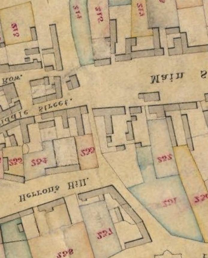
67

68 Reproduced by permission of Ordnance Survey on behalf of The Controller of Her Majesty's Stationery Office. Crown copyright. All rights reserved. Licence number

69 Reproduced by permission of Ordnance Survey on behalf of The Controller of Her Majesty's Stationery Office. Crown copyright. All rights reserved. Licence number

70 Reproduced by permission of Ordnance Survey on behalf of The Controller of Her Majesty's Stationery Office. Crown copyright. All rights reserved. Licence number

71 Reproduced by permission of Ordnance Survey on behalf of The Controller of Her Majesty's Stationery Office. Crown copyright. All rights reserved. Licence number
Test-Pit 3: 31 Park Street (SK )
") -Pit 3: 31 Park Street (SK 40732 03178) -Pit 3 was excavated in a flower bed in the rear garden of 31 Park Street, on the northern side of the street and west of an alleyway leading to St Peter s Church,
-Pit 3: 31 Park Street (SK 40732 03178) -Pit 3 was excavated in a flower bed in the rear garden of 31 Park Street, on the northern side of the street and west of an alleyway leading to St Peter s Church,
An archaeological evaluation at 16 Seaview Road, Brightlingsea, Essex February 2004
 An archaeological evaluation at 16 Seaview Road, Brightlingsea, Essex February 2004 report prepared by Kate Orr on behalf of Highfield Homes NGR: TM 086 174 (c) CAT project ref.: 04/2b ECC HAMP group site
Archaeological. Monitoring & Recording Report. Fulbourn Primary School, Cambridgeshire. Archaeological Monitoring & Recording Report.
 Fulbourn Primary School, Cambridgeshire Archaeological Monitoring & Recording Report October 2014 Client: Cambridgeshire County Council OA East Report No: 1689 OASIS No: oxfordar3-192890 NGR: TL 5190 5613
THE PRE-CONQUEST COFFINS FROM SWINEGATE AND 18 BACK SWINEGATE
 THE PRE-CONQUEST COFFINS FROM 12 18 SWINEGATE AND 18 BACK SWINEGATE An Insight Report By J.M. McComish York Archaeological Trust for Excavation and Research (2015) Contents 1. INTRODUCTION... 3 2. THE
Greater London GREATER LONDON 3/606 (E ) TQ
 TQ") GREATER LONDON City of London 3/606 (E.01.6024) TQ 30358150 1 PLOUGH PLACE, CITY OF LONDON An Archaeological Watching Brief at 1 Plough Place, City of London, London EC4 Butler, J London : Pre-Construct
GREATER LONDON City of London 3/606 (E.01.6024) TQ 30358150 1 PLOUGH PLACE, CITY OF LONDON An Archaeological Watching Brief at 1 Plough Place, City of London, London EC4 Butler, J London : Pre-Construct
An archaeological watching brief and recording at Brightlingsea Quarry, Moverons Lane, Brightlingsea, Essex October 2003
 An archaeological watching brief and recording at Brightlingsea Quarry, Moverons Lane, Brightlingsea, Essex commissioned by Mineral Services Ltd on behalf of Alresford Sand & Ballast Co Ltd report prepared
An archaeological evaluation in the playground of Colchester Royal Grammar School, Lexden Road, Colchester, Essex
 An archaeological evaluation in the playground of Colchester Royal Grammar School, Lexden Road, Colchester, Essex February 2002 on behalf of Roff Marsh Partnership CAT project code: 02/2c Colchester Museum
New Composting Centre, Ashgrove Farm, Ardley, Oxfordshire
 New Composting Centre, Ashgrove Farm, Ardley, Oxfordshire An Archaeological Watching Brief For Agrivert Limited by Andrew Weale Thames Valley Archaeological Services Ltd Site Code AFA 09/20 August 2009
3. The new face of Bronze Age pottery Jacinta Kiely and Bruce Sutton
 3. The new face of Bronze Age pottery Jacinta Kiely and Bruce Sutton Illus. 1 Location map of Early Bronze Age site at Mitchelstown, Co. Cork (based on the Ordnance Survey Ireland map) A previously unknown
An archaeological evaluation at the Blackwater Hotel, Church Road, West Mersea, Colchester, Essex March 2003
 An archaeological evaluation at the Blackwater Hotel, Church Road, West Mersea, Colchester, Essex report prepared by Laura Pooley on behalf of Dolphin Developments (U.K) Ltd NGR: TM 0082 1259 CAT project
ARCHAEOLOGICAL EVALUATION AT BRIGHTON POLYTECHNIC, NORTH FIELD SITE, VARLEY HALLS, COLDEAN LANE, BRIGHTON. by Ian Greig MA AIFA.
 ARCHAEOLOGICAL EVALUATION AT BRIGHTON POLYTECHNIC, NORTH FIELD SITE, VARLEY HALLS, COLDEAN LANE, BRIGHTON by Ian Greig MA AIFA May 1992 South Eastern Archaeological Services Field Archaeology Unit White
39, Walnut Tree Lane, Sudbury (SUY 073) Planning Application No. B/04/02019/FUL Archaeological Monitoring Report No. 2005/112 OASIS ID no.
 Planning Application No. B/04/02019/FUL Archaeological Monitoring Report No. 2005/112 OASIS ID no.") 39, Walnut Tree Lane, Sudbury (SUY 073) Planning Application No. B/04/02019/FUL Archaeological Monitoring Report No. 2005/112 OASIS ID no. 9273 Summary Sudbury, 39, Walnut Tree Lane, Sudbury (TL/869412;
39, Walnut Tree Lane, Sudbury (SUY 073) Planning Application No. B/04/02019/FUL Archaeological Monitoring Report No. 2005/112 OASIS ID no. 9273 Summary Sudbury, 39, Walnut Tree Lane, Sudbury (TL/869412;
Monitoring Report No. 99
 Monitoring Report No. 99 Enniskillen Castle Co. Fermanagh AE/06/23 Cormac McSparron Site Specific Information Site Name: Townland: Enniskillen Castle Enniskillen SMR No: FER 211:039 Grid Ref: County: Excavation
An archaeological evaluation at the Lexden Wood Golf Club (Westhouse Farm), Lexden, Colchester, Essex
, Lexden, Colchester, Essex") An archaeological evaluation at the Lexden Wood Golf Club (Westhouse Farm), Lexden, Colchester, Essex January 2000 Archive report on behalf of Lexden Wood Golf Club Colchester Archaeological Trust 12 Lexden
An archaeological evaluation at the Lexden Wood Golf Club (Westhouse Farm), Lexden, Colchester, Essex January 2000 Archive report on behalf of Lexden Wood Golf Club Colchester Archaeological Trust 12 Lexden
Church of St Peter and St Paul, Great Missenden, Buckinghamshire
 Church of St Peter and St Paul, Great Missenden, Buckinghamshire An Archaeological Watching Brief for the Parish of Great Missenden by Andrew Taylor Thames Valley Archaeological Services Ltd Site Code
7. Prehistoric features and an early medieval enclosure at Coonagh West, Co. Limerick Kate Taylor
 7. Prehistoric features and an early medieval enclosure at Coonagh West, Co. Limerick Kate Taylor Illus. 1 Location of the site in Coonagh West, Co. Limerick (based on the Ordnance Survey Ireland map)
Colchester Archaeological Trust Ltd. A Fieldwalking Survey at Birch, Colchester for ARC Southern Ltd
 Colchester Archaeological Trust Ltd A Fieldwalking Survey at Birch, Colchester for ARC Southern Ltd November 1997 CONTENTS page Summary... 1 Background... 1 Methods... 1 Retrieval Policy... 2 Conditions...
Former Whitbread Training Centre Site, Abbey Street, Faversham, Kent Interim Archaeological Report Phase 1 November 2009
 Former Whitbread Training Centre Site, Abbey Street, Faversham, Kent Interim Archaeological Report Phase 1 November 2009 SWAT. Archaeology Swale and Thames Archaeological Survey Company School Farm Oast,
Archaeological Watching Brief (Phase 2) at Court Lodge Farm, Aldington, near Ashford, Kent December 2011
 at Court Lodge Farm, Aldington, near Ashford, Kent December 2011") Archaeological Watching Brief (Phase 2) at Court Lodge Farm, Aldington, near Ashford, Kent December 2011 SWAT. Archaeology Swale and Thames Archaeological Survey Company School Farm Oast, Graveney Road
Archaeological Watching Brief (Phase 2) at Court Lodge Farm, Aldington, near Ashford, Kent December 2011 SWAT. Archaeology Swale and Thames Archaeological Survey Company School Farm Oast, Graveney Road
Archaeological evaluation at the Onley Arms, The Street, Stisted, Essex
 Archaeological evaluation at the Onley Arms, The Street, Stisted, Essex November 2014 report by Pip Parmenter and Adam Wightman with a contribution from Stephen Benfield and illustrations by Emma Holloway
Fieldwalking at Cottam 1994 (COT94F)
") Fieldwalking at Cottam 1994 (COT94F) Tony Austin & Elizabeth Jelley (19 Jan 29) 1. Introduction During the winter of 1994 students from the Department of Archaeology at the University of York undertook
Fieldwalking at Cottam 1994 (COT94F) Tony Austin & Elizabeth Jelley (19 Jan 29) 1. Introduction During the winter of 1994 students from the Department of Archaeology at the University of York undertook
2 Saxon Way, Old Windsor, Berkshire
 2 Saxon Way, Old Windsor, Berkshire An Archaeological Watching Brief For Mrs J. McGillicuddy by Pamela Jenkins Thames Valley Archaeological Services Ltd Site Code SWO 05/67 August 2005 Summary Site name:
Chapter 2. Remains. Fig.17 Map of Krang Kor site
 Chapter 2. Remains Section 1. Overview of the Survey Area The survey began in January 2010 by exploring the site of the burial rootings based on information of the rooted burials that was brought to the
Silwood Farm, Silwood Park, Cheapside Road, Ascot, Berkshire
 Silwood Farm, Silwood Park, Cheapside Road, Ascot, Berkshire An Archaeological Watching Brief For Imperial College London by Tim Dawson Thames Valley Archaeological Services Ltd Site Code SFA 09/10 April
Evidence for the use of bronze mining tools in the Bronze Age copper mines on the Great Orme, Llandudno
 Evidence for the use of bronze mining tools in the Bronze Age copper mines on the Great Orme, Llandudno Background The possible use of bronze mining tools has been widely debated since the discovery of
ARCHAEOLOGICAL MONITORING REPORT
 ARCHAEOLOGICAL MONITORING REPORT SCCAS REPORT No. 2009/324 Thorington Hall, Stoke by Nayland SBN 087 HER Information Date of Fieldwork: November 2009 - January 2010 Grid Reference: TM 0131 3546 Funding
Cetamura Results
 Cetamura 2000 2006 Results A major project during the years 2000-2006 was the excavation to bedrock of two large and deep units located on an escarpment between Zone I and Zone II (fig. 1 and fig. 2);
Grim s Ditch, Starveall Farm, Wootton, Woodstock, Oxfordshire
 Grim s Ditch, Starveall Farm, Wootton, Woodstock, Oxfordshire An Archaeological Recording Action For Empire Homes by Steve Ford Thames Valley Archaeological Services Ltd Site Code SFW06/118 November 2006
16 members of the Fieldwalking Group met York Community Archaeologist Jon Kenny at Lou Howard s farm, Rose Cottage Farm, at
 Terrington History Group Fieldwalking Group Field 1 Final report 21 October 2011 - fieldwalking 16 members of the Fieldwalking Group met York Community Archaeologist Jon Kenny at Lou Howard s farm, Rose
An archaeological watching brief at St Leonard s church, Hythe Hill, Colchester, Essex
 An archaeological watching brief at St Leonard s church, Hythe Hill, Colchester, Essex report prepared by Adam Wightman on behalf of Dorvell Construction CAT project ref.: 10/5d Colchester and Ipswich
Essex Historic Environment Record/ Essex Archaeology and History
 Essex Historic Environment Record/ Essex Archaeology and History CAT Report 578 Summary sheet Address: Kingswode Hoe School, Sussex Road, Colchester, Essex Parish: Colchester NGR: TL 9835 2528 Type of
An archaeological watching brief at Sheepen, Colchester, Essex November-December 2003
 An archaeological watching brief at Sheepen, Colchester, Essex November-December 2003 report prepared by Ben Holloway on behalf of Colchester Borough Council CAT project ref.: 03/11c Colchester Museums
1 The East Oxford Archaeology and History Project
 1 The East Oxford Archaeology and History Project EXOP TEST PIT 72 Location: Bartlemas Chapel, Cowley Date of excavation: 6-8 November 2013. Area of excavation: 0.8m x 1.2m, at the eastern end of the chapel.
Control ID: Years of experience: Tools used to excavate the grave: Did the participant sieve the fill: Weather conditions: Time taken: Observations:
 Control ID: Control 001 Years of experience: No archaeological experience Tools used to excavate the grave: Trowel, hand shovel and shovel Did the participant sieve the fill: Yes Weather conditions: Flurries
An archaeological evaluation by trial-trenching at Playgolf, Bakers Lane, Westhouse Farm, Colchester, Essex
 An archaeological evaluation by trial-trenching at Playgolf, Bakers Lane, Westhouse Farm, Colchester, Essex commissioned by Mr Stephen Belchem on behalf of ADP Ltd. report prepared by Chris Lister Planning
Archaeological Material From Spa Ghyll Farm, Aldfield
 Archaeological Material From Spa Ghyll Farm, Aldfield Introduction Following discussions with Linda Smith the Rural Archaeologist for North Yorkshire County Council, Robert Morgan of 3D Archaeological
Monitoring Report No Sacred Heart Church Aghamore Boho Co. Fermanagh AE/10/116E. Brian Sloan L/2009/1262/F
 Monitoring Report No. 202 Sacred Heart Church Aghamore Boho Co. Fermanagh AE/10/116E Brian Sloan L/2009/1262/F Site Specific Information Site Address: Sacred Heart Church, Aghamore, Boho, Co. Fermanagh
ST PATRICK S CHAPEL, ST DAVIDS PEMBROKESHIRE 2015
 ST PATRICK S CHAPEL, ST DAVIDS PEMBROKESHIRE 2015 REPORT FOR THE NINEVEH CHARITABLE TRUST THE UNIVERSITY OF SHEFFIELD AND DYFED ARCHAEOLOGICAL TRUST Introduction ST PATRICK S CHAPEL, ST DAVIDS, PEMBROKESHIRE,
Tell Shiyukh Tahtani (North Syria)
") Tell Shiyukh Tahtani (North Syria) Report of the 2010 excavation season conducted by the University of Palermo Euphrates Expedition by Gioacchino Falsone and Paola Sconzo In the summer 2010 the University
Tell Shiyukh Tahtani (North Syria) Report of the 2010 excavation season conducted by the University of Palermo Euphrates Expedition by Gioacchino Falsone and Paola Sconzo In the summer 2010 the University
Peace Hall, Sydney Town Hall Results of Archaeological Program (Interim Report)
") Results of Archaeological Program (Interim Report) Background The proposed excavation of a services basement in the western half of the Peace Hall led to the archaeological investigation of the space in
Results of Archaeological Program (Interim Report) Background The proposed excavation of a services basement in the western half of the Peace Hall led to the archaeological investigation of the space in
FURTHER MIDDLE SAXON EVIDENCE AT COOK STREET, SOUTHAMPTON (SOU 567)
") Roc. Hampshire Field Club Archaeol. Soc 52,1997, 77-87 (Hampshire Studies 1997) FURTHER MIDDLE SAXON EVIDENCE AT COOK STREET, SOUTHAMPTON (SOU 567) By M F GARNER andj VINCENT with a contribution byjacqueline
Roc. Hampshire Field Club Archaeol. Soc 52,1997, 77-87 (Hampshire Studies 1997) FURTHER MIDDLE SAXON EVIDENCE AT COOK STREET, SOUTHAMPTON (SOU 567) By M F GARNER andj VINCENT with a contribution byjacqueline
Cambridge Archaeology Field Group. Fieldwalking on the Childerley Estate, Cambridgeshire. Autumn 2014 to Spring Third interim report
 Cambridge Archaeology Field Group Fieldwalking on the Childerley Estate, Cambridgeshire Autumn 2014 to Spring 2015 Third interim report Summary Field walking on the Childerley estate of Martin Jenkins
An archaeological evaluation by trial-trenching at Scotts Farm, Lodge Lane, Purleigh, Essex October 2011
 An archaeological evaluation by trial-trenching at Scotts Farm, Lodge Lane, Purleigh, Essex October 2011 report prepared by Adam Wightman on behalf of Richard Emans CAT project ref.: 11/10a NGR: TL 582719
Erection of wind turbine, Mains of Loanhead, Old Rayne, AB52 6SX
 Erection of wind turbine, Mains of Loanhead, Old Rayne, AB52 6SX Ltd 23 November 2011 Erection of wind turbine, Mains of Loanhead, Old Rayne, AB52 6SX CONTENTS 1 INTRODUCTION 3 2 ARCHAEOLOGICAL BACKGROUND
Moated Site at Manor Farm, Islip, Oxfordshire
 Moated Site at Manor Farm, Islip, Oxfordshire An Archaeological Excavation By Jo Pine Site Code MFI05 December 2007 Summary Site name: Moated Site at Manor Farm, Islip, Oxfordshire Grid reference: SP 5298
Phase 2 Urban consolidation AD
 Phase 2 Urban consolidation AD 1250-1350 The second recognised phase of activity at Rådhuspladsen corresponded approximately to the High medieval period (c. AD 1250 1350), and saw consolidation of the
Grange Farm, Widmer End, Hughenden, Buckinghamshire
 Grange Farm, Widmer End, Hughenden, Buckinghamshire An Archaeological Evaluation for British Flora by Andy Taylor Thames Valley Archaeological Services Ltd Site Code GFH 05/63 July 2005 Summary Site name:
BALNUARAN. of C LAVA. a prehistoric cemetery. A Visitors Guide to
 A Visitors Guide to BALNUARAN of C LAVA a prehistoric cemetery Milton of Clava Chapel (?) Cairn River Nairn Balnuaran of Clava is the site of an exceptionally wellpreserved group of prehistoric burial
An archaeological watching brief on one section of an Anglian Water main Spring Lane, Lexden, Colchester
 An archaeological watching brief on one section of an Anglian Water main Spring Lane, Lexden, Colchester April-September 2001 on behalf of Breheny Contractors CAT project ref.: 01/4D Colchester Museum
ARCHAEOLOGICAL S E R V I C E S. St Nicholas' Church, Barrack Hill, Nether Winchendon, Buckinghamshire. Archaeological Watching Brief.
 T H A M E S V A L L E Y ARCHAEOLOGICAL S E R V I C E S St Nicholas' Church, Barrack Hill, Nether Winchendon, Buckinghamshire Archaeological Watching Brief by Steven Crabb Site Code: STW17/229 (SP 7735
NOTE A THIRD CENTURY ROMAN BURIAL FROM MANOR FARM, HURSTBOURNE PRIORS. by. David Allen with contributions by Sue Anderson and Brenda Dickinson
 Proc. Hampsh. Field Club Archaeol. Soc. 47, 1991, 253-257 NOTE A THIRD CENTURY ROMAN BURIAL FROM MANOR FARM, HURSTBOURNE PRIORS Abstract by. David Allen with contributions by Sue Anderson and Brenda Dickinson
TIPPERARY HISTORICAL JOURNAL 1994
 TPPERARY HSTORCAL JOURNAL 1994 County Tipperary Historical Society www.tipperarylibraries.ie/ths society@tipperarylibraries. ie SSN 0791-0655 Excavations at Cormac's Chapel, Cashel, 1992 and 1993: a preliminary
Chapel House Wood Landscape Project. Interim Report 2013
 Chapel House Wood Landscape Project Interim Report 2013 Chapel House Wood Landscape Project Interim Report 2013 The annual Dales Heritage Field School was held at Chapel House Wood again this year, and
Greater London Region GREATER LONDON 3/567 (E.01.K099) TQ BERMONDSEY STREET AND GIFCO BUILDING AND CAR PARK
 TQ BERMONDSEY STREET AND GIFCO BUILDING AND CAR PARK") GREATER LONDON 3/567 (E.01.K099) TQ 33307955 156-170 BERMONDSEY STREET AND GIFCO BUILDING AND CAR PARK Assessment of an Archaeological Excavation at 156-170 Bermondsey Street and GIFCO Building and Car
GREATER LONDON 3/567 (E.01.K099) TQ 33307955 156-170 BERMONDSEY STREET AND GIFCO BUILDING AND CAR PARK Assessment of an Archaeological Excavation at 156-170 Bermondsey Street and GIFCO Building and Car
Fort Arbeia and the Roman Empire in Britain 2012 FIELD REPORT
 Fort Arbeia and the Roman Empire in Britain 2012 FIELD REPORT Background Information Lead PI: Paul Bidwell Report completed by: Paul Bidwell Period Covered by this report: 17 June to 25 August 2012 Date
SALVAGE EXCAVATIONS AT OLD DOWN FARM, EAST MEON
 Proc. Hants. Field Club Archaeol. Soc. 36, 1980, 153-160. 153 SALVAGE EXCAVATIONS AT OLD DOWN FARM, EAST MEON By RICHARD WHINNEY AND GEORGE WALKER INTRODUCTION The site was discovered by chance in December
CUMBRIA 2/635 (C ) NY
 NY") CUMBRIA Allerdale 2/635 (C.16.6017) NY 11803070 BRIDGE STREET, COCKERMOUTH Report on an Archaeological Evaluation at Bridge Street, Cockermouth, Cumbria (Report No. 5/00) Grahame, R Carlisle : Carlisle
CUMBRIA Allerdale 2/635 (C.16.6017) NY 11803070 BRIDGE STREET, COCKERMOUTH Report on an Archaeological Evaluation at Bridge Street, Cockermouth, Cumbria (Report No. 5/00) Grahame, R Carlisle : Carlisle
Lanton Lithic Assessment
 Lanton Lithic Assessment Dr Clive Waddington ARS Ltd The section headings in the following assessment report refer to those in the Management of Archaeological Projects (HBMC 1991), Appendix 4. 1. FACTUAL
MARSTON MICHAEL FARLEY
 MARSTON MICHAEL FARLEY On 9 March agricultural contractors, laying field drains for Bucks County Council Land Agent's Department, cut through a limestone structure at SP 75852301 in an area otherwise consistently
Archaeological sites and find spots in the parish of Burghclere - SMR no. OS Grid Ref. Site Name Classification Period
 Archaeological sites and find spots in the parish of Burghclere - SMR no. OS Grid Ref. Site Name Classification Period SU45NE 1A SU46880 59200 Ridgemoor Farm Inhumation Burial At Ridgemoor Farm, on the
Land North of Pesthouse Lane Barham Suffolk BRH 054
 Land North of Pesthouse Lane Barham Suffolk BRH 054 Archaeological Evaluation Report SCCAS Report No. 2012/142 Client: Barham Parish Council Author: Jezz Meredith September 2012 SCCAS Land North of Pesthouse
Limited Archaeological Testing at the Sands House Annapolis, Maryland
 Limited Archaeological Testing at the Sands House Annapolis, Maryland Report Submitted to Four Rivers Heritage Area by John E. Kille, Ph.D., Shawn Sharpe, and Al Luckenbach, Ph.D February 10, 2012 In May-June
Excavations at Shikarpur, Gujarat
 Excavations at Shikarpur, Gujarat 2008-2009 The Department of Archaeology and Ancient History, the M. S. University of Baroda continued excavations at Shikarpur in the second field season in 2008-09. In
Moray Archaeology For All Project
 School children learning how to identify finds. (Above) A flint tool found at Clarkly Hill. Copyright: Leanne Demay Moray Archaeology For All Project ational Museums Scotland have been excavating in Moray
Is this the Original Anglo-Saxon period site of Weathercote?
 Is this the Original Anglo-Saxon period site of Weathercote? A Batty & N Crack 2016 Front Cover. Looking south east across proposed original site of Weathercote. Photograph A 2 3 Weathercote Anglo-Saxon
Wantage County Primary School, Garston Lane, Wantage, Oxfordshire
 Wantage County Primary School, Garston Lane, Wantage, Oxfordshire An Archaeological Evaluation for Oxfordshire County Council by Erlend Hindmarch Thames Valley Archaeological Services Ltd Site Code GLW
Small Finds Assessment, Minchery Paddock, Littlemore, Oxford (MP12)
") Small s Assessment, Minchery Paddock, Littlemore, Oxford (MP12) Introduction A total of 51 objects recovered from excavations at Minchery Paddock, Littlemore, Oxford (MP12) were submitted for dating and
Small s Assessment, Minchery Paddock, Littlemore, Oxford (MP12) Introduction A total of 51 objects recovered from excavations at Minchery Paddock, Littlemore, Oxford (MP12) were submitted for dating and
Archaeological trial-trenching evaluation at Chappel Farm, Little Totham, Essex. April 2013
 Archaeological trial-trenching evaluation at Chappel Farm, Little Totham, Essex April 2013 report prepared by Ben Holloway commissioned by Tim Harbord Associates on behalf of Mr Tom Howie Planning reference:
Centre for Archaeological Fieldwork,
 Centre for Archaeological Fieldwork, School of Geography, Archaeology and Palaeoecology, Queen s University Belfast Data Structure Report No. 70 (preliminary report) Archaeological Excavations at Carrickfergus
Human remains from Estark, Iran, 2017
 Bioarchaeology of the Near East, 11:84 89 (2017) Short fieldwork report Human remains from Estark, Iran, 2017 Arkadiusz Sołtysiak *1, Javad Hosseinzadeh 2, Mohsen Javeri 2, Agata Bebel 1 1 Department of
17 Phase 5. High and Late medieval features and activities AD
 17 Phase 5. High and Late medieval features and activities 1200 1550 AD 17.1 Results This time phase is based on all findings that can be placed in the High and Late medieval period 1200 1550 AD based
THE RAVENSTONE BEAKER
 DISCOVERY THE RAVENSTONE BEAKER K. J. FIELD The discovery of the Ravenstone Beaker (Plate Xa Fig. 1) was made by members of the Wolverton and District Archaeological Society engaged on a routine field
The Swan Hotel, Lavenham LVM 080
 The Swan Hotel, Lavenham LVM 080 Post-Excavation Assessment Report v0.4 SCCAS Report No. 2013/148 Client: TA Hotel Collection Author: Rob Brooks December/2014 Suffolk County Council Archaeological Service
Foreign Whaling in Iceland Archaeological Excavations at Strákatangi in Hveravík, Kaldrananeshreppi 2007 Data Structure Report
 Foreign Whaling in Iceland Archaeological Excavations at Strákatangi in Hveravík, Kaldrananeshreppi 2007 Data Structure Report Caroline Paulsen, Magnús Rafnsson and Ragnar Edvardsson February 2008 NV nr.
Opium Cabin excavation Passport In Time July 21-25, 2014
 Opium Cabin excavation Passport In Time July 21-25, 2014 Page 1 of 14 Non-American Indian settlement of the southern Blue Mountains began with the discovery of gold in drainages of the John Day River in
An archaeological evaluation at Thistle Hall, Mope Lane, Wickham Bishops, Essex July 2009
 An archaeological evaluation at Thistle Hall, Mope Lane, Wickham Bishops, Essex July 2009 report prepared by Howard Brooks and Ben Holloway on behalf of Clarity Ecoworks Ltd CAT project ref.: 09/1f ECC
E x cav atio n R e p o r t
 Medieval Trackway on land at Ivy Farm Royston, Hertfordshire Excavation Report E x cav atio n R e p o r t October 2011 Client: CgMs Consulting OA East Report No: 1305 OASIS No: oxfordar3-112012 NGR: TL
Old Brewery Close and Walton Street, Aylesbury, Buckinghamshire
 Old Brewery Close and Walton Street, Aylesbury, Buckinghamshire An Archaeological Evaluation for Berkeley Homes (Oxford and Chiltern) Ltd by Sian Anthony Thames Valley Archaeological Services Ltd Site
Excavation. Post-Medieval Ditches. Land off Norwich Common Road Wymondham Norfolk. Excavation. Client: November 2013
 Land off Norwich Common Road Wymondham Norfolk. Excavation November 2013 Client: OA East Report No: 1546 OASIS No: oxfordar3-163105 NGR: TG 12770 02684 Excavation Post-Medieval Ditches Post-Medieval Ditches
Oxfordshire. Wallingford. St Mary-le-More. Archaeological Watching Brief Report. Client: JBKS Architects and St Mary s Renewal Campaign.
 St Mary-le-More Wallingford Oxfordshire Archaeological Watching Brief Report February 2010 Client: JBKS Architects and St Mary s Renewal Campaign Issue No:1 OA Job No: 4432 NGR: SU 6071 8933 Archaeological
Barnet Battlefield Survey
 In terim report on the progress of the Barnet Battlefield Survey December 2016 The Barnet Battlefield Survey is an archaeological investigation into the 1471 Battle of Barnet. It aims to define more accurately
TA 04/15 OASIS ID
 River Tees Rediscovered Project Archaeological Excavations in Egglescliffe Stockton on Tees 2015 TA 04/15 OASIS ID 1-238455 River Tees Rediscovered Project Archaeological Excavations in Egglescliffe Stockton
ROMAN AND MEDIEVAL ACTIVITY IN THE UPPER WALBROOK VALLEY: EXCAVATIONS AT MOORGATE, CITY OF LONDON, EC2, 1997
 ROMAN AND MEDIEVAL ACTIVITY IN THE UPPER WALBROOK VALLEY: EXCAVATIONS AT 12 18 MOORGATE, CITY OF LONDON, EC2, 1997 Graham Bruce, Dominic Perring, Tim Stevens and Melissa Melikian SUMMARY In January and
ROYAL MAYAN TOMB. Faculty Sponsor: Kathryn Reese-Taylor, Department of Sociology/Archaeology
 ROYAL MAYAN TOMB 93 Royal Mayan Tomb Jennifer Vander Galien Faculty Sponsor: Kathryn Reese-Taylor, Department of Sociology/Archaeology ABSTRACT Little is known about the Mortuary practices of the ruling
A visit to the Wor Barrow 21 st November 2015
 A visit to the Wor Barrow 21 st November 2015 Following our exploration of Winkelbury a few weeks previously, we fast forwarded 12 years in Pitt Rivers remarkable series of excavations and followed him
YCCCART is very grateful to Richard Broomhead for permission to publish this report online.
 YCCCART 2017/Y2 Yatton & Congresbury Wildlife Action Group A Documentary & Archaeological Survey Of Two Moorland Sites In Yatton & Congresbury R.A.Broomhead BA Field Archaeologist RAB/15/9 YCCCART is very
January 13 th, 2019 Sample Current Affairs
 January 13 th, 2019 Sample Current Affairs 1. Harappa grave of ancient 'couple' reveals secrets of Marriage What are the key takeaways of the excavation? Was marriage legally accepted in Harappan society?
(photograph courtesy Earle Seubert)
") THE ARCHAEOLOGY OF A CEMETERY THE TRIALS AND TRIBULATIONS OF FINDING THE LOST GRAVES OF WOODMAN POINT QUARANTINE STATION This presentation is about a project initiated by the Friends of Woodman Point and
THE ARCHAEOLOGY OF A CEMETERY THE TRIALS AND TRIBULATIONS OF FINDING THE LOST GRAVES OF WOODMAN POINT QUARANTINE STATION This presentation is about a project initiated by the Friends of Woodman Point and
THE UNFOLDING ARCHAEOLOGY OF CHELTENHAM
 THE UNFOLDING ARCHAEOLOGY OF CHELTENHAM The archaeology collection of Cheltenham Art Gallery & Museum contains a rich quantity of material relating to the prehistoric and Roman occupation of the North
ROMAN, ANGLIAN AND ANGLO-SCANDINAVIAN ACTIVITY AND A MEDIEVAL CEMETERY ON LAND AT THE JUNCTION OF DIXON LANE AND GEORGE STREET, YORK
 YORK ARCHAEOLOGICAL TRUST ROMAN, ANGLIAN AND ANGLO-SCANDINAVIAN ACTIVITY AND A MEDIEVAL CEMETERY ON LAND AT THE JUNCTION OF DIXON LANE AND GEORGE STREET, YORK PRINCIPAL AUTHOR J.M. MCCOMISH WEB PUBLICATION
A NEW ROMAN SITE IN CHESHAM
 A NEW ROMAN SITE IN CHESHAM KEITH BRANIGAN AND MICHAEL KIRTON THE site under discussion was first noted in 1958 and since that time several discoveries have been made. Its investigation has been pursued
ARCHAEOLOGICAL EXCAVATION REPORT: THE PADDOCK, HIGH DIKE, NAVENBY, LINCOLNSHIRE
 ARCHAEOLOGICAL EXCAVATION REPORT: THE PADDOCK, HIGH DIKE, NAVENBY, LINCOLNSHIRE NGR: 499398, 357274 AAL Site Code: NAPA 13 OASIS Reference Number: allenarc1-205997 Report prepared for Navenby Archaeology
Chapter 2: Archaeological Description
 Chapter 2: Archaeological Description Phase 1 Late Neolithic, c 3000-2400 BC (Figs 6-9) Evidence of Neolithic activity was confined to pits dug across the southern half of the site (Fig. 6). Eighteen pits
The lithic assemblage from Kingsdale Head (KH09)
") 1 The lithic assemblage from Kingsdale Head (KH09) Hannah Russ Introduction During excavation the of potential Mesolithic features at Kingsdale Head in 2009 an assemblage of flint and chert artefacts were
1 The lithic assemblage from Kingsdale Head (KH09) Hannah Russ Introduction During excavation the of potential Mesolithic features at Kingsdale Head in 2009 an assemblage of flint and chert artefacts were
Excavation Report. Medieval Occupation at Challis Green Barrington Cambridgeshire. Excavation Report. Client: Hills Partnership Limited.
 Medieval Occupation at Challis Green Barrington Cambridgeshire Excavation Report Excavation Report April 2012 Client: Hills Partnership Limited OA East Report No: 1269 OASIS No: oxfordar3-102493 NGR: TL
STONE implements and pottery indicative of Late Neolithic settlement are known to
 Late Neolithic Site in the Extreme Northwest of the New Territories, Hong Kong Received 29 July 1966 T. N. CHIU* AND M. K. WOO** THE SITE STONE implements and pottery indicative of Late Neolithic settlement
Burrell Orchard 2014: Cleveland Archaeological Society Internship Amanda Ponomarenko The Ohio State University June - August 2014
 1 Burrell Orchard 2014: Cleveland Archaeological Society Internship Amanda Ponomarenko The Ohio State University June - August 2014 Selected for the 2014 Cleveland Archaeological Society Internship in
Cambridge Archaeology Field Group. Fieldwalking on the Childerley Estate Cambridgeshire
 Cambridge Archaeology Field Group Fieldwalking on the Childerley Estate Cambridgeshire 2009 to 2014 Summary Fieldwalking on the Childerley estate of Martin Jenkins and Family has revealed, up to March
Tepe Gawra, Iraq expedition records
 Tepe Gawra, Iraq expedition records 1021 Last updated on March 02, 2017. University of Pennsylvania, Penn Museum Archives July 2009 Tepe Gawra, Iraq expedition records Table of Contents Summary Information...
Weedon Parish Council CHAPEL GRAVEYARD REGULATIONS
 Note These Regulations are in addition to the provision of the Local Authorities Cemeteries Order 1977 and any other appropriate regulations currently in force. 1. General 1.1 The Weedon Chapel Graveyard