ARO29: Newcraighall, Edinburgh: A landscape of change through its archaeology and history
|
|
|
- Ruby McKinney
- 5 years ago
- Views:
Transcription


1 ARO29: Newcraighall, Edinburgh: A landscape of change through its archaeology and history by Alan Hunter Blair and Morag Cross With contributions by Diane Alldritt, Torben Bjarke Ballin, Beverley Ballin Smith, Donal Bateson, Natasha Ferguson, Dennis Gallagher, Robin Murdoch, Christine Rennie and Bob Will. Archaeology Reports Online, 52 Elderpark Workspace, 100 Elderpark Street, Glasgow, G51 3TR info@guard-archaeology.co.uk
2 Published by GUARD Archaeology Ltd, Editor Beverley Ballin Smith Design and desktop publishing Gillian Sneddon Produced by GUARD Archaeology Ltd ISBN: ISSN: Requests for permission to reproduce material from an ARO report should be sent to the Editor of ARO, as well as to the author, illustrator, photographer or other copyright holder. Copyright in any of the ARO Reports series rests with GUARD Archaeology Ltd and the individual authors. The maps are reproduced by permission of Ordnance Survey on behalf of the Controller of Her Majesty s Stationery Office. All rights reserved. GUARD Archaeology Licence number The consent does not extend to copying for general distribution, advertising or promotional purposes, the creation of new collective works or resale.
3 Contents Abstract 6 Introduction 6 Archaeological and historical background 7 Metal detecting survey results 7 The archaeology 8 Radiocarbon dates 20 Environmental remains and artefacts 21 The lithic assemblage 24 Prehistoric pottery 25 Medieval and Post-medieval pottery 26 The artefact analysis of the metal detecting assemblage 29 The glass 29 Clay tobacco pipes 31 Industrial waste analysis 33 Coin 34 General discussion 34 Historical research 38 Appendices 62 Acknowledgements 62 Bibliography 62 Appendix 1: Lithics catalogue 70 Appendix 2: Medieval pottery catalogue 70 Appendix 3: Catalogue of Finds from the Metal Detecting Assemblage 74 Appendix 4: Glass Catalogues 77 Appendix 5: Clay pipes Catalogue 78 List of Figures Figure 1: Site Location 5 Figure 2: Plan showing location of mineshafts, prehistoric pit groups and landscape structures 9 Figure 3: Plan of pit groups 5 (later Neolithic), 6 (late Mesolithic/early Neolithic) and 7 10 (later Neolithic) Figure 4: Sections through the main pits of pit groups 5, 6 and 7 11 Figure 5: Plan of the mineshafts in relation to later structures and features 12 Figure 6: Location of Structures 1 to 4 in relation to mine shafts and coal deposits, in the 13 southern area of Newcraighall South Figure 7: Detailed plan of Structure 1 14 Figure 8: Detailed plan of Structure 2 15 Figure 9: Detailed plan of Structure 3 16 Figure 10: Plan of and sections through the ha-ha (023) and its ditch (027) 18 Figure 11: Plan of and section through the culvert (145) 19 Figure 12: Plan of culvert (2051) 20 Figure 13: Scale-flaked knife, CAT 1 25 Figure 14: Brunstoun (Brunstane) depicted on Blaeu J and Blaeu s map of 1654 Lothian and 36 Linlitquo Figure 15: Rig and furrow cultivation marks in the north area overlaid onto map of Brunstane 37 Farm Figure 16: Newcraighall North boundary overlaid onto Slezer s map of Brunstane c
4 List of Plates Plate 1: Pit Group 1 during excavation. From the NNE 8 Plate 2: Pit 070 in Pit Group 2 during excavation 8 Plate 3: General view of area during excavation of prehistoric pit groups 8 Plate 4: Mining pit 036 in foreground with pit 031 to the rear in the central pit alignment. 10 From the south Plate 5: Mine pit 139 in central seam alignment 12 Plate 6: Mine pit 088 in west seam alignment 12 Plate 7: Mining structure 1. From the east 14 Plate 8: Structure 3 overlain by coal dust deposit (059). From the south-east 16 Plate 9: Boundary ditch 084. From the south 17 Plate 10: Ha-ha (023) and ditch (027). From the west 17 Plate 11: The truncated remains of a causeway (075) forming one of the crossing points over 18 the ha-ha (023). From the south Plate 12: Culvert 145 capping slabs. From the south 19 Plate 13: Culvert 145 during excavation with the ha-ha ditch in the distance. From the south 19 Plate 14: Clay tobacco pipe CAT N4 31 Plate 15: Clay tobacco pipe fragments CAT N2 and N3 31 Plate 16: Clay tobacco pipe fragment CAT N1 32 Plate 17: SF 3013, English Charles I, silver half-crown, List of Tables Table 1: Radiocarbon dates from NCHS 20 Table 2: General artefact list 24 Table 3: Distribution of the assemblage 25 Table 4: Medieval and later pottery types and quantities 26 Table 5: Brick and tile quantities and weight 28 Table 6: Window glass analysis 31 Table 7: Clay pipes Table 8: The characteristics of the industrial waste 34


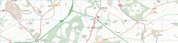
5 Site Location / NORTH SOUTH N / Key m Reproduced by permission of Ordnance Survey on behalf of the Controller of Her Majesty's Stationery Office. All rights reserved. Licence number Site Outline Excavation Areas Figure 1: Site Location. Archaeology Reports Online, All rights reserved. 5
6 Abstract A programme of archaeological work by GUARD Archaeology Ltd on the North and South sites at Newcraighall resulted in a complex story of land use changes from prehistory to the present day. This investigation was combined with detailed research into the history of the area for the seventeenth and eighteenth centuries. The earliest activity recorded centred round groups of pits where the specialist evidence suggests that people during the late Mesolithic/ early Neolithic, late Neolithic and Bronze Age had visited the place using pits for cooking and fires. However, the majority of features, date from medieval times through the post-medieval period to modern times. These include various sized coal pits or shafts, and the footings of four structures, probably colliery buildings, arranged around a now infilled mineshaft on the southern site. Elements of a designed landscape associated with Brunstane House included a ha-ha or protoha-ha that traversed the northern site. The presence of several large culverts may also have connections with both landscape alterations and the coal-mining industry. Fragments of curved and linear ditches may be remnants of earlier field systems dating from the medieval and post-medieval periods, and possibly relating to extensive remnants of broad rig cultivation found across the two areas. While many of the features were of unknown date, their spatial distribution suggests nineteenth to twentieth century activity. The historical research demonstrates the complexities of landownership with evidence of the development of coal mining and coal ownership, the value of historical maps to the research, and the social and economic realities of the times. Other coal-related features included salt pans, water wheels and lime kilns. Examination of papers relating to Brunstane House showed that they had direct bearing on the understanding and dating of the landscaping features and other groundworks, including changes to the estate boundaries and also the runrig system. A labourer s daily diary for the winter of was an especially interesting find from the point of view of what work was undertaken on the estate, by whom and for how much. This project shows the value of combining two subject areas together, as from their partial evidences, it is possible to produce a much more rounded view of the life of the times from the landowner to the coal miner during the postmedieval and early modern times. Introduction This report draws together the results of a series of archaeological investigations carried out between 2011 and 2016 on land forming part of the policies around Brunstane House and Newhailes House near Newcraighall (Figure 1) (NGR: NT ). The archaeological work led to documentary research into the history of the estate (see Historical Research) as well as research into the artefacts recovered from the investigations. The work was instigated in 2011 by Barratt East Scotland who commissioned GUARD Archaeology Ltd to undertake a desk-based assessment, metal detecting survey, trial trench evaluation and subsequent strip, map and sample excavation across land to the north of Newcraighall (Newcraighall North) that contained a series of mineshafts and landscaping features associated with Brunstane House. Further work was commissioned by Avant Homes (formerly Bett Homes) in 2015 on a proposed development area situated immediately southeast of Newcraighall (Newcraighall South). It consisted of a metal detecting survey, an archaeological evaluation, an open area excavation of a colliery works in the southern part, a strip, map and sample in the northern part of the development over possible mineshafts; an archaeological watching brief and monitoring visits (see Hunter Blair and Will 2016). Two possible mineshafts were uncovered in the southern area along with drains and other linear features. The fieldwork projects were directed by Alan Hunter Blair in 2011 and between 2014 and The sites, formly large fields, lie between the A1 to the south and west and the main East Coast railway line to the east. They lie on either side of the former mining village of Newcraighall and are situated on the southern boundary of Edinburgh City where it meets that of Musselburgh. The subsoil comprises deposits of till, of outwash sand 6 Archaeology Reports Online, All rights reserved.
7 and gravel deposits, while the bedrock is part of the Scottish Lower Coal Measures Formation, which include sandstone, siltstone and mudstone with seatclay or seatearth and coal at the top. Coal seams are common and many exceed 0.3 m in thickness (British Geological Survey 2018). All elements of fieldwork and reporting were conducted following the Chartered Institute for Archaeologists (CIfA) standards and guidance. The site archive is lodged with Nation Record of the Historic Environment and the finds have been declared to the Treasure Trove Unit. Archaeological and historical background The results of the 2011 desk-based assessment included the discovery of a ring-ditch cropmark, which was considered to represent a prehistoric roundhouse and settlement to the north-east of the Newcraighall North development areas. This was reidentified by Cross (see historical research) as an eighteenth century water feature. To the north, additional cropmarks were identified of potential prehistoric date, including the Brunstane enclosure, which is a Scheduled Ancient Monument, and another possible enclosure. These, together with aerial photographic evidence and previous archaeological investigations of similar cropmark sites, demonstrated that the Lothians were occupied relatively intensively, during later prehistory. Lying also to the north of the proposed development area, are two known medieval sites. One is Brunstane moated enclosure, a rectilinear feature visible as a cropmark on aerial photographs. The other is Brunstane House, which first appeared in historical records in the early fourteenth century as a tower house built by the Crichtons. It was demolished in 1547 and rebuilt as a house on a new L-shape plan by c The present archaeological works took place on land that is geographically close to the battlefield of Pinkie, fought between the Scots and English on 10 September 1547 as part of the Rough Wooing, the attempt of the English to link the English and Scottish Kingdoms, through the marriage of the young Queen Mary of Scotland and Edward VI of England. The battle ended in a rout (a disorderly retreat of defeated troops) with much equipment discarded by the fleeing Scots army. It is likely that some small metal finds found within the topsoil of Newcraighall North derived from this event. While the bulk of archaeological sites within the proposed development area date to the post-medieval and modern periods, none of the historical maps of the seventeenth and eighteenth centuries consulted during the desk-based assessment depict any settlement, and only a light distribution of rural settlement is noted in the surrounding 1 km study area. The village of Newcraighall developed the late eighteenth and nineteenth centuries to cater for the needs of the expanding population of Edinburgh, including housing for workers in the surrounding nursery gardens. By the later nineteenth century, particularly after the opening of the Klondyke coal pit in 1897, the settlement had become predominantly a mining village. Some of the miners cottages have been restored and are C listed buildings and are possibly depicted on the Andrew and Mostyn Armstrong map of 1773 as three rectangular buildings to the north-east of Newcraighall Road. The abandoned coal mineshafts across the development area are most likely associated with the Newcraighall or Klondyke Colliery, which operated between 1897 and 1968, and was located to the south-west of the site. The pit closed in 1968, and today there is little sign of Newcraighall s mining past. Another colliery, the New Craighall Colliery, was situated to the south-east with other mineshafts to the north-west. The course of the former Fisherrow Branch of the Edinburgh and Dalkeith Railway Line forms part of the northern boundary of the Newcraighall South site and the southern boundary of the Newcraighall North site. It is depicted on all maps between the Ordnance Survey First Edition 6-inch map of 1854 and Bartholomew s map of Visible remains include a modern foot bridge that crossed over the railway line, now a path, and Wanton Walls Bridge. Metal detecting survey results Both Newcraighall North and South sites were subject to metal detecting surveys, primarily to recover any items associated with the Battle of Pinkie. Archaeology Reports Online, All rights reserved. 7


8 On Newcraighall North the metal detecting survey resulted in the recovery of 417 metal finds distributed widely across the area. Of these items, only nine were identified as having archaeological interest. The remainder includes heavily corroded nondescript iron fragments and represents agricultural and later mining activities, modern dumping and the nearby railway. Significant finds include a small musket ball, three belt fragments, three rectangular lead objects, a fragment of a possible axe and a late seventeenth/early eighteenth century coin. The metal detecting survey of Newcraighall South also resulted in the recovery of a large number of metal artefacts, but after further examination many were discarded. Objects such as heavily corroded modern iron, lead, or alloy fragments including bolts, nails, wire and copper pipe, appeared to relate to recent agricultural activities, modern dumping and the nearby railway line. Important finds include four cast copper-alloy buckles from shoes, belts, or straps that may date to the nineteenth century, and two small lead discs, possibly weights. A circular lead medallion was also recovered, as were a decorated strap and a small cast lead Roman soldier. Coins discovered during the metal-detecting survey included a possible Charles I farthing dating between 1625 and 1649, and a Charles I silver halfcrown of Two possible George III farthings were also recovered, one of which dates to A number of Victorian pennies and modern coins were also identified. The archaeology Excavation results Groups of pits Four groups of pits were identified on the Newcraighall North site (Figure 2). Group 1 (Plate 1) comprised nine pits aligned NNE/SSW, which measured c. 1 m in diameter by 0.3 m deep. They were filled with silty-clay and some charcoal flecks. Only the fill (033) of pit (041), contained a single artefact - a fragment of clay pipe stem. Pit group 2 consisted of three shallow pits including pit (070) (Plate 2) randomly arranged north of a linear feature (065), perhaps associated with drainage and one pit located south of it. The pits measured c. 0.5 m in diameter and c m in depth. Some of their fills contained coal fragments, and post-medieval pottery was recovered from the fill (061) of pit (063). Plate 1: Pit Group 1 during excavation. From the NNE. Plate 2: Pit 070 in Pit Group 2 during excavation. Pit group 3 comprised five pits randomly arranged along the western edge of the central mineshaft alignment. These measured c. 1 m in diameter and up to 0.3 m deep. Most of the fills contained coal, and finds include sherds of post-medieval pottery and green bottle glass shards (Plate 3). Plate 3: General view of area during excavation of prehistoric pit groups. 8 Archaeology Reports Online, All rights reserved.
9 Newcraighall North Pit Group 4 Pit Group Pit Group Pit Group Newcraighall South Pit Group 5 Pit Group 7 Pit Group 6 Key Mineshaft / Pits Structure Pits m Figure 2: Plan showing location of mineshafts, prehistoric pit groups and landscape structures. Pit group 4 consisted of a vague linear alignment of six pits located towards the eastern edge of the site. Two of these (179 and 194) contained modern animal burial pits. The four remaining pits were sub-oval or sub-circular in plan and up to 0.39 m deep. Their fills contained modern ceramic and glass, which was not retained. An area of possible hardstanding (204) comprising sand with pea gravel may be associated with them. Nine pits forming three small groups, pit groups 5, 6 and 7 were found on the Newcraighall South excavation area (Figures 2, 3 and 4). The pits generally measured up to 1.02 m in diameter by c m deep. Pit group 5 comprised three pits (2075, 2069 and 2092/2095) spaced closely together. Pit (2075) was filled with a firm, mid-brown silty-sand with sandstone fragments. A prehistoric flint knife (SF 46) was recovered from this pit during excavation. Pit group 6 consisted of two pits (2080 and 2091) to the south of pit group 5. Pit 2091 contained sufficient charcoal in its fills to suggest it may represent a cooking pit. A small chert/flint core was recovered from its base. Pit group 7 comprised four pits (2084, 2086, 2088 and 2096). Finds attributable to the prehistoric period were recovered in the form of pottery fragments from the fills of pits 2088 and 2096 during excavation. Archaeology Reports Online, All rights reserved. 9
 and 7 (later Neolithic). Coal mining activities The majority of features encountered during the archaeological work were related to mining activities.")
10 D D A A B B C C Pit Group 5 Pit Group 7 I I G F G F H H Pit Group 6 E E m Figure 3: Plan of pit groups 5 (later Neolithic), 6 (late Mesolithic/early Neolithic) and 7 (later Neolithic). Coal mining activities The majority of features encountered during the archaeological work were related to mining activities. Distinct areas of mine working were identified across both the north and south parts of the site as discrete but discontinuous pit alignments of varying shapes and sizes. The pits were generally sub-rounded small or medium-sized features with steep-sides. Others were large, oval and some were shafts (Figure 5). Generally, they measured either c. 1.5 m in diameter or up to 16 m long by 8 m wide. A total of 63 pits, probably directly related to mining were recorded, but given the health and safety implications of excavating these features and in order to minimize ground disturbance, only 18 examples were trial excavated. This was done in order to characterise and date them, and for the possible retrieval of any artefacts. The smaller pits were excavated to a depth of 1.35 m by hand and the larger pits to a depth of 7 m by machine. All the pits on the Newcraighall South area were subject to machine excavation during geotechnical site investigation works. The upper fills of these pits varied: some had coal-rich earth, others contained large amounts of ash and industrial metal-working debris, others had coal-rich, blue/grey shale, and a small number were found with the addition of random sandstone cobbles. Of the larger oval pits excavated by machine, some were filled in with earth and rubble, others with shale and coal. Most of the finds recovered from these features comprise post-medieval pottery, although the fill (030) of pit 031 (Plate 4), in the central pit alignment, yielded sherds of medieval Scottish East Coast White Gritty Ware. Post-medieval and early modern pottery, glass shards and clay pipe fragments were recovered from the fills of the larger oval pits. Plate 4: Mining pit 036 in foreground with pit 031 to the rear in the central pit alignment. From the south. 10 Archaeology Reports Online, All rights reserved.
11 Seven pits that had ashy, slag-rich upper fills were generally sub-circular or sub-oval in plan and measured c. 5 m to 8 m. The majority of these features were found in the eastern pit alignment on the northern site, with a single ash-filled pit (139) located in the central pit alignment (Plate 5). Post-medieval pottery, glass sherds, clay pipe fragments, slag and occasional animal bone fragments were recovered from the fill of pit (088) in the western pit alignment (Plate 6). A A B B C C Pit Group D D E E Pit Group 6 F F G G H H I I Pit Group m Figure 4: Sections through the main pits of pit groups 5, 6 and 7. Archaeology Reports Online, All rights reserved. 11


12 Newcraighall North Newcraighall South Key Mineshaft Coalmining pit alignments indicating drift of coal seams 1004 Ha Ha, Culvert & Other Structures Field Boundaries and Ditches Cultivation rigs Other Features m Figure 5: Plan of the mineshafts in relation to later structures and features. Plate 5: Mine pit 139 in central seam alignment. Plate 6: Mine pit 088 in west seam alignment. 12 Archaeology Reports Online, All rights reserved.
13 The only structural remains (Figures 5 and 6) directly associated with mine working were found in the southernmost part of Newcraighall South, where they comprised four lime-mortar bonded sandstone structures. Two of them, Structures 1 and 2 were associated with an infilled mineshaft (015) (Figure 6). A single sandstone structure, Structure 3 (Figure 9) was recorded to the west close to an infilled mineshaft (077) and a short section of wall Structure 4 was found adjacent to a track (004) to the east of Structure 1 (see below). Structure 1 (Figure 7), was located to the immediate north of mine shaft (015) and comprised a sandstone base (014). The building was U-shaped in plan with six external stone buttresses, and was sub-divided internally by a red brick partition wall (070). It measured 3 m by 4 m externally. The structure had an additional c. 1.5 length of wall at the south-east end of the north-eastern wall, with a corresponding parallel wall (094), at 1.1 m distance. The south-east wall of the structure was not present Structure 4 Structure Structure Structure Key Mineshaft / Pits Structure Coal Deposits 0 25 m Figure 6: Location of Structures 1 to 4 in relation to mine shafts and coal deposits, in the southern area of Newcraighall South. Archaeology Reports Online, All rights reserved. 13
.")
14 Key Degraded sandstone in lime mortar Stone & Brick Mineshaft m Figure 7: Detailed plan of Structure 1. The walls of the structure, which survived to a height of 0.45 m, contained occasional unfrogged red bricks and roughly dressed sandstone masonry blocks (Plate 7). A single course of un-frogged red brick formed the internal wall faces of the south-eastern compartment of the structure. The area within had been infilled with a layer of rubble (080) beneath a trampled coalrich layer (016). The compartment on the northwest side of partition wall (070) contained a coalrich trampled layer (047) and a layer of clay with crushed shale, ash and coal fragments (071). Below these deposits were layers of trampled coal debris: (072 below 071 and 081 beneath 080) that overlay a layer of crushed sandstone (073) which acted in part as a foundation for the brick partition wall (070), and a floor at the base of the entire structure. The layers between the walls of the south-east addition (094) comprised a sandy clay with sandstone and brick fragments (096) overlying a dark trample layer (095). The difference between these infill layers and those within the building, and together with the addition of the brick facing on the inside of the south-eastern faces of the structure, suggest had been subject to remodelling during the course of its use. Plate 7: Mining structure 1. From the east. Structure 2 (Figure 8) was less well preserved than Structure 1. It comprised four equally spaced but poorly-built lime-mortar bonded sandstone rubble walls or footings (023, 044 and 045), with the longest (024) consisting of more mortar than stone. The structure measured c. 10 m in length by c. 6 m in width and it was aligned NW/SE. 14 Archaeology Reports Online, All rights reserved.
15 Key Degraded sandstone in lime mortar Stone 0 4 m Figure 8: Detailed plan of Structure 2. Between walls (024) and (045), and beyond the latter, at the south-east end of the structure was a hard deposit (049) of dark grey/reddish-brown, clay/silt with small stones. At the north end of the structure, natural sandy clay (003) was visible between footings (023) and (044). A 1.8 m long by 0.5 m wide, sub-rectangular rubble-filled pit (093) was located in the middle of the structure between footings (044) and (045) with a smaller pit (026), 0.6 m in diameter, positioned between footings (024) and (045). Immediately south-west of the structure was an area of heat-affected subsoil (043) that suggests that machinery was used within part of, if not all of Structure 2. The structure was located 8 m to the north-east of mineshaft (015) and was abutted to the north and east by a surface of hardstanding (011) of silty clay, brick fragments and sandstone rubble. The area between the mineshaft and Structures 1 and 2 also consisted of a hardstanding surface of fragments of sandstone and brick fragments, clinker and slag-rich industrial waste, overlain by coal dust, coal and shale fragments (031). Structure 3, located to the east of an infilled mineshaft (077) (Figure 9 and Plate 8), was built from mortar-bonded rubble and formed a small three-sided building (021) measuring 4.1 m long by 2.5 m wide, which was aligned NE/SW. It was built on the clay subsoil (003) and had an accumulation of rubble and industrial debris around it (019 and 064). The structure had an internal compacted surface that consisted of sandstone rubble (022) partially overlain by a deposit of fine coal fragments (059). Between this and the basal trampled layer with remnants of a paved stone floor (063), was a layer of redeposited clay with coal and sandstone fragments (061). The areas surrounding the structures and shafts consisted of deposits of coal debris and may represent areas where coal had been stock-piled (Figure 6). Deposits of coal fragments (006, 007, 036, 039, 061, 062 and 063) were located to the south and south-east of shaft 015 while coal dust deposits (019, 074 and 075) were arranged around mine shaft 077. Archaeology Reports Online, All rights reserved. 15
.")
16 Key Stone 0 1 m Figure 9: Detailed plan of Structure 3. Other recent landscape features Cultivation rigs The remains of broad rig cultivation were noted over all parts of the excavated areas of both Newcraighall North and South (Figure 5). They were generally aligned N/S and E/W, although in the north-west corner of Newcraighall North a number of furrows were aligned NE/SW. In Newcraighall South, what little remained of the cultivation marks, was generally aligned NNW/ SSE. Plate 8: Structure 3 overlain by coal dust deposit (059). From the south-east. Linear features Between the E/W and N/S aligned cultivation rig remnants in the southern part of Newcraighall North, was a N/S oriented ditch (084), recorded over a distance of 34 m (Figure 5). It measured 16 Archaeology Reports Online, All rights reserved.
 was aligned roughly E/W and measured 55 m in length, by c. 0.8 m in width and was c. 0.21 m in depth.")

17 0.95 m wide by 0.45 m deep and was filled with sandy-silt (083) (Plate 9). This is probably a relict field boundary sub-dividing areas of the rig system. Plate 9: Boundary ditch 084. From the south. Two slightly curvilinear features were recorded north of the ha-ha in Newcraighall North. One, (111) was aligned roughly E/W and measured 55 m in length, by c. 0.8 m in width and was c m in depth. It was filled with stoney, sandy clay (112). Towards its western extent, a spur (119) branched off to the south-west, which was recorded over a distance of 20 m. No datable material was recovered from the fills of these features but they probably represent truncated fragments of earlier field boundaries. Towards the east side of the site, a linear feature (186) aligned NW/SE, was cut by rig cultivation marks. It survived 48 m long, 1 m wide and 0.5 m deep, and was filled with stoney, sandy-clay (187). Two fragments of medieval pottery were recovered from the feature, which may represent part of an earlier relict field system, or a drainage ditch, or possibly both. In the SE corner of the northern area, a further, slight curvilinear feature (192) aligned NE/SW was investigated. It measured 30 m by 1.1 m and was 0.22 m deep. It was filled by dark sandy-silt (193) containing post-medieval finds. The function of this feature is unclear but it would appear recent in date. In Newcraighall South, a NE/SW aligned ditch (1016/2020) cut through the rig cultivation marks and an infilled mineshaft (1004) at the west end of site. A large horseshoe-shaped tile drain was found at the base of this ditch. A further broad deep ditch (2052) aligned N/S was found towards the east side of site, this also contained a tile drain at its base. A number of other narrow, but similar, field drain trenches were visible across the southern area of this site. Further linear/curvilinear features were visible around some of the mineshafts, these may represent the position of fences enclosing the shafts to prevent access to the workings but some of the broader, deeper features may be associated with drainage. A track (004/2054) was recorded running northwards across the site and away from the southernmost area of mine workings. It comprised sandstone rubble and brick fragments graded with cinders and ash towards the northern end of its course. Ha-ha The remains of a truncated ha-ha (Figures 5 and 10) comprising a lime-mortar bonded sandstone rubble wall (023) constructed against the north side of a V-shaped ditch (027), cut into subsoil (002) and was recorded traversing Newcraighall North in an E/W alignment. The wall survived to a height of 0.5 m with three courses of stonework noted in the ditch, which was 1.38 m wide by 0.53 m deep. The ditch had a primary fill (026), and a secondary fill (024) which encompassed tumble (025) from the ha-ha (Plate 10). Plate 10: Ha-ha (023) and ditch (027). From the west. A heavily truncated causeway (Figure 5 and Plate 11) (075) consisted of lime mortar-bonded sandstone blocks that were located towards the middle of the ha-ha. A stone-built culvert 145, located in the eastern part appeared to discharge into the remodelled section of the ha-ha ditch, perhaps long after the ha-ha had become redundant. Archaeology Reports Online, All rights reserved. 17
 forming one of the crossing points over the ha-ha (023).")
18 J 023 NK J 0 2 m K J J K K m Figure 10: Plan of and sections through the ha-ha (023) and its ditch (027). at one end of the feature which acting as a filter to prevent the drain blocking. Plate 11: The truncated remains of a causeway (075) forming one of the crossing points over the ha-ha (023). From the south. Culverts Four culverts were recorded during the site investigations (Figure 5). The first (086, not illustrated) lay to the south of Newcraighall North and was revealed during removal of the southernmost railway embankment associated with the former Fisherrow Branch of the Edinburgh and Dalkeith Railway Line. It comprised a lime-mortared sandstone culvert with two walls positioned 0.4 m apart and built four courses, or 0.47 m high. The walls were capped by sandstone slabs. Vertically positioned metal bars were found Another culvert (145) was much larger and comprised two lime-mortared sandstone walls 0.4 m wide, positioned 1.7 m apart, which attained a height of c. 1 m (Figure 11). Large, sandstone slabs capped the walls, some with tool marks, with the voids between plugged with small sandstone fragments set in lime-mortar (Plate 12). The culvert was aligned N/S with a sharp turn towards the east at its northern end where it discharged into the former course of the ha-ha ditch (027) (Plate 13). During construction of the railway line the southern end of this culvert was blocked by a wall (148) which diverted the flow of water into a rubble-filled ditch (156) that ran along the base of the north side of the railway embankment. Where the culvert capstones were displaced during this work, sections of steel rail track were laid to replace them and the upper courses of its walls had been re-pointed with cement. At the northern end of the culvert, it appeared that the ha-ha ditch had been remodelled to form a soakaway (160) filled mainly with dark sand (161). At some point, the silted-up 18 Archaeology Reports Online, All rights reserved.

.")
19 Plate 12: Culvert 145 capping slabs. From the south. 148 Plate 13: Culvert 145 during excavation with the ha-ha ditch in the distance. From the south steel rail track L L Wall void 178 Wall 0 1 m L L Key Stone Mortar Soakaway m Packing Stones 092 Figure 11: Plan of and section through the culvert (145). Archaeology Reports Online, All rights reserved. 19
20 soakaway channel (160) was partially re-cut (158) and refilled with sand and gravel and rubble. The ha-ha wall appeared to have been consolidated (092) over a distance of 7.5 m from the point at which the culvert discharged into the soakaway, but beyond this, the ha-ha did not continue. Towards the eastern end of Newcraighall North, a disturbed lime-mortared sandstone culvert (202), aligned SW/NE was uncovered. This comprised two sandstone walls positoned 0.35 m apart and capped by sandstone slabs. It was not possible to fully excavate the drain due to the presence of water. Many of its capstones to the east had been displaced, possibly during cutting of the later soakaway channel (158) for culvert 145. A canalised stream is depicted on the Ordnance Survey map of 1895 (published 1895) possibly represented by culvert (202) On Newcraighall South, was a short culvert (2051) (Figure 12), with walls built from sandstone rubble with large irregular sandstone slabs capstones. Smaller stones had been placed to plug the gaps around the edges of the capstones and limemortar filled the voids between the capstones. The culvert contained a tile field drain. Three tile field drains were visible converging at its open truncated SE end: one of these was from ditch (2020). A truncated return to the culvert (2060), which did not contain a ceramic drain, was visible aligned NE/SW to the south of culvert (2051) Radiocarbon dates Although most of the features and structures investigated on site relate to the late eighteenth and nineteenth century coal mining activities, several pits were excavated that appear to be prehistoric in origin, and artefacts including prehistoric pottery and flint tools were recovered from them. A radiocarbon dating programme Key Stone Mortar Shattered Sandstone 0 5 m Figure 12: Plan of culvert (2051). was therefore undertaken to investigate these prehistoric features on Newcraighall South. Eight dates were submitted for AMS dating to the Scottish Universities Environmental Research Centre (SUERC). These dates were derived mainly from charcoal and carbonised nutshell obtained from bulk soil samples recovered during the excavation (Table 1). Lab Code Context Feature Sample description Radiocarbon age BP δ13c 95.4% probability SUERC Pit Charcoal: Corylus 4083± cal BC LN SUERC Pit Charcoal: Corylus 4034± cal BC LN/EBA SUERC Pit Charcoal: Alnus 3056± cal BC MBA SUERC Pit Charcoal: Corylus 4041± cal BC LN/EBA SUERC Pit Charcoal: Alnus 3415± cal BC EBA SUERC Pit Charcoal: Alnus 3104± cal BC MBA SUERC Pit Carbonised nutshell: Corylus Avellana 4055± cal BC LN/EBA SUERC Pit Carbonised nutshell: Corylus Avellana 4059± cal BC LN/EBA Table 1: Radiocarbon dates from NCHS. 20 Archaeology Reports Online, All rights reserved.
21 Environmental remains and artefacts Carbonised plant macrofossils and charcoal By Diane Alldritt Introduction A total of twenty two bulk environmental samples ( GBA sensu Dobney et al. 1992) taken from archaeological Newcraighall South, were fully analysed for carbonised plant macrofossils and charcoal. They produced a small assemblage of carbonised plant material which consisted of occasional discrete caches of wood charcoal and hazel nutshell from some of the pits, in particular (2069, 2075 and 2091), whilst other pits contained only traces of charred detritus. Some samples were found to contain concentrations of clinker and coal, as well as modern seeds, suggesting more recent features or a heavy degree of mixing intruding from the modern industrial remains present at the site. Eight samples were submitted for radiocarbon dating and these consisted of well-preserved fragments of alder and hazel charcoal as well as hazel nutshell. Three samples were submitted from pit (2075 and 2066), two samples from pit (2096 and 2097) and single samples from pits (2069, 2067, 2075, 2066, 2084, 2083, 2088 and 2087). The radiocarbon dates produced spanned the very late Neolithic through to the middle Bronze Age periods, with the majority falling within the late Neolithic/ early Bronze Age range. Methodology Bulk environmental samples were processed by GUARD Archaeology Ltd. using a Siraf style water flotation system (French 1971). The resultant flot from each sample was dried before examination under a low powered binocular microscope at x10 to x20 magnifications. The heavier residue portion of each sample was dried and then sorted by eye, with potentially carbonised material subsequently forwarded to the author for identification. All identified plant remains including charcoal were removed and bagged separately by type. Fragments suitable for radiocarbon dating were bagged individually and forwarded to SUERC for analysis. Wood charcoal was examined using a high powered Vickers M10 metallurgical microscope at magnifications up to x200. The reference photographs of Schweingruber (1990) were consulted for charcoal identification. Plant nomenclature utilised in the text follows Stace (1997) for all vascular plants apart from cereals, which follow Zohary and Hopf (2000). The term seed is used in the broadest sense to include achenes, nutlets and so forth. Results The environmental samples produced a small assemblage of carbonised plant material which mostly consisted of wood charcoal along with hazel nutshell. Preservation of the charcoal was generally good, with a mixture of crushed material and 5 mm to 20 mm fragments, whilst the hazel nutshell was largely found in a highly crushed state of preservation, with only the occasional larger fragment up to 10 mm in size, perhaps from soil conditions or the roasted nuts being processed as food. The samples contained from <2.5 ml of charred detritus up to 20 ml of charcoal and nutshell fragments with occasional sterile samples also present. Modern material consisting of seeds and earthworm egg capsules was recorded in amounts from <2.5 ml up to 10 ml, which, along with fragments of clinker and coal in some deposits indicated the potential for mixing from more recent post-medieval and modern industrial activity. The detailed results table can be found in the site archive. Prehistoric Pit Groups Three distinct pit groups were found during the project with a cluster of five pits (Pit Groups 5 and 6) located toward the western side Newcraighall South consisting of 2069, 2075, 2080, 2091 and 2092, whilst 23 m east of this were a series of four further pits (2084, 2086, 2088 and 2096) forming Pit Group 7 (see Figure 3). Pits (2069, 2075 and 2092) were a cluster of three, whilst 2080 and 2091 lay slightly to the south. A single sample from pit (2069/2067) consisted primarily of crushed slivers of Quercus (oak) charcoal with a few fragments of Corylus (hazel) charcoal and some very small fragments of Corylus avellana (hazel) nutshell. The hazel nutshell from 2069 returned a date of cal BC (SUERC-74795) placing this at the late Neolithic/early Bronze Age transition period. Four samples from pit (2075/2066) contained greater Archaeology Reports Online, All rights reserved. 21
22 concentrations of burnt material, with mixtures of hazel nutshell and oak, hazel and Alnus (alder) charcoal. Samples 36, 41 and 62 from 2066 were all fairly similar with mixed fuel types and hazel nutshell forming the main constituents, whilst sample 61 from the upper fill contained all oak charcoal. The samples from 2075 suggested a reuse or return to this pit on a number of occasions, for cooking/processing of hazel nuts and perhaps other times simply to use it as a fire pit or hearth. Three radiocarbon dates were taken from fragments of hazel charcoal from pit (2075/2066) with all producing very closely matched results indicating activity in the transition period between the late Neolithic/early Bronze Age. Sample 36 (2066) returned a date of cal BC (SUERC-74786), sample 41 (2066) gave a date of cal BC (SUERC-74787), and sample 62 (2066) returned as cal BC (SUERC-74789) showing consistency of results and a fairly narrow date range of possible use. Pits 2069 and 2075 contained a similar range of evidence indicating burning activity taking place within them, probably for processing hazel nuts and to use for other cooking and heating activities. The similar radiocarbon date ranges for these two features indicated they were probably contemporary. In contrast, the upper fill of pit (2092/2068) produced no carbonised material. It contained clinker and coal, perhaps indicating some disturbance from more recent industrial activity. Outlying pit 2080/2079 was largely sterile of burnt remains, with occasional crushed fragments of clinker present, but its companion 2091/2089, a possible cooking pit or burnt area was interesting, as both samples from it produced large concentrations of Quercus (oak) charcoal in fragment sizes 10 mm to 20 mm. This feature was probably a substantial fire pit with material burnt in situ, perhaps for cooking or general heating purposes, and no other burnt remains were found in it. This feature (2091) was not dated but could potentially have been a random earlier Neolithic fire pit unrelated to the other features. The second group of pits, lying to the east of the above and consisting of 2084, 2086, 2088 and 2096, produced varied results, with some of the features containing evidence for disturbance by more recent industrial activity. Pit 2084/2083 contained some trace evidence for burning with a single fragment of Alnus (alder) charcoal identified from sample 64 (2083) mixed through with clinker and modern seeds. The alder charcoal was dated producing a date range of cal BC (SUERC-74793), placing it in the early middle Bronze Age transition period. Pit 2088 contained a few fragments of oak and alder charcoal from sample 45 (2087) along with clinker fragments. Three samples from 2096/2097 also produced traces of burnt detritus, sample 49 was found to be sterile whilst a fragment of alder charcoal was recovered from sample 66, and a small cache of highly crushed hazel nutshell was found in sample 63. Samples of alder charcoal from 2088 and 2096 were radiocarbon dated with both producing middle Bronze Age date ranges. Pit 2088/2087 gave a date of cal BC (SUERC-74788), whilst pit 2096/2097 proved to be of a similar period with a date of cal BC (SUERC-74794). Pit 2086/2085 contained the least material - a single fragment of oak charcoal. The date range obtained for the eastern group of pits indicated largely Bronze Age activity suggesting both a spatial and temporal separation from the earlier dated western pit group. Interestingly a further date obtained from eastern pit 2096/2097, this time on hazel nutshell produced a date of cal BC (SUERC-74796) which more closely matched the western pit dates. Pit 2096 therefore could have been an earlier feature that was re-used in the middle Bronze Age. Other Features A single sample from deposit 2108, an area of hard standing to the SE side of mineshaft 2106 was sterile of carbonised remains. The sample, however, produced a large amount of crushed and degraded clinker fragments, appearing to be coal derived, which are most likely related to more recent industrial activity in the area. Two pits (2103/2102 and 2105/2104) were sterile of carbonised remains, producing only coal, clinker and modern material. Discussion The agricultural economy No carbonised cereal grain or weed seeds were present in any of the samples. 22 Archaeology Reports Online, All rights reserved.
23 Wild resources The group of five pits located to the western side of Newcraighall South appeared to have been the main focus for burning with part of this activity including the processing of hazel nuts for food. Nuts would have been a local seasonal resource, gathered for immediate roasting and consumption or to be stored for use later in the winter, and the presence of hazel nutshell is usually a fairly typical indicator of Mesolithic or Neolithic activity (Bishop et al. 2009). Evidence for roasting of hazel nuts was mostly in evidence in pit 2075, which produced carbonised nutshell from three out of four samples, with some 10 mm pieces present. Smaller quantities of highly crushed nutshell were recorded from pit 2069, whilst a stray trace fragment was found in pit Hazel nutshell from 2069 produced a date of cal BC (SUERC-74795). The radiocarbon dates from 2075 and 2069 generally indicated the transition between late Neolithic/early Bronze Age activity suggesting the gathering of hazel nuts as a wild resource remained an important part of the food economy in this region into these later periods. In contrast, the eastern cluster of four pits contained significantly less material, although a few crushed fragments of hazel nutshell were located in pit 2096/2097. The radiocarbon date of cal BC (SUERC-74796) from the nutshell in 2096 was more closely aligned with the dating of the western pits and could indicate earlier use of this feature. Woodland resources The samples produced a small amount of wood charcoal consisting mainly of oak with lesser quantities of hazel and alder, indicating mixed deciduous oak woodland being exploited for fuel. Of possible prehistoric date was the outlying fire pit or cooking area 2091, which produced the greatest quantity of charcoal with a large amount of oak charcoal recorded. Containing only slightly less than this, the upper fill of pit 2075 in the western pit group also consisted solely of oak charcoal, and combined with evidence from the earlier fills, indicated a significant amount of repeat burning activity was taking place there. Pit 2075 produced three very closely matched radiocarbon dates with hazel charcoal from sample 41 (2066) producing a date range of cal BC (SUERC-74787) indicating the transition between the late Neolithic and early Bronze Age for the burning activity there. Pit 2069 also in the western group returned a similar date of cal BC (SUERC-74795) suggesting possibly quite a short concentrated episode(s) of burning taking place in this group. The eastern group of pits contained less carbonised material and had probably been disturbed to some extent by more recent industrial processes. However the radiocarbon dates produced fairly consistent results indicating middle Bronze Age burning activities taking place in these features, marking a distinct separation from the earlier activity seen in the western group. Alder charcoal from pit 2088/2087 returned a date of cal BC (SUERC-74788) whilst alder charcoal from pit 2096/2097 produced a similar possible range from cal BC (SUERC-74794). More recent industrial activity was reflected in the samples containing clinker and coal that was mixed through some of the deposits, in particular in pit 2092 and near mine shaft Conclusion The environmental samples from Newcraighall South produced small quantities of carbonised plant remains consisting of charcoal and hazel nutshell. Significant focuses of burning activity were indicated from some of the pits, in particular in western pit group (2069 and 2075) radiocarbon dated to the late Neolithic/early Bronze Age periods, and in outlying pit Hazel nuts were probably being gathered and processed as a food resource during this phase of use of the site. A lesser amount of burning activity was occurring in the pits to the east, although these did appear to have been more disturbed by recent industrial use of the area. The eastern pits were found to represent a different phase of activity with the majority of samples producing middle Bronze Age radiocarbon date ranges. Charcoal identification indicated the use of mixed deciduous oak woodland for fuel, with the main concentrations of burning taking place in pits 2075 and These features were probably substantial fire pits used for roasting hazel nuts and other cooking processes, signalling or general heating purposes during prehistory. Archaeology Reports Online, All rights reserved. 23
24 The lithic assemblage By Torben Bjarke Ballin Introduction Prehistoric artefacts consisting of pottery and a small lithic assemblage (18 pieces), were recovered from two pit groups identified during the strip map and sample phase of the Newcraighall South works. The lithic artefacts are characterised in general terms, with the aim of dating and discussing them. The evaluation of the lithic material is based upon a detailed catalogue (see Appendix 1) and the artefacts are referred to by their number in the catalogue (CAT). Key Definitions The definitions of the main lithic categories are as follows: Chips: All flakes and indeterminate pieces the greatest dimension (GD) of which is 10 mm. Flakes: All lithic artefacts with one identifiable ventral (positive or convex) surface, GD > 10 mm and L < 2W (L = length; W = width). Indeterminate pieces: Lithic artefacts which cannot be unequivocally identified as either flakes or cores. Generally the problem of identification is due to irregular breaks, frost-shattering or firecrazing. Chunks are larger indeterminate pieces, and in, for example, the case of quartz, the problem of identification usually originates from a piece flaking along natural planes of weakness rather than flaking in the usual conchoidal way. Blades and microblades: Flakes where L 2W. In the case of blades W > 8 mm, in the case of microblades W 8 mm. Cores: Artefacts with only dorsal (negative or concave) surfaces if three or more flakes have been detached, the piece is a core, if fewer than three flakes have been detached, the piece is a split or flaked pebble. Tools: Artefacts with secondary retouch (modification). Summary and discussion Only one tool was recovered from the site, with the remainder being debitage, see Table 2 (General artefact list). The debitage includes eight chips, five flakes, one blade, and three microblades. Most of the flakes and blades are incomplete and the solitary tool is a large scaleflaked knife. Flint Chert Agate Total Chips Flakes Blades 1 1 Microblades 3 3 Scale-flaked knives 1 1 Total Table 2: General artefact list. In total, six pieces are flint, whereas 11 pieces are chert. One small chip is agate. The scale-flaked knife (CAT 1), the fragment of a blade (CAT 2), and one flake (CAT 5) are in Yorkshire flint (Ballin 2011a). The remainder of the flint is thought to be local North Sea flint. The chert was probably procured locally from the region s Carboniferous limestone or collected from local shores (Cameron and Stephenson 1985). The solitary agate flake suggests that agate pebbles from the local volcanic outcrops may also have been exploited (ibid.). The chert microblades (CAT 12, 13, 15) were generally produced by the application of soft percussion, whereas the flakes and blades in Yorkshire flint (CAT 1, 2, 5) were manufactured by the application of hard percussion (Ballin 2011b; Suddaby and Ballin 2011). The scale-flaked knife (CAT 1) (Figure 13) is based on a large broadblade (69 by 32 by 7 mm), and it has neat scale-flaking along the entire right lateral side. It has a slight overhang along this edge, dorsal face, and small flat chips have been detached along this same edge, ventral face. This suggests that the piece was used for cutting. The overhang may indicate rejuvenation of the cutting-edge. In connection with the author s investigation of later Neolithic lithic assemblages from sites near the Overhowden Henge in the Scottish Borders (Ballin 2011a), three scale-flaked or plano-convex knives were presented to usewear specialist Dr Randy Donahue, University of Bradford, who carried out a cursory examination 24 Archaeology Reports Online, All rights reserved.
25 of the specimens. His verdict was the same in all three cases, that the knives had been used for cutting/sickling grasses or cereals. Most likely, the Scottish scale-flaked and plano-convex knives (or some of them) are sickles, and they probably carried out the same work as the curved sickles of southern Britain (Clark 1934). In contrast to some scale-flaked and plano-convex knives, the present piece has no gloss along its cutting-edge. were dug during the same period. As the site is clearly a palimpsest, the diagnostic pieces in the pits only provide a terminus post quem for the features, apart from the scale-flaked knife. If this piece is indeed a deliberately deposited piece (grave good or ritual sacrifice), pit 2075 is likely to have been dug in the later Neolithic, and the neighbouring pits may have been dug during the same period, maybe even by the same people. Prehistoric pottery By Beverley Ballin Smith Figure 13: Scale-flaked knife, CAT 1. As shown in Table 3 all lithic finds were recovered from pits: pit 2075 yielded three pieces, pit 2088 one piece, pit 2091 eleven pieces and pit 2092 three pieces. However, it is unlikely that any other objects than the impressive scale-flaked knife (CAT 1), represent intentional deposition. Most likely, all other artefacts not least the tiny chips, flakes and microblade fragments represent residual artefacts that is, knapping debris scattered across old settlement surfaces which entered the pits with the backfill when these were filled in. Pit Total Context Chips Flakes Blades 1 1 Microblades 3 3 Scale-flaked knives 1 1 Total Table 3: Distribution of the assemblage. The prehistoric lithics are clearly datable to several periods, with the soft percussion microblades dating to the late Mesolithic/early Neolithic framework, and the Yorkshire flint objects produced by Levallois-like technique to the middle/late Neolithic period. Figure 3 shows the distribution of the datable elements. However, it is quite possible that all of these pits Two plain sherds of robust, handmade, coarse pottery, SF 50 and 67, were found during the excavation of pits on the east side of Newcraighall South site. The pits survived as a discrete group of four features (2084, and 2096). Pit 2088 was the largest of the group but the much smaller 2096 was situated close by, but to the immediate east. A single sherd was found in each of these two features: SF 50 in pit 2088 and SF 67 in pit SF 50, a body sherd, weighs 45.3 g and has a wall thickness of 14.8 mm. The clay contained rock temper of quartz, sandstone and unidentified other rocks. It is a heavy, well-fired plain sherd but some of its coarse rock temper protrudes through the exterior surface. The slight concavity noted in the shape of the sherd suggests it originated from near the base of the pot. Its surface finish has not survived but thick carbonised food residues are noted on its interior surface. SF 67 shares many similarities with SF 50, as it is also a body sherd. It weights 27.3 g and measures 14.3 mm in wall thickness. It too has quartz and sandstone rock temper but the filler is wellintegrated with the clay. The exterior surface of the sherd has survived better than SF 50, as there is evidence that it was smoothed after forming. It is also burnt, with red/buff colours dominating. Visible on its interior surface is a thin layer of carbonised food remains. The presence of carbonised food residues on both sherds suggest that they were part of a cooking pot(s) that was used on the hearth. It is logical to ascribe these sherds as belonging to the same pot due to their shared characteristics of manufacturing techniques. However, taphonomic conditions within the two different pits, has led to differences which suggest there is an element Archaeology Reports Online, All rights reserved. 25
26 of doubt. The characteristics of this pottery (thickness, hard fired body and well integrated temper) suggest they are middle to late Bronze Age in date, and this appears to be confirmed by the radiocarbon dates: pit 2088/2087 (dated cal BC) and pit 2096/2097 (dated cal BC, but also cal BC). Medieval and Post-medieval pottery By Bob Will Introduction Pottery was found at both Newcraighall North (199 sherds) and from Newcraighall South (52 sherds) weighing a total of 2570 g. In addition there are brick and tiles amounting to 24,609 g They cover the medieval, post-medieval and modern periods although the main assemblage from Newcraighall North is modern (Table 4) All the sherds were examined, weighed and recorded according to guidelines and standards produced by the Medieval Pottery Research Group (MPRG 1998, and 2001) (The catalogue is presented as Appendix 2). No scientific analysis was undertaken. Scottish White Gritty Ware Twelve sherds Scottish White Gritty Ware fabrics were recovered (see Table 4). It is a fabric which is found throughout Scotland but particularly in the east of the country, where so far the only published kiln site is at Colstoun in East Lothian. White gritty wares first appear in the late twelfth century but the tradition lasts into the late fifteenth. This fabric has been extensively studied and it is likely that a number of kilns were in production throughout Scotland (Jones et al. 2006). All the sherds that were recovered appear to be from different vessels and cover a wide date range. The earliest sherd from Newcraighall North is a rim from a possible cooking pot which could date to the late twelfth or early thirteenth century, but there were also three sherds that were thicker-walled with a reduced fabric, which could be from the late medieval period into the fifteenth century. The earliest sherds from Newcraighall South are two undecorated body sherds from a possible cooking pot or storage jar and one has smoke marks on the external surface. Another undecorated sherd is in a slightly pink fabric which could also be from a storage jar. These three sherds could date to the late twelfth or early thirteenth century. The remaining two sherds were thicker-walled with a reduced fabric and green glaze which could be from the late medieval period, possibly the fifteenth century. Scottish Medieval Redwares One rim sherd and three body sherds were recovered in Scottish Medieval Redware fabrics. This type of pottery was produced from the thirteenth to the fifteenth century and is found across most of Scotland. It has recently been the subject of an extensive research programme funded by Historic Scotland (Haggarty et al. 2011). The sherds from Newcraighall North are all small and thin-walled with traces of glaze and a dark red heat skin. The fabric is smooth and well mixed with no obvious inclusions, which suggest that these sherds date to the late medieval period. The rim and neck sherd from Newcraighall South is from a jug with a rounded rim and a decorative cordon below. The sherd is thin-walled with patchy light green glaze and dates to the fourteenth century. Fabric Total Rim Base Handle Body sherd Weight (g) Scottish White Gritty Ware (SWGW) Scottish Medieval Redwares (SMR) Post-medieval Stoneware Scottish Post-medieval oxidised ware Scottish post-medieval reduced ware Post medieval? White earthenware Industrial stoneware Red earthenware Red earthenware slip-lined Kiln furniture Total Table 4: Medieval and later pottery types and quantities. 26 Archaeology Reports Online, All rights reserved.
27 Scottish Post-medieval Oxidised Wares (SPMOW) and Scottish Post-medieval Reduced Wares (SPMRW) Eleven sherds of Scottish Post-Medieval Oxidised Ware were recovered from across the two sites, together with seven sherds of Scottish Postmedieval Reduced Wares from Newcraighall South. These fabrics were first classified at Stirling Castle (Haggarty 1980) and date from the late fifteenth to the eighteenth century. Similar vessels were made in both fabrics and the main difference between the two is the firing conditions in the kiln which produce the grey/ black fabric colour on the reduced wares. The only published kiln site in Scotland is at Throsk on the banks of the Forth to the east of Stirling (Caldwell and Dean 1992), but other kiln sites making similar vessels are likely to have been in operation across Scotland. Historical research at Throsk has uncovered details about the potters and their families, as well as links to other parts of Scotland (Harrison 2002). It has been suggested that it was the draining of the carse that lead to the development of pottery production as the carse clays were made more easily accessible (Haggarty and Lawson 2013). The best range of vessels so far recovered comes from Throsk and Stirling Castle where platters, bowls, skillets, fish dishes and money boxes or pirlie pigs, as well as the more common jugs have been recovered. The sherds from Newcraighall North include a possible rim from a small cooking pot and a rim from a large bowl. Two of the body sherds are glazed on the inside, which would suggest that these are from a bowl rather than a jug or storage jar. The sherds from Newcraighall South include those that are glazed on both sides, suggesting that they may have come from a bowl or platter. The reduced base is slightly warped and has a stacking scar on it where the glaze has run and it had stuck to another pot in the kiln. Post-medieval Stoneware Four sherds were recovered in stoneware fabrics, two of them have a distinctive speckled tiger salt glaze appearance often found on stoneware vessels from Frechen in Germany. These Rhenish stoneware vessels were imported into Scotland from the Low Countries and Germany from the fifteenth century and became increasingly popular throughout the seventeenth century and were copied by local potters. Unlike the Frechen vessels and other imported stonewares which have dark grey fabrics the sherds from Newcraighall have a white or light grey fabric and are therefore likely to be local versions that started to copy the imported vessels in the seventeenth century and continued into the nineteenth century. A range of vessels were produce but it is the storage jars, flasks and drinking mugs that are the most common. These sherds are most likely from storage jars or flagons. One sherd from Newcraighall South was also recovered in grey stoneware fabric with brown glaze on the exterior with a slightly speckled finish. It is from the neck of a bottle or jar. One of the sherds from Newcraighall North (SF 101, unstratified) has a light grey fabric and a glossy glaze and could be from an imported stoneware bottle or flask, possibly from Siegburg. Similar vessels start to appear in Scotland from the fifteenth century. Industrial Pottery White earthenwares A total of 152 sherds were recovered from the two sites in white earthenware fabrics and these represent the largest group in the assemblage. They consist of a range of forms including bowls, teacups and plates or other flatwares. They have been decorated by a number of methods including transfer printing and hand painting. The earliest use of transfer printing was c and this soon became the dominant form of decoration, certainly from 1830, with blue being the most common colour and it common in this assemblage. Most of the sherds were too small to identify the patterns but the common willow style pattern was present. Many of the patterns are well known and were often patented, which provides a date for when they went into production. As with many of these wares, patterns continued in use for long periods of time, but also some were used by different factories at different times, which make them difficult to date. Only a few sherds with hand painted decoration were recovered in red and yellow, and these were mainly body sherds. Four sherds were recovered probably from a planter or vase with moulded decoration round the rim and bands of blue and brown round the body, which were Archaeology Reports Online, All rights reserved. 27
28 very popular in the late nineteenth century. One sherd from a banded planter has not been fired and is presumably a waster from one of the local factories in Musselburgh or East Lothian. One sherd from Newcraighall South had a slightly blue coloured glaze that was flaking off and is probably tin-glaze. This method of glazing white earthenware is slightly earlier than the other white earthenwares and could date to the late eighteenth century. Red earthenwares At total of 35 sherds are red earthenware fabrics and can be divided into two groups: brown glazed storage jars and slip-lined bowls. The fabric was fairly uniform red or orange with few inclusions and this would suggest that they were being produced in factories rather than small potteries. Nine of the sherds from Newcraighall North were from large slip-lined bowls that were used in dairying. Storage jars were represented at Newcraighall South where six sherds were recovered in red earthenware fabrics often with a dark brown glaze. One of the sherds has cream/ yellow slip decoration and is probably from a large bowl. These vessels are relatively common and were made at a number of sites throughout Scotland in the nineteenth century. One pottery has been excavated at Cupar in Fife (Martin and Martin 1996), although local potteries round Musselburgh were also making these types of vessels. Industrial Stoneware Seventeen sherds from large flagons and jars were recovered in white industrial stoneware but they also include a complete small bottle, possibly for ink or similar. These types of vessels were made in vast quantities in several factories including Glasgow and Portobello in the late nineteenth and early twentieth centuries. Stoneware jars were eventually replaced by glass and the factories production tended to decline and disappear by the 1920s, although the jars themselves may have remained in use for much longer. Kiln Furniture A fragment of a stilt or spacer used to separate pottery during firing in the kiln was also recovered during the investigations at Newcraighall South. These have three legs of equal length with sharp upward points at the end that are joined at the middle. The vessels to be fired are placed on to the points to minimise the area of contact. The stilts were made of white clay and were often made by specialist manufacturers, and frequently have numbers to indicate different sizes, but they were also made by the pottery factories. Pottery was a big industry in the Musselburgh and Prestonpans area in the nineteenth century and this fragment presumably came from one of the local potteries. Brick/tile From Newcraighall North, a large fragment of a hand-made brick and three fragments of roof tiles (pantiles) were recovered in a coarse orange/ red fabric and probably represent locally made products from the eighteenth or nineteenth century. A larger number (41) of fragments of brick and tiles were recovered from Newcraighall South (Table 5). The 26 tile fragments were all from curved roof tiles (pantiles) and were made of a coarse orange/red fabric and probably represent locally made products from the eighteenth or nineteenth century. The 15 brick fragments were all in course red or orange fabrics with inclusions of grog (broken brick in this case) and were all hand-made and unfrogged. Two complete bricks were recovered and were of similar size, one 225 mm by 110 mm by 65 mm and the other 245 mm by 115 mm by 55 mm. The complete bricks and larger fragments were all slightly irregular in shape and size which would suggest that they were all hand-made. Fabric No of fragments Weight Newcraighall North Brick and tile Tile 1 88 Newcraighall South Brick Tile Total Table 5: Brick and tile quantities and weight. Discussion The assemblage covers a wide date range from the medieval to modern period with the largest group of sherds dating to the nineteenth and twentieth centuries. Given the size of the site this is a relatively small assemblage of pottery, with the medieval and post-medieval sherds accounting for only 23.6% of the total by sherd count and 28 Archaeology Reports Online, All rights reserved.
29 only 16.7% by weight, but representing the main pottery traditions in Scotland at the time. The earliest sherds are Scottish White Gritty Ware, a rim and body sherds from cooking pots or storage jars, which could date to the thirteenth century. The post-medieval sherds are typical of the period and represent jugs and bowls and the stoneware sherd, although quite small, would indicate contact with mainland Europe although probably through merchants in Leith or other ports. The remaining sherds vessels are all common types for the nineteenth century onwards. The whitewares became the main pottery fabric and tended to be used for tablewares while the red earthenwares were used for more utilitarian storage jars and dairy bowls. The artefact analysis of the metal detecting assemblage By Natasha Ferguson The assemblage as a whole is composed primarily of heavily corroded non-descript iron fragments representing a range of activities including agriculture and residual material, such as large iron bolts relating to later mining activity, modern dumping and the nearby railway. Despite deep corrosion, a small number of iron objects are identifiable, for example a fragment of a horseshoe (SF 256), a buckle (SF 54) and a hook possibly originating from a domestic environment. The horseshoe fragment, which has a broad flat plate, represents an early example dating from the mid-seventeenth to the mid-eighteenth century (Hume 1969, 237). A small quantity of copper alloy and lead artefacts are included within the assemblage (Appendix 3). This includes a number of more diagnostic metal finds such as buckles, buttons, coins and a lead projectile, as well as some less identifiable objects, e.g. SF 319. Metallic condition, particularly of the copper alloy objects such as the possible late seventeenth/early eighteenth century coin (SF 036), and an earlier button, is very poor and does not allow for accurate identification. Much of this material dates between the early eighteenth to the twentieth century. The earliest button (SF 64) identified in the assemblage is cast from copper alloy. The surface of the button is heavily corroded and the shank is missing. However, the style of the casting, with shallow basin and outer rim, suggests a possible date of the mid-eighteenth century to the mid nineteenth century (Bailey 2004, 70). Two interesting buckles have been recovered, although as most buckle forms have remained unchanged across many centuries it can often be difficult to date them accurately. The first (SF 139) is a square copper-alloy belt buckle of semi-ornate design. As similar buckle styles have been identified on mid-seventeenth century sites of conflict it is likely this buckle may also date to this period. A simple D-shaped iron buckle (SF 054) appears to be an early type, although this simple form can potentially date anywhere from However, owing to the poor metal condition across the site, a later date for this buckle is more likely (Whitehead 2003, 18). The artefacts composed of lead are perhaps the best surviving within the assemblage. Two lead artefacts are of interest. SF 319 may represent a weighted core of another object to provide balance. SF 251 is a small musket or carbine ball which has been heavily distorted due to impact with a hard surface. As this is an isolated find it is not possible however to associate this artefact to any conflict activity such as the Battle of Pinkie, as it could as equally relate to later farming or hunting activity. The glass By Robin Murdoch Newcraighall North A total of 48 shards of glass were recovered from the site. Most were from bottles but six window glass shards and one possible drinking vessel shard were also identified (Appendix 4). Of the bottle glass, five shards were identified as eighteenth century; the one from SF 30 (078) is just possibly late seventeenth. A further 28 were nineteenth century. The small medicine bottle from SF 99 (unstratified) is late nineteenth or early twentieth century, and the five complete bottles SF (unstratified) are twentieth century. SF 98 may date to the second quarter but the others are middle to later twentieth century. The tiny clear shard from SF 42 (035) could be part of a drinking vessel but is rather thin and could easily be from an oil lamp glass chimney Archaeology Reports Online, All rights reserved. 29
30 and therefore probably nineteenth century. Many of the nineteenth century bottle shards are in black glass which is not seen in Scotland before c Some have an orange peel effect, where the outer surface resembles the skin of that fruit. This was caused by contact with a mould that was not heated to the right temperature. Although modern and unstratified, the complete bottles are quite interesting. SF 95 is from the Edinburgh and Dumfriesshire Dairy Company (E&DD Co) which adopted that name after beginning to source milk from Dumfriesshire around The dummy as it was affectionately known locally operated until 1973 when it was absorbed by Kennerty Farm Dairies, an Aberdeenshire company. Kennerty was bought in turn by Robert Wiseman in SF 95 probably dates to the period United Glass Bottles (UGB) acquired Alloa Glassworks in 1955 and changed the parent name to United Glass (UG) in 1959, hence the embossing change on the bottles. The Kennerty bottles almost certainly date to the 1970s, and the presence of a metric capacity measure and enamelled decoration on the bottles confirms this. SF 98, the Tit-bits sauce bottle comes from a small Yorkshire company based in Selby which was operational between c and the 1960s. All six window glass shards (samples A-F) were selected for analysis, but sample C turned out to be too small for the pxrf target area. The five analysed samples were all kelp-fluxed with date parameters of c c (Dungworth and Girbal 2011, and Table 6). However, judging by their colour and condition samples A, B and F are likely to be middle to later eighteenth century while samples D and E are probably early nineteenth. Newcraighall South Some 20 glass shards were recovered from the area (see Appendix 4). Of interest are the following: of two shards, one is from an aerated water bottle c and the other probably from a late eighteenth to early nineteenth century wine bottle; six shards ranged from possibly late eighteenth century to the twentieth century; two window glass shards were recovered and submitted for analysis (see below); 12 shards are generally earlier in date, however, there is a mid nineteenth century beer bottle shard. Glass, especially the cheap potash fluxed type used to make wine bottles is very prone to corrosion and its condition can vary quite drastically depending on the ph value of the soil in which it was buried. Neutral or slightly acidic conditions have little effect but alkaline can be quite drastic. The difference is demonstrated by the condition of two wine bottle bases from SFs 37 and 39. Based on shape, both of these bottles date to the mallet shape period c , but, while SF 39 is in good condition, SF 37 is very corroded with only about a third of the heart glass surviving. This indicates that SF 37 has lain in very alkaline conditons and in a probably very damp environment. In contrast to the latter, the wine bottle shards from SF 1002 and SF 29 look to be from onion shaped bottles of the first quarter of the eighteenth century, and are in excellent condition. Window glass analysis A total of 5 window glass shards from Newcraighall South were selected for analysis, by Historic Environment Scotland to establish their composition, and the results (Table 6) are interpreted with respect to the dating model in Dungworth and Girbal (2011, Fig 1), i.e. from c onwards. The earlier glass is more doubtful since it appears that all window glass would have been imported into Scotland before the start of manufacture from raw materials c In particular High Lime, Low Alkali (HLLA1) glass was introduced into England c by immigrant glassworkers from the continent. It replaced the native forest glass composition there. However, since HLLA glass was developed in Germany in the fourteenth century and had spread to France by the fifteenth century, we have little evidence of where the importation came from. The dating of HLLA glass found in Scotland is complicated. HLLA2, with a much lower percentage of manganese was developed in England around Although the use of kelp as a fluxing alkali was not introduced until c. 1700, in Dungworth s investigations it looks as if it may have been used earlier, since HLLA2 glass with at least some kelp turns up regularly. The use of kelp leaves a significant strontium marker in the composition. The only provenance we have for this hybrid so far is in-situ panes in Traquair House by Innerleithen where they are present in building wings built c Archaeology Reports Online, All rights reserved.


31 Sample SF Context Glass type Date range Comment A Kelp flux c B HLLA2/kelp c C ? <1700? Could be HLLA2/kelp but dubious D Kelp flux c E SS1 c Table 6: Window glass analysis. Sample C had the main element characteristics but there were several anomalies in the lesser components. The shard was retested with the same results, so it remains a mystery. Clay tobacco pipes By Dennis Gallagher Northcraighall North This small assemblage consists of 38 fragments, mostly nineteenth-century in date, but with a few stems whose wider stem bores may indicate a possible seventeenth or early eighteenth date (Table 7 and Appendix 5). Two makers are represented, Thomas White of Edinburgh and (possibly) John Begg of Leith. Thomas White was the most prominent pipe manufacturer in Edinburgh c He was renowned for the high quality of his pipes and had large sales, both in the home market and to the colonies. The business declined after his death in Newcraighall North SF No Area Context Bowl Mouth Date Stem Total piece range c. 17th- 19th? 6 1 u/s 1 1 c. 17th? c. 19th late c. 17th?? 1847 (Gallagher 1987, 27). There are two stems from Thomas White (Catalogue numbers: CAT N4, Plate 14, and 5). The bowl marked T(W) in an oval (CAT 6) may have originated as a mark of Thomas White but, by the mid-nineteenth century, it was widely used by other Scottish makers to signify a particular form of pipe. The similar style of mark, with a JB in an oval (CAT N7), was not widely used and is likely to be that of John Begg of Leith, recorded active as a maker Identified makers c. 17th c. 19th c. 17th? c. 19th c. 19th c. 19th John Begg c. 19th c. 19th?? c. 19th 100 u/s c. 19th Thomas White General Thomas White Total Table 7: Clay pipes. Plate 14: Clay tobacco pipe CAT N4. Plate 15: Clay tobacco pipe fragments CAT N2 and N3. Comments Archaeology Reports Online, All rights reserved. 31

32 Newcraighall South SF No Area Context Bowl Mouth Date Identified Stem Total piece range makers Comments 5 Tr th 8 Tr David 1900 Banks? 19th C. stem with glaze 17 Tr c William Adjoining basal fragment and 60 Banks stem 9 15 Porcelain - cosmetics or apaothecary jar? thearly 20th Light green glaze th-19th Glazed mouthpiece c c early 20th Small cutty with heart th th th 63 u/s th Basal frags with spurs th Scatch marks from finishing tool th Bowl wall frag th th th th to 19th c Basal frag, poorly made, late th C th Parallel abrasions from over-dry finishing th th Glazed mouthpiece and stem with traces of glaze Two adjoining frags, all three post c. probably from same shortstemmed cutty pipe 1850 Total Table 7 (continued): Clay pipes. There are three bowl fragments with decoration. Two (CAT N2 and N3 Plate 15) have relief ribbing, a style that was very common throughout the nineteenth century. The other (CAT N1, Plate 16), with Britannia in relief, is more unusual in a Scottish context. Britannia pipes from the London area have been associated with the surge of patriotism that followed the naval victories of the Napoleonic Wars, particularly that of Trafalgar in 1805 (Higgins 1981, 220-1). Pipe smoking was not a common custom in early nineteenth-century Scotland; the pipe may be an English product. Plate 16: Clay tobacco pipe fragment CAT N1. One stem fragment (CAT N5) is marked T.WHITE/ TTY PIPE. This is like to have been a Burn s Cutty 32 Archaeology Reports Online, All rights reserved.
33 Pipe, which was very popular with the expansion of the Burns cult in late 1840s following the major Burns festival held in Ayr in Smoking a Burns Cutty pipe became an expression of Scottish identity both at home and among Scots expatriates overseas. Newcraighall South The clay pipe assemblage consisted of 35 fragments from 22 different contexts ranging in date from the mid-seventeenth to the early twentieth century. The earliest pipe is a late example of the work of William Banks (CAT S1). This a well-made piece though of low quality, in not having the burnishing of higher quality pipes. Other seventeenthcentury fragments include a large bowl (CAT S2) of c This again is a low quality product as its maker s marks are indecipherable through wear of on the mould. Other stem fragments in the assemblage show evidence of careless production. One stem (SF 55, context 2081) has had its seams trimmed when the clay was leather hard, producing corrugated ridges, another one (SF 3, context 1003.) has repeated marks from the finisher s finger nails. Whoever was consuming the pipes was buying from the cheaper end of the market. The nineteenth-century pipes include a part of a bowl and stem of a small cutty pipe decorated with a hatched heart, a popular late nineteenthcentury motif (CAT S3). Industrial waste analysis By Christine Rennie A total of 470 pieces of industrial waste from the excavation of former colliery buildings at Newcraighall South were examined using a x10 hand lens and according to accepted guidelines (Historic England 2011). This was to observe any surface characteristics that could indicate the metallurgical process that produced the waste. Each bag of small finds was weighed, and the number of pieces counted. The pieces had a combined weight of kg (see Table 8). All the material was found to be iron (Fe) slag, from which most of the metal had been removed through smelting. The resultant slag was generally very light in weight and had a frothy surface appearance. The exterior of all the pieces included many vesicles showing that the air temperature within the furnace was high while the slag was liquid, and that the slag solidified quickly, trapping gases within the material. There were visible inclusions of stone, including burnt lime, on and within many of the examples. The lime may have been the flux or reducing agent used during the smelting of the iron ore. The results Aside from the single unstratified piece (SF 45), the industrial waste was recovered from five contexts over the excavation area (017, 018, 019, 020 and 026). The largest volume was retrieved from context 017, the fill of a ditch that has been interpreted as a drain for water pumped from a mine shaft. This feature contained 426 pieces of slag (SF 46, 47 and 53) with a combined weight of kg, as well as gravel, coal fragments and occasional marine shell fragments (Hunter Blair and Will 2016, 31). Twenty larger pieces of industrial waste (SF 30) weighing 3.27 kg were found in fill 020 of ditch 057. This feature was also interpreted by the excavators as a drain, and the porosity of the industrial waste within the fill would certainly allow for the free flowing of water through it. Four pieces of industrial waste (SF 34) were found in a deposit of stones and rubble 018 that abutted mineshaft head 015 and lay to the south of Structure 1. The deposit itself was mottled clay and silt that, in addition to the industrial waste, also included large stones and brick. The industrial waste had a combined weight of kg. The six pieces of industrial waste from context 019 (SF 62) weighed 0.4 kg, and were recovered from a deposit of mottled clay with inclusions of shale, coal dust and coal. The deposit abutted Structure 3 and mineshaft head 077. The excavators have interpreted it as an area for storage of coal (Hunter Blair and Will 2016, 29). Thirteen pieces of industrial waste (SF 36) from pit 026 located within Structure 2 weighed 0.97 kg. Archaeology Reports Online, All rights reserved. 33

34 Context SF Discussion Number of pieces Combined weight (kg) The industrial waste recovered from Newcraighall South appears to contain very little iron, indicating that most of the metal was removed during the smelting process. Although the waste itself is largely undiagnostic, meaning that the process that produced it cannot be positively identified, occasional pieces within the assemblage are characteristic of tap slag. This was most evident in the waste recovered from context 017 (SF 46), where rivulets were observed on the upper surface of the material. This characteristic, in combination with the frothy and vasicular aspects of the waste, suggests that the material may have derived from a late bloomery, rather than from a blast furnace. In Scotland, the use of the charcoal blast furnace for smelting is traditionally dated from the early seventeenth century (Lewis 1984, 434), but the bloomery process continued to be used in some parts of Scotland until at least the later seventeenth century (Atkinson and Wombell 2015). The overwhelming volume of waste was undiagnostic, and could have been produced by either smelting or smithing. Coin Description Light, frothy, vasicular material. Gritty surfaces with adhering stones. Occasional pieces of tap slag, but generally undiagnostic waste from Fe production Light, frothy, vasicular material. Gritty surfaces with adhering stones. Undiagnostic waste from Fe production Light, frothy, vasicular material. Gritty surfaces with adhering stones. Some inclusions of burnt lime within the waste. Undiagnostic waste from Fe production Light, frothy, vasicular material. Gritty surfaces with adhering stones. Undiagnostic waste from Fe production Light, frothy, vasicular material. Gritty surfaces with adhering stones. Undiagnostic waste from Fe production Light, frothy, vasicular material. Gritty surfaces with adhering stones. Undiagnostic waste from Fe production Light, frothy, vasicular material. Gritty surfaces with adhering stones. Undiagnostic waste from Fe production. u/s Light, frothy, vasicular material. Gritty surfaces with adhering stones. Undiagnostic waste from Fe production. Table 8: The characteristics of the industrial waste. By Donal Bateson SF 3010, an English Charles I, silver halfcrown was found in Transect 8 of the metal detecting survey (Plate 17). Its initial mark is an eye and it was issued in 1645 by the Tower Mint, London. Its weight is grammes / grains, and the die axis is 90. The condition of the coin is corroded and it is fairly worn. (See North 1991, 2213; North and Preston-Morley 1984, Brooker 359) There was no evidence from the excavations at Newcraighall South that the industrial waste was produced on the site itself. Rather, it appears that the material may have been brought to the mineworking site for specific use as fill material, mainly within the colliery s water drainage system. The question of where the industrial waste originated is unanswered. Plate 17: SF 3013, English Charles I, silver half-crown, Archaeology Reports Online, All rights reserved.
35 General discussion Prehistory The earliest evidence for activity on the site was found on Newcraighall South in the form of three groups of pits which yielded lithic artefacts and sherds of prehistoric pottery. Evidence from them suggests their use, which was probably intermittent, ranges from the Mesolithic to the middle/late Bronze Age, a period of c years or more. It would seem that the area was visited on numerous occasions during that time by hunter gatherers and others using the landscape, perhaps as a camp site. The mixed oak deciduous woodland in the vicinity would have been an attraction, providing fuel, shelter and food in the form of hazel nuts that were roasted in the pits. It is considered most likely that two of the groups of pits were dug during the late Neolithic and early Bronze Ages when a sickle, a scale-flaked knife in Yorkshire flint, was deposited or disposed in a pit of the western group. The burial of this implement may have been a deliberate action, perhaps indicating the closure of activities at the end of an autumn harvest, where feasting and a fire pit was the centre of events. The backfilling of these pits with surrounding material is likely to have included debris from earlier periods of use (visits to the site), hence the long time scales recorded by the artefacts. The prehistoric pottery that came from the eastern group of pits is probably contemporary with the radiocarbon dates indicating a middle to late Bronze Age date range, although later Neolithic lithic artefacts were also found there, suggesting they were probably the products of earlier visits to the site. The use of the landscape during the later Neolithic and the middle to later part of the Bronze Age, highlighted by the activities associated with the pits, indicate that contemporary settlements may have been situated near by, but this is not confirmed by the archaeological investigations. However, the paucity of prehistoric remains is probably due to later activities in the area. Medieval and later activities The majority of features encountered across the area related to mining activities. These generally were in the form of small pits or shafts. Larger oval pits were also present and their alignments NNE/SSW presumably reflect the mining of the particular edges or seams of coals. The edge coals of the Midlothian coalfield are so named due to the nature of the seams rising to the surface at a very steep angle. These are located at the west side of the coalfield and are aligned in a southerly direction from the Firth of Forth down through Niddry, Gilmerton and Loanhead. Whether the linear alignments of mining pits derive from periods of short duration, or whether these pits/shafts were established and worked out over a continuous broad date range, is difficult to determine. This is due to the material filling the shafts, although varied, yielded finds of a similar type and date range, although the historical research suggests that coal mining was at its peak here during the mid-seventeenth century. Although Blaeu and Blaeu s map of c.1654 (Figure 14) depicts the estate of Brunstoun, mining activities across the Midlothian coalfield are not portrayed. While most of the finds recovered from the pits related to mining, comprised early modern and post-medieval pottery, the fill of pit 031 yielded the earliest pottery, that of medieval Scottish east coast White Grittyware Ware, dating to early thirteenth century. The monks of Newbattle Abbey, a Cistercian Friary founded in 1140 and patronised by David I, generated the majority of their income from coalmines held in their possession and held the mineral rights from Newbattle to the Firth of Forth (Registrum, Bannatyne Club 1842). The monks of Newbattle are regarded as amongst the first, if not the first, mine operators in Scotland. Although evidence is scant in the form of dateable material culture from the fills of these similar features, it is possible that a number of the coal mining pits, or possible bell pits, may date from the medieval period. Due to health and safety considerations during the excavation, it was not possible to analyse the pits in detail, and their actual type was not determined. It is possible, however, that the small assemblage of medieval pottery from pit 031 may simply represent residual cultural material that became incorporated into the backfilling material by accident. The other artefacts recovered from the same fill during the excavation of the pit, included three late seventeenth century clay tobacco pipe bowls and mid-late nineteenth century glass bottle fragments. Archaeology Reports Online, All rights reserved. 35
.")
36 Figure 14: Brunstoun (Brunstane) depicted on Blaeu J and Blaeu s map of 1654 Lothian and Linlitquo (Reproduced with the permission of the National Library of Scotland: The larger oval pits may represent adits accessing drift mines to the deeper, thicker, flat coal seams that were also worked in this area of the Midlothian coalfield (Tulloch et al. 1958). Although this is a tentative interpretation, a geo-technical ground investigation probe survey carried out concurrent to the archaeological work (see project archive) recorded a 4 m deep void m below the present ground level and 20 m east of the most westerly coal mining pit alignment, in an area devoid of surface coal workings. Combining surface evidence with the ground investigation provided us with further information on the type of mining undertaken here and some indication of its likely date. The evidence of pottery, glass shards and clay pipe fragments suggest the pits were filled in during the post-medieval and early modern periods. Although not forming the coherent ground plan of a building, it is possible that pit group 2, immediately east of the central coal mining pit alignment in Newcraighall North, and pit group 3 to the south-east of this, formed parts of ancillary structures associated with mining activity. Many of the pits in these groups had concentrations of coal in their fills, which suggests they may be related to coal mining activity from this period. Although evidence for their use is scant it is possible they may have been simple structures for temporary storage or lay-down areas for materials necessary to maintain the expansion of underground workings. Alternatively, they may represent simple shelters where miners congregated during shift changes near the entrances to the mine portal. These, however, are only tentative interpretations. The colliery building remains found around the coal workings at the southern end of the site may date to the nineteenth century and represent the beginnings of improvements in mining techniques by mechanisation during the industrial revolution when the consumption of coal for industry and transportation increased exponentially. Structure 1 is likely to have been the base for the main pumping engine. There is no evidence to suggest prehistoric activity on Newcraighall North but the truncated remains of two curvilinear and one linear ditch suggest earlier field systems, possibly dating from the medieval period. The medieval pottery sherds found across the site indicate use of the wider area at this time. Remnants of later broad rig cultivation were visible across all parts of the site indicating a later use of the landscape (Figure 15). 36 Archaeology Reports Online, All rights reserved.
37 Newcraighall north KEY Archaeological sites PP development area Further development areas Key Indicative evaluation Ha-ha trench locations Rig and furrow Gas pipe exclusion zone Excavation Area Electricity exclusion zone Area of trees Figure 15: Rig and furrow cultivation marks in the north area overlaid onto map of Brunstane Farm , (unattributed map). Designed landscape elements In the 1730s other landscape changes took place. The three sandstone culverts suggest there was a certain amount of land and water management probably from the post-medieval period onwards. The landscaping of land and gardens of Brunstane House, to the north of the site, by Lord Milton at this time, was a significant capital investment in the property. The ha-ha is likely to be an integral part of the landscaping design (Figure 16), which may also have necessitated control of water runoff with the excavation of ditches and the building of culverts. The use of sandstone and lime mortar for both the ha-ha and the culverts suggest they may be contemporary or near contemporary features, and all predated the construction of the railway line. The relationship of the rig cultivation to the 1730s landscape changes has not been explored. Nineteenth century and later activities The remaining features suggest a predominance of nineteenth to twentieth century activity across the areas, not only in quantity and date of artefacts and features, but in terms of the spatial distribution. A previously recorded ringditch crop mark (Arabaolaza 2011) thought to be prehistoric in date was found instead to be a capped mineshaft. The archaeological evidence clearly demonstrates that the development area was formerly part of a farming landscape and an industrial (predominantly coal-mining) one. While the precise purpose of some of the features encountered could not be identified, the nature of the materials they contained suggests that most relate to coal mining activities. The construction of the adjacent railway and the practice of agriculture during the medieval, postmedieval and modern periods indicate that this was, and remains, a landscape of change. Archaeology Reports Online, All rights reserved. 37
 with permission of the Duke of Buccleuch and Queensbury KT.")
38 Culvert Whitehill/Newhailes Ha ha Coal pits Brunstane Figure 16: Newcraighall North boundary overlaid onto Slezer s map of Brunstane c Map provided by HES (EDD 18/12 P) with permission of the Duke of Buccleuch and Queensbury KT. Historical research by Morag Cross Brunstane Coal Mining and Ownership History In August 2014, archaeologists uncovered seventeenth century coal workings south of Brunstane House, between Duddingston and Musselburgh, near Edinburgh. The 8-acre field under historical investigation lies north of Whitehill Road, Newcraighall, and was part of Loan Shott field and Whitehill Park (also called Wanton Walls or Garden Foot Park), (NLS, Ms 17477, fos ; NRS, RHP14979, RHP85500/1, RHP85505). Loan Shott contained the western and Whitehills Park, the eastern parts of the excavation. Brunstane, originally known as Gilbertoun (various spellings), was named after a castle near Penicuik which belonged to the Crichton family, who originally owned both Brunstanes. The excavation revealed infilled holes, possibly adits or bell-pits, as well as landscaping and agricultural features, such as a periphery-marking sunken fence and accompanying ditch, and a covered, stonebuilt culvert. One of the earliest depictions of Brunstane was the 1654 map by Bleau and Bleau (Figure 14). Coal-mining operations on the Brunstane estate are extraordinarily well documented from the 1680s onwards, describing working practices and the output of individual miners. Various extracts from reports over the centuries show the increasing sophistication of geological analysis. Mining engineer John Geddes wrote in 1868, There is obviously an extensive coalfield under these lands, consisting of 27 seams of coal of an aggregate thickness of 113 ft, and including the seaward range... (which) is equal to the supply of all Scotland for a quarter of a century. The coals are known as the Edge Seams of Midlothian, and constitute three distinct groups, the third being the Brunstane or South Seams 52 ft thick, about 220 fathoms above the South Parrot, or gas coal (PRONI, D623/D/10/22). Another consultant in 1831 confirmed that Brunstane s coal fields lye to the rise of, or higher than, surrounding workings, and consequently fair drainage arrangements had been officially enforced (PRONI, D623/A/222/6, 38 Archaeology Reports Online, All rights reserved.
An archaeological evaluation at 16 Seaview Road, Brightlingsea, Essex February 2004
 An archaeological evaluation at 16 Seaview Road, Brightlingsea, Essex February 2004 report prepared by Kate Orr on behalf of Highfield Homes NGR: TM 086 174 (c) CAT project ref.: 04/2b ECC HAMP group site
Church of St Peter and St Paul, Great Missenden, Buckinghamshire
 Church of St Peter and St Paul, Great Missenden, Buckinghamshire An Archaeological Watching Brief for the Parish of Great Missenden by Andrew Taylor Thames Valley Archaeological Services Ltd Site Code
Greater London GREATER LONDON 3/606 (E ) TQ
 TQ") GREATER LONDON City of London 3/606 (E.01.6024) TQ 30358150 1 PLOUGH PLACE, CITY OF LONDON An Archaeological Watching Brief at 1 Plough Place, City of London, London EC4 Butler, J London : Pre-Construct
GREATER LONDON City of London 3/606 (E.01.6024) TQ 30358150 1 PLOUGH PLACE, CITY OF LONDON An Archaeological Watching Brief at 1 Plough Place, City of London, London EC4 Butler, J London : Pre-Construct
Test-Pit 3: 31 Park Street (SK )
") -Pit 3: 31 Park Street (SK 40732 03178) -Pit 3 was excavated in a flower bed in the rear garden of 31 Park Street, on the northern side of the street and west of an alleyway leading to St Peter s Church,
-Pit 3: 31 Park Street (SK 40732 03178) -Pit 3 was excavated in a flower bed in the rear garden of 31 Park Street, on the northern side of the street and west of an alleyway leading to St Peter s Church,
7. Prehistoric features and an early medieval enclosure at Coonagh West, Co. Limerick Kate Taylor
 7. Prehistoric features and an early medieval enclosure at Coonagh West, Co. Limerick Kate Taylor Illus. 1 Location of the site in Coonagh West, Co. Limerick (based on the Ordnance Survey Ireland map)
Colchester Archaeological Trust Ltd. A Fieldwalking Survey at Birch, Colchester for ARC Southern Ltd
 Colchester Archaeological Trust Ltd A Fieldwalking Survey at Birch, Colchester for ARC Southern Ltd November 1997 CONTENTS page Summary... 1 Background... 1 Methods... 1 Retrieval Policy... 2 Conditions...
Greater London Region GREATER LONDON 3/567 (E.01.K099) TQ BERMONDSEY STREET AND GIFCO BUILDING AND CAR PARK
 TQ BERMONDSEY STREET AND GIFCO BUILDING AND CAR PARK") GREATER LONDON 3/567 (E.01.K099) TQ 33307955 156-170 BERMONDSEY STREET AND GIFCO BUILDING AND CAR PARK Assessment of an Archaeological Excavation at 156-170 Bermondsey Street and GIFCO Building and Car
GREATER LONDON 3/567 (E.01.K099) TQ 33307955 156-170 BERMONDSEY STREET AND GIFCO BUILDING AND CAR PARK Assessment of an Archaeological Excavation at 156-170 Bermondsey Street and GIFCO Building and Car
3. The new face of Bronze Age pottery Jacinta Kiely and Bruce Sutton
 3. The new face of Bronze Age pottery Jacinta Kiely and Bruce Sutton Illus. 1 Location map of Early Bronze Age site at Mitchelstown, Co. Cork (based on the Ordnance Survey Ireland map) A previously unknown
Cambridge Archaeology Field Group. Fieldwalking on the Childerley Estate, Cambridgeshire. Autumn 2014 to Spring Third interim report
 Cambridge Archaeology Field Group Fieldwalking on the Childerley Estate, Cambridgeshire Autumn 2014 to Spring 2015 Third interim report Summary Field walking on the Childerley estate of Martin Jenkins
An archaeological evaluation at the Lexden Wood Golf Club (Westhouse Farm), Lexden, Colchester, Essex
, Lexden, Colchester, Essex") An archaeological evaluation at the Lexden Wood Golf Club (Westhouse Farm), Lexden, Colchester, Essex January 2000 Archive report on behalf of Lexden Wood Golf Club Colchester Archaeological Trust 12 Lexden
An archaeological evaluation at the Lexden Wood Golf Club (Westhouse Farm), Lexden, Colchester, Essex January 2000 Archive report on behalf of Lexden Wood Golf Club Colchester Archaeological Trust 12 Lexden
Grim s Ditch, Starveall Farm, Wootton, Woodstock, Oxfordshire
 Grim s Ditch, Starveall Farm, Wootton, Woodstock, Oxfordshire An Archaeological Recording Action For Empire Homes by Steve Ford Thames Valley Archaeological Services Ltd Site Code SFW06/118 November 2006
Evidence for the use of bronze mining tools in the Bronze Age copper mines on the Great Orme, Llandudno
 Evidence for the use of bronze mining tools in the Bronze Age copper mines on the Great Orme, Llandudno Background The possible use of bronze mining tools has been widely debated since the discovery of
New Composting Centre, Ashgrove Farm, Ardley, Oxfordshire
 New Composting Centre, Ashgrove Farm, Ardley, Oxfordshire An Archaeological Watching Brief For Agrivert Limited by Andrew Weale Thames Valley Archaeological Services Ltd Site Code AFA 09/20 August 2009
ARO23: Excavation and Survey at Comar Wood Dun, Cannich, Strathglass, Inverness-shire
 ARO23: Excavation and Survey at Comar Wood Dun, Cannich, Strathglass, Inverness-shire Mary Peteranna and Steven Birch With contributions by Beverley Ballin Smith, Catherine Smith and Susan Ramsay Archaeology
2 Saxon Way, Old Windsor, Berkshire
 2 Saxon Way, Old Windsor, Berkshire An Archaeological Watching Brief For Mrs J. McGillicuddy by Pamela Jenkins Thames Valley Archaeological Services Ltd Site Code SWO 05/67 August 2005 Summary Site name:
Former Whitbread Training Centre Site, Abbey Street, Faversham, Kent Interim Archaeological Report Phase 1 November 2009
 Former Whitbread Training Centre Site, Abbey Street, Faversham, Kent Interim Archaeological Report Phase 1 November 2009 SWAT. Archaeology Swale and Thames Archaeological Survey Company School Farm Oast,
Silwood Farm, Silwood Park, Cheapside Road, Ascot, Berkshire
 Silwood Farm, Silwood Park, Cheapside Road, Ascot, Berkshire An Archaeological Watching Brief For Imperial College London by Tim Dawson Thames Valley Archaeological Services Ltd Site Code SFA 09/10 April
Moray Archaeology For All Project
 School children learning how to identify finds. (Above) A flint tool found at Clarkly Hill. Copyright: Leanne Demay Moray Archaeology For All Project ational Museums Scotland have been excavating in Moray
ARCHAEOLOGICAL EVALUATION AT BRIGHTON POLYTECHNIC, NORTH FIELD SITE, VARLEY HALLS, COLDEAN LANE, BRIGHTON. by Ian Greig MA AIFA.
 ARCHAEOLOGICAL EVALUATION AT BRIGHTON POLYTECHNIC, NORTH FIELD SITE, VARLEY HALLS, COLDEAN LANE, BRIGHTON by Ian Greig MA AIFA May 1992 South Eastern Archaeological Services Field Archaeology Unit White
Cambridge Archaeology Field Group. Fieldwalking on the Childerley Estate Cambridgeshire
 Cambridge Archaeology Field Group Fieldwalking on the Childerley Estate Cambridgeshire 2009 to 2014 Summary Fieldwalking on the Childerley estate of Martin Jenkins and Family has revealed, up to March
An archaeological watching brief and recording at Brightlingsea Quarry, Moverons Lane, Brightlingsea, Essex October 2003
 An archaeological watching brief and recording at Brightlingsea Quarry, Moverons Lane, Brightlingsea, Essex commissioned by Mineral Services Ltd on behalf of Alresford Sand & Ballast Co Ltd report prepared
Fieldwalking at Cottam 1994 (COT94F)
") Fieldwalking at Cottam 1994 (COT94F) Tony Austin & Elizabeth Jelley (19 Jan 29) 1. Introduction During the winter of 1994 students from the Department of Archaeology at the University of York undertook
Fieldwalking at Cottam 1994 (COT94F) Tony Austin & Elizabeth Jelley (19 Jan 29) 1. Introduction During the winter of 1994 students from the Department of Archaeology at the University of York undertook
Essex Historic Environment Record/ Essex Archaeology and History
 Essex Historic Environment Record/ Essex Archaeology and History CAT Report 578 Summary sheet Address: Kingswode Hoe School, Sussex Road, Colchester, Essex Parish: Colchester NGR: TL 9835 2528 Type of
39, Walnut Tree Lane, Sudbury (SUY 073) Planning Application No. B/04/02019/FUL Archaeological Monitoring Report No. 2005/112 OASIS ID no.
 Planning Application No. B/04/02019/FUL Archaeological Monitoring Report No. 2005/112 OASIS ID no.") 39, Walnut Tree Lane, Sudbury (SUY 073) Planning Application No. B/04/02019/FUL Archaeological Monitoring Report No. 2005/112 OASIS ID no. 9273 Summary Sudbury, 39, Walnut Tree Lane, Sudbury (TL/869412;
39, Walnut Tree Lane, Sudbury (SUY 073) Planning Application No. B/04/02019/FUL Archaeological Monitoring Report No. 2005/112 OASIS ID no. 9273 Summary Sudbury, 39, Walnut Tree Lane, Sudbury (TL/869412;
An archaeological evaluation in the playground of Colchester Royal Grammar School, Lexden Road, Colchester, Essex
 An archaeological evaluation in the playground of Colchester Royal Grammar School, Lexden Road, Colchester, Essex February 2002 on behalf of Roff Marsh Partnership CAT project code: 02/2c Colchester Museum
An archaeological watching brief at Sheepen, Colchester, Essex November-December 2003
 An archaeological watching brief at Sheepen, Colchester, Essex November-December 2003 report prepared by Ben Holloway on behalf of Colchester Borough Council CAT project ref.: 03/11c Colchester Museums
Monitoring Report No. 99
 Monitoring Report No. 99 Enniskillen Castle Co. Fermanagh AE/06/23 Cormac McSparron Site Specific Information Site Name: Townland: Enniskillen Castle Enniskillen SMR No: FER 211:039 Grid Ref: County: Excavation
Lanton Lithic Assessment
 Lanton Lithic Assessment Dr Clive Waddington ARS Ltd The section headings in the following assessment report refer to those in the Management of Archaeological Projects (HBMC 1991), Appendix 4. 1. FACTUAL
Undley Hall, Lakenheath LKH 307
 ARCHAEOLOGICAL EVALUATION AND MONITORING REPORT SCCAS REPORT No. 2010/005 Undley Hall, Lakenheath LKH 307 E. Muldowney SCCAS January 2010 www.suffolkcc.gov.uk/e-and-t/archaeology Lucy Robinson, County
Archaeological trial-trenching evaluation at Chappel Farm, Little Totham, Essex. April 2013
 Archaeological trial-trenching evaluation at Chappel Farm, Little Totham, Essex April 2013 report prepared by Ben Holloway commissioned by Tim Harbord Associates on behalf of Mr Tom Howie Planning reference:
St Germains, Tranent, East Lothian: the excavation of Early Bronze Age remains and Iron Age enclosed and unenclosed settlements
 Proc Soc Antiq Scot, 128 (1998), 203-254 St Germains, Tranent, East Lothian: the excavation of Early Bronze Age remains and Iron Age enclosed and unenclosed settlements Derek Alexander* & Trevor Watkinsf
Archaeological evaluation at the Onley Arms, The Street, Stisted, Essex
 Archaeological evaluation at the Onley Arms, The Street, Stisted, Essex November 2014 report by Pip Parmenter and Adam Wightman with a contribution from Stephen Benfield and illustrations by Emma Holloway
Changing People Changing Landscapes: excavations at The Carrick, Midross, Loch Lomond Gavin MacGregor, University of Glasgow
 Changing People Changing Landscapes: excavations at The Carrick, Midross, Loch Lomond Gavin MacGregor, University of Glasgow Located approximately 40 kilometres to the south-west of Oban, as the crow flies
Archaeological. Monitoring & Recording Report. Fulbourn Primary School, Cambridgeshire. Archaeological Monitoring & Recording Report.
 Fulbourn Primary School, Cambridgeshire Archaeological Monitoring & Recording Report October 2014 Client: Cambridgeshire County Council OA East Report No: 1689 OASIS No: oxfordar3-192890 NGR: TL 5190 5613
ARCHAEOLOGICAL MONITORING REPORT
 ARCHAEOLOGICAL MONITORING REPORT SCCAS REPORT No. 2009/324 Thorington Hall, Stoke by Nayland SBN 087 HER Information Date of Fieldwork: November 2009 - January 2010 Grid Reference: TM 0131 3546 Funding
Forteviot, Perthshire 2008: Excavations of a henge monument and timber circle. Data Structure and Interim Report. by Gordon Noble and Kenneth Brophy
 Forteviot, Perthshire 2008: Excavations of a henge monument and timber circle Data Structure and Interim Report by Gordon Noble and Kenneth Brophy Summary This interim report will describe the provisional
FURTHER MIDDLE SAXON EVIDENCE AT COOK STREET, SOUTHAMPTON (SOU 567)
") Roc. Hampshire Field Club Archaeol. Soc 52,1997, 77-87 (Hampshire Studies 1997) FURTHER MIDDLE SAXON EVIDENCE AT COOK STREET, SOUTHAMPTON (SOU 567) By M F GARNER andj VINCENT with a contribution byjacqueline
Roc. Hampshire Field Club Archaeol. Soc 52,1997, 77-87 (Hampshire Studies 1997) FURTHER MIDDLE SAXON EVIDENCE AT COOK STREET, SOUTHAMPTON (SOU 567) By M F GARNER andj VINCENT with a contribution byjacqueline
Bronze Age 2, BC
 Bronze Age 2,000-600 BC There may be continuity with the Neolithic period in the Early Bronze Age, with the harbour being used for seasonal grazing, and perhaps butchering and hide preparation. In the
Archaeological sites and find spots in the parish of Burghclere - SMR no. OS Grid Ref. Site Name Classification Period
 Archaeological sites and find spots in the parish of Burghclere - SMR no. OS Grid Ref. Site Name Classification Period SU45NE 1A SU46880 59200 Ridgemoor Farm Inhumation Burial At Ridgemoor Farm, on the
16 members of the Fieldwalking Group met York Community Archaeologist Jon Kenny at Lou Howard s farm, Rose Cottage Farm, at
 Terrington History Group Fieldwalking Group Field 1 Final report 21 October 2011 - fieldwalking 16 members of the Fieldwalking Group met York Community Archaeologist Jon Kenny at Lou Howard s farm, Rose
17 Phase 5. High and Late medieval features and activities AD
 17 Phase 5. High and Late medieval features and activities 1200 1550 AD 17.1 Results This time phase is based on all findings that can be placed in the High and Late medieval period 1200 1550 AD based
Archaeological Material From Spa Ghyll Farm, Aldfield
 Archaeological Material From Spa Ghyll Farm, Aldfield Introduction Following discussions with Linda Smith the Rural Archaeologist for North Yorkshire County Council, Robert Morgan of 3D Archaeological
Phase 2 Urban consolidation AD
 Phase 2 Urban consolidation AD 1250-1350 The second recognised phase of activity at Rådhuspladsen corresponded approximately to the High medieval period (c. AD 1250 1350), and saw consolidation of the
Fort Arbeia and the Roman Empire in Britain 2012 FIELD REPORT
 Fort Arbeia and the Roman Empire in Britain 2012 FIELD REPORT Background Information Lead PI: Paul Bidwell Report completed by: Paul Bidwell Period Covered by this report: 17 June to 25 August 2012 Date
1 The East Oxford Archaeology and History Project
 1 The East Oxford Archaeology and History Project EXOP TEST PIT 72 Location: Bartlemas Chapel, Cowley Date of excavation: 6-8 November 2013. Area of excavation: 0.8m x 1.2m, at the eastern end of the chapel.
The lithic assemblage from Kingsdale Head (KH09)
") 1 The lithic assemblage from Kingsdale Head (KH09) Hannah Russ Introduction During excavation the of potential Mesolithic features at Kingsdale Head in 2009 an assemblage of flint and chert artefacts were
1 The lithic assemblage from Kingsdale Head (KH09) Hannah Russ Introduction During excavation the of potential Mesolithic features at Kingsdale Head in 2009 an assemblage of flint and chert artefacts were
Erection of wind turbine, Mains of Loanhead, Old Rayne, AB52 6SX
 Erection of wind turbine, Mains of Loanhead, Old Rayne, AB52 6SX Ltd 23 November 2011 Erection of wind turbine, Mains of Loanhead, Old Rayne, AB52 6SX CONTENTS 1 INTRODUCTION 3 2 ARCHAEOLOGICAL BACKGROUND
Chapter 2. Remains. Fig.17 Map of Krang Kor site
 Chapter 2. Remains Section 1. Overview of the Survey Area The survey began in January 2010 by exploring the site of the burial rootings based on information of the rooted burials that was brought to the
BALNUARAN. of C LAVA. a prehistoric cemetery. A Visitors Guide to
 A Visitors Guide to BALNUARAN of C LAVA a prehistoric cemetery Milton of Clava Chapel (?) Cairn River Nairn Balnuaran of Clava is the site of an exceptionally wellpreserved group of prehistoric burial
Moated Site at Manor Farm, Islip, Oxfordshire
 Moated Site at Manor Farm, Islip, Oxfordshire An Archaeological Excavation By Jo Pine Site Code MFI05 December 2007 Summary Site name: Moated Site at Manor Farm, Islip, Oxfordshire Grid reference: SP 5298
Cetamura Results
 Cetamura 2000 2006 Results A major project during the years 2000-2006 was the excavation to bedrock of two large and deep units located on an escarpment between Zone I and Zone II (fig. 1 and fig. 2);
Chapter 2: Archaeological Description
 Chapter 2: Archaeological Description Phase 1 Late Neolithic, c 3000-2400 BC (Figs 6-9) Evidence of Neolithic activity was confined to pits dug across the southern half of the site (Fig. 6). Eighteen pits
Grange Farm, Widmer End, Hughenden, Buckinghamshire
 Grange Farm, Widmer End, Hughenden, Buckinghamshire An Archaeological Evaluation for British Flora by Andy Taylor Thames Valley Archaeological Services Ltd Site Code GFH 05/63 July 2005 Summary Site name:
THE PRE-CONQUEST COFFINS FROM SWINEGATE AND 18 BACK SWINEGATE
 THE PRE-CONQUEST COFFINS FROM 12 18 SWINEGATE AND 18 BACK SWINEGATE An Insight Report By J.M. McComish York Archaeological Trust for Excavation and Research (2015) Contents 1. INTRODUCTION... 3 2. THE
Archaeological Watching Brief (Phase 2) at Court Lodge Farm, Aldington, near Ashford, Kent December 2011
 at Court Lodge Farm, Aldington, near Ashford, Kent December 2011") Archaeological Watching Brief (Phase 2) at Court Lodge Farm, Aldington, near Ashford, Kent December 2011 SWAT. Archaeology Swale and Thames Archaeological Survey Company School Farm Oast, Graveney Road
Archaeological Watching Brief (Phase 2) at Court Lodge Farm, Aldington, near Ashford, Kent December 2011 SWAT. Archaeology Swale and Thames Archaeological Survey Company School Farm Oast, Graveney Road
An archaeological evaluation by trial-trenching at Scotts Farm, Lodge Lane, Purleigh, Essex October 2011
 An archaeological evaluation by trial-trenching at Scotts Farm, Lodge Lane, Purleigh, Essex October 2011 report prepared by Adam Wightman on behalf of Richard Emans CAT project ref.: 11/10a NGR: TL 582719
An archaeological evaluation by trial-trenching at Playgolf, Bakers Lane, Westhouse Farm, Colchester, Essex
 An archaeological evaluation by trial-trenching at Playgolf, Bakers Lane, Westhouse Farm, Colchester, Essex commissioned by Mr Stephen Belchem on behalf of ADP Ltd. report prepared by Chris Lister Planning
Novington, Plumpton East Sussex
 Novington, Plumpton East Sussex The Flint Over 1000 pieces of flintwork were recovered during the survey, and are summarised in Table 0. The flint is of the same types as found in the previous survey of
An archaeological evaluation at the Blackwater Hotel, Church Road, West Mersea, Colchester, Essex March 2003
 An archaeological evaluation at the Blackwater Hotel, Church Road, West Mersea, Colchester, Essex report prepared by Laura Pooley on behalf of Dolphin Developments (U.K) Ltd NGR: TM 0082 1259 CAT project
Monitoring Report No Sacred Heart Church Aghamore Boho Co. Fermanagh AE/10/116E. Brian Sloan L/2009/1262/F
 Monitoring Report No. 202 Sacred Heart Church Aghamore Boho Co. Fermanagh AE/10/116E Brian Sloan L/2009/1262/F Site Specific Information Site Address: Sacred Heart Church, Aghamore, Boho, Co. Fermanagh
Excavation Report. Medieval Occupation at Challis Green Barrington Cambridgeshire. Excavation Report. Client: Hills Partnership Limited.
 Medieval Occupation at Challis Green Barrington Cambridgeshire Excavation Report Excavation Report April 2012 Client: Hills Partnership Limited OA East Report No: 1269 OASIS No: oxfordar3-102493 NGR: TL
Burrell Orchard 2014: Cleveland Archaeological Society Internship Amanda Ponomarenko The Ohio State University June - August 2014
 1 Burrell Orchard 2014: Cleveland Archaeological Society Internship Amanda Ponomarenko The Ohio State University June - August 2014 Selected for the 2014 Cleveland Archaeological Society Internship in
Forteviot, Perthshire: Excavations at the Entrance Avenue of the Neolithic Palisaded Enclosure Interim Report and Data Structure Report
 Forteviot, Perthshire: Excavations at the Entrance Avenue of the Neolithic Palisaded Enclosure 2007 Interim Report and Data Structure Report by Gordon Noble and Kenneth Brophy Table of Contents Summary
Small Finds Assessment, Minchery Paddock, Littlemore, Oxford (MP12)
") Small s Assessment, Minchery Paddock, Littlemore, Oxford (MP12) Introduction A total of 51 objects recovered from excavations at Minchery Paddock, Littlemore, Oxford (MP12) were submitted for dating and
Small s Assessment, Minchery Paddock, Littlemore, Oxford (MP12) Introduction A total of 51 objects recovered from excavations at Minchery Paddock, Littlemore, Oxford (MP12) were submitted for dating and
SALVAGE EXCAVATIONS AT OLD DOWN FARM, EAST MEON
 Proc. Hants. Field Club Archaeol. Soc. 36, 1980, 153-160. 153 SALVAGE EXCAVATIONS AT OLD DOWN FARM, EAST MEON By RICHARD WHINNEY AND GEORGE WALKER INTRODUCTION The site was discovered by chance in December
Is this the Original Anglo-Saxon period site of Weathercote?
 Is this the Original Anglo-Saxon period site of Weathercote? A Batty & N Crack 2016 Front Cover. Looking south east across proposed original site of Weathercote. Photograph A 2 3 Weathercote Anglo-Saxon
THE EXCAVATION OF A BURNT MOUND AT HARBRIDGE, HAMPSHIRE
 Proc Hampshire Field ClubArchaeolSoc5i, 1999,172-179 (Hampshire Studies 1999) THE EXCAVATION OF A BURNT MOUND AT HARBRIDGE, HAMPSHIRE by S J SHENNAN ABSTRACT A burnt mound of Late Brome Age date, as indicated
ARO1: Paying The Ferryman: An Archaeological Watching Brief At Lennel Church, Coldstream By Iraia Arabaolaza
 ARO1: Paying The Ferryman: An Archaeological Watching Brief At Lennel Church, Coldstream By Iraia Arabaolaza Archaeology Reports Online, 52 Elderpark Workspace, 100 Elderpark Street, Glasgow, G51 3TR 0141
A visit to the Wor Barrow 21 st November 2015
 A visit to the Wor Barrow 21 st November 2015 Following our exploration of Winkelbury a few weeks previously, we fast forwarded 12 years in Pitt Rivers remarkable series of excavations and followed him
Tell Shiyukh Tahtani (North Syria)
") Tell Shiyukh Tahtani (North Syria) Report of the 2010 excavation season conducted by the University of Palermo Euphrates Expedition by Gioacchino Falsone and Paola Sconzo In the summer 2010 the University
Tell Shiyukh Tahtani (North Syria) Report of the 2010 excavation season conducted by the University of Palermo Euphrates Expedition by Gioacchino Falsone and Paola Sconzo In the summer 2010 the University
ARCHAEOLOGICAL S E R V I C E S. St Nicholas' Church, Barrack Hill, Nether Winchendon, Buckinghamshire. Archaeological Watching Brief.
 T H A M E S V A L L E Y ARCHAEOLOGICAL S E R V I C E S St Nicholas' Church, Barrack Hill, Nether Winchendon, Buckinghamshire Archaeological Watching Brief by Steven Crabb Site Code: STW17/229 (SP 7735
KNAP OF HOWAR HISTORIC ENVIRONMENT SCOTLAND STATEMENT OF SIGNIFICANCE. Property in Care (PIC) ID: PIC301 Designations:
 ID: PIC301 Designations:") Property in Care (PIC) ID: PIC301 Designations: Scheduled Monument (SM90195) Taken into State care: 1954 (Guardianship) Last reviewed: 2004 HISTORIC ENVIRONMENT SCOTLAND STATEMENT OF SIGNIFICANCE KNAP
Property in Care (PIC) ID: PIC301 Designations: Scheduled Monument (SM90195) Taken into State care: 1954 (Guardianship) Last reviewed: 2004 HISTORIC ENVIRONMENT SCOTLAND STATEMENT OF SIGNIFICANCE KNAP
Foreign Whaling in Iceland Archaeological Excavations at Strákatangi in Hveravík, Kaldrananeshreppi 2007 Data Structure Report
 Foreign Whaling in Iceland Archaeological Excavations at Strákatangi in Hveravík, Kaldrananeshreppi 2007 Data Structure Report Caroline Paulsen, Magnús Rafnsson and Ragnar Edvardsson February 2008 NV nr.
Please see our website for up to date contact information, and further advice.
 On 1st April 2015 the Historic Buildings and Monuments Commission for England changed its common name from to Historic England. We are now re-branding all our documents. Although this document refers to,
CUMBRIA 2/635 (C ) NY
 NY") CUMBRIA Allerdale 2/635 (C.16.6017) NY 11803070 BRIDGE STREET, COCKERMOUTH Report on an Archaeological Evaluation at Bridge Street, Cockermouth, Cumbria (Report No. 5/00) Grahame, R Carlisle : Carlisle
CUMBRIA Allerdale 2/635 (C.16.6017) NY 11803070 BRIDGE STREET, COCKERMOUTH Report on an Archaeological Evaluation at Bridge Street, Cockermouth, Cumbria (Report No. 5/00) Grahame, R Carlisle : Carlisle
An archaeological watching brief at St Leonard s church, Hythe Hill, Colchester, Essex
 An archaeological watching brief at St Leonard s church, Hythe Hill, Colchester, Essex report prepared by Adam Wightman on behalf of Dorvell Construction CAT project ref.: 10/5d Colchester and Ipswich
Caistor Roman Project Interim Summary of 2015 Season of Test pits at Caistor Old Hall
 Caistor Roman Project Interim Summary of 2015 Season of Test pits at Caistor Old Hall Introduction This brief report summarises the first results of the 2015 campaign of test-pitting in the grounds of
An archaeological watching brief on one section of an Anglian Water main Spring Lane, Lexden, Colchester
 An archaeological watching brief on one section of an Anglian Water main Spring Lane, Lexden, Colchester April-September 2001 on behalf of Breheny Contractors CAT project ref.: 01/4D Colchester Museum
Section Worked stone catalogue By Hugo Anderson-Whymark
 Section 4.11.2 Worked stone catalogue By Hugo Anderson-Whymark Table 4.67: Worked stone from Alfred s Castle. TR Ctxt SF No 1 1000 0 Weaponry Sling-shot Flint pebble 100 1 57 43 37 27 Iron Age 1 1160 0
Oxfordshire. Wallingford. St Mary-le-More. Archaeological Watching Brief Report. Client: JBKS Architects and St Mary s Renewal Campaign.
 St Mary-le-More Wallingford Oxfordshire Archaeological Watching Brief Report February 2010 Client: JBKS Architects and St Mary s Renewal Campaign Issue No:1 OA Job No: 4432 NGR: SU 6071 8933 Archaeological
Barnet Battlefield Survey
 In terim report on the progress of the Barnet Battlefield Survey December 2016 The Barnet Battlefield Survey is an archaeological investigation into the 1471 Battle of Barnet. It aims to define more accurately
This is a repository copy of Anglo-Saxon settlements and archaeological visibility in the Yorkshire Wolds.
 This is a repository copy of Anglo-Saxon settlements and archaeological visibility in the Yorkshire Wolds. White Rose Research Online URL for this paper: http://eprints.whiterose.ac.uk/1172/ Book Section:
Centre for Archaeological Fieldwork,
 Centre for Archaeological Fieldwork, School of Geography, Archaeology and Palaeoecology, Queen s University Belfast Data Structure Report No. 70 (preliminary report) Archaeological Excavations at Carrickfergus
Old iron-producing furnaces in the eastern hinterland of Bagan, Myanmar.
 Old iron-producing furnaces in the eastern hinterland of Bagan, Myanmar. Field survey and initial excavation. Bob Hudson U Nyein Lwin. 2002. In November 2001, an investigation was made of a number of sites
Museum of London Archaeological Archive: standards 2 Archive Components: Standards and Specifications 2.3 Finds
 Author Maloney, Cath. LAARC Version 3 Date 08/05/2013 Status Pre-publication Change History 2.9. Replacement of Registered Finds cards with image 2.3.4.3 2.8 Additions to Appendix: sample Finds Inventory
Chapel House Wood Landscape Project. Interim Report 2013
 Chapel House Wood Landscape Project Interim Report 2013 Chapel House Wood Landscape Project Interim Report 2013 The annual Dales Heritage Field School was held at Chapel House Wood again this year, and
STONES OF STENNESS HISTORIC ENVIRONMENT SCOTLAND STATEMENT OF SIGNIFICANCE
 Property in Care (PIC) ID: PIC321 Designations: Scheduled Monument (SM90285); Taken into State care: 1906 (Guardianship) Last reviewed: 2003 HISTORIC ENVIRONMENT SCOTLAND STATEMENT OF SIGNIFICANCE STONES
FEATURE DESCRIPTIONS: PART 1. SAN AGUSTÍN MISSION LOCUS, THE CLEARWATER SITE, AZ BB:13:6 (ASM)
") CHAPTER 4 FEATURE DESCRIPTIONS: PART 1. SAN AGUSTÍN MISSION LOCUS, THE CLEARWATER SITE, AZ BB:13:6 (ASM) Thomas Klimas, Caramia Williams, and J. Homer Thiel Desert Archaeology, Inc. Archaeological work
CHAPTER 4 FEATURE DESCRIPTIONS: PART 1. SAN AGUSTÍN MISSION LOCUS, THE CLEARWATER SITE, AZ BB:13:6 (ASM) Thomas Klimas, Caramia Williams, and J. Homer Thiel Desert Archaeology, Inc. Archaeological work
Bronze-Age and Romano-British Sites South-East of Tewkesbury: evaluations and excavations
 From the Transactions of the Bristol and Gloucestershire Archaeological Society Bronze-Age and Romano-British Sites South-East of Tewkesbury: evaluations and excavations 1991-7 by G. Walker, A. Thomas
STONE implements and pottery indicative of Late Neolithic settlement are known to
 Late Neolithic Site in the Extreme Northwest of the New Territories, Hong Kong Received 29 July 1966 T. N. CHIU* AND M. K. WOO** THE SITE STONE implements and pottery indicative of Late Neolithic settlement
Forteviot, Palisaded Enclosure Excavations Data Structure Report. By Aoife Gould
 Forteviot, Palisaded Enclosure Excavations 2010 Data Structure Report By Aoife Gould Table of Contents Summary 2 Introduction 2 Location 2 Archaeological Background 4 Aims 4 Methodology 5 Results 8 Subsoil
1. Presumed Location of French Soundings Looking NW from the banks of the river.
 SG02? SGS SG01? SG4 1. Presumed Location of French Soundings Looking NW from the banks of the river. The presumed location of SG02 corresponds to a hump known locally as the Sheikh's tomb. Note also (1)
EXCAVATION AT ST MARY'S ROAD, SOUTHAMPTON (SOU 379 AND SOU 1112)
") Proc. Hampshire Field Club Archaeol. Soc. 58, 2003, 106-129 (Hampshire Studies 2003) EXCAVATION AT ST MARY'S ROAD, SOUTHAMPTON (SOU 379 AND SOU 1112) By M F GARNER With contributions ^DM GOODBURN and L
Proc. Hampshire Field Club Archaeol. Soc. 58, 2003, 106-129 (Hampshire Studies 2003) EXCAVATION AT ST MARY'S ROAD, SOUTHAMPTON (SOU 379 AND SOU 1112) By M F GARNER With contributions ^DM GOODBURN and L
ARCHAEOLOGICAL EXCAVATION REPORT: THE PADDOCK, HIGH DIKE, NAVENBY, LINCOLNSHIRE
 ARCHAEOLOGICAL EXCAVATION REPORT: THE PADDOCK, HIGH DIKE, NAVENBY, LINCOLNSHIRE NGR: 499398, 357274 AAL Site Code: NAPA 13 OASIS Reference Number: allenarc1-205997 Report prepared for Navenby Archaeology
Wantage County Primary School, Garston Lane, Wantage, Oxfordshire
 Wantage County Primary School, Garston Lane, Wantage, Oxfordshire An Archaeological Evaluation for Oxfordshire County Council by Erlend Hindmarch Thames Valley Archaeological Services Ltd Site Code GLW
A Sense of Place Tor Enclosures
 A Sense of Place Tor Enclosures Tor enclosures were built around six thousand years ago (4000 BC) in the early part of the Neolithic period. They are large enclosures defined by stony banks sited on hilltops
THE RAVENSTONE BEAKER
 DISCOVERY THE RAVENSTONE BEAKER K. J. FIELD The discovery of the Ravenstone Beaker (Plate Xa Fig. 1) was made by members of the Wolverton and District Archaeological Society engaged on a routine field
ROMAN AND MEDIEVAL ACTIVITY IN THE UPPER WALBROOK VALLEY: EXCAVATIONS AT MOORGATE, CITY OF LONDON, EC2, 1997
 ROMAN AND MEDIEVAL ACTIVITY IN THE UPPER WALBROOK VALLEY: EXCAVATIONS AT 12 18 MOORGATE, CITY OF LONDON, EC2, 1997 Graham Bruce, Dominic Perring, Tim Stevens and Melissa Melikian SUMMARY In January and
TIPPERARY HISTORICAL JOURNAL 1994
 TPPERARY HSTORCAL JOURNAL 1994 County Tipperary Historical Society www.tipperarylibraries.ie/ths society@tipperarylibraries. ie SSN 0791-0655 Excavations at Cormac's Chapel, Cashel, 1992 and 1993: a preliminary
Advanced archaeology at the archive. Museum of London Support materials AS/A2 study day
 Advanced archaeology at the archive Support materials AS/A2 study day Contents National Curriculum links and session description 1-2 Example timetable 3 Practical guidelines 4 Visit preparation and pre-visit