Mab s Orchard Community Excavation
|
|
|
- Esther Newton
- 5 years ago
- Views:
Transcription

1 Mab s Orchard Community Excavation Trotshill, Worcester Archaeological Excavation Date: 26 October 2018 By: Mark Collard Client: Worcester City Council Project Code: MOCE17
2 Mab s Orchard Community Excavation Trotshill, Worcester Archaeological Excavation Client Project Code Prepared By Illustrated By Worcester City Council MOCE17 Mark Collard Hannah Sims Rev Number Description Undertaken Approved Date 1.0 Draft MC MC 30/1/ Revised draft; detailed pottery report included 3.0 Specialist report on mortaria added MC MC 12/10/18 MC MC 17/10/ Revised after client review MC MC 26/10/18 i
3 CONTENTS 1. Summary of results Introduction Aims and Methodology The Excavation Results The Finds Discussion References... 8 Archive Statement Appendix 1 Appendix 1 Appendix 3 Appendix 4 Context Register Site Matrix The Finds Oasis report form LIST OF FIGURES Figure 1 Figure 2 Figure 3 Figure 4 Figure 5 Figure 6 Site location Trench location plan Feature plan Sections of Ditches A and B Section of Ditch A Section of Ditch C Figure 7 Section of pit [142] Figure 8 Section of feature [132] Figure 9 Excavation feature plan overlaid with 2006 evaluation features LIST OF PLATES Plate 1 Plate 2 Plate 3 Plate 4 Ditches A and B (contexts 105 and 138), looking S Ditches A and B (contexts 112 and 114), looking E Ditches A and B (contexts 116 and 117), looking E Ditch C (context 110), looking N ii
4 1. SUMMARY OF RESULTS Project Name: Mab s Orchard Community Excavation Location: Trotshill, Worcester NGR: SO Type: Excavation Date: 14 November to 2 December 2017 Location of Archive: To be deposited with Museums Worcestershire Site Code: MOCE17 An archaeological excavation was undertaken at land at Mab s Orchard, Trotshill by Rubicon Heritage Services for Worcester City Council, supported by the Heritage Lottery Fund. An area of 0.10 ha was stripped under archaeological supervision. Part of a small Roman period rectilinear enclosure was excavated, probably originating in the later 1 st /2 nd century AD; the ditch was recut in the 2 nd century. A further field ditch of 2 nd century date was excavated. A single undated pit was also recorded. The site had been truncated by landscaping in the early 21 st century. 1
5 2. INTRODUCTION 2.1 Project background This report details the results of archaeological excavation on land known as Mab s Orchard, Trotshill, Worcester (centred at NGR SO (Figure 1). The work was undertaken by Rubicon Heritage Services Ltd for Worcester City Council, and was grant-aided by the Heritage Lottery Fund and Worcestershire County Council The archaeological work was required prior to the change of use of the site to allotments. Worcester City Council secured a Heritage Lottery Fund grant to undertake a community archaeological project including geophysical survey and excavation. Other elements of the project comprise geophysical survey, and provision of a KS2 education pack for schools, based on the site and other Roman rural settlements (potential focus on agriculture, trade/economy, settlement, town/country) A Written Scheme of Investigation for Archaeological Excavation to govern the conduct of the archaeological works was prepared by Rubicon Heritage and approved in advance of the fieldwork by James Dinn, City Archaeologist, Worcester City Council (Rubicon Heritage 2017) The fieldwork followed the Guidelines for archaeological work in Worcester (Worcester City Council 2016), Standard and Guidance for Archaeological Excavation (CIfA 2014), the Management of Archaeological Projects 2 (English Heritage 1991) and the Management of Research Projects in the Historic Environment (MORPHE): Project Manager s Guide (Historic England 2015). 2.2 Site Location and Description The site lies currently within public open space lying east of the A4440 Trotshill Way and south of Trotshill Lane East. Its western boundary is formed by a public footpath from Trotshill Lane to Mabb s Close and Dugdale Drive. The underlying Solid geology of the excavation area comprises Sidmouth Mudstone Formation (BGS) Online Viewer, 10 November 2017) and no Superficial deposits are recorded. 2.3 Archaeological Background Previous works on the site include a trial trench evaluation carried out by Worcestershire Historic Environment and Archaeology Service in 2006 (WHEAS 2006). The evaluation covered a wider area but trenches within this part of the site (Figure 2) contained ditches and pits of Roman date. The ditches appeared to form rectilinear enclosures; no structural remains were identified but the quantity and type of artefacts recovered were interpreted as suggesting a settlement activity, probably of 1st-2nd century AD date. 2
6 2.3.2 A geophysical survey of the site was carried out in 2017 by Magnitude Surveys, but it appeared from this that recent dumping of material on the site has apparently obscured any archaeological features which may have been present (Magnitude Surveys 2017). 3. AIMS AND METHODOLOGY 3.1 The aims and objectives of the evaluation The aims of the archaeological fieldwork were to: record the nature of the main stratigraphic units encountered; assess the overall presence, survival and potential of structural and industrial remains; assess the overall presence, survival, condition, and potential of artefactual and ecofactual remains; and establish the relationship of the excavated remains with previous archaeological evidence within the village and examine this is the context of wider local and regional evidence These aims were to be achieved through pursuit of the following specific objectives: to define and identify the nature of archaeological deposits on site, and date these where possible; with particular regard to features identified in the evaluation. to attempt to characterise the nature and preservation of the archaeological sequence and recover as much information as possible about the spatial patterning and extent of features present on the site. to recover a well-dated stratigraphic sequence which will attempt to determine the complexity of the horizontal and vertical stratigraphy present, and to recover coherent artefact, ecofact and environmental samples. to determine the potential of the site to provide palaeoenvironmental and/or economic evidence and the forms in which such evidence may be present. 3.2 Methodology The archaeological fieldwork was undertaken by Rubicon Heritage Ltd between 14 November and 2 December An area measuring c. 41m x 24m was excavated at the location shown on Figure. 1. This was a variation from the original proposal in the WSI and was agreed with James Dinn, City Archaeologist The excavation area was set out on OS National Grid (NGR) co-ordinates using a Trimble R6 GPS unit. All information identified in the course of the site works was recorded stratigraphically, with sufficient pictorial record (plans, sections and photographs) to identify and illustrate individual features. 3
7 3.2.3 The area of investigation was excavated by a mechanical excavator equipped with a flat-bladed grading bucket, and was excavated under constant archaeological supervision. Non-significant overburden was removed in shallow spits until the first archaeological horizon or undisturbed geological substrate were exposed. Thereafter any identified deposits were cleaned and investigated by hand to define their extent, nature, form and, where possible, date All archaeological deposits and features were subjected to appropriate levels of investigation. All identified deposits were assessed for their palaeoenvironmental potential in accordance with: Environmental Archaeology: a guide to the theory and practice of methods from sampling and recording to post-excavation. 2 nd Edition (English Heritage 2011). One bulk sample was taken from the single archaeological feature identified in the excavation (pit 1005) The artefact collection policy was concerned with the provision of material for meeting the objectives of the work. Rubicon Heritage treats all retained finds in accordance with the English Heritage guidance document: A Strategy for the Care and Investigation of Finds (English Heritage, 1995) and the UKIC s document Guidelines for the Preparation of Excavation Archives for Long Term Storage (UKIC, 1990) The archive from the excavation is currently held by Rubicon Heritage Services UK Ltd at their offices in Cardiff and will be deposited with Museums Worcestershire. A summary of information from this project, set out within Appendix 3, will be entered onto the OASIS online database of archaeological projects in Britain. 4. THE EXCAVATION RESULTS 4.1 Geology The underlying geology of the site is described by the British Geological Survey (BGS) as Kellaways Clay Member: Mudstone, a sedimentary bedrock formed approximately 161 to 165 million years BP. No superficial geological deposits are recorded. The excavation of the site exposed yellow and mottled grey clay with bands of sandy clay across the entire excavation area. 4.2 Excavation results The geophysical survey report had suggested that dumping of material may have occurred on the site and this was confirmed by the excavation. Topsoil 100 was c. 0.50m deep. Beneath this was 101 consisting of redeposited natural reddish brown clay, representing redeposited subsoil and natural clay, containing modern finds as well as a good quantity of residual Roman artefacts, particularly in its lower levels. Residual patches of this material remained after machine stripping and these were removed by hand excavation (107/135/136). This clay overlay the natural very firm reddish brown clay 102 and the presence of ruts from tracked machinery 4
8 in the upper surface of the underlying natural clay confirmed that the site had been comprehensively stripped to this level before the deposition of 101 and the replacement of the topsoil. This must have occurred during the construction of the adjacent housing estate and was certainly carried out after the 2006 evaluation. The archaeological features described below had survived these landscaping works, cut into the natural clay, but they were truncated. It is likely that any less substantial features such as postholes or shallow pits and gullies would have been removed if they had existed on the site prior to the landscaping A limited number of features were found and all were sampled to characterise them; for ease of reference where multiple sections were cut across a ditch, the ditch has been given a single identifying letter (Fig. 3, Ditches A to C) The southern ditch of a small sub-rectangular enclosure (Fig. 3, Ditch A) lay along the northern side of the excavation area. Five sections were excavated along its length (Fig. 3, 128; 114; 116; 129; 105). The internal distance between the surviving ditch lengths was c. 13m but must have been less at the original level from which they had been cut. It varied in its surviving depth from 0.11m at the west end in section 128, to m at its eastern end in 129 and 105. At its widest it measured c. 1.15m (105) but generally survived to 0.7 to 0. 95m wide in other sections, although along its southern and eastern sides it had been truncated by a recut (Ditch B). The fills of the primary ditch (115, 119, 127, 130 and 139) were all homogenous reddish brown silty clays derived from the natural. Roman pottery was recovered from four of the sections (115, 119, 127 and 130, with more than 100 sherds from the latter). Only the shallow part of the ditch 128 produced no finds. All the pottery was dated to the late 1 st /2 nd centuries. One sherd of earlier mid to late 1 st century pottery was found in fill 119 alongside later material The ditch was then subsequently recut (Ditch B) along its southern and eastern outer sides (Fig. 3, Ditch B; 112; 117; 140; 138); this did not continue round the full enclosure and what appeared to a butt end 112 was excavated although it may be that as Ditch A was clearly shallower and truncated further west it simply had not survived as it was generally not as deep as Ditch A; its width was consistent at c. 1m along its length. The fills 106/113/118/133) were again homogenous reddish-brown clay silts. No finds were recovered from fill 113 in section 112 but considerable concentrations were found in the other three sections, particularly 133 (section 140, 197 sherds) and 106 (section 138, 383 sherds). The pottery from Ditch B was apparently of later date than Ditch A, belonging to the period from AD120 to AD 200. Small fragments of fired clay were also recovered from 106 and 109, and a small group of unidentifiable animal bone fragments from Ditch 907 in the 2006 evaluation trench corresponded to the line of the eastern return of the enclosure along the alignment of Ditches A and B in this area (Fig. 9). 5
9 4.2.6 A further ditch (Fig. 3, Ditch C) was recorded running north-south along the eastern side of the trench. It was very shallow (0.11m and 0.17m in the two excavated sections 110 and 123), and was flat-bottomed. At its north end, in section 110, it was 1.40m wide. To the north of this section the base sloped up and it did not survive further north and had presumably been truncated by the landscaping although was not apparently present in the 2006 evaluation trench as a linear feature; only a small rectangular feature was recorded on its projected line in that trench (Fig. 9, 911). The base of the feature was very rough and apparently root-disturbed. The fills 111 and 122 were identical, being loose brown silty clays and both contained small quantities of Roman pottery, with that from 112 dated to the late 1 st /2 nd centuries A possible pit 142 was cut on its north side by Ditch B. It was sub-circular, 0.46m in diameter, with near vertical edges. Again it was apparently truncated as it was only 0.17m deep, with a light grey brown silty clay fill 141 from which no finds were recovered The only other features recorded were two tree throw pits (125/132 and 121). Irregular feature 909 found in the 2006 evaluation trench would appear to have originally formed part of 125/132 (Fig. 9). 5. THE FINDS by C Jane Evans, Worcestershire Archaeology 5.1 A detailed finds report is contained within Appendix 3. The finds recovered from the excavation were all ceramic, mostly Roman pottery (968 sherds, 8.04kg) with a single sherd of medieval pottery, four sherds of post-medieval pottery and a very small amount of ceramic building material (two possibly of Roman date, the others being late medieval/post-medieval). No artefacts made of other materials were recovered despite a metal detector survey of the site being carried out as part of the works. 5.2 The pottery fabrics and forms, in particular the samian and mortaria, indicate a 2nd century date for Roman activity on the site, with a floruit of c AD Although the site appears to have been occupied over a relatively short period of time, some distinctions could be made between the assemblages from the primary ditch A and the subsequent recut B. The earliest ditch fills contained higher proportions of the earlier handmaade Malvernian ware, as well as an emphasis on tankards and cokking pots. The recut was more biased towards narrowmouthed jars and mortaria (all the latter came from the recut). While based on a small sample of material, these hint at changes in the character of the site over this time. The closely dated assemblage, therefore, adds to the growing body of data from rural sites in the environs of Roman Worcester. 6
10 6. DISCUSSION 6.1 The excavation provided evidence for Roman period occupation on the site to augment that found during the earlier evaluation trenching. While the features were limited in number and type, probably accentuated because of the truncation by modern landscaping, the quantity of pottery recovered indicates a focus of settlement nearby, within a clear timeframe of the late 1 st into 2 nd century AD. The date range of the pottery fabrics found within Ditch A was broadly late 1 st to 2 nd century; the absence of black-burnished ware (BB1) might suggest an earlier date. The assemblage from the recut, Ditch B, suggest a date post AD 120 and more towards the mid 2 nd century and the assemblage from Ditch C belongs in this period also. It should be noted that the finds recovered came from the primary fills of both Ditch A and Ditch B due to removal the upper parts of the ditches and their fills it may be that occupation continued later into the Roman period but there is no clear evidence for this within the finds recovered from the redeposited material disturbed during the landscaping, all of which is either of similar 2 nd century date or medieval or later. 6.2 While the physical evidence at Mab s Orchard from both the evaluation trenches and the excavation is limited and it is difficult to determine the nature of the settlement activity in detail, the date range of the site seems to fit within the emerging chronological patterns of Roman rural settlement in Worcestershire which suggest periods of considerable change in the rural landscape when many settlement areas occupied during the late Iron Age and the early Roman period appear to have been abandoned in the early to mid-second century while many new settlement sites were established suggesting that this was a period of settlement dislocation and re-ordering of the landscape (Griffin et al. 2005). To the north of the site excavations at Hindlip revealed a small group of rectangular Roman enclosures (Wainwright 2014b). An evaluation in 2017 to the north-west of the site, on the east side of Trotshill Way identified a Roman ditch aligned roughly north-east to south-west which appeared to have been recut at least once, indicating either a long period of use, or re-use (Worcestershire Archaeology 2017). The low density of general Roman material associated with it was interpreted as indicating it was an agricultural enclosure. Elsewhere, within 2km of Worcester, settlement sites have been excavated at Bath Road and in St John's, both originating in the Iron Age (Rogers 2014a; 2014b; Wainwright 2014a; 2014c) and continuing into the Roman period. The Mab s Orchard site has produced only one sherd of possible later Iron Age pottery residual in a later context and there is therefore uncertainty as to whether the settlement here had a preconquest origin. 6.3 As noted above, the pottery assemblage is a relatively closed group, with little residual material and offers only a hint of the character of the settlement activity. The changing characteristics of 7
11 the forms of vessels in the pottery assemblage from the earlier tankards and cooking vessels in Ditch A to the later jars and mortaria of Ditch B hints at possible changes over time. The assemblage does give indications of the supply networks at play in pottery supply to the area in the late 1 st and early 2 nd centuries. Other classes of artefact and ecofacts were very rare; only very small quantities of fragmented bone were recovered from the site and it is likely that soil conditions are not conducive to its preservation. The single piece of Roman tile/brick from 133 in Ditch B is notable as being possibly indicative of structures on the site. The small amount of medieval and post-medieval ceramic material on the site is presumed to derive from agricultural activities in these periods. 7. REFERENCES Griffin, S., Griffin, L. and Jackson, R. (2005) Salvage Recording and Evaluation at Throckmorton Airfield, Throckmorton, Worcestershire, Worcestershire County Council Historic Environment and Archaeology Service, Report 917. Magnitude Surveys 2017 Geophysical Survey Report of Land South of Trotshill Lane East, Worcester, Worcestershire. Magnitude Surveys Ref: MSSO201 Rogers, T. (2014a) From the Mesolithic to the Second World War; archaeological investigations at the former petrol storage facility, Bath Road, Worcester. Transactions of the Worcestershire Archaeological Society, 3rd series, 24, Rogers, T. (2014b) Excavation at Bath Road, Worcester, Iron Age and Romano-British settlement at the former petrol storage facility. Worcestershire Archaeology Research Reports 1 Rubicon Heritage 2017 Mab s Orchard Community Excavation, Trotshill, Worcester, Written Scheme of Investigation for Archaeological Excavation Wainwright, J. (2014a) Roman conquest period finds and other highlights from archaeological investigations in St John's, Worcester. Transactions of the Worcestershire Archaeological Society, 3rd series, 24, Wainwright, J. (2014b) Iron Age and Roman settlement at West Mercia Police HQ, Hindlip, Worcester: excavations Transactions of the Worcestershire Archaeological Society, 3rd series, 24, Wainwright, J. (2014c) Archaeological investigations in St John s, Worcester, Worcestershire Archaeology Research Reports 4 WHEAS (Worcestershire Historic Environment and Archaeology Service) 2006 Archaeological Evaluation at Dugdale Drive, Trotshill, Warndon, Worcester. Report 1546 Worcestershire Archaeology 2017 An archaeological evaluation of land off Parsonage Way/Trotshill Way, Worcester Report
12 ARCHIVE STATEMENT The site archive is comprised of the following materials: Item Quantity Trenching and field recording sheets 43 GPS Plans Field Drawings 1 Digital 4 sheets Digital Photographs 60 Registers (Context, finds, drawing, photo) 4 The archive material is contained within one box. The archive is currently stored in the offices of Rubicon Heritage Services Ltd and will be deposited with Museums Worcestershire. 10
13 APPENDIX 1 CONTEXT REGISTER context type part of Ditch fill of filled by width (m) depth (m) description 100 deposit - topsoil 0.5 topsoil 101 redeposited natural 0.31 redeposited natural/subsoil 102 natural natural reddish brown clay 103 ditch cut A 104 same as ditch fill A 103 same as ditch cut A N-S primary enclosure ditch 106 ditch fill B dark grey silty clay, fill of recut 107 redeposited natural 0.05 deposited by previous landscaping 108 ditch cut 108 void - see 112 and ditch fill 108 void - see 113 and ditch cut C N-S ditch 111 ditch fill C grey brown clayey silt 112 recut of ditch 114 B western terminus of recut of ditch fill B reddish grey sandy clay 114 ditch cut A primary ditch, recut as ditch fill A reddish brown sandy clay 116 recut of 117 B E-W recut enclosure ditch 117 ditch cut A E-W primary enclosure ditch 118 ditch fill B light grey silty clay 119 ditch fill A light grey silty clay 120 tree throw fill light brown silty clay 121 tree throw pit irregular cut feature 122 ditch fill C grey brown silty clay 123 ditch cut C N-S ditch 124 tree throw fill light reddish brown silty clay 125 tree throw pit circular cut 126 ditch cut B same as ditch fill A grey brown clay silt 128 ditch cut A E-W primary enclosure ditch 129 ditch cut A 130, E-W primary enclosure ditch 130 ditch fill A reddish brown silty clay 131 tree throw fill greyish brown silty clay 132 tree throw pit circualr cut 133 ditch fill B light grey brown silty clay 134 ditch fill B same as redeposited natural 0.05 reddish brown clay 136 redeposited natural 0.05 reddish brown clay 137 evaluation trench cut linear cut in natural 138 recut of ditch 105 B recut of N-S enclosure ditch ditch fill A reddish brown silty clay 140 recut of ditch 129 B E-W enclusre ditch recut 141 pit fill light grey brown silty clay 142 pit cut circular cut, steep sides Appendices
14 APPENDIX 2 SITE MATRIX Appendices
15 MOCE 17: MAB'S ORCHARD EXCAVATION 2017 SITE MATRIX TOPSOIL REDEPOSITED (MODERN LANDSCAPING) =136=135= EVALUATION TRENCH BACKFILL 137 TREE THROWS? 124 ENCLOSURE DITCH 125 FILL RECUT OF ENCLOSURE (DITCH B) PIT? N S DITCH C FILL ENCLOSURE DITCH A / / key xx cut 102 NATURAL xx fill xx deposit
16 APPENDIX 3: FINDS REPORT C Jane Evans with contributions by J M Mills and Kay Hartley 1 Introduction and archaeological background An analysis of ceramic artefacts from a community excavation at Mab's Orchard, Trotshill, Worcester (NGR SO ; HER WCM ) was undertaken on behalf of Rubicon Heritage. 2 Project parameters The finds work reported here conforms with the following guidance: for finds work by CIfA (2014), for pottery analysis by PCRG/SGRP/MPRG (2016), for archive creation by AAF (2011), and for museum deposition by SMA (1993). 3 Aims The aims of the project were to: To identify, sort, spot date, and quantify all artefacts; To describe the range of artefacts present; 4 Methods Personnel The project was undertaken by C Jane Evans (BA, MA, MCIfA); who joined Worcestershire Archaeology in 2007 and has been practicing archaeology since The project manager responsible for the quality of the project was Derek Hurst (BA (hons.); Dip post-exc). Methods Sampling policy Details of the artefact recovery policy can be found in the WSI (Rubicon Heritage 2017, section 2.5). Method of analysis All ceramic finds submitted were examined. They were identified, quantified and dated to period. A terminus post quem date was produced for each stratified context. The date was used for determining the broad date of phases defined for the site. All information was recorded on a Microsoft Access database. Pottery fabrics were examined using x20 binocular microscope and are referenced to the fabric reference series maintained by Worcestershire Archaeology ( crossreferenced to the National Roman Fabric Reference Collection (Tomber and Dore 1998) where possible. Pottery forms are referenced to published corpora or illustrated examples from other Worcester assemblages. The pottery was quantified by count, weight and rim EVE (estimated vessel equivalent); diameters and percentage extant were recorded for rims but not for bases. Any evidence for decoration, manufacture, use or repair was also noted. The samian was identified by J M Mills and the mortaria by Kay Hartley. Appendices
17 5 Results Artefactual analysis The assemblage comprised predominantly Roman pottery (Table 1), though a handful of medieval and post-medieval sherds were was also recovered. Other finds present included a Roman brick, and small quantities of fired clay, and late medieval to post-medieval ceramic building material. The majority of finds came from the ditches, in particular the primary enclosure ditch A and its recut B. The remaining finds were incorporated within re-deposited natural or found in tree-throws. Most of the ceramic building material was associated with re-deposited natural. period material class object specific type count weight(g) Roman ceramic pot ?Roman ceramic brick medieval ceramic pot 1 72?medieval ceramic brick late med/early post-med ceramic tile ?late med/early post-med ceramic tile 1 31 post-medieval ceramic pot 4 39 brick roof tile tile 4 69?post-medieval ceramic brick/tile 2 9 tile 1 26 undated ceramic fired clay Table 1 Quantification of ceramic assemblage by period and object type Roman pottery The bulk of the Roman pottery came from the enclosure ditch, predominantly from fills associated with the ditch recut B rather than the primary ditch A (Table 2). Smaller quantities of pottery came from layers of redeposited natural, ditch 110/123, and tree-throws. The assemblage dates to the 2nd century, perhaps pre-dating c AD 160. The assemblage dates to the 2nd century, perhaps pre-dating c AD 160. The best dating evidence came from the Central Gaulish Appendices
18 samian, and two mortaria: one stamped Decanius, produced at Wroxeter (see Mills and Hartley respectively below), and dated to c AD ; the other a more local product dated to the 2nd century, before c AD 160 (Hartley 2014, 47). A range of coarseware fabrics was represented (Table 3) but Severn Valley wares dominated the assemblage, representing around 80% by count, weight and rim EVE overall. A number of fabric variants were recorded, amongst which plain Severn Valley ware (Fabric 12) was the most common type. All the variants are typical of 1st to 2nd century assemblages (cf Bryant and Evans 2004, 250 7). Some of the organic-tempered ware (Fabric 12.2) also contained clay pellets, a characteristic noted in other early Roman assemblages from Worcester (eg Evans 2014, Table 5). This was noted, where present, but not quantified separately. Other typical early Roman coarsewares included handmade Malvernian ware, oxidised and reduced sandy wares, white ware and whiteslipped ware. The 'local' mortarium was probably made in the Worcester/Droitwich area (Fabric 37.5). The pottery assemblages from the two main features, the primary enclosure ditch A and the ditch recut B, are analysed and discussed separately below, to explore any chronological distinctions. interpretation count % count weight(g) % weight rim EVE % rim EVE average weight ditch C 110/ % % % 7 primary enclosure ditch A % % % 6 recut of enclosure ditch B % % % 9 natural (layer) 91 9% % % 12 tree-throw 17 2% 57 1% % 3 total % % % 8 Table 2 Summary of the Roman pottery by feature type Appendices
19 fabric code Fabric common name (NRFRC code; Tomber & Dore 1998) count % count weight(g) % weight rim EVE % rim EVE average weight 3 Malvernian ware (MAL RE A) % 662 8% % 6 12 Severn Valley ware (SVW OX 2) % % % Reduced Severn Valley ware (variant of SVW OX) 12.2 Oxidised organic tempered Severn Valley ware (variant of SVW OX) 12.3 Reduced organic tempered Severn Valley ware (variant of SVW OX) 12.4 Severn Valley ware (variant of SVW OX with voids, from?limestone) 12.5 Severn Valley ware (sandy, micaceous variant of SVW OX) 12.6 Severn Valley ware (variant of SVW OX with soft white inclusions) 55 6% 356 4% % % % % % 31 0% 0 0% % 434 5% % % 50 1% 0 0% % 457 6% % 9 13 Sandy oxidized ware 14 1% 61 1% 0 0% 4 14 Fine sandy grey ware 6 1% 15 0% 0 0% 3 15 Coarse sandy grey ware 1 0% 19 0% 0 0% Wheel-thrown Malvernian ware (variant of MAL RE A) 5 1% 29 0% 0 0% 6 20 White-slipped ware 12 1% 67 1% 0 0% 6 22 Black-burnished ware, type 1 (DOR BB 1) 34 West Midland (Wroxeter) mortarium (WRX WH) 12 1% 58 1% % 5 4 0% 537 7% % ?Worcester/Droitwich mortaria 2 0% 154 2% 0 0% 77 Appendices
20 41 Unprovenanced white ware 4 0% 6 0% 0 0% Central Gaulish Samian, Les Martres-de-Veyre (LMV SA) Central Gaulish Samian, Lezoux (LEZ SA 2) 1 0% 7 0% 0 0% 7 7 1% 61 1% 0 0% Caerleon ware (CAR OX) 3 0% 57 1% 0 0% ?Mancetter/Hartshill white ware (MAH WH) 1 0% 16 0% 0 0% 16 total Table 3 Summary of the Roman pottery by period and fabric-type Five fills (109/115, 119, 127 and 130) associated with the primary enclosure ditch A produced pottery. The closest dating evidence came from fragments of Drag 18/31 samian dishes found in fills 109 and 119 (Mills below). These were produced at Lezoux in Central Gaul between c AD Forms in other fabrics are consistent with this date range. These included Malvernian tubby cooking pots with upright and in-turned rims (cf Bryant and Evans 2004, fig and Darlington and Evans 1992, fig 24.1 respectively); a Malvernian copy of a BB1 dish; Severn Valley ware tankards with slightly splayed walls (Webster 1976, fig 7.40, 41) and a bead-rimmed bowl (cf Evans 2014, 35, fig 18.18), and a handle from a flagon in a white-slipped ware (Fabric 20). The range of fabrics (Fig JE1a and b) is typical of a broadly late 1st to 2nd century assemblage. The absence of BB1 (Fabric 22) might suggest an earlier date within the range. Three fills of the recut enclosure ditch B produced pottery (106, 118 and 133), the majority coming from fill 106 (Table 4). The best dating evidence came from the samian (Mills below) and the mortaria (see Hartley below). The samian included a Drag 37 bowl, produced at Les-Martres-de-Veyre and dated to c AD , and a probable 18/31 dish produced at Lezoux between c AD (both fill 106). The other samian forms, a Drag 35 or 36 cup/dish and a decorated sherd from a Drag 29/30 or Déchelette 64 jar (both also fill 106) could only be dated more broadly to c AD , though the latter might potentially have been produced in the earlier 2nd century. Fill 106 also produced the stamped mortarium, dating to c AD and made at Wroxeter by Decanius. The presence of BB1 (Fabric 22) supports a general post c AD 120 date, with one particular bowl rim suggesting a mid-2nd century date (cf Gillam 1976, fig 3. 36, 37). A wider range of form types and fabrics was included in this larger assemblage, all consistent with the date range indicated by the samian and mortaria. The most common Severn Valley ware forms included narrow-mouthed jars with simple out-curving, triangular or slightly overhanging rims (cf Webster 1976, fig 1.1, 3 5, fig 2.7 respectively), and wide-mouthed jars with similar rims (cf Webster 1976, fig 4.22, fig 5.23). Some distinctions can be made between the fills of the primary and recut ditches A and B. Handmade Malvernian ware (Fabric 3), a characteristically early Roman fabric, is proportionately more common in the primary ditch A than the later recut B (Fig JE1a and b). The pattern for early Severn Valley ware variants is less clear; they appear more common in the primary ditch when quantified by weight (Fig JE1a) but actually less common when quantified by rim EVE (Fig JE1b). This reflects the biases that can be introduced when analysing relatively small assemblages. The functional composition of the two assemblages, based on vessel class, is more distinct. The fills of the primary ditch A have an emphasis Appendices
21 on tankards and Malvernian tubby cooking pots (Fig JE2), while fills of the later recut B produced a much higher proportion of narrow-mouthed jars and all the mortaria. This may reflect a change in the range of activities undertaken in the vicinity, although the small assemblage sizes should again be borne in mind as potentially misleading. The assemblages from ditch C 110/123 and the tree throw were too small for detailed analysis, but are broadly 2nd century AD in date. Data for the re-deposited layers (101, 107, 134, 135) was scanned but is not presented here in detail. This is likely to be a mixed group and is derived from an unknown source in the vicinity. The presence of some characteristically early forms, for example Severn Valley ware tankards (cf Webster 1976, fig 7.38, 39) and Malvernian tubby cooking pots, together with a high proportion of organic-tempered Severn Valley ware (49% by weight, 39% by rim EVE) suggest the assemblage may derive from activity associated with the primary enclosure ditch. These layers produced the base of a samian cup that had been reworked to form a counter/lid, and the only sherds of wheel-made Malvernian ware from the site (Fabric 19). Indeed the latter suggests that this deposit has a high level of residuality. 60% 50% 40% 30% primary enclosure ditch recut of enclosure ditch 20% 10% 0% Fig JE1a Roman pottery from the enclosure ditch: fabrics representing 1% or more by % weight. Fabrics not included: primary enclosure ditch Fabrics 13, 20; recut enclosure ditch Fabrics 13, 14, 15, 20, 41, 43.21, 158 Appendices
22 60% 50% 40% primary enclosure ditch recut of enclosure ditch 30% 20% 10% 0% Fig JE1b Roman pottery from the enclosure ditch: fabrics representing 1% or more by % rim EVE (total number of rims: primary enclosure ditch 25, recut of enclosure ditch 75). Fabrics not included: primary enclosure ditch Fabrics 13, 20; recut enclosure ditch Fabrics 13, 14, 15, 20, 41, 43.21, % 60% 50% 40% 30% 20% 10% 0% primary enclosure ditch recut enclosure ditch Fig JE2 Roman pottery vessel classes from the enclosure ditch (% rim EVE) Samian (by J M Mills) A small group of samian (8 sherds; 68g) was submitted for specialist identification. All derive from vessels made in Central Gaul in the 2nd century AD; one from Les-Martres-de-Veyre and seven from Lezoux. The sherds are in good condition, with the exception of the cup base from layer 101. Six of the sherds weigh less then 10g and are not large enough to identify the form with any certainty or date closely with a high degree of confidence. The earliest sherd, from a fill of the recut enclosure ditch B (cut 138, fill 106), is from a Trajanic-early Hadrianic, Drag 37 bowl made at Les Martres-de-Veyre. The surviving moulded decoration, possibly depicting a human head and a small section of drapery, is insufficient for the potter to be identified. Appendices
23 Of the Lezoux sherds, one, from the primary enclosure ditch A (114, fill 109), is certainty from a Drag 18/31 dish, a form produced at Lezoux between AD120 and 160. A further three sherds are probably also from Drag 18/31 dishes: two from the primary enclosure ditch A (cut 114, fill 109, and cut 117, fill 119), and one from a recut of the ditch B (cut 138, fill 106). The latter fill also produced a tiny scrap of wall/rim junction from a Drag 35 cup or Drag 36 dish, but this cannot be closely dated. The only cup is represented by a flat, stamped base, which appears to have had the wall sherds deliberately trimmed off (layer 101). The interior has lost most of the slipped surface, perhaps by chemical attack rather than physical abrasion. This has damaged the potter s stamp so badly that it is barely visible and identification is impossible. The form is likely to be a Drag 33 cup, but it cannot be dated any more closely within the production period at Lezoux than c AD The final sherd, from the recut ditch (fill 106), is from a second mould-decorated vessel. The surviving decoration is entirely leaf/arrowhead tips. The vessel wall is quite thin, but insufficient survives to identify the form; it could be either a Drag 29 or Drag 30 bowl or a Déchelette 64 jar. If a Drag 29 or Déchelette 64 then this vessel would have been produced early in the 2nd century. In conclusion, this small group of Central Gaulish samian dates to the 2nd century AD. It is possible that most, if not all, of the group pre-dates AD 160, a date suggested by the Drag 18/31 dishes. However, the group is too small to draw any further conclusions. Post-Roman pottery One sherd of medieval pottery and four sherds of post-medieval pottery were recovered, most incorporated in the material redeposited during landscaping (layer 101). The medieval sherd was from the base of a vessel in Worcester-type sandy glazed ware (Fabric 64.1) dating broadly to c The post-medieval wares comprised: a post-medieval buff ware (Fabric 91) sherd from a slip-decorated plate dating to the 17th century; a sherd of post-medieval red ware (Fabric 78) dating to c AD ; and a post-medieval orange ware (Fabric 90) dating to c AD A small fragment of biscuit-fired Worcester porcelain (Fabric 83.1) came from recut ditch (106) waste from the Royal Worcester porcelain works is a common find on rural sites around the city. Other ceramic finds Most of the ceramic building material was mixed in with the redeposited landscaping material (layer 101). One brick and a small fragment of brick/tile in a finer, softer fabric that might possibly be Roman. If they are Roman they indicate a structure somewhere in the vicinity but cannot be directly associated with Roman activity on the site. The remainder comprised undiagnostic fragments of late medieval to post-medieval brick and tile. Two small fragments of probable post-medieval brick/tile came from the enclosure ditch, one from the primary ditch (fill 127) and one from the recut ditch (fill 118) these are likely to be intrusive. context object specific type period count weight(g) start date end date context terminus post quem date 101 pot Roman pot medieval pot post-medieval brick/tile?roman Appendices
24 brick?medieval tile late med/early postmed brick post-medieval roof tile post-medieval tile post-medieval pot Roman / pot post-medieval fired clay undated pot Roman nd 2nd tile late med/early postmed? tile?post-medieval pot Roman / /200 fired clay undated pot Roman pot Roman nd 2nd pot Roman brick/tile?post-medieval pot Roman pot Roman pot Roman nd 2nd pot Roman nd 2nd pot Roman nd 2nd brick/tile?post-medieval Appendices
25 130 pot Roman nd 2nd pot Roman 2 5?2nd?2nd fired clay undated pot Roman fired clay undated pot Roman nd 2nd brick Roman? pot Roman nd 2nd pot Roman nd 2nd Table 4 Summary of context dating based on artefacts 6 Synthesis The pottery fabrics and forms, in particular the samian and mortaria, indicate a 2nd century date for Roman activity on the site, with a floruit of c AD Although the site appears to have been occupied over a relatively short period of time, some distinctions could be made between the assemblages from the primary ditch and the subsequent recut. While based on a small sample of material, these hint at changes in the character of the site over this time. The closely dated assemblage, therefore, adds to the growing body of data from rural sites in the environs of Roman Worcester. 7 Bibliography AAF 2011 Archaeological archives: a guide to the best practice in the creation, compilation, transfer and curation. Available at Bryant, V, and Evans, C J, 2004 The Roman pottery, in H Dalwood and R Edwards, Excavations at Deansway, Worcester, , Romano-British small town to late medieval city, CBA Research Report 139, York, CIfA 2014 Standard and guidance for the collection, documentation, conservation and research of archaeological materials. Available at Darlington, J, and Evans, C J, 1992 Roman Sidbury, Worcester: excavations , Transactions of Worcestershire Archaeological Society 3 ser, 13, Evans, C J, 2014 The pottery, in J Wainwright, Archaeological investigations in St John's, Worcester, Worcestershire Archaeology Research Report 4, Gillam, J P, 1976 Coarse fumed ware in north Britain and beyond, Glasgow Archaeol J, 4, PCRG/SGRP/MPRG, 2016 A standard for pottery studies in archaeology Appendices
26 Rubicon Heritage 2017 Mab's Orchard Community Excavation Trotshill, Worcester. Written Scheme of Investigation for archaeological excavation. SMA 1993 Selection, retention and dispersal of archaeological collections. Available at SMA.pdf Tomber, R, and Dore, J, 1998 The national Roman fabric reference collection: a handbook, MoLAS Monograph 2 Webster, P V, 1976 Severn Valley Ware: a preliminary study, Trans Bristol Gloucestershire Archaeol Soc 94, Appendix 1 Stamped mortaria (by Kay Hartley) 1. Fabric 34. Wt 360g, diam 310mm (27%) MOCE 17 (106). Ditch 138, fill 106. One large rim and spout fragment in fine-textured, brownish-cream fabric with a cream slip. The slip is fired to a pale orange-brown above the spout where the slip is often fired darker than elsewhere, probably because of how they were stacked in the kiln. The fairly frequent, but random, tiny to medium-sized inclusions include quartz, orange-brown and rare black material; there are occasional voids in the fabric. The trituration grit consists of rounded quartz, quartz sandstone, red-brown sandstone, rare black material and flecks of galena. The fairly frequent, ill-sorted trituration grit extends up to the top of the bead with an occasional grit on the flange. The plan of the spout and especially its near diagonal undercarriage are typical of many white-ware mortaria made in the West Midlands for examples, see Brennan and Hartley 2003, fig. 7.12, nos. 7 9, where the shading under the spout emphasizes this profile. This particular spout profile does not appear to have been produced elsewhere. The left-facing, partially impressed potter s stamp is from one of eight dies used by Decanius. The upper and lower borders are reasonably clear, but only parts of ]CA[ survive, with ghosts of the preceding E and the following N. The beginning of the name was not impressed and at first sight the end of the stamp appears to be damaged, but all stamps from the same die exhibit the same messiness in the letter panel, in the second part of the name. It seems clear that the letters in the second half of the name were poorly incised when the die was made. The borders and the surviving letters do, however, allow the stamp to be identified with certainty. Eight stamps from the same die (Die 5) are now known from: Brecon (Wheeler 1926, 246, no.7); Corbridge; Worcester (3): Marks & Spencers site; H Sandon BW/M2; Mabs Orchard P5240; Wroxeter (3): (WB 98 52; Hartley 2000, 203, no.16, not illustrated); (WP.D 21.5 Kenyon, not published); (Bushe-Fox 1914, fig.17, no.32 can be attributed to this die though the stamp itself is missing). Mortaria of Decanius are known stamped with other dies. Two from Wroxeter were mentioned in Barker et al There could be a total of more than one hundred unrecorded stamps from Wroxeter which would certainly include more stamps of Decanius. Decanius was one of the major potters in the West Midland potteries. The location of these potteries is unknown, but distribution of their mortaria leaves no doubt that their prime market was Wroxeter, though their products reached many other sites in the West Midlands, Wales and north-west England. Despite the numbers found, the dating of this industry has always been dependent on rim- Appendices
27 profile and has wavered between AD and AD A mortarium with a stamp attributable to Decanius, but from another die was found at Carlisle, and this provided a surprising breakthrough (Hartley 2009, 586, no.2). In profile, it differs from all other West Midland mortaria which have been recorded so far. It is typical of mortaria made in the Verulamium region in the Flavian period and must indicate that the potter who made it, learnt his craft in the Verulamium region. The vessel is also worn. It is from a supremely well-dated context in a construction trench of the rebuilt principia of the first fort, Period 3B, which is dated to AD by dendrochronology. It must surely have reached Carlisle in the baggage of a soldier coming from Wroxeter in the Flavian period and it provides a date of c AD 80 for the beginning of mortarium production in the West Midlands. No other West Midland example so far examined is comparable in profile or can be regarded as so early, but it means that all the published mortaria of Decanius and his contemporary Docilis 1 are earlier than was once suggested. This mortarium from Mab s Orchard would best fit a date within the period of AD /130. Another small fragment from the same context is possibly also a West Midland type, but is not from the stamped vessel described above. 2. Fabric Wt 155g, diam c 280mm (13%) Ditch 138, fill 106. Two rim sherds (not joining) from one mortarium in fine-textured, slightly micaceous orange-brown fabric fired to brownish-buff near the surface; self-coloured. The surface is powdery and the mortarium has had some use before being broken. The moderate inclusions are sand-sized with a few random larger quartz, red-brown sandstone and black particles. The few surviving trituration grits include translucent and white quartz together with quartz sandstone. A tiny fragment of the leftfacing potter s stamp is visible, but it is much too small for identification. Except for having no slip, the fabric is reminiscent of?asila who probably worked in the Worcester/Droitwich area. This mortarium could fit an early 2nd-century date. Mortaria attributed to ]ΛЅILΛ[ have identified elsewhere in Worcester, from St John's (Hartley 2014, 47.1, fig 26) and from Droitwich, Hanbury Street (Hartley 2006, CD110506, 17 18, catalogue 171) (C J Evans, pers comm). Bibliography Barker, P, White, R, Pretty, K, Bird, H and Corbishley, M, 1997 The Baths Basilica, Wroxeter Excavations English Heritage Arch Report 8 Brennan, D and Hartley, K F, 2003 Mortaria, in H James, Roman Carmarthen: excavations Brit Mon Ser No. 20, Bushe-Fox, J P, 1914 Excavations on the site of the Roman town at Wroxeter, Shropshire, Rep. Res. Comm. Antiq. London no. 2. Oxford Hartley, K, 2000 Stamped mortaria, in P Ellis (ed), The Roman baths and macellum at Wroxeter: excavations by Graham Webster , English Heritage Arch Rep 9 Hartley, K, 2006, Mortaria, in D Hurst (ed) Roman Droitwich: Dodderhill fort, Bays Meadow villa, and roadside settlement, CBA Res Rep 146, 61 Hartley, K F, 2009 The stamps, in C Howard-Davis, The Carlisle Millennium Project: Excavations in Carlisle , volume 2, The Finds Appendices
28 Hartley, K, 2014 The stamped mortaria, in J Wainwright, Archaeological investigations in St John's, Worcester, Worcestershire Archaeology Research Report No 4, Wheeler, R E M, 1926, The Roman fort near Brecon. Y Cymmrodor The Magazine of the Honourable Society of Y Cymmrodorion vol xxxvii. Appendices
29 Summary of data for Worcestershire HER object specific type Date (note 1) count weight(g) Specialist report? (note 2) Key assemblage? (note 3) pot medieval 1 72 yes no pot post-medieval 4 39 yes no pot Roman yes yes brick?medieval no no brick post-medieval no no brick?roman no no brick/tile?post-medieval 2 9 no no brick/tile?roman 1 10 no no roof tile post-medieval no no tile late med/early post-med no no tile?late med/early post-med 1 31 no no tile post-medieval 4 69 no no tile?post-medieval 1 26 no no fired clay undated no no Period From To Palaeolithic BC BC Mesolithic BC 4001 BC Neolithic 4000 BC 2351 BC Bronze Age 2350 BC 801 BC Iron Age 800 BC 42 AD Roman Post-Roman Medieval Postmedieval Modern Appendices
30 Period Specific From To Lower Paleolithic BC Middle Palaeolithic Upper Palaeolithic Early Mesolithic Late Mesolithic Early Neolithic Middle Neolithic Late Neolithic Early Bronze Age Middle Bronze Age Late Bronze Age Early Iron Age Middle Iron Age Late Iron Age 100 BC 42 AD Roman 1st century AD 2nd century rd century th century Roman 5th century Post roman Pre conquest Late 11th century th century th century th century th century th century th century th century th century th century st century Not all evaluations of small excavation assemblages have specialist reports on all classes of objects. An identification (eg clay pipe) and a quantification is not a specialist report. A short discussion or a more detailed record identifying types and dates is a specialist report. This field is designed to point researchers to reports where they will find out more than merely the presence or absence of material of a particular type and date. Appendices
31 APPENDIX 4 OASIS REPORT FORM PROJECT DETAILS Project Name Short description Mab s Orchard Community Excavation, Trotshill, Worcester An archaeological excavation was undertaken at land at Mab s Orchard, Trotshill by Rubicon Heritage Services for Worcester City Council, supported by the Heritage Lottery Fund. An area of 0.10 ha was stripped under archaeological supervision. Part of a small Roman period rectilinear enclosure was excavated, probably originating in the later 1st/2nd century AD; the ditch was recut in the 2nd century. A further field ditch of 2nd century date was excavated. A single undated pit was also recorded. The site had been truncated by landscaping in the early 21st century. Project dates 14 November to 2 December 2017 Project type Excavation Previous work Evalaution; geophysical survey Future work None PROJECT LOCATION Site Location Mab s Orchard, Trotshill, Worcester Study area (M2/ha) 0.10ha Site co-ordinates SO PROJECT CREATORS Name of organisation Rubicon Heritage Services Project Brief originator Worcetser City Council Project Design (WSI) Originator Rubicon Heritage Services Project Manager Mark Collard Project Officer Nick Wells MONUMENT TYPE None SIGNIFICANT FINDS None PROJECT ARCHIVES Intended final location of archive Content Physical Museums Worcestershire Pottery; fired clay, CBM, animal bone Paper Museums Worcestershire Registers, trench recording sheets, context sheets, survey sheets. Plans and sections Digital Archaeological Data Service Digital photographs; survey data BIBLIOGRAPHY Rubicon Heritage 2017 Mab s Orchard Community Excavation, Trotshill, Worcester. Archaeological Excavation. Typescript report Appendices


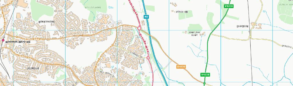
32 SITE Worcester Contains Ordnance Survey Data C Crown copyright and database right 2017 Contains Ordnance Survey Data C Crown copyright and database right 2017 SITE m Figure 1 - Mab's Orchard, Trotshill, Worcester: Site location.
33 KEY Excavation area T trial trenches T10 T9 T4 T3 N m Figure 2 - Trench location plan.
34 KEY Excavation area 2006 trial trench Edge of 2006 evaluation Trench 9 Top of feature Fig Fig. 4a 135 Ditch A Fig. 4b 129 Fig. 4c Fig Fig Base of feature Section line Slot / Ditch B Fig Ditch C N 0 10 m Figure 3 - Feature plan.
35 N mod Figure 4a E 138 W mod Figure 4b SE 140 NW mod KEY Figure 4c Stone Charcoal 0 1 m Figure 4 - Sections of ditches A and B.
36 E W mod KEY Stone m Figure 5 - Section of ditch A. W E mod KEY Stone 0 1 m Figure 6 - Section of ditch C.
37 NE SW mod m Figure 7 - Section of pit [142]. 125 W E mod m Figure 8 - Section of feature [132].
38 KEY Excavation area Evaluation Trench trial trench Top of feature Base of feature Slot Ditch A /132 Ditch B 123 Ditch C N 0 10 m Figure 9 - Excavation feature plan overlaid with 2006 evaluation features.
,")
,")
39 Plate 1 - Ditches A and B (contexts 105 and 138), looking S Plate 2 - Ditches A and B (contexts 112 and 114), looking E
,")
, looking")
40 Plate 3 - Ditches A and B (contexts 116 and 117), looking E Plate 4 - Ditch C (context 110), looking N
An archaeological evaluation at 16 Seaview Road, Brightlingsea, Essex February 2004
 An archaeological evaluation at 16 Seaview Road, Brightlingsea, Essex February 2004 report prepared by Kate Orr on behalf of Highfield Homes NGR: TM 086 174 (c) CAT project ref.: 04/2b ECC HAMP group site
39, Walnut Tree Lane, Sudbury (SUY 073) Planning Application No. B/04/02019/FUL Archaeological Monitoring Report No. 2005/112 OASIS ID no.
 Planning Application No. B/04/02019/FUL Archaeological Monitoring Report No. 2005/112 OASIS ID no.") 39, Walnut Tree Lane, Sudbury (SUY 073) Planning Application No. B/04/02019/FUL Archaeological Monitoring Report No. 2005/112 OASIS ID no. 9273 Summary Sudbury, 39, Walnut Tree Lane, Sudbury (TL/869412;
39, Walnut Tree Lane, Sudbury (SUY 073) Planning Application No. B/04/02019/FUL Archaeological Monitoring Report No. 2005/112 OASIS ID no. 9273 Summary Sudbury, 39, Walnut Tree Lane, Sudbury (TL/869412;
Archaeological evaluation at the Onley Arms, The Street, Stisted, Essex
 Archaeological evaluation at the Onley Arms, The Street, Stisted, Essex November 2014 report by Pip Parmenter and Adam Wightman with a contribution from Stephen Benfield and illustrations by Emma Holloway
SALVAGE EXCAVATIONS AT OLD DOWN FARM, EAST MEON
 Proc. Hants. Field Club Archaeol. Soc. 36, 1980, 153-160. 153 SALVAGE EXCAVATIONS AT OLD DOWN FARM, EAST MEON By RICHARD WHINNEY AND GEORGE WALKER INTRODUCTION The site was discovered by chance in December
Test-Pit 3: 31 Park Street (SK )
") -Pit 3: 31 Park Street (SK 40732 03178) -Pit 3 was excavated in a flower bed in the rear garden of 31 Park Street, on the northern side of the street and west of an alleyway leading to St Peter s Church,
-Pit 3: 31 Park Street (SK 40732 03178) -Pit 3 was excavated in a flower bed in the rear garden of 31 Park Street, on the northern side of the street and west of an alleyway leading to St Peter s Church,
An archaeological watching brief and recording at Brightlingsea Quarry, Moverons Lane, Brightlingsea, Essex October 2003
 An archaeological watching brief and recording at Brightlingsea Quarry, Moverons Lane, Brightlingsea, Essex commissioned by Mineral Services Ltd on behalf of Alresford Sand & Ballast Co Ltd report prepared
New Composting Centre, Ashgrove Farm, Ardley, Oxfordshire
 New Composting Centre, Ashgrove Farm, Ardley, Oxfordshire An Archaeological Watching Brief For Agrivert Limited by Andrew Weale Thames Valley Archaeological Services Ltd Site Code AFA 09/20 August 2009
An archaeological evaluation at the Lexden Wood Golf Club (Westhouse Farm), Lexden, Colchester, Essex
, Lexden, Colchester, Essex") An archaeological evaluation at the Lexden Wood Golf Club (Westhouse Farm), Lexden, Colchester, Essex January 2000 Archive report on behalf of Lexden Wood Golf Club Colchester Archaeological Trust 12 Lexden
An archaeological evaluation at the Lexden Wood Golf Club (Westhouse Farm), Lexden, Colchester, Essex January 2000 Archive report on behalf of Lexden Wood Golf Club Colchester Archaeological Trust 12 Lexden
ARCHAEOLOGICAL EVALUATION AT BRIGHTON POLYTECHNIC, NORTH FIELD SITE, VARLEY HALLS, COLDEAN LANE, BRIGHTON. by Ian Greig MA AIFA.
 ARCHAEOLOGICAL EVALUATION AT BRIGHTON POLYTECHNIC, NORTH FIELD SITE, VARLEY HALLS, COLDEAN LANE, BRIGHTON by Ian Greig MA AIFA May 1992 South Eastern Archaeological Services Field Archaeology Unit White
2 Saxon Way, Old Windsor, Berkshire
 2 Saxon Way, Old Windsor, Berkshire An Archaeological Watching Brief For Mrs J. McGillicuddy by Pamela Jenkins Thames Valley Archaeological Services Ltd Site Code SWO 05/67 August 2005 Summary Site name:
ARCHAEOLOGICAL MONITORING REPORT
 ARCHAEOLOGICAL MONITORING REPORT SCCAS REPORT No. 2009/324 Thorington Hall, Stoke by Nayland SBN 087 HER Information Date of Fieldwork: November 2009 - January 2010 Grid Reference: TM 0131 3546 Funding
Fieldwalking at Cottam 1994 (COT94F)
") Fieldwalking at Cottam 1994 (COT94F) Tony Austin & Elizabeth Jelley (19 Jan 29) 1. Introduction During the winter of 1994 students from the Department of Archaeology at the University of York undertook
Fieldwalking at Cottam 1994 (COT94F) Tony Austin & Elizabeth Jelley (19 Jan 29) 1. Introduction During the winter of 1994 students from the Department of Archaeology at the University of York undertook
Colchester Archaeological Trust Ltd. A Fieldwalking Survey at Birch, Colchester for ARC Southern Ltd
 Colchester Archaeological Trust Ltd A Fieldwalking Survey at Birch, Colchester for ARC Southern Ltd November 1997 CONTENTS page Summary... 1 Background... 1 Methods... 1 Retrieval Policy... 2 Conditions...
Archaeological. Monitoring & Recording Report. Fulbourn Primary School, Cambridgeshire. Archaeological Monitoring & Recording Report.
 Fulbourn Primary School, Cambridgeshire Archaeological Monitoring & Recording Report October 2014 Client: Cambridgeshire County Council OA East Report No: 1689 OASIS No: oxfordar3-192890 NGR: TL 5190 5613
An archaeological evaluation in the playground of Colchester Royal Grammar School, Lexden Road, Colchester, Essex
 An archaeological evaluation in the playground of Colchester Royal Grammar School, Lexden Road, Colchester, Essex February 2002 on behalf of Roff Marsh Partnership CAT project code: 02/2c Colchester Museum
An archaeological evaluation at the Blackwater Hotel, Church Road, West Mersea, Colchester, Essex March 2003
 An archaeological evaluation at the Blackwater Hotel, Church Road, West Mersea, Colchester, Essex report prepared by Laura Pooley on behalf of Dolphin Developments (U.K) Ltd NGR: TM 0082 1259 CAT project
3. The new face of Bronze Age pottery Jacinta Kiely and Bruce Sutton
 3. The new face of Bronze Age pottery Jacinta Kiely and Bruce Sutton Illus. 1 Location map of Early Bronze Age site at Mitchelstown, Co. Cork (based on the Ordnance Survey Ireland map) A previously unknown
Suburban life in Roman Durnovaria
 Suburban life in Roman Durnovaria Additional specialist report Finds Ceramic building material By Kayt Brown Ceramic building material (CBM) Kayt Brown A total of 16420 fragments (926743g) of Roman ceramic
Former Whitbread Training Centre Site, Abbey Street, Faversham, Kent Interim Archaeological Report Phase 1 November 2009
 Former Whitbread Training Centre Site, Abbey Street, Faversham, Kent Interim Archaeological Report Phase 1 November 2009 SWAT. Archaeology Swale and Thames Archaeological Survey Company School Farm Oast,
Cetamura Results
 Cetamura 2000 2006 Results A major project during the years 2000-2006 was the excavation to bedrock of two large and deep units located on an escarpment between Zone I and Zone II (fig. 1 and fig. 2);
A NEW ROMAN SITE IN CHESHAM
 A NEW ROMAN SITE IN CHESHAM KEITH BRANIGAN AND MICHAEL KIRTON THE site under discussion was first noted in 1958 and since that time several discoveries have been made. Its investigation has been pursued
An archaeological evaluation by trial-trenching at Playgolf, Bakers Lane, Westhouse Farm, Colchester, Essex
 An archaeological evaluation by trial-trenching at Playgolf, Bakers Lane, Westhouse Farm, Colchester, Essex commissioned by Mr Stephen Belchem on behalf of ADP Ltd. report prepared by Chris Lister Planning
Greater London GREATER LONDON 3/606 (E ) TQ
 TQ") GREATER LONDON City of London 3/606 (E.01.6024) TQ 30358150 1 PLOUGH PLACE, CITY OF LONDON An Archaeological Watching Brief at 1 Plough Place, City of London, London EC4 Butler, J London : Pre-Construct
GREATER LONDON City of London 3/606 (E.01.6024) TQ 30358150 1 PLOUGH PLACE, CITY OF LONDON An Archaeological Watching Brief at 1 Plough Place, City of London, London EC4 Butler, J London : Pre-Construct
Wantage County Primary School, Garston Lane, Wantage, Oxfordshire
 Wantage County Primary School, Garston Lane, Wantage, Oxfordshire An Archaeological Evaluation for Oxfordshire County Council by Erlend Hindmarch Thames Valley Archaeological Services Ltd Site Code GLW
Church of St Peter and St Paul, Great Missenden, Buckinghamshire
 Church of St Peter and St Paul, Great Missenden, Buckinghamshire An Archaeological Watching Brief for the Parish of Great Missenden by Andrew Taylor Thames Valley Archaeological Services Ltd Site Code
Grim s Ditch, Starveall Farm, Wootton, Woodstock, Oxfordshire
 Grim s Ditch, Starveall Farm, Wootton, Woodstock, Oxfordshire An Archaeological Recording Action For Empire Homes by Steve Ford Thames Valley Archaeological Services Ltd Site Code SFW06/118 November 2006
Grange Farm, Widmer End, Hughenden, Buckinghamshire
 Grange Farm, Widmer End, Hughenden, Buckinghamshire An Archaeological Evaluation for British Flora by Andy Taylor Thames Valley Archaeological Services Ltd Site Code GFH 05/63 July 2005 Summary Site name:
AN EARLY MEDIEVAL RUBBISH-PIT AT CATHERINGTON, HAMPSHIRE Bj>J. S. PILE and K. J. BARTON
 AN EARLY MEDIEVAL RUBBISH-PIT AT CATHERINGTON, HAMPSHIRE Bj>J. S. PILE and K. J. BARTON INTRODUCTION THE SITE (fig. 21) is situated in the village of Catherington, one mile north-west of Horndean and 200
An archaeological watching brief at Sheepen, Colchester, Essex November-December 2003
 An archaeological watching brief at Sheepen, Colchester, Essex November-December 2003 report prepared by Ben Holloway on behalf of Colchester Borough Council CAT project ref.: 03/11c Colchester Museums
Monitoring Report No. 99
 Monitoring Report No. 99 Enniskillen Castle Co. Fermanagh AE/06/23 Cormac McSparron Site Specific Information Site Name: Townland: Enniskillen Castle Enniskillen SMR No: FER 211:039 Grid Ref: County: Excavation
St Germains, Tranent, East Lothian: the excavation of Early Bronze Age remains and Iron Age enclosed and unenclosed settlements
 Proc Soc Antiq Scot, 128 (1998), 203-254 St Germains, Tranent, East Lothian: the excavation of Early Bronze Age remains and Iron Age enclosed and unenclosed settlements Derek Alexander* & Trevor Watkinsf
Monitoring Report No Sacred Heart Church Aghamore Boho Co. Fermanagh AE/10/116E. Brian Sloan L/2009/1262/F
 Monitoring Report No. 202 Sacred Heart Church Aghamore Boho Co. Fermanagh AE/10/116E Brian Sloan L/2009/1262/F Site Specific Information Site Address: Sacred Heart Church, Aghamore, Boho, Co. Fermanagh
Essex Historic Environment Record/ Essex Archaeology and History
 Essex Historic Environment Record/ Essex Archaeology and History CAT Report 578 Summary sheet Address: Kingswode Hoe School, Sussex Road, Colchester, Essex Parish: Colchester NGR: TL 9835 2528 Type of
Moated Site at Manor Farm, Islip, Oxfordshire
 Moated Site at Manor Farm, Islip, Oxfordshire An Archaeological Excavation By Jo Pine Site Code MFI05 December 2007 Summary Site name: Moated Site at Manor Farm, Islip, Oxfordshire Grid reference: SP 5298
Silwood Farm, Silwood Park, Cheapside Road, Ascot, Berkshire
 Silwood Farm, Silwood Park, Cheapside Road, Ascot, Berkshire An Archaeological Watching Brief For Imperial College London by Tim Dawson Thames Valley Archaeological Services Ltd Site Code SFA 09/10 April
An archaeological watching brief on one section of an Anglian Water main Spring Lane, Lexden, Colchester
 An archaeological watching brief on one section of an Anglian Water main Spring Lane, Lexden, Colchester April-September 2001 on behalf of Breheny Contractors CAT project ref.: 01/4D Colchester Museum
FURTHER MIDDLE SAXON EVIDENCE AT COOK STREET, SOUTHAMPTON (SOU 567)
") Roc. Hampshire Field Club Archaeol. Soc 52,1997, 77-87 (Hampshire Studies 1997) FURTHER MIDDLE SAXON EVIDENCE AT COOK STREET, SOUTHAMPTON (SOU 567) By M F GARNER andj VINCENT with a contribution byjacqueline
Roc. Hampshire Field Club Archaeol. Soc 52,1997, 77-87 (Hampshire Studies 1997) FURTHER MIDDLE SAXON EVIDENCE AT COOK STREET, SOUTHAMPTON (SOU 567) By M F GARNER andj VINCENT with a contribution byjacqueline
Archaeological trial-trenching evaluation at Chappel Farm, Little Totham, Essex. April 2013
 Archaeological trial-trenching evaluation at Chappel Farm, Little Totham, Essex April 2013 report prepared by Ben Holloway commissioned by Tim Harbord Associates on behalf of Mr Tom Howie Planning reference:
Evidence for the use of bronze mining tools in the Bronze Age copper mines on the Great Orme, Llandudno
 Evidence for the use of bronze mining tools in the Bronze Age copper mines on the Great Orme, Llandudno Background The possible use of bronze mining tools has been widely debated since the discovery of
LAND WEST OF ELM GROVE, EBRINGTON, GLOUCESTERSHIRE. NGR: SP (centred) ARCHAEOLOGICAL EVALUATION
 ARCHAEOLOGICAL EVALUATION") LAND WEST OF ELM GROVE, EBRINGTON, GLOUCESTERSHIRE. NGR: SP 1892 4012 (centred) ARCHAEOLOGICAL EVALUATION Report No. 640 May 2009 1q LAND WEST OF ELM GROVE, EBRINGTON, GLOUCESTERSHIRE. NGR: SP 1892 4012
LAND WEST OF ELM GROVE, EBRINGTON, GLOUCESTERSHIRE. NGR: SP 1892 4012 (centred) ARCHAEOLOGICAL EVALUATION Report No. 640 May 2009 1q LAND WEST OF ELM GROVE, EBRINGTON, GLOUCESTERSHIRE. NGR: SP 1892 4012
Cambridge Archaeology Field Group. Fieldwalking on the Childerley Estate Cambridgeshire
 Cambridge Archaeology Field Group Fieldwalking on the Childerley Estate Cambridgeshire 2009 to 2014 Summary Fieldwalking on the Childerley estate of Martin Jenkins and Family has revealed, up to March
Chapter 2: Archaeological Description
 Chapter 2: Archaeological Description Phase 1 Late Neolithic, c 3000-2400 BC (Figs 6-9) Evidence of Neolithic activity was confined to pits dug across the southern half of the site (Fig. 6). Eighteen pits
Fort Arbeia and the Roman Empire in Britain 2012 FIELD REPORT
 Fort Arbeia and the Roman Empire in Britain 2012 FIELD REPORT Background Information Lead PI: Paul Bidwell Report completed by: Paul Bidwell Period Covered by this report: 17 June to 25 August 2012 Date
Lanton Lithic Assessment
 Lanton Lithic Assessment Dr Clive Waddington ARS Ltd The section headings in the following assessment report refer to those in the Management of Archaeological Projects (HBMC 1991), Appendix 4. 1. FACTUAL
NOTE A THIRD CENTURY ROMAN BURIAL FROM MANOR FARM, HURSTBOURNE PRIORS. by. David Allen with contributions by Sue Anderson and Brenda Dickinson
 Proc. Hampsh. Field Club Archaeol. Soc. 47, 1991, 253-257 NOTE A THIRD CENTURY ROMAN BURIAL FROM MANOR FARM, HURSTBOURNE PRIORS Abstract by. David Allen with contributions by Sue Anderson and Brenda Dickinson
Excavation of Iron-Age and Roman Occupation at Coln Gravel, Thornhill Farm,Fairford, Gloucestershire, 2003 and 2004.
 From the Transactions of the Bristol and Gloucestershire Archaeological Society Excavation of Iron-Age and Roman Occupation at Coln Gravel, Thornhill Farm,Fairford, Gloucestershire, 2003 and 2004. by Dan
Archaeological Watching Brief (Phase 2) at Court Lodge Farm, Aldington, near Ashford, Kent December 2011
 at Court Lodge Farm, Aldington, near Ashford, Kent December 2011") Archaeological Watching Brief (Phase 2) at Court Lodge Farm, Aldington, near Ashford, Kent December 2011 SWAT. Archaeology Swale and Thames Archaeological Survey Company School Farm Oast, Graveney Road
Archaeological Watching Brief (Phase 2) at Court Lodge Farm, Aldington, near Ashford, Kent December 2011 SWAT. Archaeology Swale and Thames Archaeological Survey Company School Farm Oast, Graveney Road
An archaeological evaluation by trial-trenching at Scotts Farm, Lodge Lane, Purleigh, Essex October 2011
 An archaeological evaluation by trial-trenching at Scotts Farm, Lodge Lane, Purleigh, Essex October 2011 report prepared by Adam Wightman on behalf of Richard Emans CAT project ref.: 11/10a NGR: TL 582719
ARCHAEOLOGICAL EVALUATION REPORT. Home Farm, Woolverstone
 ARCHAEOLOGICAL EVALUATION REPORT Home Farm, Woolverstone WLV 047 A REPORT ON THE ARCHAEOLOGICAL EVALUATION, 2007 Kieron Heard Field Team Suffolk County Council Archaeological Service December 2007 Lucy
16 members of the Fieldwalking Group met York Community Archaeologist Jon Kenny at Lou Howard s farm, Rose Cottage Farm, at
 Terrington History Group Fieldwalking Group Field 1 Final report 21 October 2011 - fieldwalking 16 members of the Fieldwalking Group met York Community Archaeologist Jon Kenny at Lou Howard s farm, Rose
ROMAN AND MEDIEVAL ACTIVITY IN THE UPPER WALBROOK VALLEY: EXCAVATIONS AT MOORGATE, CITY OF LONDON, EC2, 1997
 ROMAN AND MEDIEVAL ACTIVITY IN THE UPPER WALBROOK VALLEY: EXCAVATIONS AT 12 18 MOORGATE, CITY OF LONDON, EC2, 1997 Graham Bruce, Dominic Perring, Tim Stevens and Melissa Melikian SUMMARY In January and
An archaeological watching brief and evaluation at Great Notley business park, near Braintree, Essex June-September 2005
 An archaeological watching brief and evaluation at Great Notley business park, near Braintree, Essex report prepared by Kate Orr commissioned by Andrew Martin Associates Ltd on behalf of Countryside Properties
Archaeological Evaluation at Alconbury Weald Enterprise Zone
 Archaeological Evaluation at Alconbury Weald Enterprise Zone Archaeological Evaluation Report June 2015 Client: CgMS OA East Report No: 1768 OASIS No: oxfordar3-212519 NGR: TL 1975 7684 Archaeological
SAXON AND MEDIEVAL POTTERY FRO~i!(IRBY BELLARS
 SAXON AND MEDEVAL POTTERY FROi!(RBY BELLARS by J. G. HURST n 1960 excavations in the churchyard at Kirby Bellars 1 produced over 500 sherds of pottery dating from the Roman period to the present day. 2
Cambridge Archaeology Field Group. Fieldwalking on the Childerley Estate, Cambridgeshire. Autumn 2014 to Spring Third interim report
 Cambridge Archaeology Field Group Fieldwalking on the Childerley Estate, Cambridgeshire Autumn 2014 to Spring 2015 Third interim report Summary Field walking on the Childerley estate of Martin Jenkins
7. Prehistoric features and an early medieval enclosure at Coonagh West, Co. Limerick Kate Taylor
 7. Prehistoric features and an early medieval enclosure at Coonagh West, Co. Limerick Kate Taylor Illus. 1 Location of the site in Coonagh West, Co. Limerick (based on the Ordnance Survey Ireland map)
1 The East Oxford Archaeology and History Project
 1 The East Oxford Archaeology and History Project EXOP TEST PIT 72 Location: Bartlemas Chapel, Cowley Date of excavation: 6-8 November 2013. Area of excavation: 0.8m x 1.2m, at the eastern end of the chapel.
Bronze-Age and Romano-British Sites South-East of Tewkesbury: evaluations and excavations
 From the Transactions of the Bristol and Gloucestershire Archaeological Society Bronze-Age and Romano-British Sites South-East of Tewkesbury: evaluations and excavations 1991-7 by G. Walker, A. Thomas
Whitton Church Lane (Recreation Ground) WHI 014
 WHI 014") ARCHAEOLOGICAL EVALUATION REPORT Whitton Church Lane (Recreation Ground) WHI 014 A REPORT ON THE ARCHAEOLOGICAL EVALUATION, 2008 (Planning app. no. 1362/05/FUL) Jezz Meredith Field Team Suffolk C.C. Archaeological
ARCHAEOLOGICAL EVALUATION REPORT Whitton Church Lane (Recreation Ground) WHI 014 A REPORT ON THE ARCHAEOLOGICAL EVALUATION, 2008 (Planning app. no. 1362/05/FUL) Jezz Meredith Field Team Suffolk C.C. Archaeological
Undley Hall, Lakenheath LKH 307
 ARCHAEOLOGICAL EVALUATION AND MONITORING REPORT SCCAS REPORT No. 2010/005 Undley Hall, Lakenheath LKH 307 E. Muldowney SCCAS January 2010 www.suffolkcc.gov.uk/e-and-t/archaeology Lucy Robinson, County
The lithic assemblage from Kingsdale Head (KH09)
") 1 The lithic assemblage from Kingsdale Head (KH09) Hannah Russ Introduction During excavation the of potential Mesolithic features at Kingsdale Head in 2009 an assemblage of flint and chert artefacts were
1 The lithic assemblage from Kingsdale Head (KH09) Hannah Russ Introduction During excavation the of potential Mesolithic features at Kingsdale Head in 2009 an assemblage of flint and chert artefacts were
Moray Archaeology For All Project
 School children learning how to identify finds. (Above) A flint tool found at Clarkly Hill. Copyright: Leanne Demay Moray Archaeology For All Project ational Museums Scotland have been excavating in Moray
Archaeological Evaluation Report
 16-18 Church Street Brill Buckinghamshire o a February 2008 Client: Stephen Moss Developments Issue N o : 1 OA Job N o : 3858 Planning Ref N o : 06/01304 NGR: SP 6553 1377 Client Name: Stephen Moss Developments
YCCCART is very grateful to Richard Broomhead for permission to publish this report online.
 YCCCART 2017/Y2 Yatton & Congresbury Wildlife Action Group A Documentary & Archaeological Survey Of Two Moorland Sites In Yatton & Congresbury R.A.Broomhead BA Field Archaeologist RAB/15/9 YCCCART is very
Excavations at Shikarpur, Gujarat
 Excavations at Shikarpur, Gujarat 2008-2009 The Department of Archaeology and Ancient History, the M. S. University of Baroda continued excavations at Shikarpur in the second field season in 2008-09. In
The lab Do not wash metal gently Never, ever, mix finds from different layers
 8 The lab 8.1 Finds processing The finds from the excavations at all parts of the site are brought down at the end of the day to the lab in the dig house. Emma Blake oversees the processing. Monte Polizzo
ROMAN OBJECTS FROM LANCASHIRE AND CUMBRIA: A ROUND-UP OF FINDS REPORTED VIA THE PORT ABLE ANTIQUITIES SCHEME IN 2006
 ROMAN OBJECTS FROM LANCASHIRE AND CUMBRIA: A ROUND-UP OF FINDS REPORTED VIA THE PORT ABLE ANTIQUITIES SCHEME IN 2006 Dot Bruns INTRODUCTION The Portable Antiquities Scheme is a voluntary scheme to record
MARSTON MICHAEL FARLEY
 MARSTON MICHAEL FARLEY On 9 March agricultural contractors, laying field drains for Bucks County Council Land Agent's Department, cut through a limestone structure at SP 75852301 in an area otherwise consistently
An archaeological evaluation at Dry Street, Basildon, Essex May-June 2006
 An archaeological evaluation at Dry Street, Basildon, Essex May-June 2006 report prepared by Howard Brooks commissioned by Entec on behalf of English Partnerships CAT project ref: 06/5c Site code: BADS
Novington, Plumpton East Sussex
 Novington, Plumpton East Sussex The Flint Over 1000 pieces of flintwork were recovered during the survey, and are summarised in Table 0. The flint is of the same types as found in the previous survey of
Neolithic and Roman remains on the Lufkins Farm reservoir site, Great Bentley, Essex October-November 2007
 Neolithic and Roman remains on the Lufkins Farm reservoir site, Great Bentley, Essex report prepared by Howard Brooks and Ben Holloway on behalf of A O Poole & Sons and George Wright Farms NGR: TM 0975
THE UNFOLDING ARCHAEOLOGY OF CHELTENHAM
 THE UNFOLDING ARCHAEOLOGY OF CHELTENHAM The archaeology collection of Cheltenham Art Gallery & Museum contains a rich quantity of material relating to the prehistoric and Roman occupation of the North
An archaeological evaluation at Thistle Hall, Mope Lane, Wickham Bishops, Essex July 2009
 An archaeological evaluation at Thistle Hall, Mope Lane, Wickham Bishops, Essex July 2009 report prepared by Howard Brooks and Ben Holloway on behalf of Clarity Ecoworks Ltd CAT project ref.: 09/1f ECC
Excavation. Post-Medieval Ditches. Land off Norwich Common Road Wymondham Norfolk. Excavation. Client: November 2013
 Land off Norwich Common Road Wymondham Norfolk. Excavation November 2013 Client: OA East Report No: 1546 OASIS No: oxfordar3-163105 NGR: TG 12770 02684 Excavation Post-Medieval Ditches Post-Medieval Ditches
Erection of wind turbine, Mains of Loanhead, Old Rayne, AB52 6SX
 Erection of wind turbine, Mains of Loanhead, Old Rayne, AB52 6SX Ltd 23 November 2011 Erection of wind turbine, Mains of Loanhead, Old Rayne, AB52 6SX CONTENTS 1 INTRODUCTION 3 2 ARCHAEOLOGICAL BACKGROUND
Chapter 2. Remains. Fig.17 Map of Krang Kor site
 Chapter 2. Remains Section 1. Overview of the Survey Area The survey began in January 2010 by exploring the site of the burial rootings based on information of the rooted burials that was brought to the
Greater London Region GREATER LONDON 3/567 (E.01.K099) TQ BERMONDSEY STREET AND GIFCO BUILDING AND CAR PARK
 TQ BERMONDSEY STREET AND GIFCO BUILDING AND CAR PARK") GREATER LONDON 3/567 (E.01.K099) TQ 33307955 156-170 BERMONDSEY STREET AND GIFCO BUILDING AND CAR PARK Assessment of an Archaeological Excavation at 156-170 Bermondsey Street and GIFCO Building and Car
GREATER LONDON 3/567 (E.01.K099) TQ 33307955 156-170 BERMONDSEY STREET AND GIFCO BUILDING AND CAR PARK Assessment of an Archaeological Excavation at 156-170 Bermondsey Street and GIFCO Building and Car
Archaeological Report
 A late Iron Age and Roman settlement at Leybourne Grange West Malling Kent Archaeological Report July 2017 Client: Taylor Wimpey SW Thames Archaeological Report Issue No: 3 OA Job No: 4875 NGR: TQ 678
Archaeological trial-trenching evaluation at Dale Hall, Cox s Hill, Lawford, Essex
 Archaeological trial-trenching evaluation at Dale Hall, Cox s Hill, Lawford, Essex Fieldwork directed by Ben Holloway report prepared by Howard Brooks with a contribution by Stephen Benfield on behalf
Archaeological sites and find spots in the parish of Burghclere - SMR no. OS Grid Ref. Site Name Classification Period
 Archaeological sites and find spots in the parish of Burghclere - SMR no. OS Grid Ref. Site Name Classification Period SU45NE 1A SU46880 59200 Ridgemoor Farm Inhumation Burial At Ridgemoor Farm, on the
Chapel House Wood Landscape Project. Interim Report 2013
 Chapel House Wood Landscape Project Interim Report 2013 Chapel House Wood Landscape Project Interim Report 2013 The annual Dales Heritage Field School was held at Chapel House Wood again this year, and
THE PRE-CONQUEST COFFINS FROM SWINEGATE AND 18 BACK SWINEGATE
 THE PRE-CONQUEST COFFINS FROM 12 18 SWINEGATE AND 18 BACK SWINEGATE An Insight Report By J.M. McComish York Archaeological Trust for Excavation and Research (2015) Contents 1. INTRODUCTION... 3 2. THE
Former Filling Station, High Street, Dorchester-on-Thames, Oxfordshire
 Former Filling Station, High Street, Dorchester-on-Thames, Oxfordshire An Archaeological Evaluation for Country Visions OK Limited by Sarah Coles Thames Valley Archaeological Services Ltd Site Code HSD01/36
Old Brewery Close and Walton Street, Aylesbury, Buckinghamshire
 Old Brewery Close and Walton Street, Aylesbury, Buckinghamshire An Archaeological Evaluation for Berkeley Homes (Oxford and Chiltern) Ltd by Sian Anthony Thames Valley Archaeological Services Ltd Site
An archaeological watching brief at St Leonard s church, Hythe Hill, Colchester, Essex
 An archaeological watching brief at St Leonard s church, Hythe Hill, Colchester, Essex report prepared by Adam Wightman on behalf of Dorvell Construction CAT project ref.: 10/5d Colchester and Ipswich
Small Finds Assessment, Minchery Paddock, Littlemore, Oxford (MP12)
") Small s Assessment, Minchery Paddock, Littlemore, Oxford (MP12) Introduction A total of 51 objects recovered from excavations at Minchery Paddock, Littlemore, Oxford (MP12) were submitted for dating and
Small s Assessment, Minchery Paddock, Littlemore, Oxford (MP12) Introduction A total of 51 objects recovered from excavations at Minchery Paddock, Littlemore, Oxford (MP12) were submitted for dating and
Changing People Changing Landscapes: excavations at The Carrick, Midross, Loch Lomond Gavin MacGregor, University of Glasgow
 Changing People Changing Landscapes: excavations at The Carrick, Midross, Loch Lomond Gavin MacGregor, University of Glasgow Located approximately 40 kilometres to the south-west of Oban, as the crow flies
I MADE THE PROBLEM UP,
 This assignment will be due Thursday, Oct. 12 at 10:45 AM. It will be late and subject to the late penalties described in the syllabus after Friday, Oct. 13, at 10:45 AM. Complete submission of this assignment
E x cav atio n R e p o r t
 Medieval Trackway on land at Ivy Farm Royston, Hertfordshire Excavation Report E x cav atio n R e p o r t October 2011 Client: CgMs Consulting OA East Report No: 1305 OASIS No: oxfordar3-112012 NGR: TL
Intermediate School Gym RAF Lakenheath, Eriswell ERL 214
 Intermediate School Gym RAF Lakenheath, Eriswell ERL 214 Archaeological Excavation Report SCCAS Report No. 2012/017 Client: Defence Infrastructure Organisation Author: Andrew Vaughan Beverton 06/2012 Intermediate
By Lisa Brown. Trench 1. Residual pottery. 4.1 The later prehistoric pottery
 4.1 The later prehistoric pottery By Lisa Brown 4.1.9 Introduction What follows are detailed trench by trench descriptions of the pottery, complementing the discussions in the Alfred s Castle monograph.
The Llandeilo Roman Forts: Archaeological Investigations
 The Llandeilo Roman Forts: Archaeological Investigations 2003-2007 Paratowyd gan Archaeoleg Cambria Ar gyfer Yr Ymddiriedolaeth Genedlaethol Prepared by Cambria Archaeology For the National Trust ARCHAEOLEG
Land North of Pesthouse Lane Barham Suffolk BRH 054
 Land North of Pesthouse Lane Barham Suffolk BRH 054 Archaeological Evaluation Report SCCAS Report No. 2012/142 Client: Barham Parish Council Author: Jezz Meredith September 2012 SCCAS Land North of Pesthouse
Derwent Lodge Cottage and Sibby Brows Field, PAPCASTLE, CUMBRIA
 Derwent Lodge Cottage and Sibby Brows Field, PAPCASTLE, CUMBRIA Archaeological Report Oxford Archaeology North April 2008 Time Team Issue No: 2008-09/ 810 OA North Job Nos: L9508 NGR: NY 1093 3150 Derwent
THE EXCAVATION OF A BURNT MOUND AT HARBRIDGE, HAMPSHIRE
 Proc Hampshire Field ClubArchaeolSoc5i, 1999,172-179 (Hampshire Studies 1999) THE EXCAVATION OF A BURNT MOUND AT HARBRIDGE, HAMPSHIRE by S J SHENNAN ABSTRACT A burnt mound of Late Brome Age date, as indicated
1. Presumed Location of French Soundings Looking NW from the banks of the river.
 SG02? SGS SG01? SG4 1. Presumed Location of French Soundings Looking NW from the banks of the river. The presumed location of SG02 corresponds to a hump known locally as the Sheikh's tomb. Note also (1)
ARCHAEOLOGICAL EXCAVATION REPORT: THE PADDOCK, HIGH DIKE, NAVENBY, LINCOLNSHIRE
 ARCHAEOLOGICAL EXCAVATION REPORT: THE PADDOCK, HIGH DIKE, NAVENBY, LINCOLNSHIRE NGR: 499398, 357274 AAL Site Code: NAPA 13 OASIS Reference Number: allenarc1-205997 Report prepared for Navenby Archaeology
Report on an archaeological trial-trenching evaluation: proposed reservoir site, land north of Redgate House, Wherstead, Suffolk.
 Report on an archaeological trial-trenching evaluation: proposed reservoir site, land north of Redgate House, Wherstead, Suffolk. August-September 2010 report prepared by Ben Holloway and Howard Brooks
A Sense of Place Tor Enclosures
 A Sense of Place Tor Enclosures Tor enclosures were built around six thousand years ago (4000 BC) in the early part of the Neolithic period. They are large enclosures defined by stony banks sited on hilltops
Archaeological evaluation by trial-trenching on land adjacent to 25 East Hill, Colchester, Essex, CO1 2QX September 2015
 Archaeological evaluation by trial-trenching on land adjacent to 25 East Hill, Colchester, Essex, CO1 2QX September 2015 by Laura Pooley with contributions by Stephen Benfield, illustrations by Chris Lister