Medieval Activity at Tower Close, Ramsey Cambridgeshire
|
|
|
- Bryce Walsh
- 5 years ago
- Views:
Transcription

1 Medieval Activity at Tower Close, Ramsey Cambridgeshire Archaeological Evaluation Report September 2015 Client: Rose Homes OA East Report No: 1823 OASIS No: oxfordar3-2204st NGR: TL Archaeological Evaluation Report
2 Medieval Activity at Tower Close, Ramsey, Cambridgeshire Archaeological Evaluation By Robin Webb (BA MA) With contributions by: Rob Atkins BsocSC Dip Arch MCIfA, Carole Fletcher HND BA (Hons) ACIfA, Rachel Fosberry ACIfA, Anthony Haskins BSc MSc ACIfA, Lena Strid BSc Editor: Matt Brudenell PhD Illustrator: Rebecca Pridmore BA and Gillian Greer BSc MCIfa Report Date: September 2015 Oxford Archaeology East Page 1 of 36 Report Number 1823

3 Report Number: 1823 Site Name: Tower Close, Ramsey HER Event No: ECB 4524 Date of Works: August 2015 Client Name: Rose Homes Client Ref: Planning Ref: 15/00375/FUL Grid Ref: TL Site Code: Finance Code: Receiving Body: RASTWR15 RASTWR15 Cambridgeshire County Council Accession No: Prepared by: Robin Webb Position: Supervisor Date: 16 September 2015 Checked by: Matt Brudenell Position: Senior Project Manager Date: 22nd September 2015 Signed:... Disclaimer This document has been prepared for the titled project or named part thereof and should not be relied upon or used for any other project without an independent check being carried out as to its suitability and prior written authority of Oxford Archaeology being obtained. Oxford Archaeology accepts no responsibility or liability for the consequences of this document being used for a purpose other than the purposes for which it was commissioned. Any person/party using or relying on the document for such other purposes agrees and will by such use or reliance be taken to confirm their agreement to indemnify Oxford Archaeology for all loss or damage resulting therefrom. Oxford Archaeology accepts no responsibility or liability for this document to any party other than the person/party by whom it was commissioned. Oxford Archaeology East, 15 Trafalgar Way, Bar Hill, Cambridge, CB23 8SQ t: f: e: oaeast@thehumanjourney.net w: Oxford Archaeology East 2015 Oxford Archaeology Limited is a Registered Charity No: Oxford Archaeology East Page 2 of 36 Report Number 1823
4 Table of Contents Summary Introduction Location and scope of work Geology and topography Archaeological and historical background Acknowledgements Aims and Methodology Aims Methodology Results Introduction Trench Trench Finds Summary Environmental Summary Discussion and Conclusion Significance Recommendations...16 Appendix A. Trench Descriptions and Context Inventory...17 Appendix B. Finds Reports...19 B.1 Metalwork...19 B.2 Slag...20 B.3 Flint...20 B.4 Glass...20 B.5 Pottery...21 B.6 Brick and roof tile...24 B.7 Fired and Vitrified Clay...26 Appendix C. Environmental Reports...27 C.1 Faunal Remains...27 C.2 Mollusca...29 C.3 Environmental samples...30 Appendix D. Bibliography...33 Oxford Archaeology East Page 3 of 36 Report Number 1823
5 Appendix E. OASIS Report Form...35 Oxford Archaeology East Page 4 of 36 Report Number 1823
6 List of Figures Figure 1 Figure 2 Figure 3 Figure 5 Site location showing archaeological trench (black) and development area (red) Ramsey Abbey precinct overlaid on 1891 OS map (after Spoerry et al. 2008, fig. 3) with HER plot Site Plan Selected sections List of plates Plate 1 Trench 1 from south-west Plate 2 Ditch 5 cutting ditch terminus 7 from the south-south-west Plate 3 Trench 2 from north-east Plate 4 Watering hole 17 from south-east Plate 5 Pit 25 from south-east Oxford Archaeology East Page 5 of 36 Report Number 1823
7 Summary Between the 10th and 11th of August 2015, Oxford Archaeology East undertook a trenched archaeological evaluation on land opposite Tower Close, Ramsey, Cambridgeshire (centred TL ). The site was located in the northern half of Ramsey Abbey precinct, with the two trenches revealing a mixture of features relating to domestic activity in the late medieval period. These features consisted of a medieval watering hole, later re-used for the deposition of midden material, a large pit containing general late medieval waste, and a series of ditches that represent phases of plot boundaries running across the site. These plot boundaries are likely to represent the use of the land after the dissolution of the abbey in 1539, with the properties probably fronting onto Church Green to the south. The site yielded a relatively large assemblage of domestic pottery and animal bones, with the potential to contribute to the understanding of the landscape and economy of the area in the late medieval and early post-medieval periods. Oxford Archaeology East Page 6 of 36 Report Number 1823
8 Oxford Archaeology East Page 7 of 36 Report Number 1823
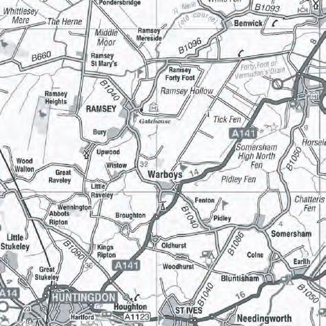
9 1 INTRODUCTION 1.1 Location and scope of work A trial trenched archaeological evaluation was conducted by Oxford Archaeology East (OA East) on land opposite Tower Close, Ramsey, Cambridgeshire, at grid reference TL (Fig. 1). The work was undertaken ahead of residential development on a vacant plot of land c. 0.16ha in area The archaeological evaluation was undertaken in accordance with a Brief issued by Kasia Gdaniec of Cambridgeshire County Council Historic Environment Team (CCC HET; Planning Application 15/00375/FUL; Gdaniec 2015), supplemented by a Specification prepared by Matt Brudenell and Nick Cox of OA East (Brudenell and Cox 2015) The work was designed to assist in defining the character and extent of any archaeological remains within the proposed development area, in accordance with the guidelines set out in National Planning Policy Framework (Department for Communities and Local Government March 2012). The results will enable decisions to be made by CCC HET, on behalf of the Local Planning Authority, with regard to the treatment of any archaeological remains found The site archive is currently held by OA East and will be deposited with the appropriate county stores in due course. 1.2 Geology and topography The site is located in the historic fenland town of Ramsey, within the projected area of the precinct of Ramsey Abbey (Fig. 2), and close to the centre of medieval Ramsey. The town of Ramsey sits on an island surrounded by Bury Fen to the south and Stocking Fen to the north, with the abbey located at the highest point (Page 1974b, 188) The development area lies c.100m north of the church of St Thomas of Canterbury (Historic Environment Record (HER) MCB 3541) and Ramsey Green, and c.150m north-west of the buildings of Ramsey Abbey (HER 02781). The site, centred on TL , is situated on the south side of Tower Close, on a vacant plot of land that lies between 5.31 and 6.30mOD, with the ground sloping down from the south-east to the north-west The geology of the area is Oxford Clay Formation mudstones of the Jurassic period overlain by superficial deposits of Quaternary March Gravels of sand and gravel (BGS 1995). 1.3 Archaeological and historical background The archaeological background draws on information held by the Cambridgeshire Historic Environment Record (HER) and the article written by Spoerry et al (2008). It is supplemented with additions from the WSI (Brudenell and Cox 2015) and the report of an evaluation that took place on Ramsey High Street, also within the abbey precinct (Webster 2015). Cartographic background The settlement at Ramsey was first depicted on a small scale county map of Huntingdonshire in 1646 by Blaeu, although the form and layout is not depcited in any detail. Jonas Moore's map of 1684, however, illustrates the general shape of Ramsey, Oxford Archaeology East Page 8 of 36 Report Number 1823
10 with settlement extending along two main roads that are linked to Ramsey Mere by lodes, or artificial watercourses. Ramsey Abbey was first depicted in more detail by Silius Titus with his estate survey of , which shows the surviving parish church within the former abbey precinct, along with other buildings, probable ponds and several small fields, of which some may have been orchards. The lines of the streets of Ramsey have changed little since they were first laid out The historic maps that cover the development area, including the Ramsey Estate Map of 1873 and Ordnance Survey series dating back to 1887, show that the site was once part of an open plot of land that was subdivided at the end of the nineteenth century (Brudenell and Cox 2015). The pattern of plot boundaries and property divisions in this area has since changed very little. Archaeological background While evidence from the immediate vicinity includes a background of Prehistoric finds and features (e.g. CHER 02873; ECB4136), and notably, the identification of a possible Roman villa c. 240m to the south (ECB2221), the archaeological and historic significance of the area is dominated by the nationally important site of Ramsey Abbey (Scheduled Monument 141), with the development area lying within the precinct of the abbey, and the abbey itself located c.150m to the south Ramsey Abbey was a Benedictine Monastery founded by Aylwin in c.969, and remained in use until The settlement of Ramsey grew from the presence of the abbey, with the area an island amongst the low-lying fenland (Gilmour 2012, 7). The abbey became one of the richest in the fens through a series of substantial endowments, and it became known as 'Ramsey the Golden' it held an extensive library that included books on all approved branches of learning and science (Page 1974a 382), supported almost 80 monks throughout the 13th century as well as daughter houses, and had a reputation for learning that continued until its dissolution in The abbey precinct was used as a fortress against King Stephen by Geoffrey de Mandeville in 1143 (Page 1974a, 379). This was followed by a succession of wealthy and worldly abbots during the 13th and 14th centuries, and saw the abbey become financially and morally decayed, before stability was re-established by In 1538 the monks of the abbey surrendered the abbey without complaint, and received high pensions as a reward. The abbey was dissolved in 1539, and the land was bought by the Cromwell family, who saw to its destruction, with much of the stone being reused at Cambridge colleges (Kings, Trinity, Gonville and Caius) and at Hinchingbrooke House (Gilmour 2012, 8) Despite the history of the abbey being known, the extent of the destruction of the abbey following its dissolution has meant that the exact location of the abbey buildings is uncertain, including that of the abbey church (Gilmour 2012, 8). It is known that Ramsey Abbey produced decorated and undecorated tile, and a tile kiln was discovered in the grounds of Ailwyn School in 1966, located close to the small copse along Hollow Lane to the south-east of the school buildings (MCB 16875). This tile kiln was well established by the 15th century, and made and sold roof and wall tiles and brick (DeWindt and DeWindt 2006, 188) The abbey precinct still remains as earthworks which may have been raised to help as flood defences with surviving property boundaries preserving the original precinct line. This has resulted in a peculiar curving shape to properties north of Little Whyte (RCHME 1926, 210 in Gilmour 2012, 10-11). The abbey precinct lies on a slight rise above the level of the town, with the abbey sitting at between 5 and 6mOD, and the Oxford Archaeology East Page 9 of 36 Report Number 1823
11 town at between 4 and 5mOD (Hall 1992, 41). The town of Ramsey grew up to meet the needs of the abbey and the traffic that it brought (Page 1974b, 188), with the town having a primarily agricultural economic base and a more fluid population than a village would have had (DeWindt 1990 cited in Nicholson 2006, 177) Previous archaeological work has shown a range of activity related to the abbey, with Late Saxon iron working (ECB 735), as well as later medieval buildings, ponds, a midden (CHER 10886), pottery or tile kilns (MCB 16875) and quarry pits (MCB 16933) The development area lies about 100m to the north of the High Street, which was the principal route to the abbey, and the parish church of St Thomas of Canterbury (HER 02832; MCB 3541). The church was built between 1180 and 1190 as a Benedictine hospital that was converted into the church for the new parish of Ramsey c.1222 (Haigh 1988 cited in Gilmour 2012, 9). The churchyard contains a medieval cross and a 13th century Barnack stone grave slab that was reused as a stile (MCB 17092) Other occupation in the area has also been seen with the remains of structures overlying levelling layers that were used as part of the reclamation of low lying wet ground in areas around the High Street (such as ECB 1861 (Atkins 2004)). This reclamation was also seen during the 13th century with the canalisation of the Great Whyte watercourse in order to consolidate the land to the west of the abbey (Page et al 1926, 189 cited in Nicholson 2006, 175) There are a number of historic buildings, mainly dating to the 19th century, in the vicinity of the development area (such as DCB 2563 and 3633). More recent activity can also be seen with the remains of World War II structures that include a pillbox (CB 15187), searchlight battery (CB 15171) and spigot mortar base (MCB 16456). 1.4 Acknowledgements The work was commissioned by Rose Homes Ltd, who also carried out the machine excavation. Hand excavation was carried out by John Diffy and Robin Webb. The site was managed by Matt Brudenell, and advice and monitoring was provided by Gemma Stewart of CCC HET. Oxford Archaeology East Page 10 of 36 Report Number 1823
12 2 AIMS AND METHODOLOGY 2.1 Aims The objective of this evaluation was to determine as far as reasonably possible the presence/absence, location, nature, extent, date, quality, condition and significance of any surviving archaeological deposits within the development area. 2.2 Methodology The Brief required that two trenches were excavated, totalling an area of 64m ² across the proposed building footprints. The trenches were 20m long and 1.6m wide Machine excavation was carried out under constant archaeological supervision with a wheeled JCB-type excavator using a toothless ditching bucket The site survey was carried out by Dave Brown using a Leica survey-grade GPS fitted with smartnet technology and an accuracy of 5mm horizontal and 10mm vertical Spoil, exposed surfaces and features were scanned with a metal detector. All metaldetected and hand-collected finds were retained for inspection, other than those which were obviously modern All archaeological features and deposits were recorded using OA East's pro-forma sheets. Trench locations, plans and sections were recorded at appropriate scales, and colour and monochrome photographs were taken of all relevant features and deposits A total of five environmental samples were taken showing deposits from within a watering hole, a pit, a ditch and a ditch terminus Site conditions were dry, with hot and muggy air conditions. Oxford Archaeology East Page 11 of 36 Report Number 1823
13 3 RESULTS 3.1 Introduction The evaluation recorded medieval and post-medieval activity within the development area, with a series of features identified in both trenches (Fig. 3). There was a distinction between the types of features present in each trench, with Trench 1 revealing a series of linear ditches and a small pit, whilst Trench 2 contained a watering hole, a large pit, and a single ditch The results have been presented by trench The natural (3) across the site was a plastic mid orange-brown sandy clay with rare patches of gravel. This was overlain by a thick subsoil (2), comprising a plastic mid yellow-brown silty clay measuring m deep. The topsoil (1) that was a friable dark brown clayey silt m thick. 3.2 Trench Trench 1 (Plate 1) lay towards the north-eastern corner of the development area, close to a standing barn. The trench had a deep subsoil, 0.39m thick, with the tranche base sloping down from 5.8mOD in the north-east corner, to 5.1mOD in the south-west. The natural and subsoil deposits were disturbed in the western half of the trench with modern rubble and hardcore recorded in the trench section, and a backfilled geotech pit The trench contained five shallow linear ditches and a pit. The ditches ran along a broadly similar alignment from north-east to south-west. These were spread across the trench. Ditch 5 (Fig. 4 and Plate 2) was 0.43m wide and 0.18m deep and had a 'u'- shaped profile, with gentle sides and a concave base. It was filled by a friable dark grey-brown clayey silt (4) that contained 12th-17th century pottery, a roof tile fragment and animal bone. This ditch also cut the western edge of the ditch terminus (7). The ditch terminus was 0.69m wide and 0.22m deep and was again 'u'-shaped in profile with gentle sides leading to a concave base. This was filled by a plastic light greenbrown silty clay (6) but yielded no finds To the west of these features was ditch 9, measuring 0.87m wide and 0.15m deep. The ditch had a bowl-shaped profile with gentle sides and a flat base. The ditch was filled by a plastic mid grey-brown silty clay (8) that contained 12th-17th century pottery, roof tile fragments and animal bone. Further to the west, near the western end of the trench, was ditch 11; 1.4m wide and 0.08m deep. This displayed a bowl-shaped profile with gentle sides and a flat base, and that was filled by a plastic mid yellow-brown silty clay (10) that contained animal bone In contrast to the ditches described above, and at the eastern end of the trench, was ditch 14 (Fig. 4). This ditch followed a similar alignment to the others, but was slightly deeper, and contained two fills (12 and 13). The ditch measured 1.0m wide and 0.3m deep and was bowl shaped with gentle sides and a concave base. The upper fill was a friable mid brown-grey clayey silt (12) that contained a roof tile fragment and animal bone. The primary fill comprised a friable mid green-grey clayey silt (13) that contained 19th century pottery The only other feature in Trench 1 was a small pit 16 on the northern edge of the trench, just to the west of ditch 9. This pit was cup-shaped, measuring 0.60m wide and 0.08m deep, with steep but shallow sides and a slightly irregular base. It was filled by a plastic mid grey-brown silty clay (15), and contained no finds. Oxford Archaeology East Page 12 of 36 Report Number 1823
14 3.3 Trench Trench 2 (Plate 3) was located towards the western side of the development area, on ground that sloped up from 5.0mOD at the northern end to 5.8mOD at the southern end. The area around the trench had modern hardcore in the topsoil (0.29m thick), but retained an intact, undisturbed subsoil (0.44m thick). The topsoil (1) and subsoil (2) were similar inn character to those observed in Trench Trench 2 contained a single shallow linear ditch (27), a large watering hole (17) and a large pit (25). The ditch was broadly perpendicular to those in Trench 1, and was aligned east to west. It measured 0.1m wide and 0.13m deep, and displayed a trayshaped profile with gentle sides and a flat base. The ditch was filled by a plastic mid grey-brown silty clay (26) that contained roof tile fragments and animal bone The largest feature on the site was a watering hole 17 (Fig. 4, Plate 4) located at the northern end of Trench 2, and measuring at least 5.1m wide and 0.9m deep. The feature had an irregular profile, with a steep, flat south-western side and shallower, stepped north-eastern side, and a concave base. It contained three fills (18, 19 and 20). The basal fill (18) was a firm mid grey-yellow sandy clay that contained a handful of roof tile fragments, 12th-14th century pottery and animal bone. This was asymmetrical in its profile, with its concentration on the shallower, stepped north-eastern side, and may have been a formed through animals trampling in and out of the watering hole. This was overlain by a firm dark green-grey sandy clay (19) that contained 13 fragments of roof tile, two pieces of brick, 12th-17th century pottery, a shard of window glass that was probably medieval, three fragments of later prehistoric worked flint, animal bone and oyster, mussel and cockle shell. This fill was similar to the domestic waste fill above (20), but with less in the way of artefacts, ecofacts and charcoal. The upper fill of the watering hole (20) was a firm dark grey sandy clay that contained 46 fragments of roof tile, two pieces of brick, 12th-17th century pottery, fired clay and vitrified clay that may have been part of a hearth lining, animal bone and oyster, mussel, cockle, winkle and whelk shell, as well as a copper alloy cast spacer plate (Small find 1), iron nails (Small find 2), and an iron strap (Small find 3) Just to the south of the watering hole was a large pit (25, Fig. 4, Plate 5), measuring at least 3.75m wide and 0.8m deep. This displayed was bowl-shaped in profile, with steep sides and a concave base, and that was filled by a series of four deposits (21, 22, 23 and 24). The uppermost of these was a friable mid green-brown clayey silt (21) that contained a single roof tile fragment, 11th-13th century pottery, animal bone and oyster shell. This overlay: a plastic mid yellow-brown clay (22) that contained a single roof tile fragment, animal bone and oyster shell; a friable dark grey-brown clayey silt (23) that contained frequent 9th-15th century pottery, animal bone and oyster shell; and a plastic dark green-brown clayey silt (24) that contained 12-15th century pottery. 3.4 Finds Summary The evaluation produced a finds assemblage that incorporated metalwork, slag, flint, glass, pottery, ceramic building material (CBM), and fired and vitrified clay The slag comprised a single undiagnostic fragment that weighed 0.024kg, and was recovered from watering hole 17. The work flint assemblage comprised three fragments, weighing 0.069kg. The material was of later prehistoric origin and was residual within the post-medieval fill (19) of the watering hole (17). The single shard of opaque window glass weighed less than 0.001kg and was possibly medieval, from fill 19 of the watering hole (17). A single fragment of fired clay was recovered from the upper fill of the watering hole (17), weighing 0.001kg, and its roughly finished outer Oxford Archaeology East Page 13 of 36 Report Number 1823
15 surface suggests it may have been structural in origin. A single fragment of vitrified clay or hearth lining was also recovered from the same deposit, weighing 0.01kg Pottery was the main component of the artefacts repertoire, with a total of 190 sherds weighing 4.821kg recovered. The assemblage ranged in date from the mid 11th century to the end of the 19th century, and was in an unabraded to moderately abraded condition A total of 76 fragments of CBM were recovered from the site, weighing 5.360kg. This assemblage comprised of four fragments of post-medieval brick (0.377kg) from the upper fills of watering hole 17, and 72 fragments of abraded late medieval/early postmedieval roof tile (4.983kg) from ditches 5, 9, 14, and 27, watering hole 17, and pit Metalwork from the site comprised five iron nails, two iron artefacts, possibly nails, a narrow iron strip or strap, and one medieval copper alloy cast spacer plate with an acorn-shaped terminal from a composite strap end. 3.5 Environmental Summary The evaluation produced faunal remains, molluscs, and charred seeds A total of 288 animal bone fragments were recovered, with a total weight of 3.146kg. The species represented were cattle, sheep/goat, pig, dog, cat, roe deer, domestic fowl, goose, duck, cod and ling. Forty five of the bones had traces of gnawing by carnivores, and a single bone was burnt. Butchery marks were evident on six cattle bones, three sheep/goat bones, six large mammal and nine medium sized mammals, demonstrating the skinning and filleting A total of 0.86kg of mollusc shell was recovered during the evaluation, and consisted of edible species from estuarine, shallow coastal waters and intertidal zones. The shell does not appear to have been deliberately broken or crushed, though some of the oyster shells show evidence of shucking prior to consumption. Oyster was the most commonly recovered shell (from all contexts in watering hole 17 and pit 25), but with the single largest concentration (0.611kg) being mussel from the watering hole (17). The shell represents food waste, with oyster and mussel being commonly commusumed in the medieval and post-medieval period A total of five bulk samples were taken during the evaluation, each of 20 litres and from late medieval features. These showed small quantities of charred cereal grains from free-threshing wheat, charred seeds of stinking mayweed, chess and docks, along with untransformed seeds of bramble and elderberry, and fragments of peas and beans. These suggest the consumption of wheat and legumes. Oxford Archaeology East Page 14 of 36 Report Number 1823
16 4 DISCUSSION AND CONCLUSION The evaluation at Tower Close, Ramsey has revealed evidence of medieval and early post-medieval activity, with a series of linear ditches, pits and a watering hole identified Aside from the recovery of three residual pieces of worked flint, which attested to little more than a background prehistoric presence in the area, the earliest activity at the site related to the construction and primary use of the two large pits at the northern end of Trench 2 (15 and 17), which are likely to date between the 12th to 15th century (i.e. pre-dissolution, or broadly equivalent to phase 4, 13th century to c.1539, as defined in Spoerry et al 2008). Of these, pit 17 is interpreted as a watering hole, based on size, shape and presence of freshwater crustaceans in the basal fill. The shallow irregular profile on the northern side of the waterhole probably resulted from livestock trampling, suggesting the area may initially have been used for grazing It is likely that both pits in Trench 2 were open for a considerable period of time, gradually silting before being used as dumps for later domestic waste. Indeed, the vast majority of the site finds were retrieved from the upper fills of these two features, particularly watering hole 17, which yielded 84% of the pottery, the latest material probably dating to the 16th or 17th century (i.e. post-dissolution, or broadly equivalent to phase 5 as defined in Spoerry et al 2008). This material derived from the preparation and serving of food and drink, and included large unabraded sherds from jars, jugs and bowls; vessels typical of a late medieval domestic repertoire. Mixed culinary waste also characterised the faunal remains from these midden fills. They included butchered bones from cattle, sheep and goats, which would have been kept for a variety of products (such as dairy, wool and traction), but also fish, avian egg shell, and marine molluscs, primarily mussels and oysters. In additional, charred wheat, peas and beans were also recovered, creating the picture of varied consumption The quantity, condition and domestic character of the finds from the midden fills in watering hole 17 and pit 15 indicate a settlement focus in close proximity to the these features. Whilst no structural remains such as potholes, beam slots or floors were recorded in the evaluation, the presence of brick and roof tile within a range of contexts, together with a fragment of possible window glass from waterhole 17, are suggestive of structures in the immediate vicinity The most likely location of any such buildings was either along the road frontage of Tower Close, and therefore within the northern half of the development area, or the frontage along Church Green, and the line of the lode Little Whyte to the south. Given the absence of structural features and the quantity of midden material recovered, it is arguably more likely that the site is a back yard setting, with waste being removed from dwellings along Church Green and dumped at the rear of the properties in partially sited pits and waterholes. The existence of property boundaries/plot division running between Tower Close and Church Green is certainly suggested by the north-east to south-west aligned ditches in Trench 1, which share a similar orientation to the present day ones boundaries that have changed little since the 19th century and are depicted on the 1891 Ordnance Survey map of Ramsey (see Figure 2). Ditches 5 and 9 yielded ceramics contemporary with those from the upper fills of pit 25, and it is possible that ditch 27 in Trench 2 formed the return of ditch 11 in Trench 1, creating a rectangular parcel of land within the north-west corner of the site matching that currently to the west. Oxford Archaeology East Page 15 of 36 Report Number 1823
17 4.2 Significance To date there have been few opportunities to investigate parcels of land within the northern half of the abbey precinct in Ramsey. The evaluation at Tower Close is significant in having identified activity centred upon the period between the 12th to 16th century, demonstrating domestic occupation in this area of the precinct immediately after the dissolution of the abbey in c The site has the potential to provide further insight into the landscape, economy and settlement of the precinct area outside its life as a religious centre. 4.3 Recommendations Recommendations for any future work based upon this report will be made by the County Archaeology Office. Oxford Archaeology East Page 16 of 36 Report Number 1823
18 APPENDIX A. TRENCH DESCRIPTIONS AND CONTEXT INVENTORY Trench 1 General description Orientation NE-SW Trench contained four ditches aligned north-east to southwest spread relatively evenly across its length, and one ditch terminus cut along the edge by one of the ditches. The trench also contained a small pit and modern disturbance. The trench layers consisted of soil and topsoil overlying a natural of sandy clay. Contexts Context no Type Width (m) Depth (m) Avg. depth (m) 0.71 Width (m) 1.6 Length (m) 20 Comment Finds Date 1 Layer Topsoil Pottery - 2 Layer Subsoil Pottery - 3 Layer - - Natural Fill Fill of ditch 5 Animal bone, pottery, roof tile Late medieval 5 Cut Cut of linear ditch - Late medieval 6 Fill Fill of ditch terminus Cut Cut of ditch terminus Fill Fill of ditch 9 Animal bone, pottery, roof tile Late medieval 9 Cut Cut of linear ditch - Late medieval 10 Fill Fill of ditch 11 Animal bone - 11 Cut Cut of linear ditch Fill Upper fill of ditch 14 Animal bone, pottery, roof tile 19th century 13 Fill Lower fill of ditch 14-19th century 14 Cut Cut of linear ditch - 19th century 15 Fill Fill of pit Cut Cut of small pit - - Trench 2 General description Orientation NNE-SSW Trench contained a ditch aligned east to west, a large sub-circular pit and a watering hole. The trench layers consisted of soil and topsoil overlying a natural of sandy clay. Contexts Context no Type Width (m) Depth (m) Avg. depth (m) 0.74 Width (m) 1.6 Length (m) 20 Comment Finds Date 1 Layer Topsoil - - Oxford Archaeology East Page 17 of 36 Report Number 1823
19 2 Layer Subsoil Layer - - Natural Cut > Cut of watering hole - Medieval 18 Fill > Basal fill of watering hole Fill > Fill of watering hole Fill > Fill of watering hole Fill > Upper fill of pit Fill > Fill of pit Fill > Fill of pit 25 Animal bone, pottery, roof tile Animal bone, brick, pottery, roof tile, shell Animal bone, brick, pottery, roof tile, shell Animal bone, pottery, roof tile, shell Animal bone, roof tile, shell Animal bone, pottery, shell Medieval Late medieval Early post-medieval Late medieval Late medieval Late medieval 24 Fill > Basal fill of pit 25 Pottery Medieval 25 Cut > Cut of large pit - Late medieval 26 Fill Fill of ditch 27 Animal bone, roof tile Late medieval 27 Cut Cut of linear ditch - Late medieval Oxford Archaeology East Page 18 of 36 Report Number 1823
20 APPENDIX B. FINDS REPORTS B.1 Metalwork by Carole Fletcher B.1.1 B.1.2 B.1.3 B.1.4 Assemblage A small assemblage of artefacts was recovered, comprising five iron nails, two iron artefacts, possibly nails, a narrow iron strip or strap, and one copper alloy cast spacer plate with an acorn-shaped terminal from a composite strap end. The cast spacer plate, the iron strip, the nails and nail-like objects were all recovered from the fill of watering hole 17, which produced both medieval and post-medieval pottery and is dated tentatively to the 17th century. The copper alloy cast spacer plate is in good condition and shows no obvious evidence of bronze disease, while the iron objects are corroded to varying degrees. The metalwork is stored in plastic bags and crystal boxes within a Stewart box containing silica gel and humidity levels are monitored using a humidity indicator strip. Discussion Nails are a common metallic find on later medieval sites, most being associated with construction, suggesting some structure in the vicinity of the area evaluated. The cast spacer plate falls within the category of dress and personal possession, strap ends are a relatively common find, and the example recovered from watering hole 17 has close parallels published in Norwich Households (Margeson 1993, 35-36, figure 20, no. 236) and on the Portable Antiquities Scheme website ( The Portable Antiquities Scheme example suggests a 13th-14th century date, while the Norwich Households example came from a late 15th century context (Margeson 1993, 36), so the cast spacer plate is contemporary with some of the pottery recovered from watering hole 17. Catalogue B.1.5 SF 1. (20), fill of watering hole 17. Complete, copper alloy cast spacer plate, a c-shaped forked spacer, with curved pointed ends and an acorn shaped (acorn within its cup) terminal or knop. The section of the spacer plate is flat and the acorn appears rather pointy. Part of a composite strap end. Length 37mm, width 29.6mm, Thickness of plate; maximum 2mm, at points 1.1mm. Terminal thickness maximum 6.2mm, width maximum 8.7mm. Weight 5.9g. Parallels: (Margeson 1993, pp figure 20, no. 236), SF 2. (20), fill of watering hole 17. Group of five iron nails and two iron artefacts (most probably nails). Near compete iron, nail with round flat head (part of which has been lost) and a tapering, rectangular sectioned shank complete with pointed tip. Length 60mm. Near compete iron, nail with sub-rounded flat or lightly domed head (corroded and somewhat misshapen) with a square sectioned shank, which is bent close to the surviving end. This may indicate the depth of the wood the nail was driven through (36mm). Length 52mm. Incomplete iron nail with sub-rectangular slightly domed head, hammered and bent on one side with missing corner (recent loss) tapering, rectangular section shank which is missing lower part and tip, Length 42mm. Incomplete iron nail with sub-square head (one corner missing) tapering, rectangular sectioned shank which is missing lower end/tip. Length 38mm. Incomplete iron nail with flat sub-rectangular head on one side of shank, square sectioned shank tapering slightly to what may be the surviving tip. Length 42mm. Iron object, possibly an incomplete tapering iron nail with a rectangular sectioned shank, the head of the object and part of the tip, which is split, is also absent. Surviving length 33mm. Iron object, possibly a nail, thin, square sectioned shaft, with a recent break, with fresh bright metal showing below where the head may have been. The shaft tapers towards the tip. Length 40mm. Oxford Archaeology East Page 19 of 36 Report Number 1823
21 B.2 Slag SF 3. (20), fill of watering hole 17. Sub-rectangular iron strap, appears to be complete. The outer is corroded and mud encrusted but an approximately 10mm strip of corrosion and mud has been lost from the?upper surface during excavation. Approximately 15mm from one end of the strip is a small round?nail hole, almost 2mm in diameter, a similar hole is likely located at the other end of the strip, however this is masked by the presence of what appears to be a nail through the trap and bent over at right angles along the back of the strip. The?nail is in excess of 22mm long. The strap may be a door or window fitting. Length 85mm, width maximum 21mm tapering to 19mm at end, thickness approximately 3-4mm. Nail hole centrally placed 15mm from end of strap. by Carole Fletcher B.2.1 A single fragment of undiagnostic slag weighing 0.024kg was recovered from pit 17. B.3 Flint by Carole Fletcher and Anthony Haskins B.3.1 Watering hole 17 produced three fragments of later prehistoric worked flint, all residual within the post-medieval watering hole fill. Context Cut Form Weight (kg) Date Core 0.048?Bronze Age Primary flake Secondary flake Total Table B1: Flint B.4 Glass B.4.1 by Carole Fletcher The evaluation produced a small shard of window glass from watering hole 17. The glass is fragile and in poor condition, being completely opaque. The condition indicates that the glass is forest or potash glass and of some age, possibly medieval. Context Cut Weight (kg) Description Date <0.001 One fragment of opaque window glass, the broken edges appear granular and the glass is in poor condition. Table B2: Glass?Medieval Oxford Archaeology East Page 20 of 36 Report Number 1823
22 B.5 Pottery by Carole Fletcher B.5.1 B.5.2 B.5.3 Introduction The evaluation produced a pottery assemblage of 190 sherds, weighing 4.821kg. The assemblage spans the mid 11th to the end of the 19th century. The condition of the overall assemblage is unabraded to moderately abraded and the mean sherd weight is moderate at approximately kg Methodology The Medieval Pottery Research Group (MPRG) A guide to the classification of medieval ceramic forms (MPRG 1998) and Minimum Standards for the Processing, Recording, Analysis and Publication of Post-Roman Ceramics (MPRG 2001) act as a standard for the post-roman pottery. Recording was carried out using Oxford Archaeology East s in-house system based on that previously used at the Museum of London. Fabric classification has been carried out for all previously described Roman, medieval and post-medieval types. All sherds have been counted, classified and weighed on a context-by-context basis. The assemblage is recorded in the summary catalogue. The pottery and archive are curated by OA East until formal deposition. Assemblage B.5.4 The bulk of the assemblage was recovered from watering hole 17, which produced 160 sherds weighing 4.515kg. This included the complete profile from what appears to be a barrel-shaped vessel with an inturned rounded rim and a single surviving side handle (sub rounded in profile), of rod handle type with a near square section. The position and small nature of the handle suggests the vessel may have had two handles and that they may have been used for suspension rather than holding or pouring. The fabric of this vessel is a yellow-buff, low iron, refractory-type clay and is similar to the material used for tile and brick manufacture (Burwell brick) in Cambridgeshire. The colour can also be seen as yellow-buff swirls within the more pink-red matrix of some of the reliefdecorated tiles made at Ramsey Abbey. A fragment of a relief-decorated tile in this yellow-buff fabric was observed in the collection of relief-decorated tiles recovered from the area around the Ailwyn School (currently held by OA East). The Abbey's tile works was well established by the 15th century, making and selling roof and wall tiles and, in the 15th century, brick (DeWindt and DeWindt 2006, 188). Also present are large sherds from a Bourne 'D' ware jug or pitcher; this and the refractory clay vessel form the majority of the pit assemblage by weight and suggest a 16th-17th century date. B.5.5 Watering hole 17 also produced sherds from a Late Medieval Ely ware jug, a Late Medieval Reduced ware bowl and a Huntingdon Late Medieval Calcareous ware vessel. Also recovered were sherds from Huntingdonshire Fen Sandy ware jars and jugs, Grimston glazed ware jugs, Medieval Ely ware jars and jugs and sherds from two curfews, one an Ely ware vessel the other an East Anglian Redware. The presence of curfew sherds indicate the management of hearths overnight, the curfew being used to cover the embers; holes in the vessel allowed the embers to stay alight while preventing sparks. Oxford Archaeology East Page 21 of 36 Report Number 1823
23 B.5.6 B.5.7 B.5.8 B.5.9 Pit 25 produced 15 sherds, including two sherds from curfews in what has tentatively been identified as (South Cambridgeshire) Smooth Sandy ware ( ) and a rim sherd from a sooted, collared, Stamford ware jar ( ). These are the earliest sherds of pottery recovered from the evaluation and may relate to early occupation of the Abbey precinct, although they are residual here within a mid 12th-end 15th century assemblage. Ditches 5 and 9, suggested by the excavator to be part of a field-property boundary system, each produced six sherds of similar pottery fabrics. Both contained Huntingdonshire Fen Sandy ware, Unglazed Reduced Sandy wares of Blackborough End type and Bourne 'D' ware vessels, suggesting a mid 15th-mid 17th date. Ditch 14 produced a single sherd of transfer-printed Refined White Earthenware weighing less than 1g that is likely to be intrusive. Conclusion The assemblage is mainly domestic in nature, with sooted sherds indicating use in the preparation and serving of food. Jugs for serving liquids are also present as are sherds from four curfews, suggesting control of domestic hearths. The medieval sherds recovered are moderately abraded, indicating some reworking of the medieval material. However, the later Bourne 'D' sherds and those of the?specialist vessel are all sharp and unabraded, indicting primary deposition at least within watering hole 17. At present the purpose of the?specialist vessel from watering hole 17 is uncertain, however it appears to have been repeatedly heated, and may have contained water as a limescale-like deposit covers the lower part of the internal surface. This vessel has been tentatively dated to the 16th-17th century and thus dates the upper fill of watering hole 17 to the same period. The levels of pottery recovered from other features is relatively modest by comparison with watering hole 17 and possibly represent reworked medieval rubbish deposits with deliberate deposition of pottery, most likely in the 16th century or later. B.5.10 Jugs are the most common vessel form present in the medieval assemblage, followed by jars, then bowls. The presence of curfews along the other vessels suggests the medieval assemblage relate to domestic functions, the maintenance of hearths, the preparation of food but most importantly the serving of liquids. The Bourne 'D' ware vessels are also most likely jugs or pitchers. B.5.11 The fabrics present are similar to those recovered from various excavations in Ramsay and its environs, including those from the Ramsay Abbey School (Fletcher and Spoerry 2008). The assemblage contains pottery from the Cambridgeshire Fenland including Huntingdonshire Fen Sandy ware and Ely ware, alongside fabrics from Norfolk, both Unglazed Reduced Sandy wares of Blackborough End type jars, and glazed Grimston jugs. Also present were a small number of sherds from Northamptonshire, including a single sherd from a Lyveden/Stanion Glazed ware jug. The medieval wares from Cambridgeshire, Norfolk and Northamptonshire decline from the mid 15th century onwards in the face of increasing supply of Bourne 'D' ware from south Lincolnshire (Spoerry et al 2008, 203). B.5.12 The assemblage relates therefore to phase 4, 13th century to c.1539 and phase 5, post-dissolution as identified by Spoerry et al (2008) with the 13th-c.1539 material in all features, representing perhaps longevity of pottery types rather than intensity of occupation. B.5.13 Pottery Catalogue Oxford Archaeology East Page 22 of 36 Report Number 1823
24 Context Cut Full Name Basic Form Sherd Count Weight (kg) Fabric Date 2 Huntingdonshire Fen Sandy ware Curfew Bourne 'D' ware Huntingdonshire Fen Sandy ware Unglazed Reduced Sandy wares, of Jar Blackborough End type Unidentified Jug Bourne 'D' ware Jug Grimston Glazed ware Huntingdonshire Fen Sandy ware Jar Unglazed Reduced Sandy wares, of Jar Blackborough End type Refined White Earthenware (transferprinted) Lyveden A-type Shelly ware Jug/jar Medieval Ely ware Unglazed Reduced Sandy wares, of Jug Blackborough End type Bourne 'D' ware Jug Grimston Glazed ware Jug Huntingdon Late Medieval Calcareous ware Huntingdonshire Fen Sandy ware Huntingdonshire Fen Sandy ware Jar Late Medieval Ely ware Late Medieval Ely ware Jug Late Medieval Reduced ware Lyveden A-type Shelly ware Lyveden/Stanion Glazed ware Jug Medieval Coarseware Shelly ware Bourne 'D' ware Jug Brill/Boarstall ware East Anglian Redwares Jug East Anglian Redwares Curfew Grimston Glazed ware Jug Grimston Glazed ware (late) Huntingdonshire Fen Sandy ware Huntingdonshire Fen Sandy ware Jar Huntingdonshire Fen Sandy ware Jug Late Medieval Reduced ware Late Medieval Reduced ware Bowl Lyveden/Stanion Glazed ware Jug Medieval Coarseware Jar Medieval Ely ware Medieval Ely ware Jar Medieval Ely ware Jug Oxford Archaeology East Page 23 of 36 Report Number 1823
25 Context Cut Full Name Basic Form Sherd Count Weight (kg) Fabric Date Medieval Ely ware Curfew Shelly Ware Unglazed Reduced Sandy wares, of Jar Blackborough End type Unidentified Jug Unidentified Glazed ware Jug Unidentified Low iron content refractorytype Jar/jug tile fabric (South Cambridgeshire) Smooth Sandy Curfew ware Huntingdonshire Fen Sandy ware Jar Huntingdonshire Fen Sandy ware Huntingdonshire Fen Sandy ware Jar Potterspury ware Jug Shelly ware Jar Stamford ware Jar Grimston Glazed ware Jug Table B3: Summary pottery Catalogue B.6 Brick and roof tile By Rob Atkins BSocSc Diparch MCIfA B.6.1 Introduction and methodology A small assemblage of CBM was found comprising 76 fragments (5360g) (Table B4). The CBM was visibly sorted into fabric types. Material No. of contexts No. fragments Weight (g) Brick Roof tile Table B4: CBM by type, number and weight Brick B.6.2 Four brick fragments were recovered from just two contexts. All are in a mixed yellow and orange clay, although yellow clay predominated in three fragments. All date to the post-medieval period with a 17th century date likely for at least two of the fragments. Context Cut No. Weig ht (g) In two fabrics: 1) Predominantly yellow (220g). Has some orange clay. Poorly made. Uneven faces. Post-medieval? 17th century 2) Yellow exterior with mixed yellow/orange interior (17g). Post-medieval In two fabrics: 1) Yellow (126g). Poorly made. Uneven faces. Many Oxford Archaeology East Page 24 of 36 Report Number 1823
26 Table B5: Brick internal cracks and holes. 58mm (2½ ) thick. Probably 17th century 2) Yellow/orange mixed (14g). Post-medieval B.6.3 B.6.4 Ceramic roof tile A small quantity of roof tile was recovered from nine contexts (Table B6). The tiles are in a mixture of fabrics but fully oxidised yellow and orange tiles predominated. It is noticeable that only 19 of the 72 tile fragments had a reduced grey core. This suggests that most of the collection dates to at least the late medieval/early post-medieval period. Kiln technology had improved by the late medieval/early post-medieval period which meant that fully oxidised wares was largely produced. The fragments were relatively abraded with none having complete widths. Sub-rounded peg holes were seen on five fragments but in each case the tile fragment was not large enough to definitely state they were of one or two peg hole type. The average size of the fragments at 69.2g per sherd is relatively small for a medieval/early post-medieval town site and suggests that the fragments may have been left some time before final deposition (such as in middens). Average size elsewhere is often at over 80g per fragment, such as at Huntingdon Town centre where 485 pieces of ceramic roof tile were recovered weighing kg (83g per sherd; Atkins and Fletcher 2009) or Coldhams Lane, Cambridge with 499 fragments (42.73kg) with an average tile fragment weight of 85.63g (Atkins 2015). Context Cut No. Weight (g) Description Orange with grey core In two fabrics: 1) Fully oxidised orange with slight grey core (108g) 2) Fully oxidised orange with a few small yellow clay lumps inclusions (43g) Yellow exterior with grey core In two fabrics: 1) Fully oxidised orange with small quantity of yellow clay included (130g) 2) Three yellow exterior with grey core (495g) In three fabrics: 1) Five fully oxidised yellow (157g) 2) Seven orange exterior with grey core (367g) 3) Orange exterior with yellow/orange mixed core (46g) In five fabrics: 1) Seven fully oxidised yellow (523g). One was slightly sooted (on one surface) 2) One orange exterior with slightly purple core (37g) 3) Eight yellow exterior with orange core (439g). One has sub-rounded hole? type 4) Six orange surface with grey core (466g). One has sub-rounded hole?type 5) 24 fully oxidised orange with a few small yellow clay Oxford Archaeology East Page 25 of 36 Report Number 1823
27 lumps inclusions (1712g). Peg hole 65mm from side? single peg hole type. Another fragment had a subrounded peg hole of unknown type Fully oxidised orange. Well made. Late medieval/early post-medieval Orange exterior with grey core In two fabrics: 1) Fully oxidised orange with a few small yellow clay lumps inclusions (11g) 2) Two yellow (surface) and yellow/orange interior (192g). One sub-rounded peg hole 58mm from side?type Table B6: Ceramic roof tile B.7 Fired and Vitrified Clay B.7.1 by Carole Fletcher A fragment of fired clay was recovered from watering hole 17. Although no withy grooves are present, the solidity of the fired clay and its roughly finished outer surface suggest it is structural in origin, however it is not closely datable. The feature also produced a fragment of vitrified clay or hearth lining. Context Cut Form Number of fragments Weight (kg) Fired clay Vitrified clay/hearth lining Table B7: Fired and vitrified clay Oxford Archaeology East Page 26 of 36 Report Number 1823
28 APPENDIX C. ENVIRONMENTAL REPORTS C.1 Faunal Remains By Lena Strid (fish identification by Rebecca Nicholson) C.1.1 C.1.2 C.1.3 C.1.4 C.1.5 C.1.6 C.1.7 Introduction A total of 288 hand-collected animal bone fragments were recovered from this site. The majority of the assemblage came from ditches and pits preliminarily dated to the Middle Ages (Table C1). The bone condition was generally good. A total of 45 bones (15.6%) had traces of gnawing by carnivores, probably dogs. A single bone was burnt (Table C2). The assemblage contains bones from cattle, sheep/goat, pig, dog, cat, roe deer, domestic fowl, goose, duck, cod and ling. One bone could be identified as sheep. As it is very difficult to distinguish between greylag goose, mallard and their domestic forms, it is unclear whether the goose and duck bones come from wild or domestic animals. Domestic goose and duck keeping were however common in the Middle Ages. Due to the small sample size it is not possible to extrapolate on the frequency of cattle, sheep/goat and pig and their contribution to the economy and diet. The lack of sieved remains suggest that the fish bones represent an absolute minimum of the proportion of fish in the diet. A small number of bones could be attributed to minimum age at death (Table C3-4), suggesting that cattle and sheep/goat were killed as sub-adults or adults whereas pigs were killed as juveniles or sub-adults. This is a common pattern in non-specialised animal husbandry, where cattle and sheep/goat were kept for a variety of products, such as dairy, wool and traction. Surplus animals were killed for meat when young and the rest of the herd were slaughtered when they were past their prime as breeding animals, draught oxen, milk and wool producers. Pigs were raised for meat and due to their high fecundity and growth rate they were mostly killed as sub-adults after reaching maximum size. Butchery marks were noted on six cattle bones and three sheep/goat bones, as well as six and nine bones from large and medium mammals. A sheep skull had several cut marks around the horn core, which itself had been chopped off. The cut marks may derive from skinning. Evidence of axial splitting of the carcass was found on one cattle pelvis, one sheep/goat skull, one large mammal sternum and two medium mammal vertebrae. The carcasses were then further disarticulated. Three cattle pelves had been chopped through at the hip socket, another cattle pelvis had been chopped through at the ilium, one cattle femur had been chopped off mid-shaft and a sheep/goat femur had been chopped off above the trochanter minor. Filleting of meat is indicated by a cut mark on a cattle pelvis. Five ribs from large mammals and six from medium mammals had been portioned in two or more parts. Pathologies were only observed on two bones from domestic fowl. They comprised one tarsometatarsus with exostoses at the distal condyles and one tibiotarsus with a large entheosphyte on the lateral side at the trochlea. No further information can be gained from such a small sample of bones. However, if further excavations take place on the site, the bones should be included in the full excavation report. Oxford Archaeology East Page 27 of 36 Report Number 1823
29 Number of fragments Cattle 22 2 Sheep/goat 29 3 Sheep 1 Pig 18 3 Dog 1 1 Cat 1 1 Roe deer 1 1 Domestic fowl 6 2 Goose 2 1 Duck 2 1 Indet. bird 15 Cod 1 1 Ling 1 1 Indet. fish 5 Medium mammal 68 Large mammal 47 Indeterminate 68 TOTAL 288 Minimum number of individuals Weight (g) 3146 Table C1: Bone assemblage from the Tower Close, Ramsey, evaluation N Burnt Gnawed % 69.1% 22.6% 1.7% 1 45 Table C2: Bone preservation and number of bones with traces of burning and gnawing Species dp4 P4 M1 M2 M3 MWS Estimated age Sheep/goat g g b years Pig a e c V-E 21 Sub-adult f a Sub-adult a Sub-adult Table C3. Tooth wear and estimated age of cattle and sheep/goat, following Grant (1982), O'Connor (1988) and Payne (1973) Species Unfused Fusing Fused Cattle Early fusion 4 Mid fusion 2 Late fusion Oxford Archaeology East Page 28 of 36 Report Number 1823
30 Sheep/goat Early fusion 2 6 Mid fusion 2 Late fusion 3 Pig Early fusion 2 Mid fusion Late fusion 2 Table C4: Epiphyseal fusion of cattle, sheep/goat and pig, following Habermehl (1975) and Serjeantson (1996). C.2 Mollusca By Carole Fletcher C.2.1 Introduction and methodology A total of kg of mollusc shells were collected by hand during excavation. A small amount of shell was also recovered during environmental processing. The shells recovered are all edible examples from estuarine, shallow coastal waters and intertidal zones. The shell is relatively well preserved and does not appear to have been deliberately broken or crushed. The shells were weighed and recorded by species, the minimum number of individuals has not been recorded at this stage. A number of the oyster shells show evidence of damage in the form of small 'V' or 'U' shaped holes on the outer edge, on both left and right valved shells. This damage is likely to have been caused during the opening or shucking of the oyster prior to its consumption. Assemblage C.2.2 Oysters are the most commonly recovered shell, present in all contexts from both watering hole 17 and pit 25, yet the single largest weight of shells was the mussel shells recovered from watering hole17. The weight of oyster and mussel shells recovered from watering hole 17 (0.611kg) suggest they are the remains of food waste, possibly representing the deliberate deposition of the remains of a single meal, the single examples of cockle, whelk and winkle being accidental inclusions. The smaller number of shells included in pit 25 suggest more general discarding of food waste. Species Common Name Habitat No of shucked shells Total Weight (kg) Ostrea edulis Oyster Estuarine and shallow coastal water Mytilus edulis Mussel Intertidal, salt water Cerastoderma edule Common cockle Intertidal, salt water Littorina littorea Winkle Estuarine, intertidal Buccinum undatum Common whelk Shallow coastal water Table C5: Mollusca types present Conclusion The assemblage represents food waste, mollusca were a common food in the medieval and post-medieval period and can be found in pre- and post-dissolution contexts on Oxford Archaeology East Page 29 of 36 Report Number 1823
31 many religious sites. The excavated pits lie within the medieval abbey precinct and the pottery recovered is a mix of medieval, early post-medieval and some 16th-17th century material. The shell does not show evidence of having been reworked after deposition and may therefore be contemporary with the 16th-17th century pottery. Context Cut Species Common Name Habitat No of shucked shells Total Weight (kg) Ostrea edulis Oyster Estuarine and shallow coastal water. Mytilus edulis Mussel Intertidal, salt water Cerastoderma edule Common cockle Intertidal, salt water Ostrea edulis Oyster Estuarine and shallow coastal water. Mytilus edulis Mussel Intertidal, salt water Cerastoderma edule Common cockle Intertidal, salt water Littorina littorea Winkle Estuarine, intertidal Buccinum undatum Common whelk Shallow coastal water Ostrea edulis Oyster Estuarine and shallow coastal water Ostrea edulis Oyster Estuarine and 3 or shallow coastal water Ostrea edulis Oyster Estuarine and shallow coastal water. Total Table C6: Mollusca by context C.3 Environmental samples By Rachel Fosberry C.3.1 C.3.1 Introduction Five bulk samples were taken during excavations at Tower Close, Ramsey, Cambridgeshire from late-medieval features. The purpose of this assessment is to determine whether plant remains are present, their mode of preservation and whether they are of interpretable value with regard to domestic, agricultural and industrial activities, diet, economy and rubbish disposal. Methodology The total volume (twenty litres) of each of the samples was processed by tank flotation using modified Siraff-type equipment. The floating component (flot) of the samples was collected in a 0.25mm nylon mesh and the residue was washed through 10mm, 5mm, 2mm and a 0.5mm sieve. A magnet was dragged through each residue fraction for the Oxford Archaeology East Page 30 of 36 Report Number 1823
32 recovery of magnetic residues prior to sorting for artefacts. Any artefacts present were noted and reintegrated with the hand-excavated finds. The dried flots were subsequently sorted using a binocular microscope at magnifications up to x 60 and an abbreviated list of the recorded remains are presented in Table C7. Identification of plant remains is with reference to the Digital Seed Atlas of the Netherlands and the authors' own reference collection. Nomenclature is according to Stace (1997). Carbonized seeds and grains, by the process of burning and burial, become blackened and often distort and fragment leading to difficulty in identification. Plant remains have been identified to species where possible. The identification of cereals has been based on the characteristic morphology of the grains and chaff as described by Jacomet (2006). C.3.1 Quantification For the purpose of this initial assessment, items such as seeds, cereal grains and legumes have been scanned and recorded qualitatively according to the following categories: # = 1-10, ## = 11-50, ### = 51+ specimens #### = 100+ specimens Items that cannot be easily quantified such as charcoal has been scored for abundance + = rare, ++ = moderate, +++ = abundant C.3.1 C.3.2 C.3.3 Results Preservation of plant remains is by carbonisation with no evidence of waterlogging in any of the features including watering hole 17. Charred cereal grains were recovered in small quantities (maximum 20 grains) from all of the features sampled and can mostly be identified as free-threshing wheat (Triticum aestivum sensu-lato) although preservation of the grains is generally poor. Fills 13 (Sample 1) of ditch 14 and fill 6 (Sample 2) of ditch 7, located in Trench 1, contain the greatest quantity of grains in addition to numerous untransformed seeds of bramble (Rubus sp.) and elderberry (Sambucus nigra); both are plant species that produce seeds with a tough outer coat (testa) that are resistant to decay and are likely to be contemporary with the deposits. Charred seeds of stinking mayweed (Anthemis cotula), chess (Bromus sp.) and docks (Rumex sp.) are also present in ditch 7. Two samples were taking from watering hole 17; lower fill 18 (Sample 3) contains numerous shells of large ostracods (freshwater crustaceans) as evidence of its primary use containing water. The upper fill 20 appears to be comprised of midden material in the form of numerous bones of large and small mammals, fish and amphibians. Other dietary evidence includes avian egg shell and marine molluscs; primarily mussels (Mytillus edulis) with occasional fragments of oyster (Ostrea edulis) and cockle (Cerastoderma edule). Charred plant remains are rare with only three wheat grains and a single seed of stinking mayweed recovered. An iron nail and a fragment of lead (possibly from a window came) were also recovered from the sample residue. Sample 5 was taken from the uppermost fill 24 of pit 25 and contains occasional charred wheat grains. Fragments of peas and beans (Fabaceae) and several stinking mayweed seeds. Sample Context Cut No. Feature Type Trench Flot Cereals Legumes Charred Untransf ored Charcoal Small Large Fishbone Marine Pottery Slag Metal Oxford Archaeology East Page 31 of 36 Report Number 1823
33 No. No. No. Volume (ml) Seeds seeds animal bones animal bones molluscs Ditch 1 60 ## # 0 ### + # # 0 0 # Ditch 1 20 ## 0 # ## + + # 0 0 # Watering hole # # 0 # 0 # Watering hole 2 20 # 0 # 0 + ### # # ## # # # Pit 2 15 # # # 0 + ## # 0 # # 0 0 Table C7: Environmental samples from RASTWR15 C.3.1 Discussion The charred plant remains recovered from the environmental samples are quite limited in both diversity and density although there is evidence of the consumption of wheat and legumes. The presence of seeds of the habitat-specific stinking mayweed suggests that the wheat was being grown on heavy clay soils. The inclusion of mixed culinary waste indicates that some of the features had subsequent use for the disposal of midden material; further recovery of which has the potential to provide a wealth of information on diet and economy of the site. Oxford Archaeology East Page 32 of 36 Report Number 1823
34 APPENDIX D. BIBLIOGRAPHY Atkins, R Medieval and Post-Medieval Features at Nos High Street, Ramsey, Cambridgeshire: An Archaeological Evaluation. Cambridgeshire County Council Archaeological Field Unit Report 713 (unpublished) Atkins, R 'Ceramic building material' in Atkins, R., A Mid/Late Iron Age ditch and medieval to modern settlement at Coldhams Lane, Cambridge. Oxford Archaeology East report 1711 (unpublished) Atkins, R. and Fletcher, C 'Brick and tile' in Clarke, R., Late Saxon to post-medieval occupation to the rear of Gazeley House and Laurence Court (Huntingdon Town Centre), Huntingdon, Cambridgeshire. Oxford Archaeology East report 1056 (unpublished) Brudenell, M. and Cox, N Tower Court, Ramsey, Cambridgeshire. Written Scheme of Investigation. Archaeological Evaluation. OA East (unpublished) Cappers, R.T.J, Bekker R.M, and Jans, J.E.A Digital Seed Atlas of the Netherlands Groningen Archaeological Studies 4, Barkhuis Publishing, Eelde, The Netherlands. DeWindt, E.B. (ed.) The Court Rolls of Ramsey, Hepmangrove and Bury, Toronto: Pontifical Institute of Medieval Studies DeWindt, A.R. and DeWindt, E.B Ramsey: The Lives of an English Fenland Town, Washington DC: The Catholic University of America Press Fletcher, C 'Medieval Pottery' in Atkins R, Ramsey Abbey: excavations at Ramsey Abbey School, Cambridgeshire, , CAM ARC Report 929 (unpublished) Gdaniec, K Brief for Archaeological Evaluation. Tower Close, Land Opposite 11-17, Ramsey. Cambridgeshire County Council Historic Environment Team (unpublished) Gilmour, N Ramsey Abbey, Cambridgeshire. Geophysical Survey and Archaeological Test Pit Excavation. OA East report 1368 (unpublished) Grant, A 'The use of toothwear as a guide to the age of domestic ungulates', in Wilson, B, Grigson, C and Payne S (eds), Ageing and sexing animal bones from archaeological sites. BAR Brit. Ser. 109, , Oxford Habermehl, K-H Die Altersbestimmung bei Haus- und Labortieren. Berlin, Hamburg Haigh, D The Religious Houses of Cambridgeshire. Cambridge: Cambridgeshire County Council Hall, D The Fenland Project Number 6: The South-Western Cambridgeshire Fenlands. East Anglian Archaeology 56. Jacomet, S Identification of cereal remains from archaeological sites (2nd edition) IPNA Universität Basel: Basel Margeson, S Norwich Households: Medieval and Post Medieval Finds from Norwich Survey Excavation. East Anglian Archaeology 58. Medieval Pottery Research Group A Guide to the Classification of Medieval Ceramic Forms. Medieval Pottery Research Group Occasional Paper I Medieval Pottery Research Group Minimum Standards for the Processing, Recording, Analysis and Publication of Post-Roman Ceramics. Medieval Pottery Research Group Occasional Paper 2 Oxford Archaeology East Page 33 of 36 Report Number 1823
35 Nicholson, K Archaeological Note: Medieval Land Reclamation and Subsequent Occupation in High Street, Ramsey TL Proceedings of the Cambridge Antiquarian Society XCV, O'Connor, T Bones from the General Accident site, Tanner Row, Archaeology of York 15/2. York Archaeological Trust/Council for British Archaeology Page, W. (ed.) 1974a. The Victoria History of the Counties of England. A History of Huntingdonshire. Volume 1. London: Dawsons of Pall Mall Page, W. (ed.). 1974b. The Victoria History of the Counties of England. A History of Huntingdonshire. Volume 2. London: Dawsons of Pall Mall Page, R.W., Proby, G. and Inskipp Ladds, S. (eds) A Victoria County History of Huntingdon. Volume 3. London: St. Catherine's Press Payne, S Kill-off patterns in sheep and goat: the mandibles from Aşwan Kale. Anatolian studies 23, RCHME The Monuments of Huntingdonshire. Serjeantson, D 'The animal bones', in Needham S, and Spence, T, Refuse and disposal at Area 16 east Runnymede, Runnymede Bridge research excavations, Volume 2. London: British Museum Press Spoerry, P., Atkins, R., Macaulay, S. and Popescu, E Ramsey Abbey, Cambridgeshire: Excavations at the Site of a Fenland Monastery. Medieval Archaeology 52: Stace, C New Flora of the British Isles (2nd edition(). Cambridge: Cambridge University Press Webster, M Land to the Rear of No.102 High Street, Ramsey, Cambridgeshire. Archaeological Evaluation Report. OA East Report 1777 (unpublished) Zohary, D., Hopf, M Domestication of Plants in the Old World The origin and spread of cultivated plants in West Asia, Europe, and the Nile Valley (3rd edition). Oxford: Oxford University Press Electronic Sources consulted Portable Antiquities Scheme website accessed 26/08/15 accessed 26/08/15 consulted on 02/09/2015Pottery Maps Consulted British Geological Survey Ramsey. England and Wales Sheet 172. Solid and Drift Geology. 1:50000 Provisional Series. Keyworth, Nottingham: British Geological Survey Oxford Archaeology East Page 34 of 36 Report Number 1823
36 APPENDIX E. OASIS REPORT FORM Project Details OASIS Number Project Name Project Dates (fieldwork) Start Finish Previous Work (by OA East) Project Reference Codes Site Code HER No. Planning App. No. Future Work Related HER/OASIS No. Type of Project/Techniques Used Prompt Development Type Please select all techniques used: Aerial Photography - interpretation Aerial Photography - new Annotated Sketch Augering Dendrochronological Survey Documentary Search Environmental Sampling Fieldwalking Geophysical Survey Grab-Sampling Gravity-Core Laser Scanning Measured Survey Metal Detectors Phosphate Survey Photogrammetric Survey Photographic Survey Rectified Photography Remote Operated Vehicle Survey Sample Trenches Survey/Recording Of Fabric/Structure Targeted Trenches Test Pits Topographic Survey Vibro-core Visual Inspection (Initial Site Visit) Monument Types/Significant Finds & Their Periods List feature types using the NMR Monument Type Thesaurus and significant finds using the MDA Object type Thesaurus together with their respective periods. If no features/finds were found, please state none. Monument Period Object Period Project Location County Site Address (including postcode if possible) District Parish HER Study Area National Grid Reference Project Originators Oxford Archaeology East Page 35 of 36 Report Number 1823
37 Organisation Project Brief Originator Project Design Originator Project Manager Supervisor Project Archives Physical Archive Digital Archive Paper Archive Archive Contents/Media Animal Bones Ceramics Environmental Glass Human Bones Industrial Leather Metal Stratigraphic Survey Textiles Wood Worked Bone Worked Stone/Lithic None Other Physical Contents Digital Contents Paper Contents Digital Media Database GIS Geophysics Images Illustrations Moving Image Spreadsheets Survey Text Virtual Reality Paper Media Aerial Photos Context Sheet Correspondence Diary Drawing Manuscript Map Matrices Microfilm Misc. Research/Notes Photos Plans Report Sections Survey Notes: Oxford Archaeology East Page 36 of 36 Report Number 1823

38 Cambridge Site

39 N Conjectured abbey layout Lodes Possible enclosure elements m 1:5000 Earthworks Gate House (known/conjectured) Figure 2: Ramsey Abbey Precinct overlaid on 1891 OS map (after Spoerry et al. 2008, fig.3) with HER plot Oxford Archaeology East Report Number 1823

40 N Tr 2 Tr 1 S.6 17 Tower Close Tr 2 S S S Tr Key Development area s.123 Section Break of slope Evaluation Trench 141 Cut number Archaeological feature Modern disturbances Natural disturbances m 1: Figure 3: Site Plan Oxford Archaeology East Report Number

41 Oxford Archaeology East Figure 4: Selected sections. Scale 1:25 SSW NW 4 5 Section SE 4.3mOD Section 6 SE Section NW 5.1mOD NNE 4.9mOD Section 7 SSW NNE 4.3mOD Report Number m 1:25


42 Plate 2: Ditch 5 cutting ditch terminus 7 from south-south-west Plate 1: Trench 1 from south-west Plate 4: Watering hole 17 from south-east Plate 5: Pit 25 from south-east Plate 3: Trench 2 from north-east Oxford Archaeology East Report Number 1823
39, Walnut Tree Lane, Sudbury (SUY 073) Planning Application No. B/04/02019/FUL Archaeological Monitoring Report No. 2005/112 OASIS ID no.
 Planning Application No. B/04/02019/FUL Archaeological Monitoring Report No. 2005/112 OASIS ID no.") 39, Walnut Tree Lane, Sudbury (SUY 073) Planning Application No. B/04/02019/FUL Archaeological Monitoring Report No. 2005/112 OASIS ID no. 9273 Summary Sudbury, 39, Walnut Tree Lane, Sudbury (TL/869412;
39, Walnut Tree Lane, Sudbury (SUY 073) Planning Application No. B/04/02019/FUL Archaeological Monitoring Report No. 2005/112 OASIS ID no. 9273 Summary Sudbury, 39, Walnut Tree Lane, Sudbury (TL/869412;
Archaeological. Monitoring & Recording Report. Fulbourn Primary School, Cambridgeshire. Archaeological Monitoring & Recording Report.
 Fulbourn Primary School, Cambridgeshire Archaeological Monitoring & Recording Report October 2014 Client: Cambridgeshire County Council OA East Report No: 1689 OASIS No: oxfordar3-192890 NGR: TL 5190 5613
An archaeological evaluation at 16 Seaview Road, Brightlingsea, Essex February 2004
 An archaeological evaluation at 16 Seaview Road, Brightlingsea, Essex February 2004 report prepared by Kate Orr on behalf of Highfield Homes NGR: TM 086 174 (c) CAT project ref.: 04/2b ECC HAMP group site
Test-Pit 3: 31 Park Street (SK )
") -Pit 3: 31 Park Street (SK 40732 03178) -Pit 3 was excavated in a flower bed in the rear garden of 31 Park Street, on the northern side of the street and west of an alleyway leading to St Peter s Church,
-Pit 3: 31 Park Street (SK 40732 03178) -Pit 3 was excavated in a flower bed in the rear garden of 31 Park Street, on the northern side of the street and west of an alleyway leading to St Peter s Church,
ARCHAEOLOGICAL MONITORING REPORT
 ARCHAEOLOGICAL MONITORING REPORT SCCAS REPORT No. 2009/324 Thorington Hall, Stoke by Nayland SBN 087 HER Information Date of Fieldwork: November 2009 - January 2010 Grid Reference: TM 0131 3546 Funding
An archaeological evaluation in the playground of Colchester Royal Grammar School, Lexden Road, Colchester, Essex
 An archaeological evaluation in the playground of Colchester Royal Grammar School, Lexden Road, Colchester, Essex February 2002 on behalf of Roff Marsh Partnership CAT project code: 02/2c Colchester Museum
An archaeological evaluation at the Blackwater Hotel, Church Road, West Mersea, Colchester, Essex March 2003
 An archaeological evaluation at the Blackwater Hotel, Church Road, West Mersea, Colchester, Essex report prepared by Laura Pooley on behalf of Dolphin Developments (U.K) Ltd NGR: TM 0082 1259 CAT project
An archaeological watching brief and recording at Brightlingsea Quarry, Moverons Lane, Brightlingsea, Essex October 2003
 An archaeological watching brief and recording at Brightlingsea Quarry, Moverons Lane, Brightlingsea, Essex commissioned by Mineral Services Ltd on behalf of Alresford Sand & Ballast Co Ltd report prepared
New Composting Centre, Ashgrove Farm, Ardley, Oxfordshire
 New Composting Centre, Ashgrove Farm, Ardley, Oxfordshire An Archaeological Watching Brief For Agrivert Limited by Andrew Weale Thames Valley Archaeological Services Ltd Site Code AFA 09/20 August 2009
Fieldwalking at Cottam 1994 (COT94F)
") Fieldwalking at Cottam 1994 (COT94F) Tony Austin & Elizabeth Jelley (19 Jan 29) 1. Introduction During the winter of 1994 students from the Department of Archaeology at the University of York undertook
Fieldwalking at Cottam 1994 (COT94F) Tony Austin & Elizabeth Jelley (19 Jan 29) 1. Introduction During the winter of 1994 students from the Department of Archaeology at the University of York undertook
Colchester Archaeological Trust Ltd. A Fieldwalking Survey at Birch, Colchester for ARC Southern Ltd
 Colchester Archaeological Trust Ltd A Fieldwalking Survey at Birch, Colchester for ARC Southern Ltd November 1997 CONTENTS page Summary... 1 Background... 1 Methods... 1 Retrieval Policy... 2 Conditions...
An archaeological evaluation at the Lexden Wood Golf Club (Westhouse Farm), Lexden, Colchester, Essex
, Lexden, Colchester, Essex") An archaeological evaluation at the Lexden Wood Golf Club (Westhouse Farm), Lexden, Colchester, Essex January 2000 Archive report on behalf of Lexden Wood Golf Club Colchester Archaeological Trust 12 Lexden
An archaeological evaluation at the Lexden Wood Golf Club (Westhouse Farm), Lexden, Colchester, Essex January 2000 Archive report on behalf of Lexden Wood Golf Club Colchester Archaeological Trust 12 Lexden
Archaeological Evaluation at Alconbury Weald Enterprise Zone
 Archaeological Evaluation at Alconbury Weald Enterprise Zone Archaeological Evaluation Report June 2015 Client: CgMS OA East Report No: 1768 OASIS No: oxfordar3-212519 NGR: TL 1975 7684 Archaeological
ARCHAEOLOGICAL EVALUATION AT BRIGHTON POLYTECHNIC, NORTH FIELD SITE, VARLEY HALLS, COLDEAN LANE, BRIGHTON. by Ian Greig MA AIFA.
 ARCHAEOLOGICAL EVALUATION AT BRIGHTON POLYTECHNIC, NORTH FIELD SITE, VARLEY HALLS, COLDEAN LANE, BRIGHTON by Ian Greig MA AIFA May 1992 South Eastern Archaeological Services Field Archaeology Unit White
Former Whitbread Training Centre Site, Abbey Street, Faversham, Kent Interim Archaeological Report Phase 1 November 2009
 Former Whitbread Training Centre Site, Abbey Street, Faversham, Kent Interim Archaeological Report Phase 1 November 2009 SWAT. Archaeology Swale and Thames Archaeological Survey Company School Farm Oast,
Essex Historic Environment Record/ Essex Archaeology and History
 Essex Historic Environment Record/ Essex Archaeology and History CAT Report 578 Summary sheet Address: Kingswode Hoe School, Sussex Road, Colchester, Essex Parish: Colchester NGR: TL 9835 2528 Type of
Church of St Peter and St Paul, Great Missenden, Buckinghamshire
 Church of St Peter and St Paul, Great Missenden, Buckinghamshire An Archaeological Watching Brief for the Parish of Great Missenden by Andrew Taylor Thames Valley Archaeological Services Ltd Site Code
Undley Hall, Lakenheath LKH 307
 ARCHAEOLOGICAL EVALUATION AND MONITORING REPORT SCCAS REPORT No. 2010/005 Undley Hall, Lakenheath LKH 307 E. Muldowney SCCAS January 2010 www.suffolkcc.gov.uk/e-and-t/archaeology Lucy Robinson, County
3. The new face of Bronze Age pottery Jacinta Kiely and Bruce Sutton
 3. The new face of Bronze Age pottery Jacinta Kiely and Bruce Sutton Illus. 1 Location map of Early Bronze Age site at Mitchelstown, Co. Cork (based on the Ordnance Survey Ireland map) A previously unknown
E x cav atio n R e p o r t
 Medieval Trackway on land at Ivy Farm Royston, Hertfordshire Excavation Report E x cav atio n R e p o r t October 2011 Client: CgMs Consulting OA East Report No: 1305 OASIS No: oxfordar3-112012 NGR: TL
Greater London GREATER LONDON 3/606 (E ) TQ
 TQ") GREATER LONDON City of London 3/606 (E.01.6024) TQ 30358150 1 PLOUGH PLACE, CITY OF LONDON An Archaeological Watching Brief at 1 Plough Place, City of London, London EC4 Butler, J London : Pre-Construct
GREATER LONDON City of London 3/606 (E.01.6024) TQ 30358150 1 PLOUGH PLACE, CITY OF LONDON An Archaeological Watching Brief at 1 Plough Place, City of London, London EC4 Butler, J London : Pre-Construct
7. Prehistoric features and an early medieval enclosure at Coonagh West, Co. Limerick Kate Taylor
 7. Prehistoric features and an early medieval enclosure at Coonagh West, Co. Limerick Kate Taylor Illus. 1 Location of the site in Coonagh West, Co. Limerick (based on the Ordnance Survey Ireland map)
2 Saxon Way, Old Windsor, Berkshire
 2 Saxon Way, Old Windsor, Berkshire An Archaeological Watching Brief For Mrs J. McGillicuddy by Pamela Jenkins Thames Valley Archaeological Services Ltd Site Code SWO 05/67 August 2005 Summary Site name:
An archaeological watching brief at Sheepen, Colchester, Essex November-December 2003
 An archaeological watching brief at Sheepen, Colchester, Essex November-December 2003 report prepared by Ben Holloway on behalf of Colchester Borough Council CAT project ref.: 03/11c Colchester Museums
Grange Farm, Widmer End, Hughenden, Buckinghamshire
 Grange Farm, Widmer End, Hughenden, Buckinghamshire An Archaeological Evaluation for British Flora by Andy Taylor Thames Valley Archaeological Services Ltd Site Code GFH 05/63 July 2005 Summary Site name:
Archaeological trial-trenching evaluation at Chappel Farm, Little Totham, Essex. April 2013
 Archaeological trial-trenching evaluation at Chappel Farm, Little Totham, Essex April 2013 report prepared by Ben Holloway commissioned by Tim Harbord Associates on behalf of Mr Tom Howie Planning reference:
Excavation Report. Medieval Occupation at Challis Green Barrington Cambridgeshire. Excavation Report. Client: Hills Partnership Limited.
 Medieval Occupation at Challis Green Barrington Cambridgeshire Excavation Report Excavation Report April 2012 Client: Hills Partnership Limited OA East Report No: 1269 OASIS No: oxfordar3-102493 NGR: TL
Excavation. Post-Medieval Ditches. Land off Norwich Common Road Wymondham Norfolk. Excavation. Client: November 2013
 Land off Norwich Common Road Wymondham Norfolk. Excavation November 2013 Client: OA East Report No: 1546 OASIS No: oxfordar3-163105 NGR: TG 12770 02684 Excavation Post-Medieval Ditches Post-Medieval Ditches
An archaeological evaluation by trial-trenching at Playgolf, Bakers Lane, Westhouse Farm, Colchester, Essex
 An archaeological evaluation by trial-trenching at Playgolf, Bakers Lane, Westhouse Farm, Colchester, Essex commissioned by Mr Stephen Belchem on behalf of ADP Ltd. report prepared by Chris Lister Planning
Archaeological evaluation at the Onley Arms, The Street, Stisted, Essex
 Archaeological evaluation at the Onley Arms, The Street, Stisted, Essex November 2014 report by Pip Parmenter and Adam Wightman with a contribution from Stephen Benfield and illustrations by Emma Holloway
An archaeological evaluation by trial-trenching at Scotts Farm, Lodge Lane, Purleigh, Essex October 2011
 An archaeological evaluation by trial-trenching at Scotts Farm, Lodge Lane, Purleigh, Essex October 2011 report prepared by Adam Wightman on behalf of Richard Emans CAT project ref.: 11/10a NGR: TL 582719
Small Finds Assessment, Minchery Paddock, Littlemore, Oxford (MP12)
") Small s Assessment, Minchery Paddock, Littlemore, Oxford (MP12) Introduction A total of 51 objects recovered from excavations at Minchery Paddock, Littlemore, Oxford (MP12) were submitted for dating and
Small s Assessment, Minchery Paddock, Littlemore, Oxford (MP12) Introduction A total of 51 objects recovered from excavations at Minchery Paddock, Littlemore, Oxford (MP12) were submitted for dating and
Cambridge Archaeology Field Group. Fieldwalking on the Childerley Estate, Cambridgeshire. Autumn 2014 to Spring Third interim report
 Cambridge Archaeology Field Group Fieldwalking on the Childerley Estate, Cambridgeshire Autumn 2014 to Spring 2015 Third interim report Summary Field walking on the Childerley estate of Martin Jenkins
1 The East Oxford Archaeology and History Project
 1 The East Oxford Archaeology and History Project EXOP TEST PIT 72 Location: Bartlemas Chapel, Cowley Date of excavation: 6-8 November 2013. Area of excavation: 0.8m x 1.2m, at the eastern end of the chapel.
Grim s Ditch, Starveall Farm, Wootton, Woodstock, Oxfordshire
 Grim s Ditch, Starveall Farm, Wootton, Woodstock, Oxfordshire An Archaeological Recording Action For Empire Homes by Steve Ford Thames Valley Archaeological Services Ltd Site Code SFW06/118 November 2006
Cambridge Archaeology Field Group. Fieldwalking on the Childerley Estate Cambridgeshire
 Cambridge Archaeology Field Group Fieldwalking on the Childerley Estate Cambridgeshire 2009 to 2014 Summary Fieldwalking on the Childerley estate of Martin Jenkins and Family has revealed, up to March
Medieval Activity at St Felix Lodge, Soham, Cambridgeshire Archaeological Evaluation Report. Client: Andy Orvis. July 2018
 Medieval Activity at St Felix Lodge, Soham, Cambridgeshire Archaeological Evaluation Report July 2018 Client: Andy Orvis Issue No: 1 OAE Report No: 2228 NGR: TL 5952 7323 Medieval Activity at St Felix
Monitoring Report No Sacred Heart Church Aghamore Boho Co. Fermanagh AE/10/116E. Brian Sloan L/2009/1262/F
 Monitoring Report No. 202 Sacred Heart Church Aghamore Boho Co. Fermanagh AE/10/116E Brian Sloan L/2009/1262/F Site Specific Information Site Address: Sacred Heart Church, Aghamore, Boho, Co. Fermanagh
Oxfordshire. Wallingford. St Mary-le-More. Archaeological Watching Brief Report. Client: JBKS Architects and St Mary s Renewal Campaign.
 St Mary-le-More Wallingford Oxfordshire Archaeological Watching Brief Report February 2010 Client: JBKS Architects and St Mary s Renewal Campaign Issue No:1 OA Job No: 4432 NGR: SU 6071 8933 Archaeological
Silwood Farm, Silwood Park, Cheapside Road, Ascot, Berkshire
 Silwood Farm, Silwood Park, Cheapside Road, Ascot, Berkshire An Archaeological Watching Brief For Imperial College London by Tim Dawson Thames Valley Archaeological Services Ltd Site Code SFA 09/10 April
16 members of the Fieldwalking Group met York Community Archaeologist Jon Kenny at Lou Howard s farm, Rose Cottage Farm, at
 Terrington History Group Fieldwalking Group Field 1 Final report 21 October 2011 - fieldwalking 16 members of the Fieldwalking Group met York Community Archaeologist Jon Kenny at Lou Howard s farm, Rose
FURTHER MIDDLE SAXON EVIDENCE AT COOK STREET, SOUTHAMPTON (SOU 567)
") Roc. Hampshire Field Club Archaeol. Soc 52,1997, 77-87 (Hampshire Studies 1997) FURTHER MIDDLE SAXON EVIDENCE AT COOK STREET, SOUTHAMPTON (SOU 567) By M F GARNER andj VINCENT with a contribution byjacqueline
Roc. Hampshire Field Club Archaeol. Soc 52,1997, 77-87 (Hampshire Studies 1997) FURTHER MIDDLE SAXON EVIDENCE AT COOK STREET, SOUTHAMPTON (SOU 567) By M F GARNER andj VINCENT with a contribution byjacqueline
Archaeological sites and find spots in the parish of Burghclere - SMR no. OS Grid Ref. Site Name Classification Period
 Archaeological sites and find spots in the parish of Burghclere - SMR no. OS Grid Ref. Site Name Classification Period SU45NE 1A SU46880 59200 Ridgemoor Farm Inhumation Burial At Ridgemoor Farm, on the
Moated Site at Manor Farm, Islip, Oxfordshire
 Moated Site at Manor Farm, Islip, Oxfordshire An Archaeological Excavation By Jo Pine Site Code MFI05 December 2007 Summary Site name: Moated Site at Manor Farm, Islip, Oxfordshire Grid reference: SP 5298
Archaeological Watching Brief (Phase 2) at Court Lodge Farm, Aldington, near Ashford, Kent December 2011
 at Court Lodge Farm, Aldington, near Ashford, Kent December 2011") Archaeological Watching Brief (Phase 2) at Court Lodge Farm, Aldington, near Ashford, Kent December 2011 SWAT. Archaeology Swale and Thames Archaeological Survey Company School Farm Oast, Graveney Road
Archaeological Watching Brief (Phase 2) at Court Lodge Farm, Aldington, near Ashford, Kent December 2011 SWAT. Archaeology Swale and Thames Archaeological Survey Company School Farm Oast, Graveney Road
An archaeological watching brief on one section of an Anglian Water main Spring Lane, Lexden, Colchester
 An archaeological watching brief on one section of an Anglian Water main Spring Lane, Lexden, Colchester April-September 2001 on behalf of Breheny Contractors CAT project ref.: 01/4D Colchester Museum
Monitoring Report No. 99
 Monitoring Report No. 99 Enniskillen Castle Co. Fermanagh AE/06/23 Cormac McSparron Site Specific Information Site Name: Townland: Enniskillen Castle Enniskillen SMR No: FER 211:039 Grid Ref: County: Excavation
Wantage County Primary School, Garston Lane, Wantage, Oxfordshire
 Wantage County Primary School, Garston Lane, Wantage, Oxfordshire An Archaeological Evaluation for Oxfordshire County Council by Erlend Hindmarch Thames Valley Archaeological Services Ltd Site Code GLW
Erection of wind turbine, Mains of Loanhead, Old Rayne, AB52 6SX
 Erection of wind turbine, Mains of Loanhead, Old Rayne, AB52 6SX Ltd 23 November 2011 Erection of wind turbine, Mains of Loanhead, Old Rayne, AB52 6SX CONTENTS 1 INTRODUCTION 3 2 ARCHAEOLOGICAL BACKGROUND
Greater London Region GREATER LONDON 3/567 (E.01.K099) TQ BERMONDSEY STREET AND GIFCO BUILDING AND CAR PARK
 TQ BERMONDSEY STREET AND GIFCO BUILDING AND CAR PARK") GREATER LONDON 3/567 (E.01.K099) TQ 33307955 156-170 BERMONDSEY STREET AND GIFCO BUILDING AND CAR PARK Assessment of an Archaeological Excavation at 156-170 Bermondsey Street and GIFCO Building and Car
GREATER LONDON 3/567 (E.01.K099) TQ 33307955 156-170 BERMONDSEY STREET AND GIFCO BUILDING AND CAR PARK Assessment of an Archaeological Excavation at 156-170 Bermondsey Street and GIFCO Building and Car
AN EARLY MEDIEVAL RUBBISH-PIT AT CATHERINGTON, HAMPSHIRE Bj>J. S. PILE and K. J. BARTON
 AN EARLY MEDIEVAL RUBBISH-PIT AT CATHERINGTON, HAMPSHIRE Bj>J. S. PILE and K. J. BARTON INTRODUCTION THE SITE (fig. 21) is situated in the village of Catherington, one mile north-west of Horndean and 200
Archaeological Evaluation Report
 16-18 Church Street Brill Buckinghamshire o a February 2008 Client: Stephen Moss Developments Issue N o : 1 OA Job N o : 3858 Planning Ref N o : 06/01304 NGR: SP 6553 1377 Client Name: Stephen Moss Developments
Lanton Lithic Assessment
 Lanton Lithic Assessment Dr Clive Waddington ARS Ltd The section headings in the following assessment report refer to those in the Management of Archaeological Projects (HBMC 1991), Appendix 4. 1. FACTUAL
THE PRE-CONQUEST COFFINS FROM SWINEGATE AND 18 BACK SWINEGATE
 THE PRE-CONQUEST COFFINS FROM 12 18 SWINEGATE AND 18 BACK SWINEGATE An Insight Report By J.M. McComish York Archaeological Trust for Excavation and Research (2015) Contents 1. INTRODUCTION... 3 2. THE
ROMAN AND MEDIEVAL ACTIVITY IN THE UPPER WALBROOK VALLEY: EXCAVATIONS AT MOORGATE, CITY OF LONDON, EC2, 1997
 ROMAN AND MEDIEVAL ACTIVITY IN THE UPPER WALBROOK VALLEY: EXCAVATIONS AT 12 18 MOORGATE, CITY OF LONDON, EC2, 1997 Graham Bruce, Dominic Perring, Tim Stevens and Melissa Melikian SUMMARY In January and
Chapter 2. Remains. Fig.17 Map of Krang Kor site
 Chapter 2. Remains Section 1. Overview of the Survey Area The survey began in January 2010 by exploring the site of the burial rootings based on information of the rooted burials that was brought to the
Phase 2 Urban consolidation AD
 Phase 2 Urban consolidation AD 1250-1350 The second recognised phase of activity at Rådhuspladsen corresponded approximately to the High medieval period (c. AD 1250 1350), and saw consolidation of the
Fort Arbeia and the Roman Empire in Britain 2012 FIELD REPORT
 Fort Arbeia and the Roman Empire in Britain 2012 FIELD REPORT Background Information Lead PI: Paul Bidwell Report completed by: Paul Bidwell Period Covered by this report: 17 June to 25 August 2012 Date
Archaeological trial-trenching evaluation at Dale Hall, Cox s Hill, Lawford, Essex
 Archaeological trial-trenching evaluation at Dale Hall, Cox s Hill, Lawford, Essex Fieldwork directed by Ben Holloway report prepared by Howard Brooks with a contribution by Stephen Benfield on behalf
Archaeological Evaluation Report
 Archaeological Test Pit Evaluation Report April 2015 Client: Jeremy Newsum OA East Report No: 1760 OASIS No: Oxfordar3-207324 NGR: TL36262 69429 Archaeological Evaluation Report Test Pit Evaluation at
Suburban life in Roman Durnovaria
 Suburban life in Roman Durnovaria Additional specialist report Finds Ceramic building material By Kayt Brown Ceramic building material (CBM) Kayt Brown A total of 16420 fragments (926743g) of Roman ceramic
17 Phase 5. High and Late medieval features and activities AD
 17 Phase 5. High and Late medieval features and activities 1200 1550 AD 17.1 Results This time phase is based on all findings that can be placed in the High and Late medieval period 1200 1550 AD based
Archaeological Material From Spa Ghyll Farm, Aldfield
 Archaeological Material From Spa Ghyll Farm, Aldfield Introduction Following discussions with Linda Smith the Rural Archaeologist for North Yorkshire County Council, Robert Morgan of 3D Archaeological
Evidence for the use of bronze mining tools in the Bronze Age copper mines on the Great Orme, Llandudno
 Evidence for the use of bronze mining tools in the Bronze Age copper mines on the Great Orme, Llandudno Background The possible use of bronze mining tools has been widely debated since the discovery of
Medieval Activity on Ramsey Road, Warboys, Cambridgeshire
 Medieval Activity on Ramsey Road, Warboys, Cambridgeshire Archaeological Evaluation Report October 2009 Client: Amesview Developments OA East Report No: 1133 OASIS No: Oxfordar3-64740 NGR: TL 3022 8028
Chapter 2: Archaeological Description
 Chapter 2: Archaeological Description Phase 1 Late Neolithic, c 3000-2400 BC (Figs 6-9) Evidence of Neolithic activity was confined to pits dug across the southern half of the site (Fig. 6). Eighteen pits
A Fieldwalking Project At Sompting. West Sussex
 by John Funnell Introduction A Fieldwalking Project At Sompting. West Sussex During March -and April 1995 the Brighton and Hove Archaeological Society conducted fie1dwa1king in a field at Sompting West
Excavations at Shikarpur, Gujarat
 Excavations at Shikarpur, Gujarat 2008-2009 The Department of Archaeology and Ancient History, the M. S. University of Baroda continued excavations at Shikarpur in the second field season in 2008-09. In
SALVAGE EXCAVATIONS AT OLD DOWN FARM, EAST MEON
 Proc. Hants. Field Club Archaeol. Soc. 36, 1980, 153-160. 153 SALVAGE EXCAVATIONS AT OLD DOWN FARM, EAST MEON By RICHARD WHINNEY AND GEORGE WALKER INTRODUCTION The site was discovered by chance in December
St Germains, Tranent, East Lothian: the excavation of Early Bronze Age remains and Iron Age enclosed and unenclosed settlements
 Proc Soc Antiq Scot, 128 (1998), 203-254 St Germains, Tranent, East Lothian: the excavation of Early Bronze Age remains and Iron Age enclosed and unenclosed settlements Derek Alexander* & Trevor Watkinsf
Former Filling Station, High Street, Dorchester-on-Thames, Oxfordshire
 Former Filling Station, High Street, Dorchester-on-Thames, Oxfordshire An Archaeological Evaluation for Country Visions OK Limited by Sarah Coles Thames Valley Archaeological Services Ltd Site Code HSD01/36
Excavation Report DRAFT. Early Medieval Ditch at Caxton Hall Cambridgeshire. Excavation Report. Client: Mr and Mrs Harrison.
 DRAFT Early Medieval Ditch at Caxton Hall Cambridgeshire Excavation Report Excavation Report December 2010 Client: Mr and Mrs Harrison OA East Report No: 1229 OASIS No: oxfordar3-87595 NGR: TL 3009 5830
Control ID: Years of experience: Tools used to excavate the grave: Did the participant sieve the fill: Weather conditions: Time taken: Observations:
 Control ID: Control 001 Years of experience: No archaeological experience Tools used to excavate the grave: Trowel, hand shovel and shovel Did the participant sieve the fill: Yes Weather conditions: Flurries
Cetamura Results
 Cetamura 2000 2006 Results A major project during the years 2000-2006 was the excavation to bedrock of two large and deep units located on an escarpment between Zone I and Zone II (fig. 1 and fig. 2);
An archaeological watching brief and evaluation at Great Notley business park, near Braintree, Essex June-September 2005
 An archaeological watching brief and evaluation at Great Notley business park, near Braintree, Essex report prepared by Kate Orr commissioned by Andrew Martin Associates Ltd on behalf of Countryside Properties
Rectory Farm Great Gransden
 Rectory Farm Great Gransden Archaeological Evaluation Report October 2012 Client: Complete Fabrications OA East Report No: 1395 OASIS No: oxfordar3-132075 NGR: 527147 255584 Archaeological Evaluation Report
Rochester Road Soak-away
 Rochester Road Soak-away RAF Lakenheath, Suffolk Client: Defence Infrastructure Organisation Date: October 2015 ERL 236 Archaeological Excavation Report v0.3 SACIC Report No. 2015/005 Author: Rob Brooks
An archaeological watching brief at St Leonard s church, Hythe Hill, Colchester, Essex
 An archaeological watching brief at St Leonard s church, Hythe Hill, Colchester, Essex report prepared by Adam Wightman on behalf of Dorvell Construction CAT project ref.: 10/5d Colchester and Ipswich
Section Worked stone catalogue By Hugo Anderson-Whymark
 Section 4.11.2 Worked stone catalogue By Hugo Anderson-Whymark Table 4.67: Worked stone from Alfred s Castle. TR Ctxt SF No 1 1000 0 Weaponry Sling-shot Flint pebble 100 1 57 43 37 27 Iron Age 1 1160 0
MARSTON MICHAEL FARLEY
 MARSTON MICHAEL FARLEY On 9 March agricultural contractors, laying field drains for Bucks County Council Land Agent's Department, cut through a limestone structure at SP 75852301 in an area otherwise consistently
Limited Archaeological Testing at the Sands House Annapolis, Maryland
 Limited Archaeological Testing at the Sands House Annapolis, Maryland Report Submitted to Four Rivers Heritage Area by John E. Kille, Ph.D., Shawn Sharpe, and Al Luckenbach, Ph.D February 10, 2012 In May-June
Old Brewery Close and Walton Street, Aylesbury, Buckinghamshire
 Old Brewery Close and Walton Street, Aylesbury, Buckinghamshire An Archaeological Evaluation for Berkeley Homes (Oxford and Chiltern) Ltd by Sian Anthony Thames Valley Archaeological Services Ltd Site
Latest archaeological finds at Must Farm provide a vivid picture of everyday life in the Bronze Age 14 July 2016
 Latest archaeological finds at Must Farm provide a vivid picture of everyday life in the Bronze Age 14 July 2016 Simplified schematic representation of a typical house at the Must farm settlement. The
TA 04/15 OASIS ID
 River Tees Rediscovered Project Archaeological Excavations in Egglescliffe Stockton on Tees 2015 TA 04/15 OASIS ID 1-238455 River Tees Rediscovered Project Archaeological Excavations in Egglescliffe Stockton
ARCHAEOLOGICAL EVALUATION REPORT. Home Farm, Woolverstone
 ARCHAEOLOGICAL EVALUATION REPORT Home Farm, Woolverstone WLV 047 A REPORT ON THE ARCHAEOLOGICAL EVALUATION, 2007 Kieron Heard Field Team Suffolk County Council Archaeological Service December 2007 Lucy
Novington, Plumpton East Sussex
 Novington, Plumpton East Sussex The Flint Over 1000 pieces of flintwork were recovered during the survey, and are summarised in Table 0. The flint is of the same types as found in the previous survey of
THE EXCAVATION OF A BURNT MOUND AT HARBRIDGE, HAMPSHIRE
 Proc Hampshire Field ClubArchaeolSoc5i, 1999,172-179 (Hampshire Studies 1999) THE EXCAVATION OF A BURNT MOUND AT HARBRIDGE, HAMPSHIRE by S J SHENNAN ABSTRACT A burnt mound of Late Brome Age date, as indicated
39 & 41 MEDINA AVENUE, NEWPORT, ISLE OF WIGHT AN ARCHAEOLOGICAL EVALUATION REPORT. Planning Application Ref: Pre-Application
 39 & 41 MEDINA AVENUE, NEWPORT, ISLE OF WIGHT AN ARCHAEOLOGICAL EVALUATION REPORT National Grid Reference: SZ 5025 8861 Planning Application Ref: Pre-Application By: AOC ARCHAEOLOGY GROUP Commissioned
EXCAVATION AT ST MARY'S ROAD, SOUTHAMPTON (SOU 379 AND SOU 1112)
") Proc. Hampshire Field Club Archaeol. Soc. 58, 2003, 106-129 (Hampshire Studies 2003) EXCAVATION AT ST MARY'S ROAD, SOUTHAMPTON (SOU 379 AND SOU 1112) By M F GARNER With contributions ^DM GOODBURN and L
Proc. Hampshire Field Club Archaeol. Soc. 58, 2003, 106-129 (Hampshire Studies 2003) EXCAVATION AT ST MARY'S ROAD, SOUTHAMPTON (SOU 379 AND SOU 1112) By M F GARNER With contributions ^DM GOODBURN and L
Changing People Changing Landscapes: excavations at The Carrick, Midross, Loch Lomond Gavin MacGregor, University of Glasgow
 Changing People Changing Landscapes: excavations at The Carrick, Midross, Loch Lomond Gavin MacGregor, University of Glasgow Located approximately 40 kilometres to the south-west of Oban, as the crow flies
By Lisa Brown. Trench 1. Residual pottery. 4.1 The later prehistoric pottery
 4.1 The later prehistoric pottery By Lisa Brown 4.1.9 Introduction What follows are detailed trench by trench descriptions of the pottery, complementing the discussions in the Alfred s Castle monograph.
ARCHAEOLOGICAL S E R V I C E S. St Nicholas' Church, Barrack Hill, Nether Winchendon, Buckinghamshire. Archaeological Watching Brief.
 T H A M E S V A L L E Y ARCHAEOLOGICAL S E R V I C E S St Nicholas' Church, Barrack Hill, Nether Winchendon, Buckinghamshire Archaeological Watching Brief by Steven Crabb Site Code: STW17/229 (SP 7735
Whitton Church Lane (Recreation Ground) WHI 014
 WHI 014") ARCHAEOLOGICAL EVALUATION REPORT Whitton Church Lane (Recreation Ground) WHI 014 A REPORT ON THE ARCHAEOLOGICAL EVALUATION, 2008 (Planning app. no. 1362/05/FUL) Jezz Meredith Field Team Suffolk C.C. Archaeological
ARCHAEOLOGICAL EVALUATION REPORT Whitton Church Lane (Recreation Ground) WHI 014 A REPORT ON THE ARCHAEOLOGICAL EVALUATION, 2008 (Planning app. no. 1362/05/FUL) Jezz Meredith Field Team Suffolk C.C. Archaeological
Caistor Roman Project Interim Summary of 2015 Season of Test pits at Caistor Old Hall
 Caistor Roman Project Interim Summary of 2015 Season of Test pits at Caistor Old Hall Introduction This brief report summarises the first results of the 2015 campaign of test-pitting in the grounds of
Archaeological Evaluation of Land at the former HBC Engineering Site on Power Station Road, Minster, Sheppey, Kent
 Archaeological Evaluation of Land at the former HBC Engineering Site on Power Station Road, Minster, Sheppey, Kent NGR: 593312 173487 Site Code: PSR/EV/16 (Planning Application: SW/15/50508025) Date of
The lab Do not wash metal gently Never, ever, mix finds from different layers
 8 The lab 8.1 Finds processing The finds from the excavations at all parts of the site are brought down at the end of the day to the lab in the dig house. Emma Blake oversees the processing. Monte Polizzo
LAND WEST OF ELM GROVE, EBRINGTON, GLOUCESTERSHIRE. NGR: SP (centred) ARCHAEOLOGICAL EVALUATION
 ARCHAEOLOGICAL EVALUATION") LAND WEST OF ELM GROVE, EBRINGTON, GLOUCESTERSHIRE. NGR: SP 1892 4012 (centred) ARCHAEOLOGICAL EVALUATION Report No. 640 May 2009 1q LAND WEST OF ELM GROVE, EBRINGTON, GLOUCESTERSHIRE. NGR: SP 1892 4012
LAND WEST OF ELM GROVE, EBRINGTON, GLOUCESTERSHIRE. NGR: SP 1892 4012 (centred) ARCHAEOLOGICAL EVALUATION Report No. 640 May 2009 1q LAND WEST OF ELM GROVE, EBRINGTON, GLOUCESTERSHIRE. NGR: SP 1892 4012
The Swan Hotel, Lavenham LVM 080
 The Swan Hotel, Lavenham LVM 080 Post-Excavation Assessment Report v0.4 SCCAS Report No. 2013/148 Client: TA Hotel Collection Author: Rob Brooks December/2014 Suffolk County Council Archaeological Service
Foreign Whaling in Iceland Archaeological Excavations at Strákatangi in Hveravík, Kaldrananeshreppi 2007 Data Structure Report
 Foreign Whaling in Iceland Archaeological Excavations at Strákatangi in Hveravík, Kaldrananeshreppi 2007 Data Structure Report Caroline Paulsen, Magnús Rafnsson and Ragnar Edvardsson February 2008 NV nr.
Folkestone Warren High Cliff Instrumentation Kent Archaeological Watching Brief Report. Client: Costain. March 2017
 Folkestone Warren High Cliff Instrumentation Kent Archaeological Watching Brief Report March 2017 Client: Costain Issue No: v1.0 OA Reference No: 6551 NGR: TR 2590 3850 Folkestone Warren High Cliff Instrumentation,