North West Cambridge, University of Cambridge Archaeological Evaluation Fieldwork
|
|
|
- Juliet Sparks
- 6 years ago
- Views:
Transcription
1
2 North West Cambridge, University of Cambridge Archaeological Evaluation Fieldwork Christopher Evans & Richard Newman With contributions by Katie Anderson, Grahame Appleby, Emma Beadsmoore, Lawrence Billington, Natasha Dodwell, Andrew Hall, David Hall, Vicki Herring, Mark Knight, Vida Rajkovača, Simon Timberlake and Anne de Vareilles Cambridge Archaeological Unit UNIVERSITY OF CAMBRIDGE February 2010/Report No. 921 HER ECB3145
3 CONTENTS INTRODUCTION 1 EVALUATION RESULTS AREA I Site I 15 Discussion 17 Site II 17 Finds Assessment Reports Flint - Lawrence Billington (with Emma Beadsmoore) 26 Prehistoric Pottery Mark Knight 26 Iron Age and Roman Pottery Katie Anderson 27 Slag and Metalworking Debris Simon Timberlake 27 Fired Clay and Building Material Grahame Appleby 28 Worked Stone Simon Timberlake 28 Faunal Remains Vida Rajkovača 28 Environmental Remains Anne de Vareilles 29 Discussion 31 Site III 32 Finds Assessment Reports Iron Age and Roman Pottery Katie Anderson 35 Medieval Pottery Richard Newman and David Hall 35 Metalwork Grahame Appleby 35 Faunal Remains Vida Rajkovača 35 Environmental Remains Anne de Vareilles 35 Discussion 36 Site IV 37 Finds Assessment Reports Flint - Lawrence Billington (with Emma Beadsmoore) 53 Prehistoric Pottery Mark Knight 53 Iron Age and Roman Pottery Katie Anderson 53 Glass Vikki Herring 56 Worked Wood Richard Newman 56 Metalwork Grahame Appleby with Andrew Hall 57 Worked Stone Simon Timberlake 59 Building Stone Simon Timberlake 60 Ceramic Building Materials Grahame Appleby 61 Slag and Metalworking Debris Simon Timberlake 61 Human Remains Natasha Dodwell 62 Faunal Remains Vida Rajkovača 62 Environmental Remains Anne de Vareilles 64 Discussion 70 Site V 71 Finds Assessment Reports Flint - Lawrence Billington 77
4 Prehistoric Pottery Mark Knight 77 Iron Age and Roman Pottery Katie Anderson 77 Saxon Pottery Richard Newman 77 Metalwork Grahame Appleby 77 Human Remains Natasha Dodwell 78 Faunal Remains Vida Rajkovača 78 Environmental Remains Anne de Vareilles 79 Discussion 81 Site IX 82 Finds Assessment Reports Medieval Pottery Richard Newman and David Hall 84 Metalwork Grahame Appleby 84 Building Stone Simon Timberlake 84 Fired Clay Grahame Appleby 84 Faunal Remains Vida Rajkovača 84 Environmental Remains Anne de Vareilles 84 Discussion 86 Dispersed Features 87 Finds Assessment Reports Roman Pottery Katie Anderson 91 Post-Medieval and Modern Pottery Richard Newman and David Hall 91 Glass Vikki Herring 91 Metalwork Grahame Appleby with Andrew Hall 92 Human Remains Natasha Dodwell 92 Environmental Remains Anne de Vareilles 93 Area I Summary of Archaeological Preservation 93 AREA II Site VI 96 Finds Assessment Reports Flint Lawrence Billington 102 Iron Age and Roman Pottery Katie Anderson 102 Faunal Remains Vida Rajkovača 102 Environmental Remains Anne de Vareilles 103 Discussion 104 Site VII 105 Finds Assessment Reports Flint Lawrence Billington 110 Roman Pottery Katie Anderson 110 Glass Vikki Herring 111 Metalwork Grahame Appleby with Andrew Hall 111 Plaster, Tesserae and Mortar Grahame Appleby 113 Ceramic Building Material and Fired Clay Grahame Appleby 114 Building Stone Simon Timberlake 114 Faunal Remains Vida Rajkovača 115 Environmental Remains Anne de Vareilles 116 Discussion 118
5 Site VIII 121 Discussion 121 Site X 121 Finds Assessment Reports Late Iron Age and Roman Pottery Katie Anderson 123 Discussion 123 Site XI 126 Finds Assessment Reports Flint - Lawrence Billington 126 Prehistoric Pottery Mark Knight 126 Later Prehistoric Pottery Katie Anderson 127 Faunal Remains Vida Rajkovača 127 Discussion 127 Site XII 127 Dispersed Features 129 Finds Assessment Reports Roman Pottery Katie Anderson 130 Post-Medieval and Modern Pottery Richard Newman and David Hall 130 Metalwork Grahame Appleby 130 Area II Summary of Archaeological Preservation 133 DISCUSSION 134 Prehistoric Distributions 137 The Romano-British Settlements 143 Saxon and Medieval 151 Broader Perspectives 153 APPENDICES 1) Specialist Method Statements Glass Vikki Herring 155 Prehistoric Pottery Mark Knight 155 Late Iron Age and Roman Pottery Katie Anderson 155 Flint Lawrence Billington 156 Human Remains Natasha Dodwell 157 Faunal Remains Vida Rajkovača 157 Environmental Remains Anne de Vareilles 157 2) Feature Descriptions 158 3) Trench Descriptions 168 Bibliography 176
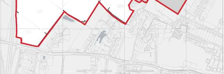
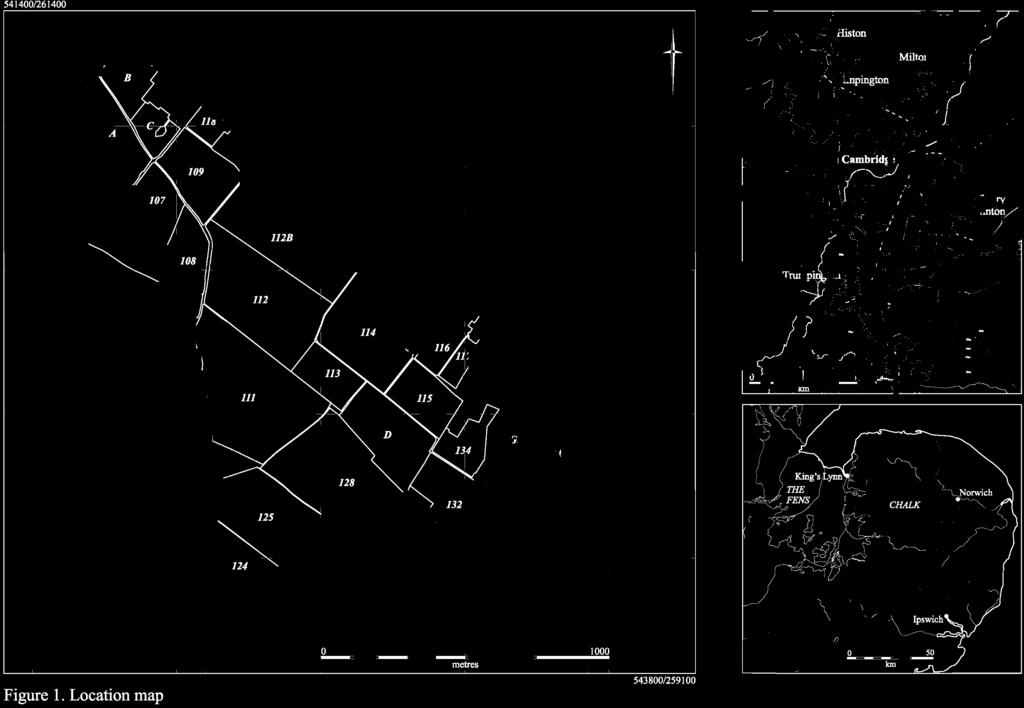
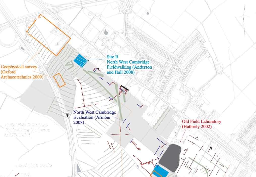
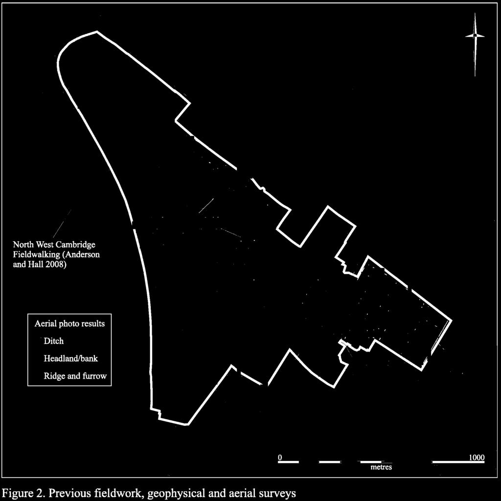
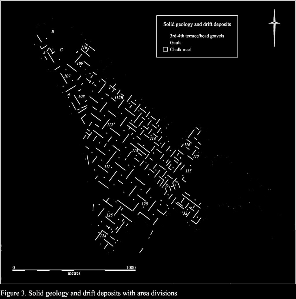
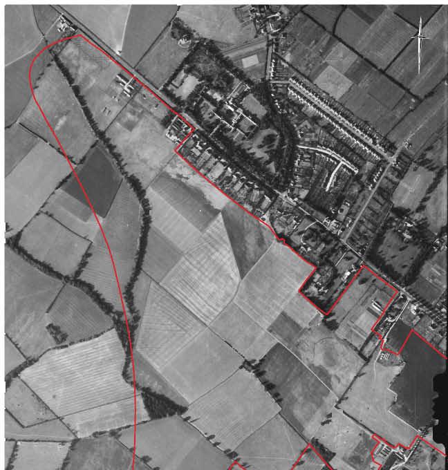
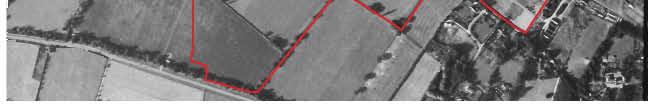
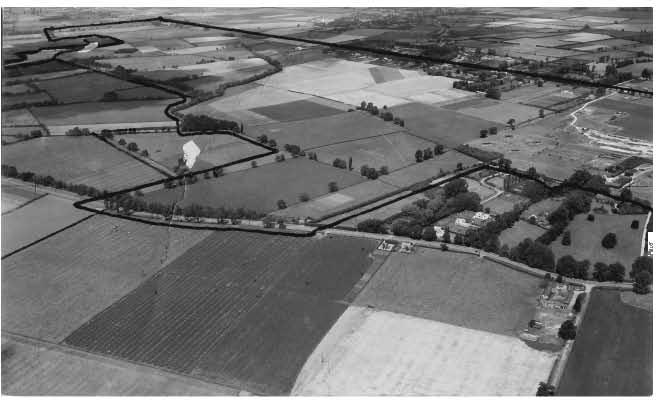
6 LIST OF FIGURES Figure 1. The Location map 2 Figure 2. Previous fieldwork, geophysical and aerial survey 3 Figure 3. Solid geology and drift deposits; area divisions 4 Figure 4. Field 109 looking northeast from Field 107 (top) and, below, south from the 5 ridge to lower clays (Fields 108 and 112) Figure 5. Known previous quarrying and 2009 trench plan; field numbers included 8 Figure Luftwaffe aerial reconnaissance photo 12 Figure 7. WWII vintage aerial photographs of University and Gravel Hill Farms; top 13 looking north, bottom looking northwest, with the Travellers Rest Pit indicated in red; note quarry and weather observation station (upper left) Figure 8. Site designations 14 Figure 9. Site I trench plan and exposed features 16 Figure 10. Site II trench, feature and phase plan 18 Figure 11. Site II geophysical survey results and exposed features 19 Figure 12. Middle Iron Age enclosure sequence F.352 etc 20 Figure 13. Foundations of the weather observation station, including F.342 (top) and 24 F.318 (bottom) Figure 14. Site III trench plan and exposed features; right Hall and Ravensdale map of 34 the Cambridge West Fields (1976) Figure 15. Site IV trench plan and exposed features 38 Figure 16. Site IVa and inhumation F.76, Trench Figure 17. Site IVb trench and feature plan 40 Figure 18. Site IV geophysical survey results and exposed features 41 Figure 19. Pit sequence F.139 etc (top) and pit F.122 (bottom) 44 Figure 20. Intercutting enclosure ditches F.78 etc. 45 Figure 21. Pit/well F.113 etc (top) and ditches F.100 and F.101 (bottom) 46 Figure 22. Pit/ditch F.247, and lathe-turned furniture spindle or finial 47 Figure 23. Site V trench plan and exposed features 73 Figure 24. Intercutting water-hole sequence in Trench Figure 25. Water-hole F.224 in Trench Figure 26. Site IX trench plan and exposed features 83 Figure 27. Area I dispersed features; elements of possible Roman fieldsystem 89 Figure 28. Burial F.289, showing a possible plank cover (top) and crouched inhumation 90 (bottom) Figure 29. Intensive post-medieval strip quarrying in Trench 172 (left) and Trench (right) Figure 30. Site VI trench plan and exposed features 97 Figure 31. Site VI geophysical survey results and exposed features 98 Figure 32. Enclosure ditch F.410 (left) and section of pond-like area in Trench Figure 33. Site VII trench plan and exposed features; bottom ditch F Figure 34. Site VII geophysical plot 108 Figure 35. Site VII ditches F.45, F.47 and F.48 (top), ditch F.46 (bottom left) and elements of the extensive building material assemblage recovered (right) 109 Figure 36. Site VIII trench plan and exposed features 120 Figure 37. Site X trench plan and exposed features 122 Figure 38. Site XI trench plan and exposed features 125 Figure 39. Site XII geophysical plot 128 Figure 40. Area II dispersed features 131 Figure 41. Surviving traces of Medieval agriculture, including extant ridge and furrow to 132 the southeast of the project area (top left), a surviving ridge in Field 118 (right) and an infilled furrow in Trench 103 (bottom left) Figure 42. Site phase plan 135 Figure 43. Top - Marr s section across the Traveller s Rest Pit: bottom - Palaeolithic to 139 Early Neolithic distributions Figure 44. Distributions: top - Late Neolithic and Early Bronze Age: bottom - later Bronze Age to Late Iron Age 140
7 Figure 45. Distributions: top, Early Roman: bottom, Later Roman 145 Figure 46. The Girton College cemetery: top - base plan: bottom - the sculptured lion s 146 head Figure 47. Phased settlement distributions: The Greater North West Cambridge Environs 152
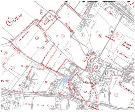
8 Summary The North West Cambridge project-area occupies c. 140 hectares of farmland situated on the suburban outskirts of the city. Its landscape is dominated by the Observatory Gravel ridge, which runs northeast-southwest across the northeastern half of the site; to the southwest, the topography slopes down around ten metres onto a relatively level Gault Clay plain. In total, over the many phases of the evaluation fieldwork outlined herein, twelve discrete sites have been distinguished and which are equally distributed between the two geological zones. The earliest activity to be identified is Palaeolithic in date, and consisted of residual material recovered from post-medieval gravel quarries situated at the eastern end of the project-area. Similarly, a number of Mesolithic and Early Neolithic artefacts were also recovered from residual contexts, their distribution being principally restricted to the area of the gravel ridge (although a small number of flints were also present within the Washpit Brook valley to the west). Although a single Late Neolithic and a small number of Late Bronze Age features were identified in situ, occupation only appears to have begun in earnest during the Middle Iron Age. At least one definite settlement of this date (Site II) was identified. By the later/late Iron Age, occupation was well established in both geological areas, with a minimum of five settlements being present (Sites II, IV-VI & XII). Five major Romano-British settlements were distinguished, of which two lay on the clays: an Early Roman farmstead on the south side of Washpit Brook (Site VI) and, down by Madingley Road, where it continues under the Park-and-Ride, what is probably a Late Roman villa (Site VII). Settlements of this period extended almost continuously along the southern side of the ridge s gravels (Sites II, IV & V). Of these, the most impressive is certainly Site IV, which covers more than 9ha. This had both Early and Late Roman components (and with an Iron Age precursor). Indeed, locally having very high feature and artefact densities with finely worked wood retrieved from a waterlogged feature by its building materials, this probably included a higher status building, and a substantial formal inhumation cemetery was also identified. Only one feature yielded Anglo-Saxon material, a pit at Site V on the ridge gravels opposite the cemetery site of that date excavated within the grounds of Girton College. Further east, evidence of the Howes Close Medieval settlement (known from documentary records; Site IX) was found beside the former University Department of Applied Biology field station buildings on Huntingdon Road. Directly related to Cambridge s Medieval West Fields (as outlined in Hall & Ravensdale s 1976 volume), traces of ridge-and-furrow agriculture (and a trackway; Site VIII) were recovered across the lower clayland areas; whereas, upon the ridge, features relating to a similar routeway and a hedged paddock were forthcoming (Sites II & III).
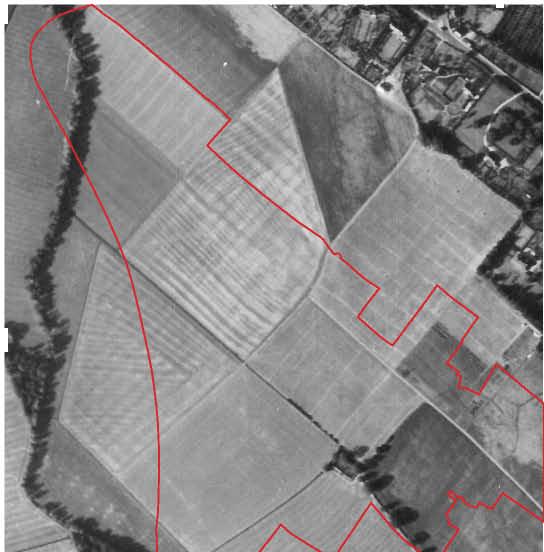
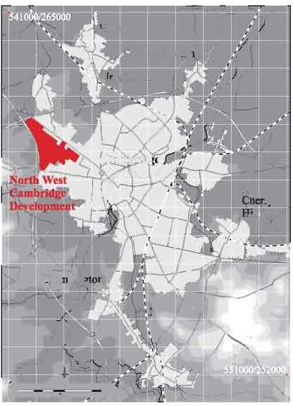
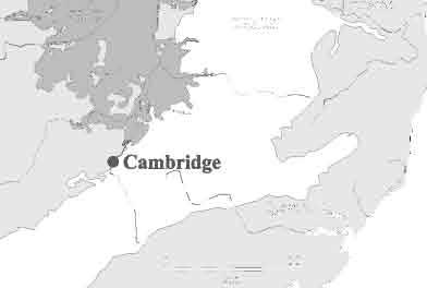
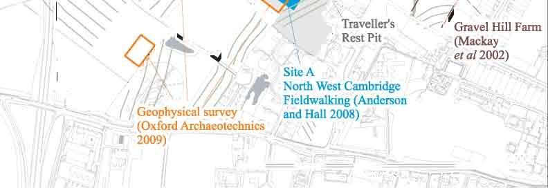
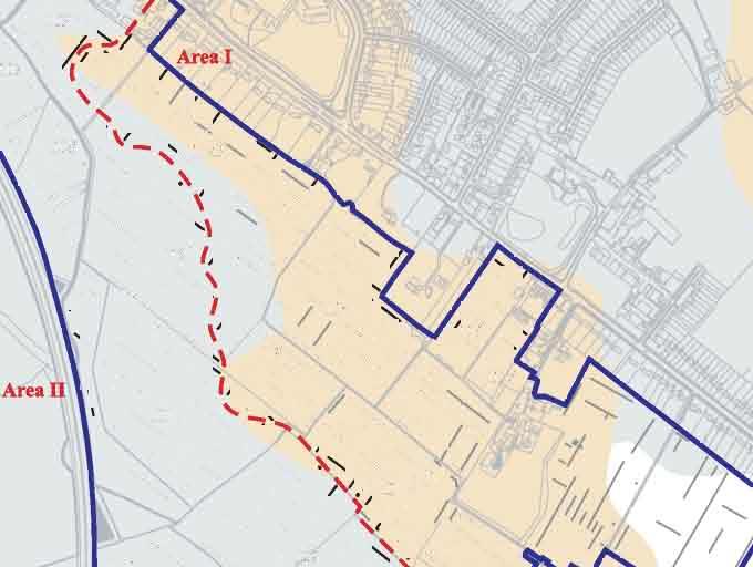
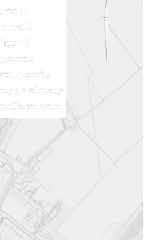
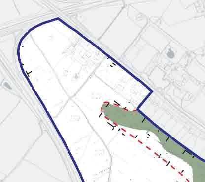
9 INTRODUCTION Commissioned by the University of Cambridge Estates Management and Buildings Service, the Cambridge Archaeological Unit (CAU) undertook a trench-based evaluation on a c. 114ha area of land located in the northwestern part of the city of Cambridge between April and November of The project-area, centred on TL , comprises a roughly triangular swathe of farmland situated on the suburban fringe of the town. The site extends from Huntingdon Road in the north to the M11 in the west, and abutts Madingley Road in the south (Fig. 1). As discussed below, this excludes the c. 20ha of the northeastern Gravel Hill fields and which fell beyond the quarry-reduced Traveller s Rest Pit; their inclusion takes the total development-area up to c. 139ha (c. 134ha excluding the Traveller s Rest Pit-area; note: the current area s hectarage-figure excludes both the hardstanding-cover of the University Farm buildings yard and the Department of Physiology s 307 Huntingdon Road facilities, plus a triangular, plantation-covered plot on the west side of the M11). A series of trenches were initially set out across the 2009 project-area in a regular, grid-like pattern (defined by the excavation of 91 5 x 5.00m test pits on a 100m grid); these were then supplemented by a number of judgmental trenches that were sited in areas where particular concentrations of archaeological features were encountered. In total, 222 trenches were excavated (13,082.6m total length; 28,165.5m 2 ). (This includes three trenches dug along the eastern side of the Madingley Road Park-and-Ride; not strictly within the project-area as such, these were cut to investigate the line of a southern approach road into the main development area.) As further discussed below, due to legal constraints we were unable to trench the c. 4ha pasture fields within the northwestern apex of the area; in compensation, these, instead, saw geophysical survey-cover throughout. Prior to the commencement of the present evaluation, two previous phases of trenching had already been undertaken at the site. The first, occurring in September 2002, consisted of 23 trenches (4325m 2 ) within the northeastern Gravel Hill fields (Mackay et al. 2002); directed towards the investigation of specific cropmark features throughout the 2009 area, the second took place in October 2008 and consisted of twenty trenches (1742m 2 ; Armour 2008; also within the project-area, a single 2.00m-long trench was excavated at the Old Field Laboratory at 219a Huntingdon Road in July 2002; Hatherly 2002). In total, therefore, 34,232.5m 2 of the project-area has now been evaluated by the CAU (see Methodology below concerning percentage-sample breakdown by area). Furthermore, in addition to these trench-based investigations, much of the northern half of the site was also fieldwalked in November 2008 (Anderson & Hall 2008) and, in December 2009, five discrete areas were targeted for geophysical survey (Oxford Archaeotechnics 2009). As far as is practicably possible, within the following report the results of these various project fieldwork stages (see Fig. 2) have been integrated with those of the present evaluation programme. 1


10
11

12
13
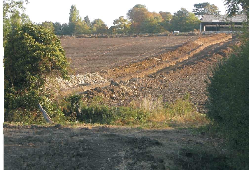
14 Landscape and Geology The landscape of the area can be divided into two distinct portions. The eastern half is dominated by a ridge of high ground, which extends beyond the limits of the project-area in a northeasterly to southwesterly direction, whilst the western half comprises a lower, relatively even plain. Geologically, the ridge consists of a head or drift deposit known as the Observatory Gravels (British Geological Survey, Sheet 188), the extent of which is shown in Figure 3. Some m wide, the ridge gravels overlies solid chalk to the east, whereas the plain to the west is comprised of Gault clay and such deposits also flank its northern side (only being exposed along the northern side of the Gravel Hill fields; Mackay et al. 2002). Within the area of evaluation, the present surface height ranges between 24.5m OD (towards the crest of the ridge) and m OD (on the clay plain below). It includes a distinct small valley within its northwestern quarter, where - following the course of Washpit Brook - the levels drop to c m OD (Fig. 4, top) and rises up again along the area s western margin to c m OD. At present the area comprises agricultural land, a mixture of arable fields and permanent pasture. Methodology From the outset, the differing nature of the geology across the project-area and its potential relationship with the distribution of past archaeological activity was incorporated into the evaluation methodology. Thus the area of the gravel ridge, the most geologically attractive location, was subject to a 5% sampling strategy, whilst the clay plain below was sampled at 2.5%. This twofold division has been maintained in presenting the results of the evaluation, below; however, it must be noted that the boundary adopted between the two areas does not precisely follow the line of their geological differentiation. Although following this change as closely as possible, the division runs between as opposed to across trenches in order to avoid replication and confusion (Fig. 5). In addition, because of the large size of the project-area and the quantity of archaeology that was encountered within it, the results obtained from each of the two areas have been further sub-divided into discrete sites. These latter have been defined on spatial as opposed to temporal grounds, and represent locations/places were distinct concentrations of archaeological features were found to occur. Eleven such sites have been identified, each of which is examined separately with the aim of determining its extent, date, state of preservation and significance (Site XII being tentatively identified solely on the basis of geophysical register). Where more than one period of activity is represented at a single locale, the relevant features are discussed by phase. To facilitate this approach, assessments of the finds assemblages are also presented on a site-by-site basis (although, to avoid repetition, methodological information for each contribution has been separated into Appendix 1). Features that have not been assigned to a particular site, either because they occurred in isolation or because they are clearly modern in origin, are instead discussed by broad area. During the evaluation, the trenches were excavated by a tracked 360 mechanical excavator using a 2.1m-wide toothless bucket. Any archaeological features that were thus revealed were then hand-excavated and recorded 6
15 using the CAU-modified version of the MoLAS recording system (Spence 1994), although, where groups of complex intercutting features were encountered, only a sample of the area was investigated and the remainder preserved in situ. Base plans were drawn at a scale of 1:50, whilst sections were drawn at a scale of 1:10. Throughout the report, context numbers are indicated within the text by square brackets (e.g. [001]) and feature numbers are denoted by the prefix F. (e.g. F.100). In order to facilitate the integration of the results of this project with those of earlier phases of work at the site, the numbers used ran consecutively from those employed during the 2008 evaluation. Feature descriptions are to be found in Appendix 2, whilst trench descriptions are presented in Appendix 3. The photographic archive consists of a series of digital images. Historical and Archaeological Background The historical and archaeological background of the development area is fully outlined in two recent desktop assessments (Dickens 1999; Redfern 2001, updated 2008) and the wider background of Cambridge itself is reviewed in several published sources (see especially Bryan 1999; Taylor 1999); neither is, therefore, reproduced here in full. Nevertheless, it is necessary to briefly outline the background of the area in order to situate the site securely within its wider context. Further details on specific sites directly related to its development are also included in the report s final discussion section. The earliest recorded material to be recovered from the site is Palaeolithic in date. Indeed, towards the eastern end of the project-area a significant assemblage of Lower Palaeolithic worked flint, consisting of up to 1000 pieces, was recovered from coprolite workings at the Traveller s Rest Pit between 1911 and 1919 (Marr 1920). Additional finds were recovered from the site until at least 1938 (Clark 1938), and an assemblage of 200 artefacts is held by the Sedgwick Museum of Earth Sciences in Cambridge. Further stray finds of Palaeolithic flints are also recorded from elsewhere within the Observatory Gravels (Griffith 1879; Babington 1883, 11-13; Browne 1974, map 10.35). Although no Mesolithic material has yet been recovered from the site, a small quantity of residual struck flint of this date was identified during the excavation of Vicar s Farm site a short distance to the south (Lucas & Whitaker 2001). In contrast, Neolithic material is well represented within the project-area in the form of surface scatters encountered in the eastern half of the site (Marr & Burkitt 1923). Although no Bronze Age material has yet been recorded, settlement activity of this date has been identified at the Fitzwilliam College Library site to the east (Slater 2008, 6-10). The most significant later prehistoric presence in the area, however, is Iron Age in date. To the northeast of the present evaluation, part of a substantial Iron Age enclosure was investigated at Marion Close in 1997 (Mortimer & Evans 1997). In addition, relatively large quantities of residual Iron Age pottery have also been recovered from Medieval and post-medieval quarry pits within the grounds of the nearby University Observatory (Masser 2000; Newman 2008a). Finally, an Iron Age presence was also identified at both the Vicar s Farm and Nano- Fabrication Building sites to the south (Lucas & Whitaker 2001, 17; Armour 2001), as well as at excavations undertaken within the grounds of New Hall College to the east (Evans 1996). 7

16
17 It is the Roman period which has produced the most substantial number of finds in the area, however, many of these were recovered during quarrying activity undertaken in the northeast corner of the project-area in the late 19 th and early 20 th centuries. In the first instance, in situ human remains from this period were discovered within two Barnack stone coffins situated in relatively close proximity to Huntingdon Road in The coffins contained a male and a female interment respectively; the latter had had numerous grave goods placed at her feet, including glass bottles, jet jewellery and a 4 th century beaker (Babington 1864; 1883, 35-6; Liversidge 1977, 15-16). Notably, a further stone coffin was also identified in this area during an evaluation of the land surrounding Gravel Hill Farm that was undertaken in 2002, although unfortunately it was no longer in situ (Mackay et al. 2002, 9-11). Furthermore, an unknown number of cremations associated with Roman pottery were also discovered in this same area in 1861 during coprolite quarrying activity (CHER 16172). Late 3 rd century coins of Gallienus, Tetricus I and Carausius, along with contemporary pottery and bronzes, are also recorded from this part of the development area (Browne 1974, map 10.34), whilst additional pottery vessels, including a jar and two flagons, were found a little way to the south by A. F. G. Griffith in 1878 (Babington 1883, 36). Immediately to the north of the project-area, additional Roman burials were also discovered within the grounds of Girton College in the late 19 th century (Hollingworth & O Reilly 1925; Liversidge 1977, 15-16). These consisted of two richly accompanied 2 nd century cremations, along with a small number of Late Roman (probably 4 th century) inhumations. Relatively large quantities of Roman building materials including worked and moulded stone, as well as five fragments of statuary were also identified at the site. Although these were initially thought to have been associated with roadside funerary monuments (Hollingworth & O Reilly 1925, 36; Liversidge 1977, 15-16), more recently it has been postulated that they may have been derived from a substantial building such as a villa (Scott 1993, 37; Taylor 1997, 53). A series of rectilinear enclosures identified by aerial photography lying immediately to the north of the College are also potentially associated with this complex. (Croft et al. 1977). Further mortuary evidence of potential Roman date has also been identified in the immediate vicinity of the project-area. In c. 1745, during the construction of the turnpike now known as Huntingdon Road, a tumulus was excavated adjacent to the line of the Roman road at Howe House (Lysons & Lysons 1808, 44-5). Several Roman coins were recovered at this time, although the barrow itself was not securely dated. The presence of a later settlement by the name of Howes in this location (see below) has led to the suggestion that additional barrows were also present in the area, as the name is consistently recorded in the plural during the Medieval period (Hall & Ravensdale 1976, 44; Reaney 1943). Interestingly, the existence of a yet another barrow situated a little way to the south, in close proximity to the present University Observatory has also been postulated. Identified from marginal notes appended to a Medieval manuscript, this monument was potentially of significant size as it subsequently appears to have given its name to Grithow/ Great How Field (Hall & Ravensdale 1976, 44). Of even greater significance to the contemporary landscape of the area, however, is the presence of at least two Roman roads. The most significant of these extended from the Roman town of Cambridge to the east towards Godmanchester in the west. 9
18 Originally observed lying a little way to west of Huntingdon Road by antiquarians in the 19 th century (Lysons & Lysons 1808, 44-5; Babington 1864, 289), a portion of this road has recently been excavated at the Murray Edwards College site (formerly New Hall College; Hutton 2009, 5-12). Its projected route crosses the northernmost portion of the project-area. Similarly, the projected course of a second roadway which was originally identified during the New Hall excavations (Evans 1996, 47-9), and subsequently exposed in the Trinity Hall Playing Fields site (Wills 2004, 7-9) also extends into the project-area, some way to the south of the former route. A third trackway may also transect the area, heading northeast from the Vicar s Farm site (Lucas & Whittaker 2001, 43). The range and extent of these earlier discoveries in the area is important because the prevailing picture of Cambridge during the Roman period is one of a settlement centred almost exclusively upon the Castle Hill area to the east (cf. Alexander & Pullinger 2000). Previously the site of a minor Iron Age settlement of village proportions, this hilltop location became occupied by a small Roman fort in the 1 st century AD that subsequently developed into a small walled town around three centuries later. Recent fieldwork, however, is demonstrating that this single locus interpretation is somewhat limited as evidence of a significant hinterland has now been detected at some distance from the presumed centre. To the southeast, Roman occupation has been identified on the riverfront (Dickens 1996) and in the Park Street/Jesus Lane area (Alexander et al. 2004), as well as extending out along Bridge Street (Newman 2008b). Of more direct relevance to the present study, key sites have also been excavated to the west at New Hall (Evans 1996), Trinity Hall Playing Fields (Wills 2004) and most importantly Vicar s Farm (Lucas & Whittaker 2001). The latter site, which is situated some 500m to the south of the project-area, consisted of a regularly laid-out rectilinear system of ditched enclosures and semi-open fields. Situated at the centre of the site were an aisled building, a timber-post circle and numerous quarry pits and wells, whilst located towards the fringes of the settlement were two cemeteries (the southernmost consisting of c. 30 inhumations and the northernmost seven cremations and two infant inhumations). A trackway was also present, with a metalled path leading off it into the settlement core. The site was occupied for over 350 years and produced substantial assemblages of ceramic and faunal remains, in addition to some 350 coins. Following its abandonment in the 5 th century AD, no visible activity occurred until the site was transformed into open fields during the Medieval period. In contrast to the Vicar s Farm site, an Anglo-Saxon presence has been recorded within the project-area. An Early Saxon (5 th to 6 th century AD) urn, of probable cinerary origin, was recovered from Bunker s Hill (which comprises the northernmost portion of Field 112) during the late 19 th century; this is currently on display in the Lawrence Room Museum at Girton College. The find is potentially of significance because, immediately to the north of the project-area (and only a short distance from Bunker s Hill), an important Early Saxon cemetery has been excavated within the grounds of Girton College. This site, which contained at least 100 inhumations and 200 cremations, produced a substantial number of finds including many cinerary urns (Hollingworth & O Reilly 1925, 2; Rogerson 2007, 28). It is also notable that one or more inhumations of Anglo-Saxon date were disturbed by 10
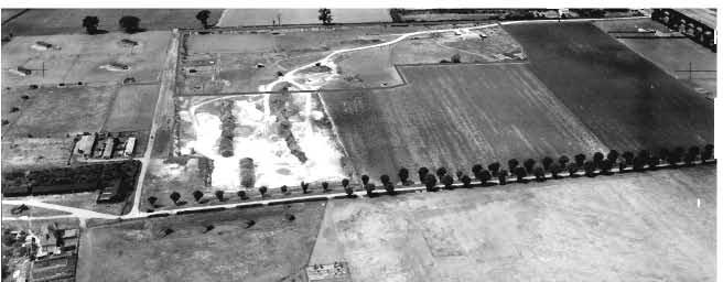
19 coprolite quarrying in the northeast corner of the project-area (Fox 1923, 244), although as with the above-mentioned urn few other details of these burials were recorded. Despite this wealth of mortuary evidence in the vicinity, however, no settlement evidence of Anglo-Saxon date has yet been identified (cf. Cessford with Dickens 2005). During the Medieval period, in contrast, a small settlement was established immediately to the north of the project-area. Situated beside the former Roman road, the hamlet of Howes is known to have been in existence by 1219 and its somewhat unusual name was first recorded in 1279 (Cam 1944). Although still inhabited in the late 14 th century, when it contained at least eight houses (Hall & Ravensdale 1976, 44), no record of the settlement exists after 1600 (Wright & Lewis 1989, 115). The hamlet partially straddled the parish boundary between Girton and Cambridge St. Giles (as does the present area of development), and a small portion of the project-area is known to have been enclosed with hedges for use by the settlement in the late 14 th or early 15 th centuries; it is also possible that buildings were constructed in this area (Hall & Ravensdale 1976, 52). The remainder of the site was given over to open fields, those in the west belonging to the village of Girton and those in the east comprising part of Cambridge s Medieval West Fields. The layout of these fieldsystems has recently been plotted from aerial photographs (Palmer in Redfern 2001, 33-45), and additional information on the area has also been reconstructed from a late 14 th century tithe document known as the Corpus Terrier (Hall & Ravensdale 1976). This latter source indicates that a number of Medieval trackways crossed the project-area, as well as demonstrating that gravel quarrying was well underway on the Observatory Ridge by c In addition, a further Medieval feature known to have lain in the immediate vicinity of the site is the Trinity Conduit. This underground aqueduct was constructed in 1327 for the Franciscans (or Grey Friars) who occupied the site that later became Sidney Sussex College, although it is first mentioned historically in an inquisition of 1434 (RCHM(E) 1959, 233; Willis & Clark 1886, and ). The conduit ran to the Friary from the spring at Bradrusshe now known as Trinity Conduit Head which is located around 100m to the southeast of the project-area. The identification of Roman pottery and abundant oyster shell around this springhead has also prompted the suggestion of a much earlier presence at the site (Lucas & Whittaker 2001, 20). The area s Medieval open fields were finally enclosed in 1805 (Guillebaud 2005, 187), and the post-enclosure history of the area has been the subject of a number of recent studies (Guillebaud 2006, 2007, 2008, and 2009). The most significant event to have occurred during this period with regard to the project-area comprised the foundation of University Farm on the site in 1909, following its transfer from its previous location in Impington (Guillebaud 2008, 191); its presence ensured that little or no development was undertaken on the site during the 20 th century. Other important modern events include the creation of a series of large-scale coprolite quarries in northeast portion of the project-area during the late 19 th and early 20 th centuries (Grove 1976; O Connor 1998) and the establishment of a weather observation station at the site during the Second World War (Fig. 7). 11
20
21


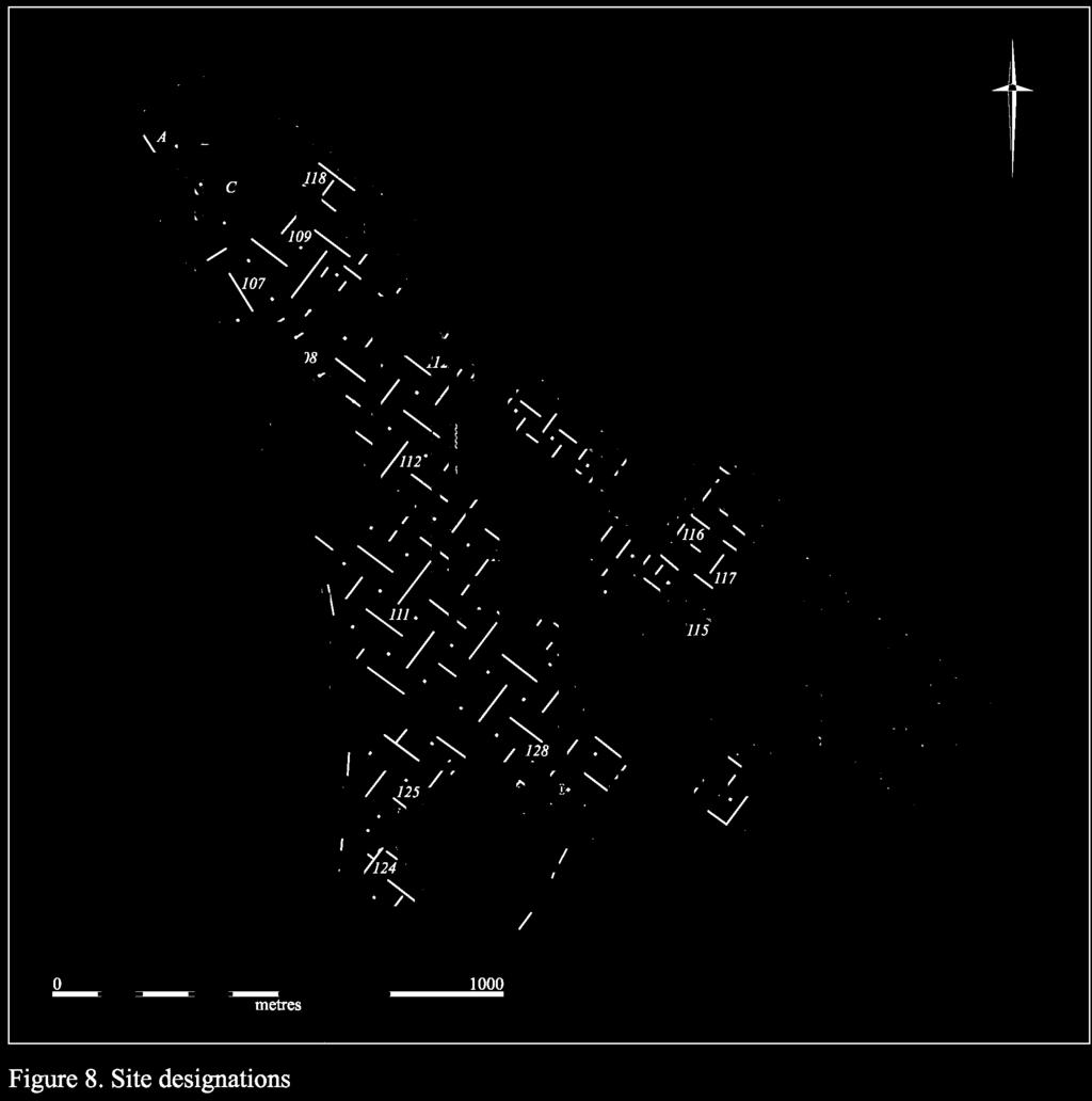
22
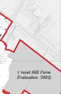
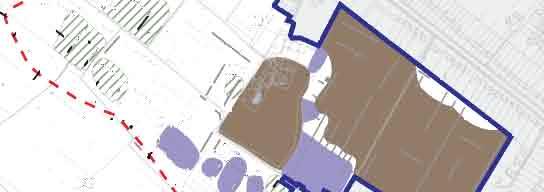
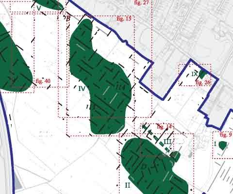
23 EVALUATION RESULTS The results of this evaluation have been divided into two sections, one detailing the archaeological remains encountered upon the gravel ridge (Area I) and the other those present on the clay plain below (Area II). In each case, the sites identified are discussed in numerical order (see Fig. 8). A discussion of the degree of archaeological preservation in each area is presented at the end of its appropriate section. AREA I Area I primarily encompasses the Observatory Gravel ridge, upon which six sites (I, II, III, IV, V and IX) have been identified. These range in date from the Lower Palaeolithic to Medieval periods, although the majority of activity in the area is Roman in date. A number of dispersed features, which have not been assigned to any particular site, are also discussed. Site I Site I consists of a discrete cluster of features of Iron Age and Roman date. It is located towards the northeast corner of the project-area, in close proximity to the Traveller s Rest Pit (Figs. 2 & 8). Site I is distinct from the remainder of the sites discussed in this report because, as it had already been both identified and defined during an evaluation of the land surrounding Gravel Hill farm that was undertaken in September 2002 (Mackay et al. 2002), it was not investigated during the most recent phase of work. Neither was the area fieldwalked in 2008 (Anderson & Hall 2008). For these reasons, therefore, the account presented here comprises a summary of the 2002 investigation. As identified, Site I consists of the remnants of a small pit a moderately sized ditch of probable Iron Age and Roman date respectively (Mackay et al. 2002, 5-7). The features were as follows: Firstly, a small circular pit measuring 0.50m in diameter and 0.40m+ deep. This contained 15 sherds of Iron Age pottery, weighing 126g. Two of these sherds comprised distinctive rim forms of Early Iron Age type (ibid., 13). Secondly, an east-northeast to west-southwest aligned ditch. This was 2.0m wide and 0.70m+ deep, with a partially stepped profile and a concave base. It contained a sequence of four weathered fills, whose profile may indicate that a putative bank had slumped into it from the west-northwest. A total of 35 sherds of pottery were recovered, weighing 355g. Whilst the majority of these were Iron Age in date, a small number of Neolithic and (most probably Early) Roman fragments were also present (ibid.). Unfortunately, these features had been very heavily truncated by 19 th century gravel and coprolite quarrying activity and survived only upon a small island of unexcavated gravel. No other archaeological activity was identified in the area. 15
24
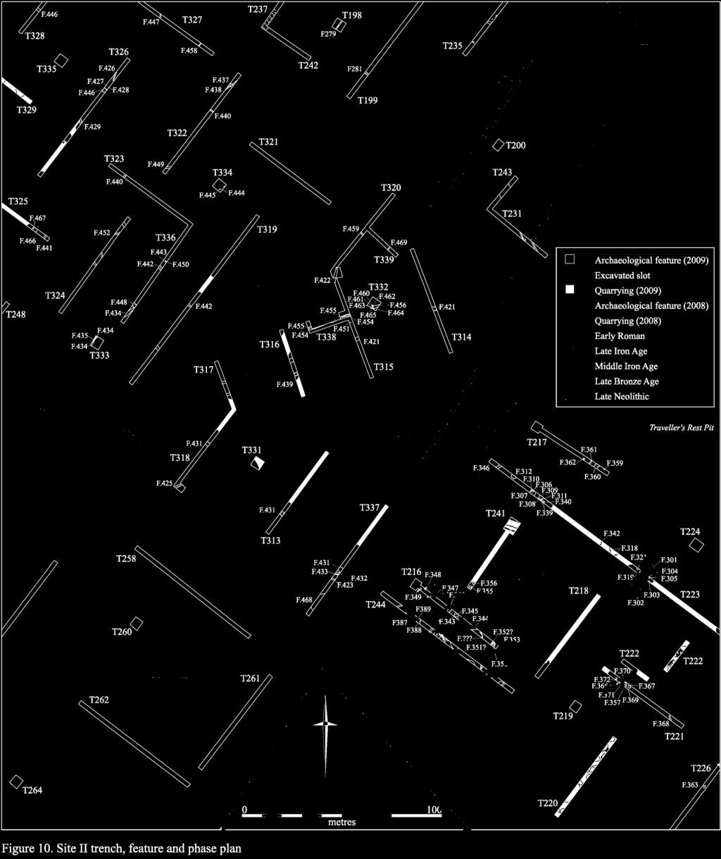
25 Discussion Although, on the one hand, the scale of the ditch allied with the relatively large quantity of domestic refuse that was recovered from it indicates that it may have lain in relatively close proximity to a locus of contemporary settlement, any further evidence which may have pertained to that settlement (such as details of its size, form or date) has clearly been destroyed (ibid., 11-12). Indeed, due to the extent of the intensive 19 th century quarrying, little can now be determined even of the original topography of the area. The primary relevance of Site I, therefore, lies in the fact that it demonstrates the presence of Iron Age and Roman activity in a part of the project-area which has otherwise been destroyed, and from which it is likely that little additional evidence will be forthcoming. The possibility that this site may have been at least partially associated with Site II to the southwest will be explored further below. Site II Site II, which comprises the second largest site to have been identified during this evaluation, contains material spanning the Lower Palaeolithic to Early Roman periods. It is situated towards the southeastern end of the project-area, and extends across the eastern half of Field D and the western half of Field 132 (Figs. 2 & 8). The topography of the area is relatively level, and lies at around 22.5m OD. Features were first encountered at this site within a single trench, Trench 1, which was excavated as part of the initial trench-based evaluation of the project-area in October 2008 (Armour 2008). Subsequently, the area was fieldwalked in November 2008 and a larger site (termed Site A) was provisionally identified (Anderson & Hall 2008, 4-8). This consisted of a scatter of 36 flints, of Late Neolithic and/or later origin, and 22 sherds of Middle Iron Age to Early Roman pottery. The extent of the intensively walked area is depicted in Figure 2. In addition to the above, a small portion of the site was also subject to geophysical survey in December 2009 (Fig. 11). The results of all of these projects have been incorporated into the following report. Altogether, a total of 84 features which are distributed across 17 trenches (Nos. 1, 216, 217, 221, 223, 241, 244, 314, 315, 318, 319, 324, 325, 332, 333, 336 and 337) have been investigated at Site II. Of this group, 31 features (or 36.9% of the total) contained datable material. The features are broken down by type in Table 1, below. Feature Type No. Excavated Linear 45 Pit 28 Curvilinear 3 Posthole 3 Pit/posthole 3 Beam-slot 2 Foundation 1 Total 84 Table 1: Excavated features at Site II by type. 17


26
27
28
29 In total, six periods of activity have been identified at Site II. The earliest of these is represented by two residually occurring struck flint flakes, which were recovered from the disturbed gravel backfills of large early 20 th century gravel quarries in Trenches 223 and 226. These pieces represent examples of a simple flake-based reduction strategy. Although not technologically diagnostic, their heavily rolled and patinated condition strongly suggests an origin in the fluvial gravels and thus a probable Lower Palaeolithic date. Notably, a significant assemblage of Palaeolithic flint has previously been recovered from the Traveller s Rest Pit, which is situated immediately to the north of the site (Griffith 1879; Babington 1883, 11-13; Marr 1920; Burkitt 1931a and 1931b; Clark 1938; Roe 1968; Browne 1974, map 10.35; Wymer 1996; Wymer 1999; White et al. 2009). The nature of this material is examined further in the main discussion chapter, below. In addition to the Palaeolithic finds, a small quantity of Mesolithic and Early Neolithic flint was also recovered from residual contexts (including F.357 and F.369 in Trench 221, F.364 in Trench 226, F.432 in Trench 337 and F.467 in Trench 325). No clear pattern could be discerned in the distribution of these artefacts, however, and the quantity of activity they represent appears to be relatively low. Although remaining weak, the strongest concentration of material was identified in Trench 221. Here, it is significant that apparently in situ Late Neolithic material was recovered from pit F.357. This included five sherds of Durrington-style Grooved Ware pottery, weighing 23g, as well as four diagnostically Late Neolithic struck flints; in addition to three pieces of knapping waste, the latter included a multi-platform flake core. Pit F.357 comprised the earliest feature in an intercutting sequence of pits, the remainder of which included F.369, F.70 and F.371. Although no material culture was recovered from any of the latter features in this group, it is possible that they are also Late Neolithic in date. The remaining features in the trench, however (which included gullies F.366 and F.372, as well as pit/gully F.367), whilst similarly undated, appear on morphological grounds much more likely to have been associated with the intensive Iron Age/Early Roman presence in the area. Limited evidence of Bronze Age activity at the site was also identified. In the first instance, a sherd of Early Bronze Age pottery was recovered from a residual Middle Iron Age context in Trench 216 (F.343). Secondly, a more definite Late Bronze Age/Early Iron Age presence was identified further to the west in Trenches 313, 314 and 315. Here, in the latter trench, irregular north-south aligned gully F.422 was investigated. This feature, which was 1.23m wide and 0.26m deep, was found to contain three sherds of Late Bronze Age/Early Iron Age pottery as well as a number of burnt stone fragments. No other features were identified that were oriented on a comparable alignment, however, and the remainder of the small Late Bronze Age pottery assemblage to be recovered during the evaluation was derived from residual contexts (including F.421 in Trench 314 and F.431 in Trench 313). The scale and extent of activity being undertaken at the site during this period therefore appears to have been relatively limited. This situation appears to have changed markedly during the Middle Iron Age. At this time, a minimum of two sub-circular enclosures were established in Field 132. Both of these features are clearly visible in the geophysical plot of 21
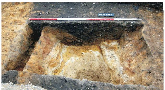
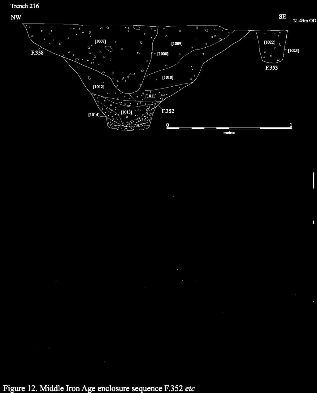
30 the area (Fig. 11), and elements of each enclosure were investigated archaeologically (in Trenches 216 and 244 respectively). The westernmost enclosure, which measured c. 18m in diameter, consisted of curvilinear ditches F.343, F.344 and F.345. These varied between 1.12m and 1.98m in width and 0.29m and 0.76m in depth. Investigations revealed that this enclosure, which had been re-cut on at least one occasion, contained Middle Iron Age pottery in its earliest phase (F.343). In addition, undated pits F.355 and F.356 which were situated in close proximity to the enclosure, in Trench 241 may also have been associated with this phase of activity. A short distance to the east, a second, slightly larger and more complex enclosure system was identified (Fig. 10). This consisted of two concentric sub-circular alignments; the outer enclosure measured c. 26m in diameter, whilst the inner measured c. 12m in diameter. Elements of the outer enclosure sequence were investigated in Trench 216. Here, it was found that the principal ditch in the sequence, F.352, measured 1.5m wide and 0.85m deep (Fig. 12). The ditch had been re-cut on at least two occasions, by shallower gullies F.351 and F.358 respectively, and the latter of these features contained a small assemblage of Middle Iron Age pottery. Also present, on the interior edge of the enclosure, was a narrow, near vertically-sided gully F.353 which appears to have formed the bedding trench for a possible timber palisade. Although the central enclosure in the complex fell outside the limit of the evaluation trench, judging by its size and location it appears likely to have comprised the dripgully of a domestic structure. Further elements of this system were also identified to the south, in Trench 244, but were not excavated. A third curvilinear ditch, which measured a minimum of 9m in diameter, was identified at the northwestern end of Trench 244. Given its limited size, this feature may perhaps have comprised part of a structure located to the south of the two principal compounds, as opposed to an additional enclosure in its own right. It is undated, and was again preserved in situ. Interestingly, the apparent absence of this ditch in the geophysical plot of the area (Fig. 11) may well be attributable to the mixed nature of the underlying geology, as it is situated at the interface between the gravel ridge and the Gault clay plain. This is also the location of the one remaining feature at Site II to have produced Middle Iron Age pottery. Ditch F.431, which is situated immediately to the northwest of the features discussed above (in Trenches 313, 318 and 337), appears to have been deliberately sited so as to mark the division between the two geological zones. Its alignment suggests that it is perhaps most likely to be Early Roman in date, and that the earlier material it contained is residual. During the Late Iron Age, the level of activity being undertaken at the site increased once again. At this time, the sub-circular enclosures which had predominated during the Middle Iron Age phase appear to have given way to a broadly rectilinear system that was oriented on an east-northeast by westsouthwest axis. The most significant Late Iron Age discovery at the site comprised a probable timber-framed building. This structure, which is clearly visible in the geophysical plot of the area (Fig. 11), measured c. 18m in length by c. 7.5m in width. Several elements of the building were investigated in Trench 216, including probable beam-slots F.347 and F.349 which varied between 0.3m and 0.84m in width and 0.07m and 0.36m in depth as well as pit/posthole F.348. Notably, the structure produced a very strong 22
31 magnetometry signal. This may perhaps be a result of the presence of metalworking debris, as three fragments of iron-smithing slag, weighing 41g, were recovered from F.349. It is not clear on the present evidence whether the building was directly associated with in situ metalworking activity, however, or had merely become a focus for the opportunistic disposal of waste material following its abandonment. Nearby, probable enclosure ditches F.350 in Trench 216 and F.385 (which was re-cut by F.386) in Trench 244 also appear to have been associated with this phase. Both contained undiagnostic Iron Age pottery. To the northeast, in Trench 223, a further cluster of Late Iron Age features was identified, lying upon a surviving island of gravel that had been truncated on either side by large early 20 th century gravel quarries. Here, northeast-southwest aligned linears F.301, F.302, F.304 and F.319 were investigated, all of which contained Late Iron Age pottery. So too did curvilinear gully F.303, which truncated the former sequence and also contained a fragment of a beehive-shaped puddingstone rotary quern. This feature is most probably structural in origin. Also present in this area were pits F.305 and F.321, both of which contained Late Iron Age pottery. Finally, Late Iron Age pottery was also present within northeast-southwest aligned ditch F.439 to the west (in Trench 316), although this appears most likely to have occurred residually within an Early Roman feature. During the Early Roman period, activity at Site II reached its apogee. At the northwestern end of the site, evidence of domestic occupation of this date was identified in the form of a large quantity of refuse that had been backfilled into ditches F.434 and F.448 (in Trenches 319, 324, 333 and 336). These features, which were aligned northeast-southwest and northwest-southeast respectively, varied between 0.87m and 1.9m in width and 0.22m and 0.53m in depth. The former contained 37 sherds of pottery, weighing 671g, as well as the majority of a micaceous quartzitic sandstone saddle quern, whilst the latter contained 97 sherds of pottery, weighing 873g, along with several fragments of Niedermendig lava quern. A short distance to the west, in Trench 325, pit/water-hole F.453 was identified. Although undated, this feature which was re-cut by F.466 and F.467 appears likely to have been situated on the fringe of the Early Roman settlement. Further undated features in this area including ditches F.427 (in Trench 326), F.440 (in Trench 322) and F.442 (in Trenches 319, 324 and 336) are also likely to have been of similar origin based upon the nature of their fills, morphology and alignment. Importantly, this discrete area of activity in the northwestern half of the site appears to have flanked a central northeast-southwest aligned track/droveway. Constituent elements of this trackway, which had clearly been re-established on a number of occasions, included F.421 (in Trenches 314, 15, 316 and 317), F.439 (Trenches 316 and 317) and F.454, which was recut by F.455, F.463 and F.465 (in Trenches 315, 332 and 338). The latter features also truncated a series of small pits consisting of F.456, F and F.464 in Trench 332, but no dating evidence was recovered from this sequence. The ditches themselves varied between 0.6m and 2.03m in width and 0.17m and 0.71m in depth. 23
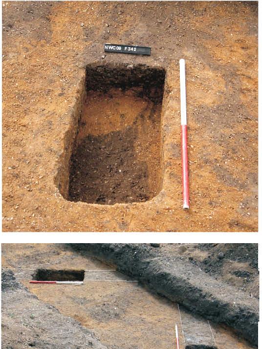
32
33 To the southeast of the trackway, a corresponding pattern of settlement activity was identified which mirrored the dominant northeast-southwest axis of the occupational evidence outlined above. In Trench 223, for example, northeast-southwest oriented ditch F.346 produced several sherds of Early Roman pottery. Furthermore, also present in this area were pits F.306-9, F.312, F.339 and F.340, which varied between 0.47m+ and 2.52m in diameter and 0.26m and 0.46m in depth; all of these features were found to contain sherds of Late Iron Age/Early Roman pottery. In addition, postholes F.310 and F.311 were also identified in this trench. These features, which although stratigraphically associated with the pit group contained no datable material, are potentially structural in origin. A little way to the north of this area, in Trench 217, a group of undated features (F ) was investigated. Here, two ditches F.360 and F.361 were found to follow the dominant northeast-southwest alignment, and were associated with pits F.359 and F.362; the group is therefore most probably contemporary with the settlement evidence identified in Trench 223 to the south. Finally, undated ditch F.425 in Trench 318 also demonstrated a very similar fill, morphology and alignment to the majority of Early Roman features investigated at the site. Also of interest at Site II was the identification of building foundations associated with the weather observation station that had been established in Field 132 during the mid 20 th century (see the Second World War aerial photograph, Fig. 6). Remnants of this complex were investigated in the form of F.318 and F.342 in Trench 223 (Fig. 13). These features were found to be very consistent in size, only varying between 0.5m and 0.56m in width and 0.32m and 0.38m in depth, and each contained fragments of 20 th century pottery as well as numerous shards of window glass. The buildings of which they had formed a part had been constructed upon the surface of a backfilled gravel quarry; once they had gone out of use, the structures had been thoroughly dismantled. Finally, it should be noted that elements of a post- Medieval field system were identified at the northwest end of site. Notably, the alignment of these post-enclosure features, many of which contained 16 th /17 th century material, broadly respected the layout of the preceding Medieval open fields. Elements of the system included F.440 (in Trench 323), F.437/F.459 (in Trenches 320 and 322), F.441/F.458 (in Trenches 325 and 327), F.446 (in Trench 328) and F.469 (in Trench 339). In addition, elements of a succeeding, 19 th century system which was aligned north-south as opposed to northeast-southwest were also identified. This consisted of F.426 (in Trench 326), F.429/F.452 (in Trenches 324 and 326) and F.447 (in Trench 327). Both systems are discussed further in the dispersed features section, below. Finds Assessment Reports A relatively substantial assemblage of material was recovered. This includes prehistoric pottery, slag, fired clay and worked flint, plus Early Roman pottery, building material and worked stone as well as faunal and environmental remains. Of particular note are two struck flints of Palaeolithic date. 25
34 Flint Lawrence Billington The evaluation at Site II produced a total of 38 flints. Most were residual Mesolithic to Later Neolithic flints incorporated into later features, although a small assemblage was recovered from Grooved Ware associated pit F.357 and, most notably, two pieces believed to have derived from the gravels are described; these are thought to be Lower Palaeolithic in date (see below). Mesolithic/Earlier Neolithic blade based material was recovered from several features. Individual blades were found in pits F.432 and F.357 and a large rejuvenation flake that had removed a substantial portion of a fine blade core came from pit F.369. A relatively large, hard hammer struck serrated blade from ditch F.364 is likely to be earlier Neolithic in date. An end scraper from pit F.467 manufactured on a thin cortical flake is probably of Mesolithic/Earlier Neolithic date. Later Neolithic flintwork is well represented in this assemblage. The small assemblage of four pieces from Late Neolithic pit F.357 can be considered contemporary with the feature with the exception of the Mesolithic/earlier Neolithic blade mentioned above. The remaining three pieces consist of knapping waste in the form of a chunk, waste flake and a fragment of a multiplatform flake core. Diagnostically later Neolithic material was also recovered from subsoil deposits and as a residual component of ditch F.358. These pieces show evidence for specialised levalloisian (Saville 1981, 7) core reduction, in the form of a well reduced discoidal core and two broad thin flakes with neatly faceted platforms. The remaining material is largely undiagnostic, consisting mostly of small hard hammer struck waste flakes, probably relating to flint working from the later Neolithic into the Bronze Age. Lower Palaeolithic (with Emma Beadsmoore) One of the Palaeolithic pieces was recovered from top-soil deposits in Trench 223. It is a large flake weighing 95g with a maximum length of 69mm, width of 70mm and thickness of 16mm. It has been stained orange by gravel deposits and is in a heavily rolled condition, with rounded arrises and numerous chatter or impact marks, presumably from contact with other stones in a dynamic fluvial environment. It has suffered more recent damage in the form of small chips. Most notably a large flake has been detached from the proximal end of the ventral side of the piece, removing the bulb of percussion and part of the platform. This large flake has a substantial unprepared striking platform. The scars of two previous removals are visible on the dorsal surface with an area of cortex at the distal end of the flake. The second piece was recovered from top-soil deposits in Trench 226. It is a sub-angular nucleus of flint weighing 215.3g, 93mm in length, 65mm in width and 29mm thick. Its condition is similar to the flake described above. A flat, natural surface on the top of the piece has been used as a striking platform to detach at least three broad flakes, the largest of which measured approximately 36mm long and 35mm wide. These pieces represent a simple flake based reduction strategy; although not technologically diagnostic, their condition strongly suggests an origin in fluvial gravels and a probable Lower Palaeolithic date. The wider context of these pieces, and the nature of the Palaeolithic material previously identified at the Traveller s Rest Pit to the north, is discussed in the main discussion chapter, below. Prehistoric Pottery Mark Knight Site II produced thirteen sherds of prehistoric pottery weighing 51g (MSW 3.9g). Five sherds from F.357 belonged to the rim section of a large diameter bucket or urn-shaped vessel decorated externally with horizontal incised grooves. The profile of the rim was a simple rounded type partly elevated by the proximity of the incised groove design. Its grog-rich fabric is normally indicative of the Durrington-style Grooved Ware repertoire. A sixth sherd came from F.343 and consisted of part of a base angle from a medium-sized urn(?) also made with a grog-based fabric (Fabric 5). A diagnostic attribute of this particular sherd was its pale cream-coloured exterior common to earlier Bronze Age ceramics. A further five fragments from F.421, F.422 and F.431 were all small and all made of the Late Bronze Age/Early Iron Age fabric (Fabric 2). The poorly sorted burnt flint inclusions within two small sherds from F.9 suggest an Early Neolithic date for these pieces. Fabric descriptions are presented in Appendix 1. 26
35 Feature Context Number Weight (g) Fabric Table 2: Prehistoric pottery from Site II. Iron Age and Roman Pottery Katie Anderson 220 sherds of Iron Age and Roman pottery were recovered, weighing 3418g and representing 3.0 EVEs. The pottery dated from the Middle Iron Age to the early Roman period, although the majority of sherds were Late Iron Age/Early Roman in date. Six Middle Iron Age sherds were recovered from F.13 in Trench 13, whilst others were recovered from F.345 and F.358 in Trench 216 and F.431 in Trench 313. A limited number of fabric types were identified at the site, with sandy wares being the most commonly occurring, representing 78% of the assemblage. Vegetable and sand-tempered sherds represented 13%, Grog-tempered sherds represented 10%, with an East Gaulish Samian sherd recovered from the surface of a feature representing less than 1%. The breakdown of the fabric types in this assemblage is typical of Later Iron Age/Early Roman assemblages in this area, which tend to be dominated by sandtempered sherds. The presence of the grog-tempered sherds is often evidence of slightly earlier activity, with few examples appearing to continue into the late pre-roman Iron Age (LPRIA); however, in the case of this assemblage, the grog-tempered sherds occur alongside definite LPRIA sherds, suggesting that they are contemporary. A number of sherds appear to have been handmade, although handmade- wheel-finished sherds, and wheel-turned (as opposed to wheel-thrown) sherds were more commonly occurring. It should however be noted that with many of the sherds, it was impossible to establish production method due to size and condition. A LPRIA date is supported by the types of decoration used, which was dominated by combing (11 vessels), with a further seven which were rilled. Both of these types of decoration are more common on LPRIA sherds, with more typically Middle/Late Iron Age scoring being identified on just one sherd. A range of vessel forms were identified, including a minimum of 30 jars. Jar types identified included a slack-shouldered jar (F.307) and three thick beaded rim jars. Three beakers, including a possible butt-beaker body sherd (F.312) were also identified. A sherd from a sieve, with several small pre-drilled holes was also recovered from F.312. Usewear evidence was limited to a small number of sherds and included two vessels with burnt residues on the interior, indicative of being used to cook some form of food stuffs. The pottery from this site had a mean weight of 16.9g, which is fairly high for a Late Iron Age and Early Roman assemblage. This suggests that material had been deposited fairly soon after breakage and also that there was little disturbance to material once it had been deposited, which might be expected had there been re-cutting of features at a later date. Pottery was recovered from three trenches (Nos. 216, 223 and 244), with features within Trench 223 producing the largest quantity of pottery, totalling 133 sherds weighing 2422g, from ten different features. Three features within Trench 244 produced pottery, albeit a small quantity, totalling 15 sherds weighing 211g. Four sherds (120g) were collected from Trench 216. Slag and Metalworking Debris Simon Timberlake Three fragments of iron smithing slag, weighing 41g, were recovered from (986) in Late Iron Age pit F
36 Fired Clay and Building Material Grahame Appleby A total of five fragments of fired clay, weighing 13g, were recovered from Site II. None of the material is particularly diagnostic. A total of 10 fragments of Roman tile, weighing 572g, were recovered from Site II. Two tegulae (weighing 373g) were present; the remainder of the material (eight fragments, weighing 199g) was undiagnostic. Worked Stone Simon Timberlake A fragment of saddle quern was recovered from Early Roman ditch F.434, whilst several smaller fragments of rotary quern were retrieved from ditches F.303 and F.448, of Late Iron Age and Early Roman date respectively. F.303, (882), <615>, Trench 223. Weight 526g 150mm x 30mm x 70mm thick. A small fragment broken off from the basal rim of an upper stone of a beehive-shaped puddingstone (East Anglian type) rotary quern (Watts 2002, 30). The intact quern may only ever have been about 200mm in diameter when complete. Only 100mm x 40mm of grind surface survives on the base. This has been ground flat to the point where it is very slightly concave in appearance. From a quern made of Hertfordshire puddingstone, a Lower Eocene conglomerate containing well rounded clasts of flint pebbles, a rock which outcrops intermittently in Hertfordshire from South Mimms to Aldenham near Watford (Robinson 1988) and St. Albans. F.434, (1253), <825>, Trench 336, 3958g. A half-round boulder of micaceous quartzitic sandstone which has been used on the flatter side as a saddle quern. Dimensions 200mm x 150mm x 110mm thick (with a rounded base). Grinding area is almost completely flat (but slightly tilted in one direction) with a smooth rounded edge on one side. Grinding surface 140mm x 150mm. F.448, (1247), <819>, Trench 336. Crumbs of a disintegrated piece of Niedermendig lava quern (weight 94g). Faunal Remains Vida Rajkovača This sub-set has yielded 87 bone specimens, 54 of which it was possible to assign to species. The assemblage has been hand collected and does not include sieved remains. Preservation ranged from moderate to quite good allowing a high proportion of specimens to be identified to species (64%). Ditch F.345 was dated to the Middle Iron Age. This feature contained three fragments of unidentifiable bones all assigned to the medium-sized mammal category. Five pits and two ditches generated pottery dating evidence from the Late Iron Age Early Roman period. Of 51 bone specimens recorded in this sub-set, 34 were identified to species (Table 3). All of the horse specimens were recovered from pit F.340 and they are likely to come from the same animal. Based on a complete third metatarsal, it was possible to calculate shoulder height estimations and they showed that horse stood 12 hands high (1.2 m). Although this animal would be considered a pony by modern standards, it is in keeping with the findings from other contemporary sites. Small horses about 12 hands high, rather like Exmoor ponies, were reared in the Iron Age, mainly for traction (Cunliffe 2005, 415). A pathological condition was noted on a horse metacarpal with the mid shaft being remodelled with three small perforations with rounded margins. This condition could be the result of a localised infection or a parasitic infestation. Other features are dominated by the remains of ovicaprids, cow and pigs. Ageing and measuring data was obtained from several sheep specimens. Two sheep mandibles demonstrated slaughter during their first or second year. Two further sheep mandibles were aged to 4-6 years of age. Three measurable specimens were recovered, two of which were identified as sheep. They produced withers height estimates of cm which is in the middle of the size range (Von den Driesch and Boessneck 1974, 329). Butchery was observed on five specimens, mainly implying disarticulation and meat removal. Only two specimens showed signs of gnawing, suggesting quick deposition of the material. Several features remain undated and they have been considered separately. These features yielded 36 bone specimens including the remains of cattle, ovicaprids and some unidentifiable mammals. 28
37 Taxonomy NISP MNI Horse 14 1 Ovicaprid 8 1 Sheep 7 1 Cow 3 1 Pig 2 1 Cattle-sized 1 - Sheep-sized 16 - Total 51 Table 3: Number of specimens identified to species (or NISP) and minimum number of animals (MNI) for LIA-EIA features at Site II. This sub-set is quantitatively insufficient for drawing conclusions about animal use at the site, but it allows some propositions to be made. On most pre-roman sites ovicaprids were reared in large numbers and they invariably form a significant, if not dominant, component of the faunal remains. It seems that the Late Iron Age economy continued with the native traditions of the Iron Age and that the increased emphasis in sheep husbandry is something which distinguishes this from the Romano-British period. Environmental Remains Anne de Vareilles Six bulk soil samples from Late Neolithic, Late Bronze Age/Early Iron Age, Late Iron Age, Late Iron Age/Early Roman and Early Roman features were selected for analysis (see Tables 4 and 5, below). Carbonised and some dried waterlogged plant remains were recovered. Resistant waterlogged seeds of crowfoot (Ranunculus Subgen. Batrachium), stinging nettles (Urtica dioica) and goosefoot (Chenopodium sp.) were found in F.357 and F.367, testifying to a once waterlogged medium. Modern rootlets and seeds in F.390 and one or two blind burrowing snail shells (Ceciloides acicula) in F.367 are all indicators of bioturbation. Sample Number Context Feature Feature type Ditch Ditch Ditch LBA/EI Early Phase/Date Early RB A. Roman? Sample volume - litres Flot volume - mililitres Flot fraction examined - % large charcoal (>4mm) med. charcoal (2-4mm) small charcoal (<2mm) vitrified charcoal parenchyma frags - undifferentiated plant storage tissue Non-cereal seeds Solanum nigrum L. Deadly nightshade - WL Helicella itala Ceciloides acicula Blind burrowing snail Mollusc shells Modern rootlets (modern, intrusive seeds) P(P) P(P) P(P) Table 4: Plant macro-remains from bulk soil samples at Site II (key: - 1 or 2, + <10, , +++ >50 items, WL = waterlogged; P = present). 29
38 Sample Number Context Feature Feature type Pit Pit Pit/ditch Phase /Date LN LIA LIA/ER Sample volume - litres Flot volume - mililitres Flot fraction examined - % med. charcoal (2-4mm) small charcoal (<2mm) vitrified charcoal parenchyma frags - undifferentiated plant storage tissue + - Cereal grains Triticum cf. spelta spelt wheat grain 1 spelt or emmer Triticum spelta / diccocum wheat 1 Triticum sp. wheat type indet. 1 Triticum / Hordeum wheat or barley 3 Total whole grain count cereal grain fragments indet., mostly <2mm 3 1 Cereal chaff Triticum spelta glume base spelt chaff 3 T.spelta/dicoccum glume base spelt or emmer chaff 1 2 Triticum sp. glume base glume wheat chaff 3 6 Total glume base count 4 11 Non-cereal seeds Ranunculus Subgen. BATRACHIUM Crowfoot + WL - WL Urtica dioica L. Common Nettle ++ WL ++ WL Hazel-nut shell Corylus avellana L. fragment 2 cf. Chenopodium sp. Gosefoot ++ WL 2, ++ WL Rumex sp. Dock 3 Medicago / Trifolium sp. medics or clover 1 Anthemis cotula L. stinking chamomile 4 medium wild grass Medium Poaceae (2-4mm) seed 2 Small Poaecae (<2mm) small wild grass seed 2 Poaceae fragment indet. - wild or cultivated grass seed frag. 4 seed indet. 1 Poaceae culm node, indet. - wild or cultivated grass stem frag. 1 min Total seed count (grass frags and WL seeds not included) Ceciloides acicula Blind burrowing snail - Modern, intrusive seeds Modern rootlets Table 5: Plant macro-remains from bulk soil samples at Site II (key: - 1 or 2, + <10, , +++ >50 items, WL = waterlogged; P = present). The sample derived from Late Neolithic Pit, F.357, [1047] contained, along with some waterlogged seeds, a little charcoal, one spelt or emmer wheat grain (Triticum spelta/dicoccum) and two possible hazel nut shell fragments (Corylus avellana). Late Bronze Age/Early Iron Age ditch F.422, [1196] and probable Early Roman ditch F.421, [1192], were also sampled. Some charcoal, mostly small (<2mm), and one or two dried waterlogged seeds of deadly P P 30
39 nightshade (Solanum nigrum L.) were recovered. Intrusive seeds, rootlets and the blind burrowing snail Ceciloides acicula indicate low levels of bioturbation. Late Iron Age pit F.390, [867], contained a minimum of seven cereal grains of spelt (T. cf. spelta) as well as possibly other wheat types and barley (Triticum / Hordeum sp.). Four hulled wheat glume bases and at least five wild plant seeds, mostly from wild grasses, were also counted. The assemblage represents a small fraction of a harvested crop. Late Iron Age or Early Romano-British pit/ditch terminus F.367, [1044], contained 11 glume bases, possibly all of spelt wheat, 10 likely arable weed seeds and only one or two cereal grains. These remains are typical cereal processing waste. A 10 Litre sample recovered from Early Romano-British ditch F.448, [1250], contained a little charcoal and some intrusive seeds and rootlets. The contexts examined all contained scattered remnants of cereal crops. The finds are unlikely to have been in situ but rather represent loose debris of larger assemblages. They indicate that spelt and possibly emmer were used during the two or three phases sampled, but do not provide further information on function and use of space. Discussion Site II is notable in that it has produced the strongest evidence of sustained later prehistoric activity to be identified anywhere at the North West Cambridge site. This pattern was first identified during the late 19 th and early 20 th centuries, when pieces of Palaeolithic and Neolithic struck flint were identified in this area (Babington 1883, 11-13; Marr 1920; Marr & Burkitt 1923). It was later substantiated by the results fieldwalking project that was undertaken in November 2008, when a scatter of 36 flints, as well as 22 sherds of Middle Iron Age to Early Roman pottery, were recovered (Anderson & Hall 2008, 4-8). It is now clear, however, that the principal concentrations of this surface material correspond very closely with the locations of large early 20 th century gravel quarries (Fig. 5). Where extant, the archaeological deposits themselves remain largely undisturbed. Residual Palaeolithic, Mesolithic and Early Neolithic material was recovered during the present evaluation. In addition, a small quantity of in situ Late Neolithic material (in Grooved Ware pit F.357) and Late Bronze Age pottery (in gully F.422) was also encountered. Intensive activity appears to have begun at the site during the Middle Iron Age, however, when a minimum of two sub-circular enclosures were established (one of which may have been associated with a timber palisade). This phase was succeeded in the Late Iron Age by the establishment of a broadly rectilinear system; a rectangular timber-framed building was present at this time, and there is evidence that metalworking activity was most probably taking place at the site. Indeed, outlying features suggest that Site II may have comprised part of a relatively large settlement during this period. The full extent of the later prehistoric presence in this area is difficult to gauge, especially in light of the scale of early 20 th century quarrying activity at the site (this is discussed further in the summary located at the end of this section). Nevertheless, it is no doubt significant that the principal watersource which is known to have existed in the area, the Trinity Conduit springhead, is situated less than 100m to the southeast (although it lies outside the current project-area). This raises the distinct possibility that elements of Site II may have extended partway onto the Gault clay plain in order to incorporate this important natural resource. Furthermore, the identification of Iron Age features at both Site I to the north east and Site III to the northwest (see further below) also indicates that outlying fringes of the settlement may have extended for some distance across the gravel ridge. The 31
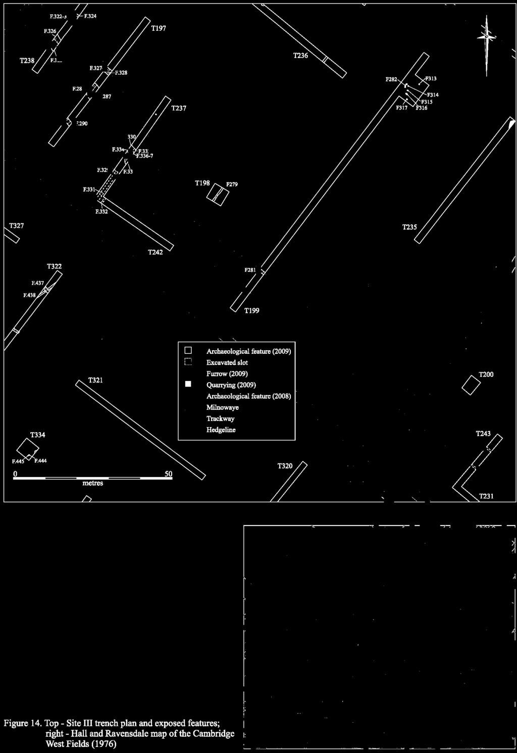
40 most extensive settlement evidence to be identified at Site II, however, is Early Roman in date, and appears to have directly followed on from the Late Iron Age occupation. At this time, a settlement was established which flanked a central track or droveway. This track followed an identical alignment to the ditch previously identified at Site I, to which it may well have connected; crop-mark evidence, combined with the trenching results outlined above, indicates that it most probably terminated at the edge of the clay plain. In this respect, therefore, it reflects a widespread pattern at the site, in that a number of features were found to have been deliberately sited so as to demarcate the boundary between the area s differing geological zones. This implies that the free-draining gravels (for settlement and agriculture) and heavy clay soils (for pasture) were both being exploited at this time. Furthermore, the identification of Roman pottery and abundant oyster shell around the Trinity Conduit springhead (Lucas & Whittaker 2001, 20) also suggests that the settlement extended some distance to the southeast. Ceramic evidence indicates that activity did not continue at Site II beyond the end of the 1 st century AD. Site III Site III is situated in Field 115, and lies only a short distance to the north of Site II (Fig. 8). It is principally Medieval in date, but also contains features that are most probably Iron Age and Roman in origin. The topography of the area is relatively level, and lies at around 23.5m OD. Although a trench was excavated in close proximity to this site in 2002 at the Old Field Laboratory, Huntingdon Road no archaeological remains were identified at this time (Hatherly 2002). Features were first encountered in the area within Trenches 13 and 20, which were excavated as part of the initial trench-based evaluation of the project-area in October 2008 (Armour 2008). The results of this work have been incorporated below. Subsequently, the area was fieldwalked in November 2008, but no positive results were obtained (Anderson & Hall 2008). The site was not subject to a geophysical survey. Altogether, a total of 28 features, distributed across six trenches (Nos. 13, 20, 197, 231, 237 and 242), have been investigated at Site III (Fig. 14). Of this group, four features (or 14.3% of the total) contained datable material. The features are broken down by type in Table 6 below. Feature Type No. Excavated Linear 23 Pit 5 Posthole 1 Total 29 Table 6: Excavated features at Site III by type. The most important result of the 2008 investigation in this area was the identification of a distinct road or trackway, which was encountered in Trench 20. Here, a northwest-southeast aligned metalled surface, [044], was found to have been flanked by roadside ditches F.17-F.19. A minimum of two phases of re-establishment were represented: once infilled, the northern ditch F.19 had been overlain by an additional area of metalling, whilst the southern boundary of the trackway (F.18) had been re-cut by F.17. The latter 32
41 feature contained two fragments of Early Roman pottery, although these are most likely to have been residual. During the present phase of evaluation, further elements of the trackway were identified in six separate trenches (Nos. 197, 199, 231, 237, 238 and 243), although no additional metalling was present. To the east of Trench 20, gullies F.283 and F.284 were investigated in Trench 231. These were both 0.45m wide and 0.11m deep, and continued into Trench 243 (where they were unexcavated). Additional evidence of the road s alignment was identified to the west, where ditches F.281 in Trench 199, F.330, F.333 and F.334 in Trench 237, F.288, F.327 and F.328 in Trench 197 and F.322-F.324 in Trench 238 were investigated. These features varied between 0.51m and 1.49m in width and 0.08m and 0.73m in depth, and contained homogenous deposits of mid greyish brown silty clay with occasional gravel inclusions. Further evidence of the re-cutting and re-establishment of the roadside ditches was identified, again comprising a minimum of two phases of activity. It also became apparent that these features were not continuously present along the entire route, as gaps were identified in Trenches 199 and 237. Furthermore, a distinct kink in the road s alignment was discerned, beginning a short distance to the east of Trench 237 (Fig. 14). Only one feature associated with the trackway, ditch F.330 in Trench 237, contained dating evidence. This consisted of two sherds of 12 th century St Neots-type Ware, weighing 4g, indicating that the feature is most probably Medieval in date. Sealed beneath the roadside ditches were a number of earlier features. In Trench 231, for example, gully F.284 truncated pit F.285, while in Trench 237, ditches F.330 and F truncated an intercutting cluster of pits comprising F.335, F.336 and F.337. Unfortunately, none of these earlier features contained datable material. During the 2008 evaluation, however, a ditch had been identified in Trench 13 that contained Iron Age pottery. This feature, F.13, was aligned northwest-southeast and measured 0.35m in width by 0.26m in depth. Yet, as it contained only a small quantity of Iron Age material, it is not entirely clear whether this remained in situ or occurred residually. Elsewhere at Site III, additional features were identified which appear to have been contemporary with the period of the trackway s use. In the first instance, the irregular form of parallel gullies F.331 and F.332 in Trench 237 when taken in conjunction with their northeast-southwest alignment suggests that they may have comprised part of a Medieval hedge-line, sub-dividing a small area of pasture from the surrounding open fields. Interestingly, these features also appear to have respected the alignment of ditch F.290/F.329 to the north (in Trenches 197 and 237 respectively). This latter feature appears to represent a continuation of the southern boundary ditch of the trackway, and may perhaps mark its original route prior to the introduction of the kink mentioned above. Finally, one feature was investigated which clearly postdated the active usage of the Medieval trackway. This consisted of pit F.287, which was over 5m in diameter and truncated roadside ditch F.288 in Trench 197. Therefore, although this pit contained two sherds of Late Iron Age/Early Roman pottery, it is most likely to have been excavated following the enclosure of the former open fields in the post-medieval period (a process which almost certainly led to the disuse of the Medieval access route). 33
42
43 Finds Assessment Reports A relatively small assemblage of material was recovered from Site III. This includes Iron Age, Roman and Medieval pottery, fired clay, faunal and environmental remains. Iron Age and Roman Pottery Katie Anderson Four sherds of pottery were recovered from Site III, weighing 69g. This comprised two Late Iron Age/Early Roman sherds (in Trench 20) and two sherds dating to the mid 1 st -3 rd century AD (in Trench 197). Medieval Pottery Richard Newman with David Hall Two sherds of Saxo-Norman pottery were recovered from ditch F.330. This consisted of two sherds of St Neots-type Ware, weighing 4g. Metalwork Grahame Appleby The only metalwork to be recovered from Site III consisted of the fragmentary remains of a single iron object of probable modern date. F.290, [820], <782>. Very fragmentary parts of a thin-walled galvanised (?) bucket/pail or kettle, with rolled rim. 19 th or 20 th century; weight 140g. Faunal Remains Vida Rajkovača Only two features at this site yielded animal bone material, both of which were Medieval in date. Pit F.285 produced a single cattle-sized limb shaft fragment. On the other hand, ditch F.287 contained a possible semi-articulated sheep skeleton. 25 ovicaprid specimens were recorded, seven of which were positively identified as sheep. Based on their size and age (12-18 months), it is suggested that the specimens all come from the same animal. Taxonomy NISP MNI Ovicaprid 18 1* Sheep 7 - Cattle-sized 1 - Sheep-sized 1 - Total 27 Table 7: Number of specimens identified to species (or NISP) and minimum number of animals (MNI) for Site III (*denotes the articulated specimen). Environmental Remains Anne de Vareilles The five litre sample recovered from Medieval ditch F.287, [827], generated a small 4 mililitre flot that contained very few charred remains, a little charcoal and one spelt glume base (Triticum spelta). Dried waterlogged duckweed (Lemna sp.) and stinging nettle (Urtica dioica) seeds, and a few shells from the fresh water snail Lymnaea truncatula testify to a once waterlogged context. Full details are presented in Table 8 below. 35
44 Sample Number 21 Context 827 Feature 287 Feature type Ditch Phase/Date Medieval Sample volume - litres 5 Flot volume - mililitres 4 Flot fraction examined - % 100 med. charcoal (2-4mm) - small charcoal (<2mm) ++ vitrified charcoal - Cereal grains Total whole grain count 0 Cereal chaff Triticum spelta glume base spelt chaff 1 Total glume base count 1 Non cereal seeds Urtica dioica L. Common Nettle +++ WL Lemna sp. Duckweeds + WL Total seed count (grass frags and WL seeds not included) 0 Fresh water mollusca Lymnaea truncatula + Modern rootlets P Table 8: Plant macro-remains and mollusca from the bulk soil samples at Site III (key: - 1 or 2, + <10, , +++ >50 items, WL = waterlogged; P = present). Discussion The layout of the probable trackway encountered at Site III corresponds almost exactly with the documented route of Milnewaye (or Mill Way), a small Medieval road that led from the rear of Howes Crofts (see further Site IX) to the gravel pits in Grithow Field (Hall & Ravensdale 1976, 36). From there, a path led down to St Neots Way, which represents the forerunner of present day Madingley Road. This route is known to have been in existence by c as it is recorded at that time in the Terrarium Cantabrigiae, or Corpus Terrier, a document recording the tithes due from the West Fields of Cambridge (ibid.). It is therefore highly likely that a number of, if not in fact the majority of, the linears identified at Site III are Medieval in origin. This is especially true of F.288, F.322-6, F.327, F.328, F.330 and F.333, as these features correspond to a small kink in the road s course that was created as it deviated around the hedges of Spalding s Close (Fig. 14). Indeed, elements of this hedge-line itself also appear to be present in the form of F.331 and F.332, but it is also clear that a minimum of two phases of trackway are represented. Whilst it is entirely possible that both are Medieval in date, it is a striking coincidence that the projected route of the Roman trackway first identified at the Vicar s Farm site to the south (Lucas & Whittaker 2001, 43) also corresponds very closely to the 36
45 southern section of Milnewaye (as was originally noted in Armour 2008, 20-21). Furthermore, the possibility of a second Roman trackway extending out towards Site III from Site IV to the west, and thus connecting that site to the present route, will also be discussed below. It is therefore possible although it remains highly conjectural that the Medieval road may represent the fossilisation of a much earlier access route across the North West Cambridge landscape. The small number of earlier features which became at least partially sealed beneath the trackway are most probably associated with the northern fringe of Site II, which is situated directly to the south of Site III. This group includes probable Iron Age ditch F.13 in Trench 13, as well as undated pits F.335, F.336 and F.337 in Trench 237, and F.285 in Trench 231. Site IV This represents the largest and most complex site to have been identified during this evaluation; it contains stratified features dating to between the Late Bronze Age and later Roman periods. The site is situated towards the centre of the project-area, on the western edge of the gravel ridge, and extends across the northeastern corner of Field 112, the western half of Field 114 and the majority of Field 113 (Fig. 8). Topographically, the area slopes gradually from the northeast to the southwest, descending from a maximum of 23.8m OD on the gravel ridge to 16.1m OD on the fringe of the clay plain below (Fig. 3). Features were first encountered at the site within Trenches 6 and 16, which were excavated as part of the initial trench-based evaluation of the projectarea in October 2008 (Armour 2008). Subsequently, the area was fieldwalked in November 2008, although no positive results were obtained (Anderson & Hall 2008). Finally, a portion of the site was also subject to geophysical survey in December 2009, which proved to be very effective (Figs. 2 & 18). The results of all of these projects have been incorporated below. Taking the earlier discoveries into account, a total of 122 features have been investigated at Site IV; these were distributed across 29 trenches (Nos. 6, 16, 96, , 126, 127, , , 145, 146, 152, , 162, 164, 180, 183, 184, 188, 189, 197 and 199; Figs ). Out of this group, 65 features or 53% of the total contained datable material. The features are broken down by type in Table 9, below. Feature Type No. Excavated Linear 89 Pit 17 Posthole 9 Pit/linear 3 Pit/well 2 Surface/layer 1 Inhumation 1 burial Total 122 Table 9: Excavated features at Site IV by type. 37
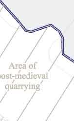
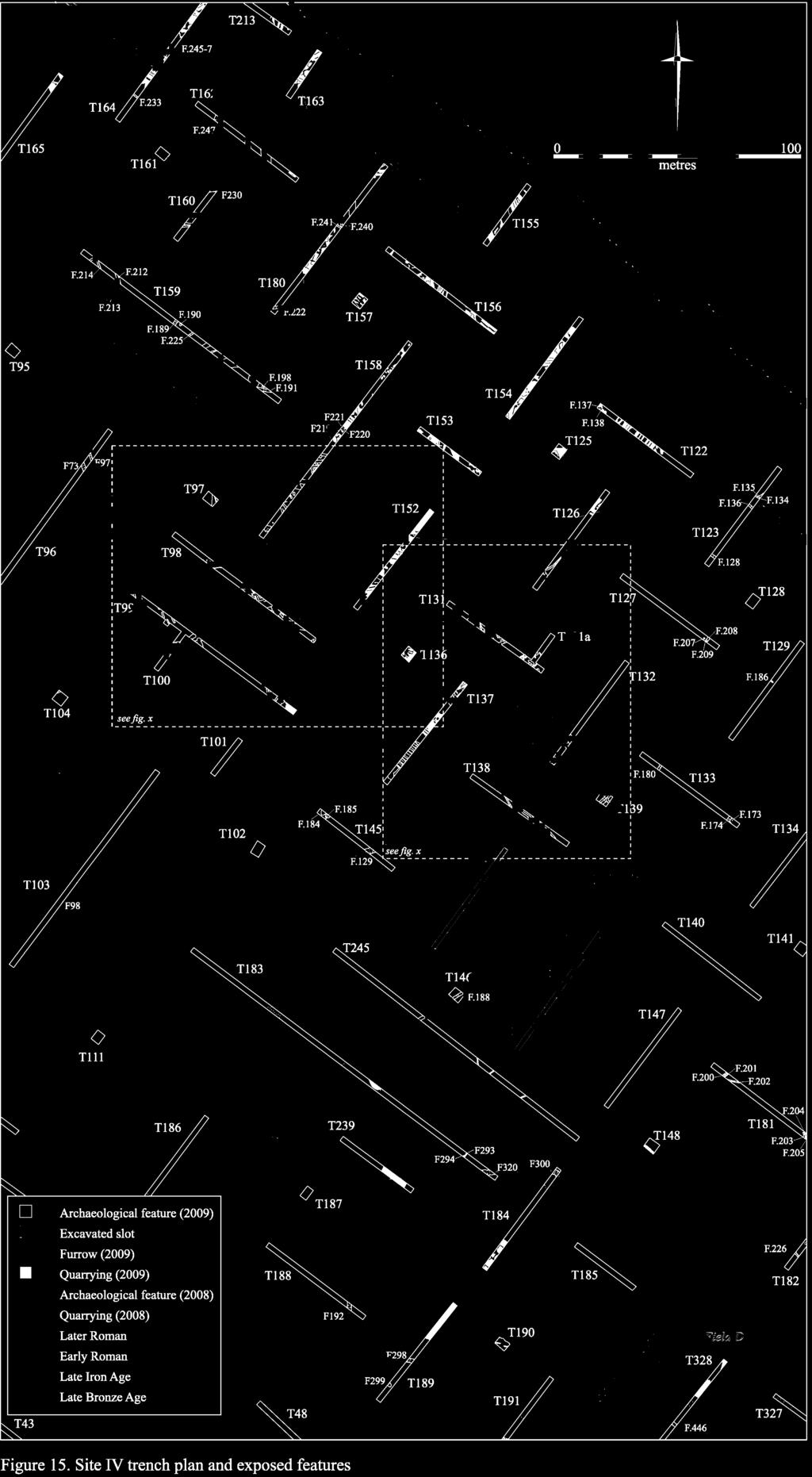
46
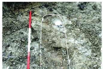
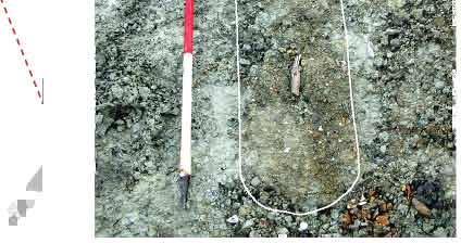
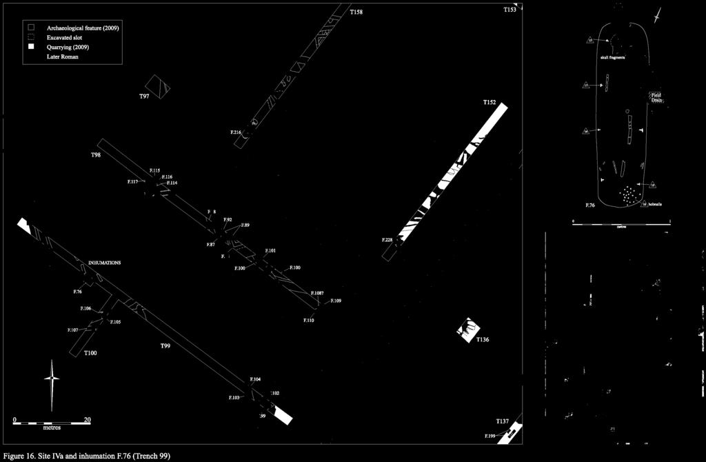
47
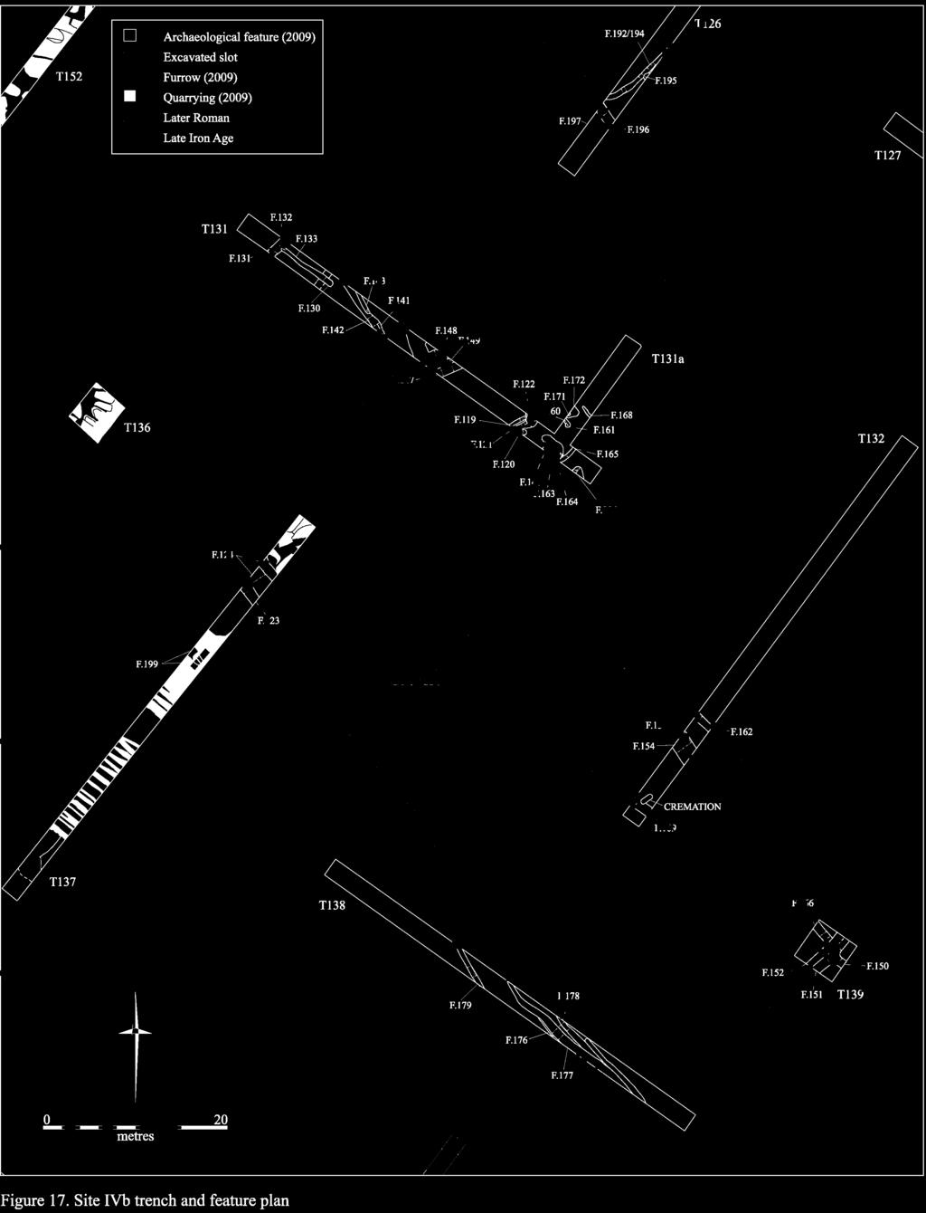
48
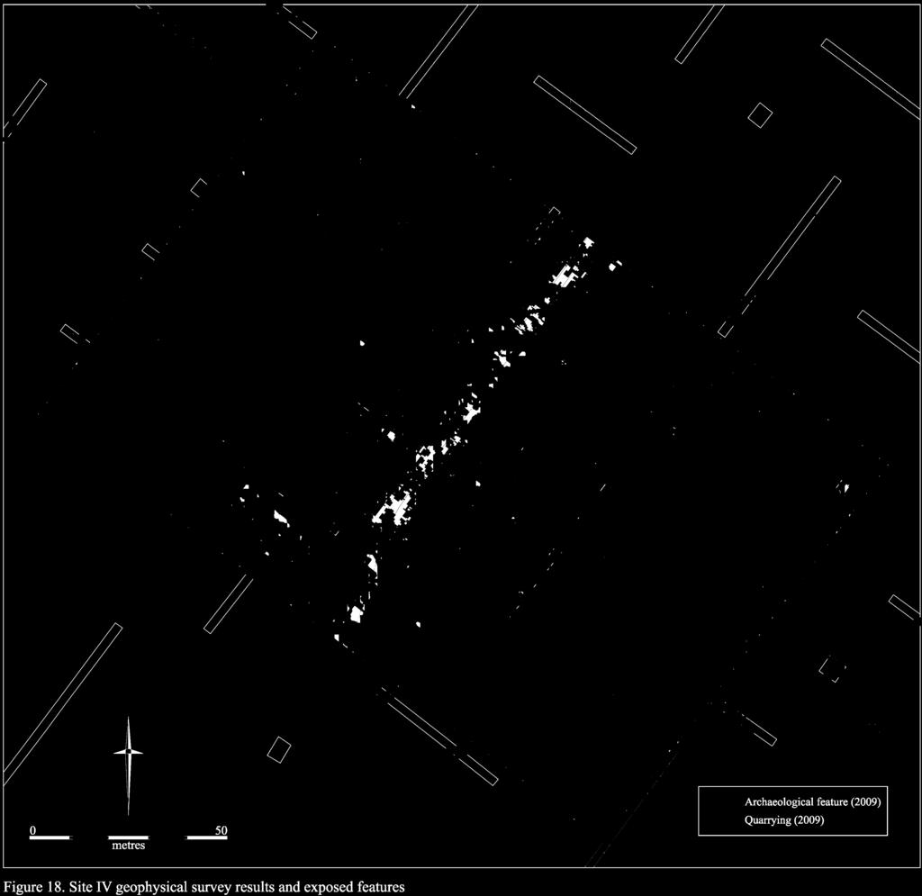
49
50 Altogether, five periods of activity have been identified at Site IV. The earliest of these is represented solely by small quantities of Mesolithic flint and Early Neolithic pottery, which occurred residually within later features (see further the specialist assessment reports, below). No clear pattern could be discerned in the distribution of these artefacts, and the quantity of activity they represent appears to be very low. The earliest stratified feature to be identified consisted of small pit F.2 in Trench 16. Late Bronze Age in date, this contained 65 sherds of pottery, weighing 1398g, which represent around one third of a large tripartite storage jar, as well as elements of at least one other vessel (see the Prehistoric Pottery assessment, below). The only other material of this date to be recovered from the site comprised five small and abraded sherds from gully F.180 in Trench 133 to the north, however, which appear most likely to have been residual. It therefore appears that the degree of Late Bronze Age activity undertaken at Site IV may have remained relatively minimal. During the Late Iron Age, in contrast, the level of activity appears to have increased. A minimum of two small enclosures were established in this period, with elements of one of these being identified in Trenches 6 and 16. Here, ditches F.6 and F.10 appear to have comprised part of an irregular suboval enclosure, whose long axis was oriented east-northeast by westsouthwest (thereby incorporating earlier pit F.2). Both ditches contained small quantities of Late Iron Age pottery. A little way to the north, in Trench 126, a similarly irregular gully F.192/F.194 was identified which also contained Late Iron Age material and may have comprised part of a second enclosure. A further sherd of Late Iron Age pottery, which occurred in association with two fragments of human skull, was recovered from the surface of an unexcavated ditch in Trench 245. The continuation of this feature into Trench 146 immediately to the north, where it was excavated as F.188, contained 2 nd - 4 th century AD pottery, suggesting that the earlier material may perhaps have been residual. Finally, an additional, undated enclosure was also identified at the southern end of the site. Occupying much of the eastern half of Field 113, this consisted of ditches F.292 in Trench 188, F.298 in Trench 189, F.300 in Trench 184 and F.320 in Trench 320. The enclosure which is roughly square in form was oriented north-south/east-west; it measured approximately 80m across, and its constituent elements varied between 1.83m and 2.58m in width and 0.49m and 0.81m in depth. Whilst, on the one hand, its regularity suggests that it is unlikely to be Iron Age in origin, the absence of domestic refuse within its fills also implies that it does not comprise part of the extensive later Roman presence in the area; it is therefore most probably Early Roman in date. This interpretation is supported by the identification, a little way to the north, of an Early Roman ditch on an identical alignment. F.129 in Trench 145 contained 65 sherds of Early Roman pottery (weighing 710g), and lay only a short distance from pit/well F.12 in Trench 6, which contained 61 sherds (weighing 1215g). Furthermore, four further 2 nd -3 rd century features in this area pit F.163 in Trench 131, metalled surface F.124 in Trench 137, ditch F.154 in Trench 132 and gully F.179 in Trench 138 also contained small quantities of residual Early Roman material. These results indicate that, during the 1 st century AD, a small settlement was probably present at the southern end of the site. During the 2 nd century, however, this was to expand markedly to the north. 42
51 Two principal zones of intensive activity have been identified during the Later Roman phase at Site IV, the layouts of both of which have been greatly illuminated by the results of the geophysical survey. The first of these is located in the northeastern portion of the site (Fig. 15). As can be seen in Figure 17, this area is principally dominated by a rectilinear network of ditches that appear to have formed part of a quadripartite, or four-part enclosure. Elements of all four quadrants were identified archaeologically; the apparent absence of a southwestern quadrant in the geophysical survey of the area is perhaps attributable to truncation or disturbance by post-medieval quarrying activity (as was identified in Trench 136, immediately to the south). In the first instance, in the centre of Trench 131, the northeastern arm of the central junction of the system was investigated. This was found to consist of three phases of ditch F.147, F.148 and F.149 which varied between 1.13m and 1.35m in width, and 0.28m and 0.8m in depth. No clear chronological distinction could be distinguished between the phases, however, as all three contained 2 nd -3 rd century AD pottery. In addition to the central axis, the northeastern, northwestern and southwestern sides of the enclosure were also identified (comprising F.196 in Trench 126, F.131 in Trench 131 and F.123 in Trench 137 respectively). These features were each found to be consistent with the size and profile of the central ditches, and contained material of a similar date, but did not appear to have been re-cut. This suggests that contemporary activity may have been largely focused upon the interior of the enclosure, where it is notable that limited investigations in each quadrant revealed a number and variety of features. Within the northeastern quadrant, a small sub-enclosure was identified. This consisted of a series of gullies, whose details are broken down in Table 10. The northwestern and southeastern sides of the enclosure were formed by F.119 and F.165, while a possible entrance was identified to the northeast that was defined by gully F.160 and posthole F.161. A further gully, F.168, was also present on this alignment. There appear to have been at least two phases to the system, as additional gullies F.120 and F.121 were inserted to the northwest following the truncation of F.119 by pit F.122. Although the size and form of the enclosure is potentially consistent with the layout of a small building, the irregular profile of its constituent gullies as well as their variability in size implies that it most probably formed part of a stockade or similarly segregated area. A structure of some kind was clearly present nearby, however, as F.121 contained a fragment of crudely squared Millstone Grit that had probably been utilised as a piece of walling (see the building stone assessment report, below). Three further fragments of burnt building stone were also present, whilst five fragments of Roman tile were recovered from the immediate vicinity. Feature Orientation Length (m) Width (m) Depth (m) Associated Pottery Date 119 ENE/WSW 1 ex ENE/WSW nd -3 rd century AD 121 ENE/WSW 1 ex nd -4 th century AD 160 NNW/SSE 0.43 ex nd -4 th century AD 165 ENE/WSW 1.05 ex nd -3 rd century AD 168 NNW/SSE 1 ex nd -3 rd century AD Table 10: Constituent elements of the sub-enclosure system in Trench
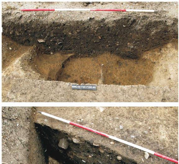
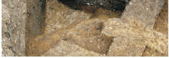
52
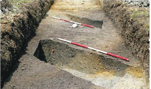
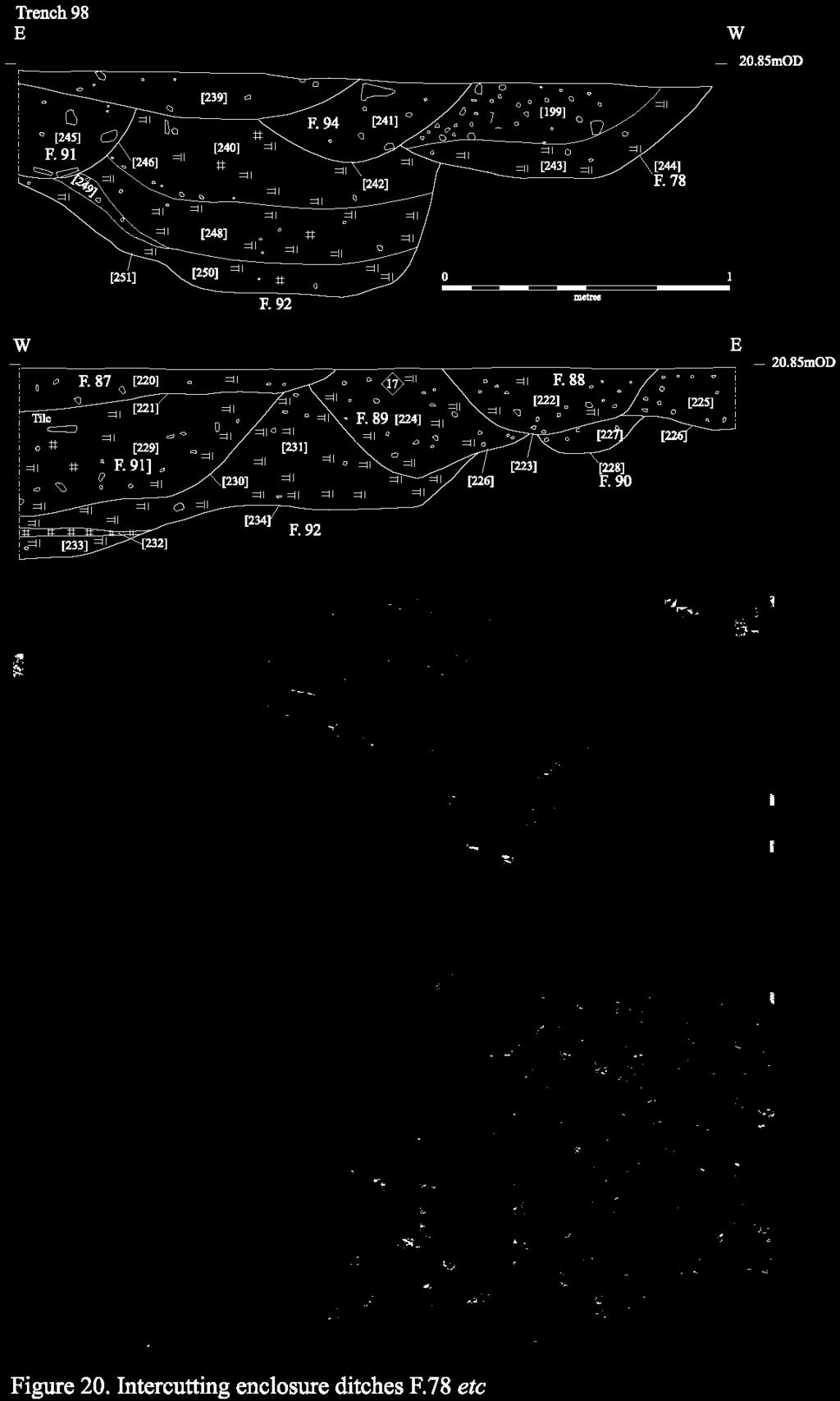
53
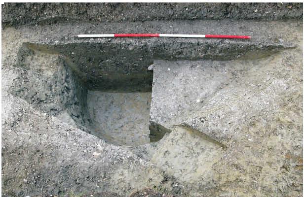
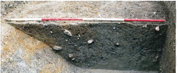
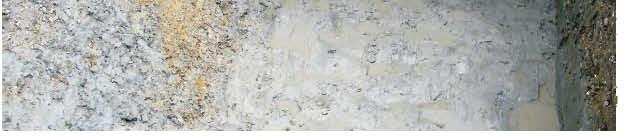
54
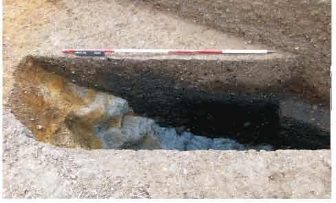

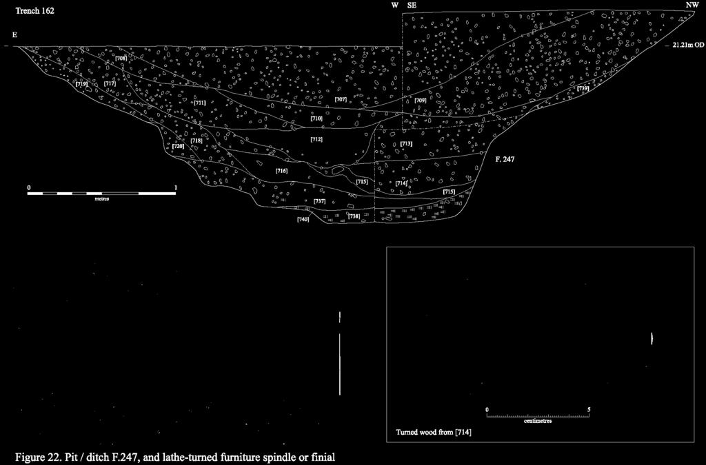
55
56 Contained within, and partially truncating, the small enclosure were a series of intercutting pits. To the southeast, a group consisting of F.139, F.140, F.163 and F.164 was investigated (Fig. 19). Altogether, these features contained 108 sherds of 2 nd -3 rd century pottery, weighing 2152g, as well as a probable candlestick fitting (which was recovered from F.163). A quantity of Early Roman material was also present within the basal fills of the latter pit, although this had most probably been redeposited following the disturbance of an earlier feature. On the northwestern side of the sub-enclosure, a further pit was present (F.122; see Fig. 19) whilst, immediately to the northeast, two additional pits F.171 and F.172 were also investigated. All of these features contained near identical 2 nd -3 rd century material, whilst F.122 also contained a significant environmental assemblage (see the environmental remains assessment, below). A very similar pattern of activity was also identified in the southwestern quadrant of the main enclosure, where gullies F.130 and F were investigated. These appear most likely to have comprised elements of a similar sub-enclosure system, which again consisted of at least two phases (interestingly, the latest phase represented by F.142 contained residual Early Neolithic pottery). A different pattern was identified in the southeastern quadrant, however, where a metalled surface was identified. This layer, F.124, clearly respected external boundary ditch F.123 and was up to 0.2m deep; its banded nature suggests that it was most probably re-laid on at least one occasion. Although it appears to have formed part of a yard or other external surface, few other details could be recovered due its truncation by extensive post-medieval gravel quarrying activity. The final quadrant in the system, which formed the northeast corner of the enclosure, comprised the least investigated archaeologically; although it fell partially within the southwestern end of Trench 126, no features were identified in this area aside from a Medieval furrow. The geophysical survey of the area, however, revealed this quadrant to be perhaps the most densely occupied of the four (Fig. 18). Towards the centre of the quadrant, a sub-rectangular arrangement of features was detected that may represent the remnants of a building, a further sub-enclosure or perhaps a dense cluster of pits. It is thus clear that the fourpart enclosure as a whole formed part of an intensive Roman settlement. All of the dating material that was recovered from it indicates that it was occupied during the 2 nd -3 rd centuries AD, although its precise chronology awaits further determination. Equally clear, however, is the fact that this enclosure formed only a small part of a much larger settlement. A very similar pattern of features was encountered further to the east, for example, in Trenches 132 and 139. The former contained a minimum of three ditches (F.155, F.162 and F.169) which broadly extend outwards from the central alignment of the enclosure. Notably, the southwesternmost of these ditches, F.169, was partially truncated by a cremation burial. This feature, which measured 1.35m by 0.6m in extent, was covered with a visible scatter of cremated bone; it was not excavated, but preserved in situ. Burials on the periphery of Roman settlements are by no means uncommon, and often form discrete cemeteries of varying size and complexity. Therefore, although it is not entirely clear in this case whether further burials are present in the near vicinity, the presence of a cemetery must be considered a distinct possibility. In this context, it is also of note that lying immediately to the west of the cremation are a series of rectilinear anomalies that were detected during the 48
57 geophysical survey (Fig. 18). Although these have been interpreted as being potentially structural in origin, it is also possible that they represent regularly laid-out enclosures associated with organised mortuary practices. Continuing further to the east, the central junction of four 2 nd -3 rd century rectilinear ditches F and F.166 was investigated in Trench 139. Out of this group, one ditch (F.166) appears to have comprised the continuation of F.155 from Trench 132, whilst the network as a whole could potentially represent part of a second four-part enclosure; however, no further elements of this system were identified in any of the surrounding trenches. The final significant element to be examined in this area comprises a probable trackway, lying immediately south of the features outlined above. The northern boundary ditch of this trackway is clearly identifiable in the geophysical plot, where it connects to the southern edge of the main quadripartite system (Fig. 18), whilst the southern boundary was identified archaeologically in Trenches 137 and 138. In the former trench, ditch F.199 had been heavily truncated by later gravel quarries (but, notably, remained at least partially extant beneath them), whilst three irregular intercutting gullies F followed the same course in Trench 138. The rather sinuous form of these latter features, which varied between 0.55m and 1.45m in width, and 0.1m and 0.16m in depth, could perhaps represent quarrying of the underlying gravel to provide (and, later, to maintain) a metalled surface to the path. To the south of the trackway, a number of geophysical anomalies are present. With the exception of a curvilinear anomaly to the south, which is potentially Iron Age in date, the majority of these anomalies appear to represent outlying elements of the large feature complex lying to the west; this is the second of the two areas of intensive archaeology to be examined. Archaeological activity in the western area, which falls within the northeastern corner of Field 112, is noticeably much denser than that which has previously been described to the east (Figs. 15 & 16). Although the nature of the underlying geology appears to have partially hindered the results of the geophysical survey undertaken in the southern portion of this zone (as it is comprised of a mixed and homogenising blend of gravel and clay), the results remain impressive and reveal a great density of features. Firstly, in the southernmost trench to be excavated in this area (Trench 99), a series of features lying on the fringe of the settlement were identified. One of the most significant of these is grave F.76. This was rectangular in form, measuring 1.83m by 0.52m in extent, and contained a very poorly preserved but regularly laid-out extended and supine inhumation (see the human remains assessment report, below). Unfortunately, the burial which was oriented north-northwest by south-southeast had been very heavily disturbed by later agricultural activity (Fig. 16). Nevertheless, a series of eight equidistantly distributed coffin nails were identified, along with 23 hobnails (demonstrating the presence of footwwear). The inhumation is most probably Roman in date. That it comprised part of a larger cemetery is demonstrated by the fact that at least three further graves were identified in this trench, lying to both the north and east of F.76. None of these additional graves were excavated, however, as there was no evidence that they had been disturbed. The cemetery appears to have been situated within, and oriented parallel to, a double-ditched enclosure. Elements of this enclosure comprising ditch F.105, which was later re-cut by F.106, and ditch F.107 were excavated in 49
58 Trench 100, immediately to the south of Trench 99. They were found to vary between 0.68m and 1.02m in width and 0.21m and 0.47m in depth, and contained a small quantity of 2 nd -4 th century AD pottery. Unexcavated portions of the enclosure continued to both the north and east in Trench 99. Further to the north, in Trench 96, a continuation of this double-ditch alignment (comprising part of either the same, or a directly succeeding, enclosure) was also identified. Here, in addition to pottery dating to the 2 nd -4 th century AD, the western ditch F.73 was found to contain animal remains representing a minimum of three horses, several cattle, two ovicaprids and one dog (see the faunal remains assessment report, below). The eastern ditch, F.97, produced no finds. Elsewhere in Trench 99, elements of at least one further enclosure, lying to the southeast of the cemetery, were identified. At the southeastern end of the trench, the presence of ditches F.99, F.102 and F.103 (which was re-cut as F.104) indicates that activity also extended in this direction. Indeed, although few details are clearly discernable in the geophysical survey data recovered from this particular location, it is still apparent that F.103/F.104 comprised part of a grid-like system of enclosures extending on a broadly north-south axis between Trenches 99 and 98. Furthermore, elements of this system are much more clearly represented archaeologically in the latter trench than in the former. For example, towards the centre of Trench 98, the corner of a large and frequently re-cut enclosure was identified; investigations revealed that this boundary was comprised of a sequence of at least eight ditches (see Table 11, below). Feature Orientation Length (m) Width (m) Depth (m) Associated Pottery Date 78 N/S 1 ex nd -4 th century AD 87 N/S 1 ex nd -3 rd century AD 88 N/S 1 ex nd -4 th century AD 89 N/S 1 ex nd -4 th century AD 90 N/S 1 ex N/S 1 ex nd -4 th century AD 92 N/S 1 ex nd -3 rd century AD 94 N/S 1 ex nd -3 rd century AD Table 11: Constituent elements of the principal enclosure sequence in Trench 98. Within this group, a minimum of three distinct phases are represented (on the basis that at least two stratigraphically separate ditches may have been open at any one time). The first phase consisted of F.90 and F.92, which were then succeeded by F.78, F.89, F.91 and F.94. Finally, the sequence was capped by F.87 and F.88 (Fig. 20). Notably, all of the ditches were backfilled with relatively large quantities of domestic refuse. This included a total of 330 sherds of pottery, weighing 4461g, although all of the assemblage dated to the 2 nd -3 rd centuries AD and no stratigraphic differentiation could be determined (see the pottery assessment report). Fragments derived from three separate quern stones, as well as a rubbing stone, were also recovered (see the worked stone assessment report). In addition, all three phases were found to contain slag and metalworking debris, including fragments of vitrified clay that were most probably derived from the rim of a hearth or tuyere (see the slag and metalworking debris assessment). This evidence indicates that iron smithing was probably being undertaken in close proximity to Trench 98, and that this activity continued for a relatively prolonged period of time. Such a conclusion 50
59 is reinforced by the presence of additional fragments of slag recovered from contemporary features located at both the southeastern (F.101 and F.110) and northwestern (F.112) ends of the trench. Other finds included nine fragments of Roman tile from F.87, as well as two fragments of Collyweston roof tile. Three further fragments of the latter material were recovered from F.91 and F.92, whilst nine additional ceramic tile fragments were recovered from Trench 98 as a whole. This evidence provides a strong indication that a relatively substantial building or group of buildings was located in the near vicinity, an impression which is complemented by the recovery of a squared-off fragment of rotary quern that appears to have been re-used as a building stone, as well as a further (burnt?) building stone, from ditch F.228 in Trench 152 immediately to the northeast. This feature also contained a small quantity of slag. To the south of the main enclosure in Trench 98, an additional enclosure extending at right-angles to its larger counterpart is represented by the presence of ditch F.101. Furthermore, this feature had in turn truncated an earlier double-ditch alignment, the northern arm of which (F.100) was also investigated (Fig. 21). Both features were found to contain 2 nd -4 th century AD pottery. At the very southeastern end of Trench 98, a further ditch F.110, which was flanked by postholes F.108 and F.109 was also present. These features appear to represent yet another phase of enclosure, and were found to contain 2 nd -3 rd century AD pottery. A similar pattern of multiple, and potentially overlapping, phases of activity was also identified at the northwestern end of the trench. Here, a double alignment of V-shaped ditches consisting of F.111 and F.114 had been recut at least once (by F.112 and F.115 respectively). The northernmost ditch was then truncated by large pit/well F.113, which measured 2.32m in diameter and 0.85m deep (Fig. 21). The presence of a vertical edge within the fill sequence of this feature indicates that it was originally revetted, although the lining appears to have been removed prior to its being backfilled in the 2 nd -3 rd century AD. A small pit, F.117, finally capped the sequence in this location. A little way to the north, in the southern half of Trench 158, the density of features was if anything even more intense (Fig. 16). The presence of discrete clusters of postholes, as well as probable beam-slots and numerous intercutting gullies and pits, indicates that this area is situated in an area of intensive settlement. This interpretation is supported by the fact that numerous surface finds were recovered from this area, including around half of the rim and the top of the neck of a cylinder or prismatic glass bottle, two well preserved nummi of Constantine II (Emperor AD ) and six fragments of riveted copper alloy sheet, which appear to have been derived from a thin-walled vessel or decorative object. A number of sherds of 2 nd -3 rd century AD pottery, including several large fragments of Samian Ware, were also identified. Because of the density of the relevant features, and the incomplete plan of their layout and relationships that was afforded by a trench-based investigation, this group was preserved in situ. A single feature pit F.216, which was located at the southeastern end of the trench was investigated, but was found to contain no material culture. The features identified in Trench 158, as well as those previously discussed from Trenches 98 and 99, correspond to the densest cluster of anomalies to be revealed by the geophysical survey of the area. The presence of numerous intercutting phases 51
60 of enclosure system can be identified in the unevaluated area, as well as several very strong anomalies that most probably represent structures and/or centres of industrial activity. It is therefore clear that a significant archaeological resource is represented. Yet it is equally important to note that evaluation trenches excavated to the northeast of the surveyed area demonstrate that activity also extended for some distance in this direction. In Trench 159, for example, two ditches of significant size representing elements of at least one north-south/east-west aligned enclosure were identified. These ditches appear most likely to represent complex sequences of re-cutting and re-establishment, similar to that previously identified in relation to the principal enclosure in Trench 98; for this reason, they were not excavated. A number of smaller, sub-enclosure ditches were also present in this trench, however, and these were investigated. Examples include F.191 and F.198 at the southwestern end of the trench, as well as F.189, F.212 (recut by F.213) and F.214 to the northeast. All of these features correspond to the dominant grid-like alignment of the enclosures previously identified to the south, and several of them once again contained 2 nd -3 rd century pottery. The same pattern also continued into Trench 157 (where ditches F.222, F.240 and F.241 were identified), as well as Trench 160 (where ditch F.230 was investigated). The most significant demonstration of the continuation of contemporary settlement activity up to (and potentially beyond) the northern boundary of Site IV was identified in Trench 162, however, which is located approximately 120m to the northeast of the surveyed area. Here, three large features were identified, all of them aligned broadly north-south. To the east, two ditches were present (but were not excavated); to the west, a large pit/ditch (F.247) was investigated (Fig. 22). This latter feature, which measured 3.9m in width and was 1.22m deep, contained a sequence of 24 fills, several of which were waterlogged. It had moderately sloping concave sides, and its base which cut into the Gault clay underlying the gravel of the ridge and was irregular and uneven due to the constant seepage of groundwater. Although many of its fills appear to represent episodes of natural silting, these were interspersed with opportunistic disposals of domestic refuse material. In all, 261 sherds of pottery, weighing 4906g, were recovered; this represents the largest assemblage to be derived from a single feature anywhere in the project-area. All of the material dated to the 2 nd -3 rd centuries AD, and included a range of finewares such as East and Central Gaulish Samian Ware as well as Nene Valley colour-coated sherds (see the pottery assessment report). Fragments deriving from at least one glass cup with trailed lip decoration were also recovered (see the glass assessment report), as well as an important assemblage of environmental material (see the environmental remains assessment). The most significant find, however, comprised a piece of worked wood from one of the waterlogged basal deposits. This was cylindrical in form, with inscribed decoration, and had been turned on a lathe (Fig. 22; see also the worked wood assessment, below). It most probably comprised part of the leg or arm of a piece of furniture, such as a chair or couch. The presence of so much material including fragments of high-status artefacts such as glass cups and wooden furniture clearly indicates that a significant settlement was situated in close proximity to this trench, at the northernmost end of the site. 52
61 Finds Assessment Reports A substantial assemblage of material was recovered. This includes prehistoric and Roman pottery, glass, worked wood, metalwork, building stone, worked stone, building material, fired clay, mortar, slag, human remains, faunal remains and environmental remains, as well as a small quantity of residual worked flint. In particular, the worked wood is of notable significance, whilst the Roman pottery assemblage is also of substantial size. Flint Lawrence Billington Four flints were recovered from Site IV. A piercer made on a blade blank from ditch F.129 is a residual Mesolithic or earlier Neolithic piece; further possible Neolithic activity is suggested by a fine narrow flake from F.300. Modern ditch F.196 produced a thermally fractured natural flint that had been retouched to form a scraper probably relating to later prehistoric activity. Prehistoric Pottery Mark Knight In total, 75 sherds of prehistoric pottery, weighing 1435g, were recovered from Site IV (see Table 12, below). Pit F.2 produced 65 sherds, weighing 1398g (MSW 21.5g). The majority of the fragments belonged to a large tripartite storage jar with a crudely finished, almost piecrust everted rim. Around a third of the vessel was present, although only about 20% of its rim was amongst the assemblage and none of its base. Its extremely hard fabric and angular form is indicative of a Late Bronze Age/Early Iron Age form. A small out-turned rim sherd with possible incised decoration indicated the presence of more than one vessel. The remaining material included five fragments of an Early Neolithic Mildenhall bowl from F.142 and five fragments of a Late Bronze Age/Early Iron Age vessel from F.180. The Mildenhall sherds were heavily abraded and plain but incorporated an expanded rim form typical of the southern decorated carinated bowl tradition. Two pieces of base angle in F.180 appeared to confirm its Late Bronze Age attribution. Fabric descriptions are presented in Appendix 1. Feature Context Number Weight (g) Fabric Table 12: Prehistoric pottery from Site IV. Iron Age and Roman Pottery Katie Anderson The largest quantity of pottery from the evaluation was recovered from Site IV. This totalled 1717 sherds, weighing 28538g and representing EVEs. The group included 61 sherds (1215g) from the 2008 evaluation (Armour 2008), including 40 sherds (1060g) from F.12. The pottery dated to the Early Roman period (mid-late 1 st century AD) and included two semicomplete (albeit with refits) carinated jars and two large sherds from a buff-sandy flagon. Evidence of Late Iron Age/Early Roman activity was also found during the 2009 evaluation. F.129 (Trench 145) contained 65 sherds weighing 710g and representing 0.79 EVEs. Several of the fills within this ditch contained pottery, although there was no apparent difference in date between material from upper and lower fills, with all of the pottery dating to the Late Iron Age and Early Roman periods. This included a Late Iron Age grog-tempered jar and a highly burnished body sherd from a Late Iron Age fineware vessel. F.124 (Trench 137) and F.154 (Trench 132) contained small quantities of pottery, which was Late Iron Age/Early Roman in date. 61 sherds of pottery, weighing 1170g and representing 1.21 EVEs, were recovered from F.163, Trench 131. This feature was a pit with three fills, all of which contained pottery, and is one of the few features from this site where the pottery shows a stratigraphic difference. The 53
62 two lower fills, [434] and [435], contained pottery dating to the mid-late 1 st century AD, which included a rilled jar and an everted rim beaker. The pottery from the upper fill, [433], was all 2 nd -3 rd century AD in date, with no residual material. This therefore suggests that the pit was dug in the Early Roman period and then left open at least until the 2 nd /3 rd centuries AD. This pit formed part of a cluster of pits, which varied in terms of the quantity of pottery, as well as date. 89 sherds weighing 1700g and representing 1.67 EVEs were recovered from F.139. The pottery was predominately 2 nd -3 rd century AD in date and included a poppy-head beaker, two Nene Valley mortaria and one Central Gaulish Samian Dr33 cup. F.122 contained 30 sherds of pottery (237g, 0.98 EVEs), which had a date range of 2 nd -4 th century AD, although a 2 nd -3 rd century AD date is more appropriate given the lack of any definite late Roman material. Vessels identified included two Central Gaulish Samian vessels, including a Dr33 cup, both dating to the 2 nd century AD. 34 sherds (531g) were recovered from F.164, including a beaded bowl. The pottery from this feature was 2 nd -3 rd century AD in date. Finally, F.140 contained 13 sherds weighing 421g and dating 2 nd -3 rd century AD. It is therefore interesting to note that, with the exception of F.163, all of the pits in this cluster which contained pottery were 2 nd -3 rd century AD in date. Furthermore the other pits also produced pottery from a single context, thus it is unclear whether the remaining pits were dug in the Early Roman period and then filled, as with F.163, or whether they were dug and filled rapidly, at some time during the 2 nd -3 rd centuries AD. Part of an enclosure system comprising ditches and their re-cuts was also identified. Pottery was recovered from several of the features in varying quantities (Table 13, below). A relatively large quantity of pottery was recovered from these features, although the number of sherds from individual features was not as much as seen in other features (see below). Despite good stratigraphic evidence, the pottery could not date the features any more closely. Feature No. Wt (g) EVEs Date x 2 nd -4 th century AD nd -3 rd century AD x 2 nd -4 th century AD x 2 nd -4 th century AD nd -4 th century AD nd -3 rd century AD nd -3 rd century AD TOTAL Table 13: Pottery from enclosure ditches in Trench 99, Site IV. F.87, F.91 and F.92 contained the largest collections of pottery from this enclosure. F.92 contained 96 sherds (1404g) with a mean weight of 14.6g, which was collected from six different contexts. The pottery from the different contexts showed no apparent difference in date, with a broad 2 nd -4 th century AD date for all of the contexts; however, given the lack of any definite late Roman wares, a 2 nd -3 rd century AD date is perhaps more appropriate. Three vessels were noted as having heavy limescale on the interior, consistent with the vessels being used to hold water. The composition of the assemblages from F.87 and F.91 was very similar, including several Horningsea greyware sherds, shell-tempered sherds and four East Gaulish Samian sherds (later 2 nd -3 rd century AD). A further ditch or pit, F.247, contained 261 sherds weighing 4906g and representing 7.83 EVEs, from 14 different contexts. All of the material dated to the 2 nd and 3 rd centuries AD and included a range of finewares and coarseware vessels, such as seven East Gaulish Samian sherds, five Central Gaulish Samian sherds and nine Nene Valley colour-coated sherds. Overall, a range of vessel fabrics were identified in the assemblage from Site IV (see Table 14), comprising a greater variety than seen at any of the other sites, which is not unexpected due to the site s size and longevity. Coarsewares, in particular sandy greywares, dominated the assemblage representing 71% of the total. This included locally made fabrics from Horningsea. Finewares represented 8% of the assemblage, including locally made sherds as well as imported sherds (Central and East Gaulish Samian). 54
63 Fabric No. Wt (g) Baetican amphora Black slipped Buff sandy Central Gaulish Samian Colour-coat 7 52 Coarse sandy greyware East Gaulish Samian Fine sandy greyware Grog tempered 2 59 Greyware (Nene Valley) 3 35 Hadham BB 2 71 Horningsea GW Imitation BB Nene Valley GW 6 94 Nene Valley colour-coat Oxidised sandy Reduced sandy Sandy 8 54 Shell- tempered Wattisfield greyware 1 5 West Stow fine reduced 1 20 White-slipped Whiteware Whiteware (Nene Valley) TOTAL Table 14: All pottery from Site IV by fabric. A number of vessel forms were also identified (Table 15), including an amphora sherd. Jars were the most commonly occurring vessel form, as is typical, and this included a variety of shapes and sizes from small cooking jars to large storage jars. The assemblage showed evidence of vessels for the preparation, cooking, serving and storage of foods. Form No. Wt (g) Amphora Beaker Bowl Cup Dish Flagon Jar Lid 4 58 Mortaria Unknown TOTAL Table 15: All pottery from Site IV by form. The fabrics and forms identified are suggestive of a fairly typical domestic assemblage. Coarsewares dominated, with a much lesser quantity of finewares. The Samian assemblage from this site presented 4.1%, which is typical for rural sites in this area, of which Samian ware tends to make up 5% or less of the total assemblage. Most of the pottery is likely to have come from the local area, although the sites close proximity to the Roman road would have 55
64 meant that it had access to much wider trade networks. The pottery evidence from Site IV suggests the site began in the mid/late 2 nd century AD and was flourishing by the early 3 rd century AD. There is, however, no evidence of any definite Late Roman pottery, which suggests that the site had gone into decline by the mid/later 3 rd century AD. It remains, however, the largest site in terms of quantity of material, and is certainly the longest lived of all the sites from the evaluation. Glass Vicki Herring Site IV produced the most significant assemblage of Roman glass to be recovered from the North West Cambridge development. The group includes fragments derived from at least one cup (of 2 nd /3 rd century date), a cylinder or prismatic bottle and a piece of 1 st to 3 rd century cast window glass. F247, [710],<513> & <518> (2 nd /3 rd century context). Two refitting rim fragments and a body shard from <513> and a small rim fragment from <518>, are probably derived from the same cylindrical cup, 12cm in diameter. Free blown colourless soda glass. Vertical, fine rounded rim, with trailed green glass decoration. Cylindrical cups such as these were the most common form of drinking vessel in Britain prior to the 4 th century, although they appear most commonly in the 2 nd -3 rd centuries. Close parallels can be found at Verulamium, Hertfordshire, in a late 2 nd century well deposit (Price & Cottam 1998, 100), and from Periods 4-6 ( AD) at Colchester, with those from Period 4 ( AD) being the most comparable (Cool & Price 1995). Similar vessels were also recovered from excavations on Castle Hill (Alexander & Pullinger 2000, 107-8) and at the Vicar s Farm site (Lucas & Whittaker 2001 Volume II, 45-6). <917>, Trench 158 (Roman context). Around half of the rim and top of the neck from a cylinder or prismatic bottle, 11cm diameter. Free blown blue/green glass. Folded rim, almost horizontal in profile. Bottles with this rim type were very common in the last quarter of the 1 st century, with similar examples found at Stansted, Essex (Price & Cottam 1998), though the prismatic forms were longer lived and are most common at Colchester from the late 1 st to the late 2 nd century (Cool & Price 1995). Bottles were common utility vessels of varying sizes used for transport and storage rather than as tableware. Occasionally, larger examples have been known to be re-used as cinerary urns (Price & Cottam 1998), as indeed occurred in the case of two 2 nd century cremations identified within the grounds of Girton College only a little way to the north in the late 19 th century (Hollingworth & O Reilly 1925; Liversidge 1977, 15-16). It is thus possible that this vessel has been disturbed from an earlier burial, although given its location a domestic origin seems likely. [510], <430> (post-medieval quarry). Window glass fragment. Light (natural) blue/green glass. 2-6cm thick. Cast. Scratch marks on one side suggest grozing. Cast window glass was commonly, locally produced from the 1 st century AD onwards though was gradually replaced by cylinder blown glass from the 4 th century. Worked Wood Richard Newman A simply decorated lathe-turned wooden object, which is comprised of a single piece of timber that appears to be at least partially broken at both ends, was recovered from waterlogged context [714] in 2 nd -3 rd century pit/ditch F.247 (SF 25). The central portion of the artefact consists of a cylindrical shaft, which is 144mm long and has a raised 11mm high lip at either end that measures 115mm in diameter. The outer faces of both lips bear simple inscribed decoration in the form of a circle, whilst projecting outwards from either side of the central bulb are two much narrower continuations of the shaft. These measure 53mm in diameter, less than half the width of the central portion of the piece, and clearly comprise the weakest points of the artefact. Indeed the ends of both projections are highly irregular, and appear to have been broken in antiquity. Overall, the object is 212mm long. This artefact clearly represents a fragment derived from a larger object. Whilst the nature of that object cannot be determined with certainty, it is quite possible that it comprised a piece of furniture such as a chair or couch. Although known survivals of wooden furniture are rare, examples have previously been identified, primarily in mainland Europe (cf. Liversidege 1955; Croom 2007). Additional information on the subject has also been derived from pictorial representations of furniture depicted in contemporary friezes and sculptures. Many of the items that are so described contain elements that are remarkably similar to that recovered from F.247. Indeed, it has been noted, for example, that the legs of Roman beds and dining couches... were distinctive elements, invariably freestanding, vertical, and, unlike table legs, turned instead of carved freehand (Ulrich 2007, 233). Furthermore, 56
65 In some instances the turned legs of Roman beds exhibit such curvaceous profiles that it seems impossible they were capable of supporting their own weight. Here, clearly the woodworker has employed a kind of sleight of hand, for the secret of expecting such tenuous spindles to bear a heavy load was the insertion of an iron rod through the vertical axis of the turned leg (ibid.). Tellingly, no evidence of such sleight of hand is visible with the current specimen. Nevertheless, it clearly represents a fragment derived from a well-made decorative artefact whether that be a relatively prosaic piece of furniture designed to imitate a more high-status (and perhaps technologically advanced) item, or some other object whose use has yet to be determined and is therefore of some significance. Metalwork Grahame Appleby with Andrew Hall Site IV produced the largest metalwork assemblage to be identified from the evaluation of the North West Cambridge site. In total, 79 items were recovered; of these, eight were composed of copper alloy, the remaining 71 of iron. Two significant groups of artefacts have been identified. The first of these was derived from a densely intercutting cluster of probable settlement-related features in Trench 158, whilst the second was associated with a coffined inhumation in Trench 99. Both groups are Roman in date. Group 1: eleven items were recovered via the metal detecting of a discrete cluster of intercutting features in Trench 158. Notably, the group included two nummi of Constantine II (born AD 316, Emperor ). <729>, SF 20. Fine example of a nummus. Constantine II: Obverse Laureate bust left holding globe surmounted by victory, inscribed FL IVL CONSTANTIVS NOB C; reverse BEATA TRANQVILLITAS and alter inscribed VOTIS XX with globe on top. Mint mark STR: Treveri (Trier, Germany). Diameter 18.47mm, weight 3g. <730>, SF 21. Probable nummus of Constantine II. Two soldiers and two standards on reverse. Usually inscribed GLORIA EXERCITVS. Diameter mm, weight 2g. Also present were six fragments of riveted copper alloy sheet, which may have derived from a thin walled vessel or decorative object. <731>, SF 23. Six fragments of copper alloy sheet, less than 1mm thick. The largest piece, 39.26mm long and 3g in weight, consists of two pieces riveted together; the four rivets are rectangular in cross-section and hammered flat. Total weight 4g. The fragments have a dark green patina. These pieces are possibly from a thin walled vessel or decorative object. Finally, three iron objects were recovered. At least one of these, however, is probably modern in date. <792>, SF 18. Corroded, complete, but relatively large, square cross-sectioned nail; length 64mm, weight 11g. Object is delaminating undated. <793>, SF 22. Corroded rectangular lump; 19mm x 22mm, weight 7g. Undated. <794>, SF 24. Corroded, tapering curved bar; length 54.86mm, weight 19g. Probable fragment from agricultural machinery (e.g. harrow tine). Group 2: the second group of objects was directly associated with a coffined inhumation (F.76) in Trench 99. This burial clearly comprised part of a larger cemetery. Five regularly spaced coffin nails were recovered, and iron stains indicate that at least three further nails had originally been present. 23 hobnails were also recovered from the area of the feet, indicating the presence of shoes or sandals. <749>. Fragment of square cross-sectioned tapering bar, almost certainly a nail, probably from a coffin; length 23.4mm, weight 3g. <787>, <788>, <789>, <791>. SF no. s (in order), and 17. These four nails are of similar appearance, corrosion and size. With relatively short tines/shanks, c. 22mm in three cases (the fourth <789> is missing the tine), and two clenched examples, these are likely to be of the same date; weight 3 to 6g. Coffin nails. <790>, SF 16. Collection of 23 domed hobnails with short tines, several clenched over, from a shoe or sandal, recovered from a partially exposed inhumation burial. Total weight 28g. Hobnails are 57
66 common items from Roman funerary and settlement contexts, with numerous examples known from sites around Britain. In addition to the items previously discussed above, a further 40 objects were also recovered from Site IV. These are entirely composed of iron artefacts, although the majority of them some 23 items comprise undiagnostic nail fragments. Amongst the remainder, however, significant Roman finds include a probable candlestick fitting from pit F.163 and a possible arrowhead from ditch F.87. F.73, [190], <747>. Small complete square cross-sectioned nail. Length 26.1mm, weight 2g. Possible coffin nail. A further undiagnostic nail fragment, 46mm long, was also recovered. F.78, [199], <748>. Small rectangular fragment of bar 22.7mm long, 17.8mm wide and 7.56mm thick; weight 9g. Unidentified. F.87, [239], <754>. Four items: a) small collar, diameter 22.23mm, internal diameter c. 8.4mm, weight 17g; b) fragment of hook or loop, weight 29g; c) fragment of nail, length 28.6mm, weight 3g; d) small square cross-sectioned bar 24.3mm long, 2g. [220], <750>. Small square cross-section bar with pyramidal-shaped point. Length 40.1mm, weight 6g. Possible small arrowhead, although nail fragment is equally plausible. F.89, [224], <751>. Small, rectangular cross-sectioned bar. Length 33.9mm, weight 11g. F.91, [229], <752>. Small, rectangular cross-sectioned bar, bent at one end possible nail; length 45.2mm, weight 8g. [245], <755>. Rectangular bar, 39.33mm long, weighing 17g. Unidentified. F.92, [247], <756>. Curved rectangular bar with rounded end and transverse break; length 65.95mm, weight 23g. Found with four nail fragments (L mm; L. 60.4mm;, L. 38mm; L. 51mm). An additional nail fragment, L. 39.3mm, was also recovered from [233], <753>. F.100, [264], <758>. Relatively thick square cross-sectioned hook, length 54mm, weight 40g. Possibly from a swivel joint, chain or looped bolt (cf. Jackson 1998, 65; cat. no. 286). F.101, [268],<759>. Two nail fragments; L. 31.2mm; L. 76.2mm. F.113, [306], <762>. Two blade fragments. The larger fragment has part of the haft surviving, and is probably double edged; length 103.7mm, c. 24mm wide, weight 39g. The second fragment has a pale purplish to brown patina, is flat, measuring 54.85mm long and weighing 15g. At one end is an irregular transverse break. The other end is round, almost billhook like, with a curved aspect to it, not dissimilar to iron scalpel blades of the Roman period; however, this is unlikely in this example due to the widening above the end of the blade. Also two nails: <760>, [304], L. 51mm; <761> [305], L. 46mm (bent). F.121, [334],<763>. Nail fragment, L. 48.3mm. F.124, [349],<765>. Nail fragment, L. 39.4mm. F.130, [366],<766>. Nail fragment, L. 45mm. F.139, [343], <764>. Two nail fragments; L. 18.2mm; L. 25mm. F.140, <916>, SF 28. Corroded flat triangular (leaf-shaped) object with tine/haft, 89.68mm long, 34mm wide, weight 43g. Requires x-ray for further identification; unknown function. F.161, [445],<771>. Nail fragment, L mm. F.163, [433], <767>. Probable candlestick fitting with straight stem and out curving barb. Similar to that described in Manning (1988, 98 & P1). Length c. 136mm. A nail fragment, L mm, was also recovered from [434],<768>. F.164, [437],<769>. Three nail fragments; L. 36.9mm; L. 30.2mm; L. 30.8mm. F.165, [439], <770>. Three nail fragments; L. 40mm; L. 54.2mm; L. 38mm. F.196, [529], <772>. Heavy rectangular fragment of iron roughly 51mm square, 10.2mm thick and weighing 100g. Probably a fragment from a piece of machinery. [612], <775>. Small complete domed hobnail, length 11.3mm, weight 1g. Roman. 58
67 Worked Stone Simon Timberlake Six saddle quern fragments were recovered from Roman contexts at Site IV. Of particular note in this group is the high incidence of querns made of Old Red Sandstone, suggesting perhaps an early date for the start of this trade from the West Country, one which may be associated with the route of the Icknield Way (as suggested by Shaffrey (2006); see discussion below). Little is really understood of the reasons for the continuation in use of much earlier quern types contemporary with the introduction of rotary hand mills in the later Iron Age. Perhaps, however, this relates to the dual or changed function of saddle quern types from cereal grain milling to other types of milling and food preparation within the domestic context. Another consideration is whether or not this represents the difference between poor and wealthy households co-existing within these Romano-British settlements. The burning of discarded quern, either as a result of its re-use as hearth stone, or else as a deliberate attempt to fragment this to produce rubble for walling, foundations or road metalling, appears to be a common enough witnessed phenomena within Cambridgeshire Roman and Romano-British rural settlements, a good example of this being the South Cambridgeshire site of Babraham (Timberlake et al., forthcoming). F.78, (199), <240>, Trench 98, 2340g. 190mm x 120mm x 50mm. A sub-rectangular flat-topped quern composed of a dense, hard, laminar orthoquartzitic sandstone; possibly fabricated from a sarsen boulder of quartzitc sandstone derived from the Lower Tertiaries or Lower Greensand rocks of Southern England. The form of this quern is rather crude, yet it does show some signs of shaping (i.e. knapping to form a bevel) around at least two of the edges; the latter probably to facilitate the process of milling. The shape and size of this piece suggests that originally the stone was larger, but then this broke (or else was broken) into two. The location of polish wear on the slightly dished (concave) grinding surface seems to suggest a considerable period of quern use subsequent to the breakage of the larger stone. There is some evidence to suggest that the stone was burnt prior to its discard. (236) a, <275>, machining of F.78 etc in Trench 98, 2822g. Four broken but adjoining fragments of a saddle quern of Old Red Sandstone (Devonian). This is composed of a pebbly grit facies with prominent sub-rounded to rounded quartz vein clasts (4-50mm diameter, but typically <20mm). A probable origin for this stone could be South Wales, Forest of Dean or the Welsh Borders. Grinding surface 190mm x 210mm, the saddle quern is wedge-shaped with a flat rather than slightly depressed surface. (236) b, <275>, machining of F.78 etc in Trench 98, 980g. A single fragment of a probable broken saddle quern composed of a pale quartzitic sandstone, almost certainly from the Lower or Upper Greensand (Cretaceous). If the latter, this could be from the Blackdown Greensand (Devon), though quite possibly this may be from a southern Lower Greensand source such as Lodsworth in Sussex. The larger area of surviving grinding surface is approx 80mm x 80mm, though evidently the underside of this stone was also used for grinding. Of this only an area of 20mm x 30mm survives. The much larger grinding surface is well worn and smooth, and more or less flat, though a very slight concavity (dishing) in this stone is detectable. There is a very slim possibility that this is a central and non-diagnostic fragment of an early beehive-type rotary quern. (236) c, <275>, machining of F.78 etc in Trench 98, 790g. An ovoid subspherical fragment of a possible rubbing stone. Quite a coarse lithology; a polymictic sandstone conglomerate with subangular to sub-rounded lithic clasts, probably a facies of Old Red Sandstone. Approx. 100mm diameter. If a rubbing stone, then this has a surprisingly coarse grind surface. Five rotary quern stone fragments were also recovered from Roman contexts at Site IV. Almost all of these are derived from quernstone types and lithologies that are commonly found on Roman and Romano-British settlements in Cambridgeshire. These include Millstone Grit handmill querns quarried and transported from the Southern Pennines extraction sites for which have been identified at Wharncliffe Edge and Hathersage, Derbyshire (Peacock 1988) imported Niedermendig lava quern from the quarries of Mayen in the Eifel District of the Rhineland most of which came through the port of Colchester and westwards along the Via Devana (Lucas & Whittaker 2001; Horter et al. 1951) then, on settlements with a Conquest Period or Late Iron Age origin, the continuing use of beehive puddingstone querns, most of the latter quarried near Abbington Piggots in Hertfordshire (Curwen 1941; Wilkes & Elrington 1978; Peacock 1987). This trade in beehive pudding-stone querns may have passed northeastwards along the Icknield Way into East Anglia, and then perhaps north and westwards into the Fens along the tributaries of the River Ouse. The location of Cambridge at the junction of a number of major transport routes east-west and north-south may be significant in this respect. What is altogether much more unusual for Cambridgeshire/ East Anglian sites is the appearance of quernstone which is clearly from quarried sources in the west of England. This includes examples made from Old Red Sandstone sandstone- 59
68 conglomerates. The typology, production sites and distribution of these querns is dealt with more fully in Ruth Shaffrey s study on Romano-British rotary querns and millstones made from Old Red Sandstone (2006). In this she notes the existence of the extremity of distribution including some Hertfordshire (St.Albans), Bedfordshire (Sandy) and East Anglian distributions linked to the easterly passage of the Icknield Way. F.121, (334), <348>, Trench 131. Crumbs of a disintegrated piece of Niedermendig lava quern (weight 18g). F.122, (337), <357>, Trench 137. Two fragments of Millstone Grit quern, one certainly part of the outside rim of a large rotary quern (probably the lower stone). Weight 2484g; area of grind surface 170mm x 100mm.Given the considerable thickness of this (85mm), and almost imperceptible angle of curvature of the quern rim, it seems likely that we could be looking at an original millstone of approx 700mm diameter. Sub-concentric and quite worn parallel sets of grind furrows are visible on the upper surface of this stone. The quern fragment shows clear signs of having been burnt, including reddening of the matrix and sooting of the surface. It seems likely that this was broken up in a fire following its discard as a quern and subsequent re-use in the surround of a hearth (or else its deliberate fragmentation to produce rubble hardcore for foundations or metalling). The smaller gritstone fragment (316g; 80mm x 60mm x 50mm thick) exhibits no identifiable characteristics. F.163, (434), <410>, Trench 131. Weight 360g. 130mm x 60mm x 10-25mm thick. A single fragment of very worn rim of a thin rotary quern of Niedermendig lava. The thinness of this stone and the almost flat grind surface confirms this to be a fragment of the upper quern (rim of) a Roman or Early Medieval example of hand mill. There is no evidence here for any furrow sets cut into the grinding surface. In some respects this example is much more like one of the thin Early Medieval querns of the stone; however, this could be Roman, given that furrows are not really necessary for grinding when using a porous vesicular lava stone. In fact traces of pick-point dressing on the upper surface of the stone can be seen. The rest of the worn and much thinned stone has crumbled or broken away at the point where this becomes thinner some 70mm in from the edge. The projected original diameter of the stone may have been around 360mm 400mm. F.127, (335), <354>, Trench 137 (a Medieval furrow that truncated a number of Roman features). A fragment of the upper stone of a small flat-topped early Romano-British domestic type rotary quern (see Curwen 1937) made from Old Red Sandstone (Devonian) rock (Shaffrey 2006, Type 1). The latter consists of a fine grained gritty and slightly pebbly sandstone (weight 950g with a grinding surface 160mm x 120mm in area, and between 30-40mm thick). The upper (flat) surface has been dressed with the point of a small pick tool (a fairly standard practice), but interestingly the grinding surface has not been cut (furrowed). The surface does however exhibit a circular (concentric) wear pattern, and towards the rim, a fine polish. The lack of specialist stone dressing may indicate a poorer domestic settlement context, or else simply an earlier Romano-British date (Curwen 1937, ). Building Stone Simon Timberlake A total of nine stone fragments of roofing tile/slate were recovered, almost all of them made from local Collyweston Slate. The use of this material, which was imported from quarries in the Stamford area of Lincolnshire, suggests the presence of fairly high status buildings at the site. The fragments were exclusively clustered in Trench 98. F.87, (239), <283>, Trench small fragment of Collyweston Slate. F.91, (229), <267>, Trench 98, 68g. 2 fragments Collyweston Slate. F.92, (247), <293>, Trench 98, 52g. 3 fragments Colyweston Slate. (248), 38g. 2 fragments Collyweston Slate. F.110, (294), <323>, Trench 98, 124g. 1 slightly worn fragment of Collyweston Slate. Up to 13 fragments of building stone were also identified at Site IV. Within this small assemblage is the evidence for the re-use of burnt and broken-up quern stone as building stone, such as might have been used in foundations or walling. Interestingly, none of these fragments were recovered from Trench 98, where the concentration of Collyweston roof tiles had previously been identified (although Trench 152 is situated in relatively close proximity). F.121, (335), <353>, Trench 131, 1294g. A fragment of a crudely-shaped (squared) block of Millstone Grit (100mm+ wide x 130mm+ long x 80mm thick), probably part of a piece of walling, but with no evidence of adhering mortar. The friable nature of this, and slightly reddened patina on one face, suggests it may have been burnt. Origin: imported stone (perhaps alongside quern) from the 60
69 Southern Pennine area. (334), <349>, 262g. 3 small fragments of burnt (reddened) Millstone Grit were also present. These were possibly part of a building stone or else a discarded quern. F.228, (626), Trench 152, <476>, 754g. A fragment of worked stone (rotary quern) made of Millstone Grit, which has one bevelled edge, which seems then to have been squared off and reused as a building stone (100mm x 100mm x 50mm). (626), <447>, 956g. 8 fragments of broken and crumbly oolitic limestone. Jurassic but not obviously from Eastern England (i.e. Lincolnshire), though still could be. Not from Barnack area. Possibly originally part of a single piece of building stone (perhaps a freestone), this appears to have broken up following burning. Ceramic Building Materials Grahame Appleby A total of 31 fragments of Roman tile, weighing 3.6kg, were recovered. This included six imbreces (weighing 1022g), six tegulae (weighing 1562g) and two pilae (weighing 463g). The remaining 17 fragments (weighing 569g) were undiagnostic. The largest concentrations were identified in Trenches 98 and 131. A total of seven fragments of fired clay, weighing 47g, were also recovered from Site IV. The majority of the material was undiagnostic, although one small fragment (weighing 3g, measuring 17.3mm x 18mm and recovered from F.300) preserved a rounded corner angle; this piece may be a fragment of structural daub. Finally, a single fragment of Roman mortar was recovered from F.87 in Trench 98. This is pale grey in colour, with a relatively high sand content and friable (weight 58g, measurements 42mm by 50mm). Slag and Metalworking Debris Simon Timberlake A total of 48 fragments of metalworking debris were recovered from Site IV, 90% of which consist of iron smithing slag. The presence of lumps of vitrified clay, and also scrap smithed iron debris, supports the idea that this is secondary iron smithing and that it probably also represents debris from the immediate locality. Significantly, the findspots of the material were tightly clustered in the southeastern corner of the site. In the first instance, a significant group of material was recovered from an intercutting sequence of enclosure ditches: F.87, (220), <250>, Trench 98, 14g. 1 fragment of vitrified clay, possibly part of the rim of a smithing hearth. (239), <282>, Trench 98, 112g. 3 fragments of iron smithing slag with charcoal incl. F.88, (222), <252>, Trench 98, 168g. 1 piece of iron smithing slag plus one scrap lump of smithed metallic iron (50x40x20mm: 138g). F.89, (224), <256>, Trench 98, 4g. 2 tiny fragments of vitrified clay; possibly part of rim of hearth or tuyere. F.91, (229), <264>, Trench 98, 74g. 2 lumps of iron smithing slag. F.92, (232), <272>, Trench 98, 48g. 1 fragment of fuel ash slag, possibly from an iron smithing hearth. (247), <292>, Trench 98, 56g. 2 fragments of iron smithing slag and one piece of fired and vitrified clay either lip of a hearth lining or fragment of tuyere. Suggests smithing hearth local to find site. (247), <757>, 342g. 1 piece of iron smithing slag; part of a small hearth base 100mm diameter by 60mm deep. (248), <298>, Trench 98, 14g. Small fragment vitrified clay with slag accreting to inside. Further material was also recovered from the same trench: F.101, (268), <310>, Trench 98, 1894g. 7 pieces of iron smithing slag; represents at least 4 hearth bases. Fuel (charcoal inclusions) and traces of gritted clay lining on some. Not very eroded - localised origin? F.110, (294), <322>, 862g. 6 fragments of iron smithing slag; part of one round smithing hearth base (120mm diameter and 40mm thick). Also 1 piece of corroded iron scrap (from smithing?). (296), <327>, 236g. 3 fragments of iron smithing slag, possibly part of proto-smithing hearth, high iron content. F.112, (303), <330>, Trench 98, 134g. 1 piece iron smithing slag. (235), <274>, Trench 98, 132g. 1 fragment of iron smithing slag. The only other material to be recovered from this site was derived from Trench 152, located only a short distance to the north of Trench 98: F.228, (626), <475>, Trench 152, 534g. 6 fragments of iron smithing slag. 61
70 Future archaeological work should endeavour to collect all of the slag assemblage and analyse this for make-up in order to determine whether these distributions represent areas of smithies. Where layers containing large amounts of iron slag are encountered, particularly where these are associated with beds of charcoal and scorched earth, care should be taken to look for relict or destroyed hearth evidence, whilst from these same deposits bulk samples should also be collected in order to sieve for the purposes of recovering hammer scale (where present); an indication perhaps of the proximity of a hearth and anvil. Human Remains Natasha Dodwell An extremely poorly preserved adult?male skeleton, [205], was identified in Trench 99. The grave, [206], was sub-rectangular in form and measured 1.9m long by 0.52m wide and 0.08m deep. The skeleton was buried in an extended, supine position aligned NNW-SSE with the head in the south end of the grave. The region of the skull and the left arm has been disturbed by a field drain. The only elements of the skeleton that survive are fragments of the right side of the skull and anterior mandible and small splintered fragments of the right humerus shaft and shafts of both lower limbs. No dentition survived. The cortical bone of the surviving elements is extremely abraded. Twenty-three hobnails were recovered from the foot region, and iron nails and stains close to the edge of the cut suggest that the body may have been buried in a coffin. The grave respected the alignment of a double ditched enclosure, as did three further probable (unexcavated) graves identified to the immediate north and west of grave F.76. In addition, two very small refitting fragments of subadult/adult-sized skull were also recovered from [992], the surface of an (unexcavated) Iron Age ditch in Trench 245. Faunal Remains Vida Rajkovača Site IV produced a relatively rich and well preserved faunal assemblage. Of 553 assessable fragments, 437 (79%) were assigned to element and further 211 (38%) to species. Domesticates dominate the assemblage, with a particularly high proportion of horses (38% of the identified species). Hand-recovered assemblages tend to be biased in favour of large, easily observed fragments and therefore the bones from larger species, whilst small fragments and therefore the bones from smaller species tend to be overlooked (Payne 1992). This assemblage is not an exception, having a high percentage of bones which were only possible to assign to a size category (Large, Medium and Unidentified Mammal) and that is due in part to the relatively high numbers of fragmented limb bones. The majority of features were Romano-British, with the exception of two features (F.129 and F.154) dated to the Late Iron Age/Early Roman period. These two have been considered and quantified separately (Table 16). During the Late Iron Age/Early Roman period, ovicaprids are the dominant species with sheep being positively identified. Two ageable specimens were recovered from F.154; a sheep mandible aged to 6-9 months and a dog scapula aged 0-6 months of age. A point of interest is a sheep metacarpal which had a polished appearance and had been perforated proximally. This type of bone working is not uncommon on Roman sites and there are suggestions that these objects have been used as straws to blow the marrow out of the larger, possibly cattle, bone shafts. Taxonomy NISP MNI Cow 5 1 Ovicaprid 7 1 Sheep 1 1 Pig 1 1 Dog 1 1 Cattle-sized 5 - Sheep-sized 4 - Total 24 Table 16: Number of specimens identified to species (or NISP) and minimum number of animals (MNI) for LIA/ER features from Site IV. 62
71 The great majority of bone was recovered from Romano-British features dated to the 2 nd to 4 th century AD, with a several contexts being dated to the 2 nd to 3 rd century. One context contained pottery dated to the 3 rd to 4 th century, giving this sub-set a later component. Although it is likely that there is more than one phase of activity represented, for the purposes of this report the Romano-British assemblage has been considered and quantified as a whole. This sub-set showed high fragmentation and the preservation ranged from moderate to quite poor, resulting in low percentage of specimens identified to species (37%). Taxonomy NISP MNI Cow 92 3 Horse 74 3 Ovicaprid 15 2 Sheep 6 2 Goat 1 1 Pig 6 1 Dog 1 1 Red deer 1 1 Cattle-sized Sheep-sized 74 - Mammal n.f.i Total 529 Table 17: Number of specimens identified to species (or NISP) and minimum number of animals (MNI) for Romano-British features from Site IV (abbreviation n.f.i. denotes the specimens that could not be further identified). This sub-set is dominated by the remains of livestock species, with a single red deer specimen being the only evidence for the exploitation of wild faunal resources. Cattle are the predominant species, which is in keeping with the period. Butchery evidence has been observed on 10 specimens (2%). Several different actions were noted: disarticulation, ribs which were cut to pot-sizes, and evidence for skinning are all present. In addition to this, a number of long bone shafts were axially (longitudinally) split, possibly for the processing of marrowfat. There are several points of interest regarding patterns of deposition that require further consideration. A slight discrepancy was noted in types of material being deposited in certain features. For instance, F.247 contained Roman glass, worked wood, considerable quantities of pottery and rich environmental evidence; however, faunal material was sparse amounting to only 18 specimens, five of which were possible to identify to species. Remains of cow, sheep and pig were recorded. Pit cluster F.122, F.140 and F.164 also produced large amounts of Roman pottery as well as an iron candlestick. As for the bone material, all three features together yielded only 12 bone fragments, two of which were identified as cow pelvis and scapula. Another interesting group of features has demonstrated the same pattern: the sequence of enclosure ditches F.78, F.87, F.89 and F.91 generated large quantities of Roman pottery and midden material but only small amounts of food waste. One feature in particular deserves special consideration, ditch F.73. This feature has yielded 347 assessable fragments, representing 66% of the whole sub set. In addition to this, all of the horse remains recorded in this sub set (NISP: 74; MNI: 3) were recovered from this feature. This feature produced a single measurable horse specimen providing some valuable biometrical information and, based on a complete third metacarpal, it was possible to produce shoulder height estimates. The horse was just under 14.2 hands high (147cm), which is at the bottom of the range and is considered to be a cut-off in height between what is considered to be a pony and a horse; however, the distinction between a pony and a horse takes account of other aspects of phenotype and appearance. Therefore, based on its shoulder height, this animal was pony-sized. Rackham quotes the size range for riding horses between 14.5 and 17 hands (1985, 23). Accordingly, this animal might have been a riding horse at the lower end of the size range. Remains of cattle were also found in large numbers, followed by two ovicaprid and one dog specimen. 63
72 The site is situated in a landscape of considerable archaeological significance near the centre of Late Iron Age and Roman Cambridge. At this site, faunal material from the Late Iron Age/ Early Roman period is rather sparse and beyond stating the representation of species, it is hard to discuss this sub-set any further; however, features dated to the Romano-British period produced large quantities of animal bone, compared to the earlier phases. Although larger, this sub-set lacked measuring and ageing evidence which has affected the possibility of bringing any conclusions about the social and economic aspects of animal keeping and consumption. Nevertheless, some suggestions about the broad economic principles and husbandry practices could be made. The Romano-British sub set is clearly predominated by the remains of cattle and horse, followed by ovicaprid. The high proportion of horse in this sub-set is interesting, especially as all of the horse remains come from ditch F.73, which is on the edge of the settlement and in relatively close proximity to an inhumation cemetery. A highly comparable pattern of deposition was observed at the contemporary Vicar s Farm site (Clarke 2001, 86) where cow and horse skulls, as well as other articulated or semi-articulated bones, were repeatedly deposited in pits located at the entrance to an inhumation cemetery. A similar pattern of species representation was also found during the excavation of a Romano- British villa/farmstead at Bottisham. This site had a much higher proportion of cattle and horse and very little sheep and other taxa (Baxter 2001). On the same site, larger waste was often disposed of in peripheral features. It could be proposed that the relatively high number of horse specimens was due to the site s roadside position. The predominance of sheep in the Iron Age is well-known, and some authors tend to refer to the Iron Age as the Sheep Age, before the Roman invasion prompted the return of the Cattle Age (Albarella 2007: 389). The preference for beef is believed to have come from the continent with Roman legions populating Britain (King 1999). The results from this sub-set fit well with the pattern recognised by King where Romanised and military sites have high proportions of cattle, compared to rural sites still continuing with the Iron Age tradition. It is crucially important to note that, however strong the agricultural intensification was at the end of the Late Iron Age, it can be said that it was partially subdued by the changes brought with the arrival of the Romans. There is also a further aspect of this assemblage that is considered to be Roman in character and that is high number of bone splinters. This type of butchery has been recognised at a number of Roman sites in the country (Maltby 1985), many of which were military in type. Some authors have suggested that the standard butchery practice was being established for the purpose of supplying the military and that professional butchers practicing in rural areas adopted this habit (Maltby 1989). Environmental Remains Anne de Vareilles Samples from one Late Iron Age and eight Romano-British features were analysed from the site (Tables below). Both carbonised and waterlogged plant remains were recovered. Of the two assumed waterlogged samples, only [737] from F.247 proved to be truly waterlogged. F.101, along with three of the other samples, contained a few surviving waterlogged seeds which point to a wetter past. The plant remains in F.140 were heavily burnt and often too fragmented to be identified. Snail shells were noted in all but F.247 and occurred in greatest quantities in F.89, where they show a shady, seasonally wet environment (see Table 22). Mollusc species and estimate counts are shown in Tables 20 and 21 below, but will not be discussed further in this report. Modern rootlets point to a low degree of bioturbation. Late Iron Age ditch F.154, [418], contained a little charcoal, two hulled wheat glume bases (Triticum sp.) and eight wild plant seeds make up the carbonised remains. Waterlogged seeds form three species have also survived. The samples recovered from Romano-British ditches F.78 [199], F.89 [224], F.101 [268], F.103 [276] and pits F.163 [435] and F.140 [131] contained few plant remains showing an expected scatter of loose crop processing and consumption debris. Romano-British Pit F.122, [340], in contrast, contained the richest charred plant assemblage seen across the North West Cambridge complex. The seven litre sample generated a large flot extremely rich in wheat glume bases. The latter are probably all spelt although poor preservation has precluded detailed identification in all cases. Despite the numerous grain fragments, chaff clearly dominates the assemblage. Wild plant seeds, including the common East Anglian Roman crop weed stinking chamomile, were also found in high numbers (Anthemis cotula an indication that clay-rich soils could now be cultivated thanks to the iron plough coulter). The assemblage represents waste from pounding, sieving 64
73 and hand-sorting harvests of spelt, presumably burnt en masse either in the pit or nearby and immediately discarded into the pit. Sample Number Context Feature Phase/Date LIA RB RB RB RB Sample volume - litres Flot volume - mililitres Flot fraction examined - % large charcoal (>4mm) med. charcoal (2-4mm) small charcoal (<2mm) vitrified charcoal - - Cereal grains Triticum spelta / diccocum spelt or emmer wheat 1 1 cereal grain fragments indet., mostly <2mm 9 Cereal chaff Triticum spelta glume base spelt chaff 2 Triticum sp. glume base glume wheat chaff 2 4 Ranunculusacris/repens/bulbosus L. Non-cereal seeds Meadow / Creeping / Bulbous Buttercup - WL Ranunculus Subgen. BATRACHIUM Crowfoot - WL Papaver sp. Poppy 1cf. +++ Urtica dioica L. Common Nettle WL Chenopodium sp. Gosefoot 1 Polygonum aviculare L. Knotgrass 1 Rumex sp. Dock 1 Rubus sp. Brambles - WL Potentilla sp. Cinquefoils 1 1 Sweet clover / Melilotus / Medicago sp. Medics 1 1 Plantago lanceolata L. Ribwort plantain 1 Odontites vernus (Bellardi) Dumort. Red Bartsia 1 3 Sambucus nigra L. Elder + WL Anthemis cotula L. stinking chamomile 1 1 Lemna sp. Duckweeds ++ WL Juncus sp. rushes +++ WL Large Poaceae (>4mm) large wild grass seed 2 1 medium wild grass Medium Poaceae (2-4mm) seed Small Poaecae (<2mm) small wild grass seed 1 Poaceae fragment indet. - wild or cultivated grass seed frag. 1 2 seed indet. (small cotyledon <2mm indet.) 2 (1) (6) Minimum total seed count (grass frags and WL seeds not included) Table 18: Plant macro-remains from bulk soil samples at Site IV (key: - 1 or 2, + <10, , +++ >50 items, WL = waterlogged; P = present). 65
74 Sample Number Context Feature Feature type Pit Pit Pit/Ditch Ditch Phase/Date RB RB RB RB Sample volume - litres Flot volume - mililitres Flot fraction examined - % large charcoal (>4mm) - med. charcoal (2-4mm) small charcoal (<2mm) vitrified charcoal + + parenchyma frags - undifferentiated plant storage tissue ++ Cereal grains Hordeum vulgare sensu lato hulled barley grain 10 Triticum cf. spelta spelt wheat grain 1 33 Triticum cf. dicoccum emmer wheat grain 2 Triticum spelta / diccocum spelt or emmer wheat Triticum sp. wheat type indet Triticum / Hordeum wheat or barley 31 Total whole grain count cereal grain fragments indet., mostly <2mm Cereal chaff Triticum spelta glume base spelt chaff 1 c T.spelta/dicoccum glume base spelt or emmer chaff 2 Triticum sp. glume base glume wheat chaff c Total glume base count 1 c germinated embryo, indet cereal indet. culm node cereal straw node 1 Non-cereal seeds Ranunculus Subgen. BATRACHIUM Crowfoot + WL ++ Urtica dioica L. Common Nettle WL Atriplex patula L./prostrata Boucher ex DC - Oraches Fallopia convolvulus (L.) A Löve Black bindweed 1 R. conglomeratus/obtusifolius/sanguineus - Dock 7 1 Rumex sp. Dock 8 seed of Knotweed Plygonaceae family 4 Brassica / Sinapis sp. Cabbages / Mustards 1 Lady'smantle/Parsley-piert Alchemilla / Aphanes sp. 1 Vicia / Lathyrus sp. 2-4mm Vetches / Wild Pea 3.5 Vetches / Wild Pea / Vicia / Lathyrus / Pisum sp. >4mm Pea 1 Medicago / Trifolium sp. medics or clover 2 8 Epilobium sp. Willowherbs 1 Odontites vernus (Bellardi) Dumort. Red Bartsia 1 2 Galium aparine L. Cleavers 1 Anthemis cotula L. stinking chamomile 12 Avena sp. wild or cultivated Oat 1 Table 19: Plant macro-remains from bulk soil samples at Site IV (key: - 1 or 2, + <10, , +++ >50 items, WL = waterlogged; P = present). 66
75 Sample Number Large Poaceae (>4mm) large wild grass seed 17 2 medium wild grass Medium Poaceae (2-4mm) seed 1 9 Small Poaecae (<2mm) small wild grass seed 3 1 Poaceae fragment indet. - wild or cultivated grass seed frag seed indet small cotyledon indet. <2mm 2 1 Total seed count (grass frags and WL seeds not included) Table 19 continued: Plant macro-remains from bulk soil samples at Site IV (key: - 1 or 2, + <10, , +++ >50 items, WL = waterlogged; P = present). The sample derived from Romano-British pit/ditch F.247, [712], contained many more cereal remains than the other ditches, with 28 spelt (Triticum spelta) and possibly emmer (T.spelta/dicoccum) glume bases. A maximum of five grains and four wild plant seeds were counted. The assemblage appears to represent crop processing waste. Lower context [737] within this pit showed good waterlogged preservation. A wide range of plants were found and many insect fragments noted. The sample also contained a relatively high number of charred wheat glume bases (40 in 0.5L), probably all of spelt, that might pertain to the same assemblage found in the overlying context [712]. The plants indicate that the large pit/ditch was permanently wet and had at least seasonal standing water. The ground surface was drier and probably only felt wet during the winter months. It was covered in rich, open vegetation where stinging nettles (Urtica dioica), common chickweed (Stellaria media), dock (Rumex conglomeratus/ obtusifolius/sanguineus) and sedges (Carex sp.) seem to have dominated. The former three thrive in nutrient rich, disturbed landscapes and would not be unusual in a settlement or arable zone. The sedges and rushes (Juncus and Luzula sp.) suggest the immediate area was not cultivated land, though interpretations must remain tentative until further samples can be processed. Not surprisingly, this settlement area has a general scatter of charred domestic waste. The remains from pit F.122 suggest that domestic crop processing waste (as opposed to threshing and winnowing, which is likely to have occurred in the fields at the time of harvest) was not kept for fuel or animal feed, but burnt and discarded into pits. Spelt, being a hulled cereal, was probably stored in its glumes and the latter only removed as part of the cooking/consumption process. Whether this process took place in individual dwellings or was a communal effort restricted to specific areas remains to be explored through further sampling of pits similar to F.122. The single waterlogged sample indicates that the landscape in its immediate vicinity was open (there was no evidence for trees or shrubs), but not bare. There was a wide variety of daisies, grasses and other herbs, as well as stinging nettles, sedges and rushes. How representative this sample is of the wider inhabited area can only be verified by processing more waterlogged samples or pollen cores across the site. The potential for good waterlogged preservation should be considered during future excavations. This site generated by far the richest archaeobotanical samples across the North West Cambridge area, and is only comparable to Site VII where similar evidence for the consumption of spelt was found. Botanical evidence from Sites IV and VII is suggestive of established settlements dependent on developed agricultural systems. Future excavations should adopt sampling strategies befitting of specific economic and social questions. 67
76 Sample Number Fresh water mollusca Lymnaea truncatula ++ Anisus leucostama ++ Damp/shade loving species Carychium tridentatum / minimum - Vallonia excentrica / pulchella - ++ Vertigo pygmaea / antivertigo + ++ Lauria cylindracea ++ Cochlicopa lubrica / lubricella - Oxychilus/Aegopinella - - Catholic species Pupilla muscorum ++ Discus rotundatus - Trichia sp Ceciloides acicula Blind burrowing snail +++ Modern rootlets (modern, intrusive seeds) P P (P) P (P) Table 20: Mollusca from the bulk soil samples at Site IV (key: - 1 or 2, + <10, , +++ >50 items, WL = waterlogged; P = present). Sample Number Fresh water mollusca Lymnaea truncatula (Lymnaea sp.) - (-) - (+) + Anisus leucostama +++ Damp/shade loving species Vallonia excentrica / pulchella Vertigo pygmaea / antivertigo Lauria cylindracea - + Cochlicopa lubrica / lubricella - - Catholic species - Trichia sp Ceciloides acicula Blind burrowing snail + Modern rootlets (modern, intrusive seeds) P P (P) P Table 21: Mollusca from the bulk soil samples at Site IV (key: - 1 or 2, + <10, , +++ >50 items, WL = waterlogged; P = present). 68
77 Sample Number 18 Context 737 Feature 247 Pit / Feature type Ditch Phase/Date Sample volume - litres 0.5 Flot volume - mililitres 75 Flot fraction examined - % 100 med. charcoal (2-4mm) + small charcoal (<2mm) ++ Cereal grains and chaff Triticum cf. spelta spelt wheat grain 2 Triticum spelta glume base spelt chaff 35 Triticum sp. glume base glume wheat chaff 3 Non-cereal seeds Ranunculus acris/repens/bulbosus Bulbous Buttercup + R. Subgen, BATRACHIUM Crowfoot + Urtica dioica L. Common Nettle +++ Urtica urens L. Small Nettle + Chenopodium cf. polyspermum L. Many-seeded goosefoot ++ Chenopodium album L. Fat-hen + Atriplex patula L./prostrata Boucher ex DC - Oraches - Stellaria media (L.) Vill Common Chickweed +++ Stellaria palustris Retz. Marsh stitchwort + Silene vulgaris Garcke Bladder campion - cf. Persicaria maculosa Gray Redshank ++ Persicaria hydropiper (L.) Spach Water-pepper + R. conglomeratus Murray Clustered dock ++ Rumex obtusifolius L. Broad-leaved Dock tepals + R. conglomeratus/obtusifolius/sanguineus - Dock +++ Rumex sp. Dock + Malva sylvestris L. Common Mallow - Rubus idaeus L. Raspberry - cf. Rubus sp. Bramble - Potentilla cf. argentea L. Hoary cinquefoil - Epilobium sp. Willowherbs ++ Apium nodiflorum (L.) Lag. Fool s Water-cress - Torilis nodosa (L.) Gaertn. Knotted hedge-parsley - Indeterminate Apiaceae Carrot family seeds - Hyoscyamus niger L. Henbane - Solanum nigrum L. Black nightshade ++ Myositis sp. Forget-me-knot + Ballota nigra L. Black Horehound ++ Lamium sp. Dead-Nettle + Prunella vulgaris L. Selfheal ++ Mentha sp. Mint - Plantago major ssp. intermedia (Gilib.) Lange - Greater plantain - Galium mollugo L. Hedge bedstraw + Table 22: Plant macro-remains and mollusca from waterlogged soil sample at Site IV (key: - 1 or 2, + <10, , +++ >50 items, WL = waterlogged; P = present). RB 69
78 Sample Number 18 Arctium sp. Burdocks - Carduus/Cirsium sp. Thistles ++ Hypochaeris radicata L. Cat's-ears - Sonchus asper (L.) hill Prickly sow-thistle + Anthemis cotula L. Stinking Chamomile 1, ++ Juncus sp. Rushes ++ Luzula sp. Wood-rushes - large, lenticular Carex sp. flat Sedge seed +++ large, trigonous Carex sp. type2 trilete Sedge seed - small trigonous Carex sp. trilete Sedge seed - large Poaceae large wild grass 1 small Poaceae small wild grass + Insect fragments +++ Fresh water mollusca Lymnaea truncatula - Anisus leucostama - Damp/shade loving species Carychium tridentatum / minimum + Cochlicopa lubrica / lubricella - Table 22 continued: Plant macro-remains and mollusca from waterlogged soil sample at Site IV (key: - 1 or 2, + <10, , +++ >50 items, WL = waterlogged; P = present). Discussion Limited evidence of a late prehistoric presence in the area was recovered. This included a small quantity of residual Mesolithic flint and Early Neolithic Mildenhall pottery, as well as a single pit containing in situ Late Bronze Age material. During the Late Iron Age, however, at least two small enclosures were established, indicating a potential rise in the level of activity at the site. It is also possible that further enclosures may have become masked beneath the extensive later settlement in the area (as is indicated by the presence of curvilinear anomalies on the geophysical survey). During the Early Roman period, a settlement was established in the southwestern corner of Field 114; this appears to have been relatively small in scale, and perhaps comprised a farmstead or isolated hamlet. Subsequently, during the 2 nd century AD, the scale of occupation appears to have increased markedly and a much larger settlement was established. A ladder-like network of broadly rectilinear enclosures has been identified, extending on a broadly north-south axis, whilst at least one additional quadripartite enclosure was present to the east, flanking a probable trackway that may have connected with Site III. Evidence of industrial activity (in the form of iron-smithing waste) and relatively substantial structures (in the form of building stones and ceramic tiles) was recovered. Also present were a regularly laid-out inhumation cemetery, containing a minimum of four interments, along with at least one cremation burial that was located in a separate area to the east. Activity most probably 70
79 continued at the site into the 4 th century AD, based upon the recovery of coins of Constantine II from Trench 158. Indeed, overall substantial assemblages of ceramic, faunal and environmental material were recovered. Perhaps most importantly, the presence of worked wood in a locally waterlogged context indicates the possibility of a high level of organic preservation within certain features at the site. One of the most intriguing aspects of the Later Roman settlement at Site IV is its layout. This is because its dominant north-south axis sits at around fortyfive degrees to the projected route of the Roman road to Colchester, which potentially lay only a very short distance to the north (close to the modern course of Huntingdon Road). Although such an arrangement is by no means unprecedented a very similar layout was identified at the New Hall site, for example, which is situated only a short distance to the east (Evans 1996) this pattern is certainly intriguing. A number of potential factors may have influenced the layout of the settlement. One of the most obvious of these is its chronology, with occupation perhaps having been firmly established prior to the creation of the routeway. Unfortunately, however, the precise chronology of the site awaits clarification following any future excavation. A second possible influence upon the layout of the settlement is the nature of the underlying topography. In this regard, clearer evidence is available at Site IV as it is situated on the south-facing slope of a small natural promontory. This rise named Bunker s Hill extends to the north, beyond the limit of the project-area, and the slight curvature in alignment which is visible in the geophysical plot of the site corresponds very closely with the contours of its slope. This implies that the settlement s layout may well have been at least partially influenced by the topography of the area. Such an interpretation is supported by the presence of elements of a possible out-field system in the area immediately surrounding Site IV, as these are oriented on a northeastsouthwest axis, parallel to the road, as opposed to reflecting the dominant north-south alignment of the settlement (see further the dispersed features section, below). In addition, the location of the settlement upon a slight natural promontory also raises a separate issue in regard to its extent. This is because the upper part of the slope, extending northwards in an arc from the c. 23m OD contour, has been very extensively quarried; so much so, in fact, that it is slightly dished in the centre (dropping to c. 22m OD). Therefore, although in its present state the later Roman settlement appears to be ladder-like in form, it is possible that it originally extended in a more grid-like pattern across a wider swathe of the slope. This possibility clearly merits systematic exploration during any future investigation of the site. Site V Site V is situated in the western half of the project-area, and extends across the boundary of Fields 109 and 112 (Figs. 8 & 23); a minimum of four phases of activity, of Mesolithic/Early Neolithic, Late Bronze Age to Middle Iron Age, Roman and Middle Saxon date, have been identified in this area. The topography of the site slopes from east to west, dropping from 21.7m OD to 15.2m OD. No trenches were excavated in this area during the
80 evaluation, but, during the subsequent fieldwalking project that was undertaken in November 2008, a small surface scatter of flint (termed Site B) was identified lying immediately to the north (Fig. 2). This proved to be of very low density, however, and only eight pieces were recovered (the majority of them secondary and tertiary flakes; Anderson & Hall 2008, 6-7). The area was not subject to a geophysical survey. In total, 21 features have been investigated at Site V. These were distributed across four trenches numbers 173, 178, 179 and 277 and seven of them, or 33.3% of the total, contained datable material. The features are broken down by type in Table 23 below. Feature Type No. Excavated Watering-hole 9 Linear 8 Pit 2 Pit/well 1 Surface/layer 1 Total 21 Table 23: Excavated features at Site V by type. The earliest activity to be identified at Site V is represented by the presence of residual Mesolithic and Early Neolithic struck flint, the majority of which was recovered from Late Bronze Age/Early Iron Age features F.210 and F.250 in Trench 173. Although relatively small (consisting only of a maximum of 18 pieces), this assemblage remains the single largest group of material of this date to have been identified anywhere at the North West Cambridge site. As such, it clearly demonstrates the importance of this location during earlier prehistory. The features from which the assemblage was principally recovered comprised part of a densely intercutting sequence of water-holes F.221, F.229, F.239 and F.250-F.253 that were associated with a layer of upcast/trample material, F.210, in Trench 173 (Fig. 24). These features were situated on the interface of the Observatory Gravel ridge and the underlying Gault clay, and appear to have taken advantage of a perched water supply in this location. The water-holes were roughly circular in form, and varied between 0.85m+ and 4m+ in diameter and 0.35m and 0.55m in depth. The largest, F.250, contained 11 sherds of Late Bronze Age/Early Iron Age pottery, weighing 75g. Its basal fill also comprised the only fully waterlogged deposit to be identified at Site V, and the examination of a bulk soil sample taken from this material revealed a wide range of waterlogged taxa. The results which included almost no evidence of shrubs and trees, but a wide diversity of small herbs indicate that the surrounding landscape was largely open at this time (see the environmental remains assessment, below). Associated with the cluster of water-holes in this trench was a layer of hardstanding, F.210, which had most probably been created on a piece-meal basis via the compaction of upcast material generated by the cleaning out and reestablishment of the surrounding features. As well as a small quantity of Late Bronze Age/Early Iron Age pottery, this deposit contained two re-fitting fragments of a right adult femur shaft and a fragment of human skull that refitted with three further fragments recovered from the basal fill of F


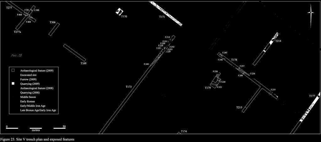
81
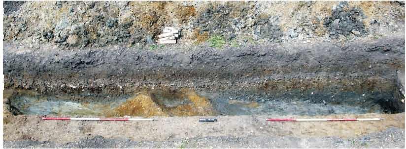
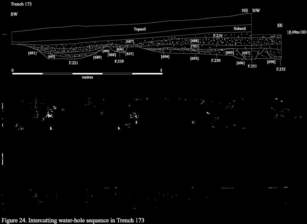
82
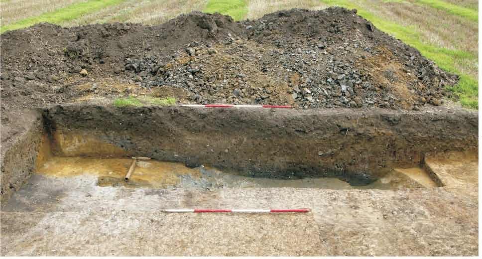
83
84 To the northeast of Trench 173, evidence of settlement activity that may potentially have been contemporary with this sequence of water-holes was identified in Trench 178. Here, three gullies F.235, F.236 and F.245 were present. These were oriented broadly east-southeast by west-northwest, and varied between 0.32m and 1.1m in width and 0.16m and 0.31m in depth; none of them contained datable material. Associated with these features, however, was pit/well F.246, which contained a large sherd of Early/Middle Iron Age date (see Prehistoric Pottery assessment, below). The presence of a sharp vertical edge within the fill sequence of this feature indicates that it was originally revetted, although no trace of a lining remained extant. Two further pits, F.237 and F.248, were also investigated in this trench, but again produced no datable material. Overall, this group of features - including the cluster of water-holes to the west appears most likely to represent the outlying fringe of a later prehistoric settlement located on the southern edge of the Observatory Gravel ridge. Due to the extent of post-medieval quarrying activity in the area, however, no further remains of this settlement were identified in any of the surrounding trenches. Following on from the prehistoric activity undertaken at Site V, a number of Roman features were also identified. In Trench 179, for example, a large water-hole F.224 was investigated (Fig. 25); this measured at least 7m in diameter, and was 0.36m deep. It was found to contain a small quantity of pottery dating to the 2 nd -3 rd centuries AD, and was truncated by an east-west aligned ditch F.249 from which similar material was also recovered. This latter feature, which was situated along the boundary between the area s differing geological zones, may have been intended to demarcate this wetter zone from the clay plain below. A further water-hole identified in Trench 215 to the east, although unexcavated, also appears to fit this pattern. In addition, to the west in Trench 173, a second Roman ditch was identified that again lay on the fringe of the gravels. This feature, F.249, was oriented north-south and contained a badly eroded later Roman coin (see the metalwork assessment, below). Furthermore, this same pattern was also identified at the eastern end of the site, where a discrete cluster of features was investigated in Trench 277. This consisted of west-northwest by east-southeast aligned segmented gullies F.390, F.391 and F.408, which varied between 0.35m and 0.57m in width and 0.16m and 0.22m in depth. These features again defined the margin of the gravel ridge, and the latter contained a small quantity of Early Roman pottery. Finally, a single post-roman feature was identified at Site V. This comprised water-hole F.238 in Trench 179, which contained 19 sherds of probable Maxey-type ware, weighing 330g, that were derived from a single shell-tempered vessel dating to c AD. Finds Assessment Reports A relatively small assemblage of material was recovered. This includes prehistoric and Roman pottery, worked flint, human remains, faunal and environmental remains. 76
85 Flint Lawrence Billington Site V produced a total of 22 worked flints, all coming from a series of water-holes and an associated layer of trample. The majority of the material is clearly residual. Mesolithic or earlier Neolithic activity is represented by three fine blades from F.238 and F.210. One of the blades from layer F.210 is deeply patinated, but has been re-used at a later date, a neat notch having been cut through the patina with steep retouch at the distal end of the piece. Much of the remaining material results from relatively informal core reduction strategies, probably of later Neolithic and Early Bronze Age date. This includes three flake cores, all with two wellreduced platforms, two of which are keeled. Distinguishing material of this date from pieces potentially associated with the later prehistoric use of the water-holes is difficult as later Bronze Age and Iron Age flint work is generally defined in the absence of certain diagnostic features and forms (see Ford et al. 1984). Several pieces do, however, show a marked lack of control and care over the reduction sequence, which suggests they may be broadly contemporary with the features. These include three flakes from F.250, F.210 and F.238, all of which are crude thick pieces with evidence for misplaced platform impacts. An extremely expediently produced scraper from F.210 may also be later prehistoric in date. Prehistoric Pottery Mark Knight All 15 sherds from the site were Late Bronze Age/Early Iron Age in date. Located in F.210 and F.250, the assemblage contained rim sherds from a small Post-Deverel-Rimbury type cup or bowl with an everted rim (F.250), as well as a crudely finished out-turned rim from a medium-sized jar. F.250 also included a base angle fragment. Fabric descriptions are presented in Appendix 1. Feature Context Number Weight (g) Fabric , 3, , Table 24: Prehistoric pottery from Site V. Iron Age and Roman Pottery Katie Anderson A small assemblage, totalling nine sherds and weighing 516g was recovered from Site V. Notably, well/pit F.246 contained two sherds of Middle Iron Age pottery, including one large flint-tempered sherd (345g). This sherd was very similar to a further sherd which was recovered from F.210, and although the sherds do not refit, it is possible that they are from a single vessel. Saxon Pottery Richard Newman A total of 19 sherds, weighing 330g, of probable Saxon pottery were recovered from waterhole F.238. These were derived from a single shell-tempered vessel with a Maxey-type fabric. This is therefore potentially 7 th to 9 th century AD in date, although it must be noted that the pottery of this period is often hard to distinguish from certain Late Iron Age fabrics and a larger assemblage is required before certainty can be achieved. Metalwork Grahame Appleby A small metalwork assemblage, consisting of only three items, was recovered from Site V. The most significant artefact consists of a badly corroded Roman coin, which was recovered from ditch F.249. F.249, [683], <722>. Nummus. Probably House of Constantine. Very corroded surface, right facing bust on obverse. Diameter 17.55mm, weight 3g. 77
86 In addition, two iron artefacts were also identified. Based upon the context of their recovery, both are most probably Roman in origin. F.229, <795>, SF 26. Large, heavily corroded and bent tanged knife; most of the tang is missing and tip is missing. Length 195mm, weight 60g. F.249, [683],<778>. Undiagnostic nail fragment; head only. Human Remains Natasha Dodwell Three refitting fragments of crania (right and left parietals) were recovered from [694], the basal fill of watering hole F.250. The breaks are recent. Several arachnoid depressions were noted and the sagittal suture is fused, but still visible suggesting that the individual is a middle aged/mature adult. Concretions of iron pan adhere to much of the internal surface of the skull. A fourth fragment of left parietal bone was recovered from [907], a number allocated to the machined spoil of laid surface F.210 around the watering holes. This 4 th fragment refits with those found at the bottom of the water-hole. It has no iron pan concretions and is of a paler colour suggesting that it has been buried in a different environment to the cranial fragment in the water-hole. The porosity on the outer surface of the fragment is characteristic of porotic hyperostosis, thought to be the result of anaemia. In addition, two re-fitting fragments of a right adult femur shaft were recovered from [687], F.210, and were probably associated with the fragment of parietal recovered from [907] (the machined spoil of this surface). Faunal Remains Vida Rajkovača Site V yielded a total of 74 bone fragments, with the majority (97%) being recovered from the Late Bronze Age/Early Iron Age water-hole group (Table 25). F.238 was a Roman water-hole containing only two fragments of animal bone. Bone material was overall moderately preserved, with the exception of the two Roman bone specimens having a brown patina and an excellent level of preservation. Taxonomy NISP MNI Cow 19 1 Ovicaprid 8 1 Goat 1 1 Pig 3 1 Horse 3 1 Dog 1 1 Red deer 3 1 Cattle-sized 22 - Sheep-sized 11 - Mammal n.f.i. 1 - Total 72 Table 25: Number of specimens identified to species (or NISP) and minimum number of animals (MNI) for LBA/EIA features (abbreviation n.f.i. denoted the specimen that could not be further identified). The Late Bronze Age/Early Iron Age watering holes produced 72 fragments of bone, the majority of which were identified as domestic livestock species. Butchery was observed on eight specimens (11%) and they are consistent with disarticulation and meat removal. Five specimens were gnawed, which suggests quick deposition of the material. Ageing data was available for the three main food species: two ovicaprid specimens gave the age at death of 6-9 and months; one cattle tibia was aged to 4 years and a pig mandible gave the age of months. Red deer is represented with one antler, radius and ulna. Antler had been shed 78
87 and collected. Middle Saxon water-hole F.238 contained only two fragments of bone, one of which was identified as cow radius. The predominance of livestock species on this site is in common with most archaeologically recovered animal bone assemblages in Britain. The assemblage is quantitatively inadequate to sustain propositions about the animal use on site, but it broadly reflects the pattern of species representation which is in keeping with the period. Environmental Remains Anne de Vareilles Four bulk soil samples from four large pits or watering-holes of Late Bronze Age/Early Iron Age and Romano-British date were selected for analysis (see Table 26 below). Although all four samples contained some waterlogged seeds only one, from F.250, was truly waterlogged. Possible Middle Saxon F.238, [645], appeared to be waterlogged and so a 500ml sub-sample was taken for analysis. Very few waterlogged seeds survived, however, showing that the sample is no longer wet and should, therefore, be processed accordingly. Features F.221 and F.224 also contained a few waterlogged seeds that show the contexts have dried since their formation. Carbonised remains are sparse; the few pieces recovered are probably from loose debris that lay scattered on the ground surface. Snail shells and modern rootlets were only found in F.221. The former occurred sporadically and do not seem to represent established communities; species are listed in Table 26 below. The sample derived from LBA/EIA pit or watering-hole F.250, [694], was rich in environmental remains, containing a wide range of waterlogged taxa. Whilst some of the plants are aquatics and semi-aquatics, such as duckweeds (Lemna sp.), rushes (Juncus sp.) and water-plantain (Alisma sp.), the majority of specimens show the ground surface was not predominantly wet. There is almost no evidence for shrubs and trees only one possible fruit stone and one elder seed (Sambucus nigra), but instead a diversity of small herbs that describe a disturbed open landscape. Some of these specimens are often found as arable weeds but will also grow on soils disturbed other than by the plough. Abundant stinging nettles (Urtica dioica), common chickweed (Stellaria media) and shepherd s purse (Capsella bursa-pastoris), amongst others, indicate that the soil was nutrient-rich. In contrast, the only carbonised remains to be recovered from LBA/EIA pit or watering-hole, F.221, [690], comprised some specks of charcoal. Four types of waterlogged seeds and a very small range of snail shells were also noted. Romano-British pit or watering-hole F.224, [603], contained two types of waterlogged seeds, a little charcoal, a fragment of a cereal grain, a hulled wheat glume base (Triticum sp.) and four wild plant seeds. A 0.5L sub-sample derived from probably nearcontemporary pit or watering-hole F.238, [645], contained a little charcoal and only a few waterlogged seeds from types of plants. A few specks of charcoal were the only carbonised remains to be found in the LBA/EIA samples. Food and other economic staples were absent. The waterlogged sample from F.250 had evidence for an open landscape of herbs and grasses growing on nutrient rich soil. The sample recovered from Romano-British F.224, [603], was not waterlogged, which shows that it has dried out since its formation. The few carbonised remains may indicate that cereals were processed nearby. Similarly, the sub-sample from F.238, [645], was not waterlogged, which shows that this feature has also been affected by fluctuations in the water-table. The remainder of the sample should be floated to establish whether [645] contained carbonised remains other than charcoal. Future excavations should consider the potential for good waterlogged conditions at this site, which could improve our understanding of this landscape. Further samples could establish whether the near absence of carbonised remains from this site is an artifice of the current sampling coverage. 79
88 Sample Number Context Feature Feature type Pits or Watering-holes Phase/Date LBA/EIA LBA/EIA RB MS? Sample volume - litres Flot volume - mililitres Flot fraction examined - % large charcoal (>4mm) - - med. charcoal (2-4mm) small charcoal (<2mm) Cereal grains and chaff cereal grain fragments indet., mostly <2mm 1 Triticum sp. glume base glume wheat chaff 1 Ranunculus acris/repens/bulbosus Bulbous Buttercup + Celery-leaved R. sceleratus L. Buttercup +++ R. Subgen, BATRACHIUM Crowfoot - WL Papaver sp. Poppy - Urtica dioica L. Common Nettle WL + WL Many-seeded Chenopodium cf. polyspermum L. goosefoot - Atriplex patula L./prostrata Boucher ex DC Oraches - Thyme-leaved Arenaria serpyllifolia L. Sandwort - Stellaria media (L.) Vill Common Chickweed ++ Stellaria pallida (Dumort.) Crép Lesser Chickweed + Stellaria palustris Retz. Marsh stitchwort + Polygonum aviculare L. Knotgrass + R. conglomeratus Murray Clustered dock + R. conglomeratus/obtusifolius/sanguineus - Dock + Rumex sp. Dock + Malva sylvestris L. Common Mallow - Capsella bursa-pastoris (L.) Medikus Shepherd s-purse + Brassica nigra type (coarse textured form) Black mustard - Rubus sp. Bramble - - WL Potentilla cf. argentea L. Hoary cinquefoil - Aphanes sp. Parsley-piert - Solanum nigrum L. Black nightshade - Lamium sp. Dead-Nettle - Plantago major ssp. intermedia (Gilib.) Lange - Greater plantain + Hoary/ Ribwort Plantago media / lanceolata L. plantain 1 Limosella aquatica L. Mudwort - Sambucus nigra L. Elder - ++ WL - WL Carduus/Cirsium sp. Thistles + Hawkweed Picris hieracioides L. Oxtongue - Alisma sp. Water-plantain + Lemna sp. Duckweeds + WL Juncus sp. Rushes ++ Table 26: Plant macro-remains from bulk soil samples at Site IV (key: - 1 or 2, + <10, , +++ >50 items, WL = waterlogged; P = present). 80
89 Sample Number cf. Cyperus fuscus L. Brown galingale + large Poaceae (>4mm) large wild grass ++ WL small Poaceae (<2mm) small wild grass - 1 Indeterminate wild plant seeds + 2 Indeterminate fruit stone fragment - Insect fragments ++ Fresh water mollusca Lymnaea truncatula - Damp/shade loving species Carychium tridentatum / minimum ++ Vallonia excentrica / pulchella - Vertigo pygmaea / antivertigo - Modern rootlets Table 26 continued: Plant macro-remains from bulk soil samples at Site IV (key: - 1 or 2, + <10, , +++ >50 items, WL = waterlogged; P = present). P Discussion Site V represents one of the longest-lived areas of archaeological activity to be identified anywhere in the project-area. A minimum of four phases of activity, of Mesolithic/Early Neolithic, Late Bronze Age to Middle Iron Age, Roman and Middle Saxon date, have been investigated. Although the original identification of activity at the site in the form of the fieldwalking results recovered in November 2008 (Anderson & Hall 2008, 6-7) can now be seen to relate only to disturbance caused by the extensive post-medieval quarrying activity, a number of in situ features were encountered. Clustered along the margins of the Observatory Gravel ridge, these features reveal a long sequence of activity predicated upon the exploitation of an important natural resource. This is because this location represents one of only two sites in the immediate vicinity of the project-area in which a ready supply of water appears to have been available (the other being the Trinity Conduit springhead, discussed above in relation to Site II). The presence of this resource led to the site becoming an important focus during the earlier prehistory, and is also likely to have strongly influenced the location of the later prehistoric settlement, as well as the numerous water-holes that were created at this time. This pattern clearly continued into the Roman period when the activity encountered was contemporary with the large settlement to the east at Site IV as well as into Middle Saxon times. Indeed, the identification of 7 th to 9 th century activity at the site is particularly significant, as it represents the only location in the project-area where material of this date has been encountered. Interestingly, the pattern of exploitation also continued into the 19 th century, as a spring is marked on the 1 st edition Ordnance Survey map lying on the boundary between Fields 109 and
90 Site IX This site is Medieval in date and is situated in Field 116, close to the northeastern boundary of the project-area (Figs. 8 & 26). The topography of the site is relatively level, and lies at around 23.4m OD. No trenches were excavated in this area during the 2008 evaluation, and, although the area was subsequently fieldwalked in November 2008, no positive results were then obtained (Anderson & Hall 2008). Not subject to a geophysical survey, in total, nine features have been investigated at Site IX. These were distributed across two trenches (Nos. 207 and 208) and three of them, or 33.3% of the total, contained datable material. The features are broken down by type in Table 27 below. Feature Type No. Excavated Linear 5 Pit 4 Total 9 Table 27: Excavated features at Site IX by type. The primary focus of activity at Site IX was centred upon Trench 207. Here, north-northeast by south-southwest aligned gully F.272 and northwestsoutheast aligned ditch F.274 were identified. These features varied between 0.46m and 1.2m in width and 0.29m and 0.35m in depth, and although the latter was undated the former contained 85 sherds of Medieval pottery, weighing 1083g. This material primarily consisted of 13 th century coarsewares, which were accompanied by a small quantity of 12 th century St Neots-type Ware, as well as a fragment of squared building stone and 20 fragments of daub (see assessment reports, below). Also present in Trench 207 were pits F.273, F.275 and F.277, which varied between 0.6m and 0.8m in diameter and 0.16m and 0.4m in depth. Pottery fragments were recovered from two of these features; F.273 contained 15 th century Essex Red Ware, and F.275 contained 12 th century St Neots-type Ware (although this may have been residual). The latter feature also contained a large fragment of fired clay that was most probably derived from a hearth lining (see Fired Clay assessment, below). Both the type and quantity of material from the features in this trench is suggestive of nearby domestic occupation during the Medieval period. In addition to the above, three undated northeast-southwest aligned gullies F.258, F.260 and F.261 as well as an unexcavated pit (F.262) were identified a short distance to the west in Trench 208. Although a modern ditch/foundation trench was also present in this trench F.259, which most probably represents the presence of a roadside building in this vicinity during the late 19 th /early 20 th century the fills, morphology and alignments of the gullies were markedly more similar to those of F.272 and F.274 to the east. They may therefore have formed part of an enclosure or paddock system associated with the fringes of the Medieval settlement. In this regard, however, it is also important to note that gully F.258/F.265 to the southwest (in Trench 206) contained exclusively post-medieval material. As this feature followed a near-identical alignment to the gullies in Trench 208, it is possible that they are instead more recent in origin (although it is also probable that the post-enclosure landscape of this area will have closely followed the preceding Medieval layout). 82


91
92 Finds Assessment Reports A relatively small assemblage of material was recovered. This includes Medieval pottery, metalwork, building stone, fired clay, faunal and environmental remains, as well as a small amount of residual worked flint. Flint Lawrence Billington A single undiagnostic chip (<10mm) was recovered from gully F.272. Medieval Pottery Richard Newman with David Hall A total of 88 sherds of Medieval pottery, weighing 900g, were recovered from three features at Site IX. The most prolific of these comprised 13 th century gully F.272. This contained two sherds of St Neots-type Ware, weighing 24g, as well as 78 sherds of Pink Coarseware, weighing 823g, three sherds of Buff Coarseware, weighing 31g and two sherds of Grey Coarseware, weighing 5g. In addition, 15 th century pit F.273 contained a sherd of Essex Red Ware, weighing 3g, and a sherd of Pink Coarseware, weighing 10g. Finally, 12 th /13 th century pit F.275 contained a sherd of St Neots-type Ware, weighing 4g. Metalwork Grahame Appleby A single iron object was recovered from Site IX. It was derived from a 13 th century context. F.272, [783], <780>. Square sectioned tapering bar forming a loop; possibly for hanging or simply bent over. Building Stone Simon Timberlake A single fragment of building stone was recovered from Medieval gully F.272. F.272, (783), <574>, Trench 207, 1372g. A fragment of a block of micaceous quartzitic sandstone, perhaps squared, and used in walling, then burnt prior to being discarded. The stone is of a sarsen type; perhaps a Lower Greensand, or else from the basal Tertiaries, though this may have been transported glacially. Size = 120mm x 110mm x 60mm. Fired Clay Grahame Appleby A total of 21 fragments of fired clay, weighing 621g, were recovered. The fabric of the material varied from relatively pale cream to black, and in hardness from low fired biscuit (F.272) to highly fired (F.275). The single fragment recovered from F.275, which measured 98.75mm in diameter and weighed 421g, included grog temper and large flint inclusions and may have been derived from a hearth or oven lining. The remainder is potentially daub. Faunal Remains Vida Rajkovača 13 th century gully F.272 yielded four unidentifiable bone specimens, three of which were cattle and one of which was sheep-sized. Environmental Remains Anne de Vareilles A 20 Litre sample derived from Medieval Gully F.272, [783] was analysed (see Table 28 below). It generated a small 4 mililitre flot with a relatively rich charred assemblage: some charcoal; about 35 cereal grains (hulled barley (Hordeum vulgare sl.), oat (Avena sp.), freethreshing wheat (Triticum aestivum sl.) and possibly spelt (T. cf. spelta)); some pulses possibly cultivars and a few wild grass seeds. The pulses were too puffed and abraded to identify, but the larger ones could be peas (Vicia/Lathyrys/Pisum sp. >4mm). The Poaceae 84
93 (grass family) fragments numbered about 100. The oat caryopses are recorded under the cereal section, but as no chaff was found their position as weed or crop could not be verified. The assemblage from Site IX shows a mix of crops, predominantly consisting of freethreshing wheat with a few wild grass seeds. These may have become charred during various cooking or processing episodes and so do not necessarily represent a single event. It is not unusual to find free-threshing grains without chaff as the latter tends to readily fall off the grain soon after harvest. Grain-sized weeds however, such as wild grasses, vetches and wild peas, will remain with the crop until it is sieved and sorted by hand. Sample Number 19 Context 783 Feature 272 Feature type Phase/Date Gully Medieval Sample volume - litres 20 Flot volume - mililitres 4 Flot fraction examined - % 100 med. charcoal (2-4mm) ++ small charcoal (<2mm) +++ Cereal grains Hordeum vulgare sensu lato hulled barley grain 1 Triticum cf. spelta spelt wheat grain 2 T. aestivum sl. free-threshing wheat 9 Triticum sp. wheat type indet. 5 Triticum / Hordeum wheat or barley 3 wild or cultivated Avena sp. Oat 8 Total whole grain count 28 cereal grain fragments indet., mostly <2mm 12 Non cereal seeds Vicia / Lathyrus sp. 2-4mm Vetches / Wild Pea 3 Vetches / Wild Pea / Vicia / Lathyrus / Pisum sp. >4mm Pea 5 Medicago / Trifolium sp. medics or clover 3 Large Poaceae (>4mm) large wild grass seed 6 Small Poaecae (<2mm) small wild grass seed 1 Poaceae fragment indet. - wild or cultivated grass seed frag. +++ small cotyledon indet. <2mm 3 Total seed count (grass frags and WL seeds not included) 18 Damp/shade loving mollusca Vallonia excentrica / pulchella - Vertigo pygmaea / antivertigo - Lauria cylindracea - Catholic species Trichia sp. + Ceciloides acicula Blind burrowing snail - Table 28: Plant macro-remains from bulk soil sample at Site IX (key: - 1 or 2, + <10, , +++ >50 items, WL = waterlogged; P = present). 85
94 Discussion Given that the quantity and variety of Medieval refuse material recovered from the site s features is strongly indicative of domestic as opposed to agricultural activity, it may well be significant that the Medieval hamlet of Howes is known to have been situated immediately to the northeast of the site at this time. This settlement was established prior to 1219, and its somewhat unusual name was first recorded in 1279 (Cam 1944). Although still inhabited in the late 14 th century, when it consisted of at least eight houses (Hall & Ravensdale 1976, 44), no record of the settlement exists after 1600 (Wright & Lewis 1989, 115). The hamlet partially straddled the parish boundary between Girton and Cambridge St. Giles (although the majority of it lay within the former), and a small portion of the project-area is known to have been enclosed with hedges for use as pasture by the inhabitants of the settlement in the late 14 th or early 15 th centuries (Hall & Ravensdale 176, 52). This area approximately corresponds to the extent of Fields 116 and 117. Notably, at least one remnant of the former hedge-line was identified archaeologically, a little way to the south of Site IX (see further Site III). The presence of a Medieval dwelling in the area of Site IX was recorded in a late 14 th century rental document (ibid., 44). Although the precise location of this building (or group of buildings) is not known, based upon the documentary sources it is highly probable that it lies within or immediately adjacent to the project-area. This evidence is supported by the recovery of fragments of building stone and burnt daub from gully F.272. The building is likely to have been associated with a range of ancillary archaeological features such as pits, gullies, wells and hearths as is typical of rural settlements of this period. The features which comprise Site IX closely correspond to this pattern, and the dating evidence recovered indicates that occupation was established at the site by the late 12 th or early 13 th century. Activity of 15 th century date was also identified, suggesting that a relatively long-lived sequence of domestic occupation is represented. Also of note at Site IX is the fact that an undated barrow containing Roman coins was discovered in the near vicinity during the construction of the Huntingdon Road turnpike in c (Lysons & Lysons 1808, 44-5). As the name Howes was consistently recorded in the plural during the Medieval period (Reaney 1943), it has been suggested that other tumuli also existed nearby at this time (Hall & Ravensdale 1976, 44). It may thus be significant that a residually occurring glass fragment derived from a high status Roman vessel was recovered from the topsoil in Trench 208, in very close proximity to Site IX (see further the dispersed features section, below). Although no other mortuary evidence was encountered during the evaluation of this area, the possible presence of earlier burials in close proximity to the former Roman road at Site IX cannot be discounted. 86
95 Dispersed Features In addition to the above-outlined sites, a further 97 dispersed features were also identified in Area I (Fig. 27). These were widely distributed across the gravel ridge, occurring in 37 separate trenches (Nos. 3, 7, 16, , 126, 127, 129, 131, 135, 138, 142, 154, 155, 158, 159, 165, 171, 181, 182, 193, 196, 199, 201, 204, 206, 208, 231, 236, , 326, 327, 330, 334 and 339). The features are broken down by type in Table 29 below. Feature Type No. Excavated Linear 55 Quarry 12 Posthole 11 Furrow 10 Pit 4 Foundation 2 Pit/linear 1 Treethrow 1 Hedgeline 1 Inhumation 1 burial Total 97 Table 29: Dispersed features in Area I by type. Although the majority of the dispersed features are modern in origin (primarily comprising field drains and other agriculturally-related ephemera), or are otherwise isolated and undated, a small number of noteworthy exceptions have been identified. The most significant of these consists of a series of ditches situated in relatively close proximity to Site IV. Here, at least 12 features, located both to the east and the west of the settlement, appear to have comprised part of a northeast-southwest by northwest-southeast oriented rectilinear system (Fig. 27). Notably, five of the ditches in this group F.11 in Trench 7, F.125 in Trench 124, F.128 in Trench 123, F.135 in Trench 123 and F.156 in Trench 142 contained small quantities of undiagnostic 2 nd to 4 th century pottery (although, as the sherds were in each case small and abraded, it is also possible that they are residual). Whilst this paucity of associated material strongly points towards an agricultural as opposed to domestic origin for these features, it also precludes any in-depth analysis of their phasing and/or association at this stage. Nevertheless, it is immediately apparent that this system is on a markedly different alignment to that of Site IV. The latter is primarily oriented north-south/east-west, whilst the present fieldsystem appears to respect instead the projected route of the Godmanchester road immediately to the northeast. On the one hand, this variation may represent a chronological distinction between the two systems (with the fieldsystem in this model post-dating the settlement), although it is perhaps rather more likely that the layout of the settlement was simply influenced to a greater degree by the topography of the underlying ridge. Certainly, it is probable that a settlement of the scale of Site IV would have been associated with a sizable outfield system, and these features therefore appear most likely to be contemporary with the main phase of occupation at that site. 87
96 Lying a little way to the east of the probable Roman fieldsystem, a crouched inhumation was identified in Trench 196 that had been placed in a regular rectangular grave. This burial, F.289, was exposed but not lifted (Fig. 28). Although unaccompanied, two aspects of the burial are notable. In the first instance, it was located in close proximity to the boundary between the parishes of Girton and Cambridge St. Giles. Whilst this could of course be entirely coincidental, such a location is relatively common for outlying burials during the Anglo-Saxon period (cf. Lucy & Reynolds 2002). The second aspect of the interment which is of interest is the presence of a dark humic deposit with regular, discrete edges (F.280) lying just above the burial (see again Fig. 28). This may represent the presence of a decayed plank, or perhaps the base of a later pit or grave, which was subsequently inserted above the primary interment (although no trace of any additional human bone was encountered in this trench). As crouched inhumation was a common rite in the late prehistoric as well as Anglo-Saxon periods, the date of the burial remains unclear. It may perhaps be significant, however, that although no prehistoric graves have yet been identified in the area, at least one Saxon inhumation is known to have been encountered a little way to the northeast during coprolite extraction undertaken in the late 19 th century (Fox 1923, 244). The only other features to be identified in the vicinity that may potentially be contemporary with the burial comprise a group of five postholes (F.313-F.317) in Trench 199. Yet these were very irregular in form and situated in an area of intensive root disturbance, suggesting that they are most likely to be natural in origin. The grave therefore appears to have been relatively isolated in the landscape. To the north of the burial, in Field 116, the irregular base of a former hedgeline was identified (F.278). This hedge almost certainly comprised part of the boundary which subdivided the pastoral land of the Medieval settlement of Howes (Site IX) from the surrounding open fields (cf. Hall & Ravensdale 1976, 52). Notably, a number of gullies on similar alignments to the hedge-line, and situated to both the north and south of this feature, were found to contain either post-medieval (F.244, F.437, F.441, F.458 and F.469) or modern (F.265, F.267, F.249, F.430) pottery. This demonstrates that the enclosed area did not return to arable use following the abandonment of the Medieval settlement in c (Wright & Lewis 1989, 115), but instead continued to be subdivided and developed. Indeed this pattern clearly continued up until relatively recently, as foundations relating to late 19 th or early 20 th century buildings were identified in Trenches 193 and 199 in Field 115. It therefore appears that the area only returned to arable use following the foundation of the University Farm at the site in 1909 (Guillebaud 2008, 191). Finally, at least ten furrows and twelve gravel quarries were also investigated in Area I. These primarily consisted of examples where the feature-type was either in doubt (such as a narrow furrow which could perhaps represent a gully) or where the feature had clearly disturbed, and therefore potentially redeposited material from, nearby in situ deposits; however, discrete examples were also excavated in order to characterise the general extent, morphology and depth of these features, to assess their potential impact upon any earlier archaeological remains. 88
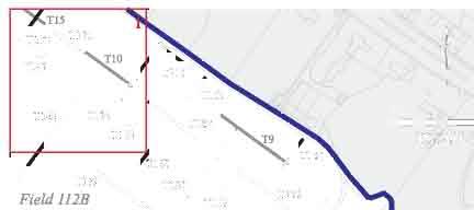
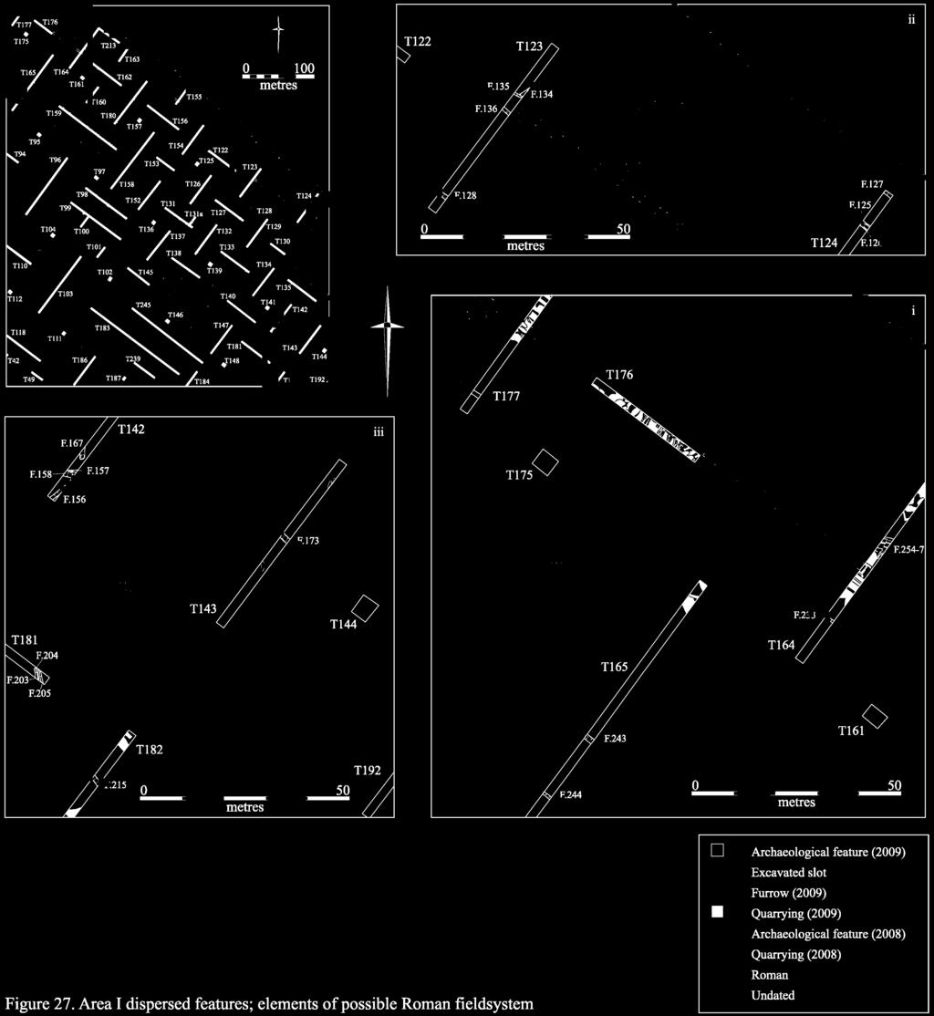
97
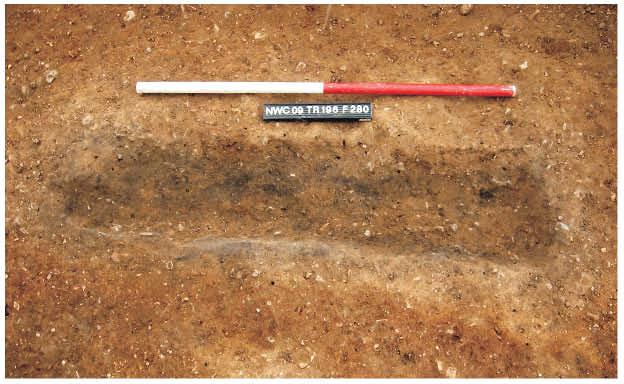
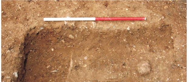
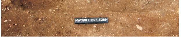
98
99 Finds Assessment Reports A relatively small assemblage of material was recovered from the dispersed features in Area I. This included Roman, post-medieval and modern pottery, plus glass, metal artefacts and environmental remains. The most significant find consisted of a small fragment from a polychrome glass vessel of Early Roman date, which may potentially have been disturbed from a burial. Roman Pottery Katie Anderson A small assemblage of Roman pottery was recovered from dispersed features in Area I, although few of the sherds were closely diagnostic. Aside from the small quantity of probably in situ material recovered from ditches F.11, F.125, F.128, F.135 and F.156, the remainder of the assemblage was redeposited within later furrows and quarry pits. Post-Medieval and Modern Pottery Richard Newman with David Hall A total of 37 sherds of post-medieval and modern pottery, weighing 624g, were recovered from the dispersed features in Area I. All of the material was derived from modern features, including gravel quarries, backfilled furrows and agricultural boundary ditches. In the first instance, the assemblage included 13 sherds of 16 th /17 th century date, weighing 325g. These comprised nine sherds of Glazed Red Earthenware, weighing 228g; a single sherd of Westerwald Stoneware, weighing 75g; two sherds of Staffordshire-type Slipware, weighing 18g; and a single fragment of an Iron-Glazed vessel, weighing 4g. Also present were 24 sherds of 18 th -20 th century material, weighing 299g. This included nine sherds of Refined White Earthenware, weighing 78g; four sherds of Unglazed Coarseware, weighing 102g; a sherd of Creamware, weighing 3g; five sherds of Late Staffordshire-type Slipware, weighing 73g; a sherd of Yellow Ware, weighing 7g; a sherd of Bone China, weighing 7g; and a single sherd of English Utilitarian Stoneware, weighing 10g. None of the material from Area I was of particular interest, and no large or significant groups were identified. Glass Vicki Herring The most significant glass to be recovered from Area I consists of a small fragment that was derived from a cast polychrome vessel (most probably a bowl) of Early Roman date. This was discovered at the northern end of Field 116, in close proximity to the projected line of the Roman road to Godmanchester, and very near to a barrow containing Roman coins that was excavated c (Lysons & Lysons 1808, 44-5), thus raising the possibility that it may have been disturbed from a burial in the near vicinity. <716>, Trench 208 (top-soil). Very small body fragment from a cast polychrome vessel, most likely a bowl (precise form unknown but most common on pillar-moulded bowls). Purple and white marbled colour. Polished interior. Most likely manufactured in the mid 1 st century AD, perhaps earlier if imported. While not common in Britain as a whole, cast polychrome bowls are relatively well known in Southern England where imports were received before the invasion and in places that were established soon after. Parallels can be found in a Pillar-moulded bowl from a Flavian burial at Radnage, Buckinghamshire (Allen 1998, 21) in blue and white marbled colour, as well as polychrome bowls, commonly Pillar-moulded, found at Colchester. The purple and white combination has parallels at Colchester (Cool & Price 1995, 18). Relatively high quality tableware such as this would have been held on to for a long time, making any estimation of a deposition date problematic. No comparable material has previously been recovered from Cambridge. 91
100 The remainder of the material recovered from this area is post-medieval/modern in date. F.225, [611], <918> (furrow). Body fragment from near the base of a utility bottle. Heavily patinated olive green potash glass. Free blown. Cylindrical or squat-cylindrical form. Late 18 th early 19 th century manufacture. F.259, [756], <558> (modern ditch). Body shard from near the base of a small octagonal bottle. Moulded light blue glass with very thin patina. 25mm diameter. Late 19 th /early 20 th century pharmaceutical bottle. [319], <342> (top-soil). Foot fragment from a drinking glass. Colourless lead glass. Form unknown. Only part of the solid conical foot and basal knop remain. Early modern. Metalwork Grahame Appleby Ten items of metalwork were recovered from Area I. Of these, one was composed of copper alloy, the remaining nine of iron. The single copper alloy artefact to be recovered consisted of a post-medieval military buckle. This was a surface find from Field D. [1270], <915>, SF 30. Post-Medieval military S -shaped belt fitting with swans head motif and chrysanthemum decorative centre. Length 38.8mm, weight 11g. Nine iron artefacts were recovered, although the majority of these consisted of undiagnostic nail fragments. F.222, [598],<774>. Undiagnostic nail fragment; L. 38.2mm. F.232, [634],<777>. Undiagnostic nail fragment; L. 98.5mm. F.283, [812], <781>. Small complete domed hobnail, length 10.5mm, weight 1g. Roman. F.430, [1212], <853>. Bent, very corroded nail or staple, wider at the terminal; length 78.2mm, weight 19g. F.469, SF 34,<854>. Undiagnostic nail fragment; L. 25.8mm. [543], <773>. Undiagnostic nail fragment; L mm. [615], <776>. Undiagnostic nail fragment; L. 47.3mm. [748], <779>. Undiagnostic nail fragment; L. 44.1mm. <741>, Trench 102. Large modern horseshoe almost certainly for a Shire Horse or Suffolk Punch. Weight 475g. Human Bone Natasha Dodwell An extremely poorly preserved adult skeleton [833] was identified in Trench 196; although it was exposed and recorded, it was not lifted. The grave [834] was wide and rectangular in form and the skeleton was tightly flexed on it right side. The surviving bone (skull including mandible and limb bone shafts) were very fragile and spongy. A small fragment of femur was bagged as it became detached whilst cleaning but the rest of the skeleton was left in-situ. The upper fill, sealing the body was stained a dark grey/ black and may represent what remains of a wooden plank. No date could be accurately attributed to the grave although its proximity to the Parish boundary and to Anglo-Saxon inhumations recovered during coprolite quarrying c.100m to the northwest suggest that it might date from this period. 92
101 Environmental Remains Anne de Vareilles A 12 litre sample derived from F.280, [800], located above burial F.289, generated a large flot rich in charcoal and modern rootlets (see Table 30 below). It also contained two glume bases, probably both of spelt wheat, and dried waterlogged seeds from four different species. The latter show that recent disturbances in the area have reduced the level of the water-table so that previously waterlogged levels are now drying out. The remains recovered are not sufficient to determine whether this deposit was associated with a plank lying above the grave, although little or no evidence of domestic refuse was identified. Sample Number 20 Context 800 Feature 280 Feature type Phase/Date? Sample volume - litres 12 Flot volume - mililitres 20 Flot fraction ex.amined - % 100 large charcoal (>4mm) ++ med. charcoal (2-4mm) +++ small charcoal (<2mm) +++ vitrified charcoal + parenchyma frags - undifferentiated plant storage tissue + Triticum spelta glume base Triticum sp. glume base Cereal chaff Non cereal seeds Pit spelt or emmer chaff 1 glume wheat chaff 1 Ranunculus Subgen. BATRACHIUM Crowfoot - WL Urtica dioica L. Common Nettle ++ WL Chenopodium sp. Goosefoots ++ WL Lemna sp. Duckweeds + WL Modern rootlets Table 30: Plant macro-remains from bulk soil sample 20 in Area I (key: - 1 or 2, + <10, , +++ >50 items, WL = waterlogged; P = present). P Area I - Summary of Archaeological Preservation The most extensive damage to the archaeological deposits encountered in Area I has been caused by post-medieval quarrying activity, which has affected all of the sites identified above to a greater or lesser degree. Two principal quarry-types have been identified in the area (Fig. 5). The first, and much the most destructive, represents late 19 th century to early 20 th century coprolite extraction. This practice, which represents one of the great boom industries of the Victorian Age (cf. O Connor 2001), was undertaken on an industrial scale in the northeast corner of the development area. The process involved the bulk extraction of the overlying gravels to expose their interface with the Upper Greensand and Lower Gault strata, where a layer of rich phosphatic material is situated. This was then utilised as a form of artificial fertiliser. Coprolite was quarried from the project-area by Swann Wallis between c and 1939, and supplied to the Eastern Counties Manure Company at Duxford (O Connor 1998, 17). 93
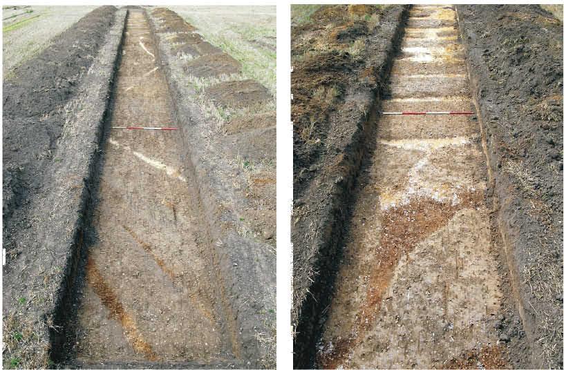
102
103 Evidence of extensive coprolite quarrying activity was encountered during the evaluation of the area surrounding Gravel Hill Farm undertaken in 2002, where only widely dispersed islands of natural gravel were found to have survived (Mackay et al. 2002, 5-7). The quarries were very large, measuring several hundred metres across and at least six metres deep. The majority had been backfilled with loosely compacted upcast material, along with deposits of refuse material derived from the nearby town, although the extent of such inclusions remains unclear. The extant Traveller s Rest Pit, a former coprolite quarry that was only partially backfilled, gives a clear indication of their original scale. It is important to note that coprolite extraction comprised one of the earliest forms of industrialised open-cast mining, and the affected portion of the site can therefore effectively be regarded as abandoned mine workings. The second type of quarrying activity to have been identified in Area I was more extensive, but less destructive, in nature. It is clear that basic gravel extraction has been undertaken across much of Area I for at least the last one thousand years, principally in the form of hand-dug pits of limited size (Fig. 29). A limited sample of these features has been investigated archaeologically during the current evaluation. This assessment has demonstrated that during the Medieval and post-medieval periods, between c and 1700 AD, quarry pits occurred in limited numbers across much of the ridge (see also Newman 2008a; Hall & Ravensdale 1976, 29). They were generally less than 5m in diameter, varied between approximately 0.5m and 1m in depth, and were backfilled with upcast quarry material. From around the 18 th century onwards, however, the degree of extraction activity intensified. Areas of strip-quarrying were created, principally in the northern part of Fields 112 and 114, but also to a much lesser degree in Field 113, the southeastern portion of Field 114 and western portion of Field D. These features were again hand-dug, being on average around 1m wide and less than 1m deep, but were linear in form and situated in very close proximity, often with less than 0.2m of gravel surviving between them. As can be seen in Figure 29, large quantities of material could be extracted in this way, with the upcast being discarded behind an ever advancing working face. Despite their extent, however, these features were relatively shallow (often being only around 0.5m deep). During the later 19 th and early 20 th centuries, a series of much larger quarries were created in Fields D and 132. Although again consisting of strip-quarries, the strips themselves were in this instance located within large potentially machine-dug pits that were in excess of 50m across. A sondage excavated across one of these pits indicates that it was at least 1.6m deep, and had been backfilled with very loosely compacted upcast material. The areas most adversely affected by quarrying activity are Sites I, II, IV and V, where it appears in each case that portions of the site have been entirely removed; however, although the quarrying was intensive, the extent of the damage caused at each site is potentially variable in relation to the type of extraction methodology that was employed within it. The pits excavated at Sites I and II, for example, are of sufficient size and scale to have destroyed almost all archaeological trace of in the areas affected. Yet those inserted at Sites IV and V, in contrast, are markedly shallower, meaning that deeper features such as wells may partially have survived beneath them (although, as has been noted above, it is possible that at Site IV the original topography has 95
104 been severely denuded). The fact that they were hand- as opposed to machine-excavated also increases the likelihood that archaeological material may have been directly reincorporated into their backfill. A secondary impact of the intensive quarrying in these areas is the lowering of the surrounding watertable, leading to the decay of previously waterlogged deposits. This effect was noted most clearly at Sites IV and V, although in both locations surviving waterlogged deposits were identified. The final impact to be noted upon archaeological preservation in the area is the detrimental effect of modern agricultural machinery. A comparison of the earthworks visible in Second World War photographs of the area (see Fig. 6) with the surviving evidence of ridge-and-furrow that was encountered archaeologically, clearly demonstrates the impact of modern agricultural techniques. The fieldwalking survey conducted in 2008, however, demonstrated that relatively little disturbed material was present in the overlying top-soil (Anderson & Hall 2008) and in situ sub-soil deposits were encountered in the majority of trenches in Area I (see Appendix 4). It is, therefore, clear that, although the more ephemeral remains of Medieval ridge-and-furrow are poorly represented at the site, those areas which have not been affected by post- Medieval quarrying activity are relatively well preserved. AREA II Area II comprises the Gault clay plain, upon which six sites (VI- VIII and X- XII) have been identified. These range in date from the Late Bronze Age to Medieval periods, although the majority of activity in the area is Roman in date. A number of dispersed features, which have not been assigned to any particular site, are also discussed. Site VI Site VI, which is of Iron Age and Roman date, is situated along the western edge of the project-area. It extends across the southwestern corner of Field 112, the southern half of Field 108 and the southeastern corner of Field 107. In general, the topography of the area slopes gradually from the northwest to the southeast declining from 21.7m OD to 15.2m OD with a notable hollow present in the southeast corner of Field 108. This dip corresponds to the shallow river-valley of the Washpit Brook, which bisects the site from north to south (Figs. 3, 8 & 30). No trenches were excavated at this site during the 2008 evaluation, and, although the area was fieldwalked in November 2008, no positive results were obtained. A portion of the site was subject to a geophysical survey in December 2009, however (Fig. 30), and the results of this project have been incorporated below. A total of 36 features have been investigated at Site VI; these were distributed across 11 trenches (Nos. 21, 22, 50, 51, 116, 280, 281, 292, 293, 294 and 295). Ten features, or 27.7% of the total, contained datable material. The features are broken down by type in Table 31 below. 96


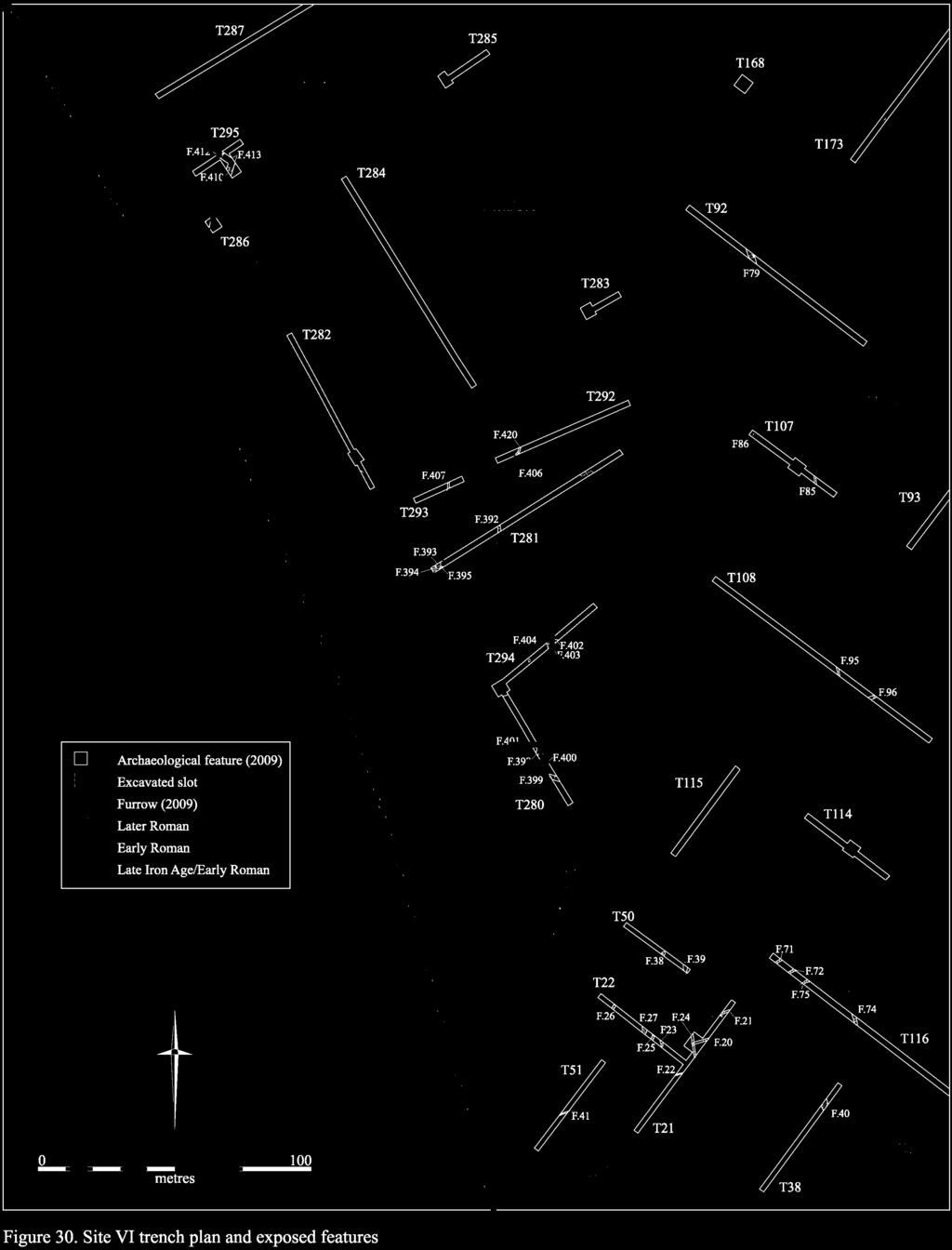
105
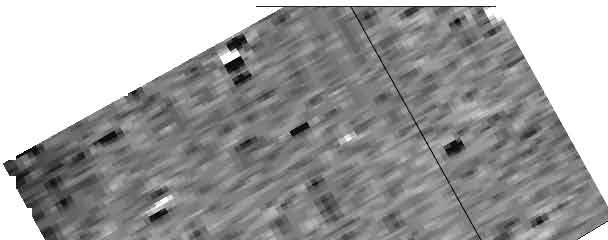
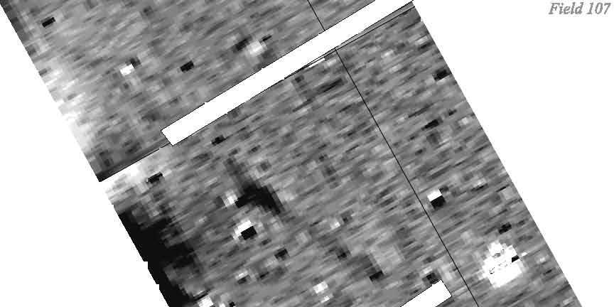
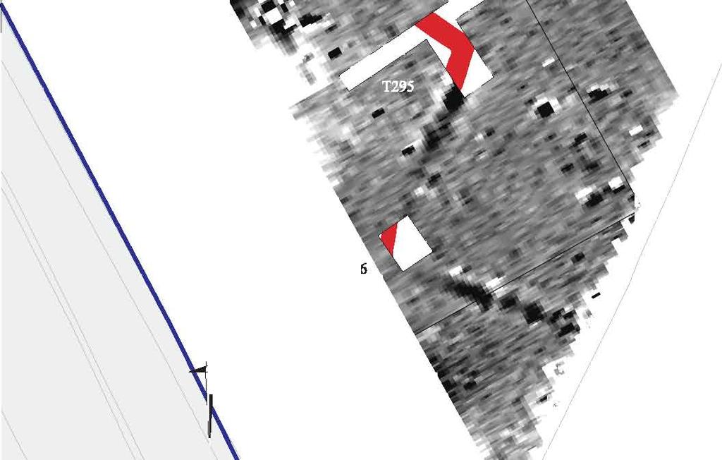
106
107 Feature Type No. Excavated Linear 33 Pit 1 Pit/linear 1 Pond/palaeochannel 1 Total 36 Table 31: Excavated features at Site VI by type. The earliest material to be recovered from the site consisted of a single Mesolithic/earlier Neolithic flint flake, which was encountered in pit F.406 in Trench 292. This feature, which also contained a sherd of Late Iron Age pottery, was situated on the western margin of a slight hollow, or relict palaeochannel, which also extended for some distance to the north (encompassing parts of Trenches 292, 283 and 92), east (encompassing parts of Trenches 107 and 108) and south (encompassing the very northern part of Trench 294). A test pit was excavated at the northern end of Trench 281 in order to assess the nature of the deposits that had accumulated in this hollow. At least four layers of mottled silty clay and desiccated peat-like material were encountered (Fig. 32). This sequence most probably represents a series of interleaving alluvial and colluvial deposits, which were derived from the seasonal flooding of the area, combined with the gradual erosion and solifluction of the clay slope to the northeast (Field 109). A series of pollen samples were taken from these deposits, and are available for future analysis if required. At the northern end of the site lying on the highest ground in the area, at c. 21m OD, and situated some distance to the west of the Washpit Brook floodplain elements of a west-northwest by east-southeast oriented Late Iron Age/Early Roman enclosure system were identified. Here, in Trench 295, a corner sequence representing a minimum of three phases of activity was investigated. The earliest of these phases was represented by ditch F.414, which was subsequently re-cut by F.410/F.412 (Fig. 32) and then later by F.413. The constituent elements of this enclosure varied between 0.53m and 1.75m in width and 0.33m and 0.8m in depth. In total, an assemblage of 91 sherds of Late Iron Age/Early Roman pottery, weighing 754g, was recovered from these features, although no chronological differentiation could be determined between the different stratigraphic elements (see the pottery assessment, below). The size of this assemblage indicates that the enclosure was most probably associated with a contemporary settlement located only a short distance to the west (although this consequently falls outside the limit of the current project-area). The continuation of the eastern boundary of the enclosure was again identified in Trench 286 to the south, but was not excavated. In addition, the geophysical results indicate that a further subenclosure, situated immediately to the east of that previously discussed above, was also present in this area (Figs. 30 & 31). No additional archaeological features were identified in any of the surrounding evaluation trenches, however, and only the northeastern fringe of the enclosure system appears to be represented. 99
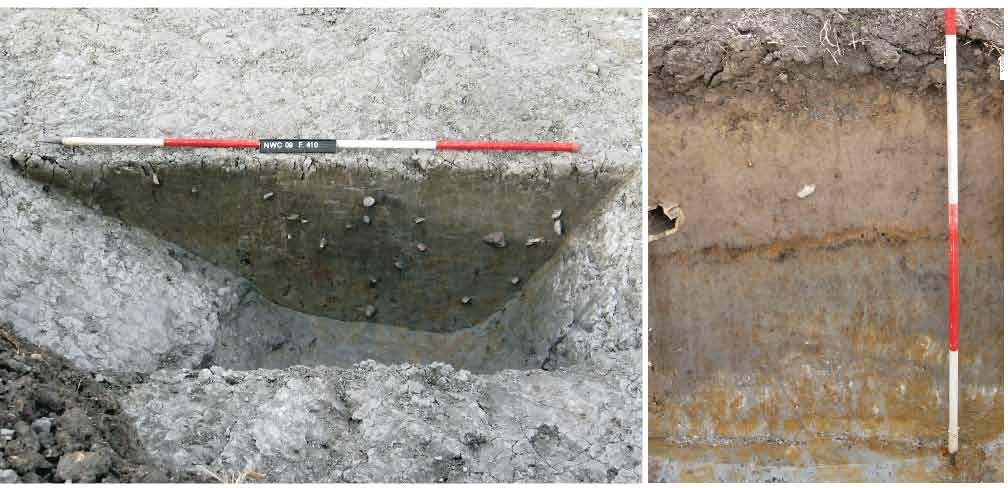
108
109 A little way to the southeast of the Late Iron Age/Early Roman enclosures, in much closer proximity to the Washpit Brook, a second discrete cluster of features was identified in Trenches 280, 281 and Here a broadly gridlike system of ditches, aligned predominately north-south by east-west, was investigated (Fig. 30). The former, north-south aligned group included F.392/F.420 (in Trenches 281 and 292), F.393/F.395/F.407 (in Trenches 281 and 407), F.398/F.403 (in Trenches 280 and 294), F.400 (in Trench 280) and F.404 (in Trench 294). These features varied between 0.47m and 0.88m in width and 0.16m and 0.88m in depth, and each had steeply sloping sides and a relatively flat base. Contemporary with, and often directly associated to, this group was a second series of ditches that were aligned east-west. These comprised F.394 (in Trench 281), F.399 (in Trench 280), F.401 (in Trench 280) and F.402 (in Trench 294), which varied between 0.27m and 1.55m in width and 0.18m and 0.36m in depth. The profiles of these features were identical to those of the former group. Only one ditch in this area F.407 contained datable material, however, in the form of a complete trimmed base sherd of Early Roman origin (see the pottery assessment, below). Although a bulk environmental sample floated from F.400 revealed the presence of cereal chaff derived from free-threshing wheat which may indicate that threshing activity took place nearby (see the environmental remains assessment, below) no other evidence of activity was identified, and the precise date and function of these features remains unclear. At the southern end of site, a third group of features was encountered on the eastern bank of the Washpit Brook. In the first instance, a minimum of six parallel northeast-southwest ditches were present in this location. These consisted of F.20/F.80 (in Trenches 21 and 116), F.21/F.75 (in Trenches 21 and 116), F.22 (in Trench 21), F.41 (in Trench 51), and F.71 and F.72 (in Trench 116). In general, the ditches had steeply sloping sides and relatively flat bases, and varied between 0.36m and 0.74m in width and 0.13m and 0.49m in depth. They each contained homogenous deposits that were primarily derived from sub-soil-like material, although it is unclear whether this had eroded into them naturally or had been deliberately backfilled. Perhaps most significantly, they were also very regularly spaced, lying approximately 5m apart on average. Only one feature, F.71, contained dating evidence, however, which consisted of a small quantity of undiagnostic 2 nd -4 th century pottery. Also comprising part of this same system were northwest-southeast aligned ditches F.74 (in Trench 116), F.24/F.39 (in Trenches 21 and 50) and F.40 (in Trench 38). These were somewhat larger than the features outlined above varying between 0.89m and 2.5m in width and 0.25m and 0.37m in depth but contained identical deposits of sub-soil-like material. Lying approximately 50m apart, they appear to represent part of an enclosure system which contained or perhaps sub-divided their narrower and more closely-set counterparts. F.24/F.39 contained a small quantity of 2 nd -3 rd century AD pottery. Finally, to the east of the latter group of features in close proximity to the Washpit Brook four further north-south aligned ditches were identified in Trench 22. These features (F.23 and F.25-7) varied between 0.73m and 1.44m in width and 0.13m and 0.25m in depth, and each contained very similar deposits of dark humic silty clay. Although no dating evidence was recovered, their alignment taken in conjunction with the nature of their fills 101
110 indicates that they most probably comprised post-medieval/modern drainage features. Finds Assessment Reports A relatively small assemblage of material was recovered. This includes Roman pottery, worked flint, faunal and environmental remains. Flint Lawrence Billington Site VI produced a single Mesolithic/earlier Neolithic flake from pit F.406. Iron Age and Roman Pottery Katie Anderson A total of 114 sherds of Late Iron Age and Early Roman pottery weighing 901g and representing 1.22 EVEs were recovered from three trenches within Site VI. Trench 295 contained the majority of sherds, comprising 91 sherds (754g). F.413 contained 67 sherds (503g), which included two grog-tempered sherds, several sherds with combed decoration and one handmade jar. The pottery from this feature was predominately Late Iron Age/Early Roman, with no obvious difference in date in the pottery from different fills. This is not unexpected from a feature which had been re-cut at a later date, which often result in the redeposition of pottery. F.412 contained 18 sherds, weighing 190g. This included a sherd which, although not refitting, came from the same vessel as two sherds from F.413. Trench 293 contained three sherds, weighing 60g, which included a complete trimmed base sherd, dating to the Early Roman period (F.407). A single Late Iron Age sherd (2g) was collected from Trench 292. The pottery assemblage from this site comprised of a variety of fabric types, with sandy wares dominating, representing 94% of the assemblage. Grog-tempered sherds accounted for the remaining 6% of the assemblage, thus this site has a very similar composition to Site II. Only a small number of vessel forms were identified, due to the size and condition of the pottery from this site; this included thirteen jars and a beaker. Decoration was limited to combing (eight sherds) and burnishing (two sherds). Usewear evidence consisted of three sherds with limescale on the interior, indicative of water storage. Overall, the assemblage from Site VI is very similar to that of Site II, in terms of its composition. It therefore seems likely that these two sites were contemporary with one another, seemingly being occupied from the early to mid 1 st century AD, before the settlements appear to have relocated to different areas (most probably, Site IV). Faunal Remains Vida Rajkovača A small quantity of animal bone was recovered from four features at this site, amounting to 33 fragments. Three of these features were dated to the Late Iron Age (F ) and F.407 is likely to be Roman in date. The material was highly fragmented and showed a poor state of preservation. The Later Iron Age enclosure ditches produced an impoverished bone assemblage dominated by the remains of sheep/goat. Butchery was observed on a pig humerus and was indicative of disarticulation. It was not possible to obtain any ageing or measuring data. Ditch F.407 contained a horse mandible with seven loose teeth, which are all likely to come from the same animal. 102
111 Taxonomy NISP MNI Ovicapra 7 1 Cow 2 1 Horse 2 1 Pig 2 1 Cattle-sized 7 - Sheep-sized 3 - Mammal n.f.i. 2 - Total 25 Table 32: Number of specimens identified to species (or NISP) and minimum number of animals (MNI) for LIA features (n.f.i. denotes the specimen that could not be identified). Environmental Remains Anne de Vareilles A 12 Litre sample derived from Romano-British ditch F.400, [1127], was analysed (Table 33, below). It generated a tiny 3 mililitre flot that contained a small range of charred remains: a few specks of charcoal, one cereal grain fragment, one element of free-threshing wheat chaff (Triticum aestivum sl. rachis internode), one cereal straw node and three fragments of grain or wild grass seed. The snail assemblage, however, is quite diverse and is dominated by species of damp and shady environments. The two fresh water species suggest that the ditch was at least seasonally waterlogged. Helicella itala seems to indicate that the ground surface was generally dry, although any interpretations remain tentative until further samples can be analysed. The cereal chaff could indicate that the threshing of free-threshing wheat took place in the vicinity of F.400. Sample Number 31 Context 1127 Feature 400 Feature type Phase/Date Sample volume - litres 12 Flot volume - mililitres 3 Ditch Flot fraction examined - % 100 small charcoal (<2mm) ++ vitrified charcoal - parenchyma frags - undifferentiated plant storage tissue + Cereal grains cereal grain fragments indet., mostly <2mm 1 Triticum aestivum sl. rachis internode Cereal chaff RB free-threshing wheat chaff 1 cereal indet. culm node cereal straw node 1 Non-cereal seeds Poaceae fragment indet. - wild or cultivated grass seed frag. 3 Fresh water mollusca Lymnaea truncatula + Anisus leucostama + Damp/shade loving species Carychium tridentatum / minimum ++ Vallonia excentrica / pulchella + Vertigo pygmaea / antivertigo ++ Succinea sp
112 Oxychilus/Aegopinella + Dryer habitats Helicella itala + Catholic species Trichia sp. ++ Modern rootlets (modern, intrusive seeds) Table 33: Plant macro-remains from bulk soil sample at Site VI (key: - 1 or 2, + <10, , +++ >50 items, WL = waterlogged; P = present). P Discussion Topographically, Site VI is dominated by a small river-valley created by the course of the Washpit Brook. The evidence of seasonal flooding in this area, as well as the recovery of Mesolithic/earlier Neolithic flint from an Iron Age pit situated on the margin of the stream s floodplain, indicates that the presence of this water-course most probably acted as a catalyst for the wider exploitation of this landscape during both the earlier and later prehistoric periods. Indeed, along with an additional Mesolithic flint recovered from the Washpit Brook valley a little further to the north at Site XI (see below), this piece represents the only evidence of activity of this date to have been identified anywhere in Area II. The proximity of a ready water supply may also have influenced the location of the Late Iron Age/Early Roman settlement whose fringe was identified at the northern end of the site. Although only partially extending into the project-area, the scale of the settlement s enclosure ditches allied with the quantity of refuse material that was recovered from them indicates that this site may have comprised the second largest focus of activity during this period to be identified in the North West Cambridge area, only being exceeded by Site II. In addition to the settlement, areas of probable agricultural activity were also identified, lying on both the west and east banks of the Washpit Brook. In the former area, the layout of the investigated network of ditches closely resembles the pattern that is typical of water-meadows of Roman (and later) date. Whilst the recovery of Early Roman pottery suggests that these features may have been contemporary with the later stages of the settlement situated to the northwest, only a single sherd of this date was present. It is equally possible, therefore, that they represent evidence of post-roman water management activity in this area. The enclosures identified on the western bank of the Brook also appear likely to be of similar origin. The tight, regular spacing of the ditches situated along their northeast-southwest axis, however, is potentially indicative of a more formal horticultural usage. The profile of these features with their steeply sloping sides and flat, regular bases is reminiscent of the lazy beds sometimes employed for the cultivation of certain crops during the Roman period. Indeed, features of near identical size and spacing were identified at the Addenbrooke s site during the Guided Busway evaluation undertaken in 2004 (Cessford & Mackay 2004, 44-5) and very similar features have also been identified at Wollaston in Northamptonshire, where they were interpreted as representing the remains of a vineyard (Brown & Meadows 2000). Although that is extremely unlikely to be the case in this particular instance, the recovery of ten sherds of predominately 2 nd -3 rd century pottery suggests that these features may have 104
113 been contemporary with the main phase of settlement activity at Site IV to the northeast. Given the limited exposure afforded by a trench-based evaluation, however, any such interpretation remains highly conjectural and detailed analysis must await the results of more extensive investigation. Site VII Site VII is Roman in date; it is situated close to the southeastern corner of the project-area, and extends across the eastern half of Field 125 and the northeastern corner of Field 124 (Figs. 8 & 33). The topography of the area is relatively level, and lies at around 14m OD. No trenches were excavated at the site during the 2008 evaluation, and the area was not fieldwalked as it lay under pasture. A portion of the site was subject to geophysical survey in December 2009, and the results of this project have been incorporated below. Altogether, 24 features have been investigated at Site VII. These were distributed across 14 trenches (Nos. 54, 55, 57, 58, 64, 68, 79-81, 82, 83, 86, 90 and 91) and 11 of them, or 48% of the total, contained datable material. The features are broken down by type in Table 34 below. Feature Type No. Excavated Linear 22 Posthole 1 Treethrow? 1 Total 24 Table 34: Excavated features at Site VII by type. The majority of the features identified consisted of ditches. The only exceptions to this pattern comprised a single posthole (F.68) in Trench 83, a small gully (F.66) and a probable tree-throw (F.56) in Trench 58, and two parallel gullies (F.60 and F.61) in Trench 54. Whilst the former features were widely dispersed, and formed no discernable pattern, the latter pair were more clearly defined. The two gullies, which were aligned east-northeast by west-southwest, were both of a similar size varying between 0.6m and 0.7m in width and were situated less than half a metre apart. No datable material was recovered from their fills, however, and they shared their alignment with neither the numerous Roman features discussed below nor with the later Medieval furrows that were also present in this field. The nature of their relationship with the two principal phases of archaeological activity to be identified at the site therefore remains unclear. The remainder of the features comprised elements of a rectilinear system of enclosures whose layout was most clearly identifiable in the eastern half of Field 125. Here, two phases of system were evident. The first of these consisted of a regularly laid out grid-like network of ditches aligned on a northwest-southeast by northeast-southwest axis. The constituent ditches varied between 1.5m and 1.8m in width, and between 0.64m and 0.82m in depth; each contained a pale grey eroded clay fill, demonstrating that they had most probably been left open to silt up naturally. Although clearly forming part of a larger network, only a single enclosure situated in the southeastern corner of Field 125 could be defined in its entirety (Fig. 33). Elements of the grid clearly extended beyond its bounds, however, potentially 105
114 in almost all directions, and it is therefore possible that at least nine enclosures are represented (with at least two of these putatively extending beyond the eastern boundary of the project-area). Examples of this pattern include northeast-southwest aligned ditch F.44 in Trench 57, which clearly continued to the north in Trench 55 (F.70), as well as northeast-southwest linear F.46/F.47, F.49 and F.58 (in Trenches 64, 80 and 81; Fig. 35), which may have continued to the west as F.54 in Trench 54. Excavations in Trench 64, however, demonstrated that northeast-southwest oriented ditch F.48 (Fig. 35) instead terminated at its junction with the former linear (as is confirmed by the results of the geophysical survey). The grid was clearly therefore not fully regular, and although elements of it were demonstrably contemporary, such as F.48 and F.46/F.47 it is possible that it represents a partly piece-meal agglomeration. But, despite dating evidence being recovered from number of ditches in this phase (including F.46, F.47, F.49, F.58, F.69 and F.70), no differentiation could be discerned as all of the material was late 2 nd /early 3 rd century AD in date. Evidence that the storage and processing of spelt wheat, hulled barley and possibly also emmer was being undertaken in the vicinity at this time was identified in an environmental sample recovered from F.46 (see the environmental remains assessment, below), but few other discernable activities are represented. During the second phase of activity, the northeastern corner of the original enclosure system was re-cut. This appears to have comprised a localised event, as the recut was only identified in Trenches 64, 81, 58, 80, and 82 (comprising features F.45, F.50, F.53 and F.59). The new ditch varied between 1.7m and 0.65m wide and 0.61m and 0.22m deep, and had moderately sloping concave sides and a relatively concave base (see Fig. 34). Notably, the formerly T-shaped junction identified in Trench 64 became an L -shaped at this time, as only its southern and western arms were re-excavated. But the clearest distinction between the two phases was the nature of their fills. Whilst the first phase ditches appear to have been largely left open to silt up naturally, those of the second phase were deliberately backfilled with a deposit of dark brown to black silty clay, which contained very common inclusions of ceramic building materials (including several types of tile) as well relatively large amounts of pottery. This debris was markedly concentrated in the northeastern corner of the enclosure, and diminished although remaining present to both the south and west. The majority of the assemblage (which is discussed in greater detail below) appears to have been associated with a substantial structure located in the near vicinity. The demolition of this building can be dated to the Later Roman period, as the associated ceramic assemblage which dates to the late 3 rd or early 4 th century AD was also accompanied by two stratified coins; a corroded 3 rd to 4 th century minim from F.45, and two fragments from a probable nummus (also 3 rd to 4 th century in date) from F.53. The building itself appears to have lain to the east of the project-area, however, as it is not visible in the geophysical plot of the area (Fig. 33). Furthermore, the presence of at least two large anomalies situated to the northeast of the enclosure further supports the interpretation that activity was primarily focused to the east at this time. 106
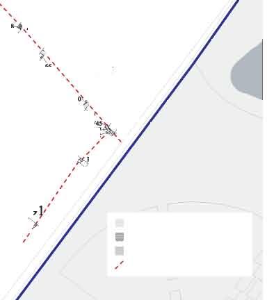
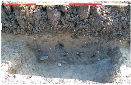

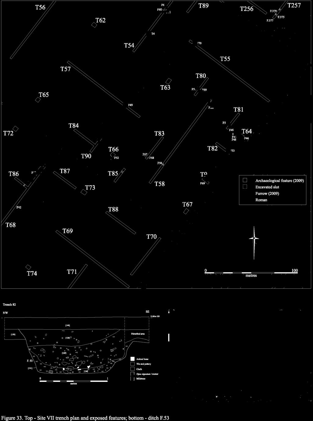
115
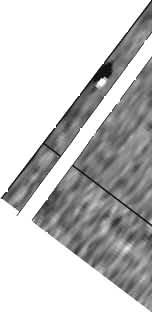
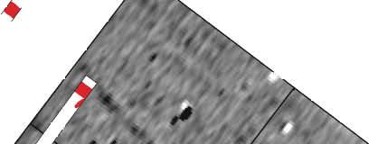
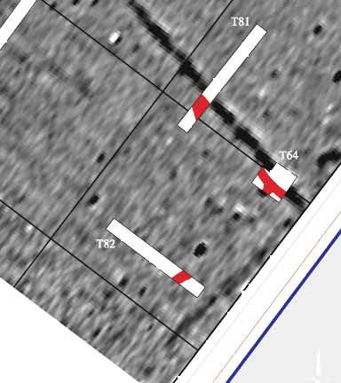

116
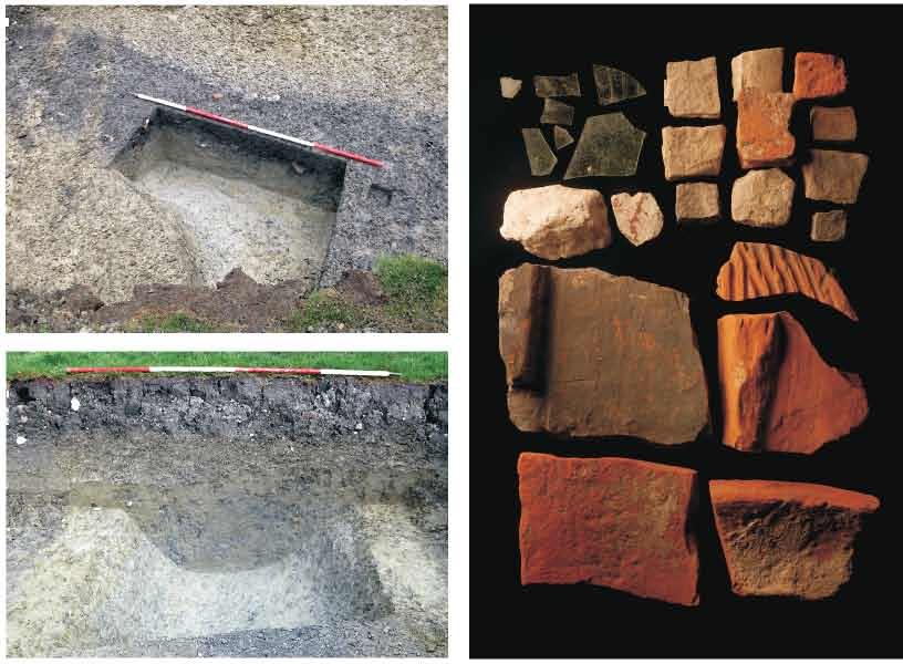
117
118 In order to test the eastern extent of Site VII, the opportunity was taken to evaluate the eastern verge of the Madingley Road Park & Ride car park. Three trenches (Nos. 232, 233 and 234) were excavated in this location (Fig. 8), but only three small undated northwest-southeast oriented linears F.295, F.296 and F.297 were encountered. Their differing form, alignment and lack of material culture indicate that they are not associated with the Roman activity to the west; indeed, they appear most likely to comprise Medieval furrows. It thus appears that Site VII is relatively discrete, and that a substantial proportion of it may lie within the proposed area of development, although clearly significant elements are situated outside of this zone. In addition, although the greatest concentration of features was identified in Field 125, it is also clear that the site extended beyond the southern boundary of this area. A further northwest-southeast aligned ditch F.52 was identified in Trench 86 in Field 124. This feature, which contained a sherd of Later Roman pottery, clearly represents a continuation of undated linear F.43 in Trench 68, and is likely to have comprised part of a secondary enclosure (potentially an element of the aforementioned phase one grid ) situated to the south of the main complex. Therefore, although no other archaeological features were identified in any of the remaining trenches in Field 124, the presence of this ditch raises the possibility that outlying elements of Site VII may also extend towards (or perhaps even reach beyond) the southern boundary of the project-area. Finds Assessment Reports A relatively substantial assemblage of material was recovered from the site This includes Roman pottery, glass, metalwork, painted plaster, tesserae, mortar, ceramic building materials, fired clay, building stone, faunal remains and environmental remains, as well as a small quantity of residual worked flint. The building materials are of particular significance due to their combination of both quantity and quality. Flint Lawrence Billington A single flint was recovered from ditch F.56. A patinated flake, probably of earlier prehistoric date, later retouched through the patina. Roman Pottery Katie Anderson The assemblage from Site VII totalled 244 sherds, weighing 3462g and representing 5.52 EVEs, which was collected from nine trenches. There is no evidence of Late Iron Age and Early Roman activity on the site, with the pottery suggesting the mid 2 nd century AD as the earliest date of occupation, although the lack of Samian in this assemblage suggests that a Late 2 nd /early 3 rd century AD date is more appropriate. There is evidence that occupation continued into the late Roman period (3 rd -4 th century AD), with an apparent peak at the site during the 3 rd century AD. Trench 64 contained 100 sherds (1640g), representing 1.24 EVEs. This included 84 sherds weighing 1456g from F.45, which broadly dated 2 nd -4 th century AD, albeit with some 2 nd -3 rd century AD and 3 rd -4 th century AD material. As there was no apparent difference in date between upper and lower fills of the ditch, it is difficult to determine when it was dug and when it went out of use. Vessels recovered from this feature included a Hadham red-slipped mortaria, a Nene Valley colour-coated jar and an Oxfordshire redslipped vessel. The pottery from Trench 81 totalled 82 sherds weighing 813g (1.05 EVEs), with the majority coming from ditch F.50. This feature contained 75 sherds weighing 791g, which predominately dated to the mid-late Roman period, although there were a small number of later Roman sherds (3 rd -4 th century AD). As with F.45, this included Hadham red-slipped 110
119 wares, an Oxfordshire red-slipped ware and several Nene Valley colour-coated sherds. Pottery from the upper and lower fills was mixed in date, which perhaps suggests some redeposition, although it also suggests the ditch may have remained open for a long period of time. The assemblage contained a range of vessel fabrics, with sandy greywares being the most frequently occurring, although Nene Valley colour-coated sherds were also well represented, accounting for 38% and 24% of the assemblage. Other fineware fabrics included Oxfordshire red-slipped wares (2%) and Hadham red-slipped wares (4.5%), which represented only small percentages of the assemblage. This is also the only one of the site assemblages to have significant number of shell-tempered sherds (24%), as although present at Site IV, these do not account for a high percentage of the assemblage. This evidence therefore suggests that the shell-tempered sherds are a feature of later Roman occupation (3 rd century AD onwards). The vessel forms present in the assemblage are typical of Roman domestic assemblages, dominated by jars (50% of all diagnostic sherds), but with beakers (15%), bowls (15%) and dishes (10%) moderately well represented. Two flagons and a mortaria were also identified. There was no usewear noted on any sherds, although there were two trimmed bases, which is indicative of these vessels having a secondary use. The composition of the assemblage in terms of fabrics is typical of Roman rural sites, although the percentage of Nene Valley colour-coats is high; however these wares flood the market in Cambridgeshire between the mid 2 nd -5 th centuries AD, and are thus are not necessarily evidence of high status activity, as if often thought to be the case with higher percentages of finewares. Glass Vicki Herring The most significant material to be recovered from Site VII consists of up to 15 shards of Late Roman window glass (Fig. 35; although some of this material may potentially be intrusive). They were found in association with a large quantity of Roman CBM and numerous tesserae, and were clearly derived from the demolition of a prestigious building in the near vicinity. F.45, [113], <861> & <130> (4 th century context). Nine window glass fragments (ranging in size from 12x13mm to 37x43mm) were recovered from this feature. Light (natural) blue/green glass. Cylinder blown, just under 2mm thick. A heavy scratch on one suggests that the pieces may be grozed. Cylinder blown window glass began to replace cast from the 4 th century AD, though this method of producing window glass remained popular until the 19 th century. Also from this context are four very tiny, unidentifiable fragments (5-15mm long and less than 1mm thick), three of which have deep parallel scratches roughly 1mm apart. F.50, [127], <169> (4 th century context). Two fragments of window glass (35-20mm in length) were recovered from this feature. Light (natural) green glass with bubbles and thin patina and cylinder blown. 2mm thick. Both grozed on one side to make a straight edge. Although potentially 4 th century in origin, the presence of patination may instead indicate a post-medieval/modern date. In addition to the above, a small quantity of post-medieval material was also recovered (one fragment of which was intrusive within Late Roman ditch F.50). F.50, [127], <169> (4 th century context). A body fragment from a utility bottle. Moulded cylindrical form. Olive green potash glass with thin patina. Late 19 th /early 20 th century in date. [149], <193>, Trench 82 (post-medieval context). Base fragment of a utility bottle. Free blown. Black potash glass with thick opalescent patina. Precise form unknown, but most likely onion-squat c ylindrical and probably of 18 th century manufacture. Metalwork Grahame Appleby with Andrew Hall Site VII produced the second largest, and arguably the richest, metalwork assemblage to be identified from the evaluation of the North West Cambridge site. In total, 53 items were recovered; of these, 13 were composed of copper alloy, 31 of iron and the remaining nine of lead. The majority of these artefacts were associated with the demolition of a relatively prestigious Late Roman dwelling, possibly a villa. Four Late Roman (3 rd to 4 th century AD) coins were recovered from Site VII; they include both nummi and minims. F.45, [112], <724>. Corroded minim; diameter 12mm, weight less than 1g. 3 rd 4 th century AD. 111
120 F.53, [129], <725>. Two corroded fragments from a probable nummus. Outline of right facing bust on obverse. Surviving width 15.7mm, weight 2g. 3 rd 4 th century AD. <727>, Top-soil, Trench 87, SF 9. Corroded minim; diameter 12mm, weight less than 1g. 3 rd 4 th century AD. <740>, Top-soil, Trench 81, SF 8. Corroded coin with pale green patina. Probable nummus. Oval in shape, 22.2mm x 27.86nn, weight 3g. 3 rd 4 th century AD. Nine further copper alloy items were recovered. Amongst these, Late Roman artefacts included a decorated strip or fitting, which was recovered from ditch F.50, along with four possible vessel fragments that were present in ditch F.45. In addition, a 17 th century buckle was also recovered from the top-soil in Trench 64. F.45, [113], <863>. Four fragments of copper alloy sheet, with dark to pale green patina. The largest piece is riveted; height 5mm, weight 2g. Possible vessel or decorative sheet fragment. F.46, [116], <869>. Two small fragments of narrow, rectangular cross-sectioned bar. Total length 30.4mm, thickness 1.1mm. Width varies with possible tab on the larger fragment; weight c. 1g. Unidentified. F.50, [127], <726>, SF 5. Fragment of decorative strip with punch dot impression/perforations along the inside edge. One rivet/attachment hole in the angle of the surviving corner, with a possible further perforation towards the centre. Dimensions: 21.3mm x 31.2mm, weight 2g. Belt, strap or decorative fitting. <723>, Top-soil, Trench 64. Broken 17 th century buckle with grooved surface, notch for tongue; 20.9mm x 32.1mm, weight 6g. <728>, Trench 58, SF 11. Corroded small, relatively thick (4.24mm) L-shaped, flat fragment with rounded corner, 10.15mm x 11.53mm, weight 1g. Unidentified. A total of 31 iron objects were recovered, although many of these are highly fragmentary. The majority of the items, which were derived from Late Roman ditches F.45 and F.50, are potentially structural in origin, and were found in association with a relatively large assemblage of other demolition material. F.45, [113], <743>. 14 nail and stud fragments of varying in size and weight (from 86.2mm to 33.2mm in length and between 2g and 72g in weight); total weight 182g. The largest nail fragment and largest stud would have been used in a substantial construction or object, including doors, roof and wall timbers. Three rectangular bar fragments, two refitting and possibly from a blade were also recovered, measuring between 25.6mm and 50mm in length; 74.7mm for the refitting pieces, total weight 23g. [113], <864>. Two domed hobnails, one badly corroded, diameters 9.8mm and 12.2mm, and two irregular flat fragments, the largest roughly square-shaped measuring 26.06mm by 27.44mm; total weight 8g. F.50, [127], <785>. SF 2. Collection of six fragments and a nail, all heavily corroded. The nail measures 39.07mm long and weighs 6g. The larger two remaining fragments (35mm and 24.5mm in size) refit to form a curved object, with a clenched iron rivet in the smaller pieces; the other fragments may also be part of this object; total weight 44g. It is tempting to identify this object as a joiners staple or bracket, although this interpretation is speculative. Five further nails were also recovered from [127], <744>. Their lengths were: L. c. 28mm; L. 35.9mm (13.7mm wide); L. 46.7mm; L. 43.8mm; L. 69.4mm. F.53, [128], <746>. Four nail fragments: L. 46mm; L. 63.2mm; L. 22.7mm; L. 21.9mm. <786>, SF 7. Trench 73. Thick, C -shaped ring with tapering terminals. Diameter 36mm, thickness 9.18mm, weight 25g. Undated. Finally, nine pieces of lead or pewter were recovered from Site VII. These represent the only examples of this material to have been identified anywhere on the North West Cambridge site. Seven of the pieces are melted and distorted, indicative of their being heated or considered waste material; these are listed together below. Notably, four of these pieces were recovered from F.50 in Trench 81. All of the fragments are most probably Roman in origin. F.50, [127], <735>, SF 3. Weight 37g; <736>, SF 4. Weight 5g; <737>, SF 6. Weight 11g; <784>, weight 2g. All melted and distorted. F.53, [129], <734>. Weight 22g. Melted and distorted. <733>, Spoil heap, Trench 81. Weight 70g. <738>, Top-soil,, SF 10. Weight 45g. 112
121 In addition to the above, two further lead objects were recovered, although at least one of these is post-medieval in origin. They comprise: <732>, Top-soil, Trench 80. Post-Medieval conical weight, with rounded base and trace of iron suspension loop in the top; waist diameter 46.5mm, height 41.3mm, weight 367g. <739>, Top-soil, Trench 58, SF 12. Flat circular disk, 9.81mm thick, 29.1mm in diameter and weighing 58g. The disk has a square-shaped central perforation. Date uncertain and function unknown; possible bobbing or balance weight. Plaster, Tesserae and Mortar Grahame Appleby Two fragments of plaster (weighing respectively 71g and 11g each) were recovered from F.45 at Site VII. The smaller fragment, measuring c. 33mm by 35mm, partially preserves a very eroded polychrome decorative pattern, with green paint along one side and the large part with traces of red, and possibly also pink, pigment. Insufficient pattern survives, but this fragment is most likely from a painted wall panel, with the slip applied whilst the plaster was still wet/damp. Green and red pigments are were frequently used in wall panels, particularly the dado. All of the tesserae retrieved during the evaluation were recovered from Site VII. Table 35 provides a breakdown by feature and trench (see Fig. 35). Of the 39 pieces of pale grey to cream coloured stone (30 pieces) or re-used tile (10 pieces; including at least tegulae, tubulae and possibly pilae), all were crudely reduced to cubes or rectangles of varying thickness (min. 7.98mm to 30.7mm). Planar dimensions were in the range of 23.5mm to 40mm, with c. 30mm the dominant size, possibly indicating the tesserae were fashioned by one or two individuals seeking to produce a uniform length and width for each piece. The use of contrasting tile and stone tesserae indicates that a polychrome effect or design was intended, although whether for a pictorial mosaic or patterned tessellated floor in unclear. Several pieces have mortar adhering to them (mainly the re-used tile pieces), with at least five pieces with mortar on all surfaces, indicative that these may not have been visible after laying. The relative cleanness of the pieces may also suggest the floor surface was systematically lifted or dismantled in antiquity. Feature Trench Total Total Table 35: Tesserae quantities by trench and feature. In total, 35 pieces of mortar were recovered from Site VII (their weight ranging from <1g to 80g and their size from 1-2mm to 53.3mm across). 28 fragments are composed of lime mortar, with flint and chalk inclusions. The remaining 10 fragments, eight from F.46 (Trench 64) and two from F.53 (Trench 82), are fragments of pink coloured grog and flint tempered Opus Signinum. The largest fragment, measuring 39.8mm by 29mm (weight 16g), possesses a flat surface with a straight-sided, rectangular cross-sectioned groove and ridge, both c. 3mm wide, possibly representing the base or edge of a tile or similar laid on the surface when still wet. Composed of crushed tile/pottery and mortar, Opus Signinum was used in the construction and laying of hard floor surfaces, in bathhouses and as a base for mosaics. The recovery of Opus Signinum from the site would suggest, along with the recovery of tessarae, window glass, stone roof tiles and box-flues (tublae; see CBM assessment report), that a building of some pretension was located nearby. 113
122 Ceramic Building Materials and Fired Clay Grahame Appleby A total of 176 fragments of Roman tile, weighing 18.98kg, were recovered from Site VII (primarily being derived from ditches F.45 and F.53), see Table 36 below and Figure 35. Included within this assemblage are a large number of tubulae (box-flue), several with traces of mortar and sooting, and four pilae (hypocaust tiles), one with mortar adhering to one surface; the presence of tubulae and pilae demonstrate the use of under-floor and up-draught wall heating; tegulae would also be used for stringing/coursing and in the construction of stoke-hole arches and, potentially, window arches. The recovery of only 167 tile fragments from the excavation at Vicar s Farm, Cambridge, and 768 fragments from the much large excavation at The Camp Ground, Earith, compared to the 241 fragments from the trialtrenching at North West Cambridge, attests to the importance of this building material. The inference that a villa building was located to the southeast of Site VII (now the Madingley Park & Ride site) would certainly provide a ready source for this material. Site Type IV VII Antifex./Tegul No. / 1 ae Wt. (g) / 93 Imbrex. No Wt. (g) Pilae No. 2 4 Wt. (g) Tegula No Wt. (g) Tubula No. / 13 Wt. (g) / 3119 Undiagnostic No Wt. (g) Total No Total Wt. (g) Table 36: A comparison of tile quantities at Sites IV and VII. A total of 100 fragments of fired clay, weighing 348g, were recovered, although this includes 73 fragments recovered as large residue from a processed environmental sample from F.45. The only diagnostic piece comprised an irregular highly fired fragment, weighing 234g and measuring 64mm by 94mm, possibly preserving the impression or a wattle or rounded piece of wood, which may be a fragment of structural daub. This was recovered from F.49. Building Stone Simon Timberlake A total of 26 stone roofing tile/slate fragments were recovered from Site VII, almost all of them made from local Collyweston Slate. The use of this material imported from quarries in the Stamford area of Lincolnshire suggests fairly high status buildings, possibly those of a villa or the equivalent. Few of the fragments show obvious signs of weathering or abrasion, suggesting that they represent primary deposition or else have short redeposition histories. Future archaeological work should endeavour to collect all of this assemblage, as distribution densities may help to identify the locations (or even the footprints) of what could otherwise have been wooden buildings. F.45, (113), <134>, Trench 64, 1202g. 4 chunky fragments of broken Collyweston slate. At least three of these have traces of nail holes (circular holes c. 5mm diameter), hence are stone roofing slates. 114
123 F.50, (127), <172>, Trench 81, 1498g. 14 fragments of broken roofing slates or tiles of Collyweston Slate (fissile limestone) from basal Lower Lincolnshire Limestone of the Stamford area (Lincs.). One of these has a nail hole, thus is clearly a stone roofing slate. F.53, (129), <182>, Trench 82, 664g. 1 side of a stone roofing slate/tile made of Collyweston Slate with one crudely squared and faced corner. Imprints of Modiolus sp fossil bivalve on one side. The original slate would probably have been 170mm long by 140mm wide. F.59, (157), <209>, Trench 80, 246g. 3 fragments of Collyweston Slate. F.66, (172), <217>, 98g. 3 fragments of Collyweston Slate. F.69, (178), <228>, 268g. 1 fragment of thinly split Collyweston Slate roofing tile. The original perhaps mm wide. A fragment of a dressed and faced building stone was also present at Site VII. This was almost certainly derived from the same building (or complex. of buildings) as the Collyweston roof tiles described above. F.47, (114), <140>, Trench 64, 246g. A flaked-off fragment from part of a faced slab of oolitic limestone presumably from a dressed and faced moulding of a building stone. Probably of a local East England building stone type (Jurassic outcrop from Lincolnshire?). Faunal Remains Vida Rajkovača Site VII has produced a considerable assemblage of animal bone amounting to 345 assessable fragments (see Table 37, below). Features were dated to 2 nd to 4 th century AD, with further four features dated to 3 rd to 4 th century AD. Two features did not contain pottery dating evidence and they remain undated. The state of preservation ranged from moderate to quite poor with a number of fragments showing signs of exfoliation and surface damage. The Roman component of the assemblage was dated to the 2 nd to 4 th centuries AD and it will be considered as a whole, although it is possible that more than one phase is represented. The material was recovered from ditches and it is eroded and highly fragmented. Taxonomy NISP MNI Cow 36 2 Ovicaprid 15 1 Sheep 4 1 Goat 1 1 Pig 7 1 Horse 4 1 Dog 6 1 Chicken 2 1 Red deer 4 1 Roe deer 3 1 Cattle-sized 72 - Sheep-sized Mammal n.f.i Bird n.f.i. 6 - Total 338 Table 37: Number of specimens identified to species (or NISP) and minimum number of animals (MNI) for Site VII (abbreviation n.f.i denotes the specimens that could not be further identified). Compared to the earlier phases, a slight shift is visible in terms of the species representation with a small increase in the number of cattle relative to sheep/goat specimens. The assemblage is dominated by the three main food species, followed by dog and horse. Another domestic species is chicken represented by two specimens. The remains of roe and red deer are meat-bearing elements and they are an indication of the ex.ploitation of wild faunal resources. A cattle mandible was recorded showing a variation in the conformation of the mental foramen. The absence of swelling of the area or the signs of periostitis indicates that 115
124 this is not pathological in origin and it is more likely to be of genetic origin. This non-metrical trait is usually linked to the restricted gene pools of local populations of cattle and this trait has been recorded on a number of other Roman assemblages (Dobney et al. 1996, 34). It was not possible to detect any gnawing marks, which could imply quick deposition of the material. Alternatively, it is possible that gnawing marks were difficult to observe due to the poor preservation of the bone surface. Dietary preference for beef is believed to have come from the continent with Roman legions populating Britain and it has been suggested that military and, therefore, Romanised sites would have higher proportions of cattle than rural civilian sites, which are likely to continue with the native Iron Age tradition (King 1999, 180). Both the pottery dating evidence and the relative proportions of species show that the site was Romanised with the larger quantities of animal bones (40% of the assemblage) being recovered from four features dated to 3 rd to 4 th century AD. This could perhaps reflect intensifying activities at the site from the 3 rd to 4 th century AD. The domestic fowl was well-known in Britain before the Roman conquest, although it then became much more common (Maltby 1981). In addition to this, butchery practices observed in this assemblage have a distinct Roman character, with chop marks being more common than cut marks, especially on ribs and vertebrae. The use of a cleaver was also noted, a dual-purpose implement designed with the intention of facilitating and improving carcass dismemberment (Seetah 2006, 109). Another characteristic butchery practice observed in this sub-set were marks on cattle scapulae indicative of the curing process (marks include removal of the coracoid and spina and cut marks on the dorsal aspect of the neck). All these aspects are thought to be typically Roman in character (ibid.) when butchers employed practices to speed up the butchery processes and the demand became higher, which resulted in the change of butchery marks that could be noted. Environmental Remains Anne de Vareilles Four Late Romano-British bulk soil samples were selected for analysis from this site. Carbonised and some dried waterlogged plant remains were recovered. Features F.45 and F.46 had a large category of heavily fragmented and distorted grains, which along with the few pieces of vitrified charcoal indicate intensive burning conditions. Resistant waterlogged seeds of crowfoot (Ranunculus Subgen. Batrachium) and stinging nettles (Urtica dioica) were found in F.52 and F.66, testifying to a once waterlogged medium. Modern rootlets in all but F.66 point to a low degree of bioturbation. Snail shells were found in all features and are listed with the plant remains in Table 38 below. The samples derived from Late Romano-British ditches F.45, [113] and F.46, [116] contained very similar assemblages. Charcoal was infrequent, suggesting that these remains are not clearings from a fire/hearth. Just under 50 whole grains of spelt (Triticum cf. spelta), possibly emmer wheat (T. spelta/dicoccum) and a little barley (Hordeum vulgare sl.) were found, along with numerous fragments. No more than 10 spelt and possibly emmer glume bases, and 20 to 22 whole wild plant seeds were recovered. The wild plant seeds could all have been arable weeds (apart form the hazel nut (Corylus avellana) in F.45). It is unusual to find so much hulled cereal grain still mixed with many weed seeds and yet with so little chaff. The amount of chaff, however, is likely to have been adversely affected by firing conditions as it does not withstand intensive burning as well as seeds might (Boardman and Jones 1990). Both of the samples derived from Late Romano-British ditch F.52, [133] and gully F.66, [172] contained a small range of charred plant remains which probably lay on the surface, having been scattered from larger assemblages, before being buried in the features. Some waterlogged seeds have survived that, along with the fresh water snail Anisus leucostama (a species that withstands drying), indicate seasonal waterlogging. Spelt wheat, hulled barley and possibly emmer appear to have been stored and processed at this site. The remains from F.45 and F.46 have been adversely affected by charring, making it difficult to decipher their origins (either discarded waste or accidental loss). Further samples could clarify the relationship of crop assemblages with the two ditches F.45 and F.46. The only other site in the North West Cambridge Development Area to contain similar remains is Site IV, where spelt was evidently a staple crop. Site VII appears to contain layers previously waterlogged but that can in fact be sampled for carbonised remains. Care should be taken to distinguish these from truly waterlogged contexts. 116
125 Sample Number Context Feature Feature type Ditch Ditch Gully Ditch Phase/Date Late Roman Sample volume - litres Flot volume - mililitres Flot fraction ex.amined - % large charcoal (>4mm) - med. charcoal (2-4mm) small charcoal (<2mm) vitrified charcoal parenchyma frags - undifferentiated plant storage tissue - Cereal grains Hordeum vulgare sensu lato hulled barley grain 6 Triticum cf. spelta spelt wheat grain 8 8 Triticum spelta / diccocum spelt or emmer wheat 8 16 Triticum sp. wheat type indet Triticum / Hordeum wheat or barley Total whole grain count cereal grain fragments indet., mostly <2mm Cereal chaff Triticum spelta glume base spelt chaff T.spelta/dicoccum glume base spelt or emmer chaff 2 4 Triticum sp. glume base glume wheat chaff Total glume base count germinated embryo, indet. 1 Non cereal seeds Ranunculus Subgen. BATRACHIUM Crowfoot + WL + WL Urtica dioica L. Common Nettle ++ WL +++ WL Hazel-nut shell Corylus avellana L. fragment Atriplex. patula L./prostrata Boucher ex. DC - Oraches 2 3 Fallopia convolvulus (L.) A Löve Black bindweed 1 Lady'smantle/Parsley-piert Alchemilla / Aphanes sp. 1 Medicago / Trifolium sp. medics or clover 3 1 Trifolium sp. clover 1 Epilobium sp. Willowherbs 1 Odontites vernus (Bellardi) Dumort. Red Bartsia 2 Carduus/Cirsium sp. Thistles + WL Anthemis cotula L. stinking chamomile 1 Lemna sp. Juncus sp. Duckweeds rushes Carex. cf. hirta L. Hairy sedge 1 Large Poaceae (>4mm) large wild grass seed 9 8 medium wild grass Medium Poaceae (2-4mm) seed 4 Small Poaecae (<2mm) small wild grass seed 2 Poaceae fragment indet. - wild or cultivated grass seed frag Table 38: Plant macro-remains from bulk soil samples at Site VII (key: - 1 or 2, + <10, , +++ >50 items, WL = waterlogged; P = present). +++ WL 117
126 Sample Number Seed indet. 3 Small cotyledon indet. <2mm 1 1 Total seed count (grass frags and WL seeds not included) Fresh water mollusca Lymnaea truncatula + - Anisus leucostama Damp / Shade loving species Carychium tridentatum / minimum Vallonia ex.centrica / pulchella Vertigo pygmaea / antivertigo Cochlicopa lubrica / lubricella - Vitraea sp. + Oxychilus/Aegopinella ++ Catholic species Pupilla muscorum - - Discus rotundatus Trichia sp Ceciloides acicula Blind burrowing snail + fish scale - Modern rootlets P P P Table 38 continued: Plant macro-remains from bulk soil samples at Site VII (key: - 1 or 2, + <10, , +++ >50 items, WL = waterlogged; P = present). Discussion Ceramic evidence indicates that activity had most probably begun at Site VII by the late 2 nd /early 3 rd century AD. At this time a rectilinear system of ditches, consisting of a grid-like arrangement of at least three (and potentially upwards of nine) enclosures, was set out on a northeast-southwest axis. Of this group, however, only the enclosure situated in the southeastern corner of Field 125 was fully identifiable within the area of evaluation. Judging by the results that were obtained from its investigation, it seems likely to have comprised an ancillary area in which the storage and processing of spelt wheat, hulled barley and possibly also emmer was undertaken (see further the environmental remains assessment, below). Indeed, an agricultural usage such as this accords well with the apparent absence of typically domestic features, such as rubbish pits, in the area. It also implies that relatively ephemeral structures such as barns or storehouses, which may potentially have left little discernable geophysical trace in the heavy clay soil, could well be present in the vicinity (providing a possible context for posthole F.68). The principal focus of Site VII, however, appears to have lain slightly further to the east, beneath what is now the Madingley Road Park & Ride car park. Evidence for the presence of more intensive activity in this area was recovered in the form of the substantial deposit of demolition debris that had been backfilled into the ditches re-cut into the northeastern corner of the enclosure. Indeed, given the limited scale of exposure afforded by a trenchbased evaluation, an impressive assemblage of building materials was 118
127 recovered from this area (Fig. 35). Altogether, the finds included: 176 fragments of tile, including 46 imbrices, 45 tegulae, 13 tubulae (or box-flue tiles), four pilae and a possible antifex; 26 fragments of Collyweston roof tile; 39 tesserae; a fragment of painted wall plaster (bearing three colours, but no identifiable pattern); a fragment of dressed and faced building stone; 10 fragments of opus signinum, numerous iron nails and a small quantity of burnt daub. Up to 15 shards of Late Roman cylinder-blown window glass were also recovered (see further the specialist assessment reports, above). These materials, which appear most likely to have been deposited during the late 3 rd or early 4 th century, were clearly derived from a substantial Roman building (or group of buildings). Furthermore, the large size and varied composition of the assemblage strongly suggests that this structure was located in the immediate vicinity of the area of its deposition. That the material was tightly clustered in the northeast corner of the enclosure, and markedly diminished to both the west and south, also supports this interpretation. A further element of interest with regard to the assemblage is the relative cleanness of several of its constituent elements (such as the tesserae, for example). This implies that the building or buildings are likely to have been systematically dismantled, and suggests that it may perhaps have been only the unusable or unwanted material that was discarded into the nearby ditches. Whether this is because the demolition took place as part of a wider phase of remodelling, with the original materials destined to be reemployed elsewhere on the site, or instead represents the organised recycling of building material following the general abandonment of the settlement, remains unclear. It is certainly of note, however, that there are indications the site may have been relatively short-lived. Firstly, whilst the pottery recovered is generally 3 rd to 4 th century in date, a marked peak is apparent in the 3 rd century and it is possible that very little exclusively 4 th century material is present (see further the pottery assessment report, below). Furthermore, only a single phase of re-cutting was identified within the ditches which comprised the network of enclosures, and this itself appears to have been relatively short-lived as no silt had apparently had time to accrue prior to the insertion of the demolition material. Overall, it can be seen that Site VII represents the western edge of a wealthy Mid to Late Roman rural settlement. The presence of tubulae, pilae, Collyweston roof tiles, tesserae, painted wall plaster, opus signinum and window glass along with metalwork and relatively large amounts of pottery (see below) suggests the presence of a villa, or villa-like building, in the near vicinity (cf. Percival 1976, 13-16; Smith 1993, 2-5). This impression is further reinforced by evidence of the storage and processing of grain at the site (activities that were represented in environmental samples recovered from both phases of enclosure ditch). Thus, although questions clearly remain as to both the precise extent and chronology of activity at Site VII, further investigations in this area have the potential to significantly elucidate our understanding of the wider Roman landscape of this part of Cambridge. 119


128
129 Site VIII Site VIII is most probably Medieval in date and is situated in Field 128, a short distance to the north of Site VII (Figs. 8 & 36). The topography of the area is relatively level, and lies at around 15.6m OD. No trenches were excavated at this site during the 2008 evaluation, and the area was not fieldwalked as it lay under pasture; it was not subject to a geophysical survey. In total, four features have been investigated at Site VIII. These were located in a single trench, Trench 257, and all of them consisted of linears; none contained any datable material. The primary result of the evaluation at Site VIII was the identification of a northwest-southeast aligned trackway. Investigations revealed that this consisted of a minimum of two phases. The first phase was represented by boundary ditches: F.375 to the south and, to the north, F.378. These were Vshaped in form, and varied between 0.43 and 0.83m in width, and were m deep. Subsequently, F.375 was re-cut by F.379 and F.378 was re-cut by F.381. These re-cuts were shallower than the original ditches, and more Ushaped ; they varied between 1.12m and 1.29m in width, and were m deep. It is clear that the trackway also continued to the east of Trench 257, as unexcavated elements of the northern boundary ditch were identified in Trenches 267 and 265 (Fig. 36). The only other feature to be identified at this site comprised a Medieval furrow, F.377. Discussion The features identified at Site VIII closely correspond to the location of a Medieval trackway that is known to have extended from Braderrusshe in the west to Seaman s Ditch and Trinity Conduit Head in the east (Hall & Ravensdale 1976). This track appears to have been very similar to the Milnewaye that has previously been identified at Site III to the north, and was also in existence by c when it was likewise recorded in the Terrarium Cantabrigiae (ibid.). The present trackway appears to be less well preserved than the former example, however, and produced only a single undiagnostic peg tile fragment. This clearly limits its potential contribution to any broader understanding of the Medieval landscape of the area. Site X Site X is Roman in date and is situated in Field 108, towards the northwestern end of the project-area (Figs. 8 & 37). Although the topography of the area inclines gradually to the south, the site itself lies towards the crest of the slope at around 19.2m OD. No trenches were excavated at this site during the 2008 evaluation, and the area was not fieldwalked as it lay under pasture; it was not subject to a geophysical survey. In total, five features have been investigated at Site X. These were distributed across two trenches Numbers 269 and 312 and all of them consisted of linears. Only one of the features, however, or 20% of the total, contained datable material. 121
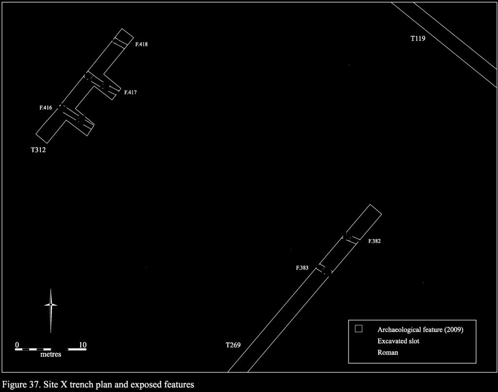
130
131 As at Site VIII, the principal result of the evaluation at Site X was the identification of a probable trackway or road. This was again oriented northwest-southeast, but unlike the former example the present trackway does not appear to have been Medieval in date. It primarily consisted of ditch F.416 in Trench 312 (which corresponds with F.383 in Trench 269) and ditch F.417 in Trench 312 (which corresponds with F.382 in Trench 269). These features, which comprised the southern and northern boundaries of the road respectively, were U-shaped in profile, with steeply sloping sides and concave bases; they varied between 0.79m and 0.9m in width and 0.3m and 0.32m in depth. They each contained deposits of heavily weathered silty clay with occasional gravel inclusions, in addition to which F.417 produced three sherds of Late Iron Age/Early Roman pottery. No evidence of re-cutting was identified, but a third ditch was present to the north of F.417/F.382 in Trench 312 (Fig. 37). This feature, F.418, shared an identical profile and fill with the aforementioned ditches. It may therefore have comprised part of an additional phase of activity, which following the usage, and possible deterioration, of the original route involved the shifting of the road s course a short distance to the north. No trace of metalling, or other surfacing material, was present, but the slope had been very heavily ploughed. Although no Medieval trackways are recorded in this vicinity, the location and orientation of these features corresponds very closely with the proposed route of the Roman road from Cambridge to Godmanchester (which antiquarians of the 18 th century termed the Via Devana). This possibility is discussed further below. Finds Assessment Report A very small assemblage of material was recovered from Site X: three sherds of Late Iron Age and Roman pottery. Late Iron Age and Roman Pottery Katie Anderson Three sherds weighing 16g were collected from Site X. This included one Late Iron Age Grogtempered sherd from a jar, and one Early Roman body sherd. Discussion Little is known for certain of the route of the road extending northwest towards Godmanchester from the Roman town of Cambridge, although it is generally assumed to have run either across or immediately to the north of the project-area (e.g. Babington 1883, 26-42; Fox 1923, 168-9; Margary 1973, 210; Hall & Ravensdale 1976, 35; Browne 1978, 17-19). That a road did exist in this location is known from the presence of two mile markers, which were found in 1812 c. 5km beyond Cambridge on the road to Godmanchester (Browne 1978, 28). The more complete stone of the pair bore two superimposed texts, which have both been dated to AD 306-7, recording the repair of the road as part of a much larger province-wide renovation scheme (Collingwood & Wright 1965, no. 2236). A relatively well preserved section of what is most probably this same road was also excavated in the early 20 th century near Emmanuel Knoll, some miles to the northwest of Cambridge 123
132 (Walker 1910, 166-7). In light of these discoveries, a number of the Roman mortuary deposits that have previously been identified in the immediate vicinity of the North West Cambridge site have been interpreted as comprising roadside burials. This includes the richly accompanied cremation burials excavated at Girton College, which may have been associated with elaborate funerary monuments, as well as the stone sarcophagi encountered during coprolite quarrying conducted in the northeast corner of the project-area (Babington 1864; Hollingworth & O Reilly 1925; Liversidge 1977, 15-16). The former provisionally lay to the east of the road, whilst the latter were most probably situated to its west. Despite the general consensus on both the presence and broad orientation of this road, however classified by Margary (1973) as Route 24 its precise course remains unclear. The earliest observation of its route was recorded following the construction of the turnpike road to Huntingdon in c (Wright & Lewis 1989, 115): After paſſing through the ſtation, our road left it by the oppoſite gate, keeping nearly in the line of the modern road to Huntingdon: it paſſed through the fields of the farm called Hows houſe, where a barrow containing ſeveral Roman coins was removed in making the preſent turnpike road, and went close by Lolworth hedges, to which it directly points (Lysons & Lysons 1808, 44-5). A few decades later, following the commencement of intensive quarrying activity in the area, Charles Babington recorded that: The Roman way which the antiquaries of the last century called the Via Devana is believed to have left Camboritum (Castle End, Cambridge) at the same place were the present turnpike road to Huntingdon passes out of the town, or perhaps very slightly to the west of that spot; to have passed over or by the side of what until recently was called The Hill of Health and through the grounds of a gentleman s house called The Grove. Its course afterwards was probably through the fields lying to the west of the present road, for there is no doubt it traversed the closes opposite Howe s House [Fields 116 and 117 of the project-area]. All trace of this ancient road was removed at some former period... there is very little, except perhaps a slight rise in the ground, to show where the Roman way passed (Babington 1864, 289). Although interesting especially since the latter report places the road directly within the current project-area neither account appears to have been based upon solid evidence. Recent excavations, however, undertaken at New Hall/Murray Edwards College in 1994 and 2009 (Evans 1996; Hutton 2009), have identified traces of what is this same road. In each case, its course was projected to lie very close to that previously recoded by the Lysons and Babington (Evans 1996, 95; Hutton 2009, 5-12). Nevertheless, the ditches at Site X represent the only instance where features on this alignment have been identified within the North West Cambridge development area. No evidence was recovered in the vicinity of Site IX despite this location being directly cited by Babington, above and no trace of a road was identified in the geophysical survey of Fields B and C immediately to the west (see further Site XII, below). In conclusion, therefore, it is clear that this evaluation raises significant questions about the form and/or alignment of the Cambridge to Godmanchester Roman road. If the proposed alignment is correct, then it reveals that this section of the road, at least, was very ephemerally constructed. If it is not correct, then its route along with the associated interpretation of any proposed roadside features in the near vicinity clearly requires further investigation. This topic will be examined further in the main discussion section, below. 124


133
134 Site XI Site XI is Late Bronze Age to Middle Iron Age in date and is situated in Field A, towards the northwestern corner of the project-area (Fig. 8 & 38). The topography of the site is relatively level, and lies at around 13m OD. No trenches were excavated in this area during the 2008 evaluation, and the site was not fieldwalked as it lay under pasture; it was not subject to a geophysical survey. In total, three features have been investigated at Site XI. These were distributed across three trenches Numbers 305, 307 and 311 and all of them contained datable material. The features consisted of two linears and a pit. In the first instance, two broadly east-west aligned ditches were identified; F.409 in Trench 305, and F.411 in Trench 307. These features varied between 0.97m and 1.1m in width and 0.32m and 0.34m in depth. The former contained 45 sherds of Late Bronze Age/Middle Iron Age pottery, weighing 170g, which were most probably derived from a single vessel, whilst the latter contained a single sherd of Middle Iron Age date. Given the similarity of their irregular U-shaped profiles, however, in addition to their consistently greyish brown silty clay fills, it is probable that both features comprised part of the same curvilinear ditch. The extent of this feature and the form of the enclosure of which it most probably formed a part remains unclear, as no further elements of the system were identified, despite judgemental trenches being sited to the west (Trench 309), east (Trenches 308 and 310) and south (Trench 298). Nevertheless, one further feature was identified a short distance to the south in Trench 311. This comprised probable pit F.415, which contained 13 abraded sherds of Middle Iron Age pottery. Although this feature could potentially comprise the terminus of a shallow ditch extending on a curvilinear alignment from F.411 to the north (see Fig. 38), the absence of any intervening feature in Trench 298 allied with the steep-sided and flatbottomed profile of F.415, which contrasts markedly with the morphology of the ditch implies that it most probably formed a discrete outlying feature. No further archaeological remains were identified in this area. Finds Assessment Reports A small assemblage of material was recovered from Site XI. This includes prehistoric pottery, worked flint and faunal remains. Flint Lawrence Billington Site XI produced a single flint, a later Mesolithic microlith. It falls into Clark s (1934) type B or Jacobi s (1978) type C, having straight-backed retouch accompanied by an oblique truncation at the proximal end. Prehistoric Pottery Mark Knight The 45 sherds (weighing 170g) recovered from F.409 appeared to belong to a single mediumsized vessel made of an extremely hard shell-tempered fabric. Part of a base survived but the remainder of the assemblage was made up of plain body sherds. Its LBA/EIA attribution is based upon its fabric (Fabric 6). Fabric descriptions are presented in Appendix
135 Later Prehistoric Pottery Katie Anderson Site XI produced 14 sherds, weighing 7g. This comprised small sandy body sherds which are Middle Iron Age in date. Thirteen sherds were recovered from F.415, with the final sherd coming from F.411. The sherds were all very small and abraded. Faunal Remains Vida Rajkovača A total of 24 fragments of bone were recovered from three features at this site, one of which was dated to the Late Bronze Age (F.409) and two of which were Iron Age in date (F.411 and F.415). F.409 contained loose cattle teeth and tooth fragments, as well as seven unidentifiable fragments. F.411 and F.415 yielded eight assessable specimens. The remains of cattle, sheep and pig were identified. Beyond stating the representation of species, however, it is not possible to draw any significant conclusions from so small an assemblage. Discussion Although relatively small, the quantities of pottery and faunal remains recovered from the features at Site XI are sufficient to indicate that they did not comprise part of an outlying fieldsystem, but instead lay a short distance from a locus of contemporary settlement. The full extent and chronology of the associated area of occupation remains unclear, however. Nevertheless, it is apparent that the settlement s inhabitants were utilising a very similar environment to those of Site VI to the southeast, as this site is also situated on the southwest floodplain of the Washpit Brook. Furthermore, the geophysical survey undertaken in Fields B and C to the north also indicates that a further settlement may have been situated on the opposite bank of the Brook during approximately the same period (see further Site XII, below). Finally, it is interesting to note the recovery of residual Mesolithic flint at this site, as this further attests to the importance of the Washpit Brook corridor during the earlier as well as later prehistoric periods. Site XII Site XII is situated in the northwest corner of the project-area, in Field B (a paddock currently used by the Department of Physiology; Figs. 2, 8 & 39). Because of Home Office licensing conditions placed upon the Department of Physiology s researches, we were unable to dig any trenches within the c. 4ha area represented by Fields B and C. Instead, Oxford Archaeotechnics undertook geophysical survey, although due to the ground conditions the results are rather indistinct (Fig. 39). What is probably a post-medieval field boundary appears to run roughly parallel with the line of Washpit Brook, and may have delineated its flanking water-meadows. In the northernmost paddock, two possible linears cross its line. While these are likely to be similarly 'late ditch boundaries, there is just a chance albeit slim that they relate to the Site XI ditch system. 127
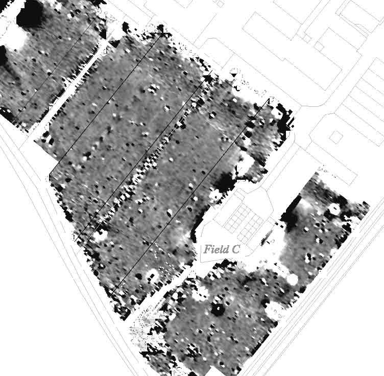
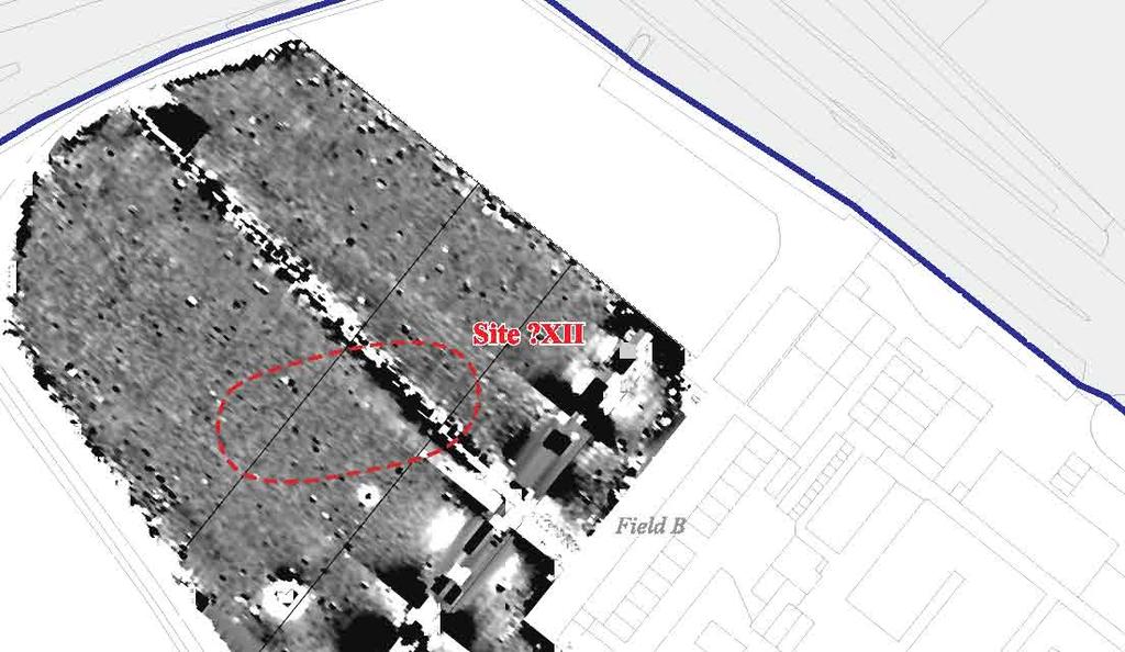
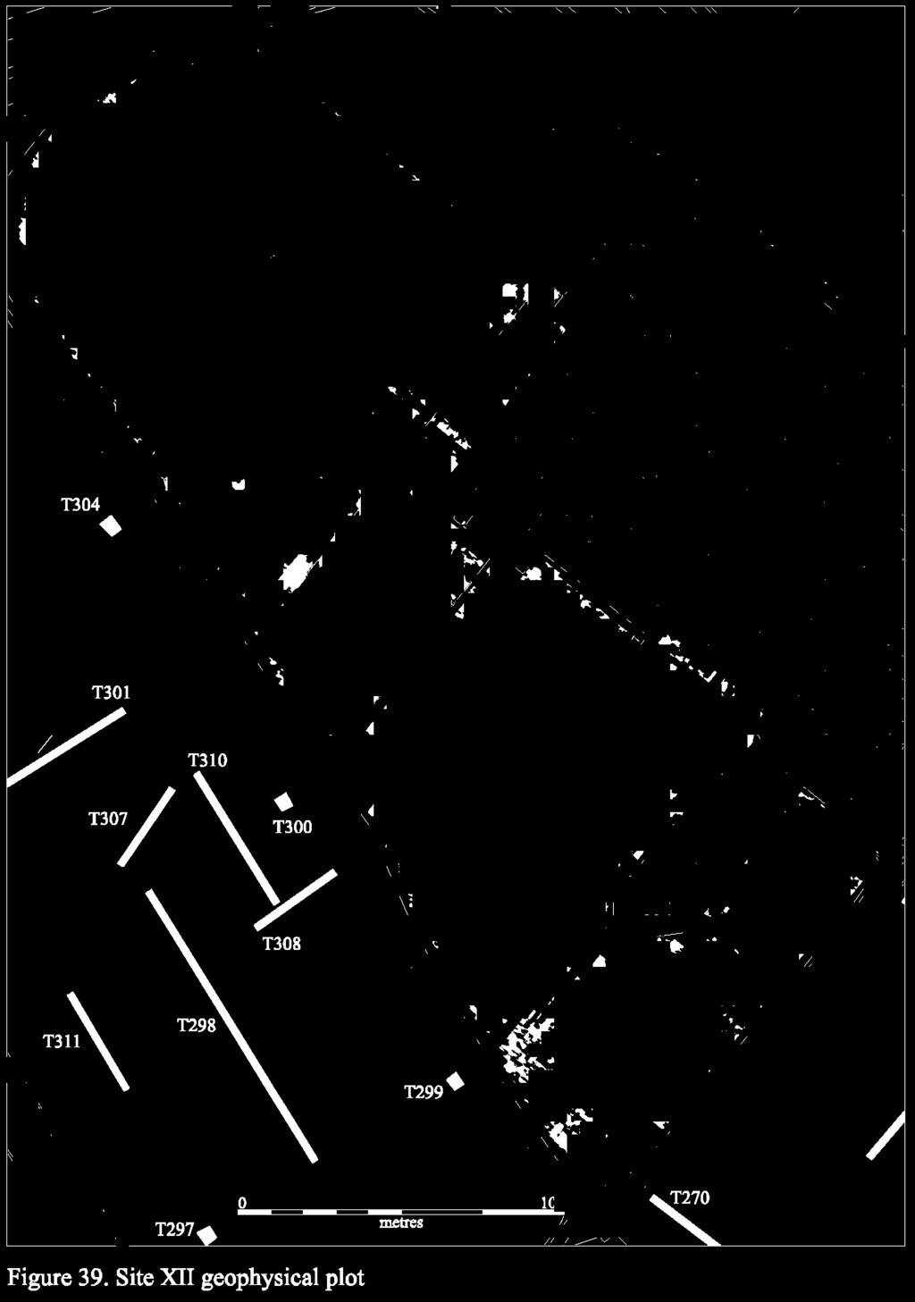
136
137 In the south of the area, and adjacent to the Brook, the geophysical survey identified a series of weak curvilinear/linear anomalies. Although possibly attesting to some manner of early settlement, it is thought that these are more likely to have been agriculture-related. Somewhat more convincing were a series of ephemeral linear anomalies in the northern paddock. There, falling in the mid-slope swathe, these suggest two/three conjoining organic-plan sub-rectangular enclosures which, if real, are probably Middle/later Iron Age settlement compounds. Despite unavoidable ambiguity, for the sake of reference these features have been designated as Site XII. Dispersed Features In addition to the above sites, a further 43 dispersed features were also encountered in Area II. These were widely distributed across the clay plain, with little or no discernable patterning (Figs. 8 & 40). Features were identified in 27 trenches (Nos , 30, 47, 52, 54, 58, 66, 83, 92, 93, 103, 107, 108, 110, 121, 150, 151, 232, 246, 248, 256, 257 and 280); these are broken down by type in Table 39 below. Feature Type No. Excavated Linear 23 Furrow 16 Treethrow 2 Pit/linear 1 Pit 1 Total 43 Table 39: Dispersed features in Area II by type. As in Area I, the majority of the dispersed features in Area II are modern in date, or else are isolated and undated. Two exceptions to this pattern are worthy of further consideration, however. The first of these is located in Field 118, at the northernmost end of the project-area. Here, in Trench 150, a northsouth aligned ditch was identified (F.144) that contained a sherd of Late Iron Age/Early Roman pottery. This feature, which most probably represents the continuation of F.95 that had previously been identified in Trench 108 to the south, does not appear to have lain in close proximity to a locus of contemporary settlement and is most likely to represent the boundary of an outlying fieldsystem. Although unremarkable in itself, the ditch is notable because it lay relatively close to the probable Roman road at Site X, but clearly did not respect its alignment. Given the early date of the pottery which it contained, it is possible that the feature represents part of a fieldsystem which predates the establishment of the roadway. If correct, this would indicate that the landscape of the area was reorganised when the road was introduced (thereby suggesting a potential catalyst for the apparently successive relationship between the settlements at Sites II and IV further to the south). Secondly, the possible remnants of a pre-medieval fieldsystem, consisting of shallow gullies F.82 in Trench 93 and F.83 and F.93 in Trench 110, may be present in Field 112 (Fig. 40); however, it must be noted that post-enclosure 129
138 field boundaries were also identified in this field (including F.79 in Trench 92, F.85 in Trench 107 and F.95 and F.96 in Trench 108). Yet whilst little distinction can be drawn between the two systems in terms of their alignment as both are oriented on a northeast-southwest axis, broadly following the contours of the underlying topography it is notable that only the post- Medieval ditches are visible in aerial photographs of the area. This suggests that traces of an earlier fieldsystem, which could potentially have extended southwest from Site IV towards the eastern fringe of Site VI, may have become masked by Medieval ploughing. Given both the absence of datable material within, and the markedly ephemeral nature of, the features in question, however, any such identification must remain highly provisional. Finds Assessment Reports A very small assemblage of material was recovered from the dispersed features in Area II. This includes Roman, post-medieval and modern pottery, plus a small quantity of metalwork. Roman Pottery Katie Anderson A very small assemblage of Roman pottery was recovered from dispersed features in Area II. Aside from the small quantity of in situ material recovered from ditch F.144; however, the remainder of the assemblage was redeposited within later furrows. Post-Medieval and Modern Pottery Richard Newman with David Hall A total of nine sherds of post-medieval and modern pottery, weighing 106g, were recovered from the dispersed features in Area II. All of the material was derived from modern features, including gravel quarries, backfilled furrows and agricultural boundary ditches. In the first instance, the assemblage included seven sherds of 16 th /17 th century date, weighing 52g. These comprised four sherds of Glazed Red Earthenware, weighing 41g; a single sherd of Westerwald Stoneware, weighing 6g; a sherd of Staffordshire-type Slipware, weighing 4g; and a single fragment of Plain Red Coarseware, weighing 1g. Also present were two sherds of 18 th -20 th century material, weighing 54g. These both comprised fragments of Sunderland-type coarseware. None of the material from Area II was of particular interest, and no large or significant groups were identified. Metalwork Grahame Appleby Two iron objects were recovered from Area II, although at least one of these is post-medieval in date. F.399, [1123], <783>. Small complete, (head has delaminated) rectangular cross-sectioned nail, length 30.83mm, weight 4g. <858>, Field 108. Heavy, triangular-shaped wedge for splitting wood or masonry; height 121mm, width 67.55mm, thickness at base 38mm, weight 1227g. Post-Medieval; discarded. 130
139
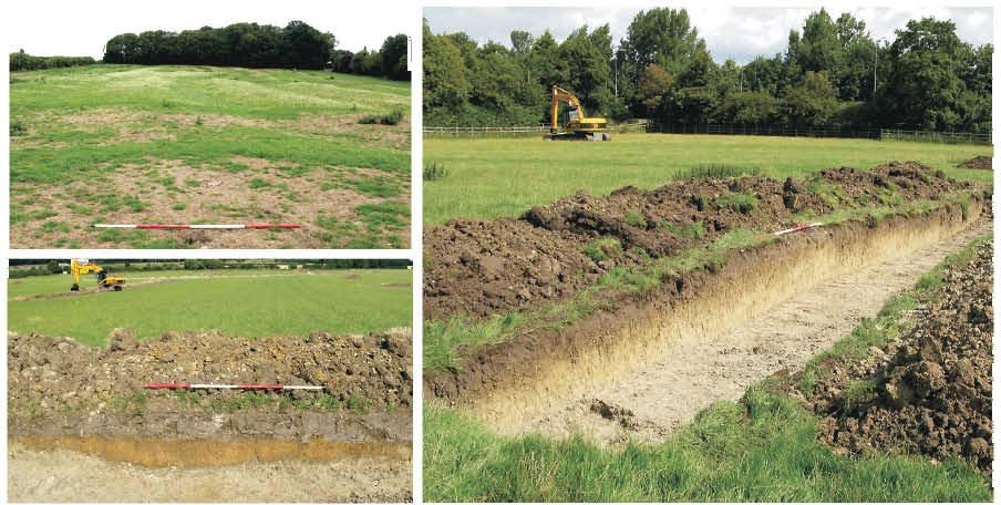
140
141 Area II - Summary of Archaeological Preservation Unlike in Area I, where the underlying Observatory Gravels comprised an exploitable commercial resource during the Medieval and post-medieval periods, in Area II no trace of quarrying activity was encountered (although it is possible that localised clay extraction may have been undertaken). As a result, a generally higher level of archaeological preservation was identified. Nevertheless, the impact of modern agricultural practices was again widely represented, and their effects were most clearly demonstrated by the poor survival of traces of Medieval open field agriculture. Although clearly visible in mid 20 th century aerial photographs of the North West Cambridge area (see Figs. 6 and 7, above), the archaeological survival of both ridges and furrows in Area II was poor. Only one upstanding ridge was identified, lying in Field 118 in close proximity to Huntingdon Road (Fig. 41). Furrows, as is typical, were more widely represented, but their survival was inconsistent and little additional information with regard to their layout or organisation could be gained to supplement the extensive documentary sources for the area (Hall & Ravensdale 1976). Indeed, the degree of modern truncation is immediately apparent if the surviving traces are compared with the extant remains of ridge-and-furrow located just outside the project-area to the east of the Madingley Road Park & Ride car-park (Fig. 41). Despite the denudation of any upstanding earthworks by modern agricultural machinery, however, the preservation of the underlying archaeological deposits was relatively high. In situ sub-soil deposits were encountered in the majority of trenches in Area II (see Appendix 3), and only small quantities of material appeared to have been displaced into the topsoil. 133
142 DISCUSSION Spanning from the Palaeolithic through to Medieval times, the evaluation results well-attest to the area s long land-use history. Indeed, given the size of the development area and in the light of comparably intense landscape-scale evaluation programmes elsewhere in the region (Evans et al. 2008), by the number and interval of the later prehistoric and Roman sites recovered - five Bronze Age and six each Iron Age/Roman (excluding the putative Godmanchester road-line) - we can feel assured that all of the major sites within the area have been identified. On the whole, the preservation of the project s sites would have to be ranked as only moderate to poor. The area s long history of arable usage has meant that they are severely plough-truncated and only in the southeastern corner of Field 115 does any horizontal strata survive - the metalled surface associated with the Site III Medieval trackway. This being said, along the lower slope of the gravel ridge in Sites IV and V, informal gravel surfaces were found to bed across the top of intercutting pitting hollows. Similarly, it was only in this area of Site IV that any waterlogging of deposits was encountered (due to the perching of the watertable at the gravel/clay interface); nevertheless, there must still be some comparable potential for Site V s pit-wells and, also, within the area of Site VI s pond/channel deposits. The most severe disturbance to the area s archaeology has clearly been wrought through quarrying. While there are swathes where the upper sub-strata has almost been totally eradicated through quarrying - the two Gravel Hill fields investigated in 2002 and the crest of the gravel ridge adjacent to Huntingdon Road (in Fields 109, 112 & 114); at the latter, the northern extent of Sites IV and V have clearly been lost altogether through mineral extraction. Elsewhere, the gravels are pockmarked throughout by small-scale pit-quarries and which have truncated archaeological features. Before proceeding, to abet reference it is worth summarising the site-findings in gazetteer form (Fig. 42): I) An Early Iron Age and Roman site (c. 1220sqm) just surviving on the edge of the Traveller s Rest Pit. II) A Roman and Middle/later Iron Age settlement (also involving a distinct Bronze Age component), with the latter being particularly dense along the south side of Field 132. Note that, relating to findings within the immediate area during the early decades of the last century, both Palaeolithic and Neolithic flintwork has also been recovered from the area; Neolithic pottery and flint was also recovered from trenches in the west-centre of that field, with one feature of that date present. In the northwest, this site complex appears to include still another Iron Age foci and further Neolithic pottery was also found in the corner of the western, Dry Field. Indeed, the site s Roman settlement extended throughout the east-central portions of the latter and, there, the flanking ditches of a possible northeast-southwest oriented roadway of that period were also identified; local, later Iron Age settlement remains were also recovered there. III) The ditch-defined route of the Medieval Milneweye road/track. 134


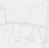
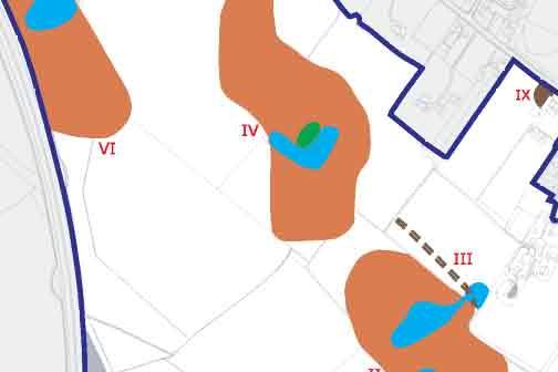
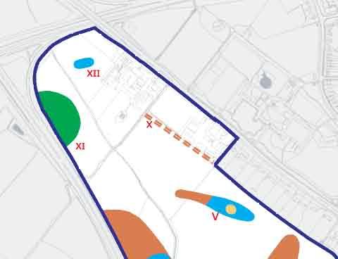
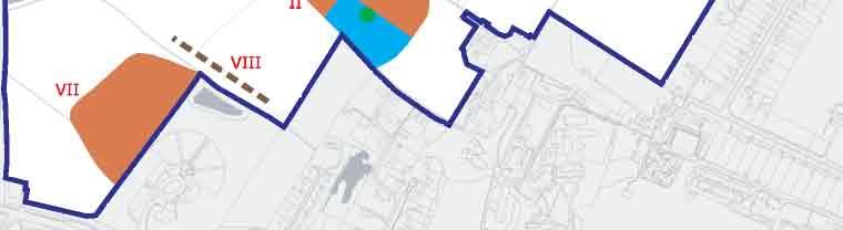

143
144 IV) In the main, this is a major, high status Roman settlement complex, extending in total over c. 9.1ha (+; see below), and which included a distinct Late Roman focus within its north-central portion. A formal inhumation cemetery was identified through its westcentral swathe and very high artefact densities were found throughout its central sector. In addition, due to perched watertable conditions, waterlogging was encountered within some of its deeper features, and a piece of finely lathe-turned woodwork was recovered. Though the artefact and feature density is lower along the site s eastern side, there both distinctly Early Roman and Bronze/Iron Age features were also found, and Neolithic pottery was recovered in one trench along the site s north-central margin (and, elsewhere, a Mesolithic flint). V) Correlating with a spring-line seam between the gravels and clay, later Bronze/Early Iron Age pit-wells occur within this area of Field 112 (total site area, c. 1.38ha). Also present are what are probably Roman ditches; interrupted by quarry-disturbance, these extend west into Field 109. In addition to Middle Iron Age pottery, both Mesolithic and later Neolithic/Early Bronze Age flintwork also occurred at this locale. What appears, moreover, to be an Early Saxon pot was recovered from a trench at the western end of the site and which might attest to settlement relating to the Girton College cemetery on the other side of Huntingdon Road. VI) Roman field paddocks and agricultural ditches, representing the margins of a settlement of that date, were recovered in Field 112 and which extend west into Field 108. The core-area of the settlement was subsequently recovered in the southeastern corner of Field 107, where a large Late Iron Age/Early Roman enclosure was identified. Note that, evidently relating to the early course of Washpit Brook, along the northwestern margin of Field 108 palaeo-channel/-pool deposits were encountered, with a sherd of generic Iron Age pottery recovered from them (total site area, c. 5.6ha). VII) Although not having a particularly high feature density, along the eastern side of the field this site s Roman ditch boundaries include quantities of finds and high-quality building materials (stone, tesserae, mortared tile and box-flue tile and, also, painted plaster). These obviously must derive from a high status building nearby, possibly a villa. Note, that although the site obvious extends east under the Park-and-Ride, no contemporary features were present within the access-route trenches dug along the eastern side of that plot. VIII) The flanking ditches of the Medieval Braderusshe road/track. IX) Some quantities of Medieval pottery were recovered from features in the Huntingdon Road-end of a trench in Field 116 and which presumably relates to the Howe s Close settlement of that date (c. 1200sqm). X) In the northwestern corner of Field 109, a pair of ditches evidently flanked the line of a northwest-southeast oriented road/droveway. While possibly of Medieval attribution, only Roman material was derived from their excavation and it is possible that it actually correlates with the route of Godmanchester Road. By projection, at this location it would correspond to that roadway's recent exposures at Castle Street and New Hall/Murray Edwards College. (Note, a few ditches - probably of Roman attribution - were also recovered in Field 118.) XI) A very low density of apparently Bronze Age features were exposed and which probably represents the eastern margins of a settlement; a small quantity of Iron Age pottery was also recovered. XII) The geophysical survey undertaken across the (un-trenched) northwestern pasture fields revealed what appears to possibly be a series of interconnecting, organic-plan subrectangular enclosures; if proven to be real, these are likely to be of Middle/later Iron Age attribution. 136
145 Prehistoric Distributions Given the well-drained character of the ridge s gravels, it could be considered surprising that further evidence of earlier prehistoric activity (i.e. pre- Middle/Late Bronze Age; Figs. 43 & 44) was not forthcoming. With only 69 flints (in addition to the fieldwalking-collected material, see Andersen & Hall 2008) and 13 sherds of that attribution were retrieved, in relationship to the scale of the fieldwork, this would not, for example, bear comparison to equivalent lowland river-valley gravel yields. Yet, of course, aside from sharing approximate geologies, such situations would not be comparable. Not only were the area s gravels land-locked as it were, but they also lie relatively high at c. 20m OD. Leaving aside questions of landscape access (corridor routes, etc.), the crucial issue would have to have been permanent water supply and which the immediate ridge-landscape would have seen a dearth of. Indeed, there would have only been two: the spring-lines at Trinity Conduit Head just south of Field 132/Site II and, also, the pond-well (and wind-pump) marked on early OS maps in the northwestern corner of Field 112 (Site V). Not unsurprisingly, these both appear to have been foci of early activity. Considering the early-material distributions, the recovery of two Palaeolithic flints from the area of Field 112/Site II would directly correlate with Marr et al. s Traveller s Rest Pit findings. While obviously not a major component of the current fieldwork s assemblage, given the within-gravel context of this material (i.e. unlikely to have much redeposited feature-based or ploughsoil register), the renowned significance of these findings and that any deep foundations might have upon them, it is worth summarising in some detail the earlier fieldwork results (the below contribution being written in conjunction with Billington) During the late 19 th century, a number of stone implements of Palaeolithic date are known to have been disturbed by large-scale coprolite quarrying undertaken in the northeast corner of the project-area (cf. Babington 1883, 11-13). In light of these discoveries, between 1911 and 1919 a series of detailed observations were made at one particular quarry in the area, the Traveller s Rest Pit, by John Edward Marr (who was lecturer in and later, from 1917, Woodwardian Professor of Geology at the University of Cambridge). In the southeastern corner of the southernmost of the two pits that comprised the quarry, Marr recorded a six metre-high section consisting of four principal layers (Fig. 43). The lowest of these, which was around three metres deep, consisted of evenly-bedded gravels that were overlain by around two metres of cryoturbated unevenlybedded gravels and sandy loam. Above this lay around half a metre of upper evenly-bedded gravels, which were then capped, in turn, by soil and warp or rubble drift (Marr 1920, ). Although he at first considered these deposits to have been fluvial in origin (Marr 1917; 1920; 1926; Marr & King 1928), Marr later postulated that they might instead represent glacial outwash material (Marr & King 1932). In contrast, a recent reinterpretation of the sequence has suggested that the two basal deposits represent deposition by a braided stream under cold (potentially glacial) conditions, with the upper deposits representing a possible return to a fluvial environment (Steve Boreham pers. comm.). Amino acid racemization analysis of a Pupilla muscorum shell recovered from the upper gravels produced a date in the early Wolstonian period (i.e. between 360,000BP and 130,000BP), although as only a single date has so far been obtained this cannot be regarded as entirely reliable. Archaeologically, the Traveller s Rest Pit is important because of both the quantity and date of the lithic material that was recovered from it. Marr recorded that: Implements are relatively abundant, and I have collected with my own hands a large series from the piled-up gravel-heaps and one or two in situ, and a few more have been found by friends. None 137
146 have been obtained from the workmen, whom I have purposely kept ignorant of their existence, so that there might be no danger of implements being brought from elsewhere (Marr 1920, ). Indeed, Marr claimed to have obtained nearly 1000 pieces of worked flints from the site, which were recovered during many hundreds of visits made over the course of eight years (ibid., 215). In his consideration of this assemblage, Miles Crawford Burkitt (lecturer in Archaeology and Anthropology at the University of Cambridge) concluded that two more or less distinct series were present (Burkitt 1920, 241; 1921, 54-5). The first of these Series a consisted of waterworn implements, which are in some cases stained deep ochreous-brown and in other cases greenish bluish-brown (ibid.). Within this group, forms of undoubtedly Lower Palaeolithic age are common (ibid.). It is thus most probably from this series that the flints recovered during the current evaluation were derived, having been disturbed from the lower gravel strata by 19 th century quarrying activity (see above, Site II). Given the highly abraded state of these implements, it is probable that they had been widely dispersed by contemporary fluvial action. They, therefore, stand in direct contrast to the material which comprised the second series Series b as these later implements were defined as usually bluish and... much less waterworn (ibid.). The Series b artefacts apparently included typical Mousterian pieces, including side scrapers and flakes with the faceted striking platforms characteristic of Levallois technologies (Burkitt 1920, 242). The side scraper illustrated in the paper (fig. 5) would certainly not be out of place in a Mousterian assemblage. On this basis, Burkitt was to suggest that series a represented an Acheulian industry while Series b reflected later activity of late Acheulean or more probably of Mousterian age (ibid.). Very little of Marr s collection of artefacts appears to have survived. The Sedgwick Museum has 200 flint artefacts from the Travellers Rest Pit in their collections which have been tabulated here from information contained in the catalogue (Table 40). Although Marr himself appears to have contributed relatively little to this group - the majority of his assemblage having been discarded (Marr 1920, 215) - significant later donors to the collection included Abbe Breuil, M. C. Burkitt and T. C. Lethbridge (with the latter having clearly visited the site on numerous occasions). This collection has been assessed by a number of later researchers (e.g. Clark 1938; Roe 1968; Wymer 1996). Clark was the first to note that all the implements in the collection appeared to belong to Burkitt s Series a, and cast doubt on the existence of a Mousterian industry at the site, noting that these artefacts could have derived from overlying soil deposits and represent Holocene lithic material (1938, 250). Marr and Burkitt were themselves to later identify some of the material as Neolithic in origin (Marr & Burkitt 1923). Subsequent work has tended to follow Clark s suggestion; most recently an assessment of the material has suggested that Burkitt s conclusions should be regarded with caution (White et al. 2009). Table 40: Sedgwick Museum s Traveller s Rest Pit flint artefacts Type South Pit North Pit Unspecified Total Flake Handaxe Unspecified Pebble Scraper Point Disc Implement Chopper 2 2 Borer 1 1 Burin 1 1 Nucleus 1 1 Total
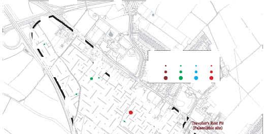
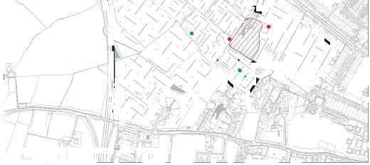
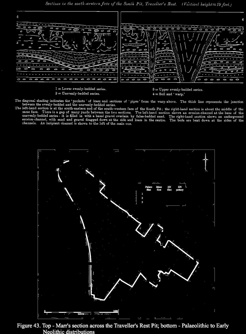
147
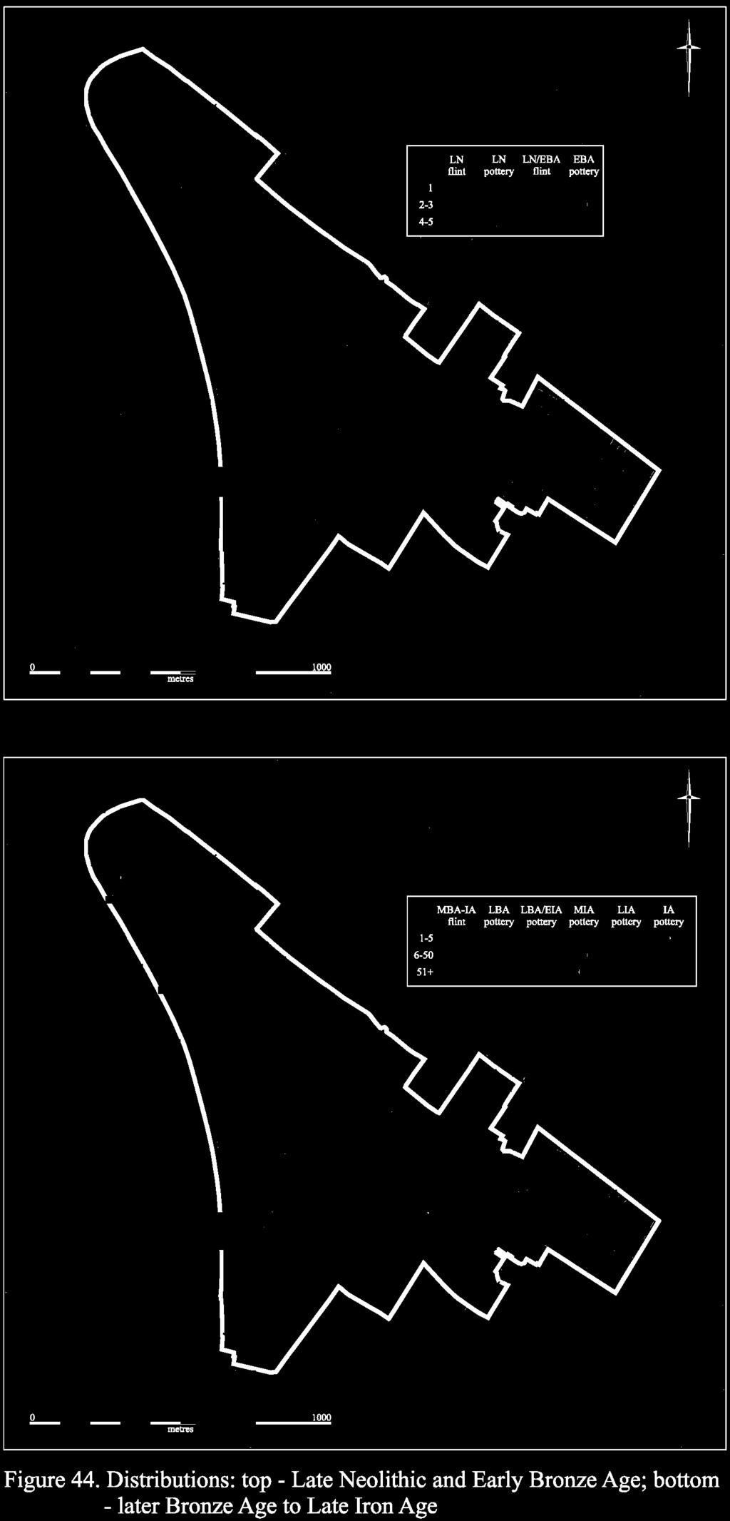
148
149 The results from the evaluation contribute little to this debate, and it is unfortunate that Marr s original collection appears to have been largely lost. The relative abundance of Neolithic and Early Bronze Age flints recovered from Site II certainly suggests, in agreement with Clark, that a proportion of the assemblage from the pit was probably of much later date. Levallosian technologies of the later Neolithic (Saville 1981) may have easily been confused with Mousterian industries by Burkitt; indeed, it was around this time (1914), that the heated debate concerning the date of the (Neolithic) flint mining at Grimes Graves was beginning; some workers advocating a Palaeolithic date on the basis of the Levallois-type technological traits exhibited by the flint assemblage (see Russell 2000, 22-5). Although the large volume of lithic material recovered from the site may, in part, have been influenced by the extensive Later Prehistoric presence in the area, and despite the doubt cast upon a Mousterian element to the assemblage it is nevertheless clear that the Traveller s Rest Pit represents an important Palaeolithic site. In a recent examination of the Pleistocene archaeology of the Great Ouse Valley, the material recovered from the Pit was singled out as the earliest yet identified in the region (Reynolds 2000, 38), and it is clearly of considerable regional if not national significance (ibid, 43) Of crucial importance to any assessment of the impact of potential development is the extent to which we can consider the Traveller s Rest Pit as being representative of the Observatory Gravels generally or as a uniquely prolific specific locale. As shown on Figure 43, Mesolithic flintwork also occurred within that area and, aside from a single piece of that date from Field 114, on the gravels, it otherwise only occurred within the vicinity of the Site V spring-source. That being said, perhaps the most interesting findings of that date are the two pieces from along the southern side of Washpit Brook. These represent the only diagnostic lithics to have been recovered from the area s clays and, directly comparable to the location of Mesolithic scatters at Longstanton (Evans et al. 2008, 176, fig. 3.21), they similarly attest to the Brook s route as a landscape corridor, however minor, and also the degree/character of Mesolithic land-use penetration. Of the Early Neolithic material, aside from the pottery recovered from Field 114, sherds of that date also occurred adjacent to the Traveller s Rest Pit. Similarly, the only definite piece of Early Neolithic flintwork was also recovered nearby in Field 112, and the Site II assemblage probably included other material of that date, but which are simply not sufficiently diagnostic. Indeed, Site II yielded the most substantive evidence of sustained early usage. Apart from relative quantities of later Neolithic/Early Bronze Age flint and pottery, it also included the one unequivocal feature of that date, the Grooved Ware-attributed pit in Trench 221. Generally, the recovery of this material would, again, correlate with the later-period component of the earlier, Traveller s Rest Pit collections and, too, our fieldwalking results from that area (Area A; Andersen & Hall 2008). The recovery of later Neolithic/Early Bronze Age flintwork from Trench 178 in Field 112 would similarly coincide with our Area B fieldwalking material and, though there probably redeposited through quarrying, would broadly correspond with the spring-related activity in that vicinity. Finally in this regard, the seemingly isolated inhumation found in Trench 196 within Field 115 is similarly thought to be of later Neolithic/Early Bronze Age attribution. Of the area s later Bronze/Early Iron Age distributions, in addition to the material of that date recovered earlier at Site I, this occurred at four locations: Sites II, IV, V and XI. Although involving, it total, some 135 sherds, just less than half of these (65) were recovered from one pit at Site IV. While other features possibly of that attribution also occurred there (and at Site II), the main features of this date were the Site V pit-wells and the ditch-line at Site XI. Note, however, that unlike as is now commonly found in the region s lowland river-valley 141
150 gravel terraces, no evidence was forthcoming of any large-scale Bronze Age fieldsystems (see Yates 2007 and Evans et al. 2009). Generic Iron Age wares were also recovered from Site XI (and from Site VI s pond), with distinct Middle Iron Age pottery occurring at Sites II and V. At the latter location - the western spring-line pit-wells - it is thought likely that Iron Age settlement per se occurred along its northern margin and where it has largely been lost through quarrying. The most obvious/robust Middle Iron Age settlement evidence was, otherwise, retrieved from Site II, and included roundhouse eavesgullies and associated small curvilinear enclosures; the gravel terrace-edge boundary there (F.431) also produced only pottery of that date. At that site, Late/later Iron Age occupation (including evidence of industrial activity) rather related to its rectilinear ditch system. Similarly, the enclosure system at Site VI would also seem to have been established in the Late Iron Age. Of all the sites of this period it is most difficult to gauge the scale of Site IV s Late occupation. Focussing on the area of Trenches 6, 16, 146 and 245, this clearly involved a number of minor enclosure ditches and, indeed, the large curvilinear feature registering on the geophysical survey just north of Trench 145 may also have been associated (another gully of that date occurred further north of this cluster in Trench 126). What is relevant in this capacity is that all the main Roman settlements upon the gravels - Sites II, IV and V - also registered relatively substantial Middle/later Iron Age occupation. Indeed, it was only Roman Site VII, down on the clays, that was not proceeded by any Iron Age occupation. Of the Washpit Brook-side sites, the Site VI system would be of Late Iron Age origin, with generic Iron Age pottery occurring in the Brook s pond deposits proper, and also at Site XI (even though the latter s ditch-line was of earlier, Late Bronze Age attribution); if real, the Site XII settlement enclosures are likely to have been of Middle/later date. Considered in a broader perspective, upon the gravels the Middle/later Iron Age settlements appear to have lain at an interval of approximately 400m. The distance from Site V to XII s possible enclosures being some 100m greater, but, then, the location of Iron Age activity upon the clays was probably largely determined by proximity to the line of the Washpit Brook. The locational attraction of the Brook s corridor generally should not underestimated. As was discussed as regards its pull in relationship to the Mesolithic distributions, all of the prehistoric activity distinguished upon the area s claylands occurred adjacent to its course: Sites VI and XI, variously Later Bronze/Iron Age and, the possible, Site XII enclosure. Indeed, this raises the question whether the area s clays were then, prior to Roman times, still forested. If so, aside from just providing a ready source of water, the Brook s line may well have served as a landscape route-way. Further to overviewing the immediate landscape s prehistoric sequence, what is equally noteworthy is the apparent absence of Middle Bronze Age occupation and, particularly, fieldsystems. As opposed to earlier visitation-usage, it would appear that the area was first colonised for permanent occupation during the Late Bronze/Early Iron Age, with formal settlement only really taking-off during the Middle/later Iron Age. What should be stressed is, while seeing somewhat more enhanced levels of Mesolithic/Neolithic activity, that really the settlement history of the immediate area s land-locked gravels did not differ substantially than the region s claylands generally, and it clearly lacks the 142
151 intensity of pre-iron Age usage - and monument-building - as is found on its low-lying river-valley gravel terraces. The Romano-British Settlements Given how prominently ceramic evidence features concerning the issue of Iron Age/Roman continuity on the project s sites and, also, its importance for understanding the character of the latter-period settlements, it is appropriate that we introduce this section with Anderson s overview-summery of their pottery evidence. Analysis of the pottery provides an understanding of the development of the settlements from the Middle/Late Iron Age to the Late Roman period, and shows a clear progression. Firstly, it is clear that the area as a whole was occupied continuously throughout this time-frame. The earliest period (Middle/Late Iron Age/Early Roman) saw the development of at least two separate settlements, Sites II and VI, which the ceramic evidence suggests are almost certainly contemporary with one another. The vessel fabrics and forms are similar enough to suggest the same source, although further analysis would be able to determine this one way or the other. The pottery demonstrates how handmade vessels in the Middle Iron Age tradition were made and used alongside wheel-turned Late Iron Age forms, and the earliest examples of Romanising pottery. The presence of all these various types of wares within the same feature is suggestive of a date between 0-50 AD. Interestingly, the evidence from the evaluation indicates that occupation on both sites ceased by the mid 1 st century AD, since none of the pottery appears to date beyond the pre-flavian period (AD 43-68). Site IV then appears to take off where Sites II and VI left, showing evidence of activity from the late 1 st century AD until the later Roman period, although there was a paucity of any definite Late Roman pottery, which suggests that the site did not continue in to the late 3 rd -4 th centuries AD. The pottery evidence suggests that Site IV is the largest and longest lived of all of the settlements, which is perhaps a result of its close proximity to the Roman road. Finally, Site VII is the last to begin - during the mid/late 2 nd century AD - as suggested by the pottery evidence. This is the only site that produced good evidence for Late Roman activity, with a variety of fabrics and forms associated with the Late pottery industries; however, its early development was almost certainly contemporary with the latter phases of Site IV. In many ways these assemblages are typical of rural, domestic sites, with it being the quantity of material rather than the quality that sets this area apart. All of the site assemblages appear to be domestic in terms of their composition, with usewear-evidence of sooting, burnt residues and lime-scale supporting this. The quantity of material recovered from the evaluation was also substantial and suggests that these sites formed part of a very large, densely occupied settlement-network. The location of the Roman road may well have had an impact, at least, Site IV, and, in terms of pottery, may have led to a greater variety of vessels being available. The high proportion of Nene Valley finewares on Site VII may equally support this view. The pottery, therefore, rather than evincing high status activity, instead is a result of the scale and longevity of the settlements as a whole and, also, the access that the sites are likely to have had to goods from outside of the immediate area. Concerning the distribution and density of the project-area s Roman sites, at a gross level they can simply be held as comparable to those now known throughout much of the South Cambridgeshire region and occur at an interval of c m (see Evans et al. 2008, Chapter 3). This being said, the scale of the gravel ridge s settlement of that date does seem remarkable (Fig. 42). Indeed, this is all the more so given that Sites II and IV s Roman usage/occupation was probably continuous and was essentially interrupted' only due to the intervening quarrying. As further discussed below, Site IV s Roman complex may well have continued north-westward to the grounds of Girton College; equally, nor do we know the scale of Site I s Roman activity (i.e. was it continuous with Site II?) or, in fact, the location/size of the period s settlements that were lost through quarrying in the eastern, Gravel Hill fields. 143
152 Two points warrant stressing in the regard. First is that in the apparent packing of settlement on the better-drained gravel ridge (amid, otherwise, heavy claylands) this is directly comparable to what has also been found on Longstanton/Oakington s clayland-locked gravels (see ibid, , fig. 3.21). This, of course, is not particularly surprising as these northwestern-southeastern gravels are, essentially, a part of the same geological deposits and which seems a distinct landscape/topographic phenomenon. Indeed, in the light of Longstanton s findings (and the scale of its Roman settlements), this raises the issue of whether the density of North West Cambridge s Roman settlement actually related to its town-hinterland situation as opposed to a more widespread ridge-related phenomenon. The second point to emphasis relates to the fact that within the distribution of the project-area s Roman sites there appears to be a distinct location pull to the ridge s southern edge; in other words, Sites II, IV and V are located at the margins of the gravel adjacent to its clay-geology interface (Fig. 42). This would still be true even if Site IV extended northwest to Girton College (there being beside the ridge s western end; see below) and, more telling, the ridge s central/northeastern gravels across Fields saw no Roman settlement. Again, there are two factors that would account for this. On the one hand, an 'edge-gravel location would mean that it would have been easier to achieve groundwater-supply as wells would need to be sunk deeply. On the other hand, this locational propensity, aside from maximising settlement upon the ridge s gravels, must surely have related to the fact that much of their arable produce originated from the more fertile clay-derived soils. This would be confirmed by the fact that the plant remains from the ridge-settlements included clayland cropweeds. As regards the latter point, what we cannot ascertain at this time - and what must be a directive for any future investigations - is whether the clayland sites (VI & VIII) were actually locally exporting produce to the immediate gravel ridge settlements, or if the latter s fields were primarily located upon the adjacent clays. As to the character of the project-area s Roman sites, probably seeing continuity from its Iron Age settlement, Site II would essentially seem to have been of Early, 1 st century date (Fig. 45). Though too few finds were recovered for certainty, Site VI would generally seem comparable and, basically, seems to be a Conquest Period settlement, possibly with a Late Iron Age foundation. Although Site II was clearly far more extensive (and may, thereby, include other components, especially if it did extend south to the area of Trinity Conduit Head s spring; e.g.?ritual), both are likely to have been farmstead settlements. 144
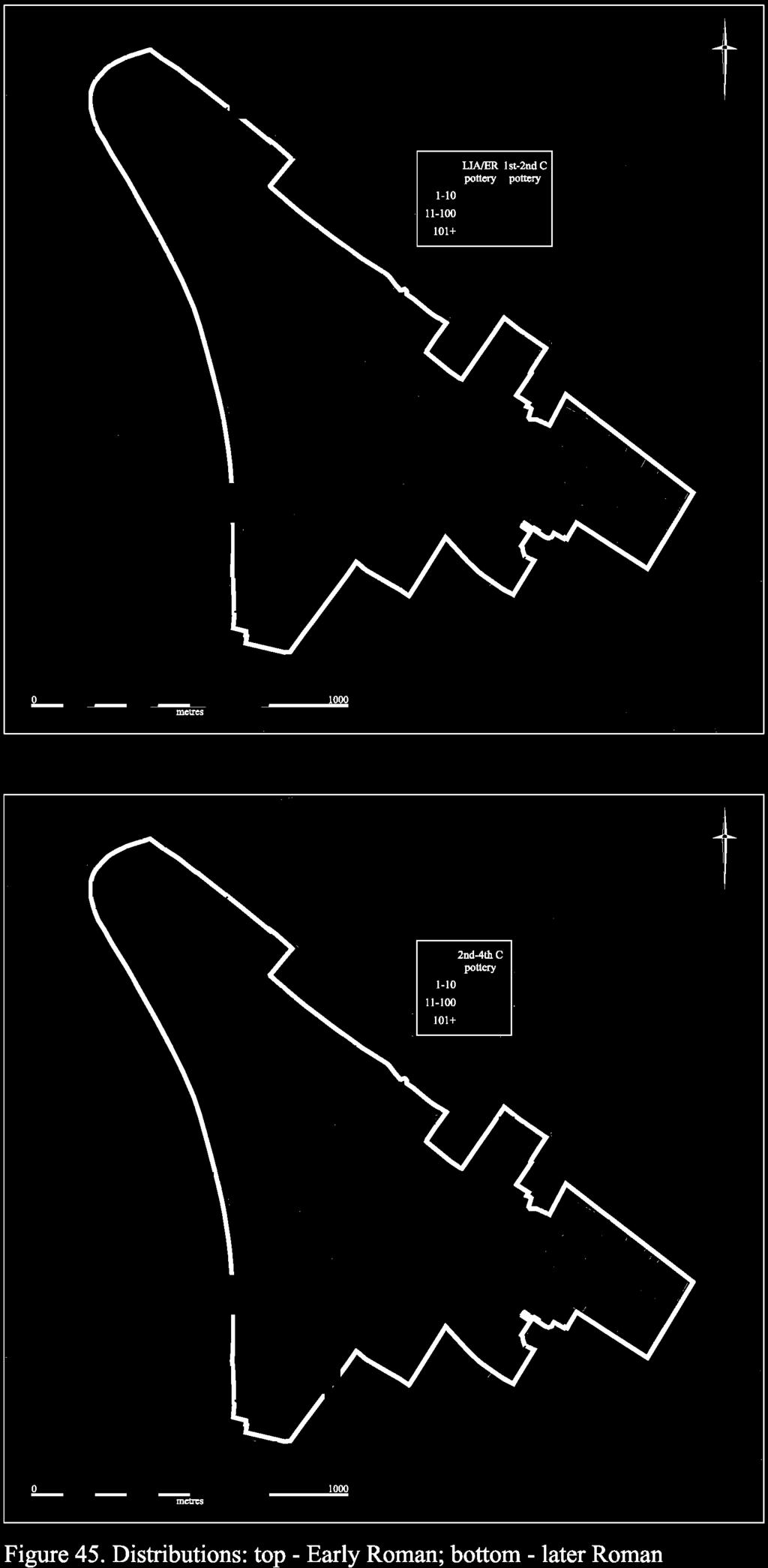
153
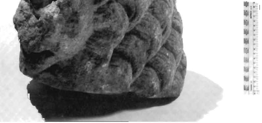
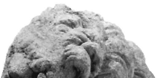
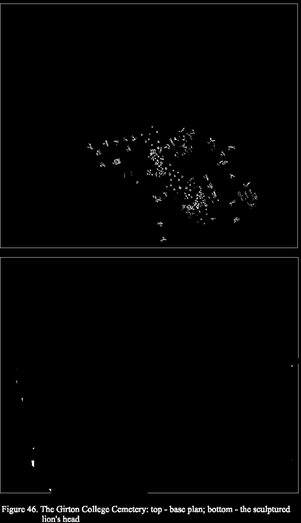
154
155 Site VII, on the other hand, clearly was of later Roman date (2 nd -4 th centuries; Fig. 45). While the plan achieved of its paddocks is no more complex than, for example, Site VI s, it clearly was of an entirely different character. The quantity of high-quality building materials achieved from it - especially its tesserae - surely attests to the demolition of a building of status and, in all probability, a villa. While, unfortunately, it is likely that the footprint of its main structure was, if not lost altogether, then at least severely disturbed during the construction of the County Council s Park-and-Ride which overlays its western half, this is nonetheless a significant discovery. This site now claims a place alongside the Arbury and Milton villa sites on the north side of Cambridge and, more generally, resonates with what seems to have been the high status Roman cremation and inhumation burials known from the immediate area (e.g. at Girton College and the project-area s northeastern, Gravel Hill coprolite-quarrying fields). This being said, two major, seemingly stone-footed Roman building complexes were found in the course of the Longstanton fieldwork (see Evans et al. 2008, fig. 3.23). Together these findings suggest that, probably largely as a result of it being caricatured as falling within the fen hinterland, the character of the area s Roman countryside - the north-of-cambridge clay plain - has been greatly underestimated. Finally, what of Site IV? While, as defined within the project-area (and as separated from Site II), at c. 9ha its area was not significantly larger than, for example, Site VI s, its feature and finds densities were far greater. Indeed, it evidently was a complex and of multi-faceted character. This, in part, was clearly due to its duration and that it was occupied throughout the Roman period (though its Early component was much more localised than its later) and that its usage may well have varied over time. Its assemblages, nevertheless, included both extensive evidence of industry (e.g. slag) and, also - as expressed in the quality of its glassware and the lathe-turned wooden furniture - higher status goods (pace Anderson above). The recovery of building stone and tile from it (though not in the densities of Site VII), could equally suggest that it included a building of some quality, and the formality of its inhumation cemetery could similarly attest to this. The diverse/mixed character of Site IV s occupation would also be expressed in the layout of its ditch paddocks. Essentially, its seem to be arranged within a near north-south oriented ladder system. Yet, at the same time, (and as is most obvious on its geophysical plot; Fig. 18), it also involved various off-angle and even quasi-curvilinear elements; the latter surely largely being attributable to its Late -phase usage. As the Girton College interments may well have related to the current project s Sites IV and V settlements, it is worth summarising the Romano-British evidence from that excavation. In 1881, the ground in front of the Old Wing of Girton College, constructed in 1871, was being prepared for the insertion of a series of tennis courts (Fig. 46). Following the discovery of human remains during the course of this work, the area - which is now occupied by Emily Davies Court - was excavated by Francis Jenkinson, a fellow of Trinity College. In addition to a large number of Early Anglo-Saxon interments, two richly accompanied Roman cremation burials were also encountered. These had both been interred within square, vertically-sided graves that had been revetted with wooden planks (the revetments having been identified via the survival of numerous iron nails). Grave I, the northernmost of the two, contained a square glass bottle (which 147
156 was utilised as the cinerary urn), a small cylindrical glass vessel, two Samian Ware dishes, two jugs of unglazed, cream coloured ware, a coarse creamware dish, an iron lampstand (plus a rod for its suspension) and, finally, several decayed iron fragments that may have comprised the remnants of a chest (Hollingworth & O Reilly 1925, 33). Grave II was, if anything, even more richly accompanied, and had a hexagonal glass bottle (which had, again, been employed as the cinerary urn), a glass dish with incised decoration in the form of a duck, a glass decanter, a glass unguentarium, a small cylindrical glass vessel, a coarse creamware jug, a green-glazed bowl with white striae, an iron lampstand (plus a rod for its suspension), and eight bronze bosses with eight accompanying metal rings (plus numerous scraps of iron and bronze; ibid). Both of these burials appear to have been 2 nd century in date, and may potentially have been accompanied by a third as somewhere near Grave a large portion of a Roman earthenware bottle was discovered (ibid, 32). This was seen as suggestive of a possibly Roman burial anciently disturbed (ibid). If this assumption is correct, a potential west-northwest to eastsoutheast alignment may be discerned, running broadly parallel to the nearby Cambridge to Godmanchester road. Also of note within the corpus of burials excavated at the site are two graves Numbers 28 and 34 respectively which were accompanied by complete Late Roman Castor Ware beakers. Although it is possible that these represent curated, or possibly even recovered items that were re-employed within an Early Saxon as opposed to Roman context, it remains equally possible that some degree of continuity between the two periods occurred. Further support for this notion of a second, Late Roman phase of burial activity is also provided by the fact that the latter of these two burials that in Grave 34 had been decapitated, a rite more commonly associated with Late Roman as opposed to Early Saxon interments. Despite this evidence, however, it must also be noted that residual Roman pottery was encountered within the majority of graves at the site; thus, further underlining the extent of the Roman presence in the area. In addition to the various burials outlined above, a substantial amount of contemporary building material was also encountered during the excavations at Girton College. Indeed, besides at least two examples of Roman bricks embedded in mortar, a great quantity of stone, chiefly oolite, sometimes worked, sometimes in rough blocks, was found during the excavation of the Anglo- Saxon cemetery (ibid, 34). At least 17 of the succeeding graves, as well as a number of the cremations, had had stones placed around or above the body. In certain cases this included quite large quantities. In Grave 59, for example, the body had been placed upon a neatly arranged platform of worked stone blocks, whilst that in Grave 3 was covered by a great mass of stone which included a fragment derived from a column (ibid). Furthermore, in one place, within 10 yards of the interments, the ground was full of fragments of stone which seemed to bear no relation to the graves (ibid, 35). Unfortunately, however, this deposit does not appear to have been investigated. Still other possible structural evidence of this period was also encountered. Perhaps most notably, a little way to the north of Grave 42 a trench was identified that was 4½ feet wide, with steep sides; the soil was mixed with much white clay and pieces of Roman pottery occurred (ibid). It is certainly possible that both of these latter features represent the remains of Roman foundations, with the second example having been robbed of its stonework. Indeed, the rough stone blocks referred to above appear most likely to represent unworked foundation material derived from just such a source. Perhaps the most intriguing, and certainly the most enigmatic, Roman discovery to be made at the site consists of the fragmentary remains of two statues. As Jenkinson recorded in his notebook, during excavations undertaken a little way to the northeast of Grave 59: we struck into a black earth pit containing bones of domestic animals, some charcoal, a few oysters and some 2 dozen fragments of Roman pottery. At 2 feet 8 inches occurred a Saxon urn with bones in situ. At 3 feet 8 inches a human skeleton with a bronze buckle and 1 blue glaze bead about the left shoulder. Another lay on its left side, next to that a child. Two more children had been placed with their heads about the centres of the bodies of their elders. The pit extended a few feet to the NW, and 2 Roman vessels in fragments were found in one of the lowest strata; one mixed with animal bones. At the bottom of the pit occurred 5 large pieces of sculpted stone, one being a spirited representation of a lion s head (as quoted in Hollingworth & O Reilly 1925, 35). In addition to the head (Fig. 46), three further fragments of the lion representing portions of the paws and tail were present in the pit. The fifth fragment to be recovered consisted of a human torso around two thirds life-size, although this was badly degraded. Whilst these statues are clearly Roman in origin, however, the date of their deposition is somewhat less clear. On the one 148
157 hand, given their association with two near-complete ceramic vessels and a quantity of animal bone, it is certainly possible that they represent in situ depositions within the base of a large Roman pit. In this model, the feature would subsequently have become the focus of a series of Early Saxon burials. Yet, it is not at all clear how the pit would have remained sufficiently visible, or indeed appeared sufficiently appealing, to be later utilised in such a manner having once been backfilled. The earliest of these burials were, moreover, made at some considerable depth, deeper than almost any other interment at the site. It is, therefore, perhaps more likely that the pit itself is Early Saxon in date. The statuary might thus represent broken remnants that were opportunistically discarded partway through the process of demolition and salvage, whilst their association with domestic waste and fragments of Roman pottery could be the by-product of the apparent ubiquity of such material across the site (as evidenced by its presence in the majority of Saxon graves). The suggestion has been made that the Roman material encountered during the excavation of the Girton College cemetery, including both the statuary and the numerous fragments of worked stone that were utilised in many of the graves, was derived from an elaborate roadside tomb (Hollingworth & O Reilly 1925, 36; Liversidge 1977, 15-16). Given the sheer quantity of building material represented, however allied with the evidence of possible foundation trenches, along with the widespread presence of contemporary domestic refuse it has also been suggested that remains are more likely to represent the traces of a nearby settlement or villa complex (Scott 1993, 37; Taylor 1997, 53). Aside from what might have been the nearby building-source of the cemetery s Roman moulded stone, the crucial point is that the arrangement of its interments would suggest that they were aligned in relationship to underlying (Roman) ditch system and, in which case, the orientation of this system would match Site IV s. Indeed, this approximate orientation was also common to the secondary phase of the Iron Age and Roman cropmarks summarily excavated, in 1975, some 300m north of the College (now under the line of the A14; FARG & Croft 1977). For our immediate purposes, three points concerning this site warrant notice. First, it clearly continued further southwards towards the College; second, the parallel double-ditches on its western side probably marked some manner of road/trackway; and, finally, the tight right-angled/cornered layout of its southern enclosure could possibly relate to a shrine/temple complex or some other formal setting - though, in all honesty, too little of it is visible on aerial photographs to justify this and, equally, the site s excavation was too limited to say very much generally. Given, nevertheless, its layout it was surely part of the same gravel ridge-sited/-aligned settlement system as the Girton College cemetery site/site IV layout. Though it is tempting to directly link Site IV with the Girton College site, the evidence of a 2002 evaluation undertaken anticipating the construction of the College s new Archive and Special Collections Library Building would suggest otherwise (Whittaker 2002). Sited on what would be the northward projection of Site IV, no significant archaeology or early finds at all were recovered in the three trenches dug there and, therefore, Site IV cannot have extended that far north. (Nothing was similarly found when the New Pavilion Site, on the west of the College s sports grounds, was recently trialtrenched; Fletcher 2008.) Taking account of its quarry-truncation in that direction, its estimated total area is, nevertheless, still 12.86ha; in other words, significantly greater than the size of Roman Cambridge itself (as walled). In lieu of this, it is perhaps far more likely that the earlier, Girton College cemetery/settlement may have rather been quasi-continuous with the current project s Site V; the intervening northern extent of the latter being variously truncated by quarries and overlain by the University Farm s yard (and, to the east, Huntingdon Road properties). The problem here, of course, is just where to draw individual settlement-site boundaries. To wit, in all likelihood, all three - Sites IV, V and Girton College ( west ) - were probably part of one very large, 149
158 componented Romano-British settlement complex, and which must have included a very high status building (i.e. the source of the cemetery s moulded stone). In many respects comparable to the great Site 18 crossroads settlement now known at Longstanton - also including a stone-footed building (and nearby a stone pillar fragment was recovered; Evans et al. 2008, fig ) - this Site IV et al. complex certainly warrants being thought of as a significant Roman place in its own right and not as just some hinterland-adjunct to Roman Cambridge. Of the area s Roman roads, we should first consider negative evidence. This primarily concerns the New Hall Road which, as shown on Figure 47, should have continued from its most westerly exposure to date, at the Trinity Hall Playing Fields Site, on a southwesterly route and have passed through Fields 128 and 132. There, however, no trace of it whatsoever was found. Recent fieldwork in the Cambridge area has demonstrated that Roman roads were often only ditch-flanked within the vicinity of contemporary settlements. If as projected, however, it had continued through the area of Site II then some demarcation or respect of its route should have been expected. In a similar manner, within that site there was also no evidence of the north-westward continuation of the trackway exposed on the Vicar s Farm site (see Fig. 47). While the latter could be accounted by the fact that, as a minor way, it either did not continue that far north or else veered west to the Conduit Head area, the absence of the New Hall Road is far more difficult to explain and is simply without a ready answer at this time. Against this, the southwest-northeast oriented, double-/triple-ditch system within the western portion of Site II, and which appeared to continue northeast to conjoin with the Site I boundary, certainly seems to mark a major landscape seam and, probably, a road; though, again, no continuation of this route was revealed along its southwestern projection in Fields 125 and 128. Aside from the possibility that, as discussed above, the Medieval Site III track might have fossilised an earlier, Roman way, the final route to consider in this context is, of course, the Cambridge-Godmanchester Road. This is widely thought to have been similarly held within the straightness of present-day Huntingdon Road. Recent excavations both in the core of the Roman town and, westwards, in the grounds of Murray Edwards College (see Evans forthcoming and Hutton 2009), instead indicates that it would have run just south of that modern route. Given its westward projection, it should have passed through Fields 116/117, but where no evidence of it was forthcoming. This being said, the route-flanking ditches found along the northern side of Field 109 (Site X) would seem to match its projection. Yet, despite also their tentative Roman dating evidence, it would have to be said that its rather narrow and minor (and unrecut) boundaries were not particularly convincing as a marking a major Roman road. To this would also have to be added that the geophysical surveys in the (un-trenched) pasture fields immediate to the northwest gave no indication of it. Perhaps even more telling is the alignment of Site IV s boundaries. With its main axis oriented near north-south - and seemingly continuing into, at least the grounds of Girton College if not further north - it would be awkward to dovetail this with a Roman road on anything near this route or, indeed, Huntingdon Road generally. Yet, with two Roman milestone markers known with the immediate Girton/Huntingdon Road area (even it they were re-set when Huntingdon Road and much of northwestern length of the A14 was established as a turnpike route in post-medieval times), this surely indicates that Cambridge- Godmanchester Roman road must have lain somewhere within the corridor 150
159 between Site IV and the Girton cemetery. Indeed, one suspects that the Site IV/Girton College settlement was probably crossroads-related, with its two routes simply not crossing at right-angles (and with the c. north-south axis predominant within the layout of its settlement). Probably continuing south from the F.A.R.G./Croft s north-of-college site, the line of this north-south road was not identified within Site IV. Due, however, to the impact of both subsequent quarrying and its multi-phased usage (i.e. route-truncating Late Roman features might confuse its distinction), this need not imply that the current south-of- Huntingdon Road/Godmanchester route Site IV settlement was not still organised around it. The implications of this are potentially great and it may well reflect the fact that the area s roads were not continuously straight, but kinked in relationship to topographic factors; unfortunately, though, pending further largescale investigations, the resolution of this problem is beyond our current remit. Saxon and Medieval Concerning the project s post-roman findings, that Anglo-Saxon material was only recovered within the area of Site V and opposite Girton College cannot be coincidental, and clearly related to the settlement whose populace was interred within the cemetery excavated within the College s grounds. Similarly, though unto itself Site IX s evidence of Medieval usage/occupation is relatively modest, it clearly correlates with Northamptonshire Archaeology s finding of Medieval settlement on the other side of Huntingdon Road as part of the NIAB investigations (Masson 2008). Together, this must represent quite a substantial settlement - a Deserted Medieval Hamlet - and would correspond with Howes Close as known from Cambridge s West Fields documents (Hall & Ravensdale 1976). Primarily concerned with the layout and ownership of the area s Medieval fields, in the light of that volume s researches and how obvious the ridge-andfurrow is on the Luftwaffe photographic cover (Fig. 6), it is relevant that such agricultural traces did not survive up on the ridge gravels proper, though their furrows were still evidence on the clays. Otherwise, the most significant finding of the programme in this context was the distinction of the two northwestsoutheast aligned trackways: Braderusshe in the south (Site VIII) and, in the north, Milneweye (Site III). Aside from demonstrating the accuracy of Hall and Ravensdale s documentary researches (and sketch-plotting), the route of the latter has led to the speculation above whether its might have fossilised a Roman way. It also warrants mention that on its southwestern side in Field 115, the clearly contemporary ditches of a trackside enclosure/paddock were present. At one point, narrow double-ditches - characteristic of hedge-laying - were found (Trench 242) and which would equally correlate with Hall and Ravensdale s indication of a hedged paddock at that end of the track. 151
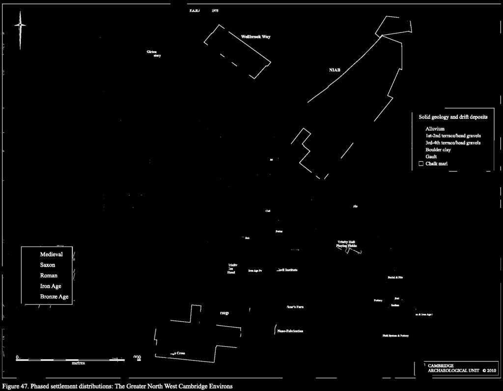
160
Colchester Archaeological Trust Ltd. A Fieldwalking Survey at Birch, Colchester for ARC Southern Ltd
 Colchester Archaeological Trust Ltd A Fieldwalking Survey at Birch, Colchester for ARC Southern Ltd November 1997 CONTENTS page Summary... 1 Background... 1 Methods... 1 Retrieval Policy... 2 Conditions...
3. The new face of Bronze Age pottery Jacinta Kiely and Bruce Sutton
 3. The new face of Bronze Age pottery Jacinta Kiely and Bruce Sutton Illus. 1 Location map of Early Bronze Age site at Mitchelstown, Co. Cork (based on the Ordnance Survey Ireland map) A previously unknown
Cambridge Archaeology Field Group. Fieldwalking on the Childerley Estate Cambridgeshire
 Cambridge Archaeology Field Group Fieldwalking on the Childerley Estate Cambridgeshire 2009 to 2014 Summary Fieldwalking on the Childerley estate of Martin Jenkins and Family has revealed, up to March
Church of St Peter and St Paul, Great Missenden, Buckinghamshire
 Church of St Peter and St Paul, Great Missenden, Buckinghamshire An Archaeological Watching Brief for the Parish of Great Missenden by Andrew Taylor Thames Valley Archaeological Services Ltd Site Code
An archaeological evaluation at 16 Seaview Road, Brightlingsea, Essex February 2004
 An archaeological evaluation at 16 Seaview Road, Brightlingsea, Essex February 2004 report prepared by Kate Orr on behalf of Highfield Homes NGR: TM 086 174 (c) CAT project ref.: 04/2b ECC HAMP group site
A R C H A E O L O G Y. N o. 3 NORTH WEST CAMBRIDGE (2) EXCAVATIONS Assessment Report Craig Cessford and Christopher Evans
 EXCAVATIONS Assessment Report Craig Cessford and Christopher Evans") NORTH WEST CAMBRIDGE A R C H A E O L O G Y 2012-13 EXCAVATIONS Assessment Report Craig Cessford and Christopher Evans N o. 3 (2) NORTH WEST CAMBRIDGE ARCHAEOLOGY University of Cambridge 2012 13 Excavations
NORTH WEST CAMBRIDGE A R C H A E O L O G Y 2012-13 EXCAVATIONS Assessment Report Craig Cessford and Christopher Evans N o. 3 (2) NORTH WEST CAMBRIDGE ARCHAEOLOGY University of Cambridge 2012 13 Excavations
Fieldwalking at Cottam 1994 (COT94F)
") Fieldwalking at Cottam 1994 (COT94F) Tony Austin & Elizabeth Jelley (19 Jan 29) 1. Introduction During the winter of 1994 students from the Department of Archaeology at the University of York undertook
Fieldwalking at Cottam 1994 (COT94F) Tony Austin & Elizabeth Jelley (19 Jan 29) 1. Introduction During the winter of 1994 students from the Department of Archaeology at the University of York undertook
New Composting Centre, Ashgrove Farm, Ardley, Oxfordshire
 New Composting Centre, Ashgrove Farm, Ardley, Oxfordshire An Archaeological Watching Brief For Agrivert Limited by Andrew Weale Thames Valley Archaeological Services Ltd Site Code AFA 09/20 August 2009
An archaeological watching brief and recording at Brightlingsea Quarry, Moverons Lane, Brightlingsea, Essex October 2003
 An archaeological watching brief and recording at Brightlingsea Quarry, Moverons Lane, Brightlingsea, Essex commissioned by Mineral Services Ltd on behalf of Alresford Sand & Ballast Co Ltd report prepared
Cambridge Archaeology Field Group. Fieldwalking on the Childerley Estate, Cambridgeshire. Autumn 2014 to Spring Third interim report
 Cambridge Archaeology Field Group Fieldwalking on the Childerley Estate, Cambridgeshire Autumn 2014 to Spring 2015 Third interim report Summary Field walking on the Childerley estate of Martin Jenkins
Former Whitbread Training Centre Site, Abbey Street, Faversham, Kent Interim Archaeological Report Phase 1 November 2009
 Former Whitbread Training Centre Site, Abbey Street, Faversham, Kent Interim Archaeological Report Phase 1 November 2009 SWAT. Archaeology Swale and Thames Archaeological Survey Company School Farm Oast,
ARCHAEOLOGICAL EVALUATION AT BRIGHTON POLYTECHNIC, NORTH FIELD SITE, VARLEY HALLS, COLDEAN LANE, BRIGHTON. by Ian Greig MA AIFA.
 ARCHAEOLOGICAL EVALUATION AT BRIGHTON POLYTECHNIC, NORTH FIELD SITE, VARLEY HALLS, COLDEAN LANE, BRIGHTON by Ian Greig MA AIFA May 1992 South Eastern Archaeological Services Field Archaeology Unit White
SALVAGE EXCAVATIONS AT OLD DOWN FARM, EAST MEON
 Proc. Hants. Field Club Archaeol. Soc. 36, 1980, 153-160. 153 SALVAGE EXCAVATIONS AT OLD DOWN FARM, EAST MEON By RICHARD WHINNEY AND GEORGE WALKER INTRODUCTION The site was discovered by chance in December
Chapter 2. Remains. Fig.17 Map of Krang Kor site
 Chapter 2. Remains Section 1. Overview of the Survey Area The survey began in January 2010 by exploring the site of the burial rootings based on information of the rooted burials that was brought to the
Grim s Ditch, Starveall Farm, Wootton, Woodstock, Oxfordshire
 Grim s Ditch, Starveall Farm, Wootton, Woodstock, Oxfordshire An Archaeological Recording Action For Empire Homes by Steve Ford Thames Valley Archaeological Services Ltd Site Code SFW06/118 November 2006
Grange Farm, Widmer End, Hughenden, Buckinghamshire
 Grange Farm, Widmer End, Hughenden, Buckinghamshire An Archaeological Evaluation for British Flora by Andy Taylor Thames Valley Archaeological Services Ltd Site Code GFH 05/63 July 2005 Summary Site name:
7. Prehistoric features and an early medieval enclosure at Coonagh West, Co. Limerick Kate Taylor
 7. Prehistoric features and an early medieval enclosure at Coonagh West, Co. Limerick Kate Taylor Illus. 1 Location of the site in Coonagh West, Co. Limerick (based on the Ordnance Survey Ireland map)
2 Saxon Way, Old Windsor, Berkshire
 2 Saxon Way, Old Windsor, Berkshire An Archaeological Watching Brief For Mrs J. McGillicuddy by Pamela Jenkins Thames Valley Archaeological Services Ltd Site Code SWO 05/67 August 2005 Summary Site name:
Greater London GREATER LONDON 3/606 (E ) TQ
 TQ") GREATER LONDON City of London 3/606 (E.01.6024) TQ 30358150 1 PLOUGH PLACE, CITY OF LONDON An Archaeological Watching Brief at 1 Plough Place, City of London, London EC4 Butler, J London : Pre-Construct
GREATER LONDON City of London 3/606 (E.01.6024) TQ 30358150 1 PLOUGH PLACE, CITY OF LONDON An Archaeological Watching Brief at 1 Plough Place, City of London, London EC4 Butler, J London : Pre-Construct
An archaeological evaluation at the Lexden Wood Golf Club (Westhouse Farm), Lexden, Colchester, Essex
, Lexden, Colchester, Essex") An archaeological evaluation at the Lexden Wood Golf Club (Westhouse Farm), Lexden, Colchester, Essex January 2000 Archive report on behalf of Lexden Wood Golf Club Colchester Archaeological Trust 12 Lexden
An archaeological evaluation at the Lexden Wood Golf Club (Westhouse Farm), Lexden, Colchester, Essex January 2000 Archive report on behalf of Lexden Wood Golf Club Colchester Archaeological Trust 12 Lexden
Lanton Lithic Assessment
 Lanton Lithic Assessment Dr Clive Waddington ARS Ltd The section headings in the following assessment report refer to those in the Management of Archaeological Projects (HBMC 1991), Appendix 4. 1. FACTUAL
Changing People Changing Landscapes: excavations at The Carrick, Midross, Loch Lomond Gavin MacGregor, University of Glasgow
 Changing People Changing Landscapes: excavations at The Carrick, Midross, Loch Lomond Gavin MacGregor, University of Glasgow Located approximately 40 kilometres to the south-west of Oban, as the crow flies
Bronze Age 2, BC
 Bronze Age 2,000-600 BC There may be continuity with the Neolithic period in the Early Bronze Age, with the harbour being used for seasonal grazing, and perhaps butchering and hide preparation. In the
An archaeological evaluation in the playground of Colchester Royal Grammar School, Lexden Road, Colchester, Essex
 An archaeological evaluation in the playground of Colchester Royal Grammar School, Lexden Road, Colchester, Essex February 2002 on behalf of Roff Marsh Partnership CAT project code: 02/2c Colchester Museum
Undley Hall, Lakenheath LKH 307
 ARCHAEOLOGICAL EVALUATION AND MONITORING REPORT SCCAS REPORT No. 2010/005 Undley Hall, Lakenheath LKH 307 E. Muldowney SCCAS January 2010 www.suffolkcc.gov.uk/e-and-t/archaeology Lucy Robinson, County
39, Walnut Tree Lane, Sudbury (SUY 073) Planning Application No. B/04/02019/FUL Archaeological Monitoring Report No. 2005/112 OASIS ID no.
 Planning Application No. B/04/02019/FUL Archaeological Monitoring Report No. 2005/112 OASIS ID no.") 39, Walnut Tree Lane, Sudbury (SUY 073) Planning Application No. B/04/02019/FUL Archaeological Monitoring Report No. 2005/112 OASIS ID no. 9273 Summary Sudbury, 39, Walnut Tree Lane, Sudbury (TL/869412;
39, Walnut Tree Lane, Sudbury (SUY 073) Planning Application No. B/04/02019/FUL Archaeological Monitoring Report No. 2005/112 OASIS ID no. 9273 Summary Sudbury, 39, Walnut Tree Lane, Sudbury (TL/869412;
Archaeological. Monitoring & Recording Report. Fulbourn Primary School, Cambridgeshire. Archaeological Monitoring & Recording Report.
 Fulbourn Primary School, Cambridgeshire Archaeological Monitoring & Recording Report October 2014 Client: Cambridgeshire County Council OA East Report No: 1689 OASIS No: oxfordar3-192890 NGR: TL 5190 5613
Silwood Farm, Silwood Park, Cheapside Road, Ascot, Berkshire
 Silwood Farm, Silwood Park, Cheapside Road, Ascot, Berkshire An Archaeological Watching Brief For Imperial College London by Tim Dawson Thames Valley Archaeological Services Ltd Site Code SFA 09/10 April
This is a repository copy of Anglo-Saxon settlements and archaeological visibility in the Yorkshire Wolds.
 This is a repository copy of Anglo-Saxon settlements and archaeological visibility in the Yorkshire Wolds. White Rose Research Online URL for this paper: http://eprints.whiterose.ac.uk/1172/ Book Section:
Archaeological sites and find spots in the parish of Burghclere - SMR no. OS Grid Ref. Site Name Classification Period
 Archaeological sites and find spots in the parish of Burghclere - SMR no. OS Grid Ref. Site Name Classification Period SU45NE 1A SU46880 59200 Ridgemoor Farm Inhumation Burial At Ridgemoor Farm, on the
A visit to the Wor Barrow 21 st November 2015
 A visit to the Wor Barrow 21 st November 2015 Following our exploration of Winkelbury a few weeks previously, we fast forwarded 12 years in Pitt Rivers remarkable series of excavations and followed him
Test-Pit 3: 31 Park Street (SK )
") -Pit 3: 31 Park Street (SK 40732 03178) -Pit 3 was excavated in a flower bed in the rear garden of 31 Park Street, on the northern side of the street and west of an alleyway leading to St Peter s Church,
-Pit 3: 31 Park Street (SK 40732 03178) -Pit 3 was excavated in a flower bed in the rear garden of 31 Park Street, on the northern side of the street and west of an alleyway leading to St Peter s Church,
THE RAVENSTONE BEAKER
 DISCOVERY THE RAVENSTONE BEAKER K. J. FIELD The discovery of the Ravenstone Beaker (Plate Xa Fig. 1) was made by members of the Wolverton and District Archaeological Society engaged on a routine field
A Fieldwalking Project At Sompting. West Sussex
 by John Funnell Introduction A Fieldwalking Project At Sompting. West Sussex During March -and April 1995 the Brighton and Hove Archaeological Society conducted fie1dwa1king in a field at Sompting West
St Germains, Tranent, East Lothian: the excavation of Early Bronze Age remains and Iron Age enclosed and unenclosed settlements
 Proc Soc Antiq Scot, 128 (1998), 203-254 St Germains, Tranent, East Lothian: the excavation of Early Bronze Age remains and Iron Age enclosed and unenclosed settlements Derek Alexander* & Trevor Watkinsf
FURTHER MIDDLE SAXON EVIDENCE AT COOK STREET, SOUTHAMPTON (SOU 567)
") Roc. Hampshire Field Club Archaeol. Soc 52,1997, 77-87 (Hampshire Studies 1997) FURTHER MIDDLE SAXON EVIDENCE AT COOK STREET, SOUTHAMPTON (SOU 567) By M F GARNER andj VINCENT with a contribution byjacqueline
Roc. Hampshire Field Club Archaeol. Soc 52,1997, 77-87 (Hampshire Studies 1997) FURTHER MIDDLE SAXON EVIDENCE AT COOK STREET, SOUTHAMPTON (SOU 567) By M F GARNER andj VINCENT with a contribution byjacqueline
Bristol & Gloucestershire Archaeological Society
 Chris Hayden, Rob Early, Edward Biddulph, Paul Booth, Anne Dodd, Alex Smith, Granville Laws and Ken Welsh, Horcott Quarry, Fairford and Arkell's Land, Kempsford: Prehistoric, Roman and Anglo-Saxon settlement
BALNUARAN. of C LAVA. a prehistoric cemetery. A Visitors Guide to
 A Visitors Guide to BALNUARAN of C LAVA a prehistoric cemetery Milton of Clava Chapel (?) Cairn River Nairn Balnuaran of Clava is the site of an exceptionally wellpreserved group of prehistoric burial
Bronze-Age and Romano-British Sites South-East of Tewkesbury: evaluations and excavations
 From the Transactions of the Bristol and Gloucestershire Archaeological Society Bronze-Age and Romano-British Sites South-East of Tewkesbury: evaluations and excavations 1991-7 by G. Walker, A. Thomas
Excavation. Post-Medieval Ditches. Land off Norwich Common Road Wymondham Norfolk. Excavation. Client: November 2013
 Land off Norwich Common Road Wymondham Norfolk. Excavation November 2013 Client: OA East Report No: 1546 OASIS No: oxfordar3-163105 NGR: TG 12770 02684 Excavation Post-Medieval Ditches Post-Medieval Ditches
Excavation Report. Medieval Occupation at Challis Green Barrington Cambridgeshire. Excavation Report. Client: Hills Partnership Limited.
 Medieval Occupation at Challis Green Barrington Cambridgeshire Excavation Report Excavation Report April 2012 Client: Hills Partnership Limited OA East Report No: 1269 OASIS No: oxfordar3-102493 NGR: TL
Chapter 2: Archaeological Description
 Chapter 2: Archaeological Description Phase 1 Late Neolithic, c 3000-2400 BC (Figs 6-9) Evidence of Neolithic activity was confined to pits dug across the southern half of the site (Fig. 6). Eighteen pits
Novington, Plumpton East Sussex
 Novington, Plumpton East Sussex The Flint Over 1000 pieces of flintwork were recovered during the survey, and are summarised in Table 0. The flint is of the same types as found in the previous survey of
Moray Archaeology For All Project
 School children learning how to identify finds. (Above) A flint tool found at Clarkly Hill. Copyright: Leanne Demay Moray Archaeology For All Project ational Museums Scotland have been excavating in Moray
STONES OF STENNESS HISTORIC ENVIRONMENT SCOTLAND STATEMENT OF SIGNIFICANCE
 Property in Care (PIC) ID: PIC321 Designations: Scheduled Monument (SM90285); Taken into State care: 1906 (Guardianship) Last reviewed: 2003 HISTORIC ENVIRONMENT SCOTLAND STATEMENT OF SIGNIFICANCE STONES
Greater London Region GREATER LONDON 3/567 (E.01.K099) TQ BERMONDSEY STREET AND GIFCO BUILDING AND CAR PARK
 TQ BERMONDSEY STREET AND GIFCO BUILDING AND CAR PARK") GREATER LONDON 3/567 (E.01.K099) TQ 33307955 156-170 BERMONDSEY STREET AND GIFCO BUILDING AND CAR PARK Assessment of an Archaeological Excavation at 156-170 Bermondsey Street and GIFCO Building and Car
GREATER LONDON 3/567 (E.01.K099) TQ 33307955 156-170 BERMONDSEY STREET AND GIFCO BUILDING AND CAR PARK Assessment of an Archaeological Excavation at 156-170 Bermondsey Street and GIFCO Building and Car
Tell Shiyukh Tahtani (North Syria)
") Tell Shiyukh Tahtani (North Syria) Report of the 2010 excavation season conducted by the University of Palermo Euphrates Expedition by Gioacchino Falsone and Paola Sconzo In the summer 2010 the University
Tell Shiyukh Tahtani (North Syria) Report of the 2010 excavation season conducted by the University of Palermo Euphrates Expedition by Gioacchino Falsone and Paola Sconzo In the summer 2010 the University
1. Presumed Location of French Soundings Looking NW from the banks of the river.
 SG02? SGS SG01? SG4 1. Presumed Location of French Soundings Looking NW from the banks of the river. The presumed location of SG02 corresponds to a hump known locally as the Sheikh's tomb. Note also (1)
THE PRE-CONQUEST COFFINS FROM SWINEGATE AND 18 BACK SWINEGATE
 THE PRE-CONQUEST COFFINS FROM 12 18 SWINEGATE AND 18 BACK SWINEGATE An Insight Report By J.M. McComish York Archaeological Trust for Excavation and Research (2015) Contents 1. INTRODUCTION... 3 2. THE
A Sense of Place Tor Enclosures
 A Sense of Place Tor Enclosures Tor enclosures were built around six thousand years ago (4000 BC) in the early part of the Neolithic period. They are large enclosures defined by stony banks sited on hilltops
THE UNFOLDING ARCHAEOLOGY OF CHELTENHAM
 THE UNFOLDING ARCHAEOLOGY OF CHELTENHAM The archaeology collection of Cheltenham Art Gallery & Museum contains a rich quantity of material relating to the prehistoric and Roman occupation of the North
Excavation of Iron-Age and Roman Occupation at Coln Gravel, Thornhill Farm,Fairford, Gloucestershire, 2003 and 2004.
 From the Transactions of the Bristol and Gloucestershire Archaeological Society Excavation of Iron-Age and Roman Occupation at Coln Gravel, Thornhill Farm,Fairford, Gloucestershire, 2003 and 2004. by Dan
Peace Hall, Sydney Town Hall Results of Archaeological Program (Interim Report)
") Results of Archaeological Program (Interim Report) Background The proposed excavation of a services basement in the western half of the Peace Hall led to the archaeological investigation of the space in
Results of Archaeological Program (Interim Report) Background The proposed excavation of a services basement in the western half of the Peace Hall led to the archaeological investigation of the space in
Archaeological Material From Spa Ghyll Farm, Aldfield
 Archaeological Material From Spa Ghyll Farm, Aldfield Introduction Following discussions with Linda Smith the Rural Archaeologist for North Yorkshire County Council, Robert Morgan of 3D Archaeological
Essex Historic Environment Record/ Essex Archaeology and History
 Essex Historic Environment Record/ Essex Archaeology and History CAT Report 578 Summary sheet Address: Kingswode Hoe School, Sussex Road, Colchester, Essex Parish: Colchester NGR: TL 9835 2528 Type of
1 The East Oxford Archaeology and History Project
 1 The East Oxford Archaeology and History Project EXOP TEST PIT 72 Location: Bartlemas Chapel, Cowley Date of excavation: 6-8 November 2013. Area of excavation: 0.8m x 1.2m, at the eastern end of the chapel.
The results of field walking, casual observations, test pitting and an earthwork survey undertaken by CAFG within Haslingfield parish between
 The results of field walking, casual observations, test pitting and an earthwork survey undertaken by CAFG within Haslingfield parish between 1981-2012 The results of field walking, casual observations,
Cetamura Results
 Cetamura 2000 2006 Results A major project during the years 2000-2006 was the excavation to bedrock of two large and deep units located on an escarpment between Zone I and Zone II (fig. 1 and fig. 2);
Monitoring Report No. 99
 Monitoring Report No. 99 Enniskillen Castle Co. Fermanagh AE/06/23 Cormac McSparron Site Specific Information Site Name: Townland: Enniskillen Castle Enniskillen SMR No: FER 211:039 Grid Ref: County: Excavation
The lithic assemblage from Kingsdale Head (KH09)
") 1 The lithic assemblage from Kingsdale Head (KH09) Hannah Russ Introduction During excavation the of potential Mesolithic features at Kingsdale Head in 2009 an assemblage of flint and chert artefacts were
1 The lithic assemblage from Kingsdale Head (KH09) Hannah Russ Introduction During excavation the of potential Mesolithic features at Kingsdale Head in 2009 an assemblage of flint and chert artefacts were
A R C H A E O L O G Y. N o. 8 NORTH WEST CAMBRIDGE. The Traveller s Rest Sub-site. Assessment Report. Christopher Evans
 NORTH WEST CAMBRIDGE A R C H A E O L O G Y The Traveller s Rest Sub-site Assessment Report Christopher Evans N o. 8 NORTH WEST CAMBRIDGE ARCHAEOLOGY University of Cambridge 2013 Excavations - The Traveller
ARCHAEOLOGICAL EXCAVATION REPORT: THE PADDOCK, HIGH DIKE, NAVENBY, LINCOLNSHIRE
 ARCHAEOLOGICAL EXCAVATION REPORT: THE PADDOCK, HIGH DIKE, NAVENBY, LINCOLNSHIRE NGR: 499398, 357274 AAL Site Code: NAPA 13 OASIS Reference Number: allenarc1-205997 Report prepared for Navenby Archaeology
Archaeological trial-trenching evaluation at Chappel Farm, Little Totham, Essex. April 2013
 Archaeological trial-trenching evaluation at Chappel Farm, Little Totham, Essex April 2013 report prepared by Ben Holloway commissioned by Tim Harbord Associates on behalf of Mr Tom Howie Planning reference:
STONE implements and pottery indicative of Late Neolithic settlement are known to
 Late Neolithic Site in the Extreme Northwest of the New Territories, Hong Kong Received 29 July 1966 T. N. CHIU* AND M. K. WOO** THE SITE STONE implements and pottery indicative of Late Neolithic settlement
Moated Site at Manor Farm, Islip, Oxfordshire
 Moated Site at Manor Farm, Islip, Oxfordshire An Archaeological Excavation By Jo Pine Site Code MFI05 December 2007 Summary Site name: Moated Site at Manor Farm, Islip, Oxfordshire Grid reference: SP 5298
Fieldwalk On Falmer Hill, Near Brighton - Second Season
 Fieldwalk On Falmer Hill, Near Brighton - Second Season by the Brighton and Hove Archaeological Society This report as well as describing the recent fieldwalks also includes descriptions of previous discoveries
TIPPERARY HISTORICAL JOURNAL 1994
 TPPERARY HSTORCAL JOURNAL 1994 County Tipperary Historical Society www.tipperarylibraries.ie/ths society@tipperarylibraries. ie SSN 0791-0655 Excavations at Cormac's Chapel, Cashel, 1992 and 1993: a preliminary
E x cav atio n R e p o r t
 Medieval Trackway on land at Ivy Farm Royston, Hertfordshire Excavation Report E x cav atio n R e p o r t October 2011 Client: CgMs Consulting OA East Report No: 1305 OASIS No: oxfordar3-112012 NGR: TL
ROMAN AND MEDIEVAL ACTIVITY IN THE UPPER WALBROOK VALLEY: EXCAVATIONS AT MOORGATE, CITY OF LONDON, EC2, 1997
 ROMAN AND MEDIEVAL ACTIVITY IN THE UPPER WALBROOK VALLEY: EXCAVATIONS AT 12 18 MOORGATE, CITY OF LONDON, EC2, 1997 Graham Bruce, Dominic Perring, Tim Stevens and Melissa Melikian SUMMARY In January and
Advanced archaeology at the archive. Museum of London Support materials AS/A2 study day
 Advanced archaeology at the archive Support materials AS/A2 study day Contents National Curriculum links and session description 1-2 Example timetable 3 Practical guidelines 4 Visit preparation and pre-visit
An archaeological evaluation at the Blackwater Hotel, Church Road, West Mersea, Colchester, Essex March 2003
 An archaeological evaluation at the Blackwater Hotel, Church Road, West Mersea, Colchester, Essex report prepared by Laura Pooley on behalf of Dolphin Developments (U.K) Ltd NGR: TM 0082 1259 CAT project
17 Phase 5. High and Late medieval features and activities AD
 17 Phase 5. High and Late medieval features and activities 1200 1550 AD 17.1 Results This time phase is based on all findings that can be placed in the High and Late medieval period 1200 1550 AD based
Land at Ullswater Road, Campsea Ashe, Suffolk CAA 032. Archaeological Post-excavation Assessment DRAFT. Client: Flagship Housing Group
 DRAFT Land at Ullswater Road, Campsea Ashe, Suffolk CAA 032 Archaeological Post-excavation Assessment SCCAS Report No. 2013/131 Client: Flagship Housing Group Author: Mark Sommers March 2014 Suffolk County
A NEW ROMAN SITE IN CHESHAM
 A NEW ROMAN SITE IN CHESHAM KEITH BRANIGAN AND MICHAEL KIRTON THE site under discussion was first noted in 1958 and since that time several discoveries have been made. Its investigation has been pursued
SERIATION: Ordering Archaeological Evidence by Stylistic Differences
 SERIATION: Ordering Archaeological Evidence by Stylistic Differences Seriation During the early stages of archaeological research in a given region, archaeologists often encounter objects or assemblages
Excavations at Shikarpur, Gujarat
 Excavations at Shikarpur, Gujarat 2008-2009 The Department of Archaeology and Ancient History, the M. S. University of Baroda continued excavations at Shikarpur in the second field season in 2008-09. In
Burrell Orchard 2014: Cleveland Archaeological Society Internship Amanda Ponomarenko The Ohio State University June - August 2014
 1 Burrell Orchard 2014: Cleveland Archaeological Society Internship Amanda Ponomarenko The Ohio State University June - August 2014 Selected for the 2014 Cleveland Archaeological Society Internship in
LAND WEST OF ELM GROVE, EBRINGTON, GLOUCESTERSHIRE. NGR: SP (centred) ARCHAEOLOGICAL EVALUATION
 ARCHAEOLOGICAL EVALUATION") LAND WEST OF ELM GROVE, EBRINGTON, GLOUCESTERSHIRE. NGR: SP 1892 4012 (centred) ARCHAEOLOGICAL EVALUATION Report No. 640 May 2009 1q LAND WEST OF ELM GROVE, EBRINGTON, GLOUCESTERSHIRE. NGR: SP 1892 4012
LAND WEST OF ELM GROVE, EBRINGTON, GLOUCESTERSHIRE. NGR: SP 1892 4012 (centred) ARCHAEOLOGICAL EVALUATION Report No. 640 May 2009 1q LAND WEST OF ELM GROVE, EBRINGTON, GLOUCESTERSHIRE. NGR: SP 1892 4012
Suburban life in Roman Durnovaria
 Suburban life in Roman Durnovaria Additional specialist report Finds Ceramic building material By Kayt Brown Ceramic building material (CBM) Kayt Brown A total of 16420 fragments (926743g) of Roman ceramic
An archaeological evaluation by trial-trenching at Playgolf, Bakers Lane, Westhouse Farm, Colchester, Essex
 An archaeological evaluation by trial-trenching at Playgolf, Bakers Lane, Westhouse Farm, Colchester, Essex commissioned by Mr Stephen Belchem on behalf of ADP Ltd. report prepared by Chris Lister Planning
Control ID: Years of experience: Tools used to excavate the grave: Did the participant sieve the fill: Weather conditions: Time taken: Observations:
 Control ID: Control 001 Years of experience: No archaeological experience Tools used to excavate the grave: Trowel, hand shovel and shovel Did the participant sieve the fill: Yes Weather conditions: Flurries
YCCCART is very grateful to Richard Broomhead for permission to publish this report online.
 YCCCART 2017/Y2 Yatton & Congresbury Wildlife Action Group A Documentary & Archaeological Survey Of Two Moorland Sites In Yatton & Congresbury R.A.Broomhead BA Field Archaeologist RAB/15/9 YCCCART is very
ARCHAEOLOGICAL MONITORING REPORT
 ARCHAEOLOGICAL MONITORING REPORT SCCAS REPORT No. 2009/324 Thorington Hall, Stoke by Nayland SBN 087 HER Information Date of Fieldwork: November 2009 - January 2010 Grid Reference: TM 0131 3546 Funding
The Living and the Dead
 The Living and the Dead Round Barrows and cairns The transition from the late Neolithic to the early Bronze Age is traditionally associated with an influx of immigrants to the British Isles from continental
Archaeological Watching Brief (Phase 2) at Court Lodge Farm, Aldington, near Ashford, Kent December 2011
 at Court Lodge Farm, Aldington, near Ashford, Kent December 2011") Archaeological Watching Brief (Phase 2) at Court Lodge Farm, Aldington, near Ashford, Kent December 2011 SWAT. Archaeology Swale and Thames Archaeological Survey Company School Farm Oast, Graveney Road
Archaeological Watching Brief (Phase 2) at Court Lodge Farm, Aldington, near Ashford, Kent December 2011 SWAT. Archaeology Swale and Thames Archaeological Survey Company School Farm Oast, Graveney Road
Life and Death on a Romano-British estate: Turnershall Farm in Hertfordshire
 Introduction Life and Death on a Romano-British estate: Turnershall Farm in Hertfordshire In 2002 metal detectorists discovered two of the most significant burials to come from Roman Britain. The objects
AREA C. HENRY 0. THOMPSON American Center of Oriental Research Amman, Jordan
 AREA C HENRY 0. THOMPSON American Center of Oriental Research Amman, Jordan Of the 1971 work previously reported,' Squares 4,5, and 6 were not excavated in 1973, but work in Squares 1, 2, and 3 was continued.
Section Worked stone catalogue By Hugo Anderson-Whymark
 Section 4.11.2 Worked stone catalogue By Hugo Anderson-Whymark Table 4.67: Worked stone from Alfred s Castle. TR Ctxt SF No 1 1000 0 Weaponry Sling-shot Flint pebble 100 1 57 43 37 27 Iron Age 1 1160 0
An archaeological watching brief at Sheepen, Colchester, Essex November-December 2003
 An archaeological watching brief at Sheepen, Colchester, Essex November-December 2003 report prepared by Ben Holloway on behalf of Colchester Borough Council CAT project ref.: 03/11c Colchester Museums
Intermediate School Gym RAF Lakenheath, Eriswell ERL 214
 Intermediate School Gym RAF Lakenheath, Eriswell ERL 214 Archaeological Excavation Report SCCAS Report No. 2012/017 Client: Defence Infrastructure Organisation Author: Andrew Vaughan Beverton 06/2012 Intermediate
Caistor Roman Project Interim Summary of 2015 Season of Test pits at Caistor Old Hall
 Caistor Roman Project Interim Summary of 2015 Season of Test pits at Caistor Old Hall Introduction This brief report summarises the first results of the 2015 campaign of test-pitting in the grounds of
Archaeological evaluation at the Onley Arms, The Street, Stisted, Essex
 Archaeological evaluation at the Onley Arms, The Street, Stisted, Essex November 2014 report by Pip Parmenter and Adam Wightman with a contribution from Stephen Benfield and illustrations by Emma Holloway
CHAPTER 14. Conclusions. Nicky Milner, Barry Taylor and Chantal Conneller
 PA RT 6 Conclusions In conclusion it is only fitting to emphasise that, useful though the investigations at Star Carr have been in helping to fill a gap in the prehistory of north-western Europe, much
An archaeological watching brief on one section of an Anglian Water main Spring Lane, Lexden, Colchester
 An archaeological watching brief on one section of an Anglian Water main Spring Lane, Lexden, Colchester April-September 2001 on behalf of Breheny Contractors CAT project ref.: 01/4D Colchester Museum
Pre-Assessment Report on Heritage Assets within the A428 Cambridge Bus Lanes Study Area 4 August 2017
 Pre-Assessment Report on Heritage Assets within the A428 Bus Lanes Study Area 4 August 2017 Notice This document and its contents have been prepared and are intended solely for information and use in relation
Evidence for the use of bronze mining tools in the Bronze Age copper mines on the Great Orme, Llandudno
 Evidence for the use of bronze mining tools in the Bronze Age copper mines on the Great Orme, Llandudno Background The possible use of bronze mining tools has been widely debated since the discovery of
MARSTON MICHAEL FARLEY
 MARSTON MICHAEL FARLEY On 9 March agricultural contractors, laying field drains for Bucks County Council Land Agent's Department, cut through a limestone structure at SP 75852301 in an area otherwise consistently
Old iron-producing furnaces in the eastern hinterland of Bagan, Myanmar.
 Old iron-producing furnaces in the eastern hinterland of Bagan, Myanmar. Field survey and initial excavation. Bob Hudson U Nyein Lwin. 2002. In November 2001, an investigation was made of a number of sites
CUMBRIA 2/635 (C ) NY
 NY") CUMBRIA Allerdale 2/635 (C.16.6017) NY 11803070 BRIDGE STREET, COCKERMOUTH Report on an Archaeological Evaluation at Bridge Street, Cockermouth, Cumbria (Report No. 5/00) Grahame, R Carlisle : Carlisle
CUMBRIA Allerdale 2/635 (C.16.6017) NY 11803070 BRIDGE STREET, COCKERMOUTH Report on an Archaeological Evaluation at Bridge Street, Cockermouth, Cumbria (Report No. 5/00) Grahame, R Carlisle : Carlisle
Human remains from Estark, Iran, 2017
 Bioarchaeology of the Near East, 11:84 89 (2017) Short fieldwork report Human remains from Estark, Iran, 2017 Arkadiusz Sołtysiak *1, Javad Hosseinzadeh 2, Mohsen Javeri 2, Agata Bebel 1 1 Department of