Phase 1 Area: Somerville College, Walton Street, Oxford
|
|
|
- Abner Perry
- 5 years ago
- Views:
Transcription


1 Phase 1 Area: Somerville College, Walton Street, Oxford Archaeological Evaluation Report July 2017 Client: Bidwells LLP for Somerville College Issue No: OA Reference No: OXSCWEV NGR: SP Oxford Archaeology Ltd 28 July 2017
2
3 Client Name: Bidwells LLP for Somerville College Document Title: Phase 1 Area: Somerville College, Walton Street, Oxford Document Type: Evaluation Report Report No.: Grid Reference: SP Planning Reference: 16/03062/FUL Site Code: OXSCW17 Invoice Code: OXSCWEV Receiving Body: Oxfordshire County Museum Service Accession No.: OXCMS: OA Document File Location: \\ \Projects\o\Oxford_Somerville College, Walton Street\Report OA Graphics File Location: \\ \invoice codes i thru q\o_codes\oxscwev\pdfs Issue No: Date: July 2017 Prepared by: Robin Bashford (Site Supervisor) Checked by: Ben Ford (Senior Project Manager) Edited by: Name (position) Approved for Issue by: Name (position) Signature:.. Disclaimer: This document has been prepared for the titled project or named part thereof and should not be relied upon or used for any other project without an independent check being carried out as to its suitability and prior written authority of Oxford Archaeology being obtained. Oxford Archaeology accepts no responsibility or liability for the consequences of this document being used for a purpose other than the purposes for which it was commissioned. Any person/party using or relying on the document for such other purposes agrees and will by such use or reliance be taken to confirm their agreement to indemnify Oxford Archaeology for all loss or damage resulting therefrom. Oxford Archaeology accepts no responsibility or liability for this document to any party other than the person/party by whom it was commissioned. OA South Janus House Osney Mead Oxford OX2 0ES OA East 15 Trafalgar Way Bar Hill Cambridge CB23 8SG OA North Mill 3 Moor Lane Mills Moor Lane Lancaster LA1 1QD t. +44 (0) t. +44 (0) t. +44 (0) e. info@oxfordarch.co.uk w. oxfordarchaeology.com Oxford Archaeology is a registered Charity: No Oxford Archaeology Ltd 28 July 2017
4 Phase 1 Area: Somerville College, Walton Street, Oxford Archaeological Evaluation Report Written by Robin Bashford With contributions from John Cotter, Rebecca Nicholson, Ruth Shaffrey, Cynthia Poole, Lee G. Broderick, Ian R. Scott, Sharon Cook and illustrations by Charles Rousseaux and Matt Bradley Contents Summary... vii Acknowledgements...viii 1 INTRODUCTION Scope of work Location, topography and geology Archaeological and historical background EVALUATION AIMS AND METHODOLOGY Aims Methodology RESULTS Introduction and presentation of results Trench 1 (Figs 2, 3 and 4; Plate 1) Trench 2 (Figs 2, 5 and 6; Plate 2) Trench 3 (Figs 2, 7 and 8; Plate 3) Trench 4 (Figs 2, 9 and 10) Trench 5 (Figs 2, 11 and 12) Trench 6 (Figs 2, 13 and 14; Plate 4) Trench 7 (Figs 2, 15 and 16; Plate 5) Trench 8 (Figs 2, 17 and 18; Plates 6 and 7) Trench 9 (Figs 2, 19 and 20; Plate 8) FINDS REPORTS Pottery Clay tobacco pipes Glass Metals Oxford Archaeology Ltd iv 28 July 2017
5 4.5 Ceramic building material Stone ENVIRONMENTAL REPORTS Environmental Samples Animal Bones Fish Bones Marine Shell DISCUSSION Reliability of field investigation Interpretation Significance... 5 APPENDIX A TRENCH DESCRIPTIONS AND CONTEXT INVENTORY... 7 APPENDIX B BIBLIOGRAPHY APPENDIX C SITE SUMMARY DETAILS Oxford Archaeology Ltd v 28 July 2017
6 List of Figures Fig. 1 Site location Fig. 2 Trench location Fig. 3 Trench 1: Plan 100 Fig. 4 Trench 1: Section 100 Fig. 5 Trench 2: Plan 202 Fig. 6 Trench 2: Sections 205 and 203 Fig. 7 Trench 3: Plan 303 Fig. 8 Trench 3: Sections 300, 302, 303 and 304 Fig. 9 Trench 4: Plan 400 Fig. 10 Trench 4: Section 401 Fig. 11 Trench 5: Plan 502 Fig. 12 Trench 5: Sections 502 and 503 Fig. 13 Trench 6: Plan 601 Fig. 14 Trench 6: Sections 601 and 602 Fig. 15 Trench 7: Plan 700 Fig. 16 Trench 7: Section 700 Fig. 17 Trench 8: Plan 800 Fig. 18 Trench 8: Sections 800, 801 and 802 Fig. 19 Trench 9: Plan 900 Fig. 20 Trench 9: Section 902 Fig. 21 Suggested correlation of De Gomme s 1644 plan of the fortifications with modern mapping, showing the location of the Trenches at Somerville College Fig. 22 Part of de Gomme s plan of 1644 showing bastion in approximate location of site Fig. 23 Part of Loggan s plan of 1675 showing upstanding earthwork to east of Walton Street Fig. 24 Trenches plotted onto OS 1 st Edition Map of 1876 Fig. 25 SW NE transect across site List of Plates Plate 1 Ditch 101 in Trench 1, looking north west Plate 2 Machine excavated sondage through fills of probable Civil War Ditch Plate 3 Profile of Ditch 305 in Trench 3, looking south east Plate 4 General shot of pit cuts in Trench 6, looking south east Plate 5 General shot of Wall 700 and mortar surface 702 in Trench 7 Plate 6 General shot of Sections 800 (left), 801 (facing) and 802 (right) in Trench 8 Plate 7 Well 805 in Trench 8, looking south west Plate 8 Section 902 in Trench 9, looking north west Oxford Archaeology Ltd vi 28 July 2017
7 Summary Oxford Archaeology (OA) was commissioned by Bidwell LLP on behalf of Somerville College to undertake a trial trench evaluation at the site of the proposed Catherine Hughes Building, Somerville College, Walton Street, Oxford (SP ). The evaluation revealed the top of the second terrace gravel which in one trench was overlain by a layer of post glacial brickearth. A number of features were revealed which had fills that were predominantly composed of redeposited brickearth and gravel, which elsewhere in the city has been indicative of prehistoric or late Saxon features. However, a single sherd of 12 th 14 th century pottery was recovered from a soil sample taken from the fills of one of these features, which may indicate a later date for some fills of this nature where they are encountered on the periphery of the core of the medieval city. With the exception of these features, little evidence for medieval occupation was revealed within the trenches, which probably reflects the fact that the area now occupied by Somerville College almost certainly lay within open fields in the medieval period. A north south aligned linear feature was revealed within a trench in the southwestern corner of the site. The fills of this feature produced artefactual material dating to the late 17 th early 18 th centuries, and it almost certainly correlates to part of the Civil War defensive network around the city, as illustrated by Bernard de Gomme in The dating evidence is also consistent with the fact that this section of the earthwork is shown as extant on David Loggan s later plan of A series of deeply stratified deposits of a similar date was also revealed in a trench to the north east of this feature. Although the extent of these deposits was not revealed within the confines of the trench, it seems likely that they represent the backfill of the eastward return of the north south aligned feature described above. A number of walls were revealed which broadly correlate with structures shown on the OS 1 st edition map of Additionally, the majority of the trenches contained a series of large 19th century pits which almost certainly represent occupation associated with these properties. A stone lined well of similar date was also revealed. Oxford Archaeology Ltd vii 28 July 2017
8 Acknowledgements Oxford Archaeology would like to thank Chris Clover of Bidwells LLP on behalf of Somerville College for commissioning this project. Thanks is also extended to David Radford who monitored the work on behalf of Oxford City Council for their advice and guidance. The project was managed for Oxford Archaeology by Ben Ford. The fieldwork was supervised by Robin Bashford, who was supported by Ben Slader, Ashley Strutt, Omar Shariff Quadir, Natalie Anderson and Bob Mackintosh. Digitizing was carried out by Matt Bradley and Charles Rousseaux. Thanks is also extended to the teams of OA staff that cleaned and packaged the finds under the management of Leigh Allen, processed the environmental remains under the management of Rebecca Nicholson, and prepared the archive under the management of Nicola Scott. Oxford Archaeology Ltd viii 28 July 2017
9 1 INTRODUCTION 1.1 Scope of work Oxford Archaeology (OA) was commissioned by Bidwell LLP on behalf of Somerville College to undertake a trial trench evaluation at the site of the proposed Catherine Hughes Building, Somerville College, Walton Street, Oxford (SP ). The proposal includes the demolition of existing buildings and the erection of a five storey student accommodation block (The Catherine Hughes Building) to provide 68 student rooms fronting Walton Street in addition to a rear extension to and refurbishment of Little Clarendon Street (The Shaw Lefevre Building) to provide 42 student rooms The work was undertaken as a condition of Planning Permission (planning ref. 16/03062/FUL). Following the preparation of a Heritage Impact Assessment by John Moore Heritage Services (JMHS 2016), a brief was set by David Radford of Oxford City Council, and a written scheme of investigation was produced by OA detailing how OA would implement the specified requirements. 1.2 Location, topography and geology The site lies on the east side of Walton Street just to the north of its junction with Little Clarendon Street at NGR SP It consists of existing buildings, Walton Street and Bedford House, with associated car parking tarmac surfaces in Penrose Yard. The yard is bounded to the north by the rear elevation of Harold Rogers 1927 Penrose Building and at its east end by the 1932 Sanatorium (subsequently converted into flats in 1966). The Sanatorium closes off the service yard from the soft and hard landscaping of the Sand Garden and the Fellows Garden to the east (Figs 1 and 2) The site is situated towards the edge of the western side of a N S low promontory at the end of which is the historic core of Oxford (the Castle lies c. 650m due south). The nearest, and easternmost channel of the Thames, Castle Mill Stream lies 450m to the west. The underlying natural geology of the area is floodplain terrace gravel (Geological Survey of Great Britain, Sheet No. 236). The existing ground is relatively level at c 61.50mOD. 1.3 Archaeological and historical background Prehistoric Evidence for a Bronze Age barrow cemetery has been recorded at a number of different sites to the north of the confluence of the Rivers Thames and Cherwell, and partially under the city of Oxford itself. Recent works undertaken by Thames Valley Archaeological Services (TVAS) within the Kendrew Quadrangle of St John's College have identified part of a likely henge monument, which has been interpreted as the dominant landscape feature which would have acted as a focal point of activity at the end of the Neolithic and into the early Bronze Age (TVAS 2008 and Wallis 2011) Cropmarks in the University Parks have been noted since the 17th century. The cropmarks indicate the presence of at least five barrows with further excavated examples at the Rex Richards Building, St Michael s Street, The Sackler Library (Poore and Wilkinson 2001, 29) and latterly The Gene Function Building (Boston and Bowater 2003). Oxford Archaeology Ltd 1 28 July 2017
10 1.3.3 Immediately to the north of Somerville College, recent works during the redevelopment of the Radcliffe Infirmary site revealed three previously unknown barrows (Braybrooke 2010). Early medieval The town of Oxford is believed to have its origins in the early 8th century about the time that the early religious house of St Frideswide was founded on the site of what subsequently became Christ Church. The city was developed as a fortified burh in the reign of King Alfred or his son Edward the Elder. By the 10th century a network of streets had been established and a defensive circuit constructed. Some evidence for a turf rampart has been found and wherever the early medieval rampart has been observed it has been on or close to the line of the later medieval wall. Recent discoveries at St Johns College and Mansfield Road have indicated a potential defensive line to the north of the defensive circuit of the late Saxon burh, although the projected line of this lies to the south of Somerville College Evidence for Saxon occupation was revealed immediately to the north of the site during the Radcliffe Infirmary works. Close to Walton Street part of a heavily truncated Saxon sunken feature building (SFB) was found; this contained a sherd of stamp decorated 5 th 6 th century pottery and several burnt timbers indicating destruction by fire. To the south and west of the SFB, a Saxon pit was also discovered cutting the twin ring ditch of one of the barrows referred to above. The pit contained further pottery, burnt material, several complete and many fragments of ceramic loom weights (Braybrooke 2010) Further to the north settlement activity was identified during work at 75 Walton Street (Inskeep 1998) where material evidence was recovered including pottery, tile, bone and a quern fragment. Medieval The following two paragraphs are taken from Oxford City Council s Urban Archaeological Resource Assessment (OARARA 2012): By the late medieval period Walton Manor formed part of the estate of Osney Abbey. The Hundred Rolls of 1279 recorded some 46 dwellings in the hamlet with later references to a grange belonging to the Abbott of Osney. By the 14 th century, Godstow also held land in the village although there is evidence of some decline in the later medieval period with just eight tenants registered in the Godstow Manor in This decline was likely reflected in the Osney estate and the village appears to have been deserted altogether by the end of the 16th century In 1975 a midden or pit to the rear of 75 Walton Street was recorded and included a quantity of sheep and cattle bones, 11 th 13 th century pottery and a ridge tile post dating the 12 th century, suggesting a substantial dwelling nearby. Medieval pottery was also recovered from upper levels. The site of the manor and later Walton Farmhouse may be located nearby at No 73 Walton Street; this had been a three storeyed timber framed building, out of keeping with the others around it. This difference may reflect its earlier position as the house for the medieval farm. Additional medieval finds were made at 82 Walton Street (Inskeep 1998) The area now occupied by Somerville College almost certainly lay within open fields in the medieval period. Evidence of ridge and furrow cultivation, cultivated soils and field Oxford Archaeology Ltd 2 28 July 2017
11 boundaries has been found at some sites along Walton Street. A survey of west Oxford undertaken by Julian Munby and Tony Dodd (2006) records the history of the ownership and use of the land prior to the development of Walton Street and Worcester place in the 19th century (Munby and Dodd 2006). Post medieval The following paragraph is taken from Oxford City Council s Urban Archaeological Resource Assessment (OARARA 2012): During the Civil War Oxford became the Royalist capital; the defences were repaired and enhanced and the colleges occupied and used as garrison blocks and royal residences. The first defensive line around Oxford was constructed in 1642 for the Royalist garrison and was subsequently slighted by Parliamentarian forces the following year. When the Royalists returned they constructed the remade first defensive line and constructed a new and more extensive outer line. Several areas around the city were also provided with additional defences. A star work was placed around St Clements and Magdalen Bridge in order to protect this important access into the town. This work took place between 1644 and 1645 and served in the Siege of Oxford in Few contemporary sources can provide an accurate plan of their location and several maps indicate different layouts for the defences (Lattey et al. 1936: 161). The most reliable plan is that of the royalist engineer Sir Bernard de Gomme, although this should be treated with some caution. Drawn in 1644 it appears to show an incomplete line of defences around the city; notations on the map indicate the earliest phase of defensive construction along the north side of Oxford inside the later, more extensive phase (ibid.: 166). The defensive line has been encountered during excavations to the north and west of the city, but is poorly understood to the east and south. The remaining earthworks are shown with considerable accuracy on Loggan s map of 1675, and de Gomme s map was used as the basis for the later large scale Siege of Oxford painting by Jan de Wyck dated Loggan s map shows that a section of the earthwork is still extant in the approximate location of the site in the latter part of the 17 th century (Fig. 23) In the eighteenth century, the future site of Somerville College formed part of the common fields of St. Giles's parish. Davis's map of 1797 shows some inclosures bordering the Woodstock Rd., with open pasture beyond. The Survey of 1772 makes it clear that there were no houses immediately south of the infirmary (VCH 1954) The construction of the Oxford Canal in 1790 (VCH 1979, ) enabled industrial as well as residential development at the end of the 18 th century and start of the 19 th century. The Eagle Iron Works moved to Walton Well Road in The Radcliffe Infirmary was erected between 1759 and Walton House was constructed c by Alderman Thomas Ensworth and later became Somerville College (see below). The University Press moved to Walton Street in 1830; the presence of which led to the rapid development of the Jericho district through the latter part of that century. Working class houses were constructed along Walton Street and Jericho mainly in the decade , but this continued into the 1860s and 1880s Bedford House school was originally based at 130 Walton Street, but moved to new premises which opened on 22 May Jackson s Oxford Journal of 16 October 1875 reported: A new School in Walton street, built for Mr. Thorogood, Master of the Bedford Oxford Archaeology Ltd 3 28 July 2017
12 House School, by Mr. Joseph Hall, was opened on the 22nd of May last. The School, which is built of brick, with stone facings, is spacious, and there is a large playground at the back, together with all the necessary offices. Further information regarding the history of the school can be found on the Oxford History website: ( Somerville College The following information is a summary of the history of the college buildings as detailed in the Victoria County History (VCH 1954): In June 1879 premises temporarily suitable for a hall of residence were found in Walton House, a St. John's property to the west of St Giles. The whole property purchased by 1881 measured 2 acres, 2 roods, 25 perches. In the first years two architects were employed to carry out two different plans for providing residential accommodation. The first was an adaptation of the original house. In 1881 T. G. Jackson designed a new wing projecting from the south east corner. It provided twelve new rooms with a favourable south aspect, later to be blocked by other buildings. In 1985 Walter Lane designed a north eastern extension to balance the Jackson wing, and at the same time considerable changes were made in the structure of the house; the roof was raised to make five rooms in the attics and the east frontage was brought forward. The same architect built the Woodstock Rd. Gatehouse in 1892, and the hostel, a small block on the site of the old coach house, in The latter was intended as part of a future building to be called the Eleanor Smith Cottages, but the plan was never completed. Meanwhile the alternative policy of building a second self contained hall with its own administration had also been pursued in imitation of Newnham. The west building, set at the NW. end of the site and designed by H. C. Moore, was built in two stages. The first, in , gave accommodation for eighteen students with their own dining room and drawing rooms; the second, which included two sets of tutors' rooms and a lodge at the Walton St. Gate, was completed in A gymnasium projecting from the north east corner of West was built in 1890 at the cost of Miss E. J. Forster. It was converted into a lecture room in Plans for a library were first discussed in The building, designed by Basil Champneys, was completed in 1903 and opened by John Morley in It was set against the north boundary wall and connected by a short cloister at either end with the west block and the house. The library itself was on the first floor above a row of students' rooms and a loggia. A gallery was added in 1924 in accordance with the original plan A hall large enough to hold the whole college was the second urgent requirement, and in 1912 it was possible to begin the building. The position chosen for the hall and block of rooms was south of the house and facing west. It stood partly on the original site and partly on the east end of an adjoining freehold presented to the college by Miss E. J. Forster in This property was made up of two strips purchased from University College and Balliol for 4,000 and 1,400 respectively. The University College property comprised a number of cottages in Radcliffe Row, earlier known as Cock's Row, and extended west to 119 and 119A Walton St.; the Balliol strip on the farther side of Radcliffe Row was let as a rope walk (Fig. 24). Permission to close the right of way through Radcliffe Row was given by the City council in 1903, in view of the possible use of this site for the Library. The cottages were pulled down and the site laid out as a garden in The new building was connected with the Jackson Oxford Archaeology Ltd 4 28 July 2017
13 wing by an archway over which a wide staircase led to the hall. Below the hall were senior common rooms and kitchens. The Maitland block to the south accommodated eighteen students and two tutors. The buildings were designed by Edmund Fisher and were opened by the Vice Chancellor, Dr. Heberden, in Since the war the main additions have been Penrose, the East quadrangle, and the chapel. The Penrose block, designed by Mr. Harold Rogers, was built in 1927 at the south west end of the garden and on the site of 119 and 119A Walton St. The East quadrangle, opened by Lord Halifax, the Visitor, in 1934, was the fulfilment of a long planned intention, which is shown in the gradual absorption of the Woodstock Road properties between the Gate House and St. Aloysius Church. The architect of the new quadrangle was Mr. Morley Horder, who had already designed two smaller additions to the college, a reading room and fellows' set, filling the gap between the hall and Maitland, and a sanatorium adjoining the Penrose building to the South. The chapel was offered to the college in 1932 by an anonymous donor and was dedicated in The position chosen for it was at right angles to Maitland on the site of the Radcliffe Row and rope walk properties. The architect was Mr. Courtenay Theobald, who also designed a case for the organ. In 1930 the college purchased the lease and freehold of Bedford House, a private school for boys, built by the Rev. J. H. Thorogood in 1875, a St. John's property adjoining 119 and 119A Walton St. The building was taken into use with only slight alterations as a lecture room. It was enlarged in Oxford Archaeology Ltd 5 28 July 2017
14 2 EVALUATION AIMS AND METHODOLOGY 2.1 Aims General Archaeological evaluation trenching aimed to gather sufficient information to generate a reliable predictive model of the extent, character, date, state of preservation and depth of burial of important archaeological remains within the area of study It was agreed that the number and spread of Stage 1 evaluation trenches in the Phase 1 Area was sufficient for further post demolition Stage 1 evaluation not to be required in the Phase 1 Area. Oxford City Council will advise on any Stage 2 archaeological mitigation required The project takes account of pertinent elements of the city and regional resource assessments and research agendas available on the web: emid=277 Specific Aims and Objectives The specific aims and objectives of the evaluation were: To determine or confirm the general nature of any remains present. To determine or confirm the approximate date or date range of any remains, by means of artefactual or other evidence. Establish the character, extent and date of any prehistoric, Saxon, medieval and postmedieval activity. Establish the presence or absence of the Civil War defensive line. 2.2 Methodology Scope of works A total of nine archaeological evaluation trenches (Nos. 1 9) were positioned within the Phase 1 Area. Their positions were designed to target areas of design impact from the proposed development, avoid existing buildings and services, and provide a broad coverage to realise the above aims (Fig.2). Site specific methodology A summary of OA s general approach to excavation and recording can be found in Appendix A of the WSI. Standard methodologies for geomatics and survey, environmental evidence, artefactual evidence and burials can also be found in that document (Appendices B, C, D and E respectively). Site specific methodologies were as follows: Oxford Archaeology Ltd 6 28 July 2017
15 i. All trenches were marked out according to the locations and dimensions as shown on Fig. 2 with the exception of Trench 9, which was moved c1.5m to the south west to avoid impacting on an existing path which is currently in use. ii. iii. iv. Trenches 2, 3, 4 and 7 had the hard surface removed by David Beecroft Ltd (after scanning for services) Trenches 2, 3, 4, 7 and 1 had overburden removed by mechanical excavator using a toothless bucket, under archaeological supervision from the Site Director to the first significant horizon or to a depth of 1.2m maximum (whichever came first) Trenches 5, 6, 8, and 9 were inaccessible for machine access and were excavated by hand to the first significant archaeological horizon or 1.2m maximum depth (whichever came first) v. Archaeological deposits were not removed by machine except where such a procedure had been sanctioned by the City Council Archaeologist. vi. vii. viii. ix. Hand excavation of a representative sample of archaeological deposits continued once the significant archaeological horizon had been reached. Modern truncation was removed where it assisted in revealing the nature, depth etc of the archaeological sequence Sufficient features were sample excavated to achieve the Stage 1 objectives above. For discrete features such as pits and postholes this involved halfsectioning a representative sample. Linear features were sectioned. As deeply stratified deposits were encountered it was necessary to excavate sample boxes and examine the stratigraphy revealed in the section of excavated cut features. Shoring was required in one of the trenches (Trench 4) on the advice of OA Health and Safety advisor, Ken Welsh. Hand augering of deep archaeological features where hand excavation is impractical was undertaken. Oxford Archaeology Ltd 7 28 July 2017
16 3 RESULTS 3.1 Introduction and presentation of results The following section summarises the stratigraphic sequence in each trench from the earliest deposit to the most recent Detailed context descriptions are presented in the context inventory (Appendix A), and within the descriptive text below where they are integral to the interpretation of the deposit in question Finds reports are presented in Section 4; a report on the environmental analysis is presented in Section 5; and a discussion and interpretation of the results, can be found in Section Trench 1 (Figs 2, 3 and 4; Plate 1) Trench 1 measured 2m² and was excavated within the community garden on the Walton Street frontage to the west of the Bedford House. The top of the terrace gravel was encountered at 0.94m below existing ground level (60.55m OD). Although the top 0.30m of the deposit comprised a mix of reddish brown silt; loose silty gravel; sterile yellow sand; grey sandy silt and sterile sand and gravel (110), it is possible that this did indeed represent the top of the natural geological deposits, as it was overlain by a c0.4m thick deposit of mid reddish brown clayey silt (109) which may have represented the post glacial brickearth which overlies the second terrace, albeit the higher concentration of gravel inclusions in the top 0.2m of the deposit may have indicated that it had been re worked (107). However, comparisons between the elevation of the mixed gravel deposit and a that of a layer very similar in composition encountered within Trench 3 may suggest an alternative interpretation as to the origin of the brickearth deposit. This is discussed in greater detail in Section The possible brickearth was overlain by 0.32m of fairly homogenous loamy buried soil (106) which appeared to have been cut by the eastern edge of a north south aligned ditch (101), which also truncated the brickearth deposit and gravels to a depth of 1.94m below ground level (59.55m OD). The feature had seven fills (102, 103, 104, 105, 112, 113 and 114), two of which produced early post medieval redware (fills 105 and 114) dating from The upper fill (105) had been truncated by a stone built structure (100) with a loose sandy bond. The configuration and function of the structure was unclear, although the southern face suggested an east west alignment and it is likely to be associated with a structure which formerly fronted onto Walton Street The remaining deposit within the trench comprised a mixed bedding deposit (108) for the existing brick surface. 3.3 Trench 2 (Figs 2, 5 and 6; Plate 2) Trench 2 measured 3m x 2m and was excavated within Penrose Yard to the rear of Walton Street. Possible terrace gravel was only encountered within two hand augered boreholes in the base of a machine excavated sondage within the trench (AH1 and 2 at 59.23m and 59.03m OD respectively). Oxford Archaeology Ltd 8 28 July 2017
17 3.3.2 The possible gravel was overlain by a series of 17th 18th century deposits (214, 216) which must have been filling a negative feature given the relative elevation of the terrace gravel in adjacent trenches. These fills were cut by two roughly ovate pits (202 and 204) of indeterminate function, which contained 19th century artefactual material The fills of these pits and the top of the sequence of 17th 18th century deposits were overlain by a fairly homogenous loamy buried soil (200) which was cut by a clinker filled pit containing 19th century pottery and ceramic building material. Deposit 200 also appeared to have been truncated by the construction cut (217) for a north east/south west aligned wall (211) in the northern end of the trench. The Wall was constructed from large, roughly hewn limestone blocks in a predominantly beige coloured sandy lime mortar, and was abutted by a perpendicularly aligned structure (209), the construction cut (210) for which had also truncated the uppermost of the sequence of 17th 18th century deposits (214) described above. Structure 209 was constructed of a mixture of limestone blocks and brick The remaining deposits within the trench comprised modern levelling and bedding layers for the existing tarmac surface. 3.4 Trench 3 (Figs 2, 7 and 8; Plate 3) Trench 3 was also excavated within Penrose Yard and also measured 3m x 2m. As with Trench 1, a c0.30m thick mixed deposit of reddish brown silt; sterile sand and gravel and grey silt (300) appeared to represent the first significant archaeological horizon. However, this was encountered at 0.66m below existing ground level (c61.02m OD), approximately 0.47m higher than the elevation of the top of the mixed gravel deposit in Trench 1 (60.55m OD). This discrepancy casts some doubt on the interpretation of the brickearth deposit in Trench 1 and the implications of this are discussed further in Section Deposit 300 had been truncated by north west/south east aligned linear feature (305) and a second apparently linear feature on a roughly north south alignment (307). The relationship between these two features was uncertain given the similarity in the composition of the fills. Feature 305 contained a primary fill comprising predominantly re deposited gravel eroded from the edge of the feature (313) and overlain by a mid reddish brown clayey silt (306) similar in composition to the brickearth deposit encountered elsewhere within the city. The sequence of fills was almost identical within Feature 307 with a gravel rich lower fill (308) overlain by a reddish brown clayey silt (309) A third possible feature (310) with a fill almost entirely comprised of re deposited brickearth (311) was encountered in the north east corner of the trench. It is possible that this represented the northern continuation of the putative ditch 307, although upon excavation it appeared to have a more pit like profile and may have represented a separate discrete feature. A single small sherd of Kennet Valley B ware (c ) was recovered from a soil sample taken from Fill The fills of Features 305 and 307 were cut by a pit (301) in the south western end of the trench, the single fill of which (302) produced artefactual material dating from The fills of all these features and the mixed gravel deposit were overlain by a 0.38m thick layer of homogeneous loamy soil (303) which was in turn overlain by 0.25m of rubble hardcore (304) for the existing tarmac surface. Oxford Archaeology Ltd 9 28 July 2017
18 3.5 Trench 4 (Figs 2, 9 and 10) Trench 4 measured 4m x 2m and was excavated in the south east corner of Penrose Yard. The north eastern half of the trench was only excavated to a depth of 0.4m below existing ground level due to the presence of a ceramic pipe Possible natural gravel was encountered at c2.15m below existing ground level (59.48m OD) within a hand augered borehole (AH3). This was overlain by a series of silty clay deposits (407) which produced pottery dating from the 19 th century. As with the deposits in Trench 2, this deposit must have been filling a negative feature, given the relative elevation of the terrace gravel in adjacent trenches At the south eastern end of the trench, Deposit 407 had been truncated by a vertically sided pit (402), the lower excavated fill of which (403) contained early mid 19 th century pottery In the north western end of the trench, Deposit 407 was cut by the north eastern corner of a possible stone lined pit (408), although this had been heavily truncated by a brick soakaway Deposit 407; the upper fill (406) of Pit 402 and the possible stone lined feature were overlain by a homogeneous clayey silt deposit (405) up to 0.5m thick and itself overlain by a modern levelling layer (404). 3.6 Trench 5 (Figs 2, 11 and 12) Trench 5 measured 3m x 2m and was excavated within the Sand Garden to the east of Penrose Yard. Terrace gravel was encountered at 60.11m OD, but had been truncated by a series of intercutting pits (512, 518, 514) encountered within a sondage in the south east corner of the trench The sondage was excavated from an arbitrary level of 60.41m OD, as this was 1.2m below ground level and further excavation across the entirety of the trench was restricted due to health and safety concerns. The general sequence at this level comprised a fairly homogeneous sand and gravel rich deposit (515) overlain by second homogeneous layer of sandy silt, approximately 0.40m thick. No obvious well defined cuts were apparent within these deposits, but it seems likely that they represent the upper fills of the intercutting pits encountered within the sondage. If this is the case, then it would suggest that the top of the first significant archaeological horizon is at approximately 60.78m OD The putative pit fills (517 and 515) were overlain by a loamy buried soil horizon (503) and both this latter deposit and the underlying fills had been truncated by the construction cut (510) for a north east/south west aligned brick wall footing (507/506). The wall comprised a rubble foundation overlain by a concrete base (507) for a stepped brick footing with one offset course at the base (506). The offset course was overlain by a rubble rich deposit (502) which varied in thickness across the trench and may have represented a construction horizon associated with either the Penrose Building or the former Sanitorium to the west. This was overlain by a 0.20m thick layer of dark grey clayey silt which probably represented a buried garden soil (501) Structure 507/506 was also abutted by the concrete foundation for a brick structure on a perpendicular alignment (505/504). The configuration of this structure suggested that it Oxford Archaeology Ltd July 2017
19 may have represented an earlier version of the garden wall defining the eastern extent of the Sand Garden, as the northern extent appeared to terminate in a pillar base. Additionally, a scar was apparent on the south wall of the Penrose Building to the north, perhaps indicating where the opposing pillar had once butted the latter structure. The relationship between Structure 505/504 and the buried garden soil (501) was uncertain The remaining deposit within the trench was the existing garden soil (500) and was approximately 0.30m thick. 3.7 Trench 6 (Figs 2, 13 and 14; Plate 4) Trench 6 was also excavated within the Sand Garden, and also measured 3m x 2m. As with Trench 5, initial excavation was to a maximum depth of 1.2m below existing ground level (c60.50m OD), after which a 0.8m wide sondage was excavated through the length of the trench. A mixed layer of gravel and reddish brown sandy silt (617) was encountered at 60.36m OD, which may have represented the top of the terrace gravel and was similar in composition to the top of the geological deposits seen elsewhere (i.e. Trenches 1 and 3). As with Trench 5 this had been heavily truncated by a series of inter cutting pits. Although no dating evidence was recovered, the earliest of these (620) appeared to be encountered in the south west corner of the sondage and was filled by a sterile mid reddish brown clayey silt (619) At the south eastern end of the sondage was a probable pit (613), the fill of which (614) produced late 18 th early 19 th century pottery. The fills of both these pits were overlain by two sandy silt deposits (606 overlain by 605) which were similar in composition, although deposit 605 contained considerably more gravel inclusions and appeared more mixed in colour. As with Trench 5 it is possible that these fairly homogeneous deposits represented the mixed upper fills of other pits. Three further pit cuts were discernible at the interface between deposits 605 and 606 (607, 609 and 616). Mid 19 th century pottery was recovered from the fill (610) of Pit 609. The fills of these pits, and Deposit 605, were overlain by a c0.40m thick layer of loamy buried soil (604), which was in turn overlain by a mortar and rubble rich layer (602 and 603) which varied in thickness across the trench and is likely to equate to the putative construction horizon identified in Trench 5 (502) The remaining deposits within the trench appeared to represent later garden soils (601 and 600). 3.8 Trench 7 (Figs 2, 15 and 16; Plate 5) Trench 7 was excavated on the Walton Street frontage of Penrose Yard and measured 2m x 1m. The earliest deposit encountered was a fairly homogeneous silty clay (706) which was only observed in a small sondage at the northern end of the trench. This deposit was at least 0.4m thick and was overlain by a 0.12m thick, compacted mortar surface (702) which was overlain by 0.10m of fairly compacted sandy gravel (708). The mortar surface had been truncated at the northern end of the trench by a construction cut (701) for a southwest/north east aligned wall (700) running perpendicular to Walton Street. The surviving element of the wall was approximately 0.40m deep and comprised at least 3 courses of roughly hewn limestone blocks in a beige sandy mortar, although this was not consistently present between courses. The fills of the construction trench (704 and 705) contained artefactual material which suggested that the structure was likely to be 19 th century in origin. Oxford Archaeology Ltd July 2017
20 3.8.2 The wall and the compacted gravel layer were overlain by a mixed deposit (707) which, together with the gravel layer and mortar surface, had been truncated by a number of service trenches. These are likely to have been redundant, but were treated as live in the absence of definitive evidence to the contrary. Consequently, further excavation was not possible, with the exception of the aforementioned sondage, which was excavated within the base of construction cut The remaining deposits within the trench comprised a 0.1m thick layer of Type I for the existing concrete surfaced. 3.9 Trench 8 (Figs 2, 17 and 18; Plates 6 and 7) Trench 8 was excavated in the Fellows Garden and measured 3m x 2m. Possible terrace gravel was encountered in the north west corner of the trench at c0.55m below existing ground level (60.76m OD) and had been truncated by a series of 19 th century features The extent of the earliest of these features was not observed within the confines of the trench, although the fill (807) had been truncated by a stone lined well (805), the top of which appeared to have been robbed by a later pit cut (809). Pits were also present in the north western and south eastern ends of the trench (811 and 800 respectively), although the relationship between these features was uncertain The remaining deposits within the trench comprised a possible buried soil horizon (816) overlain by the existing topsoil and turf of the Fellows Garden Trench 9 (Figs 2, 19 and 20; Plate 8) Trench 9 was also excavated within the Fellows Garden and also measured 3m x 2m. Terrace gravel was encountered at approximately 1m below existing ground level (60.45m OD) and had been truncated by a large pit (902), the upper fill of which (905) produced pottery dating from The upper fill of the pit had been truncated by a smaller discrete feature (916) of uncertain date and function The fills of Pits 902 and 916 (903, 905 and 917 respectively) were overlain by a 0.24m thick layer of loamy buried soil (915), which was cut by a later pit (912) with a lower fill of very sterile sand (914); and also by a brick built structure of indeterminate function (910) in the south west corner of the trench The remaining deposits within the trench were the existing topsoil and turf of the lawn of the Fellows Garden (906, 900). Oxford Archaeology Ltd July 2017
21 4 FINDS REPORTS 4.1 Pottery By John Cotter Introduction and methodology A total of 179 sherds of post Roman pottery weighing 4509g were recovered from 27 contexts. Most of this is post medieval. The pottery was examined and spot dated during the present assessment stage. For each context the total pottery sherd count and weight were recorded on an Excel spreadsheet, followed by the context spot date which is the date bracket during which the latest pottery types in the context are estimated to have been produced or were in general circulation. Comments on the presence of datable types were also recorded, usually with mention of vessel form (jugs, bowls etc.) and any other attributes worthy of note (eg. decoration etc.). Fabric codes referred to for the medieval wares are those of the Oxfordshire type series (Mellor 1994) whereas post medieval codes are those of the Museum of London (MoLA 2014). The range of pottery is described in some detail in the spreadsheet and therefore only summarised below. Date and nature of the assemblage The assemblage is mostly in a fairly worn and fragmentary condition, although some of the many 19th century sherds are quite large and fresh. Ordinary domestic pottery types are represented and all typical of the wares commonly found in central Oxford Most of these contexts contain 19th century pottery, which is plentiful here, along with smaller amounts of residual pottery of the 17th and 18th centuries, and rare sherds of medieval pottery. There is good reason therefore to suppose that most of the few contexts with spot dates earlier than the 19th century (mostly with very small amounts of pottery) actually contain residual/redeposited material. Instances where this may not be the case include the following: Context (306), the fill of a ditch, containing a small sherd of Kennet Valley B ware (OXAQ, c ); Context (302), the fill of a shallow pit producing a few sherds datable c ; Contexts (105), (106), (114) and (216) all backfills of the Civil War defensive ditch, these produced a few sherds each of 16th 17th century pottery and in the case of (216) a sherd of c Loggan s map of 1675 shows this ditch was still extant at this date (information supplied by the excavator) A dozen small medieval sherds are present here (including the late Brill fabric OXBX, c ). The earliest of these is a single body sherd of Cotswold type ware (Fabric OXAC, c ) residual in Context (302). There is also the small sherd of Kennet Valley B ware (OXAQ, c ) mentioned above from (306), and a few sherds of medieval glazed jugs in Brill/Boarstall ware (OXAM, c ), here probably of 13th to 15th century date, but again residual. Also a limited range of 16th to 18th century pottery, including a few sherds of London tin glazed wares (TGW) and a couple of sherds from 17th century Bellarmine bottles in German stoneware (FREC). None of this is particularly remarkable and most of it is probably residual. A range of late 18th to early 19th century Staffordshire type tablewares is present including Developed Creamware (CREA DEV, c ) and Pearlware (PEAR, c ). There is a strong mid 19th century dating emphasis on the latest material mostly dated by Oxford Archaeology Ltd July 2017
22 Staffordshire type transfer printed tablewares (TPW) and English stonewares (ENGS and ENGS BRST). Probably the most interesting item in the whole assemblage is a 19th century Temperance side dish from Context (213). This is about one third complete and is in transferprinted Pearlware (PEAR TR) with polychrome highlights and an inscription in black around the edge of the floor: INTEMPERANCE [PR]ODUCES STARVATION enclosing a central scene of a destitute family about to be evicted from their home; it dates to around Further details of the assemblage may be consulted in the spot dates spreadsheet. No further work is recommended. 4.2 Clay tobacco pipes By John Cotter A total of 70 pieces of clay pipe weighing 349g were recovered from 20 contexts. These have been catalogued and recorded on an Excel spreadsheet. The catalogue records, per context, the spot date, the quantity of stem, bowl and mouth fragments, the overall sherd count, weight, and comments on condition and any makers marks or decoration present. The catalogue comprises 20 pipe bowls, 49 pieces of stem and one mouthpiece. The condition of the material, overall, is fairly poor and fragmentary; the earlier pipe bowls and stems are mostly quite worn. The later ones are in a fresher condition. Some stem pieces up to 95mm long survive but most are much shorter. The material is described in some detail in the catalogue and so is summarised here Nine of the twenty contexts have pipe bowls or stems dating them firmly to the 19th century (like most of the pottery) and six others are dated by the presence of pipe bowls or stems to the later 18th or 19th century. There is a good chance therefore that the pipes in the remaining five contexts dated to the 17th or 17th 18th centuries are all, or mostly, residual/redeposited Context (614) produced two of the earliest datable pipe bowls: one of c and one of c Local bowls of c (Oxford Type C) also occur. Probably the most interesting piece (Ctx 905) is an 18th century stem fragment bearing the mark RICH/ ARD.S/ AYER by the pipemaker Richard Sayer of East Woodhay (Hants) who was active c Marked pipes by this maker are known from several other sites in Oxford (Oswald 1984, fig ; Cotter 2015, 172). Several 19th century pipe bowls are present including four by the Huggins pipemaking family of Oxford; three of these have marks on the spur for the maker Benjamin Huggins who was active c (Oswald 1984, fig A B). Huggin s address is listed as 76 Observatory Street and his manufactory may have been located there. Observatory Street lies only c 200 metres north of the Somerville College and this might explain the frequency of Huggin s pipes on the site. No further work on the assemblage is recommended. 4.3 Glass By Ian R. Scott There are just 33 sherds of glass, including 10 sherds of window glass. Most of the glass came from contexts 601 (n = 13), 801 (n = 6), 803 (n = 4) and context 906 (n = 4). The 23 sherds of vessel glass include 13 sherds from wine bottles, mostly dating to the late 18th or Oxford Archaeology Ltd July 2017
23 19th century. There is single thick walled sherd with opaque weathering that is probably from an early 18th century wine bottle (context 610, Cat. No. 5), but this is residual amongst later material. Other bottle glass from context 610 includes the base of a Torpedo soda water bottle (Cat, No.9) of mid to late 19th century date and part of a medicine or medicinal tonic bottle of 19th century date. Also from context 601 there is a pedestal base in colourless glass presumably from a vessel, although it form is uncertain. The glass from context 801 includes sherds from wine or beer bottles in very dark green glass ( black bottle glass) (Cat Nos 18 19). Again these are of 19th century date The 10 sherds of window glass include eight sherds from context 610. All the window is almost certainly post medieval in date, but cannot be more closely dated. Context 105 (1) Bottle. Small sherd probably from modern beer bottle. Amber glass. Context 108 (2) Wine bottle. Sherd from shoulder and neck of a cylindrical wine bottle. Dark olive green glass. Late 18th or 19th century. Context 203 (3) Wine bottle. Sherd from neck of a cylindrical wine bottle. Dark olive green glass. Late 18th or 19th century Context 407 (4) Wine bottle. Sherd from base of a wine bottle. Dark green glass. Late 18th or early 19th century Context 610 (5) Wine bottle. Thick walled body sherd from an early (early 18thcentury) wine bottle. Eroded and with opaque iridescent weathering. Context 704 Context 707 (6) Wine bottle. Body sherd from a cylindrical wine bottle. Probably made in a dip mould. Olive green glass. Later 18th or early 19th century. (7) Medicine or tonic bottle. Body sherd from a bottle of rectangular section with chamfered corners. Pale green glass. 19th century? (8) Pedestal base clearly applied or added to a vessel. Form of the vessel is uncertain because only the very base survives attached to the pedestal. The base of the vessel is pierced by a hole. Colourless glass. (9) Soda water bottle. Thick base of an early 'torpedo bottle' for soda or mineral water. No inscription survives. Green glass. Later 19th century. (10) Window. Sherd of window glass with one straight edge and signs of glazing. Good flat smooth faces. Dark blue green glass. Sample <2>. Post medieval or probably later (11) Window. Sherd no straight edges, but good flat smooth surfaces. Pale blue green. Sample <2>. (6 x sherds). Post medieval but probably later. (12) Window. Sherd of window glass with good flat smooth faces. Blue green glass. Post medieval or probably later (13) Window. Small sherd of thin window glass. Smooth surfaces. Green glass. Post medieval or probably later. (14) Window. Small sherd with parallel edges. Pale blue green glass. Post medieval or probably later in date. Oxford Archaeology Ltd July 2017
24 Context 801 Context 803 Context Metals By Ian R Scott (15) Soda water bottle. Part of neck and rounded finish of a soda water bottle for a corked closure. Very pale green glass. Later 19th century. (16) Moulded glass stopper. Flat disc top and short tapered stopper. Colourless glass. 19th or 20th century. (17) Bottle. Shoulder sherd from a machine moulded bottle with moulded decoration. Colourless glass. 20th century or later. (18) Wine bottle. Sherd from the heel of a wine bottle made in a dip mould with conical pushup. Very dark green glass (so called 'black bottle'). Mid 19th century (19) Wine bottle. 2 x refitting sherds from the heel of a wine bottle made in a dip mould with conical pushup. Very dark green glass (so called 'black bottle'). Mid 19th century (20) Medicine or tonic bottle. Base of a bottle of rectangular section with chamfered corners. Made in two piece mould. Pale blue green glass. Later 18th or 19th century. (21) Wine bottle. Thick walled body sherd from cylindrical wine bottle. Green glass. Later 18th or early 19th century (22) Wine bottle. Sherd from heel/base of wine bottle with deep pushup and marked basal sag. Green glass. Late 18th to early 19th century (23) Wine bottle. Neck with applied tooled finished formed with a finishing tool. Very dark olive green glass. 1820s to 1850s (24) Wine bottle. Base of a cylindrical wine bottle with deep bell shaped pushup, rounded heel and no basal sag. 2 x refitting sherds. Dark green glass. Probably mid 19th century. (25) Bottle. Moulded bottle with abrupt heel and flat slightly irregular base with no obvious mould lines. Dark yellow green glass. 19th century. (26) Bottle. Body sherd from a cylindrical bottle. Green glass There are 63 metal objects (93 frags) from this site, including 23 nails (35 frags). Much of the material is no closely datable, but much which is datable appears to be of comparatively recent date, that is of 19th century of later date. The heel iron (Cat. No. 17) from context 500 and lock escutcheon from context 509 date to later 19th or early 20th century, the cufflink (Cat. No. 22) from context 608 and the small cruciform brooch (Cat.No.53) from context 803 are probably of similar date, and the Vickers and Maxim factory token (Cat. No. 51) from context 803 will have been issued during the period The dress or sewing pins (Cat. Nos 3 4, 13, 24 5, 34, 54) could be of Medieval or post medieval date, the technology ofpinmaker did not change much until the 19th century. The smaller pins particularly those from context 106 (Cat.No. 4) and context 610 (Cat. No. 24) are probably late in date, possibly date as late as the 19th century. The one possible earlier find is small leaf shaped arrowhead Oxford Archaeology Ltd July 2017
25 (Cat. No. 2) from context 106, which might be medieval in date, although it could be later in date, since archery was a popular past time in the early 19th century. The three tined fork (Cat. No. 62) from context 617 is a form that was used during the 18th century. Context 105 (1) Nail with small head, incomplete and encrusted. Plus tiny undiagnostic fragment. Fe. Context 106 (2) Small leaf shaped socketed arrowhead. The socket is incomplete. Fe. L: 41mm; W: 15mm. (3) Dress or sewing pin with crimped round head, complete. Cu alloy. L: 30mm (4) Dress or sewing pin with wound wire head, complete. Cu alloy. L: 23mm Context 108 (5) Curtain hook (or dress hook), cu alloy, flattened and partly bent out of shape bent. L: 68mm. Context 205 (6) Button. Plain hollow domed shank button. Cu alloy. D: 26mm (7) Nail, small nail, complete. Fe. L: 35mm; 2 x stem fragments. Fe. Context 208 (8) Very broad strip or binding with small lip along one edge. Appears to curve through its length. Now in 7 refitting fragments. See also Cat. No. 9. Fe. L: c 760mm; W: c 100mm Context 214 Context 302 Context 403 Context 500 Context 509 Context 519 (9) Broad strip or plate fragments (x 7), probably further pieces of Cat No. 8. Fe. (10) Nail, heavily encrusted (2 x frags). Fe. (11) Nail, heavily encrusted; and nail stem fragment. Fe. (12) Probable button, very slightly dished and heavily encrusted. Attachment method unclear. Cu alloy. D: 18mm (13) Dress or sewing pin with wire wound and crimped head. Cu alloy. L: 32mm (14) Nail, small head, complete. Fe. L: 67mm; 2 x nail stem frags. Fe. (15) Sheet or plate, small fragment. Fe. (16) Wire, bent length. Fe. (17) Heel iron, no visible nail holes. Fe. L: 60mm; W: 68mm (18) Nail with tapered stem and small T head, complete. Fe. L: 61mm (19) Oval escutcheon plate with keyhole cut out and two nail holes. Cu alloy. L: 27mm; W: 29mm. (20) Nails. 1 x nail with tapered stem and small head. Fe. L: 77mm; 1 x nail almost complete, encrusted with small?flat head. Fe. L: c 66mm. (21) Probable small nail encrusted, possibly incomplete. Fe. Oxford Archaeology Ltd July 2017
26 Context 608 Context 610 Context 611 Context 705 (22) Cufflink with two slightly dished and decorated discs joined by a single oval link. Cu alloy. D: of discs: 18mm. (23) Cone or funnel formed from fe sheet with welded seam. It has a lip or rolled rim at the wider end. Possibly originally galvanised. Fe. D: c 120mm; Ht: 73mm. (24) Small dress or sewing pin the tiny crimp spherical head. Cu alloy. L: 20mm. Sample <2> (25) Spherical pin head? Cu alloy. Sample <2> (26) Large flat circular plate, with a circular hole at its centre. Two possible nail holes visible adjacent to central hole. Function unclear. Fe. D: 235mm: Th: c 8mm; D of central hole c 65mm. (27) Broad strip, 2 x fragments. Probably modern rolled strip? Fe. W: 23mm. (28) Broad strip, 1 x fragment. Fe. W: 32mm. (29) Large nail with slightly domed rectangular head, and stem tapering to a chisel tip. L: c 107mm; 1 x nail stem fragment. Fe. (30) Possible nails with tapered rectangular section stems and small heads (x 3), 2 near complete, 1 incomplete. Fe. L: 125mm (31) Strip or binding slightly curved in section. No visible nail or pin holes. Cu alloy. L: c 230mm; W: 13mm (32) Nail stem fragment only. Fe. (33) Nails (x 2), incomplete & heavily encrusted. Fe. Context 706 (34) Dress or sewing pin with small crimped circular head. Cu alloy. L: 23mm. Context 707 Context 801 (35) Nail stem fragment. Fe (36) Tiny cu alloy fragment, little more than a cu stain on fragment of brick (37) Handle fragment, possibly from a vessel. Stamped cu alloy. L extant: 45mm (38) Spike or prick formed from wire with a rolled over loop at one end. Fe. L: 170mm (39) Strip (2 refitting frags) with 2 nails. W: 24,, L: c 205mm (40) Rod. Fe. L: 154mm (41) Bar fragment, rectangular section, with nail fragment fused by corrosion. L: 97mm (42) Nail, large with slightly domed oval head and tapering stem. Fe. L: 113mm. (43) Nail with small head, complete. Fe.65mm; 2 x nails with small heads incomplete. Oxford Archaeology Ltd July 2017
27 Context 802 Context 803 Context 906 Context 917 (44) Nail with?small head, encrusted and bent. Fe. L: c 110mm (45) Nail stem fragment only. Fe. (46) Nail with sub rectangular flat head and tapered stem. Fe. L: 54mm (47) Wire, thick. Fe. L: c 180mm (48) Wire, somewhat eroded. Fe. L: 63mm. (49) Nail stem fragment. Fe (50) Slag, one fragment (51) Factory token. Possibly a worker s identity token, to be produced when collecting wages, or when booking out a tool from the store, or to be shown when entering the works. Legend on both sides reads: 'VICKERS SONS & MAXIM LIMITED. SHEFFIELD.' and is overstamped '7371' on each face. Cu alloy. D: 33mm. Dates between 1897 and (52) Chisel, small with broad rectangular blade of rectangular cross section and short tapered stem with battered head. L: 126mm; W: 39mm. (53) Small brooch in the form of a Cross pattée, with pin fastening Appears to have been enamelled originally, traces of white enamel visible. 21.5mm x 21.5mm (54) Dress or sewing pin with wire wound and crimped head. Cu alloy. L: 30mm (55) Nail with small domed head. Fe. L: c 60mm (56) Binding strips, two thin strips of cu alloy with a strip of timber sandwiched between. Appear to form an elongated ovoid terminal. Function uncertain. L: 64mm; W: 20mm. (57) S shaped meat hook. Fe. L: 124mm. 19th or 20th century. (58) Tapering fe spike with brass hook or rest. L: 110mm. Fe and Cu alloy (59) Fire poker formed from slightly tapered rod, narrower at the top which ends in a near spherical knob. The poker is incomplete. Fe. L extant: 240mm (60) Strip or binding with 1 nail. W: 24. Fe. L: c 105mm (61) Large nail with small circular slightly domed head. Tapered square section stem. Fe. L: 137mm (62) Three tined fork with plain bone handle attached by a rod tang. One tine is missing. The tines and stem of the fork are heavily encrusted with corrosion. Fe and bone. Length: 175mm. 18th century Oxford Archaeology Ltd July 2017
28 4.5 Ceramic building material By Cynthia Poole Introduction A modest assemblage of ceramic building material (CBM) amounting to 59 fragments (7228g) was recovered from a ditch, pits and garden soils across all trenches except trench 3. The majority of the assemblage is later post medieval in date, though a few pieces may be later medieval or early post medieval. Dating is necessarily imprecise, as most of the assemblage is very fragmentary except for some late 19th century tiles. No complete items survive. The assemblage has been fully recorded on an Excel spreadsheet in accordance with guidelines set out by the Archaeological Ceramic Building Materials Group (ACBMG 2007). The record includes quantification, fabric type, form, surface finish, markings and evidence of use/reuse (mortar, burning etc). Fabrics were characterised with the aid of x20 hand lens and where possible assigned to one of the broad groups of the Oxford fabric series. The assemblage is summarised by context in the table below. Date and Nature of the Assemblage Much of the assemblage comprises flat roof tile (21 fragments, 1659g) of later medieval and post medieval date. Whilst the term flat tile is often used synonymously with peg tile, this may include the flatter sides of angular ridge tile. Most of the tile was made in red sandy fabric (Oxford fabric group III) or with fine cream laminations (Oxford fabric group IV). Though these are generally regarded as medieval in date the same broad fabric characteristics are found in the post medieval tile though they tend to be somewhat finer in character than the earlier examples. The flat tile varied in thickness from 10 to 18mm; the thicker pieces may include ridge tile fragments based on tile characteristics elsewhere in Oxford. Two pieces with thicknesses of 22mm (ctx 611) and 17 20mm (ctx 802) are possible ridge tile fragments, especially the latter which had a slightly bevelled lower arris to the side with a hint of knife trimming on the underside, which is usually a feature of ridge tile. The lower half of a peg tile (ctx 610) of post medieval date retained the complete breadth of 163mm. A single piece could be firmly designated as a peg tile (ctx 705), on the evidence of a circular peg hole measuring 14mm dia with a thickened halo of clay around the base, a feature occasionally observed on medieval peg tile elsewhere in Oxford Only five fragments (355g) of flat/peg tile and one of the possible ridge tiles were considered to be medieval of 13th mid 15th century date on the basis of fabric (Oxford fabric IIIB and VIIBB) and finish; all were found residually in later phased contexts. A further seven pieces (424g) together with the second possible ridge tile are probably of late medieval or early post medieval date (late 15th 16th century) and were made in Oxford fabric groups III and IV. Post medieval roof tile totalled seven fragments (628g) and were made in a red sandy fabric similar to Oxford fabric group III, though generally containing finer inclusions compared to the medieval fabrics A group of late Victorian ridge tile was found mostly in trench 9 with one piece from trench 8. These were made in two fabrics, both probably produced outside the local regional. Fabric D was a light pinkish brown very fine sandy clay used for three pieces (1071g) from contexts 906 and 917. They derived from ridge tiles with flat sides and a roll top crest. The Oxford Archaeology Ltd July 2017
29 second group of ridge tile were made in a fabric that probably derives from the Staffordshire coal measures: this was a very hard pinkish brown fabric flecked with frequent small cream grits <5mm, black inclusions 0.5 2mm and rare maroon sandy ferruginous pellets up to 12mm and the surfaces were vitrified fired to a dark grey colour. This is similar to the Staffordshire Blue engineering bricks. The tiles had flat sides with a plain angular crest and measured 13 27mm thick, generally thinning to the lower edges. The tile breadths could be estimated to be in the region of mm and lengths were greater than 230mm A single scrap (17g) of floor quarry tile from the base corner with cut bevelled edges was found in context 608. It was made in a light reddish orange sandy fabric similar to Oxford group III and is probably of post medieval date Brick fragments were all probably hand made stock moulded solid bricks without frogs or perforations made in sandy fabrics similar to Oxford group III or laminated marly clays similar to Oxford group IV. The only surviving dimensions were two thicknesses of 63 and 70mm. Three bricks had vitrified overfired surfaces. They are broadly of 17th 19th century date. Conclusions Most the CBM occurs residually in 19th century contexts, except for the late Victorian ridge tiles, which are broadly contemporary with the phasing of their contexts. These may represent construction waste from the construction of college buildings built at this period. No buildings were present on the site prior to the late 18th century, so it is unlikely that the medieval and early post medieval CBM derives from buildings in the vicinity of the site, unless some earlier building materials were recycled in some manner during the 19th century building works. It is possible they relate to the Civil War activity, perhaps brought in as additional material to consolidate the earthworks or represent waste material from elsewhere dumped in the various pits identified on the site. Table: Ceramic building material summarised by context Context Nos Wt (g) Forms Spot date Roof: flat Medieval Roof: flat; Brick LC18 C Roof: flat LMed EPmed Roof: flat; Brick; Indet LMed EPmed Roof: flat; Brick Pmed Brick Pmed Roof flat; Brick; Floor Pmed Roof: flat; Brick; Indet Pmed Roof: flat & ridge? C15 C Indet Pmed Roof: flat & peg C16 C Roof: flat C13 C Roof: flat C17 C Roof: ridge?; Brick L C18 C Roof: ridge; Brick M C19 E C Roof: ridge M C19 E C Roof: ridge & flat M C19 E C20 Total Oxford Archaeology Ltd July 2017
30 4.6 Stone By Ruth Shaffrey Introduction Insert all artefact reports here. Where appropriate these should be cross references to the main body of the report, both in terms of results (i.e what was found in the features) and how the artefacts help with interpretation (e.g. with dating evidence) A total of nine pieces of stone were retained and submitted for analysis. These have been recorded into an Excel spreadsheet and can be found in the project archive. These include seven fragments of sandy limestone roofing (558g from contexts 704, 403 and 610). These can all be discarded. An eighth piece of stone is a complete roofstone of diamond shape but without a perforation (context 208). Roofstones without perforations are usually found in the valleys of roofs, but here they would be wedge shaped, so it is possible that this stone was not used A slate pencil was recovered from a fill of pit 609 (610). It is a small example, typical of those found in archaeological contexts having been discarded or dropped when very well used. Oxford Archaeology Ltd July 2017
31 5 ENVIRONMENTAL REPORTS 5.1 Environmental Samples By Sharon Cook Introduction Two samples were taken during the evaluation at Somerville College, Walton Street, Oxford in July Sample <1> (306) was a 15 litre sample from a ditch dated to , [305] within trench 3, while sample <2> (610) was a 20 litre sample from a Victorian pit fill [609] within trench 6. Method The samples were processed by water flotation using a modified Siraf style machine. The flots were collected on a 250µm mesh and the heavy residue sieved to 500µm; both were dried in a heated room, after which the residues were sorted by eye for artefacts. The dried flots were scanned using a binocular microscope at approximately x 10 magnification. Results Sample <1> produced a flot of less than 5ml in volume, of which 100% was scanned. The majority of the flot consists of clinker/coal/anthracite with very little charcoal. The charcoal observed is in good condition but small in size with only two fragments large enough to be considered for wood species identification. A single small and abraded fragment of hazelnut shell (Corylus avellana) was observed, however this is too small to be utilized for dating purposes. A single fragment of fish scale was also noted within the flot but likewise this is too fragmented to be identifiable further Sample <2> produced a flot of 60 ml of which 100% was scanned. As with sample <1>, the majority of material was clinker/coal/anthracite with very little charcoal. The charcoal observed is again in good condition but small in size with only a small number of fragments large enough to be considered for wood species identification. No other charred remains were noted within the flot. Occasional snails were observed (<10) however these are nondiagnostic due to the small number present The dried residues were sorted by eye to 2mm and both samples produced small amounts of pottery. Sample <1> also contained glass fragments, animal bone, a bent copper pin, clay pipe fragments and a single piece of slag. Conclusion and Recommendations These samples contained very little charred plant material although the charcoal which was observed was in good condition. It is likely that the clinker type material observed within the flot of sample <1> which is small in size, is a result of bioturbation, having worked down from overlying contexts. It is not recommended that any further work be carried out on this assemblage If further excavation is carried out, it is recommended that further sampling should take place, ideally from a range of features of differing dates across the site. This sampling Oxford Archaeology Ltd July 2017
32 should be carried out in accordance with the most recent sampling guidelines (eg. Oxford Archaeology, 2005 and English Heritage, 2011). 5.2 Animal Bones By Lee G. Broderick A total of 105 animal bones were recovered from the site, mostly associated with contexts dated to the nineteenth century and mostly collected by hand. Environmental samples were taken from one context (610) and these were sieved at 10mm, 4mm and 2mm fractions, adding to the other data (Table 2).The specimens were generally in moderate to good condition with caprines (sheep [Ovis aries] and/or goats [Capra hircus]) being the most commonly represented species in the assemblage. Domestic cattle (Bos taurus taurus) specimens were also fairly common, with several other species being represented by one or two specimens. These included wild species that may have been present on the site as a result of hunting (i.e. rabbit [Oryctolagus cuniculus] and hare [Lepus europaeus]) as well as other domesticates (pig [Sus scrofa domesticus]) and as those that may have been either (domestic/greylag geese [Anser anser] and domestic/mallard duck [Anas platyorhynchos]) and pets/pests (cat [Felis sylvestris]). The environmental samples increased the proportion of bird specimens recovered, as well as those of micro mammals, which were otherwise absent from the assemblage. It may be assumed that these groups of species would have been more common in the assemblage were more of it recovered in this manner.a third of the medium and large mammal specimens recovered exhibited butchery marks mostly saw marks, but also chop marks and cut marks. Many of them also showed potential for ageing through epiphyseal fusion data, with a roughly equal split between fused and unfused epiphyses. Finally, six of the specimens showed signs of having been gnawed four (including caprines and a large mammal specimen) by canids, probably dogs, which were absent from the assemblage, one (pig) by rodents, probably rats, which were also absent from the assemblage, and one (duck) by cats It is difficult to draw any further conclusions from such a small sample but certain general points can be made: although sometimes perceived as being of less importance than earlier periods, the zooarchaeology of the modern period is currently poorly understood. This is a time that saw profound changes in the way that people interacted with animals and the environment, in the development of breeds (both of livestock and of pets), in butchery practices and in biogeography. The preservation of this assemblage, together with the way that it might be dated fairly precisely, suggests that if a larger assemblage were recovered from the site then it may shed some light on each of these topics. In short, it is recommended that the bones should be included in the full excavation report If no more material is recovered then it might be suitable for use as part of a teaching collection, in order to show the development of butchery practices. Oxford Archaeology Ltd July 2017
33 Table 1: Total NISP (Number of Identified SPecimens) and NSP (Number of SPecimens) figures per period from the site. c ? c ? c c ? c ? c ? domestic cattle domestic cattle? 1 caprine caprine? 1 pig 1 1 cat 1 European hare 1 1 rabbit 1 micro mammal 1 small mammal medium mammal large mammal Total Mammal bird 1 greylag/domestic goose? 1 domestic duck/mallard 1 Total Bird Total NISP Total NSP c c ? c ? c ? c c c c c c Undated Oxford Archaeology Ltd 1 28 July 2017
34
35 Table 2: NSP recovered from sieved and unsieved samples. Sieved Unsieved Bird 2 1 Micro Mammal 1 0 Small Mammal 1 8 Medium Mammal 0 42 Large Mammal 0 18 indet Total NISP 4 69 Total NSP Table 3: NSP and total mass of specimens per context. Context NSP Mass (g) Oxford Archaeology Ltd 1 28 July 2017
36
37 Table 4: Non-species data recorded for specimens from the site. Butchery marks Pathologies Gnawed Burnt Ageing data Biometric data Sex domestic cattle 2 3 domestic cattle? 1 caprine caprine? 1 pig European hare 2 medium mammal 5 large mammal 3 1 Total Mammal domestic duck/mallard Total Bird indet. 1 2 Total Oxford Archaeology Ltd 1 28 July 2017
38
39 5.3 Fish Bones By Rebecca Nicholson Introduction Six fish bone fragments were hand recovered from post medieval pit fill context (302) during the evaluation excavations at Somerville College The only bone readily identifiable to species is a large flatfish (probably plaice, Pleuronectes platessa) subopercular, a coracoid and fragments of spines and rays may come from the same fish. 5.4 Marine Shell By Rebecca Nicholson Introduction A small quantity of oyster (Ostrea edulis L.) shell was hand recovered from the evaluation excavations at Somerville College The small assemblage is detailed in the table below. All the shell comes from deposits dated as post medieval or early modern (17 th 19 th century). Oysters are fairly common in medieval and post medieval refuse contexts from Oxford, demonstrating the effective transportation and marketing of this perishable foodstuff, probably dredged from managed beds around the Solent, or further east around the coast of Sussex, Kent or Essex The only shell of note is an example of a right oyster vale from (803) perforated centrally with a distinctive rectangular hole. Examples of similarly perforated oyster shells date from the Roman to the post medieval periods, but there is currently no consensus about the function of these shells, one suggestion being that they were cut to extract mother ofpearl, perhaps for button making ( another that the shells were perforated during roof repairs, or perhaps more likely given their occurrence in collections of unperforated shells, that the holes were made by tools used to harvest them (Dupont 2010). Other shell fragments from this context showed extensive damage caused by the marine sponge Cliona. Context Weight(g) No. left valves No. Right valves Notes Frags Fairly small cupshaped valves Worn frags Worn frags Fairly large, complete Variable size and condition. Oxford Archaeology Ltd 1 28 July 2017
40 Context Weight(g) No. left valves No. Right valves Notes One right valve is thick and internally bistered One right valve is worked; has rectangular hole cut through the centre Opening notch on left margin Table. Catalogue of oyster shell Oxford Archaeology Ltd 2 28 July 2017
41 6 DISCUSSION 6.1 Reliability of field investigation The stratigraphic sequence is reasonably well understood. However, only a relatively small area was subject to evaluation and consequently the following interpretation is necessarily circumspect. 6.2 Interpretation Geological deposits In the majority of the trenches, the natural geology had been heavily truncated. However, the presence of probable in situ brickearth in Trench 1 suggests that the top of the gravel in the western half of the trench was undisturbed and lay at 60.55m OD As the top of the gravel in Trench 3 to the east was encountered at 61.00m OD, this would suggest that the gravel falls from the east towards the floodplain to the west. During the recent refurbishment of the Ruskin Building to the south west of the site, the top of the gravel was encountered at 57.74m OD which appears to be consistent with this interpretation. Early features The composition of the fills of a number of features revealed during the evaluation may be indicative of an early date The fills of these features (in Trenches 3 and 6) were predominantly composed of redeposited brickearth and gravel, which elsewhere in the city has been indicative of prehistoric or late Saxon features. However, the small sherd of pottery recovered from the environmental sample taken from the upper fill of Ditch 305 (306) would suggest a date range of c for the filling of the feature. The similarity in the composition of the fills of these potentially 12 th 14 th century features to that of earlier features identified elsewhere may reflect the location of the site on the periphery of the medieval core of the city. Civil War defences The north south aligned ditch in Trench 1 almost certainly formed part of the Civil War defensive network around the City as depicted by de Gomme in 1644 (Figs 21 and 22). On March 22 nd 1646/7, The House of Commons ordered the new works to be slighted and dismantled (Lattey et al 1936, 178). However, the dating evidence recovered from the feature suggests that it was backfilled in the late 17 th early 18 th century, which is consistent with the fact that David Loggan shows this section of earthwork as extant on his plan of 1675 (Fig. 23). Consequently, it would seem that the slighting of the defences was not synchronous around the whole circuit It is possible that the deeply stratified fills encountered in Trench 2 (216) also represent backfilling of a section of the defensive ditch, particularly given the similarity in the date of the artefactual material recovered to that from the feature in Trench 1. The possible gravel encountered at the base of the auger holes in Trench 2 also correlated roughly with the base of the ditch in Trench 1 (59.18m OD and 59.59m OD respectively). However, the extent of the feature was not established within the confines of the trench, and consequently the alignment Oxford Archaeology Ltd 3 28 July 2017
42 of the putative ditch in Trench 2 is unclear. However, as the fills were not present within Trench 3, it is reasonable to assume that the edge of the feature lies between Trenches 2 and 3 and that consequently it is aligned east west. The possible configuration of the likely defensive ditches is discussed in greater detail in Section It was initially thought that the deposits encountered within the auger hole in Trench 4 may also have been filling the defensive ditch. However, the 19 th century dating evidence recovered from this deposit(s) (407) would suggest that the feature it is filling is more likely to be associated with the concentration of large 18 th 19 th century features encountered to the west (see below). Post medieval pits Generally speaking, very little evidence for medieval and early post medieval occupation was revealed within the trenches, which probably reflects the fact that the cartographic evidence suggests that the area now occupied by Somerville College almost certainly lay within open fields during this period. The exception to this was the shallow 16 th 17 th century pit revealed in Trench th century Structures A number of the structures revealed within the trenches appear to broadly correspond with buildings or walls shown on the OS 1 st edition map of 1876 (Figure 24) It seems highly likely that the north west/south east aligned wall in Trench 5 (506) is the boundary wall marking the eastern extent of the playground to the rear of the school (Bedford House), and that the cross wall (504) may well be associated with the outbuilding depicted to the east of the boundary wall. However, wall 504 clearly post dated the boundary wall and it is possible that it also post dates the configuration of structures shown on the 1 st edition. The terminus of the structure was indicative of a gateway, and a corresponding scar on the southern face of the Penrose Building may suggest that wall 504 actually represents an earlier version of the standing wall between the Sand Garden and Fellows Garden Similarly, the north west/south east aligned wall in Trench 2 (211) almost certainly represents the boundary wall running from the south east corner of 120 Walton Street down the western side of Radcliffe Row. The perpendicular wall (209) may well have formed an internal division within the outbuildings shown to the west of this wall Both of these north west/south east aligned walls were encountered marginally to the east of their locations as shown on the 1 st edition. Consequently, it is possible that the similarly aligned wall in Trench 7 (700) represents the external western wall of the structure fronting Walton Street shown on the same plan, as its location within the trench would correlate with this wall if the discrepancy between the structures as found and mapped is the same as that within Trenches 2 and 5. The mortar surface (702) is likely to have been internal, and as it was truncated by the construction trench (701) for the wall (700), it probably belongs to an early phase of building The structure in Trench 1 was not fully characterized, but almost certainly relates to a building fronting Walton Street prior to the construction of Bedford House in The date Oxford Archaeology Ltd 4 28 July 2017
43 of the possible stone lined pit in Trench 4 is uncertain but may also be associated with this earlier phase. Negative features The dating evidence from the 19 th century pits encountered in Trenches 4 and 6 appear to suggest an early mid 19 th century date for these features and consequently it seems likely that they are also associated with the building which fronted Walton Street prior to the construction of the school The artefactual evidence from the pits and well encountered in Trenches 5, 8 and 9 suggests a late 19 th early 20 th century date which would be consistent with the occupation of the Rope Walk tenement prior to the construction of the Maitland Building in Interestingly, similar features appear to have caused difficulties during the ground works for the construction of Maitland, as noted in the Victoria County History: The rope walk tenant was not disturbed until 1911, when the Maitland buildings were decided upon. The foundations of the new building presented unexpected difficulty and expense because of the existence of deep pits filled with loose gravel and rubble. De Gomme's plan of the fortifications of Oxford in 1644 shows that the outer lines of defence crossed the Somerville site at this corner. It seems probable that the pits formed part of the entrenchments, but this possibility was not explored at the time (VCH 1954) It is possible that these features did indeed relate to the Civil War fortifications. Pitfalls have recently been recorded in association with the defensive ditch during works at the Tinbergen Building on the corner of South Parks Road and St Cross Road (OA 2016). However, given the evidence for deep features from the recent trenching in the Sand Garden and Fellows Garden, it seems more likely that the features encountered in 1911 are of similar origin to the 19 th century pits revealed during the evaluation. 6.3 Significance The urban archaeological research agenda for Oxford is set out in a series of documents available on the Oxford City Council website, which set out a number of questions that the surviving archaeological remains in the city may assist in answering ( The development of hinterland villages around Oxford is poorly understood. Less welldeveloped village cores may provide the best opportunities to study patterns of expansion and contraction and obtain representative rural assemblages. (OARARA 2012) The potentially early features encountered within Trenches 3 and 6 may represent 12 th 14 th century activity (although it should be stressed that the dating of these features was primarily through the similarity in the composition of the fills to that of the one feature from which finds were recovered, which itself was only dated by a single pot sherd from an environmental sample). Similarly dated deposits have been found further to the north at 73 and 75 Walton Street (1.3.9 above), although any suggested correlation between these deposits and the features encountered during the evaluation is highly conjectural Can the line, phasing and character of the Royalist defences and Parliamentarian siege works be further established? (OARARA 2012). Oxford Archaeology Ltd 5 28 July 2017
44 6.3.5 Although the full extent of the feature in Trench 1 and the extent and alignment of the feature in Trench 2 were not established with any degree of certainty, it seems highly likely that they represent the backfilling of the Civil War defensive ditch. However, there is a discrepancy between the configuration of the defences as depicted by de Gomme in 1644, and that shown on Loggan s map of 1675 (Figs 22 and 23). The configuration as shown on the Urban Archaeological Database (UAD) is based on that shown by Loggan (Figure 21), although if this is correct then it would suggest that the feature in Trench 2 should also have been encountered in the trenches within the Sand Garden and Fellows Garden to the east (Trenches 5, 8 and 9). Whilst it is possible that the 19 th century pits have truncated the possible ditch in these locations, the presence of the terrace gravel at a relatively high elevation in Trench 9 (60.45m OD) and possibly Trenches 5 and 9 (60.11m OD and 60.76m OD respectively) would suggest that the putative ditch was not present in these locations. Consequently, the apparent discrepancy between de Gomme s plan and the extant earthwork depicted by Loggan makes the interpretation of the configuration of the circuit based on the results of the evaluation problematic The identification of further Early Modern pottery, glassware, tokens and clay pipe assemblages may much to add to our understanding of local trade and consumption patterns, especially where related to specialist activities or distinct communities The fact that the features revealed within Trenches 5, 8 and 9 are likely to relate to the occupation of the Rope Walk tenement may go some way to understanding local trade and consumption patterns with regard to trades servicing the canal Additionally, the zooarchaeology of the modern period is currently poorly understood. This is a time that saw profound changes in the way that people interacted with animals and the environment, in the development of breeds (both of livestock and of pets), in butchery practices and in biogeography. The preservation of the animal bone assemblage, together with the way that it might be dated fairly precisely, suggests that if a larger assemblage were recovered from the site then it may shed some light on each of these topics (Broderick, above). Oxford Archaeology Ltd 6 28 July 2017
45 APPENDIX A TRENCH DESCRIPTIONS AND CONTEXT INVENTORY Trench 1 Context No. 100 Structure Post medieval wall 101 Cut Civil War ditch 102 Fill Fill of Civil War ditch Type Description Soil Description Date 103 Fill Fill of Civil War ditch 104 Fill Fill of Civil War ditch 105 Fill Fill of Civil War ditch Predominantly mid reddishbrown clayey silt with lenses of re deposited gravel and mid grey clay silt Friable mid brownish grey clayey silt Tenacious mid grey silty clay Friable mid greyish brown clayey silt with occasional gravel fragments 106 Deposit Buried soil Friable mid brownish grey clayey silt with occasional gravel fragments 107 Deposit?Re worked brickearth c ? c ? Mid reddish brown clay silt with occasional lenses and concentrations of dark grey sandy silt and occasional large gravel pebbles and gravel fragments Mixed rubble/gravel etc c Deposit Bedding layer for brick surface 109 Deposit Brickearth Mid reddish brown clayey silt with very occasional gravel fragments 110 Layer Mixed top of terrace gravel Mixed loose silty gravel; sterile yellow sand; grey sandy silt; sand and gravel 111 Layer Terrace gravel Sand and gravel 112 Fill Fill of Civil War ditch Re deposited/eroded sand and gravel 113 Fill Fill of Civil War ditch Mixed re deposited gravel and brickearth 114 Fill Fill of Civil War ditch Tenacious mid grey brown silty clay c ? Oxford Archaeology Ltd 7 28 July 2017
46 Trench 2 Context Type Description Soil Description Date No. 200 Deposit Modern Dark grey sandy silt levelling deposit 201 Layer Terrace gravel 202 Cut Pit cut 203 Fill Fill of pit 202 Dark grey sandy silt with some charcoal flecking 204 Cut Pit cut 205 Fill Fill of pit 204 Dark brown sandy silt with c some charcoal flecking 206 Fill Fill of pit 202 Soft dark grey sandy silt with 10% gravel fragments 207 Fill Fill of pit 202 Soft mid brownish red sandy silt with 15% gravel fragments 208 Fill Fill of pit 202 Soft light brownish yellow sandy silt with 15% gravel fragments 209 Structure NW SE aligned wall 210 Cut Construction cut for wall Structure NE SW aligned wall 212 Cut Pit cut 213 Fill Fill of pit 212 Soft dark grey sandy silt with 10% gravel fragments and clinker throughout c Fill Possible fill of Civil War ditch 215 Fill Fill of construction cut Fill Possible fill of Civil War ditch 217 Cut Construction cut for wall 211 Compact ranging from reddish grey to reddish brown sandy silt and silty gravel with 15% small gravel fragments Soft mid grey sandy silt with 10% small gravel fragments Firm mid grey brown sandy silt with 10% small gravel fragments c Oxford Archaeology Ltd 8 28 July 2017
47 Trench 3 Context No. 300 Deposit Mixed upper element of terrace gravel Type Description Soil Description Date Mixed brickearth and gravel with concentrations of middark grey clay silt with 25% gravel inclusions 301 Cut Shallow post med pit 302 Fill Fill of pit 301 Tenacious mid pale brownish grey silty clay with c2 3% gravel fragments 303 Deposit Buried soil Mid brownish grey clay silt with c5% gravel fragments and occasional charcoal 304 Deposit Modern Brick rubble and shingle levelling/bedding deposit for tarmac 305 Cut NW SE aligned ditch 306 Fill Fill of ditch 305 Mid reddish brown clayey silt with occasional gravel fragments 307 Cut Possible N S aligned ditch 308 Fill Fill of possible ditch Fill Fill of possible ditch Cut Possible pit 311 Fill Fill of possible pit 310 Predominantly re deposited gravel with greyish brown silty lenses Mid reddish brown clay silt Mid reddish brown clay silt with occasional gravel fragments 312 Fill Fill of ditch 305 Mid reddish brown clay silt 313 Fill Fill of ditch 305 Predominantly sandy gravel with lenses and concentrations of mid grey sandy silt Trench 4 Context Type Description Soil Description Date No. 401 Deposit Modern gravel surface Shingle c c Oxford Archaeology Ltd 9 28 July 2017
48 Trench 4 Context Type Description Soil Description Date No. 402 Cut Pit cut 403 Fill Fill of pit 402 Friable mid greyish brown silt with moderate charcoal and gravel c Deposit?Levelling deposit Loose mid brown sandy silt with yellowish brown lens and frequent pebbles, charcoal and occasional brick fragments 405 Deposit Buried soil Friable mid brownish grey silt with frequent charcoal fleckis and occasional CBM fragments 406 Deposit Probable upper fill of pit 402 Friable mid greyish brown silt with occasional charcoal 407 Fill Possible pit fill Friable reddish brown silt with occasional gravel fragments 408 Structure Stone lined pit? c ? Trench 5 Context Type Description Soil Description Date No. 500 Deposit Topsoil Dark brown grey sandy silt c Deposit Buried garden soil 502 Deposit Possible construction horizon Friable dark brown grey sandy silt with 5 10% gravel fragments Loose light brown yellowish grey silty sand with 60% gravel, loose concrete material and occasional broken slate and brick 503 Deposit Buried soil Soft mid brown grey sandy silt loam with 5% gravel fragments and occasional brick fragments and charcoal flecks 504 Structure Garden wall 505 Structure Concrete foundation of Structure Boundary wall c Oxford Archaeology Ltd July 2017
49 Trench 5 Context No. 507 Structure Concrete foundation of Fill Rubble backfill of construction cut Fill Fill of construction cut 510 Type Description Soil Description Date Predominantly CBM fragments Loose mid brownish grey sandy silt with 30% gravel fragments and CBM fragments 510 Cut Construction cut for wall Fill Fill of pit 512 Compact mid reddish brown sandy silt loam with 10% gravel fragments 512 Cut Pit cut 513 Fill Fill of pit 514 Loose mid reddish brown sandy silt loam with 2% gravel fragments 514 Cut Pit cut 515 Deposit Mixed upper pit fills 516 Structure Possible surface drain butting wall Deposit Mixed upper pit fills Compact mid brownish yellow silty sand with 70% gravel fragments Compact mid reddish brown sandy silt loam with c40% gravel fragments 518 Cut Pit cut 519 Fill Fill of pit 518 Friable mid grey brown sandy silt with 2% gravel fragments and occasional charcoal and CBM 520 Layer Terrace gravel Trench 6 Context Type Description Soil Description Date No. 600 Deposit Garden soil Dark brown grey sandy silt with 1 2% gravel fragments 19C c ? c ? Oxford Archaeology Ltd July 2017
50 Trench 6 Context Type Description Soil Description Date No. 601 Deposit Garden soil Soft mid dark grey brown sandy silt with c15% CBM fragments 602 Deposit Construction horizon 603 Deposit Construction horizon 604 Deposit Buried garden soil 605 Deposit Mixed upper pit fills 606 Deposit Mixed upper pit fills Compact mid brown grey sandy silt with 40 50% construction debris Friable light brownish white mortar with 1% rounded gravel Compact friable mid grey sandy silt with 15% gravel fragments and occasional charcoal flecks Compact mid brown grey sandy silt with 8 11% gravel fragments and occasional larger stones, charcoal and CBM Compact, mixed reddish brown, light brown grey and mid grey sandy silt with 10 25% gravel fragments 607 Cut Pit cut 608 Fill Fill of pit 607 Compact mid reddish grey sandy silt with 2% gravel fragments and occasional charcoal flecks 609 Cut Pit cut 610 Fill Fill of pit 609 Soft dark brown grey sandy silt with 5% gravel fragments 611 Fill Fill of pit 609 Soft mid reddish brown sandy silt with occasional charcoal and 2% gravel fragments 612 Fill Fill of pit 609 Soft mid grey sandy silt with c2% gravel fragments and very occasional charcoal 613 Cut Pit cut 614 Fill Fill of pit 613 Compact dark grey sandy silt with c4% gravel fragments 615 Fill Fill of pit 616 Compact mid grey sandy silt with 20% gravel fragments 616 Cut Pit cut c ? c c ? Oxford Archaeology Ltd July 2017
51 Trench 6 Context No. 617 Deposit Mixed top of terrace gravel Type Description Soil Description Date Mixed loose silty gravel; sterile yellow sand; grey sandy silt; sand and gravel 618 Fill Fill of pit 616 Friable light grey sandy silt with 7% small gravel fragments 619 Fill Fill of pit 620 Friable mid reddish brown silty clay with 1% gravel fragments (re deposited brickearth) 620 Cut Pit cut 621 Layer Terrace gravel More sterile gravel deposit below Finds Ref Finds reference allocated to artefacts recovered by groundworkers Probably from deposits 605 and/or 606 Trench 7 Context Type Description Soil Description Date No. 700 Structure NW SE aligned wall footing Early mid 19thC 701 Cut Construction cut for wall Surface Compacted mortar surface 703 Deposit Fill of construction cut Fill Fill of construction cut Fill Fill of construction cut Deposit Possible buried soil Compact creamy white mortar with c5% gravel inclusions Soft light brownish yellow sandy silt Soft dark grey brown sandy silt with 1 2% gravel fragments Soft dark brown grey sandy silt with 1 2% gravel fragments Friable dark grey brown silty clay c c Oxford Archaeology Ltd July 2017
52 Trench 7 Context No. 707 Deposit Levelling deposit for modern surface Type Description Soil Description Date 708 Deposit Gravel rich deposit overlying mortar surface 702 Friable dark brownish grey silty loam with 15% gravel fragments and occasional CBM 50% gravel in sandy matrix Trench 8 Context Type Description Soil Description Date No. 800 Cut Pit cut 801 Fill Fill of pit 800 Dark grey brown sandy silt c with frequent small stones 802 Fill Fill of pit 809 Grey brown mixed sandy c gravel and sandy silt with slate throughout 803 Fill Fill of pit 811 Loose mid brown sandy silt c with moderate charcoal and occasional CBM 804 Fill Fill of pit 800 Friable mid pale brownish grey silty clay 805 Structure Well 806 Fill Fill of pit 800 Friable mid dark brownish grey silty clay with 25% gravel fragments 807 Fill?Pit fill Friable mid dark blueish grey clayey silt 808 Fill?Pit fill Friable mid dark grey clayey silt 809 Cut Pit cut, possibly robbing upper element of well Layer Possible natural Sterile sand and gravel; possibly re deposited?? 811 Cut Pit cut 812 Fill Fill of pit 811 Friable brownish grey clayey silt 813 Cut Construction cut for well C Oxford Archaeology Ltd July 2017
53 Trench 8 Context Type Description Soil Description Date No. 814 Fill Backfill of well Mid grey brown clayey silt Fill Fill of pit 800 Friable mid grey sandy silt 816 Deposit Buried?garden soil Predominantly mid dark grey brown sandy loam Trench 9 Context Type Description Soil Description Date No. 900 Deposit Turf 901 Layer Terrace gravel Light yellow sand 902 Cut Pit cut 903 Fill Fill of pit 902 Mid brown sandy silt 904 Cut Pit cut 905 Fill Fill of pit 904 Dark grey sandy silt c Deposit Topsoil Dark grey sandy silt c ?Fill Fill of pit 912 Dark reddish grey sandy silt 908?Fill Fill of pit 912 Mid yellow compacted gravel 909 Cut Cut for brick structure Structure Brick structure of indeterminate function 911 Fill Fill of cut Mid grey sandy silt for/bedding layer for brick structure Cut Pit cut 913 Fill Fill of pit 912 Light grey sandy silt 914 Fill Fill of pit 912 Dark grey sandy silt 915 Fill Fill of pit 912 Mid grey sandy silt 916 Cut Pit cut 917 Fill Fill of pit 916 Dark grey sandy silt Oxford Archaeology Ltd July 2017
54 APPENDIX B BIBLIOGRAPHY ACBMG, 2007 Ceramic building material, minimum standards for recovery, curation, analysis and publication Atkinson, D, and Oswald, A, 1969 London clay tobacco pipes, Journal of the British Archaeological Association 32, Boston, C, and Bowater, C, 2003 Excavation of a Bronze Age Barrow at the proposed Centre for Gene Function, South Parks Road, Oxford, Oxoniensia Vol. LXVIII Braybrooke, T, 2010 Oxford, Radcliffe Infirmary. South Midlands Archaeology Vol.40 Brodribb, G, 1987 Roman brick and tile, Alan Sutton Gloucester Cotter, J, 2015 Clay pipes in Teague, S, Norton A and Dodd, Late Saxon, medieval and post medieval archaeology at the Nun s Garden, The Queen s College, Oxford, Oxoniensia 80, Dupont, C, 2010 A large scale exploitation of oysters during the Middle Ages at Beauvoir sur Mer (France), Munibe 31(supplement), English Heritage, Environmental Archaeology. A guide to the theory and practice of methods, from sampling and recovery to post excavation (second edition). Centre for Archaeology guidelines Inskeep, RR, 1998 Medieval Finds on Walton Street, Oxford and the Settlement and Farmhouse of Walton, Oxoniensia 63, Lambrick, G, 2013 Prehistoric Oxford. The Tom Hassell Lecture for 2012, Oxoniensia 78 Lattey, RT, Parsons, EJS and Philip IG, 1936 A Contemporary Map of the Defenses of Oxford in Oxoniensia 1, Mellor, M, 1994 Oxfordshire Pottery: A Synthesis of middle and late Saxon, medieval and early postmedieval pottery in the Oxford Region Oxoniensia 59, MoLA 2014 Medieval and post medieval pottery codes ( post medieval pottery codes Munby, J, and Dodd, T, 2006 A Survey of West Oxford, Oxoniensia 71, 461 Oxford Archaeology, 2005 Sampling guidelines. Unpublished document (revised 2010) Oxford Archaeology, 2016 Tinbergen Building, South Parks Road, Oxford Archaeological Strip Map and Sample Report OARARA 2012 Oxford Archaeological Resource Assessments and Research Agendas ( Oxford Archaeology Ltd July 2017
55 Oswald, A, 1984 Clay pipes in Hassall, T G, Halpin, C E and Mellor, M, Excavations in St. Ebbe s, Oxford, : Part II: Post medieval domestic tenements and the post Dissolution site of the Greyfriars, Oxoniensia 49, Oxford History Poore, D, and Wilkinson, D P, 2001 Beaumont Palace and The White Friars: Excavations at the Sackler Library, Beaumont Street, Oxford. Oxford Archaeological Unit Occasional Paper Number 9 TVAS, 2008 Kendrew Quadrangle: Monuments, Murder and Farming ( Summary.pdf) VCH, 1954, A History of the County of Oxford: Volume 3, The University of Oxford VCH, 1979, A History of the County of Oxford: Volume 4, The City of Oxford Wallis, S, 2011 Former Queen Elizabeth House (Kendrew Quadrangle), St John's College, Blackhall Road, Oxford. A Post Excavation Assessment. Unpublished TVAS report Warry, P, 2006 Tegulae manufacture, typology and use in Roman Britain BAR British Series 417 Oxford Archaeology Ltd July 2017
56 APPENDIX C SITE SUMMARY DETAILS Site name: Phase 1 Area: Somerville College, Walton Street, Oxford Site code: OXSCW17 Grid Reference SP Type: Evaluation Date and duration: 26 th June 10 th July 2017; 11 days Location of archive: The archive is currently held at OA, Janus House, Osney Mead, Oxford, OX2 0ES, and will be deposited with Oxfordshire County Museum Service in due course, under the following accession number: OXCMS: Summary of Results: Oxford Archaeology (OA) was commissioned by Bidwell LLP on behalf of Somerville College to undertake a trial trench evaluation at the site of the proposed Catherine Hughes Building, Somerville College, Walton Street, Oxford (SP ). The evaluation revealed the top of the second terrace gravel which in one trench was overlain by a layer of post glacial brickearth. A number of features were revealed which had fills that were predominantly composed of re deposited brickearth and gravel, which elsewhere in the city has been indicative of prehistoric or late Saxon features. However, a single sherd of 12th 14th century pottery was recovered from a soil sample taken from the fills of one of these features, which may indicate a later date for some fills of this nature where they are encountered on the periphery of the core of the medieval city. With the exception of these features, little evidence for medieval occupation was revealed within the trenches, which probably reflects the fact that the area now occupied by Somerville College almost certainly lay within open fields in the medieval period. A north south aligned linear feature was revealed within a trench in the south western corner of the site. The fills of this feature produced artefactual material dating to the late 17th early 18th centuries, and it almost certainly correlates to part of the Civil War defensive network around the city, as illustrated by Bernard de Gomme in The dating evidence is also consistent with the fact that this section of the earthwork is shown as extant on David Loggan s later plan of A series of deeply stratified deposits of a similar date was also revealed in a trench to the north east of this feature. Although the extent of these deposits was not revealed within the confines of the trench, it seems likely that they represent the backfill of the eastward return of the north south aligned feature described above. A number of walls were revealed which broadly correlate with structures shown on the OS 1st edition map of Additionally, the majority of the trenches contained a series of large 19thcentury pits which almost certainly represent occupation Oxford Archaeology Ltd July 2017

57 associated with these properties. A stone lined well of similar date was also revealed. Oxford Archaeology Ltd July 2017
58


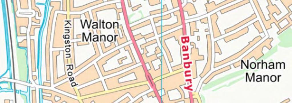

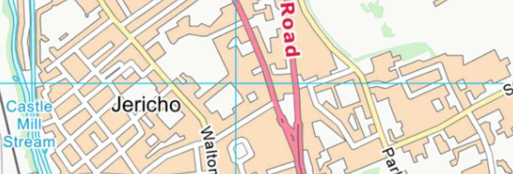
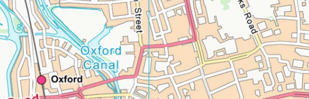
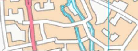
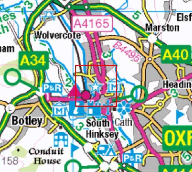
59 MANCHESTER BIRMINGHAM CAMBRIDGE CARDIFF OXFORD LONDON EXETER SOUTHAMPTON X:\o\Oxford_Somerville College, Walton Street\010Geomatics\03 GIS Projects\OXSCWEV_Oxford_Somerville_College_walton_Street_Figure1_ mxd*matt.bradley*25/07/2017 Contains OS data Crown Copyright and database right 2017 Site location! 1:10,000 Figure 1: Site location
60

61 N X:\o\Oxford_Somerville College, Walton Street\010Geomatics\03 GIS Projects\OXSCWEV_Oxford_Somerville_College_walton_Street_Figure3_Trench 1_ mxd*matt.bradley*27/07/ Late 17th/Early 18th Century back fill of Civil War Ditch S m A Evaluation trench Sondage Archaeological Feature Intervention Structure Stone Brick øøø Concrete øøø Slate Modern Section Figure 3: Trench 1
62 O:\O_codes\OXSCWEV\*Walton Street, Sommerville College, Oxford*CAR* SW Section NE 61.49mOD m 1:20 Figure 4: Trench 1, section 100


63 N X:\o\Oxford_Somerville College, Walton Street\010Geomatics\03 GIS Projects\OXSCWEV_Oxford_Somerville_College_walton_Street_Figure5_Trench 2_ mxd*matt.bradley*27/07/ th Century pits ! < AH m A4 S.205! < AH1 S.205 Late 17th/Early 18th Century back fill of Civil War Ditch Evaluation trench Sondage Intervention Archaeological Feature Structure Stone Brick øøø Concrete øøø! < Slate Modern Section Auger hole Figure 5: Trench 2
64 O:\O_codes\OXSCWEV\*Walton Street, Sommerville College, Oxford*CAR* NW 209 Section 203 Tarmac Modern hardcore levelling deposit SE 61.67mOD NW Section 205 Tarmac SE 61.67mOD Modern hardcore levelling deposit Section steps north c.0.8m AH1 AH2 Possible gravel Possible gravel 0 1m 1:20 Figure 6: Trench 2, sections 203 and 203
65 X:\o\Oxford_Somerville College, Walton Street\010Geomatics\03 GIS Projects\OXSCWEV_Oxford_Somerville_College_walton_Street_Figure7_Trench 3_ mxd*matt.bradley*27/07/ N Early Features S S Evaluation trench S.300 Sondage Archaeological Feature 305 Intervention 16th-17th Century pit Structure Stone S m A4 Brick øø Concrete øø Slate Modern Section Figure 7: Trench 3
66 O:\O_codes\OXSCWEV\*Walton Street, Sommerville College, Oxford*CAR* NE SW Section SE Section 300 Tarmac NW Section 303 Tarmac 304 NE 61.68mOD SE 61.68mOD mOD NE Section 304 Tarmac SW mOD m 1:20 Figure 8: Trench 3, sections 300, 302, 303 and 304


67 N Possible Civil War ditch fill 408 X:\o\Oxford_Somerville College, Walton Street\010Geomatics\03 GIS Projects\OXSCWEV_Oxford_Somerville_College_walton_Street_Figure9_Trench 4_ mxd*matt.bradley*27/07/ S m A4 407! < AH3 19th Century pits Evaluation trench Sondage Archaeological Feature Intervention Structure Stone Brick øøø Concrete øøø øøø! < Slate Modern Section Auger hole Figure 9: Trench 4
68 O:\O_codes\OXSCWEV\*Walton Street, Sommerville College, Oxford*CAR* E Section ??.??mOD W 0 1m 1:20 Figure 10: Trench 4, section 401
69 X:\o\Oxford_Somerville College, Walton Street\010Geomatics\03 GIS Projects\OXSCWEV_Oxford_Somerville_College_walton_Street_Figure11_Trench 5_ mxd*matt.bradley*27/07/ N th Century pits øøø S.502 øøøøø øøøøøøøø øøøøøøøøøø 515 øøøøøøøøøøøø øøøøøøøøøø ø øøøøøøøø øø øøøøøø øø øøø øø øø øø 518 øø ø øø øø øø øøø øøø øøøø 504 øø øø øøøøø øø øøø øøøøø øø øø øøøøøø 510 øøø øøø øøøøøø øøø øø øøøøø 506 øøø øø øøøøø 507 øøø øøø øøøøøø øøø øøøøøøø øøø øøø øøø øøø øøøø øøø S.503 ø øøø 510 øøøø øøøøøø øøøøøøø øøøøø øøøøø 507 øøøøø øøøøø 506 øøøø ø m 517 A4 19th Century construction cut Evaluation trench Sondage Archaeological Feature Intervention Structure Stone Brick øø Concrete øø Mortar Slate Modern Section Figure 11: Trench 5
70 O:\O_codes\OXSCWEV\*Walton Street, Sommerville College, Oxford*CAR* NW Section mOD SE 506 NE Section 503 SW 61.71mOD m 1:20 Concrete Figure 12: Trench 5, sections 502 and 503


71 N 616 Possible early feature X:\o\Oxford_Somerville College, Walton Street\010Geomatics\03 GIS Projects\OXSCWEV_Oxford_Somerville_College_walton_Street_Figure13_Trench 6_ mxd*matt.bradley*27/07/ S th Century pits m A S Evaluation trench Sondage Archaeological Feature Intervention Structure Stone Brick øøø Concrete øøø Slate Modern Section Figure 13: Trench 6
72 O:\O_codes\OXSCWEV\*Walton Street, Sommerville College, Oxford*CAR* SE E Section Section mOD W NW mOD m 1:20 Figure 14: Trench 6, sections 502 and 503
73 N X:\o\Oxford_Somerville College, Walton Street\010Geomatics\03 GIS Projects\OXSCWEV_Oxford_Somerville_College_walton_Street_Figure15_Trench 7_ mxd*matt.bradley*27/07/ S m A4 702 Evaluation trench Sondage Archaeological Feature Intervention Structure Stone Brick øøø Concrete øøø Mortar Slate Modern Mortar floor Section Figure 15: Trench 7
74 O:\O_codes\OXSCWEV\*Walton Street, Sommerville College, Oxford*CAR* SE 707 Service 707 trench Pipe/cable Section 700 Concrete surface Hardcore base 0 1m 1:20 Service trench NW 61.44mOD Figure 16: Trench 7, section 700


75 N 19th Century pits S X:\o\Oxford_Somerville College, Walton Street\010Geomatics\03 GIS Projects\OXSCWEV_Oxford_Somerville_College_walton_Street_Figure17_Trench 8_ mxd*matt.bradley*27/07/ S th Century pits m A S.800 Evaluation trench Sondage Archaeological Feature Intervention Structure Stone Brick øøø Concrete øøø Slate Modern Section Figure 17: Trench 8
76 O:\O_codes\OXSCWEV\*Walton Street, Sommerville College, Oxford*CAR* SE NE 806 Section 800 Topsoil Section SW 61.44mOD 61.46mOD NW Topsoil 808 Concrete Concrete SW Section mOD NE Topsoil m 1:20 Figure 18: Trench 8, sections 800, 801 and 802
77 X:\o\Oxford_Somerville College, Walton Street\010Geomatics\03 GIS Projects\OXSCWEV_Oxford_Somerville_College_walton_Street_Figure19_Trench 9_ mxd*matt.bradley*27/07/ N S Evaluation trench Sondage th Century pits Archaeological Feature Intervention Structure Stone m A4 øø Concrete øø Slate Modern Section Brick Figure 19: Trench 9
78 O:\O_codes\OXSCWEV\*Walton Street, Sommerville College, Oxford*CAR* Section 902 SW NE 61.45mOD m 1:20 Figure 20: Trench 9, section 902


79 X:\o\Oxford_Somerville College, Walton Street\010Geomatics\03 GIS Projects\OXSCWEV_Oxford_Somerville_College_walton_Street_Figure21_ mxd*matt.bradley*27/07/ A4 100 m De Gomme's 1644 plan Evaluation trench Contains OS data Crown Copyright and database right 2017 Figure 21: Suggested correlation of De Gomme's 1644 plan of the fortifications with modern mapping, showing the location ofthe trenches at Sommerville college


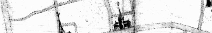
80 A4 250 m Figure 22: Part of De Gomme's plan of 1644 showing bastion at approximate location of site X:\o\Oxford_Somerville College, Walton Street\010Geomatics\03 GIS Projects\OXSCWEV_Oxford_Somerville_College_walton_Street_Figure mxd*matt.bradley*28/07/2017


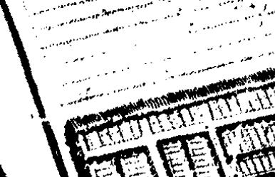
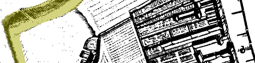
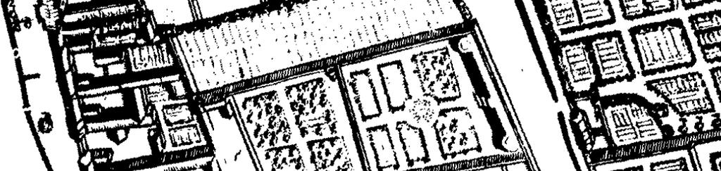
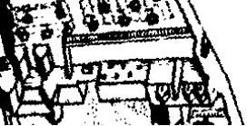
81 A4 100 m Figure 23: Part of Loggan's map of 1675 showing upstanding earthwork east of Walton Street X:\o\Oxford_Somerville College, Walton Street\010Geomatics\03 GIS Projects\OXSCWEV_Oxford_Somerville_College_walton_Street_Figure mxd*matt.bradley*28/07/2017


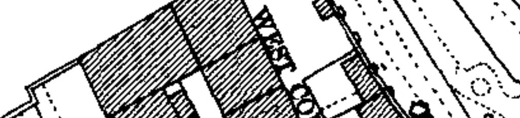
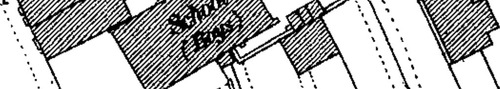


82 A4 20 m Evaluation trench Figure 24: Trenches plotted onto OS 1st Edition map of X:\o\Oxford_Somerville College, Walton Street\010Geomatics\03 GIS Projects\OXSCWEV_Oxford_Somerville_College_walton_Street_Figure mxd*matt.bradley*28/07/2017
83 O:\O_codes\OXSCWEV\*Walton Street, Sommerville College, Oxford*CAR* SW Front of Walton St Tr1 Tr2 Tr3 Tr4 Tr6 Tr5 Tr8 Tr9 NE 61.50mOD Early buried soil Buried soil Terrace gravel In-situ brickearth Possible early features Late 17th/early 18th century backfill of Civil War ditch Mixed upper fills of 19th century pits 19th century pits 0 10m 1:200 Figure 25: SW-NE transect across site


84 O:\O_codes\OXSCWEV\*Walton Street, Sommerville College, Oxford*CAR* Plate 1: Ditch 101 in Trench 1, looking north-west Plate 2: Macine excavated sondage through fills of probable Civil War Ditch, looking east


85 O:\O_codes\OXSCWEV\*Walton Street, Sommerville College, Oxford*CAR* Plate 3: Profile of Ditch 305 in Trench 3, looking south-east Plate 4: General shot of pit cuts in Trench 6, looking south-east


86 O:\O_codes\OXSCWEV\*Walton Street, Sommerville College, Oxford*CAR* Plate 5: General shot of Wall 700 and mortar surface 702 in Trench 7, looking north-west Plate 6: General shot of Sections 800 (left), 801 (facing) and 802 (right) in Trench 8, looking south-west


87 O:\O_codes\OXSCWEV\*Walton Street, Sommerville College, Oxford*CAR* Plate 7: Well 805 in Trench 8, looking south-west Plate 8: Section 902 in Trench 9, looking north-west
88
An archaeological evaluation at 16 Seaview Road, Brightlingsea, Essex February 2004
 An archaeological evaluation at 16 Seaview Road, Brightlingsea, Essex February 2004 report prepared by Kate Orr on behalf of Highfield Homes NGR: TM 086 174 (c) CAT project ref.: 04/2b ECC HAMP group site
Archaeological. Monitoring & Recording Report. Fulbourn Primary School, Cambridgeshire. Archaeological Monitoring & Recording Report.
 Fulbourn Primary School, Cambridgeshire Archaeological Monitoring & Recording Report October 2014 Client: Cambridgeshire County Council OA East Report No: 1689 OASIS No: oxfordar3-192890 NGR: TL 5190 5613
New Composting Centre, Ashgrove Farm, Ardley, Oxfordshire
 New Composting Centre, Ashgrove Farm, Ardley, Oxfordshire An Archaeological Watching Brief For Agrivert Limited by Andrew Weale Thames Valley Archaeological Services Ltd Site Code AFA 09/20 August 2009
ARCHAEOLOGICAL EVALUATION AT BRIGHTON POLYTECHNIC, NORTH FIELD SITE, VARLEY HALLS, COLDEAN LANE, BRIGHTON. by Ian Greig MA AIFA.
 ARCHAEOLOGICAL EVALUATION AT BRIGHTON POLYTECHNIC, NORTH FIELD SITE, VARLEY HALLS, COLDEAN LANE, BRIGHTON by Ian Greig MA AIFA May 1992 South Eastern Archaeological Services Field Archaeology Unit White
Grim s Ditch, Starveall Farm, Wootton, Woodstock, Oxfordshire
 Grim s Ditch, Starveall Farm, Wootton, Woodstock, Oxfordshire An Archaeological Recording Action For Empire Homes by Steve Ford Thames Valley Archaeological Services Ltd Site Code SFW06/118 November 2006
Former Whitbread Training Centre Site, Abbey Street, Faversham, Kent Interim Archaeological Report Phase 1 November 2009
 Former Whitbread Training Centre Site, Abbey Street, Faversham, Kent Interim Archaeological Report Phase 1 November 2009 SWAT. Archaeology Swale and Thames Archaeological Survey Company School Farm Oast,
Church of St Peter and St Paul, Great Missenden, Buckinghamshire
 Church of St Peter and St Paul, Great Missenden, Buckinghamshire An Archaeological Watching Brief for the Parish of Great Missenden by Andrew Taylor Thames Valley Archaeological Services Ltd Site Code
An archaeological watching brief and recording at Brightlingsea Quarry, Moverons Lane, Brightlingsea, Essex October 2003
 An archaeological watching brief and recording at Brightlingsea Quarry, Moverons Lane, Brightlingsea, Essex commissioned by Mineral Services Ltd on behalf of Alresford Sand & Ballast Co Ltd report prepared
2 Saxon Way, Old Windsor, Berkshire
 2 Saxon Way, Old Windsor, Berkshire An Archaeological Watching Brief For Mrs J. McGillicuddy by Pamela Jenkins Thames Valley Archaeological Services Ltd Site Code SWO 05/67 August 2005 Summary Site name:
An archaeological evaluation in the playground of Colchester Royal Grammar School, Lexden Road, Colchester, Essex
 An archaeological evaluation in the playground of Colchester Royal Grammar School, Lexden Road, Colchester, Essex February 2002 on behalf of Roff Marsh Partnership CAT project code: 02/2c Colchester Museum
Colchester Archaeological Trust Ltd. A Fieldwalking Survey at Birch, Colchester for ARC Southern Ltd
 Colchester Archaeological Trust Ltd A Fieldwalking Survey at Birch, Colchester for ARC Southern Ltd November 1997 CONTENTS page Summary... 1 Background... 1 Methods... 1 Retrieval Policy... 2 Conditions...
An archaeological evaluation at the Lexden Wood Golf Club (Westhouse Farm), Lexden, Colchester, Essex
, Lexden, Colchester, Essex") An archaeological evaluation at the Lexden Wood Golf Club (Westhouse Farm), Lexden, Colchester, Essex January 2000 Archive report on behalf of Lexden Wood Golf Club Colchester Archaeological Trust 12 Lexden
An archaeological evaluation at the Lexden Wood Golf Club (Westhouse Farm), Lexden, Colchester, Essex January 2000 Archive report on behalf of Lexden Wood Golf Club Colchester Archaeological Trust 12 Lexden
Greater London GREATER LONDON 3/606 (E ) TQ
 TQ") GREATER LONDON City of London 3/606 (E.01.6024) TQ 30358150 1 PLOUGH PLACE, CITY OF LONDON An Archaeological Watching Brief at 1 Plough Place, City of London, London EC4 Butler, J London : Pre-Construct
GREATER LONDON City of London 3/606 (E.01.6024) TQ 30358150 1 PLOUGH PLACE, CITY OF LONDON An Archaeological Watching Brief at 1 Plough Place, City of London, London EC4 Butler, J London : Pre-Construct
Archaeological Evaluation Report
 16-18 Church Street Brill Buckinghamshire o a February 2008 Client: Stephen Moss Developments Issue N o : 1 OA Job N o : 3858 Planning Ref N o : 06/01304 NGR: SP 6553 1377 Client Name: Stephen Moss Developments
Archaeological evaluation at the Onley Arms, The Street, Stisted, Essex
 Archaeological evaluation at the Onley Arms, The Street, Stisted, Essex November 2014 report by Pip Parmenter and Adam Wightman with a contribution from Stephen Benfield and illustrations by Emma Holloway
Silwood Farm, Silwood Park, Cheapside Road, Ascot, Berkshire
 Silwood Farm, Silwood Park, Cheapside Road, Ascot, Berkshire An Archaeological Watching Brief For Imperial College London by Tim Dawson Thames Valley Archaeological Services Ltd Site Code SFA 09/10 April
An archaeological evaluation at the Blackwater Hotel, Church Road, West Mersea, Colchester, Essex March 2003
 An archaeological evaluation at the Blackwater Hotel, Church Road, West Mersea, Colchester, Essex report prepared by Laura Pooley on behalf of Dolphin Developments (U.K) Ltd NGR: TM 0082 1259 CAT project
Oxfordshire. Wallingford. St Mary-le-More. Archaeological Watching Brief Report. Client: JBKS Architects and St Mary s Renewal Campaign.
 St Mary-le-More Wallingford Oxfordshire Archaeological Watching Brief Report February 2010 Client: JBKS Architects and St Mary s Renewal Campaign Issue No:1 OA Job No: 4432 NGR: SU 6071 8933 Archaeological
Moated Site at Manor Farm, Islip, Oxfordshire
 Moated Site at Manor Farm, Islip, Oxfordshire An Archaeological Excavation By Jo Pine Site Code MFI05 December 2007 Summary Site name: Moated Site at Manor Farm, Islip, Oxfordshire Grid reference: SP 5298
Test-Pit 3: 31 Park Street (SK )
") -Pit 3: 31 Park Street (SK 40732 03178) -Pit 3 was excavated in a flower bed in the rear garden of 31 Park Street, on the northern side of the street and west of an alleyway leading to St Peter s Church,
-Pit 3: 31 Park Street (SK 40732 03178) -Pit 3 was excavated in a flower bed in the rear garden of 31 Park Street, on the northern side of the street and west of an alleyway leading to St Peter s Church,
Monitoring Report No. 99
 Monitoring Report No. 99 Enniskillen Castle Co. Fermanagh AE/06/23 Cormac McSparron Site Specific Information Site Name: Townland: Enniskillen Castle Enniskillen SMR No: FER 211:039 Grid Ref: County: Excavation
An archaeological evaluation by trial-trenching at Playgolf, Bakers Lane, Westhouse Farm, Colchester, Essex
 An archaeological evaluation by trial-trenching at Playgolf, Bakers Lane, Westhouse Farm, Colchester, Essex commissioned by Mr Stephen Belchem on behalf of ADP Ltd. report prepared by Chris Lister Planning
ARCHAEOLOGICAL MONITORING REPORT
 ARCHAEOLOGICAL MONITORING REPORT SCCAS REPORT No. 2009/324 Thorington Hall, Stoke by Nayland SBN 087 HER Information Date of Fieldwork: November 2009 - January 2010 Grid Reference: TM 0131 3546 Funding
39, Walnut Tree Lane, Sudbury (SUY 073) Planning Application No. B/04/02019/FUL Archaeological Monitoring Report No. 2005/112 OASIS ID no.
 Planning Application No. B/04/02019/FUL Archaeological Monitoring Report No. 2005/112 OASIS ID no.") 39, Walnut Tree Lane, Sudbury (SUY 073) Planning Application No. B/04/02019/FUL Archaeological Monitoring Report No. 2005/112 OASIS ID no. 9273 Summary Sudbury, 39, Walnut Tree Lane, Sudbury (TL/869412;
39, Walnut Tree Lane, Sudbury (SUY 073) Planning Application No. B/04/02019/FUL Archaeological Monitoring Report No. 2005/112 OASIS ID no. 9273 Summary Sudbury, 39, Walnut Tree Lane, Sudbury (TL/869412;
7. Prehistoric features and an early medieval enclosure at Coonagh West, Co. Limerick Kate Taylor
 7. Prehistoric features and an early medieval enclosure at Coonagh West, Co. Limerick Kate Taylor Illus. 1 Location of the site in Coonagh West, Co. Limerick (based on the Ordnance Survey Ireland map)
Archaeological Evaluation at Alconbury Weald Enterprise Zone
 Archaeological Evaluation at Alconbury Weald Enterprise Zone Archaeological Evaluation Report June 2015 Client: CgMS OA East Report No: 1768 OASIS No: oxfordar3-212519 NGR: TL 1975 7684 Archaeological
Fieldwalking at Cottam 1994 (COT94F)
") Fieldwalking at Cottam 1994 (COT94F) Tony Austin & Elizabeth Jelley (19 Jan 29) 1. Introduction During the winter of 1994 students from the Department of Archaeology at the University of York undertook
Fieldwalking at Cottam 1994 (COT94F) Tony Austin & Elizabeth Jelley (19 Jan 29) 1. Introduction During the winter of 1994 students from the Department of Archaeology at the University of York undertook
Archaeological Watching Brief (Phase 2) at Court Lodge Farm, Aldington, near Ashford, Kent December 2011
 at Court Lodge Farm, Aldington, near Ashford, Kent December 2011") Archaeological Watching Brief (Phase 2) at Court Lodge Farm, Aldington, near Ashford, Kent December 2011 SWAT. Archaeology Swale and Thames Archaeological Survey Company School Farm Oast, Graveney Road
Archaeological Watching Brief (Phase 2) at Court Lodge Farm, Aldington, near Ashford, Kent December 2011 SWAT. Archaeology Swale and Thames Archaeological Survey Company School Farm Oast, Graveney Road
Grange Farm, Widmer End, Hughenden, Buckinghamshire
 Grange Farm, Widmer End, Hughenden, Buckinghamshire An Archaeological Evaluation for British Flora by Andy Taylor Thames Valley Archaeological Services Ltd Site Code GFH 05/63 July 2005 Summary Site name:
An archaeological watching brief at Sheepen, Colchester, Essex November-December 2003
 An archaeological watching brief at Sheepen, Colchester, Essex November-December 2003 report prepared by Ben Holloway on behalf of Colchester Borough Council CAT project ref.: 03/11c Colchester Museums
An archaeological evaluation by trial-trenching at Scotts Farm, Lodge Lane, Purleigh, Essex October 2011
 An archaeological evaluation by trial-trenching at Scotts Farm, Lodge Lane, Purleigh, Essex October 2011 report prepared by Adam Wightman on behalf of Richard Emans CAT project ref.: 11/10a NGR: TL 582719
Archaeological trial-trenching evaluation at Chappel Farm, Little Totham, Essex. April 2013
 Archaeological trial-trenching evaluation at Chappel Farm, Little Totham, Essex April 2013 report prepared by Ben Holloway commissioned by Tim Harbord Associates on behalf of Mr Tom Howie Planning reference:
Folkestone Warren High Cliff Instrumentation Kent Archaeological Watching Brief Report. Client: Costain. March 2017
 Folkestone Warren High Cliff Instrumentation Kent Archaeological Watching Brief Report March 2017 Client: Costain Issue No: v1.0 OA Reference No: 6551 NGR: TR 2590 3850 Folkestone Warren High Cliff Instrumentation,
FURTHER MIDDLE SAXON EVIDENCE AT COOK STREET, SOUTHAMPTON (SOU 567)
") Roc. Hampshire Field Club Archaeol. Soc 52,1997, 77-87 (Hampshire Studies 1997) FURTHER MIDDLE SAXON EVIDENCE AT COOK STREET, SOUTHAMPTON (SOU 567) By M F GARNER andj VINCENT with a contribution byjacqueline
Roc. Hampshire Field Club Archaeol. Soc 52,1997, 77-87 (Hampshire Studies 1997) FURTHER MIDDLE SAXON EVIDENCE AT COOK STREET, SOUTHAMPTON (SOU 567) By M F GARNER andj VINCENT with a contribution byjacqueline
Archaeological sites and find spots in the parish of Burghclere - SMR no. OS Grid Ref. Site Name Classification Period
 Archaeological sites and find spots in the parish of Burghclere - SMR no. OS Grid Ref. Site Name Classification Period SU45NE 1A SU46880 59200 Ridgemoor Farm Inhumation Burial At Ridgemoor Farm, on the
Cambridge Archaeology Field Group. Fieldwalking on the Childerley Estate, Cambridgeshire. Autumn 2014 to Spring Third interim report
 Cambridge Archaeology Field Group Fieldwalking on the Childerley Estate, Cambridgeshire Autumn 2014 to Spring 2015 Third interim report Summary Field walking on the Childerley estate of Martin Jenkins
Greater London Region GREATER LONDON 3/567 (E.01.K099) TQ BERMONDSEY STREET AND GIFCO BUILDING AND CAR PARK
 TQ BERMONDSEY STREET AND GIFCO BUILDING AND CAR PARK") GREATER LONDON 3/567 (E.01.K099) TQ 33307955 156-170 BERMONDSEY STREET AND GIFCO BUILDING AND CAR PARK Assessment of an Archaeological Excavation at 156-170 Bermondsey Street and GIFCO Building and Car
GREATER LONDON 3/567 (E.01.K099) TQ 33307955 156-170 BERMONDSEY STREET AND GIFCO BUILDING AND CAR PARK Assessment of an Archaeological Excavation at 156-170 Bermondsey Street and GIFCO Building and Car
Cambridge Archaeology Field Group. Fieldwalking on the Childerley Estate Cambridgeshire
 Cambridge Archaeology Field Group Fieldwalking on the Childerley Estate Cambridgeshire 2009 to 2014 Summary Fieldwalking on the Childerley estate of Martin Jenkins and Family has revealed, up to March
Small Finds Assessment, Minchery Paddock, Littlemore, Oxford (MP12)
") Small s Assessment, Minchery Paddock, Littlemore, Oxford (MP12) Introduction A total of 51 objects recovered from excavations at Minchery Paddock, Littlemore, Oxford (MP12) were submitted for dating and
Small s Assessment, Minchery Paddock, Littlemore, Oxford (MP12) Introduction A total of 51 objects recovered from excavations at Minchery Paddock, Littlemore, Oxford (MP12) were submitted for dating and
Erection of wind turbine, Mains of Loanhead, Old Rayne, AB52 6SX
 Erection of wind turbine, Mains of Loanhead, Old Rayne, AB52 6SX Ltd 23 November 2011 Erection of wind turbine, Mains of Loanhead, Old Rayne, AB52 6SX CONTENTS 1 INTRODUCTION 3 2 ARCHAEOLOGICAL BACKGROUND
3. The new face of Bronze Age pottery Jacinta Kiely and Bruce Sutton
 3. The new face of Bronze Age pottery Jacinta Kiely and Bruce Sutton Illus. 1 Location map of Early Bronze Age site at Mitchelstown, Co. Cork (based on the Ordnance Survey Ireland map) A previously unknown
Fort Arbeia and the Roman Empire in Britain 2012 FIELD REPORT
 Fort Arbeia and the Roman Empire in Britain 2012 FIELD REPORT Background Information Lead PI: Paul Bidwell Report completed by: Paul Bidwell Period Covered by this report: 17 June to 25 August 2012 Date
1 The East Oxford Archaeology and History Project
 1 The East Oxford Archaeology and History Project EXOP TEST PIT 72 Location: Bartlemas Chapel, Cowley Date of excavation: 6-8 November 2013. Area of excavation: 0.8m x 1.2m, at the eastern end of the chapel.
ARCHAEOLOGICAL S E R V I C E S. St Nicholas' Church, Barrack Hill, Nether Winchendon, Buckinghamshire. Archaeological Watching Brief.
 T H A M E S V A L L E Y ARCHAEOLOGICAL S E R V I C E S St Nicholas' Church, Barrack Hill, Nether Winchendon, Buckinghamshire Archaeological Watching Brief by Steven Crabb Site Code: STW17/229 (SP 7735
Essex Historic Environment Record/ Essex Archaeology and History
 Essex Historic Environment Record/ Essex Archaeology and History CAT Report 578 Summary sheet Address: Kingswode Hoe School, Sussex Road, Colchester, Essex Parish: Colchester NGR: TL 9835 2528 Type of
Wantage County Primary School, Garston Lane, Wantage, Oxfordshire
 Wantage County Primary School, Garston Lane, Wantage, Oxfordshire An Archaeological Evaluation for Oxfordshire County Council by Erlend Hindmarch Thames Valley Archaeological Services Ltd Site Code GLW
E x cav atio n R e p o r t
 Medieval Trackway on land at Ivy Farm Royston, Hertfordshire Excavation Report E x cav atio n R e p o r t October 2011 Client: CgMs Consulting OA East Report No: 1305 OASIS No: oxfordar3-112012 NGR: TL
Lanton Lithic Assessment
 Lanton Lithic Assessment Dr Clive Waddington ARS Ltd The section headings in the following assessment report refer to those in the Management of Archaeological Projects (HBMC 1991), Appendix 4. 1. FACTUAL
An archaeological watching brief at St Leonard s church, Hythe Hill, Colchester, Essex
 An archaeological watching brief at St Leonard s church, Hythe Hill, Colchester, Essex report prepared by Adam Wightman on behalf of Dorvell Construction CAT project ref.: 10/5d Colchester and Ipswich
Monitoring Report No Sacred Heart Church Aghamore Boho Co. Fermanagh AE/10/116E. Brian Sloan L/2009/1262/F
 Monitoring Report No. 202 Sacred Heart Church Aghamore Boho Co. Fermanagh AE/10/116E Brian Sloan L/2009/1262/F Site Specific Information Site Address: Sacred Heart Church, Aghamore, Boho, Co. Fermanagh
Archaeological Material From Spa Ghyll Farm, Aldfield
 Archaeological Material From Spa Ghyll Farm, Aldfield Introduction Following discussions with Linda Smith the Rural Archaeologist for North Yorkshire County Council, Robert Morgan of 3D Archaeological
MARSTON MICHAEL FARLEY
 MARSTON MICHAEL FARLEY On 9 March agricultural contractors, laying field drains for Bucks County Council Land Agent's Department, cut through a limestone structure at SP 75852301 in an area otherwise consistently
Old Brewery Close and Walton Street, Aylesbury, Buckinghamshire
 Old Brewery Close and Walton Street, Aylesbury, Buckinghamshire An Archaeological Evaluation for Berkeley Homes (Oxford and Chiltern) Ltd by Sian Anthony Thames Valley Archaeological Services Ltd Site
Land North of Pesthouse Lane Barham Suffolk BRH 054
 Land North of Pesthouse Lane Barham Suffolk BRH 054 Archaeological Evaluation Report SCCAS Report No. 2012/142 Client: Barham Parish Council Author: Jezz Meredith September 2012 SCCAS Land North of Pesthouse
THE PRE-CONQUEST COFFINS FROM SWINEGATE AND 18 BACK SWINEGATE
 THE PRE-CONQUEST COFFINS FROM 12 18 SWINEGATE AND 18 BACK SWINEGATE An Insight Report By J.M. McComish York Archaeological Trust for Excavation and Research (2015) Contents 1. INTRODUCTION... 3 2. THE
Excavation. Post-Medieval Ditches. Land off Norwich Common Road Wymondham Norfolk. Excavation. Client: November 2013
 Land off Norwich Common Road Wymondham Norfolk. Excavation November 2013 Client: OA East Report No: 1546 OASIS No: oxfordar3-163105 NGR: TG 12770 02684 Excavation Post-Medieval Ditches Post-Medieval Ditches
TA 04/15 OASIS ID
 River Tees Rediscovered Project Archaeological Excavations in Egglescliffe Stockton on Tees 2015 TA 04/15 OASIS ID 1-238455 River Tees Rediscovered Project Archaeological Excavations in Egglescliffe Stockton
A visit to the Wor Barrow 21 st November 2015
 A visit to the Wor Barrow 21 st November 2015 Following our exploration of Winkelbury a few weeks previously, we fast forwarded 12 years in Pitt Rivers remarkable series of excavations and followed him
Excavations at Shikarpur, Gujarat
 Excavations at Shikarpur, Gujarat 2008-2009 The Department of Archaeology and Ancient History, the M. S. University of Baroda continued excavations at Shikarpur in the second field season in 2008-09. In
Cetamura Results
 Cetamura 2000 2006 Results A major project during the years 2000-2006 was the excavation to bedrock of two large and deep units located on an escarpment between Zone I and Zone II (fig. 1 and fig. 2);
Wandsworth London. Alma Tavern. o a. A rch aeol ogi cal I nvestigation R eport. Client: Young s and Co. Brewery Plc and Nickless Allen.
 Alma Tavern Wandsworth London Archaeological Investigation Report o a April 2010 Client: Young s and Co. Brewery Plc and Nickless Allen Issue No: 1 NGR: TQ 260 750 A rch aeol ogi cal I nvestigation R eport
An archaeological watching brief on one section of an Anglian Water main Spring Lane, Lexden, Colchester
 An archaeological watching brief on one section of an Anglian Water main Spring Lane, Lexden, Colchester April-September 2001 on behalf of Breheny Contractors CAT project ref.: 01/4D Colchester Museum
Former Filling Station, High Street, Dorchester-on-Thames, Oxfordshire
 Former Filling Station, High Street, Dorchester-on-Thames, Oxfordshire An Archaeological Evaluation for Country Visions OK Limited by Sarah Coles Thames Valley Archaeological Services Ltd Site Code HSD01/36
STONES OF STENNESS HISTORIC ENVIRONMENT SCOTLAND STATEMENT OF SIGNIFICANCE
 Property in Care (PIC) ID: PIC321 Designations: Scheduled Monument (SM90285); Taken into State care: 1906 (Guardianship) Last reviewed: 2003 HISTORIC ENVIRONMENT SCOTLAND STATEMENT OF SIGNIFICANCE STONES
Phase 2 Urban consolidation AD
 Phase 2 Urban consolidation AD 1250-1350 The second recognised phase of activity at Rådhuspladsen corresponded approximately to the High medieval period (c. AD 1250 1350), and saw consolidation of the
Limited Archaeological Testing at the Sands House Annapolis, Maryland
 Limited Archaeological Testing at the Sands House Annapolis, Maryland Report Submitted to Four Rivers Heritage Area by John E. Kille, Ph.D., Shawn Sharpe, and Al Luckenbach, Ph.D February 10, 2012 In May-June
NOTE A THIRD CENTURY ROMAN BURIAL FROM MANOR FARM, HURSTBOURNE PRIORS. by. David Allen with contributions by Sue Anderson and Brenda Dickinson
 Proc. Hampsh. Field Club Archaeol. Soc. 47, 1991, 253-257 NOTE A THIRD CENTURY ROMAN BURIAL FROM MANOR FARM, HURSTBOURNE PRIORS Abstract by. David Allen with contributions by Sue Anderson and Brenda Dickinson
St Germains, Tranent, East Lothian: the excavation of Early Bronze Age remains and Iron Age enclosed and unenclosed settlements
 Proc Soc Antiq Scot, 128 (1998), 203-254 St Germains, Tranent, East Lothian: the excavation of Early Bronze Age remains and Iron Age enclosed and unenclosed settlements Derek Alexander* & Trevor Watkinsf
CUMBRIA 2/635 (C ) NY
 NY") CUMBRIA Allerdale 2/635 (C.16.6017) NY 11803070 BRIDGE STREET, COCKERMOUTH Report on an Archaeological Evaluation at Bridge Street, Cockermouth, Cumbria (Report No. 5/00) Grahame, R Carlisle : Carlisle
CUMBRIA Allerdale 2/635 (C.16.6017) NY 11803070 BRIDGE STREET, COCKERMOUTH Report on an Archaeological Evaluation at Bridge Street, Cockermouth, Cumbria (Report No. 5/00) Grahame, R Carlisle : Carlisle
A Sense of Place Tor Enclosures
 A Sense of Place Tor Enclosures Tor enclosures were built around six thousand years ago (4000 BC) in the early part of the Neolithic period. They are large enclosures defined by stony banks sited on hilltops
Undley Hall, Lakenheath LKH 307
 ARCHAEOLOGICAL EVALUATION AND MONITORING REPORT SCCAS REPORT No. 2010/005 Undley Hall, Lakenheath LKH 307 E. Muldowney SCCAS January 2010 www.suffolkcc.gov.uk/e-and-t/archaeology Lucy Robinson, County
THE EXCAVATION OF A BURNT MOUND AT HARBRIDGE, HAMPSHIRE
 Proc Hampshire Field ClubArchaeolSoc5i, 1999,172-179 (Hampshire Studies 1999) THE EXCAVATION OF A BURNT MOUND AT HARBRIDGE, HAMPSHIRE by S J SHENNAN ABSTRACT A burnt mound of Late Brome Age date, as indicated
THE UNFOLDING ARCHAEOLOGY OF CHELTENHAM
 THE UNFOLDING ARCHAEOLOGY OF CHELTENHAM The archaeology collection of Cheltenham Art Gallery & Museum contains a rich quantity of material relating to the prehistoric and Roman occupation of the North
THE RAVENSTONE BEAKER
 DISCOVERY THE RAVENSTONE BEAKER K. J. FIELD The discovery of the Ravenstone Beaker (Plate Xa Fig. 1) was made by members of the Wolverton and District Archaeological Society engaged on a routine field
ST PATRICK S CHAPEL, ST DAVIDS PEMBROKESHIRE 2015
 ST PATRICK S CHAPEL, ST DAVIDS PEMBROKESHIRE 2015 REPORT FOR THE NINEVEH CHARITABLE TRUST THE UNIVERSITY OF SHEFFIELD AND DYFED ARCHAEOLOGICAL TRUST Introduction ST PATRICK S CHAPEL, ST DAVIDS, PEMBROKESHIRE,
LAND WEST OF ELM GROVE, EBRINGTON, GLOUCESTERSHIRE. NGR: SP (centred) ARCHAEOLOGICAL EVALUATION
 ARCHAEOLOGICAL EVALUATION") LAND WEST OF ELM GROVE, EBRINGTON, GLOUCESTERSHIRE. NGR: SP 1892 4012 (centred) ARCHAEOLOGICAL EVALUATION Report No. 640 May 2009 1q LAND WEST OF ELM GROVE, EBRINGTON, GLOUCESTERSHIRE. NGR: SP 1892 4012
LAND WEST OF ELM GROVE, EBRINGTON, GLOUCESTERSHIRE. NGR: SP 1892 4012 (centred) ARCHAEOLOGICAL EVALUATION Report No. 640 May 2009 1q LAND WEST OF ELM GROVE, EBRINGTON, GLOUCESTERSHIRE. NGR: SP 1892 4012
The Swan Hotel, Lavenham LVM 080
 The Swan Hotel, Lavenham LVM 080 Post-Excavation Assessment Report v0.4 SCCAS Report No. 2013/148 Client: TA Hotel Collection Author: Rob Brooks December/2014 Suffolk County Council Archaeological Service
ROMAN AND MEDIEVAL ACTIVITY IN THE UPPER WALBROOK VALLEY: EXCAVATIONS AT MOORGATE, CITY OF LONDON, EC2, 1997
 ROMAN AND MEDIEVAL ACTIVITY IN THE UPPER WALBROOK VALLEY: EXCAVATIONS AT 12 18 MOORGATE, CITY OF LONDON, EC2, 1997 Graham Bruce, Dominic Perring, Tim Stevens and Melissa Melikian SUMMARY In January and
SALVAGE EXCAVATIONS AT OLD DOWN FARM, EAST MEON
 Proc. Hants. Field Club Archaeol. Soc. 36, 1980, 153-160. 153 SALVAGE EXCAVATIONS AT OLD DOWN FARM, EAST MEON By RICHARD WHINNEY AND GEORGE WALKER INTRODUCTION The site was discovered by chance in December
December 6, Paul Racher (P007) Archaeological Research Associates Ltd. 900 Guelph St. Kitchener ON N2H 5Z6
 Archaeological Research Associates Ltd. 900 Guelph St. Kitchener ON N2H 5Z6") Ministry of Tourism, Culture and Sport Culture Programs Unit Programs and Services Branch Culture Division 401 Bay Street, Suite 1700 Toronto ON M7A 0A7 Tel.: 416-314-2120 Ministère du Tourisme, de la
Ministry of Tourism, Culture and Sport Culture Programs Unit Programs and Services Branch Culture Division 401 Bay Street, Suite 1700 Toronto ON M7A 0A7 Tel.: 416-314-2120 Ministère du Tourisme, de la
16 members of the Fieldwalking Group met York Community Archaeologist Jon Kenny at Lou Howard s farm, Rose Cottage Farm, at
 Terrington History Group Fieldwalking Group Field 1 Final report 21 October 2011 - fieldwalking 16 members of the Fieldwalking Group met York Community Archaeologist Jon Kenny at Lou Howard s farm, Rose
Bristol & Gloucestershire Archaeological Society
 Chris Hayden, Rob Early, Edward Biddulph, Paul Booth, Anne Dodd, Alex Smith, Granville Laws and Ken Welsh, Horcott Quarry, Fairford and Arkell's Land, Kempsford: Prehistoric, Roman and Anglo-Saxon settlement
SERIATION: Ordering Archaeological Evidence by Stylistic Differences
 SERIATION: Ordering Archaeological Evidence by Stylistic Differences Seriation During the early stages of archaeological research in a given region, archaeologists often encounter objects or assemblages
Novington, Plumpton East Sussex
 Novington, Plumpton East Sussex The Flint Over 1000 pieces of flintwork were recovered during the survey, and are summarised in Table 0. The flint is of the same types as found in the previous survey of
Museum of London Archaeological Archive: standards 2 Archive Components: Standards and Specifications 2.3 Finds
 Author Maloney, Cath. LAARC Version 3 Date 08/05/2013 Status Pre-publication Change History 2.9. Replacement of Registered Finds cards with image 2.3.4.3 2.8 Additions to Appendix: sample Finds Inventory
Caistor Roman Project Interim Summary of 2015 Season of Test pits at Caistor Old Hall
 Caistor Roman Project Interim Summary of 2015 Season of Test pits at Caistor Old Hall Introduction This brief report summarises the first results of the 2015 campaign of test-pitting in the grounds of
AN EARLY MEDIEVAL RUBBISH-PIT AT CATHERINGTON, HAMPSHIRE Bj>J. S. PILE and K. J. BARTON
 AN EARLY MEDIEVAL RUBBISH-PIT AT CATHERINGTON, HAMPSHIRE Bj>J. S. PILE and K. J. BARTON INTRODUCTION THE SITE (fig. 21) is situated in the village of Catherington, one mile north-west of Horndean and 200
Archaeological Watching Brief Report
 Hampton Court Palace Signage Archaeological Watching Brief Report February 2011 Client: Historic Royal Palaces Issue No: 1 OA Job No: 4371 NGR: TQ 1560 6870 Archaeological Watching Brief Report Servergo:/oaupubs1_AthuH*HCP53*HCP53BS*Hampton
The lithic assemblage from Kingsdale Head (KH09)
") 1 The lithic assemblage from Kingsdale Head (KH09) Hannah Russ Introduction During excavation the of potential Mesolithic features at Kingsdale Head in 2009 an assemblage of flint and chert artefacts were
1 The lithic assemblage from Kingsdale Head (KH09) Hannah Russ Introduction During excavation the of potential Mesolithic features at Kingsdale Head in 2009 an assemblage of flint and chert artefacts were
Burrell Orchard 2014: Cleveland Archaeological Society Internship Amanda Ponomarenko The Ohio State University June - August 2014
 1 Burrell Orchard 2014: Cleveland Archaeological Society Internship Amanda Ponomarenko The Ohio State University June - August 2014 Selected for the 2014 Cleveland Archaeological Society Internship in
C o w e s. Isle of Wight. BAE Systems Land. Archaeological Evaluation Report. Client: BAE Systems. November 2008
 BA Systems Land C o w e s Isle of ight Archaeological valuation Report November 2008 Client: BA Systems Issue No: 1 OA Job No: 4253 NGR: SZ 489 453 Archaeological valuation Report Client Name: BA Systems
Chapter 2: Archaeological Description
 Chapter 2: Archaeological Description Phase 1 Late Neolithic, c 3000-2400 BC (Figs 6-9) Evidence of Neolithic activity was confined to pits dug across the southern half of the site (Fig. 6). Eighteen pits
TOTTENHAM COURT ROAD CROSSRAIL EASTERN TICKET HALL 12 Goslett Yard London WC2
 TOTTENHAM COURT ROAD CROSSRAIL EASTERN TICKET HALL 12 Goslett Yard London WC2 City of Westminster A targeted watching brief report November 2010 Museum of London 2010 Site code: TCG 09 NGR: 529810 181260
Advanced archaeology at the archive. Museum of London Support materials AS/A2 study day
 Advanced archaeology at the archive Support materials AS/A2 study day Contents National Curriculum links and session description 1-2 Example timetable 3 Practical guidelines 4 Visit preparation and pre-visit
Peace Hall, Sydney Town Hall Results of Archaeological Program (Interim Report)
") Results of Archaeological Program (Interim Report) Background The proposed excavation of a services basement in the western half of the Peace Hall led to the archaeological investigation of the space in
Results of Archaeological Program (Interim Report) Background The proposed excavation of a services basement in the western half of the Peace Hall led to the archaeological investigation of the space in
Eton College Courtyard Resurfacing Work, Windsor, Berkshire Archaeological Watching Brief Report. Client: Eton College. March 2017
 Eton College Courtyard Resurfacing Work, Windsor, Berkshire Archaeological Watching Brief Report March 2017 Client: Eton College Issue No: 1 OA Reference No: ETONSWB2 NGR: SU 96701 77909 Client Name:
STONE implements and pottery indicative of Late Neolithic settlement are known to
 Late Neolithic Site in the Extreme Northwest of the New Territories, Hong Kong Received 29 July 1966 T. N. CHIU* AND M. K. WOO** THE SITE STONE implements and pottery indicative of Late Neolithic settlement
ARCHAEOLOGICAL EVALUATION REPORT. Home Farm, Woolverstone
 ARCHAEOLOGICAL EVALUATION REPORT Home Farm, Woolverstone WLV 047 A REPORT ON THE ARCHAEOLOGICAL EVALUATION, 2007 Kieron Heard Field Team Suffolk County Council Archaeological Service December 2007 Lucy
M ereside, H anmer, Clwyd
 THE CLWYD-POWYS ARCHAEOLOGICAL TRUST M ereside, H anmer, Clwyd ARCHAEOLOGICAL EVALUATION CPAT Report No 81 CPAT Report No 81 Mereside, Hanmer, Clwyd ARCHAEOLOGICAL EVALUATION bywg Owen November 1993 Report
17 Phase 5. High and Late medieval features and activities AD
 17 Phase 5. High and Late medieval features and activities 1200 1550 AD 17.1 Results This time phase is based on all findings that can be placed in the High and Late medieval period 1200 1550 AD based