Stage 1 and 2 Archaeological Assessment of Tutela Heights Phase 1, Stuart & Ruggles Tract, County of Brant, Ontario. Prepared for:
|
|
|
- Thomas Harmon
- 5 years ago
- Views:
Transcription

1 Stage 1 and 2 Archaeological Assessment of Tutela Heights Phase 1, Stuart & Ruggles Tract, Prepared for: Walton Development and Management # Bay Street, Toronto, Ontario M5L 1G3 Tel Fax Archaeological Licence P049 (Steiss) MTC CIF P ASI File 10TS-32 August, 2010
2 Page i Stage 1 and 2 Archaeological Assessment of Tutela Heights Phase 1, Stuart & Ruggles Tract, EXECUTIVE SUMMARY Archaeological Services Inc. was retained by Walton Development and Management of Toronto, Ontario to undertake a Stage 1 and 2 archaeological assessment of Tutela Heights Phase 1, Stuart & Ruggles Tract, in the County of Brant, Township of Brantford, Ontario. The study area encompasses hectares and is located on the south side of Tutela Heights Road, west of Davern Road, east of Rue Chatueax Terrace and north of Phelps Road. The study area consists of cultivated fields and wooded lands. The background review of the study area revealed that no sites had been registered within the study area but that eighteen had been registered within one kilometre of the study area. A review of all available historical mapping and archival records indicated that the study area has been settled since the early nineteenth century. The study area was assessed at five metre intervals. All areas of disturbance were documented. During the course of the archaeological survey, three historical sites, one historic industrial site, one possible historic Aboriginal site, two historic findspots, 59 pre-contact sites and 85 pre-contact findspots were documented. Given the isolated and undiagnostic nature of P2 (AgHb-419), P3, P6, P8, P11, P12, P13, P14, P15, P16, P17, P19, P21, P22, P24, P25, P29, P31, P33 (AgHb-433), P34, P35, P36, P37, P43, P44, P45, P47, P48, P49, P50, P51 (AgHb-438), P52, P53 (AgHb-439), P54, P55, P56, P57, P59, P60, P61 (AgHb-441), P62, P63, P64, P69, P70, P71, P72, P74, P75, P76, P77, P78, P79, P80, P84, P85, P86, P87, P88, P89, P90, P91 (AgHb-447), P92 (AgHb-448), P99, P102, P104 (AgHb-457), P106, P109, P110, P111, P112, P113, P114, P115, P118, P119, P121, P123, P124, P125 (AgHb-464), P126, P128, P129, P131 (AgHb-466), P133, P134, P135, P137 (AgHb-469), P140, P142, P143, P144 and P145, these findspots do not represent significant archaeological resources and are considered to be free of any further archaeological concern. Given the isolated nature of H1 and H3, these findspots do not represent significant archaeological resources and are considered to be free of any further archaeological concern. Findspots P10, P30, P38, P66, P73, P94, P96, P122, P130 and P146, represent components that have yielded few artifacts, but appear to have highly focused distributions. Given this factor, it is recommended that these areas be subject to a revisit and if additional artifacts are encountered at each site, then those sites will be subject to Stage 3 investigation. If the revisits do not result in the recovery of any additional artifacts, recommendation will be made to clear those sites of further archaeological concern. Given the nature of the deposits at Euro-Canadian sites AgHb-416 and AgHb-417, these sites potentially represent significant archaeological resources. If these sites cannot be avoided in the development plan, they must be subject to a comprehensive Stage 3 assessment, in accordance with the Ministry of Tourism and Culture s Standards and Guidelines for Consulting Archaeologists (2009). Given the nature of the deposits and considering the property s land use history, the Blackers Brickworks site (AgHb-415) represents a potentially significant archaeological resource. If this site cannot be avoided in the development plan, it must be subject to a comprehensive Stage 3 assessment.
3 Page ii Site AgHb-413 represents a significant component of the Late Iroquoian and contact period history of Brantford. If this site cannot be avoided in the development plan, it must be subject to a comprehensive Stage 3 assessment. Sites P1 (AgHb-418), P5 (AgHb-421), P9 (AgHb-423), P18 (AgHb-424), P20 (AgHb-426), P23 (AgHb-427), P26 (AgHb-428), P27 (AgHb-429), P28 (AgHb-430), P32 (AgHb-432), P39 (AgHb-434), P40 (AgHb-435), P41 (AgHb-436), P42 (AgHb-437), P58 (AgHb-440), P65 (AgHb-442), P67 (AgHb-443), P68 (AgHb-444), P81 (AgHb-445), P83 (AgHb-446), P93 (AgHb-449), P108 (AgHb-459), P117 (AgHb-461), P136 (AgHb-468), P147 (AgHb-472), and P148 (AgHb-473) represent significant archaeological resources of potential high heritage value. If these sites cannot be avoided in the development plan, they must be subject to comprehensive Stage 3 assessment. The following sites are situated within areas to be protected and will not be subject to Stage 3 investigation: P4 (AgHb-420), P95 (AgHb-451), P97 (AgHb-452), P98 (AgHb-453), P100 (AgHb-454), P101 (AgHb-455), P103 (AgHb-456), P105 (AgHb-458), P116 (AgHb-460), P120 (AgHb-462), P121, P127 (AgHb- 465), P132 (AgHb-467), P138 (AgHb-470), P139 (AgHb-471) and Euro-Canadian site AgHb-414. The remainder of the subject property may be considered free from further archaeological concern.
4 Page ii PROJECT PERSONNEL Project Director: Project Manager: Field Director: Field Archaeologists: Project Historian: Report Preparation: Artifact Processing: Artifact Analysis Artifact Photography: Graphics: Report Compilation and Editing: Debbie Steiss, MA, Partner & Senior Archaeologist (P049) Beverly Garner, Hons. BA, Assistant Manager Mr. Robert Wojtowicz, BSc Staff Archaeologist (R291) Ms. Maya Basdeo Ms. Devon Brusey Mr. Jenna Down Ms. Jillian Fraser Ms. Johanna Kelly Mr. Adrian Morrison Ms. Anatoly Venovcev Mr. Brian Narhi Ms. Andrea Carnevale, Hons. BSc Staff Archaeologist (R314) Ms. Carol Bella Mr. Shawn Bayes, BA Ms. Elaine Cheng, BA, Staff Archaeologist (R318) Ms. Andrea Carnevale Ms. Alexis Dunlop, MSc, Laboratory Manager Ms. Deborah Steiss Ms. Andrea Carnevale Ms. Sarina Finlay, Hons. BA, GIS/CAD technician Ms. Andrea Carnevale Ms. Andrea Carnevale Ms. Beverly Garner
5 Page iii TABLE OF CONTENTS EXECUTIVE SUMMARY...I PROJECT PERSONNEL... II 1.0 INTRODUCTION STAGE 1 BACKGROUND RESEARCH PREVIOUS ARCHAEOLOGICAL RESEARCH PHYSIOGRAPHY AND ASSESSMENT OF PRE-CONTACT POTENTIAL ASSESSMENT OF HISTORIC ARCHAEOLOGICAL POTENTIAL: SUMMARY REVIEW OF HISTORICAL MAPPING STAGE 2 FIELD ASSESSMENT... 6 Test Pit Survey... 6 Pedestrian Survey RESULTS OF THE FIELD ASSESSMENT Pre-Contact Sites and Findspots AgHb-418 P AgHb-419 P P AgHb-420 P AgHb-421 P P AgHb-422 P P AgHb-423 P AgHb-474 P P P P P AgHb-475 P P P AgHb-424 P P AgHb-426 P P P AgHb-427 P P P AgHb-428 P AgHb-429 P AgHb-430 P P AgHb-431 P P AgHb-432 P AgHb-433 P P P P P AgHb-476 P AgHb-434 P AgHb-435 P AgHb-436 P AgHb-437 P
6 Page iv P P P P P P P AgHb-438 P P AgHb-439 P P P P P AgHb-440 P P P AgHb-441 P P P P AgHb-442 P AgHb-477 P AgHb-443 P AgHb-444 P P P P AgHb-478 P AgHb-479 P P P P P P P P AgHb-445 P P AgHb-446 P P P P P P P P AgHb-447 P AgHb-448 P AgHb-449 P AgHb-450 P AgHb-451 P AgHb-480 P AgHb-452 P AgHb-453 P P AgHb-454 P AgHb-455 P P AgHb-456 P AgHb-457 P AgHb-458 P
7 Page v P AgHb-459 P P P P P AgHb-481 P P P AgHb-460 P AgHb-461 P P P AgHb-462 P AgHb-486 P AgHb-463 P P P AgHb-464 P P AgHb-465 P AgHb-482 P P AgHb-483 P AgHb-466 P AgHb-467 P P P AgHb-484 P AgHb-468 P AgHb-469 P AgHb-470 P AgHb-471 P P P P P P AgHb-185 P AgHb-472 P AgHb-473 P Historic Sites and Findspots H AgHb H AgHb Blacker Brickworks (AgHb-415)...84 AgHb AgHb Review of Historic Features indicated on the 1875 Illustrated Historical Atlas of the County of Brant County LAND USE HISTORY ADMINISTRATIVE AND SURVEY HISTORY STEWART AND RUGGLES TRACT HISTORY OF STUDY AREA Tutela (Tutelo) Heights R. Brooks Farm W. Brooks Farm T. Brooks Farm... 93
8 Page vi E. Blacker Farm Blacker Brickyard J. Stewart Farm SUMMARY OF LAND USE HISOTRY CONCLUSIONS AND RECOMMENDATIONS REFERENCES CITED PHOTOGRAPHY APPENDIX: ARTIFACT CATALOGUES LIST OF FIGURES Figure 1: The location of the subject lands... 1 Figure 2: The study area superimposed on the 1858 Tremaine Map of the County of Brant... 4 Figure 3: The study area superimposed on the 1875 Illustrated Historical Atlas of the County of Brant County Figure 4: Stage 2 Field Survey of Tutela Heights Phase Figure 5: Figure 6: Stage 2 Field Survey of Tutela Heights Phase 1 Detail of Sites... 9 LIST OF TABLES Table 1: Registered Archaeological Sites Within One Kilometre... 2 Table 2: Outline of Southern Ontario Prehistory... 3 Table 3: Weather Conditions for the Stage 2 Field Assessment... 6 Table 4: Sites and Findspots encountered during the Stage 2 Assessment of Tutela Heights Phase Table 5: Artifact Catalogue for AgHb Table 6: Artifact Catalogue for P Table 7: Artifact Catalogue for P Table 8: Artifact Catalogue for AgHb Table 9: Artifact Catalogue for AgHb Table 10: Artifact catalogue for P Table 11: Artifact Catalogue for AgHb Table 12: Artifact Catalogue for P Table 13: Artifact Catalogue for P Table 14: Artifact Catalogue for P Table 15: Artifact Catalogue for P Table 16: Artifact Catalogue for P Table 17: Artifact Catalogue for P Table 18: Artifact Catalogue for P Table 19: Artifact Catalogue for P Table 20: Artifact Catalogue for P Table 21: Artifact Catalogue for P Table 22: Artifact Catalogue for AgHb Table 23: Artifact Catalogue for P Table 24: Artifact Catalogue for AgHb Table 25: Artifact Catalogue for P Table 26: Artifact Catalogue for P Table 27: Artifact Catalogue for AgHb Table 28: Artifact Catalogue for P Table 29: Artifact Catalogue for P Table 30: Artifact Catalogue for AgHb Table 31: Artifact Catalogue for AgHb Table 32: Artifact Catalogue for AgHb
9 Page vii Table 33: Artifact Catalogue for P Table 34: Artifact Catalogue from AgHb Table 35: Artifact Catalogue for P Table 36: Artifact Catalogue for AgHb Table 37: Artifact Catalogue for AgHb Table 38: Artifact Catalogue for P Table 39: Artifact catalogue for P Table 40: Artifact Catalogue for P Table 41: Artifact Catalogue for P Table 42: Artifact Catalogue for P Table 43: Artifact Catalogue for AgHb Table 44: Artifact Catalogue for AgHb Table 45: Artifact Catalogue for AgHb Table 46: Artifact Catalogue for AgHb Table 47: Artifact Catalogue for P Table 48: Artifact Catalogue for P Table 49: Artifact Catalogue for P Table 50: Artifact Catalogue for P Table 51: Artifact Catalogue for P Table 52: Artifact Catalogue for P Table 53: Artifact Catalogue for P Table 54: Artifact Catalogue for AgHb Table 55: Artifact Catalogue for P Table 56: Artifact Catalogue for AgHb Table 57: Artifact Catalogue for P Table 58: Artifact Catalogue for P Table 59: Artifact Catalogue for P Table 60: Artifact Catalogue for P Table 61: Artifact Catalogue for AgHb Table 62: Artifact Catalogue for P Table 63: Artifact Catalogue for P Table 64: Artifact Catalogue for AgHb Table 65: Artifact Catalogue for P Table 66: Artifact Catalogue for P Table 67: Artifact Catalogue for P Table 68: Artifact Catalogue for AgHb Table 69: Artifact Catalogue for P Table 70: Artifact Catalogue for AgHb Table 71: Artifact Catalogue for AgHb Table 72: Artifact Catalogue for P Table 73: Artifact Catalogue for P Table 74: Artifact Catalogue for P Table 75: Artifact Catalogue for P Table 76: Artifact Catalogue for P Table 77: Artifact Catalogue for P Table 78: Artifact Catalogue for P Table 79: Artifact Catalogue for P Table 80: Artifact Catalogue for P Table 81: Artifact Catalogue for P Table 82: Artifact Catalogue for P Table 83: Artifact Catalogue for P Table 84: Artifact Catalogue for AgHb Table 85: Artifact Catalogue for P Table 86: Artifact Catalogue for AgHb Table 87: Artifact Catalogue for P Table 88: Artifact Catalogue for P
10 Page viii Table 89: Artifact Catalogue for P Table 90: Artifact Catalogue for P Table 91: Artifact Catalogue for P Table 92: Artifact Catalogue for P Table 93: Artifact Catalogue for P Table 94: Artifact Catalogue for AgHb Table 95: Artifact Catalogue for AgHb Table 96: Artifact Catalogue for AgHb Table 97: Artifact Catalogue for AgHb Table 98: Artifact Catalogue for AgHb Table 99: Artifact Catalogue for P Table 100: Artifact Catalogue for AgHb Table 101: Artifact Catalogue for AgHb Table 102: Artifact Catalogue for P Table 103: Artifact Catalogue for AgHb Table 104: Artifact Catalogue for AgHb Table 105: Artifact Catalogue for P Table 106:Artifact Catalogue for AgHb Table 107: Artifact Catalogue for AgHb Table 108: Artifact Catalogue for AgHb Table 109: Artifact Catalogue for P Table 110: Artifact Catalogue for AgHb Table 111: Artifact Catalogue for P Table 112: Artifact Catalogue for P Table 113: Artifact Catalogue for P Table 114: Artifact Catalogue for P Table 115: Artifact Catalogue for P Table 116: Artifact Catalogue for P Table 117: Artifact Catalogue for P Table 118: Artifact Catalogue for AgHb Table 119: Artifact Catalogue for AgHb Table 120: Artifact Catalogue for P Table 121: Artifact Catalogue for P Table 122: Artifact Catalogue for AgHb Table 123: Artifact Catalogue for AgHb Table 124: Artifact Catalogue for AgHb Table 125: Artifact Catalogue for P Table 126: Artifact Catalogue for P Table 127: Artifact Catalogue for AgHb Table 128: Artifact Catalogue for P Table 129: Artifact Catalogue for AgHb Table 130: Artifact Catalogue for P Table 131: Artifact Catalogue for P Table 132: Artifact Catalogue for P Table 133: Artifact Catalogue for AgHb Table 134: Artifact Catalogue for AgHb Table 135: Artifact Catalogue for P Table 136: Artifact Catalogue for P Table 137: Artifact Catalogue for P Table 138: Artifact Catalogue for AgHb Table 139: Artifact Catalogue for AgHb Table 140: Artifact Catalogue for AgHb Table 141: Artifact Catalogue for AgHb Table 142: Artifact Catalogue for P Table 143: Artifact Catalogue for P Table 144: Artifact Catalogue for P
11 Page ix Table 145: Artifact Catalogue for P Table 146: Artifact Catalogue for P Table 147: Artifact Catalogue for P Table 148: Artifact Catalogue for AgHb Table 149: Artifact Catalogue for AgHb Table 150: Nineteenth Century Artifact Date Ranges in Ontario Table 151: Artifact Catalogue for H Table 152: Artifact Catalogue for H Table 153: Artifact Catalogue for AgHb Table 154: Tutela Height Phase 1 - Archaeological Sites Subject to Stage 3 Investigations Table 155: Tutela Height Phase 1 - Archaeological Sites Subject to Revisits LIST OF APPENDIX TABLES Appendix A Table 1: Artifact Catalogue for AgHb Appendix B Table 2:: Artifact Catalogue for AgHb Appendix C Table 3: Artifact Catalogue for AgHb Appendix D Table 4: Artifact Catalogue for AgHb LIST OF PLATES Plate 1: Biface (Cat.#L5) from AhGb-418 (P1)...13 Plate 2: Projectile point fragment (Cat.#L1) from AgHb-420 (P4) Plate 3: Biface fragment (Cat.#L4) from AgHb-421 (P5)...15 Plate 4: Biface fragment (Cat.#L1) from AgHb-422 (P7) Plate 5: Late Archaic (ca. 2,500-1,000 B.C.) projectile point fragment (Cat.#L5) and biface fragments (Cat.#L6 and Cat.#L4) from AgHb-423 (P9)...17 Plate 6: Scraper (Cat.#L13), secondary knapping flake (Cat.#L14), shatter (Cat.#L6), primary reduction flake (Cat.#L1), Middle Archaic corner-notched Brewerton point (ca. 4,000-2,500 B.C.; Cat.#L11), Middle Archaic corner-notched Brewerton point (ca. 4,000-2,500 B.C.; Cat.#L10), Late Archaic Innes point (ca. 1,500 B.C.; Cat.#L12), and projectile point fragment (Cat.#L9) from AgHb-424 (P18) Plate 7: Biface fragment (Cat.#L5) and Biface (Cat.#L4) from AgHb-426 (P20) Plate 8: Shatter (Cat.#L15), projectile point (ca. 1,500 B.C.; Cat.#L18), preform (ca. 6,000-2,500 B.C.; Cat.#L17), Biface (Cat.#L15), and Biface (Cat.#L16) from AgHb-427 (P23) Plate 9: Biface fragments (Cat.#L5 and Cat.#L4) from AgHb-429 (P27) Plate 10: Biface (Cat.#L3) from AgHb-431 (P30) Plate 11: Projectile point fragment from AgHb-432 (P32)...31 Plate 12: Scraper (Cat.#L3) from AgHb-433 (P33)...31 Plate 13: Projectile point fragments (Cat.#L10 and Cat.#L11) and scraper (Cat.#L8 and Cat.#L6) from AgHb-434 (P39)34 Plate 14: Biface fragment (Cat.#L3) and Late Archaic Crawford Knoll (ca. 1, B.C.) projectile point (Cat.#L4) from AgHb-436 (P41) Plate 15: Projectile point fragment (Cat.#L1) from AgHb-437 (P42) Plate 16: Biface (Cat.#L1) from AgHb-438 (P51) Plate 17: Scraper (Cat.#L53) from AgHb-439 (P53) Plate 18: Middle Archaic Brewerton side-notched projectile point (ca. 4,000-2,500 B.C.; Cat.#L2) from AgHb-440 (P58) Plate 19: Biface fragment (Cat. #L2) from AgHb-441 (P61) Plate 20: Fossil Hill secondary knapping flake (Cat.#L1) Plate 21: Graver (Cat.#L1) and projectile point fragment (Cat.#L3) from AgHb-445 (P81) Plate 22: Two pieces of European flint shatter (Cat.#L4) and an end scraper (Cat.#L3) from, AgHb-446 (P83)...51 Plate 23: Biface (Cat.#L1) from AgHb-447 (P91) Plate 24: Biface fragment from AgHb-448 (P92) Plate 25: Late Woodland Levanna projectile point (Cat.#L2) from AgHb-449 (P93) Plate 26: Early Woodland Adena projectile point fragment (Cat.#L1) from AgHb-454 (P100)... 58
12 Page x Plate 27: Projectile point fragment (Cat.#L5), and two biface fragments (Cat.#L3 and Cat.#L4) from AgHb-455 (P101) 59 Plate 28: Transitional Archaic Perkiomen (ca. 1,600 1,500 B.C.) projectile point from AgHb-457 (P104) Plate 29: Possible Middle Archaic Brewerton projectile point from AgHb-458 (P105)...62 Plate 30: Middle Archaic Brewerton corner-notched projectile point (ca. 4,000-2,500 B.C.; Cat.#L3) from AgHb-460 (P116) Plate 31: A: Late Archaic Crawford Knoll projectile point (Cat.#L9), b: Early Archaic Nettling point (Cat.#L8), c: preform (Cat.#L6), d: projectile point fragment (Cat.#L7) and e: Early Woodland Meadowood point (Cat.#L10) from AgHb- 461 (P117) Plate 32: Early Woodland Meadowood point (ca B.C.) from AgHb-486 (P121) (Cat.#L1) Plate 33: Biface fragment (Cat.#L2) from AgHb-463 (P122) Plate 34: Biface (Cat.#L1) from AgHb-464 (P125) Plate 35: Late Archaic projectile point fragment (ca. 1, B.C.; Cat.# L5) from AgHb-465 (P127)...71 Plate 36: Middle Woodland Snyders projectile point (ca. 400 B.C. AD 500; Cat.#L4) from AgHb-467 (P132) Plate 37: Projectile point fragment (Cat.#L1) from AgHb-468 (P136) Plate 38: Biface fragment (Cat.#L1) from AgHb-469 (P137) Plate 39: Projectile point fragments (Cat.#L4 and Cat.#L5) from AgHb-471 (P139)...77 Plate 40: Late Archaic stemmed projectile point from AgHb-472 (P147) Plate 41: Iroquoian triangular point from AgHb-473 (P148)...80 Plate 42: Select artifacts from AgHb-413. a: Cat.#H1, b: Cat.#H3, c: Cat.#H6, d: Cat.#H10, e: Cat.#H13, f: Cat.#H14 and g: Cat.#H Plate 43: Metal artifacts from AgHb-413. Cat.#M1 and Cat.#M Plate 44: Select artifacts from AgHb-414 (H4). A: Blue Chinoiserie Transfer Print Muffin Plate Cat.#H2, b: Handpainted Late Palette Saucer Cat.#H3, c: Transfer Print Flatware fragment Cat.#H7 and d: Scalloped Edgeware Flatware Cat.#H Plate 45: Select artifacts from Blackers Brickworks AgHb-415 (Cat.#H2) Plate 46: Select artifacts from AgHb-416. a: Floware Cat.#H1, b: Transfer Printed sherd Cat.#H10, c: Ceramic sherd Cat.#H35, d: Milk Glass fragment Cat.#H58 and e: Pipe Stem Fragment Cat.#H Plate 47: Select artifacts from AgHb-417. a: Moulded Supper Plate Cat.#H16, b: Undecorated sherd Cat.#H18, c: Undecorated sherd Cat.#H19, d: Salt-glazed Framgent Cat.#H20, and Glass Bottle Fragments e: Cat.#H22 and f: Cat.#H Plate 48: Schedule 6 Return of Industrial Establishments (Brantford Township Census 1871), showing data for the Blacker Brick Yard second item from the bottom Plate 49: Looking southwest at end of Rue Chateaux Terrace Plate 50: Looking southwest at area subject to test pit survey Plate 51: Looking northwest at test pitting of the grassed and treed area Plate 52: Soil profile of test pit in the grassed areas of the northwest corner of the study area Plate 53: Conditions for the pedestrian survey within ploughed land. Looking northwest at location of AgHb-421 (P5) Plate 54: Conditions for the pedestrian survey within ploughed land. Looking south along the western boundary of the study area Plate 55: Looking south along the western boundary of the study area Plate 56: Looking south at location of AgHb-420 (P4) Plate 57: Field crew conducting a pedestrian survey of ploughed land. Looking west at the location of findspot P Plate 58: Looking north from the location of findspot AgHb-470 (P138) Plate 59: Looking north from the location of findspot P143 and P Plate 60: Looking southeast at the location of findspot P Plate 61: Looking east at the location of findspot P13 and P Plate 62: Looking north at the location of findspots P47 and P Plate 63: Looking south at the location of findspots P49, P50, and site AgHb-438 (P51) Plate 64: Looking southeast at the location of findspots P54 and P Plate 65: Conditions for the pedestrian survey within the relatively flat ploughed area in the northern portion of the property. Looking southeast from the north corner of the study area Plate 66: Looking south from the northern boundary of the study area at the field crew conducting the pedestrian survey...109
13 Page xi Plate 67: Conditions for the pedestrian survey within the relatively flat ploughed fields of the northern portion of the study area. Looking southeast at the location of findspot P Plate 68: Looking northeast at the location of findspots P70 and P Plate 69: Looking west at the location of findspots P78 and P Plate 70 : A view north along the driveway Plate 71: A view north along the treed and grassed area long the driveway Plate 72 : Artifact scatter of site AgHb-446 (P83) Plate 73: Artifact scatter of site AgHb-413 and AgHb-445 (P81) and findspot P Plate 74: Looking south at driveway leading to farm complex in the vicinity of site AgHb Plate 75: Looking south at area test pitted around outbuilding in the vicinity of site AgHb Plate 76: Looking south along back of outbuilding at grassed area test pitted in the vicinity of AgHb Plate 77: Soil profile of test pit at site AgHb Plate 78: Grassed area around silo where test pit survey was conducted in the vicinity of site AgHb Plate 79: Grassed area around demolished house where test pit survey was conducted Plate 80: View of demolished house in vicinity of site AgHb Plate 81: Soil profile of test pit at site AgHb Plate 82: Looking northeast at the location of AgHb Plate 83: Field crew conducting pedestrian survey around the location of findspot P Plate 84: Looking west at the location of findspot P Plate 85: Conditions of pedestrian survey in sloping ploughed field, looking northwest Plate 86: Field crew conducting a pedestrian survey of ploughed land. Looking south at the location of the site AgHb- 436 (P41) Plate 87: Conditions of pedestrian survey of ploughed land. Looking south at the location of the sites AgHb-435 (P40) and AgHb-434 (P39) Plate 88: Looking north at location of P63 on top of gently sloping ploughed area Plate 89: Looking northwest at the location of site AgHb-432 (P32) Plate 90: Looking southwest at the location of site AgHb-430 (P28) and findspots P29 and P Plate 91: Looking northeast at the location of site AgHb-430 (P28) and findspot P Plate 92: Looking north at the location of site AgHb-433 (P33) and findspots P34 and P Plate 93: Looking north at the location of findspot P Plate 94: Looking north at the location of findspots P16, P22 and P Plate 95: Looking south at the location of findspot P Plate 96: Conditions for the pedestrian survey in the southern portion of the study area. Looking across site AgHb- 423 (P9) Plate 97: Looking south across findspots P114 and P Plate 98: Looking northeast across site AgHb-464 (P125) and findspot P Plate 99: Looking southeast towards site AgHb-463 (P122) Plate 100: Looking northwest from the southern boundary of the study area across site AgHb-462 (P120) Plate 101: Looking northeast from the southern boundary of the study area across findspot (P119) Plate 102: Looking across the location of site AgHb-455 (P101) Plate 103: Conditions for the pedestrian survey within ploughed land in the southeast corner of the study area

14 Page INTRODUCTION Archaeological Services Inc. was retained by Walton Development and Management of Toronto, Ontario to undertake a Stage 1 and 2 archaeological assessment of Tutela Heights Phase 1, Stuart & Ruggles Tract, in the County of Brant, Township of Brantford, Ontario. The study area encompasses hectares and is located on the west side of the Grand River, south side of Tutela Heights Road, west of Davern Road, east of Rue Chatueax Terrace and north of Phelps Road (Figure 1). Figure 1: The location of the subject lands. NTS Sheet Markham 30 M/14, 1994 This assessment was conducted under the project direction of Ms. Debbie Steiss, under professional archaeological license P049 (MTC CIF P ) issued to Ms. Steiss in accordance with the Ontario Heritage Act (R.S.O and 2005). The field assessment was conducted under the direction of Mr. Robert Wojtowicz. Ms. Beverly Garner was the project manager. Permission to access the subject lands was granted by Walton Development and Management of Toronto in April, 2010.
15 Page STAGE 1 BACKGROUND RESEARCH A Stage 1 archaeological assessment involves research to describe the known and potential archaeological resources within the vicinity of a study area. The background research for such an assessment incorporates a review of previous archaeological research, physiography, and nineteenth and twentieth-century development for the study area. Background research was completed to identify any archaeological sites in the study area and to assess its archaeological potential. 2.1 Previous Archaeological Research In order that an inventory of archaeological resources could be compiled for the study area, three sources of information were consulted: site record forms for registered sites housed at the Ontario Ministry of Tourism and Culture (MTC); published and unpublished documentary sources, and the files of Archaeological Services Inc. In Ontario, information concerning archaeological sites is stored in the Ontario Archaeological Sites Database (O.A.S.D.), a database maintained by the Ontario Ministry of Tourism and Culture. This database contains archaeological sites registered within the Borden system. Under the Borden system, Canada has been divided into grid blocks based on latitude and longitude. A Borden block is approximately 13 kilometres east to west, and approximately 18.5 kilometres north to south. Each Borden block is referenced by a four-letter designator, and sites within a block are numbered sequentially as they are found. The study area is located in Borden Block AgHb. No archaeological sites have been registered within the subject property; however, 18 sites have been registered within a one kilometre radius of the property. The information available about these sites has been summarized in Table 1. The cultural/temporal categories of Southern Ontario are outlined in Table 2. Table 1: Registered Archaeological Sites Within One Kilometre Borden Site Name Cultural/Temporal Affiliation Site Type Researcher AgHb-6 Tutela Princess Point Unknown D. Stothers AgHb-266 Ruijis & Late Archaic, Early Lithic scatter P. Timmins, TMHC* Kirchberger Woodland, Middle Woodland AgHb-222 Prehistoric Campsite D. Poulton AgHb-223 Meadowood, Early Woodland Campsite D. Poulton AgHb-224 Prehistoric Lithic scatter, Campsite D. Poulton AgHb-225 Late Archaic Lithic scatter, Campsite D. Poulton AgHb-245 Late Archaic Lithic scatter D. Poulton AgHb-246 Prehistoric Campsite D. Poulton AgHb-247 Middle Archaic, Laurentian Campsite D. Poulton AgHb-264 Late Archaic, Early-Middle Findspot P. Timmins, TMHC* Woodland AgHb-265 Prehistoric Unknown P. Timmins, TMHC* AgHb-282 Precontant/Historic Unknown H. Martelle, TMHC* AgHb-283 Precontact/Historic Homestead H. Martelle, TMHC* AgHb-350 Middle Archaic Findspot P. Timmins, TMHC* AgHb-351 Late Archaic Findspot P. Timmins, TMHC* AgHb-352 Late Archaic Findspot P. Timmins, TMHC* AgHb-353 Precontact Findspot P. Timmins, TMHC* AgHb-354 Late Archaic Findspot P. Timmins, TMHC* * TMHC Timmins Martelle Heritage Consultants Inc.
16 Page 3 Table 2: Outline of Southern Ontario Prehistory Period Archaeological Material Culture Date Range Lifeways/Attributes PALEO-INDIAN Early Gainey, Barnes, Crowfield BC Big game hunters Late Holcombe, Hi-Lo, lanceolate BC Small nomadic groups ARCHAIC Early Nettling, Bifurcate-base BC Nomadic hunters and gatherers Middle Kirk, Stanly, Brewerton, Laurentian BC Transition to territorial settlements Late Lamoka, Genesee, Crawford Knoll, Innes BC Polished/ground stone tools (small stemmed) WOODLAND Early Meadowood BC Introduction of pottery Middle Point Peninsula, Saugeen 400 BC - AD 800 Incipient horticulture Late Algonkian, Iroquoian AD Transition to village life and agriculture Algonkian, Iroquoian AD Establishment of large palisade villages Algonkian, Iroquoian AD Tribal differentiation and warfare HISTORIC Early Huron, Neutral, Petun, Odawa, Ojibwa AD Tribal displacements Late Six Nations Iroquois, Ojibwa AD 's Euro/Canadian AD present European settlement 2.2 Physiography and Assessment of Pre-Contact Potential The study area is situated within the Norfolk Sand Plain physiographic region of southern Ontario. The sands and silts that characterize the region were deposited as a delta within glacial Lakes Whittlesey and Warren (Chapman and Putnam 1984: ). Soils in the vicinity include Wilsonville, Fox and Caledon, all of which are well-drained soils from sandy parent material (Ontario Soil Survey n.d.). The local topography is complex due to the presence of numerous small tributaries which have dissected the Grand River flood plain. The Grand River watershed has long been recognized as an area that is exceptionally rich in archaeological remains dating back 11,000 years ago and continues to the present (ASI 1997). Due to the diversity and richness of its natural environment, the region in which the study area lies has attracted human habitation from the time of human s first entrance into Ontario (ASI 1997). Potable water is the single most important resource necessary for any extended human occupation or settlement. Since water sources have remained relatively stable in south-central Ontario after the Pleistocene era, proximity to water can be regarded as a useful index for the evaluation of archaeological site potential. Indeed, distance from water has been one of the most commonly used variables for predictive modeling of site location. Peoples would have been attracted to the creeks and water of the Grand River, especially during the spring, by the abundance of fish, as well as by other important aquatic resources. The MTC s Draft Standards and Guidelines for Consultant Archaeologists (2009:5) stipulates that primary water sources (lakes, rivers, streams, creeks, etc.), secondary water sources (intermittent streams and creeks, springs, marshes, swamps, etc.), ancient water sources (glacial lake shorelines indicated by the presence of raised sand or gravel beach ridges, relic river or stream channels indicated by clear dip or swale in the topography, shorelines of drained lakes or marshes, cobble beaches, etc.), as well as accessible or inaccessible shorelines (high bluffs, swamp or marsh fields by the edge of a lake, sandbars stretching into marsh, etc.) are characteristics that indicate archaeological potential. The study area is comprised of lands adjacent to the Grand River with several tributaries running across it.

17 Page 4 Other geographic characteristics that can indicate archaeological potential include: elevated topography (eskers, drumlins, large knolls, plateaux), pockets of well-drained sandy soil, especially near areas of heavy soil or rocky ground, distinctive land formations that might have been special or spiritual places, such as waterfalls, rock outcrops, caverns, mounds, and promontories and their bases. Resource areas are also considered to be characteristics that indicate archaeological potential (MTC 2009:5-6). Therefore, due to the proximity of a primary water source as well as topographic features conducive to site location, it may be concluded that there is potential for the recovery of archaeological remains within the study area depending on the degree of previous land disturbance. 2.3 Assessment of Historic Archaeological Potential: Summary Review of Historical Mapping The 1858 Tremaine Map of the County of Brant and the 1875 Illustrated Historical Atlas for Brant County were reviewed to determine the potential for finding historic archaeological remains within the study area. The study area is located within the former Township of Brantford, County of Brant and comprises of the Stuart & Ruggles Tract. The 1858 Tremaine Map of the County of Brant illustrates the west half of the study area as owned by Mr. R. Brooks and the east half as owned by Mr. E. Blacker. A small portion of the study area also extends into the southern most part of the adjacent property owned by Mr. J. Stewart. There are no structures illustrated within the study area. The study area fronts a historic transportation route of present day Tutela Heights Road. Figure 2: The study area superimposed on the 1858 Tremaine Map of the County of Brant.

18 Page 5 The 1875 Illustrated Historical Atlas of the County of Brant County indicates that the region had become more heavily settled by this time. The west half of the study area has been divided into two properties owned by Mr. W. Brooks and Mr. T Brooks. A homestead and orchard are illustrated on both Brooks properties in the northern portion of the property south of the road. The eastern portion of the study area remained under the ownership of Mr. E. Blacker. A house and orchard are illustrated in the northern portion of the property south of the road. At this time, a small portion of the study area still extended into Mr. Stewart property. It should be noted that not all features of interest were mapped systematically in the 1858 Tremaine Map and the 1875 Atlas, given that they were financed by subscription, and subscribers were given preference with regard to the level of detail provided on the maps. Moreover, not every feature of interest would have been within the scope of this atlas. Nevertheless, for the Euro-Canadian period, the majority of early nineteenth century farmsteads (i.e., those which are arguably the most potentially significant resources and whose locations are rarely recorded on nineteenth century maps) are likely to be captured by the basic proximity to the water model outlined above, since these occupations were subject to similar environmental constraints. An added factor is the development of the network of concession roads through the course of the nineteenth century. Figure 3: The study area superimposed on the 1875 Illustrated Historical Atlas of the County of Brant County. Accordingly, undisturbed lands within 100 metres of the early settlement roads may also be considered to have potential for the presence of Euro-Canadian archaeological sites, including the east-west roadway extending through the study area (modern day Tutela Height Road). The MTC s Draft Standards and Guidelines for Consultant Archaeologists (2009:6) stipulates that areas of early Euro-Canadian settlement (pioneer homesteads, isolated cabins, farmstead complexes), early wharf or dock complexes, pioneer churches and early cemeteries, are considered to have archaeological potential. There may be commemorative markers of their history, such as local, provincial, or federal monuments or heritage parks. Early historical transportation routes (trails, passes, roads, railways, portage routes), properties listed on a municipal register or designated under the Ontario Heritage Act or a federal, provincial, or municipal historic landmark or site, and properties that local histories or informants have identified with possible archaeological sites, historical events, activities, or occupations are also considered to have archaeological potential. Thus, based on the subject land s location adjacent to a historic transportation route, proximity to the Grand River and the historical farmsteads, there is potential for the identification of historical archaeological remains within the study area.
19 Page STAGE 2 FIELD ASSESSMENT The Stage 2 field assessment was carried out in order to inventory, identify and describe any archaeological resources extant on the subject property prior to development. The survey was conducted under the field direction of Mr. Robert Wojtowicz. The weather for the field days is summarized in Table 3. Table 3: Weather Conditions for the Stage 2 Field Assessment Date of Field Work Weather Conditions May 25 th, 2010 hot and clear May 31 st, 2010 hot with a mix of sun and clouds June 1 st, 2010 warm and clear June 2 nd, 2010 mild with a mix of sun and clouds June 4 th, 2010 mild and overcast June 7 th, 2010 mild and clear June 8 th, 2010 mild and clear June 10 th, 2010 overcast and light rain June 11 th, 2010 mild and overcast June 12 th, 2010 mild with a mix of sun and clouds The property comprises very undulating land. The majority of the land is cultivated agricultural fields (Plates 51 and 52), with fields divided by woodlots or lands covered by heavy vegetation (Plate 69). As a result of the varieties in vegetation cover, survey strategies varied accordingly. Field observations have been compiled on project mapping for the study area (Figures 4-6). Test Pit Survey Areas of potential within woodlots or other lands covered by heavy vegetation were test pitted at five metre intervals (Plates 1-4, 32-33, and 37-45). Each test pit was hand excavated into subsoil and all of the topsoil was screened through six millimetre screen to facilitate artifact recovery. Upon completion, all of the test pits were backfilled. Test pits excavated within the fallow field south of Rue Chatueax Terrace (Plates 47-49), revealed both disturbed and undisturbed soil profiles (Plate 50). The topsoil encountered consisted of dark reddish brown clay loam while the subsoil, consisted of light reddish brown clay. Test pits ranged in depth from 24 cm to 48 cm. Throughout this area, mottled soils were noted and the excavation of three test pits ceased due to the watertable. No artifacts were recovered in this area. The farm complex, located on Tutela Heights Road, was also subject to test pit survey at five metre intervals (Plates and 72-74). Several piles of building rubble and modern garbage have been deposited randomly throughout the farm complex (Plates 76-80). The complex features a modern brick house, a barn, three outbuildings, one demolished house/outbuilding foundation and a cement silo surrounded by a lawn area. Within the lawn around the modern house, soil profiles were a dark reddish brown clayey loam topsoil (25 cm deep on average) over light reddish brown clay (43 cm deep on average). Twelve positive test pits were excavated within this area (AgHb-416) which will be discussed in Section 3.1. Test pit excavations within the lawn around the northern edge of the barn (Plates 72-75), revealed soil profiles were layered with dark reddish brown clayey loam topsoil (26 cm deep on average) over light reddish brown
20 Page 7 clay (29 cm deep on average). Twelve positive test pits were excavated within this area (AgHb-417) which will be discussed in Section 3.1. Pedestrian Survey The balance of the study area consists of open agricultural lands (Plates 5-9). These lands had been ploughed and well weathered, and were subjected to a pedestrian survey at five metre intervals. The soils encountered in these fields consist of a clayey loam soil.
21 LEGEND STUDY AREA BOUNDARY TEST PIT SURVEY AT 5 m INTERVALS PEDESTRIAN SURVEY AT 5 m INTERVALS PRECONTACT SITE HISTORIC SITE PRECONTACT/HISTORIC FINDSPOT DIRECTION OF PHOTOGRAPHIC PLATES 528 Bathurst St. Toronto, Ontario Canada, M5S 2P9 T F info@iasi.to/ BASE: DRAFT PLAN OF PROPOSED SUBDIVISION PART OF THE STEWART AND RUGGLES TRACT, (GEOGRAPHIC TOWNSHIP OF BRANTFORD) COUNTY OF BRANT DESIGN PLAN SERVICES INC. JULY 15TH, 2010 Figure 4: Stage 2 Field Survey of Tutela Height Phase 1, City of Brantford m SCALE ASI PROJECT NO.: 10TS-32 DATE: July 23,2010 DRAWN BY: AC FILE: 10TS-32 Figure 4

 COUNTY OF BRANT DESIGN PLAN SERVICES INC. JULY 15TH, 2010 Figure 5: Stage 2 Field Survey of Tutela Height Phase 1, City of Brantford - Detail of Sites. 0 100m SCALE ASI PROJECT NO.")
22 LEGEND 99 PEDESTRIAN SURVEY AT 5 m INTERVALS STUDY AREA BOUNDARY TEST PIT SURVEY AT 5 m INTERVALS BASE: 528 Bathurst St. Toronto, Ontario Canada, M5S 2P9 T F info@iasi.to/ PRECONTACT SITE PRECONTACT/HISTORIC FINDSPOT HISTORIC SITE DIRECTION OF PHOTOGRAPHIC PLATES DRAFT PLAN OF PROPOSED SUBDIVISION PART OF THE STEWART AND RUGGLES TRACT, (GEOGRAPHIC TOWNSHIP OF BRANTFORD) COUNTY OF BRANT DESIGN PLAN SERVICES INC. JULY 15TH, 2010 Figure 5: Stage 2 Field Survey of Tutela Height Phase 1, City of Brantford - Detail of Sites m SCALE ASI PROJECT NO.: 10TS-32 DATE: July 23,2010 DRAWN BY: AC FILE: 10TS-32 Figure 4
23 Page Results of the Field Assessment During the course of the Stage 2 survey, three historical sites, one historic industrial site, one possible historic Aboriginal site, two historical findspots, 59 pre-contact sites and 85 pre-contact findspots were encountered (Figure 3). The sites and findspots are summarized in Table 4 below. The sites have been registered in the Ontario Archaeological Sites Database (OASD). Table 4: Sites and Findspots encountered during the Stage 2 Assessment of Tutela Heights Phase 1 Site or Findspot Cultural Affiliation Type Coordinate [NAD 27] Pre-contact P1 (AgHb-418) Pre-contact lithic scatter 17T P2 (AgHb-419) Pre-contact Isolated findspot 17T P3 Pre-contact Isolated findspot 17T P4 (AgHb-420) Pre-contact Isolated findspot 17T P5 (AgHb-421) Pre-contact lithic scatter 17T P6 Pre-contact Isolated findspot 17T P7 (AgHb-422) Pre-contact Isolated findspot 17T P8 Pre-contact Isolated findspot 17T P9 (AgHb-423) Pre-contact Late Archaic lithic scatter 17T P10 Pre-contact Lithic scatter 17T P11 Pre-contact Isolated findspot 17T P12 Pre-contact Isolated findspot 17T P13 Pre-contact Isolated findspot 17T P14 Pre-contact Isolated findspot 17T P15 Pre-contact Isolated findspot 17T P16 Pre-contact Isolated findspot 17T P17 Pre-contact Isolated findspot 17T P18 (AgHb-424) Pre-contact Middle Archaic lithic scatter 17T P19 (AgHb-425) Pre-contact Isolated findspot 17T P20 (AgHb-426) Pre-contact lithic scatter 17T P21 Pre-contact Isolated findspot 17T P22 Pre-contact Isolated findspot 17T P23 (AgHb-427) Pre-contact Late Archaic lithic scatter 17T P24 Pre-contact Isolated findspot 17T P25 Pre-contact Isolated findspot 17T P26 (AgHb-428) Pre-contact lithic scatter 17T P27 (AgHb-429) Pre-contact lithic scatter 17T P28 (AgHb-430) Pre-contact lithic scatter 17T P29 Pre-contact Isolated findspot 17T P30 (AgHb-431) Pre-contact lithic scatter 17T P31 Pre-contact Isolated findspot 17T P32 (AgHb-432) Pre-contact Middle Archaic lithic scatter 17T P33 (AgHb-433) Pre-contact lithic scatter 17T P34 Pre-contact Isolated findspot 17T P35 Pre-contact Isolated findspot 17T P36 Pre-contact Isolated findspot 17T P37 Pre-contact Isolated findspot 17T P38 Pre-contact Isolated findspot 17T P39 (AgHb-434) Pre-contact Late Archaic lithic scatter 17T P40 (AgHb-435) Pre-contact lithic scatter 17T P41 (AgHb-436) Pre-contact Late Archaic lithic scatter 17T P42 (AgHb-437) Pre-contact Isolated findspot 17T P43 Pre-contact Isolated findspot 17T P44 Pre-contact Isolated findspot 17T
24 Page 11 Table 4: Sites and Findspots encountered during the Stage 2 Assessment of Tutela Heights Phase 1 Site or Findspot Cultural Affiliation Type Coordinate [NAD 27] P45 Pre-contact Isolated findspot 17T P47 Pre-contact Isolated findspot 17T P48 Pre-contact Isolated findspot 17T P49 Pre-contact Isolated findspot 17T P50 Pre-contact Isolated findspot 17T P51 (AgHb-438) Pre-contact Isolated findspot 17T P52 Pre-contact Isolated findspot 17T P53 (AgHb-439) Pre-contact Isolated findspot 17T P54 Pre-contact Isolated findspot 17T P55 Pre-contact Isolated findspot 17T P56 Pre-contact Isolated findspot 17T P57 Pre-contact Isolated findspot 17T P58 (AgHb-440) Pre-contact Middle Archaic lithic scatter 17T P59 Pre-contact Isolated findspot 17T P60 Pre-contact Isolated findspot 17T P61 (AgHb-441) Pre-contact lithic scatter 17T P62 Pre-contact Isolated findspot 17T P63 Pre-contact Isolated findspot 17T P64 Pre-contact Isolated findspot 17T P65 (AgHb-442) Pre-contact lithic scatter 17T P66 Pre-contact Isolated findspot 17T P67 (AgHb-443) Pre-contact lithic scatter 17T P68 (AgHb-444) Pre-contact lithic scatter 17T P69 Pre-contact Isolated findspot 17T P70 Pre-contact Isolated findspot 17T P71 Pre-contact Isolated findspot 17T P72 Pre-contact Isolated findspot 17T P73 Pre-contact Isolated findspot 17T P74 Pre-contact Isolated findspot 17T P75 Pre-contact Isolated findspot 17T P76 Pre-contact Isolated findspot 17T P77 Pre-contact Isolated findspot 17T P78 Pre-contact Isolated findspot 17T P79 Pre-contact Isolated findspot 17T P80 Pre-contact Isolated findspot 17T P81 (AgHb-445) Pre-contact lithic scatter 17T P82 Pre-contact Isolated findspot 17T P83 (AgHb-446) Pre-contact lithic scatter 17T P84 Pre-contact Isolated findspot 17T P85 Pre-contact Isolated findspot 17T P86 Pre-contact Isolated findspot 17T P87 Pre-contact Isolated findspot 17T P88 Pre-contact Isolated findspot 17T P89 Pre-contact Isolated findspot 17T P90 Pre-contact Isolated findspot 17T P91 (AgHb-447) Pre-contact lithic scatter 17T P92 (AgHb-448) Pre-contact lithic scatter 17T P93 (AgHb-449) Pre-contact Late Woodland 17T P94 (AgHb-450) Pre-contact lithic scatter 17T P95 (AgHb-451) Pre-contact lithic scatter 17T P96 Pre-contact Isolated findspot 17T P97 (AgHb-452) Pre-contact lithic scatter 17T P98 (AgHb-453) Pre-contact lithic scatter 17T P99 Pre-contact Isolated findspot 17T
25 Page 12 Table 4: Sites and Findspots encountered during the Stage 2 Assessment of Tutela Heights Phase 1 Site or Findspot Cultural Affiliation Type Coordinate [NAD 27] P100 (AgHb-454) Pre-contact Early Woodland Isolated 17T findspot P101 (AgHb-455) Pre-contact lithic scatter 17T P102 Pre-contact Isolated findspot 17T P103 (AgHb-456) Pre-contact lithic scatter 17T P104 (AgHb-457) Pre-contact lithic scatter 17T P105 (AgHb-458) Pre-contact Middle Archaic lithic scatter 17T P106 Pre-contact Isolated findspot 17T P108 (AgHb-459) Pre-contact lithic scatter 17T P109 Pre-contact Isolated findspot 17T P110 Pre-contact Isolated findspot 17T P111 Pre-contact Isolated findspot 17T P112 Pre-contact Isolated findspot 17T P113 Pre-contact Isolated findspot 17T P114 Pre-contact Isolated findspot 17T P115 Pre-contact Isolated findspot 17T P116 (AgHb-460) Pre-contact Middle Archaic 17T P117 (AgHb-461) Pre-contact Early Archaic to Meadowood 17T lithic scatter P118 Pre-contact Isolated findspot 17T P119 Pre-contact Isolated findspot 17T P120 (AgHb-462) Pre-contact Early Woodland 17T P122 (AgHb-463) Pre-contact lithic scatter 17T P123 Pre-contact Isolated findspot 17T P124 Pre-contact Isolated findspot 17T P125 (AgHb-464) Pre-contact Isolated findspot 17T P126 Pre-contact Isolated findspot 17T P127 (AgHb-465) Pre-contact Late Archaic lithic scatter 17T P128 Pre-contact Isolated findspot 17T P129 Pre-contact Isolated findspot 17T P130 Pre-contact Isolated findspot 17T P131 (AgHb-466) Pre-contact lithic scatter 17T P132 (AgHb-467) Pre-contact Middle Woodland 17T P133 Pre-contact Isolated findspot 17T P134 Pre-contact Isolated findspot 17T P135 Pre-contact Isolated findspot 17T P136 (AgHb-468) Pre-contact Isolated findspot 17T P137 (AgHb-469) Pre-contact Isolated findspot 17T P138 (AgHb-470) Pre-contact lithic scatter 17T P139 (AgHb-471) Pre-contact Early to Middle Archaic 17T P140 Pre-contact Isolated findspot 17T P141 Pre-contact Isolated findspot 17T P142 Pre-contact Isolated findspot 17T P143 Pre-contact Isolated findspot 17T P144 Pre-contact Isolated findspot 17T P145 Pre-contact Isolated findspot 17T P146 Pre-contact Isolated findspot 17T P147 (AgHb-472) Pre-contact Late Archaic lithic scatter 17T P148 (AgHb-473) Pre-contact Late Woodland Isolated 17T findspot Historic H1 Historic Euro-Canadian Isolated findspot 17T H2 (AgHb-413) Historic Euro-Canadian Possibly Historic Aboriginal 17T
26 Page 13 Table 4: Sites and Findspots encountered during the Stage 2 Assessment of Tutela Heights Phase 1 Site or Findspot Cultural Affiliation Type Coordinate [NAD 27] H3 Historic Euro-Canadian Isolated findspot 17T H4 (AgHb-414) Historic Euro-Canadian Possible homestead 17T Blacker's Brickworks Historic Euro-Canadian Industrial site 17T (AgHb-415) H5 (AgHb-416) Historic Euro-Canadian Possible homestead 17T H6 (AgHb-417) Historic Euro-Canadian Possible homestead 17T Pre-Contact Sites and Findspots A pre-contact site is distinguished from a findspot by either the quantity of material encountered (>3 artifacts) or by the presence of a formal tool or diagnostic artifact such as a projectile point. A historical site is evaluated based on the quantity of the material encountered (>20 artifacts) and the presence of diagnostic artifacts, such as refined white earthenware with an identifiable motif. Dates for pre-contact sites are determined by the form of the diagnostic lithics and pottery encountered and the archaeological culture to which they pertain (Table 1). AgHb-418 P1 Site AgHb-418 was encountered during pedestrian survey of an area of flat ploughed field overlooking a low wet area with a seasonal stream, southeast of the end of Rue Chateaux Terrace. This site is directly south of the SWM pond for the neighbouring subdivision. The lithic scatter extended approximately 18 m north-south and 29 m eastwest. A total of 26 artifacts was encountered on the surface and a representative sample of eight artifacts was collected from the site (Table 5). The artifact assemblage consists of one primary thinning flake manufactured from Lockport chert, one primary thinning flake, one secondary knapping flake and one piece of shatter manufactured from Onondaga chert, and one oval mid-stage biface fragment manufactured from Haldimand chert (Table 5, Plate 1). The biface fragment has the following dimensions: length, 41 mm; width, 26 mm; and thickness, 9 mm. These artifacts are not diagnostic of any particular temporal period or cultural affiliation. A UTM coordinate of 17T Plate 1: Biface (Cat.#L5) from AhGb-418 (P1) [NAD 27] for AgHb-418 was recorded using a handheld global positioning system (GPS) unit. The field crew examined a 20 m radius around the finds at one metre intervals; no additional artifacts were found. Given the size and density of the surface scatter, it is recommended that AgHb-418 be subjected to a Stage 3 assessment. Cat. # Table 5: Artifact Catalogue for AgHb-418 Qty Sub-Operation Artifact Type Material L W T Comments L1 1 Surface Primary thinning flake Onondaga utiliz. on distal margin? L2 1 Surface Primary thinning flake Lockport L3 4 Surface Secondary knapping flakes Onondaga L4 1 Surface Shatter Onondaga L5 1 Surface Biface Haldimand middle stage biface, oval-shaped
. It has the following dimensions: length, 17 mm; width, 11 mm; and thickness, 3 mm.")
27 Page 14 AgHb-419 P2 Findspot P2 was encountered on a gently to steeply sloped ploughed surface, adjacent to a low wet area with a seasonal stream. The find consists of one isolated Onondaga chert biface fragment (Table 6). It has the following dimensions: length, 17 mm; width, 11 mm; and thickness, 3 mm. This artifact is not diagnostic of any particular temporal period or cultural affiliation. A UTM coordinate of 17T [NAD 27] for AgHb-419 was recorded using a handheld global positioning system (GPS) unit. The field crew examined a 20 m radius around the find at one metre intervals; no additional artifacts were found. Given the isolated character of the artifact, no further work is recommended at this find spot. Cat. # Qty Sub- Operation Artifact Type Table 6: Artifact Catalogue for P2 Material L W T Thermal Alt. L1 1 Surface Biface fragment Onondaga Yes small Comments P3 Findspot P3 was encountered on a gently sloped ploughed surface, adjacent to a low wet area with a seasonal stream. The find consists of one piece of Onondaga chert shatter (Table 7). This artifact is not diagnostic of any particular temporal period or cultural affiliation. A UTM coordinate of 17T [NAD 27] for P3 was recorded using a handheld global positioning system (GPS) unit. The field crew examined a 20 m radius around the find at one metre intervals; no additional artifacts were found. Given the isolated character of the artifact, no further work is recommended at this find spot. Table 7: Artifact Catalogue for P3 Cat. # Qty Sub-Operation Artifact Type Material L1 1 Surface Shatter Onondaga AgHb-420 P4 Findspot P4 was encountered on a gently sloped to relatively flat ploughed surface, adjacent to a low wet area with a seasonal stream (Plate 54). The find consists of one medial portion projectile point fragment (Table 8, Plate 2). Manufactured from Onondaga chert, this point has the following dimensions: length, 23 mm; width, 22 mm; and thickness, 5 mm. Due to the fragmentary nature of this artifact, any particular temporal period or cultural affiliation can not be determined. A UTM coordinate of 17T [NAD 27] for P4 was recorded using a handheld global positioning system (GPS) unit. The field crew examined a 20 m radius around the find at one metre intervals; no additional artifacts were found. Given the isolated character of the artifact, no further work is recommended at this find spot. Plate 2: Projectile point fragment (Cat.#L1) from AgHb-420 (P4)
28 Page 15 Table 8: Artifact Catalogue for AgHb-420 Cat. # Qty Sub- Operation Artifact Type L1 1 Surface Projectile Point Fragment Material L W T Comments Onondaga shallow notched projectile point base fragment, snapped at base AgHb-421 P5 Site AgHb-421 was encountered on relatively flat ploughed surface, adjacent to a low wet area with a seasonal stream (Plate 51). The lithic scatter extended approximately 30 m north-south and 17 m east-west. A total of 24 artifacts was encountered on the surface and a representative sample of six artifacts was collected from the site (Table 9). The artifact assemblage consists of one primary thinning flake, one secondary knapping flake and one piece of shatter, all manufactured from Onondaga chert and one biface fragment manufactured from Bois Blanc chert (Table 9, Plate 3). The biface fragment has the following dimensions: length, 33 mm; width, 12 mm; and thickness, 8 mm. These artifacts are not diagnostic of any particular temporal period or cultural affiliation. A UTM coordinate of 17T [NAD 27] for P5 was recorded using a handheld global positioning system (GPS) unit. The field crew examined a 20 m radius around the finds at one metre intervals; no additional artifacts were found. Given the size and density of the surface scatter, it is recommended that AgHb-421 be subjected to a Stage 3 assessment. Plate 3: Biface fragment (Cat.#L4) from AgHb-421 (P5) Table 9: Artifact Catalogue for AgHb-421 Cat. # Qty Sub-Operation Artifact Type Material L W T Comments L1 1 Surface Primary thinning Onondaga flake L2 1 Surface Secondary Onondaga knapping flake L3 3 Surface Shatter Onondaga L4 1 Surface Biface fragment Bois Blanc biface edge fragment P6 Findspot P6 was encountered on a gently sloped ploughed surface. The find consists of one Onondaga chert secondary knapping flake (Table 10). This artifact is not diagnostic of any particular temporal period or cultural affiliation. A UTM coordinate of 17T [NAD 27] for P6 was recorded using a handheld global positioning system (GPS) unit. The field crew examined a 20 m radius around the find at one metre intervals; no additional artifacts were found. Given the isolated character of the artifact, no further work is recommended at this find spot.
29 Page 16 Table 10: Artifact catalogue for P6 Cat. # Qty Sub-Operation Artifact Type Material L1 1 Surface Secondary knapping flake Onondaga AgHb-422 P7 Findspot P7 was encountered on a gently sloped, ploughed surface, adjacent to a low wet area with a seasonal stream. The find consists of one isolated Early Woodland Meadowood period biface fragment with steep retouch along its proximal end evidencing possible use as a scraping edge (Table 11, Plate 4). Manufactured from Onondaga chert, this biface fragment has the following dimensions: length, 28 mm; width, 22 mm; and thickness, 5 mm. A UTM coordinate of 17T [NAD 27] for AgHb-422 was recorded using a handheld global positioning system (GPS) unit. The field crew examined a 20 m radius around the find at one metre intervals; no additional artifacts were found. Given the isolated character of the artifact, no further work is recommended at this find spot. Table 11: Artifact Catalogue for AgHb-422 Plate 4: Biface fragment (Cat.#L1) from AgHb- 422 (P7) Cat. # Qty Sub- Operation Artifact Type L1 1 Surface Biface fragment Material L W T Retouch/ Utilized Comments Onondaga Yes thin Early Woodland Meadowood biface fragment steep retouch at proximal end forming scraper edge P8 Findspot P8 was encountered on a gently sloped, ploughed surface. The find consists of one Selkirk chert secondary knapping flake (Table 12). This artifact is not diagnostic of any particular temporal period or cultural affiliation. A UTM coordinate of 17T [NAD 27] for P8 was recorded using a handheld global positioning system (GPS) unit. The field crew examined a 20 m radius around the find at one metre intervals; no additional artifacts were found. Given the isolated character of the artifact, no further work is recommended at this find spot. Table 12: Artifact Catalogue for P8 Cat. # Qty Sub-Operation Artifact Type Material L1 1 Surface Secondary knapping flake Selkirk

30 Page 17 AgHb-423 P9 Site AgHb-423 was encountered on a relatively flat, ploughed surface, adjacent to a low wet area with a seasonal stream (Plate 82). The lithic scatter extended approximately 47 m north-south and 22 m east-west. A total of 16 artifacts was encountered on the surface and a representative sample of eight artifacts was collected from the site (Table 13). The artifact assemblage consists of one primary thinning flake, two secondary knapping flakes and two pieces of shatter, one complete biface, one incomplete biface fragment and one projectile point fragment (Table 13, Plate 5). All artifacts are manufactured from Onondaga chert. The complete biface (Cat.#H6) is mid-stage in production and has the following dimensions: length, 33 mm; width, 37 mm; and thickness, 10 mm. The incomplete biface (Cat.#L4) is a thin Early Woodland Meadowood (ca B.C.) biface base fragment with retouch along its proximal end. It has the following dimensions: length, 30 mm; width, 24 mm; and thickness, 4 mm. The base and medial portion of the possible Late Archaic (ca. 2,500-1,000 B.C.) corner-notched projectile point has the following dimensions: length, 26 mm; width, 22 mm; thickness, 6 mm; notch width, 4 mm and notch depth, 3 mm. A UTM coordinate of 17T [NAD 27] for P9 was recorded using a handheld global positioning system (GPS) unit. The field crew examined a 20 m radius around the finds at one metre intervals; no additional artifacts were found. Given the size and density of the surface scatter, it is recommended that AgHb-423 be subjected to a Stage 3 assessment. Plate 5: Late Archaic (ca. 2,500-1,000 B.C.) projectile point fragment (Cat.#L5) and biface fragments (Cat.#L6 and Cat.#L4) from AgHb-423 (P9)
31 Page 18 Table 13: Artifact Catalogue for P9 Cat. # Qty Sub- Operation Artifact Type L1 1 Surface Primary thinning flake Material Onondaga L W T Thermal Alt. # Altered Comments L2 2 Surface Secondary knapping flakes Onondaga L3 2 Surface Shatter Onondaga Yes 1 L4 1 Surface Biface fragment Onondaga thin Early Woodland Meadowood biface base frag., retouched atproximal end L5 1 Surface Projectile point fragment Onondaga basal portion of small, thick prob. Late Archaic cornernotched pt., notch w=4; d=3mm L6 1 Surface Biface Onondaga middle stage biface AgHb-474 P10 AgHb-474 was encountered on a relatively flat ploughed surface, adjacent to a low wet area with a seasonal stream. P10 is approximately 34 m of southeast of P9. The lithic scatter extended approximately 11 m northsouth and 9 m east-west. The artifact assemblage consists of three secondary knapping flakes and two pieces of shatter (Table 14). All artifacts are manufactured from Onondaga chert. These artifacts are not diagnostic of any particular temporal period or cultural affiliation. A UTM coordinate of 17T [NAD 27] for AgHb-474 was recorded using a handheld global positioning system (GPS) unit. The field crew examined a 20 m radius around the find at one metre intervals; no additional artifacts were found. Given the number of artifacts recovered from this locale and their relatively focussed distribution, it is recommended that the site be revisited. If additional artifacts are encountered, the find spot should be subjected to a Stage 3 assessment. Table 14: Artifact Catalogue for P10 Cat. # Qty Sub-Operation Artifact Type Material L1 3 Surface Secondary knapping Onondaga flakes L2 2 Surface Shatter Onondaga P11 Findspot P11 was encountered on a gently sloped ploughed surface, adjacent to a low wet area with a seasonal stream (Plate 58). The find consists of one Onondaga chert secondary knapping flake (Table 15). This artifact is not diagnostic of any particular temporal period or cultural affiliation. A UTM coordinate of 17T [NAD 27] for P11 was recorded using a handheld global positioning system (GPS) unit. The field crew examined a 20 m radius around the find at one metre intervals; no additional artifacts were found. Given the isolated character of the artifact, no further work is recommended at this find spot.
32 Page 19 Table 15: Artifact Catalogue for P11 Cat. # Qty Sub-Operation Artifact Type Material L1 1 Surface Secondary knapping flake Onondaga P12 Findspot P12 was encountered on a gently sloped ploughed surface. The find consists of one Onondaga chert secondary knapping flake (Table 16). This artifact is not diagnostic of any particular temporal period or cultural affiliation. A UTM coordinate of 17T [NAD 27] for P12 was recorded using a handheld global positioning system (GPS) unit. The field crew examined a 20 m radius around the find at one metre intervals; no additional artifacts were found. Given the isolated character of the artifact, no further work is recommended at this find spot. Table 16: Artifact Catalogue for P12 Cat. # Qty Sub-Operation Artifact Type Material L1 1 Surface Secondary knapping flake Onondaga P13 Findspot P13 was encountered on a gently sloped ploughed surface. The artifact assemblage consists of one primary thinning flake, one secondary knapping flake and one piece of shatter, all manufactured from Onondaga chert (Table 17). These artifacts are not diagnostic of any particular temporal period or cultural affiliation. A UTM coordinate of 17T [NAD 27] for P13 was recorded using a handheld global positioning system (GPS) unit. The field examined surveyed a 20 m radius around the find at one metre intervals; no additional artifacts were found. Given the character of the surface scatter, no further work is recommended at this find spot. Table 17: Artifact Catalogue for P13 Cat. # Qty Sub-Operation Artifact Type Material L1 1 Surface Primary thinning flake Onondaga L2 1 Surface Secondary knapping flake Onondaga L3 1 Surface Shatter Onondaga P14 Findspot P14 was encountered on a gently sloped ploughed surface. The find consists of one secondary knapping flake manufactured from Onondaga chert (Table 18). This artifact is not diagnostic of any particular temporal period or cultural affiliation. A UTM coordinate of 17T [NAD 27] for P14 was recorded using a handheld global positioning system (GPS) unit. The field crew examined a 20 m radius around the find at one metre intervals; no additional artifacts were found. Given the isolated character of the artifact, no further work is recommended at this find spot. Table 18: Artifact Catalogue for P14 Cat. # Qty Sub-Operation Artifact Type Material L1 1 Surface Secondary knapping flake Onondaga
33 Page 20 AgHb-475 P15 Site AgHb-475 was encountered on a gently sloped ploughed surface. The lithic scatter extended approximately 16 m north-south and 18 m east-west. A total of 10 artifacts was encountered on the surface and a representative sample of five artifacts was collected from the site (Table 19). The artifact assemblage consists of three secondary knapping flakes and two pieces of shatter, all manufactured from Onondaga chert (Table 19). These artifacts are not diagnostic of any particular temporal period or cultural affiliation. A UTM coordinate of 17T [NAD 27] for AgHb-475 was recorded using a handheld global positioning system (GPS) unit. The field crew examined a 20 m radius around the find at one metre intervals; no additional artifacts were found. Given the character of the surface scatter, no further work is recommended at this site. Table 19: Artifact Catalogue for P15 Cat. # Qty Sub-Operation Artifact Type Material L1 3 Surface Secondary knapping flakes Onondaga L2 2 Surface Shatter Onondaga P16 Findspot P16 was encountered on a gently sloped ploughed surface (Plate 92). The artifact assemblage consists of two secondary knapping flakes manufactured from Onondaga chert (Table 20). These artifacts are not diagnostic of any particular temporal period or cultural affiliation. A UTM coordinate of 17T [NAD 27] for P16 was recorded using a handheld global positioning system (GPS) unit. The field crew examined a 20 m radius around the find at one metre intervals; no additional artifacts were found. Given the isolated character of the artifacts, no further work is recommended at this find spot. Table 20: Artifact Catalogue for P16 Cat. # Qty Sub-Operation Artifact Type Material L1 2 Surface Secondary knapping flakes Onondaga P17 Findspot P17 was encountered on a gently sloped ploughed surface. The find consists of one piece of shatter manufactured from Onondaga chert (Table 21). This artifact is not diagnostic of any particular temporal period or cultural affiliation. A UTM coordinate of 17T [NAD 27] for P17 was recorded using a handheld global positioning system (GPS) unit. The field examined surveyed a 20 m radius around the find at one metre intervals; no additional artifacts were found. Given the isolated character of the artifact, no further work is recommended at this find spot. Table 21: Artifact Catalogue for P17 Cat. # Qty Sub-Operation Artifact Type Material L1 1 Surface Shatter Onondaga AgHb-424 P18 Site AgHb-424 was encountered on relatively flat ploughed surface. The lithic scatter extended approximately 62 m north-south and 53 m east-west. A total of 78 artifacts was encountered on the surface and a representative sample of 19 artifacts was collected from the site (Table 22). The artifact assemblage consists of one primary reduction flake, one primary thinning flake, seven secondary knapping flakes, three pieces of shatter, two projectile point fragments, two complete projectile points, one scraper, one biface fragment and one

 manufactured from Onondaga chert, and has the following dimensions: total point length, 33 mm; width, 33 mm; and thickness, 8 mm. The second complete projectile point (Cat.")
34 Page 21 anvil/hammerstone (Table 22, Plate 6). Raw materials present in this artifact assemblage include: Onondaga chert, Kettle Point, Lockport and Blois Blanc chert, as well as Chalcedony. One projectile point is manufactured from slate and one secondary knapping flake is manufactured from an unknown chert. The first complete projectile point (Cat.#L10) is a Middle Archaic corner-notched Brewerton point (ca. 4,000-2,500 B.C.) manufactured from Onondaga chert, and has the following dimensions: total point length, 33 mm; width, 33 mm; and thickness, 8 mm. The second complete projectile point (Cat.#L11) is a Middle Archaic corner-notched Brewerton point (ca. 4,000-2,500 B.C.) manufactured from slate, and has the following dimensions: total point length, 43 mm; blade width, 31 mm; blade thickness, 7 mm, notch width, 9 mm; notch depth, 7 mm; and base width, 28 mm. The blade of this point has been retouched to a slightly serrated edge. The first incomplete projectile point is a tip fragment, manufactured from Onondaga chert and has the following dimensions: length, 19 mm; width, 11 mm; and thickness, 3 mm (Cat.#L9). The second projectile point fragment is a Late Archaic Innes point (ca. 1,500 B.C.), missing its tip and manufactured from Kettle Point chert (Cat.#L12). It has the following dimensions: length, 27 mm; blade width, 23 mm; thickness, 5 mm; base width, 13 mm and base length, 10 mm. The scraper, manufactured from Chalcedony and fashioned from a piece of shatter, has pronounced steep retouch along its working edge and has the following dimensions: length, 19 mm; width, 25 mm; and thickness, 6 mm (Cat.#L13). The biface fragment (Cat.#L15) is manufactured from Bois Blanc and has the following dimensions: length, 18 mm; width, 14 mm; and thickness, 6 mm. A UTM coordinate of 17T [NAD 27] for P9 was recorded using a handheld global positioning system (GPS) unit. The field crew examined a 20 m radius around the finds at one metre intervals; no additional artifacts were found. Given the size and density of the surface scatter, it is recommended that AgHb-424 be subjected to a Stage 3 assessment. Plate 6: Scraper (Cat.#L13), secondary knapping flake (Cat.#L14), shatter (Cat.#L6), primary reduction flake (Cat.#L1), Middle Archaic corner-notched Brewerton point (ca. 4,000-2,500 B.C.; Cat.#L11), Middle Archaic corner-notched Brewerton point (ca. 4,000-2,500 B.C.; Cat.#L10), Late Archaic Innes point (ca. 1,500 B.C.; Cat.#L12), and projectile point fragment (Cat.#L9) from AgHb-424 (P18).
35 Page 22 Cat. # Qty Sub- Operation Artifact Type Table 22: Artifact Catalogue for AgHb-424 Material L W T Retouch/ Utilized Comments L1 1 Surface Primary reduction Kettle Point flake L2 1 Surface Primary thinning Onondaga flake L3 4 Surface Secondary Onondaga knapping flakes L4 1 Surface Secondary Chalcedony knapping flake L5 1 Surface Shatter Onondaga L6 1 Surface Shatter Lockport L7 1 Surface Secondary Onondaga Yes concave, lateral retouch knapping flake L8 1 Surface Shatter Lockport Yes distal flake frag. w ret./ utiliz. on distal margin L9 1 Surface Projectile Point Onondaga tip only frag. Fragment L10 1 Surface Projectile point Onondaga squat Middle Archaic corner-notched Brewerton pt. L11 1 Surface Projectile point Slate squat Middle Archaic corner-notched Brewerton pt., reworked blade, notch w=9, d=7mm; base w= 28mm L12 1 Surface Projectile Point Fragment Kettle Point stemmed pt. missing tip, prob. Late Archaic Innes pt., base w=13; L=10mm L13 1 Surface Scraper Chalcedony Yes shatter w steep, pronounced retouch L14 1 Surface Secondary Unknown Fossil Hill? knapping flake L15 1 Surface Biface fragment Bois Blanc frag. from a biface? G1 1 Surface anvil stone/hammer stone indeterminate sedimentary rock two areas of pitting on one face P19 Findspot P19 was encountered on a relatively flat ploughed surface. The find consists of one piece of shatter manufactured from Onondaga chert (Table 23). This artifact is not diagnostic of any particular temporal period or cultural affiliation. A UTM coordinate of 17T [NAD 27] for P19 was recorded using a handheld global positioning system (GPS) unit. The field crew examined a 20 m radius around the find at one metre intervals; no additional artifacts were found. Given the isolated character of the artifact, no further work is recommended at this find spot. Table 23: Artifact Catalogue for P19 Cat. # Qty Sub-Operation Artifact Type Material L1 1 Surface Shatter Onondaga
.")
36 Page 23 AgHb-426 P20 Site AgHb-426 was encountered on relatively flat ploughed surface (Plate 90). The lithic scatter extended approximately 17 m north-south and 11 m east-west. A total of 13 artifacts was encountered on the surface and a representative sample of six artifacts was collected from the site (Table 24). The artifact assemblage consists of one Onondaga chert secondary knapping flake, one Kettle Point chert secondary knapping flake, one complete Kettle Point chert biface, one incomplete Onondaga chert biface fragment, and two pieces of Onondaga chert shatter (Table 24, Plate 7). The complete biface has the following dimensions: length, 41 mm; width, 31 mm; and thickness, 12 mm (Cat.#L4). It is possible that the multiple tips present along the distal end of the piece were utilized as graver tips. The biface fragment has the following dimensions: length, 35 mm; width, 26 mm; and thickness, 6 mm (Cat.#L5). A UTM coordinate of 17T [NAD 27] for P9 was recorded using a handheld global positioning system (GPS) unit. The field crew examined a 20 m radius around the finds at one metre intervals. Given the size and density of the surface scatter, it is recommended that AgHb-426 be subjected to a Stage 3 assessment. Plate 7: Biface fragment (Cat.#L5) and Biface (Cat.#L4) from AgHb-426 (P20) Cat. # Qty Sub- Operation Artifact Type L1 1 Surface Secondary knapping flake Table 24: Artifact Catalogue for AgHb-426 Material Onondaga L W T Thermal Alt. # Altered Comments L2 2 Surface Shatter Onondaga Yes 1 L3 1 Surface Secondary knapping flake Kettle Point L4 1 Surface Biface Kettle Point incomplete bifacial flaking, cortex present, poss. multiple distal graver tips L5 1 Surface Biface fragment Onondaga thin, incomplete bifacial flaking
37 Page 24 P21 Findspot P21 was encountered on a relatively flat ploughed surface. The two artifacts were found across a 7 m north-south by 6.5 m east-west area. The artifact assemblage consists of one secondary knapping flake and two pieces of shatter, all manufactured from Onondaga chert (Table 25). These artifacts are not diagnostic of any particular temporal period or cultural affiliation. A UTM coordinate of 17T [NAD 27] for P21 was recorded using a handheld global positioning system (GPS) unit. The field crew examined a 20 m radius around the find at one metre intervals; no additional artifacts were found. Given the character of the surface scatter, no further work is recommended at this find spot. Table 25: Artifact Catalogue for P21 Cat. # Qty Sub- Operation Artifact Type Material L1 1 Surface Secondary knapping flake Onondaga L2 2 Surface Shatter Onondaga P22 Findspot P22 was encountered on a gently sloping ploughed surface (Plate 92). The artifact assemblage consists of one secondary knapping flake and one secondary retouched flake, all manufactured from Onondaga chert (Table 26). These artifacts are not diagnostic of any particular temporal period or cultural affiliation. A UTM coordinate of 17T [NAD 27] for P22 was recorded using a handheld global positioning system (GPS) unit. The field crew examined a 20 m radius around the find at one metre intervals; no additional artifacts were found. Given the character of the surface scatter, no further work is recommended at this find spot. Cat. # Qty Sub- Operation Table 26: Artifact Catalogue for P22 Artifact Type Material Thermal Alt. L1 1 Surface Secondary knapping flake Onondaga L2 1 Surface Secondary retouch flake Onondaga Yes 1 # Altered AgHb-427 P23 Site AgHb-427 was encountered on a relatively flat ploughed surface. The lithic scatter extended approximately 91 m north-south and 44 m east-west. A total of 102 artifacts was encountered on the surface and a representative sample of 26 artifacts was collected from the site (Table 27). The artifact assemblage consists of one primary reduction flake, three primary thinning flakes, 10 secondary knapping flakes, three pieces of shatter, two bifaces, two biface fragments, one preform, one projectile point, two projectile point fragments and one celt (Table 27; Plate 8). Raw materials present in the collection include: Onondaga, Trent Valley, Lockport and Haldimand cherts. The first complete biface is a large mid-stage biface manufactured from Onondaga chert with the following dimensions: length, 77 mm; width, 42 mm; and thickness, 13 mm (Cat.#L15). The second complete biface is a large mid-stage biface manufactured from Lockport chert and had the following dimensions: length, 70 mm; width, 49 mm; and thickness, 14 mm (Cat.#L16). One biface proximal end fragment manufactured from Onondaga chert has the following dimensions: length, 15 mm; width, 22 mm; and thickness, 6 mm (Cat.#L16). A second biface proximal end fragment manufactured from Onondaga chert has the following dimensions: length, 37 mm; width, 27 mm; and thickness, 7 mm (Cat.#L13). The complete preform manufactured from Onondaga chert, possible dates to the Middle Archaic period (ca. 6,000-2,500 B.C.) and has the following dimensions: length, 48 mm; width, 33 mm; and thickness, 9 mm (Cat.#L17). The complete projectile point is a side-notched/stemmed Late Archaic Innes point (ca. 1,500 B.C.) manufactured from
.")
. The celt is manufactured from an indeterminate igneous rock and has the following dimensions: length, 105 mm; width, 50.4 mm; and thickness, 32 mm.")
38 Page 25 Onondaga chert and has the following dimensions: length, 39 mm; width, 33 mm; and thickness, 11 mm; base width, 39 mm; and notch width 8 mm (Cat.#L17). Two projectile point fragments manufactured from Onondaga chert are too incomplete to be diagnostic of any particular temporal period or cultural affiliation (Cat.#L12 and L14). The first has the following dimensions: length, 22 mm; width, 19 mm; and thickness, 6 mm (Cat.#L12). The second has the following dimensions: length, 28 mm; width, 24 mm; and thickness, 5 mm (Cat.#L14). The celt is manufactured from an indeterminate igneous rock and has the following dimensions: length, 105 mm; width, 50.4 mm; and thickness, 32 mm. A UTM coordinate of 17T [NAD 27] for P23 was recorded using a handheld global positioning system (GPS) unit. The field crew examined a 20 m radius around the finds at one metre intervals; no additional artifacts were found. Given the size and density of the surface scatter, it is recommended that AgHb-427 be subjected to a Stage 3 assessment. Plate 8: Shatter (Cat.#L15), projectile point (ca. 1,500 B.C.; Cat.#L18), preform (ca. 6,000-2,500 B.C.; Cat.#L17), Biface (Cat.#L15), and Biface (Cat.#L16) from AgHb-427 (P23).
39 Page 26 Cat. # Qty Sub- Operation Artifact Type Table 27: Artifact Catalogue for AgHb-427 Material L1 1 Surface Primary Onondaga reduction flake L2 7 Surface Secondary Onondaga knapping flakes L3 1 Surface Secondary Trent Valley knapping flake L4 2 Surface Shatter Lockport L5 1 Surface Shatter Lockport L6 1 Surface Secondary knapping flake L7 1 Surface Primary thinning flake L8 1 Surface Primary thinning flake L9 1 Surface Secondary knapping flake L10 1 Surface Primary thinning flake L11 1 Surface Biface fragment L12 1 Surface Projectile Point Fragment L13 1 Surface Biface fragment L14 1 Surface Projectile Point Fragment L W T Retouch/ Utilized Thermal Alt. # Altered Comments Onondaga Yes distal and lateral edge retouch Onondaga Yes pronounced distal retouch forming endscraper edge Onondaga Yes Yes 1 ventral, lateral ret./ utiliz. Onondaga Yes ret./ utiliz. on ventral, lateral margin Haldimand Onondaga tip frag. Onondaga tip only Onondaga tip portion of refined biface Onondaga tip + partial blade L15 1 Surface Biface Onondaga large, middle stage biface, straight base L16 1 Surface Biface Lockport large middle stage biface, rather rectangularshaped L17 1 Surface Preform Onondaga preform for prob. Middle Archaic pt., has shape of a Brewerton pt. L18 1 Surface Projectile point Onondaga Yes 1 complete sidenotched/ stemmed Late Archaic Innes pt., base w=39mm; notch w=8mm
40 Page 27 Table 27: Artifact Catalogue for AgHb-427 Cat. # Qty Sub- Operation Artifact Type Material G1 1 Surface celt Indeterminate igneous rock L W T Retouch/ Utilized Thermal Alt. # Altered Comments possible axe, slightly asymmetrical bit and blade, bit is pitted, poll is missing and laterally broken P24 Findspot P24 was encountered on a gently sloping ploughed surface (Plate 92). The find consists of one secondary knapping flake manufactured from Onondaga chert (Table 28). This artifact is not diagnostic of any particular temporal period or cultural affiliation. A UTM coordinate of 17T [NAD 27] for P24 was recorded using a handheld global positioning system (GPS) unit. The field crew examined a 20 m radius around the find at one metre intervals; no additional artifacts were found. Given the isolated character of the find, no further work is recommended. Table 28: Artifact Catalogue for P24 Cat. # Qty Sub-Operation Artifact Type Material L1 2 Surface Secondary knapping flakes Onondaga P25 Findspot P25 was encountered on a relatively flat ploughed surface. The artifact assemblage consists of three secondary knapping flakes and one piece of shatter, all manufactured from Onondaga chert (Table 29). This artifact is not diagnostic of any particular temporal period or cultural affiliation. A UTM coordinate of 17T [NAD 27] for P25 was recorded using a handheld global positioning system (GPS) unit. The field crew pedestrian surveyed a 20 m radius around the find at one metre intervals; no additional artifacts were found. Given the isolated character of the find, no further work is recommended. Table 29: Artifact Catalogue for P25 Cat. # Qty Sub-Operation Artifact Type Material L1 3 Surface Secondary knapping flakes Onondaga L2 1 Surface Shatter Onondaga AgHb-428 P26 Site AgHb-426 was encountered on gently sloping ploughed surface. The lithic scatter extended approximately 8 m north-south and 10 m east-west. The artifact assemblage consists of two Onondaga chert secondary knapping flakes and three pieces of Onondaga chert shatter (Table 30). These artifacts are not diagnostic of any particular temporal period or cultural affiliation. A UTM coordinate of 17T [NAD 27] for AgHb-428 was recorded using a handheld global positioning system (GPS) unit. The field crew examined a 20 m radius around the finds at one metre intervals. Given the limited nature of the artifact finds, no further work is recommended at this find spot.

41 Page 28 Cat. # Qty Sub- Operation Table 30: Artifact Catalogue for AgHb-428 Artifact Type Material Retouch/Utilized Comments L1 1 Surface Secondary knapping flake Onondaga L2 3 Surface Shatter Onondaga L3 1 Surface Secondary knapping flake Onondaga Yes fine ret./ utiliz. on lateral and distal margins AgHb-429 P27 Site AgHb-429 was encountered on gently sloping ploughed surface. The lithic scatter extended approximately 5 m north-south and 7.5 m east-west. The artifact assemblage consists of one secondary knapping flake, two pieces of shatter, two biface fragments and one complete biface (Table 31, Plate 9). All artifacts are manufactured from Onondaga chert. The first biface fragment has the following dimensions: length, 14 mm; width, 12 mm; and thickness, 8 mm (Cat.#L4). The second biface fragment has the following dimensions: length, 22 mm; width, 32 mm; and thickness, 7 mm (Cat.#L5). The complete mid-stage biface has the following dimensions: length, 31 mm; width, 27 mm; and thickness, 10 mm (Cat.#L6). These artifacts are not diagnostic of any particular temporal period or cultural affiliation. A UTM coordinate of 17T [NAD 27] for AgHb-429 was recorded using a handheld global positioning system (GPS) unit. The field crew examined a 20 m radius around the finds at one metre intervals. Given the size and density of the surface scatter it is recommended that AgHb-429 be subjected to a Stage 3 assessment. Plate 9: Biface fragments (Cat.#L5 and Cat.#L4) from AgHb-429 (P27)
42 Page 29 Cat. # Qty Sub- Operation Artifact Type L1 1 Surface Secondary knapping flake Table 31: Artifact Catalogue for AgHb-429 Material L W T Retouch/ Utilized Comments Onondaga Yes concave, lateral retouch L2 1 Surface Shatter Onondaga Yes retouched lateral edge on distal flake frag. L3 2 Surface Shatter Onondaga L4 1 Surface Biface fragment Onondaga frag. from a biface L5 1 Surface Biface fragment Onondaga tip frag. of middle stage biface L6 1 Surface Biface Onondaga middle stage biface AgHb-430 P28 Site AgHb-430 was encountered on gently sloping ploughed surface (Plates 87 and 88). The lithic scatter extended approximately 10 m north-south and 15 m east-west. A total of 24 artifacts was encountered on the surface and a representative sample of seven artifacts was collected from the site (Table 32). The artifact assemblage consists of two primary thinning flakes, two secondary knapping flakes and three pieces of shatter (Table 32). Raw materials in the collection include: Onondaga, Lockport and Bois Blanc cherts. These artifacts are not diagnostic of any particular temporal period or cultural affiliation. A UTM coordinate of 17T [NAD 27] for AgHb-430 was recorded using a handheld global positioning system (GPS) unit. The field crew examined a 20 m radius around the finds at one metre intervals; no additional artifacts were found. Given the size and density of the surface scatter, it is recommended that AgHb-430 be subjected to a Stage 3 assessment. Table 32: Artifact Catalogue for AgHb-430 Cat. # Qty Sub-Operation Artifact Type Material Thermal Alt. # Altered L1 1 Surface Primary thinning flake Onondaga L2 1 Surface Primary thinning flake Lockport L3 3 Surface Shatter Onondaga Yes 1 L4 1 Surface Secondary knapping flake Bois Blanc L5 1 Surface Secondary knapping flake Onondaga P29 Findspot P29 was encountered on a relatively flat to gently sloping ploughed surface (Plate 87). P29 was four metres northeast of P28. The artifact assemblage consists of one secondary knapping flake and one piece of shatter, both manufactured from Onondaga chert (Table 33). These artifacts are not diagnostic of any particular temporal period or cultural affiliation. A UTM coordinate of 17T [NAD 27] for P25 was recorded using a handheld global positioning system (GPS) unit. The field crew examined a 20 m radius around the find at one metre intervals; no additional artifacts were found. Given the character of the surface scatter, no further work is recommended at this find spot, although it will likely be investigated by means of peripheral units in P28. Table 33: Artifact Catalogue for P29 Cat. # Qty Sub-Operation Artifact Type Material Thermal Alt. # Altered L1 1 Surface Secondary knapping flake Onondaga L2 1 Surface Shatter Onondaga Yes 1
43 Page 30 AgHb-431 P30 Site AgHb-431 was encountered on a gently sloping ploughed surface (Plate 87-88). The lithic scatter extended approximately 10 m north-south and 16 m east-west. A total of seven artifacts was encountered on the surface and a representative sample of five artifacts was collected from the site (Table 34). The artifact assemblage consists of one primary thinning flake, one piece of shatter and one complete biface (Table 34, Plate 10). All artifacts are manufactured from Onondaga chert. The mid-stage biface has the following dimensions: length, 46 mm; width, 30 mm; and thickness, 9 mm (Cat.#L3). These artifacts are not diagnostic of any particular temporal period or cultural affiliation. A UTM coordinate of 17T [NAD 27] for AgHb-431 was recorded using a handheld global positioning system (GPS) unit. The field crew examined a 20 m radius around the finds at one metre intervals; no additional artifacts were found. Given the number of artifacts recovered from this locale and their relatively focussed distribution, it is recommended that the site be revisited. If additional artifacts are encountered, the site should be subjected to a Stage 3 assessment. Plate 10: Biface (Cat.#L3) from AgHb-431 (P30) Table 34: Artifact Catalogue from AgHb-431 Cat. # Qty Sub- Operation Artifact Type Material L W T Thermal Alt. # Altered Comments L1 1 Surface Primary thinning flake Onondaga L2 3 Surface Shatter Onondaga Yes 1 L3 1 Surface Biface Onondaga rather rectangular, middle stage biface, w retouched along lateral edge P31 Findspot P31 was encountered on a gently sloping ploughed surface. The find consists of one secondary knapping flake manufactured from Bois Blanc chert (Table 35). This artifact is not diagnostic of any particular temporal period or cultural affiliation. A UTM coordinate of 17T [NAD 27] for P31 was recorded using a handheld global positioning system (GPS) unit. The field crew examined a 20 m radius around the find at one metre intervals; no additional artifacts were found. Given the isolated character of the artifact, no further work is recommended at this find spot. Table 35: Artifact Catalogue for P31 Cat. # Qty Sub-Operation Artifact Type Material L1 1 Surface Secondary knapping flake Bois Blanc
.")

44 Page 31 AgHb-432 P32 Site AgHb-432 was encountered on a relatively flat to gently sloping ploughed surface (Plate 86). The artifact assemblage consists of one secondary knapping flake, one piece of shatter and one projectile point found within a 5 m radius (Table 36, Plate 11). Raw materials present in the collection include: Onondaga, Bois Blanc and Haldimand cherts. The projectile point is a complete Middle Archaic side-notched Brewerton point manufactured from Haldimand chert with the following dimensions: length, 34 mm; width, 32 mm; thickness, 8 mm; base width, 25 mm; notch width, 8 mm and notch depth, 4 mm (Cat.#L3). A UTM coordinate of 17T [NAD 27] for AgHb-432 was recorded using a handheld global positioning system (GPS) unit. The field crew examined a 20 m radius around the find at one metre intervals; no additional artifacts were found. Given the size and density of the surface scatter, it is recommended that AgHb-432 be subject to a Stage 3 assessment. Plate 11: Projectile point fragment from AgHb-432 (P32) Cat. # Qty Sub- Operation Artifact Type L1 1 Surface Secondary knapping flake Table 36: Artifact Catalogue for AgHb-432 Material Onondaga L W T Comments L2 1 Surface Shatter Bois Blanc L3 1 Surface Projectile point Haldimand Middle Archaic side-notched Brewerton pt., broken base at notches, base w=25mm; notch w=8, d=4mm AgHb-433 P33 Site AgHb-433 was encountered on a relatively flat ploughed surface (Plate 89). The lithic scatter extended approximately 14 m north-south and 10 m east-west. The artifact assemblage consists of one primary thinning flake, two secondary knapping flakes, one piece of shatter, and one scraper (Table 37, Plate 12). Raw materials present in the collection include: Onondaga, Lockport and Kettle Point cherts. The scraper is fashioned from a shatter fragment with pronounced steep retouch along its working edge and has the following dimensions: length, 20 mm; width, 14 mm; and thickness, 5 mm (Cat.#L3). A UTM coordinate of 17T [NAD 27] for AgHb-433 was recorded using a handheld global positioning system (GPS) unit. The field crew examined a 20 m radius Plate 12: Scraper (Cat.#L3) from AgHb-433 (P33)
45 Page 32 around the find at one metre intervals; no additional artifacts were found. Given the widespread character of the surface scatter, no further work is recommended at this site. Cat. # Qty Sub- Operation Artifact Type Table 37: Artifact Catalogue for AgHb-433 Material L W T Retouch/ Utilized Comments L1 2 Surface Secondary Onondaga knapping flakes L2 1 Surface Shatter Lockport L3 1 Surface Scraper Kettle Point Yes shatter frag. w steep, pronounced retouch L4 1 Surface Primary thinning flake Onondaga Yes retouched ventral, lateral margin P34 Findspot P34 was encountered on a relatively flat ploughed surface (Plate 90). The artifacts were found across an area of 7 m north-south by 5 m east-west. The artifact assemblage consists of two secondary knapping flakes and one piece of shatter manufactured from Onondaga chert (Table 38). These artifacts are not diagnostic of any particular temporal period or cultural affiliation. A UTM coordinate of 17T [NAD 27] for P34 was recorded using a handheld global positioning system (GPS) unit. The field crew examined a 20 m radius around the find at one metre intervals; no additional artifacts were found. Given the limited character of the surface scatter, no further work is recommended at this site. Cat. # Qty Sub- Operation Artifact Type L1 1 Surface Secondary knapping flake L2 1 Surface Secondary retouch flake Table 38: Artifact Catalogue for P34 Material Retouch/Utilized Comments Onondaga Onondaga L3 1 Surface Shatter Onondaga Yes distal flake frag. w some lateral retouch P35 Findspot P35 was encountered on a gently sloping ploughed surface. The find consists of one secondary knapping flake manufactured from Onondaga chert (Table 39). This artifact is not diagnostic of any particular temporal period or cultural affiliation. A UTM coordinate of 17T [NAD 27] for P35 was recorded using a handheld global positioning system (GPS) unit. The field crew examined a 20 m radius around the find at one metre intervals; no additional artifacts were found. Given the isolated character of the artifact, no further work is recommended at this site. Table 39: Artifact catalogue for P35 Cat. # Qty Sub-Operation Artifact Type Material L1 1 Surface Secondary knapping flake Onondaga
46 Page 33 P36 Findspot P35 was encountered on a relatively flat ploughed surface. The find consists of one piece of shatter manufactured from Onondaga chert (Table 40). This artifact is not diagnostic of any particular temporal period or cultural affiliation. A UTM coordinate of 17T [NAD 27] for P36 was recorded using a handheld global positioning system (GPS) unit. The field crew examined a 20 m radius around the find at one metre intervals; no additional artifacts were found. Given the isolated character of the artifact, no further work is recommended at this site. Table 40: Artifact Catalogue for P36 Cat. # Qty Sub-Operation Artifact Type Material L1 1 Surface Shatter Onondaga P37 Findspot P37 was encountered on a relatively flat ploughed surface. P37 is five metres south of P36. The find consists of two secondary knapping flakes manufactured from Onondaga chert (Table 41). These artifacts are not diagnostic of any particular temporal period or cultural affiliation. A UTM coordinate of 17T [NAD 27] for P37 was recorded using a handheld global positioning system (GPS) unit. The field crew examined a 20 m radius around the find at one metre intervals; no additional artifacts were found. Given the isolated character of the artifacts, no further work is recommended at this site. Cat. # Qty Sub- Operation Table 41: Artifact Catalogue for P37 Artifact Type Material Retouch/ Utilized Comments L1 1 Surface Secondary knapping flake Onondaga L2 1 Surface Secondary knapping flake Onondaga Yes pronounced ventral, lateral retouch for scraper edge AgHb-476 P38 Site AgHb-476 was encountered on a relatively flat ploughed surface (Plate 89). The lithic scatter extended approximately 10 m north-south and 8 m east-west. The artifact assemblage consists of two secondary knapping flakes and one piece of shatter manufactured from Onondaga chert and one secondary knapping flake manufactured from Bois Blanc chert (Table 42). These artifacts are not diagnostic of any particular temporal period or cultural affiliation. A UTM coordinate of 17T [NAD 27] for AgHb-476 was recorded using a handheld global positioning system (GPS) unit. The field crew examined a 20 m radius around the find at one metre intervals; no additional artifacts were found. Given the number of artifacts recovered from this locale and their relatively focussed distribution, it is recommended that the site be revisited. If additional artifacts are encountered, the site should be subjected to a Stage 3 assessment. Table 42: Artifact Catalogue for P38 Cat. # Qty Sub-Operation Artifact Type Material L1 1 Surface Secondary knapping flake Bois Blanc L2 1 Surface Secondary knapping flake Onondaga L3 1 Surface Shatter Onondaga L4 2 Surface Secondary retouch flakes Onondaga
.")
47 Page 34 AgHb-434 P39 Site AgHb-434 was encountered on a gently sloping ploughed surface (Plate 84). The lithic scatter extended approximately 18 m north-south and 17 m east-west. A total of 26 artifacts was encountered on the surface and a representative sample of 12 artifacts was collected from the site (Table 43). The artifact assemblage consists of two primary thinning flakes, two secondary knapping flakes, three pieces of shatter, one biface fragment, two projectile point fragments and two scrapers (Table 43, Plate 13). Raw materials present in the collection include: Onondaga, Kettle Point and Trent Valley cherts. The biface fragment has the following dimensions: length, 20 mm; width, 14 mm; and thickness, 4 mm (Cat.#L9). The first projectile point fragment is a narrow blade fragment of a stemmed point and has the following dimensions: length, 32 mm; width, 16 mm; and thickness, 4 mm (Cat.#L10). The second projectile point fragment is a small, poorly formed stemmed point, manufactured from Kettle Point chert and has the following dimensions: length, 25 mm; width, 18 mm; and thickness, 4 mm (Cat.#L11). The first scraper is a combination side- endscraper, manufactured from Kettle Point chert and fashioned from a primary thinning flake. It has the following dimensions: length, 28 mm; width, 27 mm; and thickness, 7 mm (Cat.#L6). The mid-stage biface has the following dimensions: length, 46 mm; width, 30 mm; and thickness, 9 mm (Cat.#L3). The second scraper, fashioned from a piece of Plate 13: Projectile point fragments (Cat.#L10 and Cat.#L11) and scraper (Cat.#L8 and Cat.#L6) from AgHb-434 (P39) shatter has steep retouch along its distal working edge and has the following dimensions: length, 39 mm; width, 35 mm; and thickness, 8 mm (Cat.#L8). A UTM coordinate of 17T [NAD 27] for AgHb-434 was recorded using a handheld global positioning system (GPS) unit. The field crew examined a 20 m radius around the find at one metre intervals; no additional artifacts were found. Given the size and density of the surface scatter, it is recommended that AgHb-434 be subjected to a Stage 3 assessment. Cat. # Qty Sub- Operation Artifact Type Table 43: Artifact Catalogue for AgHb-434 Material L W T Retouch/ Utilized Comments L1 1 Surface Primary thinning Onondaga flake L2 1 Surface Secondary Onondaga knapping flake L3 2 Surface Shatter Onondaga L4 1 Surface Shatter Trent Valley L5 1 Surface Primary thinning flake Onondaga Yes dorsal, lateral edge retouch L6 1 Surface Scraper Kettle Point Yes combination end/side scraper, made on a primary flake L7 1 Surface Shatter Onondaga Yes distal primary flake w retouch on both lateral margin L8 1 Surface Scraper Onondaga shatter w steep, distal
48 Page 35 Cat. # Qty Sub- Operation Artifact Type Table 43: Artifact Catalogue for AgHb-434 Material L W T Retouch/ Utilized Comments retouch L9 1 Surface Biface fragment Onondaga bifacial frag. L10 1 Surface Projectile Point Fragment L11 1 Surface Projectile Point Fragment L12 1 Surface Secondary knapping flake Onondaga narrow blade of stemmed pt., broken at base/ shoulder Onondaga small, crude stemmed pt. w reworked blade and rounded Onondaga Yes ventral, lateral edge retouch AgHb-435 P40 Site AgHb-435 was encountered on a gently sloping ploughed surface. The lithic scatter extended approximately 26 m north-south and 22 m east-west. A total of 23 artifacts was encountered on the surface and a representative sample of five artifacts was collected from the site (Table 44). The artifact assemblage consists of one primary thinning flake, three secondary knapping flakes and one piece of shatter (Table 44). Raw materials present in the collection include: Onondaga chert, Balsam Lake chert and Bois Blanc chert. A UTM coordinate of 17T [NAD 27] for AgHb-435 was recorded using a handheld global positioning system (GPS) unit. The field crew examined a 20 m radius around the find at one metre intervals; no additional artifacts were found. Given the size and density of the surface scatter, it is recommended that AgHb-435 be subjected to a Stage 3 assessment. Cat. # Qty Sub- Operation Artifact Type Table 44: Artifact Catalogue for AgHb-435 Material Retouch/ Utilized Thermal Alt. # Altered Comments L1 1 Surface Secondary knapping flake Balsam Lake L2 1 Surface Secondary knapping flake Onondaga Yes lateral retouch near distal end L3 1 Surface Shatter Onondaga Yes 1 L4 1 Surface Secondary knapping flake Bois Blanc L5 1 Surface Primary thinning flake Bois Blanc AgHb-436 P41 Site AgHb-436 was encountered on a relatively flat ploughed surface (Plate 83). The lithic scatter extended approximately 24 m north-south and 14 m east-west. A total of 13 artifacts was encountered on the surface and a representative sample of six artifacts was collected from the site (Table 45). The artifact assemblage consists of four secondary knapping flakes, one biface fragment and one projectile point (Table 45, Plate 14). Raw materials present in the collection include: Onondaga and Bois Blanc cherts and Flint Ridge Chalcedony. The biface fragment has the following dimensions: length, 52 mm; width, 36 mm; and thickness, 14 mm (Cat.#L3). The projectile point is a complete possible Late Archaic Crawford Knoll point (ca. 1, B.C.) manufactured from Flint Ridge Chalcedony and has the following dimensions: total point length, 34 mm; blade width, 13 mm; blade thickness, 5 mm; base width, 8 mm and base height, 6 mm (Cat.#L4). A UTM coordinate of 17T [NAD 27] for AgHb-436 was recorded using a handheld global positioning system (GPS) unit. The field crew examined a 20 m radius around the find at one metre intervals; no additional artifacts were found. Given the size and density of the surface scatter, it is recommended that AgHb-436 be subjected to a Stage 3 assessment.

49 Page 36 Plate 14: Biface fragment (Cat.#L3) and Late Archaic Crawford Knoll (ca. 1, B.C.) projectile point (Cat.#L4) from AgHb-436 (P41) Table 45: Artifact Catalogue for AgHb-436 Cat. # Qty Sub- Operation Artifact Type Material L1 3 Surface Secondary knapping flakes Onondaga L2 1 Surface Secondary knapping flake Bois Blanc L W T Comments L3 1 Surface Biface fragment Onondaga crude biface or bifacial core frag. L4 1 Surface Projectile point Flint Ridge Chalcedony small, narrow stemmed pt., prob. Late Archaic Crawford Knoll pt., base w=8, h=6mm AgHb-437 P42 Site AgHb-437 was encountered on a relatively flat ploughed surface. P42 is approximately 4 metres south of P41. The find consists of one projectile point fragment manufactured from Onondaga chert (Table 46, Plate 15). This base fragment is fashioned from a flake and has the following dimensions: length, 19 mm; width, 22 mm; and thickness, 6 mm (Cat.#L1). A UTM coordinate of 17T [NAD 27] for AgHb-437 was recorded using a handheld global positioning system (GPS) unit. The field crew examined a 20 m radius around the find at one metre intervals; no additional artifacts were found. Given the character of the artifacts and its close proximity to P41, it is recommended that site AgHb-437 be subjected to a Stage 3 assessment.

50 Page 37 Plate 15: Projectile point fragment (Cat.#L1) from AgHb-437 (P42) Table 46: Artifact Catalogue for AgHb-437 Cat. # Qty Sub- Operation Artifact Type L1 1 Surface Projectile Point Fragment Material L W T Comments Onondaga non-diagnostic proj. pt. base made on a flake, unifacial, shallow side notches P43 Findspot P43 was encountered on a relatively flat ploughed surface. The lithic scatter extended approximately 7 m north-south and 5 m east-west. The artifact assemblage consists of three secondary knapping flakes and one piece of shatter, all manufactured from Onondaga chert (Table 47). These artifacts are not diagnostic of any particular temporal period or cultural affiliation. A UTM coordinate of 17T [NAD 27] for P43 was recorded using a handheld global positioning system (GPS) unit. The field crew examined a 20 m radius around the find at one metre intervals; no additional artifacts were found. Given the character of the surface scatter, no further work is recommended at this find spot. Table 47: Artifact Catalogue for P43 Cat. # Qty Sub- Operation Artifact Type Material Retouch/Utilized Comments L1 2 Surface Secondary knapping Onondaga flakes L2 1 Surface Shatter Onondaga L3 1 Surface Secondary knapping flake Onondaga Yes retouched distal and lateral margins P44 Findspot P44 was encountered on a gently sloping to relatively flat ploughed surface. The find consists of one secondary knapping flake manufactured from Onondaga chert (Table 48). This artifact is not diagnostic of any particular temporal period or cultural affiliation. A UTM coordinate of 17T [NAD 27] for
51 Page 38 P44 was recorded using a handheld global positioning system (GPS) unit. The field crew examined a 20 m radius around the find at one metre intervals; no additional artifacts were found. Given the isolated character of the artifact, no further work is recommended at this find spot. Table 48: Artifact Catalogue for P44 Cat. # Qty Sub-Operation Artifact Type Material L1 1 Surface Secondary retouch flake Onondaga P45 Findspot P45 was encountered on a relatively flat ploughed surface. The find consists of one piece of shatter manufactured from Onondaga chert (Table 49). This artifact is not diagnostic of any particular temporal period or cultural affiliation. A UTM coordinate of 17T [NAD 27] for P45 was recorded using a handheld global positioning system (GPS) unit. The field crew examined a 20 m radius around the find at one metre intervals; no additional artifacts were found. Given the isolated character of the artifact, no further work is recommended at this find spot. Table 49: Artifact Catalogue for P45 Cat. # Qty Sub-Operation Artifact Type Material L1 1 Surface Shatter Onondaga P47 Findspot P47 was encountered on a relatively flat ploughed surface (Plate 60). The find consists of one piece of shatter manufactured from Onondaga chert (Table 50). This artifact is not diagnostic of any particular temporal period or cultural affiliation. A UTM coordinate of 17T [NAD 27] for P47 was recorded using a handheld global positioning system (GPS) unit. The field crew examined a 20 m radius around the find at one metre intervals; no additional artifacts were found. Given the isolated character of the artifact, no further work is recommended at this find spot. Table 50: Artifact Catalogue for P47 Cat. # Qty Sub-Operation Artifact Type Material Thermal Alt. # Altered L1 1 Surface Shatter Onondaga Yes 1 P48 Findspot P48 was encountered on a relatively flat ploughed surface. The find consists of one piece of shatter manufactured from Onondaga chert (Table 51). This artifact is not diagnostic of any particular temporal period or cultural affiliation. A UTM coordinate of 17T [NAD 27] for P48 was recorded using a handheld global positioning system (GPS) unit. The field crew examined a 20 m radius around the find at one metre intervals; no additional artifacts were found. Given the isolated character of the artifact, no further work is recommended at this find spot. Table 51: Artifact Catalogue for P48 Cat. # Qty Sub-Operation Artifact Type Material Thermal Alt. # Altered L1 1 Surface Shatter Onondaga Yes 1

52 Page 39 P49 Findspot P49 was encountered on a relatively flat ploughed surface (Plate 61). The find consists of one secondary knapping flake manufactured from Onondaga chert (Table 52). This artifact is not diagnostic of any particular temporal period or cultural affiliation. A UTM coordinate of 17T [NAD 27] for P49 was recorded using a handheld global positioning system (GPS) unit. The field crew examined a 20 m radius around the find at one metre intervals; no additional artifacts were found. Given the isolated character of the artifact, no further work is recommended at this find spot. Table 52: Artifact Catalogue for P49 Cat. # Qty Sub-Operation Artifact Type Material Thermal Alt. # Altered L1 1 Surface Secondary retouch flake Onondaga Yes 1 P50 Findspot P50 was encountered on a relatively flat ploughed surface (Plate 61). The find consists of one piece of shatter manufactured from Onondaga chert (Table 53). This artifact is not diagnostic of any particular temporal period or cultural affiliation. A UTM coordinate of 17T [NAD 27] for P50 was recorded using a handheld global positioning system (GPS) unit. The field crew examined a 20 m radius around the find at one metre intervals; no additional artifacts were found. Given the isolated character of the artifact, no further work is recommended at this find spot. Table 53: Artifact Catalogue for P50 Cat. # Qty Sub-Operation Artifact Type Material Thermal Alt. # Altered L1 1 Surface Shatter Onondaga Yes 1 AgHb-438 P51 Site AgHb-438 was encountered on a relatively flat ploughed surface (Plate 61). The find consists of one complete oval shaped, mid-stage biface manufactured from Lockport chert (Table 54, Plate 16). It has the following dimensions: length, 55 mm; width, 34 mm; and thickness, 16 mm (Cat.#L1). A UTM coordinate of 17T [NAD 27] for AgHb-438 was recorded using a handheld global positioning system (GPS) unit. The field crew examined a 20 m radius around the find at one metre intervals; no additional artifacts were found. Given the isolated character of the artifact, no further work is recommended at this find spot. Plate 16: Biface (Cat.#L1) from AgHb-438 (P51)

53 Page 40 Cat. # Qty Sub-Operation Artifact Type Material Table 54: Artifact Catalogue for AgHb-438 L W T Comments L1 1 Surface Biface Lockport middle stage biface, oval-shaped P52 Findspot P52 was encountered on a relatively flat ploughed surface. The find consists of one piece of shatter manufactured from Onondaga chert (Table 55). This artifact is not diagnostic of any particular temporal period or cultural affiliation. A UTM coordinate of 17T [NAD 27] for P52 was recorded using a handheld global positioning system (GPS) unit. The field crew examined a 20 m radius around the find at one metre intervals; no additional artifacts were found. Given the isolated character of the artifact, no further work is recommended at this find spot. Table 55: Artifact Catalogue for P52 Cat. # Qty Sub-Operation Artifact Type Material Thermal Alt. # Altered L52 1 Surface Shatter Onondaga Yes 1 AgHb-439 P53 Site AgHb-439 was encountered on a relatively flat ploughed surface. The find consists of one complete scraper fashioned from a primary thinning flake point fragment and manufactured from Onondaga chert (Table 56, Plate 17). It has the following dimensions: length, 41 mm; width, 31 mm; and thickness, 6 mm (Cat.#L53). A UTM coordinate of 17T [NAD 27] for AgHb-439 was recorded using a handheld global positioning system (GPS) unit. The field crew examined a 20 m radius around the find at one metre intervals; no additional artifacts were found. Given the isolated character of the artifact, no further work is recommended at this find spot. Plate 17: Scraper (Cat.#L53) from AgHb-439 (P53) Cat. # Qty Sub- Operation Artifact Type Table 56: Artifact Catalogue for AgHb-439 Material L W T Retouch Utilized Comments L53 1 Surface Scraper Onondaga Yes comb. scraper w distal and lateral edge retouch, made on a primary flake P54 Findspot P54 was encountered on a relatively flat to gently sloping ploughed surface (Plate 62). The find consists of one piece of shatter manufactured from Onondaga chert (Table 57). This artifact is not diagnostic of any particular temporal period or cultural affiliation. A UTM coordinate of 17T [NAD 27] for P54 was recorded using a handheld global positioning system (GPS) unit. The field crew examined a 20 m
54 Page 41 radius around the find at one metre intervals; no additional artifacts were found. Given the isolated character of the artifact, no further work is recommended at this find spot. Table 57: Artifact Catalogue for P54 Cat. # Qty Sub-Operation Artifact Type Material L1 1 Surface Shatter Onondaga P55 Findspot P55 was encountered on a relatively flat to gently sloping ploughed surface (Plate 62). The artifact assemblage consists of one secondary knapping flake and one piece of shatter, both manufactured from Onondaga chert (Table 58). These artifacts are not diagnostic of any particular temporal period or cultural affiliation. A UTM coordinate of 17T [NAD 27] for P55 was recorded using a handheld global positioning system (GPS) unit. The field crew examined a 20 m radius around the find at one metre intervals; no additional artifacts were found. Given the isolated character of these artifacts, no further work is recommended at this find spot. Table 58: Artifact Catalogue for P55 Cat. # Qty Sub-Operation Artifact Type Material Thermal Alt. # Altered L1 1 Surface Secondary knapping flake Onondaga L2 1 Surface Shatter Onondaga Yes 1 P56 Findspot P56 was encountered on a relatively flat ploughed surface. The artifact assemblage consists of one secondary knapping flake manufactured from Kettle Point chert and one piece of shatter manufactured from Onondaga chert (Table 59). These artifacts are not diagnostic of any particular temporal period or cultural affiliation. A UTM coordinate of 17T [NAD 27] for P56 was recorded using a handheld global positioning system (GPS) unit. The field crew examined a 20 m radius around the find at one metre intervals; no additional artifacts were found. Given the isolated character of these artifacts, no further work is recommended at this find spot. Table 59: Artifact Catalogue for P56 Cat. # Qty Sub-Operation Artifact Type Material Retouch/ Utilized Comments L1 1 Surface Secondary knapping flake Kettle Point L2 1 Surface Primary thinning flake Onondaga Yes retouched distal edge P57 Findspot P57 was encountered on a relatively flat ploughed surface. The find consists of one piece of shatter manufactured from Onondaga chert (Table 60). This artifact is not diagnostic of any particular temporal period or cultural affiliation. A UTM coordinate of 17T [NAD 27] for P57 was recorded using a handheld global positioning system (GPS) unit. The field crew examined a 20 m radius around the find at one metre intervals; no additional artifacts were found. Given the isolated character of the artifact, no further work is recommended at this find spot. Table 60: Artifact Catalogue for P57 Cat. # Qty Sub-Operation Artifact Type Material L1 1 Surface Shatter Onondaga
.")
55 Page 42 AgHb-440 P58 Site AgHb-440 was encountered on a relatively flat ploughed surface. The artifact assemblage consists of one complete projectile point and one piece of shatter, both manufactured from Onondaga chert (Table 61, Plate 18). The projectile point is a Middle Archaic Brewerton side-notched point (ca. 4,000-2,500 B.C.) with the following dimensions: length, 39 mm; width, 28 mm; and thickness, 8 mm (Cat.#L2). A UTM coordinate of 17T [NAD 27] for AgHb-440 was recorded using a handheld global positioning system (GPS) unit. The field crew examined a 20 m radius around the find at one metre intervals; no additional artifacts were found. Given the importance of the diagnostic point, it is recommended that AgHb-418 be subject to a Stage 3 assessment. Plate 18: Middle Archaic Brewerton side-notched projectile point (ca. 4,000-2,500 B.C.; Cat.#L2) from AgHb-440 (P58) Table 61: Artifact Catalogue for AgHb-440 Cat. # Qty Sub-Operation Artifact Type Material L W T Comments L1 1 Surface Shatter Onondaga L2 1 Surface Projectile point Onondaga squat Middle Archaic Brewerton side-notched pt., reworked P59 Findspot P59 was encountered on a relatively flat ploughed surface. The find consists of one secondary knapping flake manufactured from Onondaga chert (Table 62). This artifact is not diagnostic of any particular temporal period or cultural affiliation. A UTM coordinate of 17T [NAD 27] for P59 was recorded using a handheld global positioning system (GPS) unit. The field crew examined a 20 m radius around the find at one metre intervals; no additional artifacts were found. Given the isolated character of the artifact, no further work is recommended at this find spot. Table 62: Artifact Catalogue for P59 Cat. # Qty Sub-Operation Artifact Type Material L1 1 Surface Secondary knapping flake Onondaga

56 Page 43 P60 Findspot P60 was encountered on a relatively flat ploughed surface (Plate 81). The find consists of one primary thinning flake manufactured from Onondaga chert (Table 63). This artifact is not diagnostic of any particular temporal period or cultural affiliation. A UTM coordinate of 17T [NAD 27] for P60 was recorded using a handheld global positioning system (GPS) unit. The field crew examined a 20 m radius around the find at one metre intervals; no additional artifacts were found. Given the isolated character of the artifact, no further work is recommended at this find spot. Table 63: Artifact Catalogue for P60 Cat. # Qty Sub-Operation Artifact Type Material L1 1 Surface Primary thinning flake Onondaga AgHb-441 P61 Site AgHb-441 was encountered on a relatively flat to gently sloping ploughed surface. The artifact assemblage consists of one biface fragment and one piece of shatter, both manufactured from Onondaga chert (Table 64, Plate 19). The biface fragment is mid-stage, has a weakly developed single notch and has the following dimensions: length, 28 mm; width, 38 mm; and thickness, 12 mm (Cat.#L2). These artifacts are not diagnostic of any particular temporal period or cultural affiliation. A UTM coordinate of 17T [NAD 27] for AgHb-441 was recorded using a handheld global positioning system (GPS) unit. The field crew examined a 20 m radius around the find at one metre intervals; no additional artifacts were found. Given the isolated character of these artifacts, no further work is recommended at this find spot. Plate 19: Biface fragment (Cat. #L2) from AgHb-441 (P61) Table 64: Artifact Catalogue for AgHb-441 Cat. # Qty Sub-Operation Artifact Type Material L W T Comments L1 1 Surface Shatter Onondaga L2 1 Surface Biface fragment Onondaga squared base portion of middle stage biface, notch on one side P62 Findspot P62 was encountered on a relatively flat to gently sloping ploughed surface. The artifact assemblage consists of two secondary knapping flakes manufactured from Onondaga chert (Table 65). These artifacts are not diagnostic of any particular temporal period or cultural affiliation. A UTM coordinate of 17T [NAD 27] for P62 was recorded using a handheld global positioning system (GPS) unit. The field crew examined a 20 m radius around the find at one metre intervals; no additional artifacts were found. Given the isolated character of the artifacts, no further work is recommended at this find spot.
57 Page 44 Cat. # Qty Sub- Operation Table 65: Artifact Catalogue for P62 Artifact Type Material Thermal Alt. L1 1 Surface Secondary retouch flake Onondaga Yes 1 L2 1 Surface Secondary knapping flake Onondaga # Altered P63 Findspot P63 was encountered on a relatively flat to gently sloping ploughed surface (Plate 82). The find consists of one secondary knapping flake manufactured from Onondaga chert (Table 66). This artifact is not diagnostic of any particular temporal period or cultural affiliation. A UTM coordinate of 17T [NAD 27] for P63 was recorded using a handheld global positioning system (GPS) unit. The field crew examined a 20 m radius around the find at one metre intervals; no additional artifacts were found. Given the isolated character of the artifact, no further work is recommended at this find spot. Table 66: Artifact Catalogue for P63 Cat. # Qty Sub- Operation Artifact Type Material L1 1 Surface Secondary knapping flake Onondaga P64 Findspot P64 was encountered on a relatively flat ploughed surface. The find consists of one piece of shatter manufactured from Onondaga chert (Table 67). This artifact is not diagnostic of any particular temporal period or cultural affiliation. A UTM coordinate of 17T [NAD 27] for P70 was recorded using a handheld global positioning system (GPS) unit. The field crew examined a 20 m radius around the find at one metre intervals; no additional artifacts were found. Given the isolated character of the artifact, no further work is recommended at this find spot. Table 67: Artifact Catalogue for P64 Cat. # Qty Sub-Operation Artifact Type Material L1 1 Surface Shatter Onondaga AgHb-442 P65 Site AgHb-442 was encountered on a relatively flat ploughed surface. The lithic scatter extended approximately 3 m north-south and 2 m east-west. The artifact assemblage consists of three secondary knapping flakes manufactured from Onondaga chert and two secondary knapping flake manufactured from Lockport chert (Table 68). These artifacts are not diagnostic of any particular temporal period or cultural affiliation. A UTM coordinate of 17T [NAD 27] for AgHb-442 was recorded using a handheld global positioning system (GPS) unit. The field crew examined a 20 m radius around the site periphery at one metre intervals; no additional artifacts were found. Given the size and density of the surface scatter it is recommended that AgHb- 418 be subject to a Stage 3 assessment.
58 Page 45 Cat. # Qty Sub- Operation Table 68: Artifact Catalogue for AgHb-442 Artifact Type Material Comments L1 2 Surface Secondary knapping flakes Onondaga L2 1 Surface Secondary knapping flake Onondaga notching, denticulation along 1 side L3 2 Surface Secondary knapping flakes Lockport AgHb-477 P66 Findspot P66 was encountered on a relatively flat ploughed surface. The find consists of one secondary knapping flake manufactured from Fossil Hill chert (Table 69). This artifact is not diagnostic of any particular temporal period or cultural affiliation, although that chert type is typically used to manufacture Paleo-Indian tools. A UTM coordinate of 17T [NAD 27] for P66 was recorded using a handheld global positioning system (GPS) unit. The field crew examined a 20 m radius around the find at one metre intervals; no additional artifacts were found. Given the nature of the artifact, it is recommended that the site be revisited. If additional artifacts are encountered, the site should be subjected to a Stage 3 assessment. Plate 20: Fossil Hill secondary knapping flake (Cat.#L1) Cat. # Qty Sub- Operation Artifact Type L1 1 Surface Secondary knapping flake Table 69: Artifact Catalogue for P66 Material Fossil Hill formation Retouch/ Utilized Yes Comments retouched lateral edge incl. concave area AgHb-443 P67 Site AgHb-443 was encountered on a relatively flat ploughed surface south of the houses along Tutela Height s Road. The lithic scatter extended approximately 18 m north-south and 17 m east-west. A total of 81 artifacts was encountered on the surface and a representative sample of six artifacts was collected from the site (Table 70). The artifact assemblage consists of one primary thinning flake and five secondary knapping flakes, all manufactured from Onondaga chert (Table 70). These artifacts are not diagnostic of any particular temporal period or cultural affiliation. A UTM coordinate of 17T [NAD 27] for AgHb-443 was recorded using a handheld global positioning system (GPS) unit. The field crew examined a 20 m radius around the periphery of the site at one metre intervals; no additional artifacts were found. Given the size and density of the surface scatter it is recommended that AgHb-4443 be subjected to a Stage 3 assessment. Table 70: Artifact Catalogue for AgHb-443 Cat. Retouch/ Thermal # Qty Sub-Operation Artifact Type Material # Utilized Alt. Altered Comments L1 1 Surface Primary thinning flake Onondaga Yes distal retouch L2 5 Surface Secondary knapping flakes Onondaga Yes 1
59 Page 46 AgHb-444 P68 Site AgHb-444 was encountered on a relatively flat ploughed surface. The lithic scatter extended approximately 29 m north-south and 19 m east-west. A total of 26 artifacts was encountered on the surface and a representative sample of five artifacts was collected from the site (Table 71). The artifact assemblage consists of one secondary knapping flake and four pieces of shatter, all manufactured from Onondaga chert (Table 71). These artifacts are not diagnostic of any particular temporal period or cultural affiliation. A UTM coordinate of 17T [NAD 27] for P57 was recorded using a handheld global positioning system (GPS) unit. The field crew examined a 20 m radius around the periphery of the scatter at one metre intervals; no additional artifacts were found. Given the size and density of the surface scatter it is recommended that AgHb-444 be subjected to a Stage 3 assessment. Table 71: Artifact Catalogue for AgHb-444 Cat. # Qty Sub-Operation Artifact Type Material L1 1 Surface Secondary knapping flake Onondaga L2 4 Surface Shatter Onondaga P69 Findspot P69 was encountered on a relatively flat ploughed surface. The find consists of one secondary knapping flake manufactured from Onondaga chert (Table 72). This artifact is not diagnostic of any particular temporal period or cultural affiliation. A UTM coordinate of 17T [NAD 27] for P69 was recorded using a handheld global positioning system (GPS) unit. The field crew examined a 20 m radius around the find at one metre intervals; no additional artifacts were found. Given the isolated character of the artifact, no further work is recommended at this find spot. Table 72: Artifact Catalogue for P69 Cat. # Qty Sub-Operation Artifact Type Material L1 1 Surface Secondary knapping flake Onondaga P70 Findspot P70 was encountered on a relatively flat ploughed surface (Plate 66). The find consists of one primary thinning flake and one secondary knapping flake, both manufactured from Onondaga chert (Table 73). These artifacts are not diagnostic of any particular temporal period or cultural affiliation. A UTM coordinate of 17T [NAD 27] for P70 was recorded using a handheld global positioning system (GPS) unit. The field crew examined a 20 m radius around the find at one metre intervals; no additional artifacts were found. Given the isolated character of the artifact, no further work is recommended at this find spot. Table 73: Artifact Catalogue for P70 Cat. # Qty Sub-Operation Artifact Type Material L1 1 Surface Primary thinning flake Onondaga L2 1 Surface Secondary retouch flake Onondaga P71 Findspot P71 was encountered on a relatively flat ploughed surface. The find consists of one primary thinning flake manufactured from Onondaga chert (Table 74). This artifact is not diagnostic of any particular temporal period or cultural affiliation. A UTM coordinate of 17T [NAD 27] for P71 was recorded using a handheld global positioning system (GPS) unit. The field crew examined a 20 m radius around the find
60 Page 47 at one metre intervals; no additional artifacts were found. Given the isolated character of the artifact, no further work is recommended at this find spot. Table 74: Artifact Catalogue for P71 Cat. # Qty Sub-Operation Artifact Type Material L1 1 Surface Primary thinning flake Onondaga AgHb-478 P72 Site AgHb-478 was encountered on a relatively flat ploughed surface (Plate 66). The lithic scatter extended approximately 19 m north-south and 9 m east-west. A total of 10 artifacts was encountered on the surface and a representative sample of six artifacts was collected from the site (Table 75). The artifact assemblage consists of four secondary knapping flakes and two pieces of shatter, all manufactured from Onondaga chert (Table 75). These artifacts are not diagnostic of any particular temporal period or cultural affiliation. A UTM coordinate of 17T [NAD 27] for AgHb-478 was recorded using a handheld global positioning system (GPS) unit. The field crew examined a 20 m radius around the periphery of the scatter at one metre intervals; no additional artifacts were found. Given the widely scattered distribution of the artifacts, no further work is recommended at this spot. Cat. # Qty Sub- Operation Table 75: Artifact Catalogue for P72 Artifact Type Material Thermal Alt. # Altered L1 4 Surface Secondary knapping flake Onondaga Yes 2 L2 2 Surface Shatter Onondaga AgHb-479 P73 Site AgHb-479 was encountered on a relatively flat ploughed surface. The lithic scatter extended approximately 15 m north-south and 12 m east-west. The artifact assemblage consists of two primary thinning flakes, one secondary knapping flake and one piece of shatter, all manufactured from Onondaga chert and one secondary knapping flake manufactured from Bois Blanc chert (Table 76). These artifacts are not diagnostic of any particular temporal period or cultural affiliation. A UTM coordinate of 17T [NAD 27] for AgHb-479 was recorded using a handheld global positioning system (GPS) unit. The field crew examined a 20 m radius around the site area at one metre intervals; no additional artifacts were found. Given the number of artifacts recovered from this locale and their relatively focussed distribution, it is recommended that the site be revisited. If additional artifacts are encountered, the site should be subjected to a Stage 3 assessment. Table 76: Artifact Catalogue for P73 Cat. # Qty Sub-Operation Artifact Type Material Comments L1 2 Surface Primary thinning flakes Onondaga gold coloured patina/ cortex present on 1 flake L2 1 Surface Secondary knapping flake Onondaga L3 1 Surface Secondary knapping flake Bois Blanc L4 1 Surface Shatter Onondaga P74 Findspot P74 was encountered on a relatively flat ploughed surface. The artifact assemblage consists of two pieces of shatter manufactured from Onondaga chert (Table 77). These artifacts are not diagnostic of any particular temporal period or cultural affiliation. A UTM coordinate of 17T [NAD 27] for
61 Page 48 P74 was recorded using a handheld global positioning system (GPS) unit. The field crew examined a 20 m radius around the find at one metre intervals; no additional artifacts were found. Given the isolated character of the artifacts, no further work is recommended at this find spot. Table 77: Artifact Catalogue for P74 Cat. # Qty Sub-Operation Artifact Type Material Thermal Alt. # Altered L1 2 Surface Shatter Onondaga Yes 1 P75 Findspot P75 was encountered on a relatively flat ploughed surface. The artifact assemblage consists of one primary thinning flake and one piece of shatter, both manufactured from Onondaga chert (Table 78). These artifacts are not diagnostic of any particular temporal period or cultural affiliation. A UTM coordinate of 17T [NAD 27] for P75 was recorded using a handheld global positioning system (GPS) unit. The field crew examined a 20 m radius around the find at one metre intervals; no additional artifacts were found. Given the isolated character of the artifacts, no further work is recommended at this find spot. Table 78: Artifact Catalogue for P75 Cat. # Qty Sub-Operation Artifact Type Material L1 1 Surface Primary thinning flake Onondaga L2 1 Surface Shatter Onondaga P76 Findspot P76 was encountered on a gently sloping ploughed surface. The find consists of one secondary knapping flake manufactured from Onondaga chert (Table 79). This artifact is not diagnostic of any particular temporal period or cultural affiliation. A UTM coordinate of 17T [NAD 27] for P76 was recorded using a handheld global positioning system (GPS) unit. The field crew examined a 20 m radius around the find at one metre intervals; no additional artifacts were found. Given the isolated character of the artifact, no further work is recommended at this find spot. Table 79: Artifact Catalogue for P76 Cat. # Qty Sub-Operation Artifact Type Material L1 1 Surface Secondary knapping flake Onondaga P77 Findspot P77 was encountered on a gently sloping ploughed surface. The find consists of one secondary knapping flake manufactured from Onondaga chert (Table 80). This artifact is not diagnostic of any particular temporal period or cultural affiliation. A UTM coordinate of 17T [NAD 27] for P77 was recorded using a handheld global positioning system (GPS) unit. The field crew examined a 20 m radius around the find at one metre intervals; no additional artifacts were found. Given the isolated character of the artifact, no further work is recommended at this find spot. Table 80: Artifact Catalogue for P77 Cat. # Qty Sub-Operation Artifact Type Material Thermal Alt. # Altered L1 1 Surface Secondary knapping flake Onondaga Yes 1
62 Page 49 P78 Findspot P66 was encountered on a relatively flat ploughed surface (Plate 67). The find consists of one piece of shatter manufactured from Onondaga chert (Table 81). This artifact is not diagnostic of any particular temporal period or cultural affiliation. A UTM coordinate of 17T [NAD 27] for P78 was recorded using a handheld global positioning system (GPS) unit. The field crew examined a 20 m radius around the find at one metre intervals; no additional artifacts were found. Given the isolated character of the artifact, no further work is recommended at this find spot. Table 81: Artifact Catalogue for P78 Cat. # Qty Sub-Operation Artifact Type Material L1 1 Surface Shatter Onondaga P79 Findspot P79 was encountered on a relatively flat ploughed surface. The find consists of one primary thinning flake manufactured from Onondaga chert (Table 82). This artifact is not diagnostic of any particular temporal period or cultural affiliation. A UTM coordinate of 17T [NAD 27] for P79 was recorded using a handheld global positioning system (GPS) unit. The field crew examined a 20 m radius around the find at one metre intervals; no additional artifacts were found. Given the isolated character of the artifact, no further work is recommended at this find spot. Table 82: Artifact Catalogue for P79 Cat. # Qty Sub-Operation Artifact Type Material L1 1 Surface Primary thinning flake Onondaga P80 Findspot P80 was encountered on a relatively flat ploughed surface (Plate 67). The find consists of one secondary retouch flake manufactured from Onondaga chert (Table 83). This artifact is not diagnostic of any particular temporal period or cultural affiliation. A UTM coordinate of 17T [NAD 27] for P80 was recorded using a handheld global positioning system (GPS) unit. The field crew examined a 20 m radius around the find at one metre intervals; no additional artifacts were found. Given the isolated character of the artifact, no further work is recommended at this find spot. Table 83: Artifact Catalogue for P80 Cat. # Qty Sub-Operation Artifact Type Material L1 1 Surface Secondary retouch flake Onondaga AgHb-445 P81 Site AgHb-445 was encountered on a relatively flat ploughed surface (Plate 71). This site overlaps with site AgHb-413. The lithic scatter extended approximately 17 m north-south and 10 m east-west. The artifact assemblage consists of one secondary knapping flake, one graver fragment and one projectile point fragment, all manufactured from Onondaga chert (Table 84, Plate 20). The graver, fashioned from a flake, has the following dimensions: length, 23 mm; width, 21 mm; and thickness, 3 mm (Cat.#L1). The tip portion of the projectile point fragment has the following dimensions: length, 10 mm; width, 11 mm; and thickness, 3 mm (Cat.#L3). These artifacts are not diagnostic of any particular temporal period or cultural affiliation. A UTM coordinate of 17T [NAD 27] for AgHb-445 was recorded using a handheld global positioning system (GPS) unit. The field crew examined a 20 m radius around the finds at one metre intervals; no additional
 from AgHb-445 (P81) Cat. # Qty Sub- Operation Artifact Type Material Table 84: Artifact Catalogue for AgHb-445 L W T Retouch/ Utilized Thermal Alt.")
63 Page 50 artifacts were found. Given the nature of the artifacts, it is recommended that AgHb-445 be subjected to a Stage 3 assessment. Plate 21: Graver (Cat.#L1) and projectile point fragment (Cat.#L3) from AgHb-445 (P81) Cat. # Qty Sub- Operation Artifact Type Material Table 84: Artifact Catalogue for AgHb-445 L W T Retouch/ Utilized Thermal Alt. # Altered Comments L1 1 Surface Graver Onondaga Yes flake frag. w concave retouch leading to graver tip at broken proximal end L2 1 Surface Secondary retouch flake Onondaga L3 1 Surface Projectile point fragment Onondaga Yes 1 extreme tip frag. P82 Findspot P82 was encountered on a relatively flat ploughed surface (Plate 71). This site overlaps with site AgHb-413. The lithic scatter extended approximately 15 m north-south and 10 m east-west. A total of 8 artifacts was encountered on the surface and a representative sample of four artifacts was collected from the site (Table 45). The artifact assemblage consists of one primary thinning flake and two secondary knapping flakes, all manufactured from Onondaga chert and one piece of shatter too thermally altered to identify the chert type (Table 85). These artifacts are not diagnostic of any particular temporal period or cultural affiliation. A UTM coordinate of 17T [NAD 27] for P82 was recorded using a handheld global positioning system (GPS) unit. The field crew examined a 20 m radius around the site area at one metre intervals; no additional artifacts were found. Given the character of the surface scatter, no further work is recommended at this find spot.

64 Page 51 Table 85: Artifact Catalogue for P82 Cat. # Qty Sub-Operation Artifact Type Material L1 2 Surface Secondary knapping flakes Thermal Alt. Onondaga Yes 1 # Altered Comments L2 1 Surface Shatter Unknown Yes 1 too thermally altered to determine chert type L3 1 Surface Primary thinning flake Onondaga AgHb-446 P83 Site AgHb-446 was encountered on a relatively flat ploughed surface (Plate 70). This site overlaps with site AgHb-413. The lithic scatter extended approximately 58 m north-south and 95 m east-west. A total of 95 artifacts was encountered on the surface and a representative sample of nine artifacts was collected from the site (Table 45). The artifact assemblage consists of five secondary knapping flakes and one piece of shatter, all manufactured from Onondaga chert, one end scraper manufactured from Bois Blanc chert and two pieces of shatter manufactured from a European flint which most likely are associated with the historic site (Table 86, Plate 21). The end scraper is fashioned from a flake and has the following dimensions: length, 39 mm; width, 27 mm; and thickness, 8 mm (Cat.#L1). A UTM coordinate of 17T [NAD 27] for AgHb-446 was recorded using a handheld global positioning system (GPS) unit. The field crew examined a 20 m radius around the finds at one metre intervals; no additional artifacts were found. Given the size and density of the surface scatter, it is recommended that AgHb-446 be subjected to a Stage 3 assessment. Plate 22: Two pieces of European flint shatter (Cat.#L4) and an end scraper (Cat.#L3) from, AgHb-446 (P83) Cat. # Qty Sub- Operation Artifact Type L1 5 Surface Secondary knapping flakes Table 86: Artifact Catalogue for AgHb-446 Material Onondaga L W T Retouch/ Utilized Thermal Alt. L2 1 Surface Shatter Onondaga Yes 1 L3 1 Surface End scraper Bois Blanc L4 2 Surface Shatter Flint- European # Altered Comments deep, pronounced distal retouch forming end scraper on a flake, cortex present 2 frags. of European gunflint material
65 Page 52 P84 Findspot P84 was encountered on a relatively flat ploughed surface. The find consists of one secondary knapping flake manufactured from Onondaga chert (Table 87). This artifact is not diagnostic of any particular temporal period or cultural affiliation. A UTM coordinate of 17T [NAD 27] for P84 was recorded using a handheld global positioning system (GPS) unit. The field crew examined a 20 m radius around the find at one metre intervals; no additional artifacts were found. Given the isolated character of the artifact, no further work is recommended at this find spot. Table 87: Artifact Catalogue for P84 Cat. # Qty Sub-Operation Artifact Type Material Comments L1 1 Surface Secondary knapping flake Onondaga bending initiation, w faceted striking platform P85 Findspot P85 was encountered on a relatively flat ploughed surface. The find consists of one secondary knapping flake manufactured from Onondaga chert (Table 88). This artifact is not diagnostic of any particular temporal period or cultural affiliation. A UTM coordinate of 17T [NAD 27] for P80 was recorded using a handheld global positioning system (GPS) unit. The field crew examined a 20 m radius around the find at one metre intervals; no additional artifacts were found. Given the isolated character of the artifact, no further work is recommended at this find spot. Table 88: Artifact Catalogue for P85 Cat. # Qty Sub-Operation Artifact Type Material L1 1 Surface Secondary knapping flake Onondaga P86 Findspot P86 was encountered on a relatively flat ploughed surface (Plate 65). The find consists of one secondary knapping flake manufactured from Onondaga chert (Table 89). This artifact is not diagnostic of any particular temporal period or cultural affiliation. A UTM coordinate of 17T [NAD 27] for P86 was recorded using a handheld global positioning system (GPS) unit. The field crew examined a 20 m radius around the find at one metre intervals; no additional artifacts were found. Given the isolated character of the artifact, no further work is recommended at this find spot. Table 89: Artifact Catalogue for P86 Cat. # Qty Sub-Operation Artifact Type Material L1 1 Surface Secondary knapping flake Onondaga P87 Findspot P87 was encountered on a relatively flat ploughed surface. The find consists of one secondary knapping flake manufactured from Onondaga chert (Table 90). This artifact is not diagnostic of any particular temporal period or cultural affiliation. A UTM coordinate of 17T [NAD 27] for P87 was recorded using a handheld global positioning system (GPS) unit. The field crew examined a 20 m radius around the find at one metre intervals; no additional artifacts were found. Given the isolated character of the artifact, no further work is recommended at this find spot. Table 90: Artifact Catalogue for P87 Cat. # Qty Sub-Operation Artifact Type Material L1 1 Surface Secondary knapping flake Onondaga
66 Page 53 P88 Findspot P88 was encountered on a relatively flat ploughed surface. The find consists of one piece of shatter manufactured from Onondaga chert (Table 91). This artifact is not diagnostic of any particular temporal period or cultural affiliation. A UTM coordinate of 17T [NAD 27] for P88 was recorded using a handheld global positioning system (GPS) unit. The field crew examined a 20 m radius around the find at one metre intervals; no additional artifacts were found. Given the isolated character of the artifacts, no further work is recommended at this find spot. Table 91: Artifact Catalogue for P88 Cat. # Qty Sub-Operation Artifact Type Material Thermal Alt. # Altered L1 2 Surface Shatter Onondaga Yes 1 P89 Findspot P89 was encountered on a relatively flat ploughed surface. The find consists of one piece of shatter manufactured from Onondaga chert (Table 92). This artifact is not diagnostic of any particular temporal period or cultural affiliation. A UTM coordinate of 17T [NAD 27] for P89 was recorded using a handheld global positioning system (GPS) unit. The field crew examined a 20 m radius around the find at one metre intervals; no additional artifacts were found. Given the isolated character of the artifact, no further work is recommended at this find spot. Table 92: Artifact Catalogue for P89 Cat. # Qty Sub-Operation Artifact Type Material Thermal Alt. # Altered L89 1 Surface Shatter Onondaga Yes 1 P90 Findspot P90 was encountered on a relatively flat ploughed surface. The find consists of one piece of shatter manufactured from Onondaga chert (Table 93). This artifact is not diagnostic of any particular temporal period or cultural affiliation. A UTM coordinate of 17T [NAD 27] for P90 was recorded using a handheld global positioning system (GPS) unit. The field crew examined a 20 m radius around the find at one metre intervals; no additional artifacts were found. Given the isolated character of the artifact, no further work is recommended at this find spot. Table 93: Artifact Catalogue for P90 Cat. # Qty Sub-Operation Artifact Type Material Comments L1 1 Surface Shatter Onondaga distal primary flake frag. AgHb-447 P91 Site AgHb-447 was encountered on a relatively flat ploughed surface. The artifact assemblage, found together, consists of one secondary knapping flakes and one complete biface, both manufactured from Onondaga chert (Table 94, Plate 22). The tear-drop shaped biface is mid-stage in production and has the following dimensions: length, 42 mm; width, 29 mm; and thickness, 9 mm (Cat.#L2). A UTM coordinate of 17T [NAD 27] for AgHb-447 was recorded using a handheld global positioning system (GPS) unit. The field crew examined a 20 m radius around the find at one metre intervals; no additional artifacts were found. Given the isolated character of the artifacts, no further work is recommended at this find spot.

67 Page 54 Plate 23: Biface (Cat.#L1) from AgHb-447 (P91) Cat. # Qty Sub- Operation Artifact Type Table 94: Artifact Catalogue for AgHb-447 Material L W T Comments L1 1 Surface Secondary knapping flake Onondaga L2 1 Surface Biface Onondaga tear drop-shaped, middle stage biface AgHb-448 P92 Site AgHb-448 was encountered on a relatively flat ploughed surface. The lithic scatter extended approximately 26 m northsouth and 15 m east-west. A total of 10 artifacts was encountered on the surface and a representative sample of six artifacts was collected from the site (Table 95). The artifact assemblage consists of one secondary knapping flakes, two secondary retouch flakes and two pieces of shatter, all manufactured from Onondaga chert, and one biface fragment manufactured from Lockport chert (Table 95, Plate 24). The biface fragment is a base portion and has the following dimensions: length, 16 mm; width, 32 mm; and thickness, 10 mm (Cat.#L4). A UTM coordinate of 17T [NAD 27] for AgHb-448 was recorded using a handheld global positioning system (GPS) unit. The field crew examined a 20 m radius around the finds at one metre intervals; no additional artifacts were found. Given the widely dispersed nature of the surface scatter, no further work is recommended at this find spot. Plate 24: Biface fragment from AgHb-448 (P92)

68 Page 55 Cat. # Qty Sub- Operation Artifact Type Table 95: Artifact Catalogue for AgHb-448 Material L W T Comments L1 1 Surface Secondary knapping flake Onondaga L2 2 Surface Secondary retouch flakes Onondaga L3 2 Surface Shatter Onondaga L4 1 Surface Biface fragment Lockport base portion of refined biface, transverse break at midsection AgHb-449 P93 Site AgHb-449 was encountered on a relatively flat ploughed surface. The artifact assemblage consists of one secondary knapping flake and one complete projectile point, both manufactured from Onondaga chert (Table 96, Plate 24). The projectile point is a complete Transitional Late Woodland Levanna point with the following dimensions: length, 29 mm; width, 25 mm; and thickness, 4 mm (Cat.#L2). A UTM coordinate of 17T [NAD 27] for AgHb-449 was recorded using a handheld global positioning system (GPS) unit. The field crew examined a 20 m radius around the find at one metre intervals; no additional artifacts were found. Given the nature of the diagnostic, it is recommended that AgHb- 449 be subjected to a Stage 3 assessment. Plate 25: Late Woodland Levanna projectile point (Cat.#L2) from AgHb-449 (P93) Cat. # Qty Sub- Operation Artifact Type Table 96: Artifact Catalogue for AgHb-449 Material L W T Comments L1 1 Surface Secondary knapping flake Onondaga L2 1 Surface Projectile point Onondaga complete Transitional Woodland Levanna pt., finely flaked sides- almost serrated, slightly concave base AgHb-450 P94 Site AgHb-450 was encountered on a relatively flat ploughed surface. The artifact assemblage, found within a 10 m diameter, consists of one secondary knapping flake manufactured from Kettle Point chert, one secondary knapping flake, one secondary retouch flake and one biface fragment, all manufactured from Onondaga chert (Table 97). The biface fragment has the following dimensions: length, 33 mm; width, 25 mm; and thickness, 10 mm (Cat.#L1). A UTM coordinate of 17T [NAD 27] for AgHb-450 was recorded using a handheld global positioning system (GPS) unit. The field crew examined a 20 m radius around these finds at one metre intervals; no additional artifacts were found. Given the number of artifacts recovered from this locale and
69 Page 56 their relatively focussed distribution, it is recommended that the site be revisited. If additional artifacts are encountered, the site should be subjected to a Stage 3 assessment. Table 97: Artifact Catalogue for AgHb-450 Cat. # Qty Sub- Operation Artifact Type L1 1 Surface Secondary knapping flake L2 1 Surface Secondary knapping flake L3 1 Surface Secondary retouch flake L4 1 Surface Biface fragment Material L W T Retouch/ Utilized Thermal Alt. # Altered Kettle Point Onondaga Yes 1 Onondaga Comments Onondaga crude biface or core frag. AgHb-451 P95 Site AgHb-451 was encountered on a relatively flat to gently sloping ploughed surface. The lithic scatter extended approximately 12 m north-south and 18 m east-west. A total of 20 artifacts was encountered on the surface and a representative sample of five artifacts was collected from the site (Table 98). The artifact assemblage consists of one secondary knapping flake manufactured from Selkirk chert and two secondary knapping flakes and two pieces of shatter, all manufactured from Onondaga chert (Table 98). A UTM coordinate of 17T [NAD 27] for AgHb-451 was recorded using a handheld global positioning system (GPS) unit. The field crew examined a 20 m radius around these finds at one metre intervals; no additional artifacts were found. Given the size and density of the surface scatter, it is recommended that AgHb- 451 be subjected to a Stage 3 assessment. Table 98: Artifact Catalogue for AgHb-450 Cat. # Qty Sub-Operation Artifact Type Material L1 1 Surface Secondary knapping flake Selkirk L2 2 Surface Secondary knapping flakes Onondaga L3 2 Surface Shatter Onondaga AgHb-480 P96 Site AgHb-480 was encountered on a relatively flat to gently sloping ploughed surface. The lithic scatter extended approximately 8 m north-south and 9 m east-west. The artifact assemblage consists of one secondary knapping flake manufactured from Bois Blanc chert and one secondary knapping flake, one secondary retouch flake and two pieces of shatter, all manufactured from Onondaga chert (Table 99). These artifacts are not diagnostic of any particular temporal period or cultural affiliation. A UTM coordinate of 17T [NAD 27] for AgHb-480 was recorded using a handheld global positioning system (GPS) unit. The field crew examined a 20 m radius around the find at one metre intervals; no additional artifacts were found. Given the number of artifacts recovered from this locale and their relatively focussed distribution, it is recommended that the site be revisited. If additional artifacts are encountered, the site should be subjected to a Stage 3 assessment.
70 Page 57 Table 99: Artifact Catalogue for P96 Cat. # Qty Sub-Operation Artifact Type Material Retouch/Utilized Comments L1 1 Surface Secondary knapping flake Bois Blanc L2 1 Surface Secondary knapping flake Onondaga Yes lateral ret./ utiliz. L3 1 Surface Secondary retouch flake Onondaga L4 2 Surface Shatter Onondaga AgHb-452 P97 Site AgHb-452 was encountered on a relatively flat to gently sloping ploughed surface. The lithic scatter extended approximately 11 m north-south and 16 m east-west. A total of 15 artifacts was encountered on the surface and a representative sample of five artifacts was collected from the site (Table 100). The artifact assemblage consists of three secondary knapping flakes and one piece of shatter, all manufactured from Onondaga chert, and one piece of shatter manufactured from Bois Blanc chert (Table 100). These artifacts are not diagnostic of any particular temporal period or cultural affiliation. A UTM coordinate of 17T [NAD 27] for AgHb-452 was recorded using a handheld global positioning system (GPS) unit. The field crew examined a 20 m radius around the find at one metre intervals; no additional artifacts were found. Given the size and density of the surface scatter, it is recommended that AgHb-452 be subjected to a Stage 3 assessment. Table 100: Artifact Catalogue for AgHb-452 Cat. # Qty Sub-Operation Artifact Type Material Retouch/ Utilized Comments L1 3 Surface Secondary knapping flakes Onondaga L2 1 Surface Shatter Bois Blanc Yes flake frag. w poss. distal edge utilized L3 1 Surface Shatter Onondaga Yes flake frag. w poss. lateral utilized AgHb-453 P98 Site AgHb-453 was encountered on a relatively flat ploughed surface. The lithic scatter extended approximately 18 m north-south and 25 m east-west. A total of 25 artifacts was encountered on the surface and a representative sample of five artifacts was collected from the site (Table 101). The artifact assemblage consists of three secondary knapping flakes manufactured from Onondaga chert and two secondary knapping flakes manufactured from Lockport chert (Table 101). These artifacts are not diagnostic of any particular temporal period or cultural affiliation. A UTM coordinate of 17T [NAD 27] for AgHb-453 was recorded using a handheld global positioning system (GPS) unit. The field crew examined a 20 m radius around these finds at one metre intervals; no additional artifacts were found. Given the size and density of the surface scatter it is recommended that AgHb-453 be subjected to a Stage 3 assessment. Table 101: Artifact Catalogue for AgHb-453 Cat. # Qty Sub-Operation Artifact Type Material L1 3 Surface Secondary knapping flakes Onondaga L2 2 Surface Secondary knapping flakes Lockport P99 Findspot P99 was encountered on a gently sloping ploughed surface (Plate 87). The find consists of one piece of shatter manufactured from Onondaga chert (Table 102). This artifact is not diagnostic of any particular temporal
71 Page 58 period or cultural affiliation. A UTM coordinate of 17T [NAD 27] for P90 was recorded using a handheld global positioning system (GPS) unit. The field crew examined a 20 m radius around the find at one metre intervals; no additional artifacts were found. Given the isolated character of the artifact, no further work is recommended at this find spot. Table 102: Artifact Catalogue for P99 Cat. # Qty Sub-Operation Artifact Type Material L1 1 Surface Secondary retouch flake Bois Blanc AgHb-454 P100 Site AgHb-454 was encountered on a relatively flat to gently sloping ploughed surface. The find consists of one projectile point manufactured from Onondaga chert (Table 103, Plate 25). The projectile point is a complete Early Woodland Adena point with the following dimensions: total point length, 43 mm; blade width, 27 mm; blade thickness, 9 mm; stem length, 19 mm and stem width, 17 mm (Cat.#L1). A UTM coordinate of 17T [NAD 27] for AgHb-454 was recorded using a handheld global positioning system (GPS) unit. The field crew examined a 20 m radius around the find at one metre intervals; no additional artifacts were found. Given the diagnostic nature of the projectile point, it is recommended that AgHb-454 be subjected to a Stage 3 assessment. Plate 26: Early Woodland Adena projectile point fragment (Cat.#L1) from AgHb-454 (P100) Cat. # L1 1 Surface Projectile point fragment Qty Sub-Operation Artifact Type Material Table 103: Artifact Catalogue for AgHb-454 L W T Comments Onondaga base and partial blade of Early Woodland Adena pt., transverse snap at tip, weak shoulders and narrow blade,stem has a pointed base; stem L=19, W=17mm AgHb-455 P101 Site AgHb-455 was encountered on a relatively flat, poorly drained ploughed surface (Plate 100). The lithic scatter extended approximately 46 m north-south and 26 m east-west. A total of 13 artifacts was encountered on the surface and a representative sample of eight artifacts was collected from the site (Table 104). The artifact assemblage consists of two primary thinning flakes, three pieces of shatter, two biface fragments, all
.")
72 Page 59 manufactured from Onondaga chert and one projectile point fragment manufactured from Lockport chert (Table 104, Plate 26). The first biface fragment is the tip portion and has the following dimensions: length, 24 mm; width, 32 mm; and thickness, 8 mm (Cat.#L3). The second biface fragment has the following dimensions: length, 44 mm; width, 33 mm; and thickness, 10 mm (Cat.#L4). The tip portion of the projectile point has the following dimensions: length, 20 mm; width, 16 mm; and thickness, 5 mm (Cat.#L5). A UTM coordinate of 17T [NAD 27] for AgHb-455 was recorded using a handheld global positioning system (GPS) unit. The field crew examined a 20 m radius around the finds at one metre intervals; no additional artifacts were found. Given the size and density of the surface scatter, it is recommended that AgHb-455 be subjected to a Stage 3 assessment. Plate 27: Projectile point fragment (Cat.#L5), and two biface fragments (Cat.#L3 and Cat.#L4) from AgHb-455 (P101) Cat. # Qty Sub- Operation Artifact Type L1 2 Surface Primary thinning flakes Table 104: Artifact Catalogue for AgHb-455 Material Onondaga L W T Retouch/ Utilized Thermal Alt. Yes Comments L2 3 Surface Shatter Onondaga Yes L3 1 Surface Biface fragment Onondaga tip portion of middle stage biface L4 1 Surface Biface fragment L5 1 Surface Projectile point fragment Onondaga Yes middle stage biface base, oblique break, some steep lateral retouch - poss. scraper edge Lockport tip only
73 Page 60 P102 Findspot P102 was encountered on a relatively flat, poorly drained ploughed surface. The artifact assemblage consists of one secondary knapping flake and one piece of shatter manufactured from Onondaga chert and one primary thinning flake manufactured from Lockport chert (Table 104). These artifacts are not diagnostic of any particular temporal period or cultural affiliation. A UTM coordinate of 17T [NAD 27] for P102 was recorded using a handheld global positioning system (GPS) unit. The field crew examined a 20 m radius around the finds at one metre intervals; no additional artifacts were found. Given the isolated character of the surface scatter, no further work is recommended at this find spot. Table 105: Artifact Catalogue for P102 Cat. # Qty Sub-Operation Artifact Type Material L1 1 Surface Secondary knapping flake Onondaga L2 1 Surface Primary thinning flake Lockport L3 1 Surface Secondary retouch flake Onondaga AgHb-456 P103 Site AgHb-456 was encountered on a relatively flat, poorly drained ploughed surface. P103 is approximately 12 metres north of P102. The lithic scatter extended approximately 4 m north-south and 4 m east-west. A total of six artifacts were encountered on the surface and a representative sample of five artifacts was collected from the site (Table 106). The artifact assemblage consists of four secondary knapping flakes and one piece of shatter, all manufactured from Onondaga chert (Table 106). These artifacts are not diagnostic of any particular temporal period or cultural affiliation. A UTM coordinate of 17T [NAD 27] for AgHb-456 was recorded using a handheld global positioning system (GPS) unit. The field crew examined a 20 m radius around the finds at one metre intervals; no additional artifacts were found. Given the size and density of the surface scatter, it is recommended that AgHb-456 be subjected to a Stage 3 assessment. Table 106:Artifact Catalogue for AgHb-456 Cat. # Qty Sub-Operation Artifact Type Material Thermal Alt. Comments L1 4 Surface Secondary retouch flakes Onondaga L2 1 Surface Shatter Onondaga Yes AgHb-457 P104 Site AgHb-457 was encountered on a relatively flat, poorly drained ploughed surface. The lithic scatter extended approximately 24 m north-south and 24 m east-west. A total of 10 artifacts was encountered on the surface and a representative sample of six artifacts was collected from the site (Table 107). The artifact assemblage consists of two secondary knapping flakes, two pieces of shatter, one biface fragment and one projectile point (Table 107, Plate 27). Raw materials present in the assemblage include: Onondaga, Haldimand and one unknown chert type. The biface fragment has the following dimensions: length, 16 mm; width, 10 mm; and thickness, 4 mm (Cat.#L3). The projectile point is a complete Transitional Archaic Perkiomen point (ca. 1,600 1,500 B.C.) and has the following dimensions: total point length, 34 mm; blade width, 30 mm; blade thickness, 5 mm; and base width, 7 mm (Cat.#L6). A UTM coordinate of 17T [NAD 27] for AgHb-457 was recorded using a handheld global positioning system (GPS) unit. The field crew examined a 20 m radius around the find at one metre intervals; no additional artifacts were found. Given the discovery of a projectile point and biface on the site, it is recommended that site AgHb-457 be subjected to a Stage 3 assessment.

74 Page 61 Plate 28: Transitional Archaic Perkiomen (ca. 1,600 1,500 B.C.) projectile point from AgHb-457 (P104) Cat. # Qty Sub- Operation Artifact Type Table 107: Artifact Catalogue for AgHb-457 Material L W T Comments L1 1 Surface Secondary knapping flake Onondaga L2 1 Surface Secondary knapping flake Unknown L3 1 Surface Shatter Onondaga L4 1 Surface Shatter Haldimand L5 1 Surface Biface fragment Onondaga biface edge frag. L6 1 Surface Projectile point Onondaga Transitional Archaic Perkiomen pt., broad blade, slightly concave base and rounded basal corners, base W=7mm AgHb-458 P105 Site AgHb-458 was encountered on a relatively flat, poorly drained ploughed surface. The lithic scatter extended approximately 16 m north-south and 28 m east-west. A total of 10 artifacts was encountered on the surface and a representative sample of six artifacts was collected from the site (Table 108). The artifact assemblage consists of two primary thinning flakes, one secondary knapping flake, two pieces of shatter and one projectile point, all manufactured from Onondaga chert (Table 108, Plate 28). The projectile point is a complete broad stem and heavily reworked Middle Archaic Brewerton point with the following dimensions: total point length, 27 mm; blade width, 25 mm; thickness, 6 mm and stem width, 17 mm (Cat.#L3). A UTM coordinate of 17T [NAD 27] for AgHb-458 was recorded using a handheld global positioning system (GPS) unit. The field crew examined a 20 m radius around the finds at one metre intervals; no additional artifacts were found.
75 Page 62 Given the size and density of the surface scatter, it is recommended that AgHb-458 be subjected to a Stage 3 assessment. Plate 29: Possible Middle Archaic Brewerton projectile point from AgHb-458 (P105) Cat. # Qty Sub- Operation Table 108: Artifact Catalogue for AgHb-457 W T Artifact Type Material L Retouch/ Utilized Comments L1 1 Surface Primary Onondaga thinning flake L2 1 Surface Secondary Onondaga knapping flake L3 2 Surface Shatter Onondaga L4 1 Surface Primary thinning flake Onondaga Yes distal retouch L6 1 Surface Projectile point Onondaga short, squat pt. w broad stem and heavily reworked blade, prob. Middle Archaic Brewerton pt. ; basal stem w=17mm P106 Findspot P106 was encountered on a gently sloping ploughed surface. The find consists of one secondary retouch flake and two pieces of shatter, all manufactured from Onondaga chert (Table 109). These artifacts are not diagnostic of any particular temporal period or cultural affiliation. A UTM coordinate of 17T [NAD 27] for P106 was recorded using a handheld global positioning system (GPS) unit. The field crew examined a 20 m radius around the find at one metre intervals; no additional artifacts were found. Given the character of the surface scatter, no further work is recommended at this find spot. Table 109: Artifact Catalogue for P106 Cat. # Qty Sub-Operation Artifact Type Material Thermal Alt. # Altered L1 1 Surface Shatter Onondaga L2 1 Surface Secondary retouch flake Onondaga L3 1 Surface Shatter Onondaga Yes 1
76 Page 63 AgHb-459 P108 Site AgHb-459 was encountered on a relatively flat ploughed surface. The artifact assemblage consists of one secondary knapping flake manufactured from Bois Blanc chert and one projectile point fragment manufactured from Onondaga chert (Table 110). The projectile point fragment has the following dimensions: length, 16 mm; width, 9 mm; and thickness, 5 mm (Cat.#L3). These artifacts are not diagnostic of any particular temporal period or cultural affiliation. A UTM coordinate of 17T [NAD 27] for AgHb-459 was recorded using a handheld global positioning system (GPS) unit. The field crew examined a 20 m radius around the find at one metre intervals; no additional artifacts were found. Given the size and density of the surface scatter it is recommended that AgHb-459 be subjected to a Stage 3 assessment. Table 110: Artifact Catalogue for AgHb-459 Cat. # Qty Sub- Operation Artifact Type Material L W T Comments L1 1 Surface Secondary knapping flake Bois Blanc L2 1 Surface Projectile point fragment Onondaga basal tang frag. of a proj. pt. P109 Findspot P109 was encountered on a relatively flat ploughed surface. The find consists of one secondary retouch flake manufactured from Onondaga chert (Table 111). This artifact is not diagnostic of any particular temporal period or cultural affiliation. A UTM coordinate of 17T [NAD 27] for P109 was recorded using a handheld global positioning system (GPS) unit. The field crew examined a 20 m radius around the find at one metre intervals; no additional artifacts were found. Given the isolated character of the artifact, no further work is recommended at this find spot. Table 111: Artifact Catalogue for P109 Cat. # Qty Sub-Operation Artifact Type Material L1 1 Surface Secondary knapping flake Onondaga P110 Findspot P110 was encountered on a relatively flat ploughed surface. The find consists of one piece of shatter manufactured from Onondaga chert (Table 112). This artifact is not diagnostic of any particular temporal period or cultural affiliation. A UTM coordinate of 17T [NAD 27] for P110 was recorded using a handheld global positioning system (GPS) unit. The field crew examined a 20 m radius around the find at one metre intervals; no additional artifacts were found. Given the isolated character of the artifact, no further work is recommended at this find spot. Table 112: Artifact Catalogue for P110 Cat. # Qty Sub-Operation Artifact Type Material Thermal Alt. # Altered L1 1 Surface Shatter Onondaga Yes 1 P111 Findspot P111 was encountered on a relatively flat ploughed surface. The find consists of one secondary retouch flake manufactured from Onondaga chert (Table 113). This artifact is not diagnostic of any particular temporal period or cultural affiliation. A UTM coordinate of 17T [NAD 27] for P111 was recorded using a handheld global positioning system (GPS) unit. The field crew examined a 20 m radius around the find
77 Page 64 at one metre intervals; no additional artifacts were found. Given the isolated character of the artifact, no further work is recommended at this find spot. Table 113: Artifact Catalogue for P111 Cat. # Qty Sub-Operation Artifact Type Material Retouch/ Utilized Comments L1 1 Surface Secondary knapping flake Onondaga Yes retouched on distal margin P112 Findspot P112 was encountered on a relatively flat ploughed surface. The find consists of one piece of shatter manufactured from Lockport chert (Table 114). This artifact is not diagnostic of any particular temporal period or cultural affiliation. A UTM coordinate of 17T [NAD 27] for P112 was recorded using a handheld global positioning system (GPS) unit. The field crew examined a 20 m radius around the find at one metre intervals; no additional artifacts were found. Given the isolated character of the artifact, no further work is recommended at this find spot. Cat. # Qty Sub- Operation Table 114: Artifact Catalogue for P112 Artifact Type Material L1 1 Surface Shatter Lockport distal flake frag. Comments AgHb-481 P113 Findspot P113 was encountered on a relatively flat, poorly drained ploughed surface. The artifact assemblage consists of one primary thinning flake, one secondary knapping flake, one secondary retouch flake and one piece of shatter, all manufactured from Onondaga chert (Table 115). These artifacts are not diagnostic of any particular temporal period or cultural affiliation. A UTM coordinate of 17T [NAD 27] for P106 was recorded using a handheld global positioning system (GPS) unit. The field crew examined a 20 m radius around the find at one metre intervals; no additional artifacts were found. Given the limited nature of the surface scatter, no further work is recommended at this find spot. Table 115: Artifact Catalogue for P113 Cat. # Qty Sub-Operation Artifact Type Material L1 1 Surface Primary thinning flake Onondaga L2 1 Surface Secondary knapping flake Onondaga L3 1 Surface Secondary retouch flake Onondaga L4 1 Surface Shatter Onondaga P114 Findspot P114 was encountered on a gently sloping ploughed surface (Plate 95). The artifact assemblage consists of one secondary knapping flake and one piece of shatter, both manufactured from Onondaga chert (Table 116). These artifacts are not diagnostic of any particular temporal period or cultural affiliation. A UTM coordinate of 17T [NAD 27] for P114 was recorded using a handheld global positioning system (GPS) unit. The field crew examined a 20 m radius around the find at one metre intervals; no additional artifacts were found. Given the isolated character of the artifacts, no further work is recommended at this find spot.

78 Page 65 Table 116: Artifact Catalogue for P114 Cat. # Qty Sub-Operation Artifact Type Material L1 1 Surface Secondary knapping flake Onondaga L2 1 Surface Shatter Onondaga P115 Findspot P115 was encountered on a gently sloping ploughed surface (Plate 95). The find consists of one primary thinning flake manufactured from Onondaga chert (Table 117). This artifact is not diagnostic of any particular temporal period or cultural affiliation. A UTM coordinate of 17T [NAD 27] for P106 was recorded using a handheld global positioning system (GPS) unit. The field crew examined a 20 m radius around the find at one metre intervals; no additional artifacts were found. Given the isolated character of the artifact, no further work is recommended at this find spot. Cat. # Qty Sub- Operation Artifact Type Table 117: Artifact Catalogue for P115 Material Thermal Alt. # Altered Comments L1 1 Surface Primary thinning flake Onondaga Yes 1 ventral surface removed by large potlid fracture AgHb-460 P116 Site AgHb-460 was encountered on a relatively flat ploughed surface. The lithic scatter extended approximately 27 m north-south and 11 m east-west. A total of 10 artifacts was encountered on the surface and a representative sample of five artifacts was collected from the site (Table 118). The artifact assemblage consists of one secondary knapping flake, three pieces of shatter and one projectile point, all manufactured from Onondaga chert (Table 118, Plate 29). The projectile point is a complete Middle Archaic Brewerton corner-notched point (ca. 4,000-2,500 B.C.) with the following dimensions: length, 38 mm; width, 31 mm; and thickness, 6 mm (Cat.#L3). A UTM coordinate of 17T [NAD 27] for AgHb-460 was recorded using a handheld global positioning system (GPS) unit. The field crew examined a 20 m radius around the find at one metre intervals; no additional artifacts were found. Given the discovery of a diagnostic projectile point, it is recommended that AgHb-460 be subjected to a Stage 3 assessment. Table 118: Artifact Catalogue for AgHb-460 Cat. # Qty Sub-Operation Artifact Type Material L1 1 Surface Secondary knapping Onondaga Plate 30: Middle Archaic Brewerton corner-notched projectile point (ca. 4,000-2,500 B.C.; Cat.#L3) from AgHb-460 (P116) L W T Comments flake L2 3 Surface Shatter Onondaga L3 1 Surface Projectile point Onondaga Middle Archaic Brewerton corner-notched pt., snapped
.")
79 Page 66 AgHb-461 P117 Site AgHb-461 was encountered on a relatively flat ploughed surface. The lithic scatter extended approximately 72 m northsouth and 33 m east-west. A total of 61 artifacts was encountered on the surface and a representative sample of 12 artifacts was collected from the site (Table 119). The artifact assemblage consists of two primary thinning flakes, three secondary knapping flakes, two pieces of shatter, one preform, three projectile point fragments and one complete projectile point. Raw materials present in the assemblage include: Onondaga, Bois Blanc, Lockport and Selkirk cherts (Table 119, Plate 30). The complete preform has the following dimensions: length, 38 mm; width, 20 mm; and thickness, 9 mm (Cat.#L6). The first projectile point fragment is a possible Early to Middle Archaic (ca. 7,000-6,000 B.C. to ca. 6,000-2,500 B.C.) point missing its tip and both tangs. It has the following dimensions: length, 40 mm; width, 23 mm; and thickness, 7 mm (Cat.#L7). The second projectile point fragment is an Early Archaic Nettling point (ca. 7,500-6,000 B.C.) with finely serrated lateral margins and a broken base. It has the following dimensions: length, 32 mm; width, 23 mm; and thickness, 5 mm (Cat.#L8). The third projectile point fragment is a possible Early Woodland Meadowood point (ca B.C.) missing its tip and one tang. It has the following dimensions: length, 43 mm; width, 29 mm; and thickness, 5 mm (Cat.#L10). The first complete projectile point is a Late Archaic Crawford Knoll point (ca. 1, B.C.) manufactured from Selkirk chert. It has the following dimensions: total point length, 43 mm; blade width, 29 mm; thickness, 5 mm, base width, 13 mm (Cat.#L9). A UTM coordinate of 17T [NAD 27] for AgHb-461 was recorded using a handheld global positioning system (GPS) unit. The field crew examined a 20 m radius around the site scatter at one metre intervals; no additional artifacts were found. Given the size and density of the surface scatter, it is recommended that AgHb-461 be subjected to a Stage 3 assessment. c a d Plate 31: A: Late Archaic Crawford Knoll projectile point (Cat.#L9), b: Early Archaic Nettling point (Cat.#L8), c: preform (Cat.#L6), d: projectile point fragment (Cat.#L7) and e: Early Woodland Meadowood point (Cat.#L10) from AgHb-461 (P117) b e Cat. # Qty Sub- Operation Artifact Type L1 1 Surface Secondary knapping flake L2 2 Surface Secondary knapping flakes Table 119: Artifact Catalogue for AgHb-461 Material Bois Blanc Onondaga L3 2 Surface Shatter Onondaga L W T Retouch/ Utilized Comments
80 Page 67 Cat. # Qty Sub- Operation Artifact Type L4 1 Surface Primary thinning flake L5 1 Surface Primary thinning flake Table 119: Artifact Catalogue for AgHb-461 Material L W T Retouch/ Utilized Comments Onondaga Yes retouched around one lateraledge and distal edge Lockport Yes ventral, lateral ret./ utiliz. L6 1 Surface Preform Onondaga unfinished pt., fractured at base L7 1 Surface Projectile point fragment Onondaga narrow blade portion of notched/ stemmed pt., prob. Early to Middle Archaic pt., broken at extreme tip and at L8 1 Surface Projectile point fragment shoulders Onondaga Early Archaic Nettling pt., finely serrated sides, broken base and extreme tip, oblique flaking L9 1 Surface Projectile point Selkirk Late Archaic Crawford Knoll pt., base w=13mm L10 1 Surface Projectile point fragment Onondaga Early Woodland Meadowood pt., thin w convex base, broken tip and 1 basal corner broken P118 Findspot P118 was encountered on a gently sloping ploughed surface. The find consists of one piece of shatter manufactured from Trent Valley chert (Table 120). This artifact is not diagnostic of any particular temporal period or cultural affiliation. A UTM coordinate of 17T [NAD 27] for P106 was recorded using a handheld global positioning system (GPS) unit. The field crew examined a 20 m radius around the find at one metre intervals; no additional artifacts were found. Given the isolated character of the artifact, no further work is recommended at this find spot. Table 120: Artifact Catalogue for P118 Cat. # Qty Sub-Operation Artifact Type Material Thermal Alt. # Altered L1 1 Surface Shatter Trent Valley Yes 1 P119 Findspot P119 was encountered on a gently sloping ploughed surface adjacent to a tributary (Plate 99). The find consists of one piece of shatter manufactured from Bois Blanc chert (Table 121). This artifact is not diagnostic of any particular temporal period or cultural affiliation. A UTM coordinate of 17T [NAD 27] for P119 was recorded using a handheld global positioning system (GPS) unit. The field crew examined a 20 m radius around the find at one metre intervals; no additional artifacts were found. Given the isolated character of the artifact, no further work is recommended at this find spot. Table 121: Artifact Catalogue for P119 Cat. # Qty Sub-Operation Artifact Type Material Thermal Alt. L1 1 Surface Shatter Bois Blanc Yes
81 Page 68 AgHb-462 P120 Site AgHb-462 was encountered on a relatively flat ploughed surface adjacent to a tributary (Plate 98). The artifact assemblage consists of one secondary knapping flake and one projectile point fragment, both manufactured from Onondaga chert (Table 122). The projectile point fragment is an Early Woodland Meadowood point (ca B.C.), missing its tip with one lateral edge reworked to an incurvate edge (Cat.#L1). It has the following dimensions: total point length, 37 mm; blade width, 21 mm; blade thickness, 5 mm; base width, 20 mm; notch width 6 mm and notch depth, 4 mm. A UTM coordinate of 17T [NAD 27] for AgHb-462 was recorded using a handheld global positioning system (GPS) unit. The field crew examined a 20 m radius around the finds at one metre intervals; no additional artifacts were found. Given the discovery of a diagnostic projectile point fragment, it is recommended that AgHb-462 be subjected to a Stage 3 assessment. Cat. # Qty Sub- Operation Artifact Type L1 1 Surface Projectile point fragment L2 1 Surface Secondary knapping flake Table 122: Artifact Catalogue for AgHb-462 Material L W T Comments Onondaga Early Woodland Meadowood pt., missing tip, thin, side-notched, 1 side has been resharpened leaving almost no shoulder, base w=20mm; notch w=6, d=4mm Onondaga AgHb-486 P121 Site AgHb-486 was encountered on a gently sloping ploughed surface. The artifact assemblage consists of one projectile point fragment manufactured from Onondaga chert (Table 122). The projectile point fragment is an Early Woodland Meadowood point (ca B.C.), missing its tip with one lateral edge reworked leaving almost no shoulder (Cat.#L1). It has the following dimensions: total point length, 38 mm; blade width, 20 mm; blade thickness, 4 mm; base width, 21 mm; notch width 6 mm and notch depth, 4 mm. A UTM coordinate of 17T [NAD 27] for AgHb-486 was recorded using a handheld global positioning system (GPS) unit. The field crew examined a 20 m radius around the find at one metre intervals; no additional artifacts were found. Given the discovery of a diagnostic projectile point, it is Plate 32: Early Woodland Meadowood point (ca. recommended that AgHb-486 be subjected to a Stage B.C.) from AgHb-486 (P121) (Cat.#L1). assessment. Cat. # Qty Sub- Operation L1 1 Surface Projectile point fragment Table 123: Artifact Catalogue for AgHb-462 W Artifact Type Material L T Comments Onondaga Early Woodland Meadowood pt., missing tip, thin, side-notched, 1 side has been re sharpened leaving almost no shoulder, base w=20mm; notch w=6, d=4mm
82 Page 69 AgHb-463 P122 Site AgHb-463 was encountered on a relatively flat to sloping ploughed surface (Plate 97). The artifact assemblage consists of three secondary knapping flakes and one biface fragment, all manufactured from Onondaga chert (Table 123, Plate 31). The biface fragment is oval shaped and has the following dimensions: length, 41 mm; width, 38 mm; and thickness, 9 mm (Cat.#L2). These artifacts are not diagnostic of any particular temporal period or cultural affiliation. A UTM coordinate of 17T [NAD 27] for AgHb-463 was recorded using a handheld global positioning system (GPS) unit. The field crew examined a 20 m radius around the finds at one metre intervals; no additional artifacts were found. Given the number of artifacts recovered from this locale and their relatively focussed distribution, it is recommended that the site be revisited. If additional artifacts are encountered, the site should be subjected to a Stage 3 assessment. Cat. # Qty Sub- Operation Table 124: Artifact Catalogue for AgHb-463 Artifact Type Material L W T Comments L1 3 Surface Secondary knapping flakes Onondaga L2 1 Surface Biface fragment Onondaga symmetrical refined biface, oval-shaped, transverse break at midsection P123 Findspot P123 was encountered on a relatively flat ploughed surface, overlooking tributary. The find consists of one piece of shatter manufactured from Onondaga chert (Table 124). This artifact is not diagnostic of any particular temporal period or cultural affiliation. A UTM coordinate of 17T [NAD 27] for P123 was recorded using a handheld global positioning system (GPS) unit. The field crew examined a 20 m radius around the find at one metre intervals; no additional artifacts were found. Given the isolated character of the artifact, no further work is recommended at this find spot. Table 125: Artifact Catalogue for P123 Plate 33: Biface fragment (Cat.#L2) from AgHb-463 (P122) Cat. # Qty Sub-Operation Artifact Type Material Thermal Alt. # Altered L1 1 Surface Shatter Onondaga Yes 1 P124 Findspot P124 was encountered on a gently sloping ploughed surface. The find consists of one secondary retouch flake manufactured from Bois Blanc chert (Table 125). This artifact is not diagnostic of any particular temporal period or cultural affiliation. A UTM coordinate of 17T [NAD 27] for P124 was recorded using a handheld global positioning system (GPS) unit. The field crew examined a 20 m radius around the find at one metre intervals; no additional artifacts were found. Given the isolated character of the artifact, no further work is recommended at this find spot.

83 Page 70 Table 126: Artifact Catalogue for P124 Cat. # Qty Sub-Operation Artifact Type Material L1 1 Surface Secondary retouch flake Bois Blanc AgHb-464 P125 Site AgHb-464 was encountered on a relatively flat to gently sloping ploughed surface (Plate 96). The find consists of one complete biface manufactured from Lockport chert (Table 126, Plate 32). The biface is mid-stage in production and has the following dimensions: length, 57 mm; width, 40 mm; and thickness, 13 mm (Cat.#L1). A UTM coordinate of 17T [NAD 27] for AgHb-464 was recorded using a handheld global positioning system (GPS) unit. The field crew examined a 20 m radius around the find at one metre intervals; no additional artifacts were found. Given the isolated character of the artifact, no further work is recommended at this find spot. Plate 34: Biface (Cat.#L1) from AgHb-464 (P125) Cat. # Qty Sub-Operation Table 127: Artifact Catalogue for AgHb-464 Artifact Type Material L W T Comments L1 1 Surface Biface Lockport complete, thick, middle stage biface P126 Findspot P126 was encountered on a relatively flat, poorly drained ploughed surface. The artifact assemblage consists of one piece of shatter manufactured from Onondaga chert and one secondary retouch flake manufactured from Kettle Point chert (Table 127). These artifacts are not diagnostic of any particular temporal period or cultural affiliation. A UTM coordinate of 17T [NAD 27] for P126 was recorded using a handheld global positioning system (GPS) unit. The field crew examined a 20 m radius around the find at one metre intervals; no additional artifacts were found. Given the isolated character of the artifacts, no further work is recommended at this find spot. Table 128: Artifact Catalogue for P126 Cat. # Qty Sub- Operation Artifact Type Material L1 1 Surface Shatter Onondaga L2 1 Surface Secondary retouch flake Kettle Point
84 Page 71 AgHb-465 P127 Site AgHb-465 was encountered on a relatively flat, poorly drained ploughed surface. The artifact assemblage consists of two primary thinning flakes, two secondary knapping flakes, two pieces of shatter, one complete projectile point and one projectile point fragment, all manufactured from Onondaga chert (Table 128; Plate 33). The complete projectile point is a Late Archaic Crawford Knoll point (ca. 1, B.C.) with the following dimensions: length, 27 mm; width, 19 mm; and thickness, 6 mm (Cat.#L5). The projectile point fragment is the blade portion of a non-diagnostic point fashioned from a flake (Cat.#L6). It has the following dimensions: length, 47 mm; width, 29 mm; and thickness, 9 mm. A UTM coordinate of 17T [NAD 27] for AgHb-460 was recorded using a handheld global positioning system (GPS) unit. The field crew examined a 20 m radius around the find at one metre intervals; no additional artifacts were found. Given the size and density of the surface scatter, it is recommended that AgHb-465 be subjected to a Stage 3 assessment. Cat. # Qty Sub- Operation Artifact Type Table 129: Artifact Catalogue for AgHb-465 Material L W T Retouch/ Utilized Thermal Alt. L1 1 Surface Primary Onondaga thinning flake L2 2 Surface Secondary Onondaga Yes 1 knapping flakes L3 2 Surface Shatter Onondaga Yes 1 L4 1 Surface Primary thinning flake L5 1 Surface Projectile point L6 1 Surface Projectile point fragment Plate 35: Late Archaic projectile point fragment (ca. 1, B.C.; Cat.# L5) from AgHb-465 (P127) # Altered Comments Onondaga Yes dorsal, lateral retouch Onondaga small sidenotched pt., prob. Late Archaic Crawford K Onondaga blade of nondiagnostic pt., made on a flake, w plano AgHb-482 P128 Findspot P128 was encountered on a relatively flat ploughed surface, adjacent to a seasonal stream. The lithic scatter extended approximately 28 m north-south and 23 m east-west. A total of 13 artifacts was encountered on the surface and a representative sample of six artifacts was collected from the site (Table 129). The artifact assemblage consists of one secondary knapping flake manufactured from Bois Blanc chert, two secondary
85 Page 72 knapping flakes manufactured from Kettle Point chert, two secondary knapping flakes and one piece of shatter manufactured from Onondaga chert (Table 129). These artifacts are not diagnostic of any particular temporal period or cultural affiliation. A UTM coordinate of 17T [NAD 27] for AgHb-482 was recorded using a handheld global positioning system (GPS) unit. The field crew examined a 20 m radius around the find at one metre intervals; no additional artifacts were found. Given the size and density of the surface scatter, it is recommended that AgHb-482 be subjected to a Stage 3 assessment. Table 130: Artifact Catalogue for P128 Cat. # Qty Sub- Operation Artifact Type Material L1 1 Surface Secondary knapping flake Bois Blanc L2 2 Surface Secondary knapping flakes Kettle Point L3 2 Surface Secondary knapping flakes Onondaga L4 1 Surface Shatter Onondaga P129 Findspot P129 was encountered on a relatively flat ploughed surface, adjacent to a seasonal stream. The find consists of one secondary knapping flake manufactured from Kettle Point chert (Table 130). This artifact is not diagnostic of any particular temporal period or cultural affiliation. A UTM coordinate of 17T [NAD 27] for P129 was recorded using a handheld global positioning system (GPS) unit. The field crew examined a 20 m radius around the find at one metre intervals; no additional artifacts were found. Given the isolated character of the artifact, no further work is recommended at this find spot. Table 131: Artifact Catalogue for P128 Cat. # Qty Sub-Operation Artifact Type Material L1 1 Surface Secondary retouch flake Kettle Point AgHb-483 P130 Site AgHb-483 was encountered on a relatively flat ploughed surface, adjacent to a seasonal stream. The lithic scatter extended approximately 20 m north-south and 18 m east-west. A total of eight artifacts was encountered on the surface and a representative sample of five artifacts was collected from the site (Table 131). The artifact assemblage consists of one primary thinning flake, one secondary knapping flake and two secondary retouch flakes (Table 131). Raw materials present in the assemblage include: Onondaga, Bois Blanc and Haldimand cherts. These artifacts are not diagnostic of any particular temporal period or cultural affiliation. A UTM coordinate of 17T [NAD 27] for AgHb-483 was recorded using a handheld global positioning system (GPS) unit. The field crew examined a 20 m radius around these finds at one metre intervals; no additional artifacts were found. Given the number of artifacts recovered from this locale and their relatively focussed distribution, it is recommended that the site be revisited. If additional artifacts are encountered, the site should be subjected to a Stage 3 assessment. Cat. # Qty Table 132: Artifact Catalogue for P128 Sub- Artifact Type Material Operation Thermal Alt. # Altered L1 1 Surface Primary thinning flake Onondaga L2 1 Surface Secondary retouch flake Bois Blanc L3 1 Surface Secondary knapping flake Haldimand L4 2 Surface Secondary retouch flakes Onondaga Yes 1
86 Page 73 AgHb-466 P131 Site AgHb-466 was encountered on a relatively flat, poorly drained ploughed surface. The lithic scatter extended approximately 15 m north-south and 20 m east-west. A total of 13 artifacts was encountered on the surface and a representative sample of five artifacts was collected from the site (Table 132). The artifact assemblage consists of four secondary knapping flakes and one biface fragment, all manufactured from Onondaga chert (Table 132). The biface fragment has the following dimensions: length, 17 mm; width, 12 mm; and thickness, 4 mm (Cat.#L2). These artifacts are not diagnostic of any particular temporal period or cultural affiliation. A UTM coordinate of 17T [NAD 27] for AgHb-460 was recorded using a handheld global positioning system (GPS) unit. The field crew examined a 20 m radius around the find at one metre intervals; no additional artifacts were found. Given the dispersed nature of the surface scatter, no further work is recommended at this find spot. Cat. # Qty Sub- Operation Artifact Type L1 4 Surface Secondary knapping flakes L2 1 Surface Biface fragment Table 133: Artifact Catalogue for AgHb-466 Material Onondaga L W T Thermal Alt. # Altered Comments Onondaga Yes 1 bifacial edge frag. AgHb-467 P132 Site AgHb-467 was encountered on a relatively flat, poorly drained ploughed surface. The lithic scatter extended approximately 33 m north-south and 17 m east-west. A total of 27 artifacts was encountered on the surface and a representative sample of six artifacts was collected from the site (Table 133). The artifact assemblage consists of three secondary knapping flakes and one secondary retouch flake and one complete projectile point manufactured from Onondaga chert, and one secondary knapping flake manufactured from Lockport chert (Table 133, Plate 34). The complete projectile point is a possible Middle Woodland Snyders point (ca. 400 B.C. AD 500) with a missing tip (Cat.#L4). It has the following dimensions: total point length, 41 mm; blade width, 33 mm; blade thickness, 6 mm; notch width, 4 mm; notch depth, 7 mm and base width, 21 mm. A UTM coordinate of 17T [NAD 27] for AgHb-467 was recorded using a handheld global positioning system (GPS) unit. The field crew examined a 20 m radius around the find at one metre intervals; no additional artifacts were found. Given the size and density of the surface scatter, it is recommended that AgHb-467 be subjected to a Stage 3 assessment. Plate 36: Middle Woodland Snyders projectile point (ca. 400 B.C. AD 500; Cat.#L4) from AgHb-467 (P132)
87 Page 74 Cat. # Qty Sub-Operation Artifact Type Material Table 134: Artifact Catalogue for AgHb-467 L W T Comments L1 3 Surface Secondary Onondaga knapping flakes L2 1 Surface Secondary Lockport knapping flake L3 1 Surface Secondary retouch Onondaga flake L4 1 Surface Projectile point Onondaga thin, broad corner-notched pt., resembles Middle Woodland Snyders pt., broken tip has been retouched to repair edge, convex base; notch w=4, d=7mm; base w=21mm P133 Findspot P133 was encountered on a gently sloping ploughed surface. The find consists of one secondary knapping flake manufactured from Onondaga chert (Table 134). This artifact is not diagnostic of any particular temporal period or cultural affiliation. A UTM coordinate of 17T [NAD 27] for P133 was recorded using a handheld global positioning system (GPS) unit. The field crew examined a 20 m radius around the find at one metre intervals; no additional artifacts were found. Given the isolated character of the artifact, no further work is recommended at this find spot. Table 135: Artifact Catalogue for P133 Cat. # Qty Sub-Operation Artifact Type Material L1 1 Surface Secondary knapping flake Onondaga P134 Findspot P134 was encountered on a relatively flat ploughed surface. The find consists of one primary thinning flake manufactured from Bois Blanc chert (Table 135). This artifact is not diagnostic of any particular temporal period or cultural affiliation. A UTM coordinate of 17T [NAD 27] for P134 was recorded using a handheld global positioning system (GPS) unit. The field crew examined a 20 m radius around the find at one metre intervals; no additional artifacts were found. Given the isolated character of the artifact, no further work is recommended at this find spot. Table 136: Artifact Catalogue for P134 Cat. # Qty Sub-Operation Artifact Type Material Retouch/ Utilized Comments L1 1 Surface Primary thinning flake Bois Blanc Yes distal edge retouch AgHb-484 P135 Findspot P135 was encountered on a relatively flat ploughed surface. The find consists of one secondary knapping flake manufactured from Lockport chert and one secondary knapping flake manufactured from Onondaga chert (Table 136). These artifacts are not diagnostic of any particular temporal period or cultural affiliation. A UTM coordinate of 17T [NAD 27] for AgHb-484 was recorded using a handheld global positioning system (GPS) unit. The field crew examined a 20 m radius around the find at one metre intervals; no additional artifacts were found. Given the character of the surface scatter, no further work is recommended at this find spot.

.")
88 Page 75 Table 137: Artifact Catalogue for P134 Cat. # Qty Sub-Operation Artifact Type Material L1 3 Surface Secondary knapping flakes Onondaga L2 1 Surface Secondary knapping flake Lockport AgHb-468 P136 Site AgHb-468 was encountered on a gently sloping ploughed surface. The find consists of one projectile point fragment manufactured from Kettle Point chert (Table 137, Plate 35). The projectile point has the following dimensions: length, 23 mm; width, 18 mm; and thickness, 4 mm (Cat.#L1). This artifact is not diagnostic of any particular temporal period or cultural affiliation. A UTM coordinate of 17T [NAD 27] for AgHb- 468 was recorded using a handheld global positioning system (GPS) unit. The field crew examined a 20 m radius around the find at one metre intervals; no additional artifacts were found. Given the isolated character of the artifact, no further work is recommended at this find spot. Plate 37: Projectile point fragment (Cat.#L1) from AgHb-468 (P136) Table 138: Artifact Catalogue for AgHb-468 Cat. # Qty Sub- Operation Artifact Type L1 1 Surface Projectile point fragment Material L W T Comments Kettle Point very finely flaked proj. pt. tip, broken transversely AgHb-469 P137 Site AgHb-469 was encountered on a gently sloping ploughed surface. The find consists of one biface fragment manufactured from Onondaga chert (Table 138, Plate 36). The biface fragment has the following dimensions: length, 21 mm; width, 19 mm; and thickness, 4 mm (Cat.#L1). This artifact is not diagnostic of any particular temporal period or cultural affiliation. A UTM coordinate of 17T [NAD 27] for AgHb-469 was recorded using a handheld global positioning system (GPS) unit. The field crew examined a 20 m radius around the find at one metre intervals; no additional artifacts were found. Given the isolated character of the artifact, no further work is recommended at this find spot. Plate 38: Biface fragment (Cat.#L1) from AgHb-469 (P137)
89 Page 76 Cat. # Qty Sub- Operation Artifact Type Table 139: Artifact Catalogue for AgHb-469 Material L W T Comments L1 1 Surface Biface fragment Onondaga tip /base only frag.of refined biface AgHb-470 P138 Site AgHb-470 was encountered on a relatively flat ploughed surface, adjacent to a seasonal stream (Plate 65). The lithic scatter extended approximately 16 m north-south and 20 m east-west. A total of 17 artifacts was encountered on the surface and a representative sample of seven artifacts was collected from the site (Table 139). The artifact assemblage consists of one primary thinning flake, four secondary knapping flakes and two pieces of shatter, all manufactured from Onondaga chert (Table 139). These artifacts are not diagnostic of any particular temporal period or cultural affiliation. A UTM coordinate of 17T [NAD 27] for AgHb-460 was recorded using a handheld global positioning system (GPS) unit. The field crew examined a 20 m radius around the find at one metre intervals; no additional artifacts were found. Given the size and density of the surface scatter, it is recommended that AgHb-470 be subjected to a Stage 3 assessment. Cat. # Table 140: Artifact Catalogue for AgHb-470 Sub- Qty Artifact Type Operation Material L1 1 Surface Primary thinning flake Onondaga L2 4 Surface Secondary knapping flakes Onondaga L3 2 Surface Shatter Onondaga AgHb-471 P139 Site AgHb-471 was encountered on a relatively flat ploughed surface, adjacent to a seasonal stream. The lithic scatter extended approximately 10 m north-south and 10 m east-west. The artifact assemblage consists of one secondary knapping flake, one piece of shatter, two projectile point fragments, all manufactured from Onondaga chert and one biface fragment manufactured from Lockport chert (Table 140, Plate 37). The first projectile point fragment is a Early Archaic Nettling point (ca. 7,500-6,000 B.C.) with the following dimensions: length, 39 mm; width, 22 mm; and thickness, 5 mm (Cat.#L4). The second projectile point fragment is a probable Middle Archaic (ca. 6,000-2,500 B.C.), and notched point with long blade and incipient basal notching on one lateral edge (Cat.#L5). It has the following dimensions: length, 57 mm; width, 26 mm; and thickness, 8 mm. A UTM coordinate of 17T [NAD 27] for AgHb-471 was recorded using a handheld global positioning system (GPS) unit. The field crew examined a 20 m radius around the find at one metre intervals; no additional artifacts were found. Given the density of the surface scatter and the recovery of diagnostic projectile point fragments, it is recommended that AgHb-471 be subjected to a Stage 3 assessment.

90 Page 77 Plate 39: Projectile point fragments (Cat.#L4 and Cat.#L5) from AgHb-471 (P139) Cat. # Qty Sub- Operation Artifact Type Table 141: Artifact Catalogue for AgHb-471 Material L W T Comments L1 2 Surface Secondary retouch Onondaga flakes L2 1 Surface Shatter Onondaga L3 1 Surface Biface fragment Lockport midsection frag. of middle stage biface L4 1 Surface Projectile point fragment Onondaga serrated blade of Early Archaic Nettling pt., broken L5 1 Surface Projectile point fragment Onondaga prob. Middle Archaic notched pt. w long blade and incipient basal notching on 1 side, oblique fracture removed opposite basal corner P140 Findspot P140 was encountered on a relatively flat to gently sloping ploughed surface. The find consists of one piece of shatter manufactured from Onondaga chert (Table 141). This artifact is not diagnostic of any particular temporal period or cultural affiliation. A UTM coordinate of 17T [NAD 27] for P140 was recorded using a handheld global positioning system (GPS) unit. The field crew examined a 20 m radius around the find at one metre intervals; no additional artifacts were found. Given the isolated character of the artifact, no further work is recommended at this find spot. Table 142: Artifact Catalogue for P140 Cat. # Qty Sub-Operation Artifact Type Material L1 1 Surface Shatter Onondaga
91 Page 78 P142 Findspot P135 was encountered on a relatively flat ploughed surface. The find consists of one piece of shatter manufactured from Onondaga chert (Table 142). This artifact is not diagnostic of any particular temporal period or cultural affiliation. A UTM coordinate of 17T [NAD 27] for P135 was recorded using a handheld global positioning system (GPS) unit. The field crew examined a 20 m radius around the find at one metre intervals; no additional artifacts were found. Given the isolated character of the artifact, no further work is recommended at this find spot. Table 143: Artifact Catalogue for P142 Cat. # Qty Sub-Operation Artifact Type Material Thermal Alt. # Altered L1 2 Surface Shatter Onondaga Yes 1 P143 Findspot P143 was encountered on a gently sloping ploughed surface. The find consists of one secondary knapping flake manufactured from Onondaga chert (Table 143). This artifact is not diagnostic of any particular temporal period or cultural affiliation. A UTM coordinate of 17T [NAD 27] for P143 was recorded using a handheld global positioning system (GPS) unit. The field crew examined a 20 m radius around the find at one metre intervals; no additional artifacts were found. Given the isolated character of the artifact, no further work is recommended at this find spot. Table 144: Artifact Catalogue for P143 Cat. # Qty Sub-Operation Artifact Type Material L1 1 Surface Secondary knapping flake Onondaga P144 Findspot P144 was encountered on a gently sloping ploughed surface. The find consists of one piece of shatter manufactured from Onondaga chert (Table 144). This artifact is not diagnostic of any particular temporal period or cultural affiliation. A UTM coordinate of 17T [NAD 27] for P144 was recorded using a handheld global positioning system (GPS) unit. The field crew examined a 20 m radius around the find at one metre intervals; no additional artifacts were found. Given the isolated character of the artifact, no further work is recommended at this find spot. Table 145: Artifact Catalogue for P144 Cat. # Qty Sub-Operation Artifact Type Material L1 1 Surface Shatter Onondaga P145 Findspot P145 was encountered on a relatively flat ploughed surface. The find consists of one secondary knapping flake manufactured from Onondaga chert (Table 145). This artifact is not diagnostic of any particular temporal period or cultural affiliation. A UTM coordinate of 17T [NAD 27] for P145 was recorded using a handheld global positioning system (GPS) unit. The field crew examined a 20 m radius around the find at one metre intervals; no additional artifacts were found. Given the isolated character of the artifact, no further work is recommended at this find spot. Table 146: Artifact Catalogue for P145 Cat. # Qty Sub-Operation Artifact Type Material L1 1 Surface Secondary knapping flake Onondaga

92 Page 79 AgHb-185 P146 Findspot P146 was encountered on a relatively flat ploughed surface. The find consists of one primary thinning flake possibly manufactured from Fossil Hill chert (Table 146). This artifact is not diagnostic of any particular temporal period or cultural affiliation. A UTM coordinate of 17T [NAD 27] for P146 was recorded using a handheld global positioning system (GPS) unit. The field crew examined a 20 m radius around the find at one metre intervals; no additional artifacts were found. Given the discovery of a Fossil Hill chert flake, it is recommended that the site be revisited. If additional artifacts are encountered, the site should be subjected to a Stage 3 assessment. Table 147: Artifact Catalogue for P146 Cat. # Qty Sub-Operation Artifact Type Material Comments L1 1 Surface Primary thinning flake Unknown Fossill Hill? AgHb-472 P147 Site AgHb-472 was encountered on a gently sloping to relatively flat ploughed surface (Plate 93). The lithic scatter extended approximately 10 m north-south and 10 m east-west. The artifact assemblage consists of one primary thinning flake, two pieces of shatter and one projectile point fragment, all manufactured from Onondaga chert (Table 147, Plate 38). The projectile point fragment is a Late Archaic (ca. 2,500-1,000 B.C.) stemmed point, possibly either a Perkiomen or Innes point (Cat.#L3). The blade is thin and asymmetrical and the base is slightly convex. It has the following dimensions: length, 23 mm; width, 25 mm; thickness, 6 mm; base width, 3 mm; notch width, 9 mm; and notch depth, 6 mm. One piece of fire cracked rock was encountered but not retained. A UTM coordinate of 17T [NAD 27] for AgHb-472 was recorded using a handheld global positioning system (GPS) unit. The field crew examined a 20 m radius around the find at one metre intervals; no additional artifacts were found. Given the size and density of the surface scatter and the recovery of diagnostic tools, it is recommended that AgHb-472 be subjected to a Stage 3 assessment. Plate 40: Late Archaic stemmed projectile point from AgHb-472 (P147)

93 Page 80 Cat. # Qty Sub- Operation Artifact Type Table 148: Artifact Catalogue for AgHb-472 Material L W T Thermal Alt. L1 1 Surface Primary Onondaga thinning flake L2 2 Surface Shatter Onondaga Yes 1 L3 1 Surface Projectile point fragment # Altered Comments Onondaga Late Archaic stemmed pt., either Perkiomen or Innes, broken blade is thin, asymmetrical and base is slightly convex; base w=13; notch w=9, d=6mm AgHb-473 P148 Site AgHb-473 was encountered on a relatively flat ploughed surface. The find consists of one complete projectile point manufactured from Onondaga chert (Table 148, Plate 39). The projectile point is a Late Woodland Iroquoian triangular point (ca. AD 1,500-1,600) with the following dimensions: length, 32 mm; width, 18 mm; and thickness, 4 mm (Cat.#L1). A UTM coordinate of 17T [NAD 27] for AgHb-473 was recorded using a handheld global positioning system (GPS) unit. The field crew examined a 20 m radius around the find at one metre intervals; no additional artifacts were found. Given the recovery of a diagnostic tool, it is recommended that AgHb-473 be subjected to a Stage 3 assessment. Plate 41: Iroquoian triangular point from AgHb-473 (P148) Cat. # Qty Sub- Operation Artifact Type Table 149: Artifact Catalogue for AgHb-473 Material L W T Comments L1 1 Surface Projectile point Onondaga Iroquoian triangular pt., concave base w basal thinning, collateral flaking
94 Page Historic Sites and Findspots Historical artifacts are dated by the material from which they are made and by the type of decoration and motif that they feature. Historical artifact date ranges for Ontario are presented in Table 149. A historical site is distinguished from a findspot by either the quantity of material encountered (>20 artifacts) or by the presence of diagnostic artifacts, such as refined white earthenware ceramics. Table 150: Nineteenth Century Artifact Date Ranges in Ontario Artifact Type Before After 1890 Nails Wrought Machine Cut Machine Cut Machine Cut Wire Ceramic Wares Edge Painted Pearlware Creamware Blue and Green scalloped All Blue or Early Palette* Refined White Earthenware (RWE) Mostly blue scalloped Refined White Earthenware (RWE) Ironstone introduced Ironstone common Semi-porcelain introduced Blue straight Not common Not common Late Palette** Late Palette Not common Not common Sponged Not found Rare Common Becomes rare Rare Blue only Blue, brown, black, Blue, brown, black Blue and browns Many colours; over glaze Printed red, purple or green popular in 1880 s Flow Not found Not found Popular Not common Revival of Flow Yelloware Not found Introduced in Present Present Present 1840 s Flintlocks; Percussion; Percussion; rise of Cartridge Cartridge Guns Percussion Flintlocks in cartridge in 1860s invented in decline 1807 Glass Bottles: Bases Glass Bottles: Manufacture Glass Bottles: Finish Other Pontil mark Pontil mark Pontil mark in decline Cup mould, Cup mould, two Cup mould, two two piece piece open mold, piece open mold, open mold, and three piece and three piece and three mold mold piece mold No pontil mark Seam from base to lip No pontil mark Seam from base onto lip and over lip Crown finish; threaded lips common U.S. McKinley tariff act of 1891 requires country of origin to be marked on goods. H1 Site H1 was encountered within a gently rolling ploughed field in the northern part of the study area. The find consists of one indeterminate lead fragment and one indeterminate long bone fragment (Table 150). The field crew examined the entire area at one metre intervals; no additional artifacts were found. A UTM coordinate of 17T [NAD 27] for H1 was recorded using a handheld global positioning system (GPS) unit. Given the character of the surface scatter, no further work is recommended at this find spot.


95 Page 82 Table 151: Artifact Catalogue for H1 Cat. # Qty Sub-Operation Class Sub-class Type Comments H1 1 Surface Indeterminate Indeterminate Unidentified small lead fragment with impressed rounded lines motif on one side, rough edges F1 1 Surface Faunal Mammal indeterminate Longbone AgHb-413 Site AgHb-413 was encountered during pedestrian survey of an area of ploughed field in the northern part of the study area (Plate 71). The scatter extended approximately 81 m north-south and 77 m east-west. A total of 360 artifacts was encountered on the surface and a representative sample of 98 artifacts was collected from the site (Appendix A - Table 1). A UTM coordinate of 17T [NAD 27] was established at the centre of the scatter using a handheld global positioning system (GPS) unit. The ceramic assemblage consists of sherds of Pearlware, RWE and Ironstone tablewares, with decorated, undecorated and transfer printed motifs. Personal items such as pipe stem fragments were also recovered. These materials were commonly found on rural farmsteads, pre-1830s through to 1880s, throughout this region of Ontario. In addition to this, three metal artifacts, two bronze kettle scraps and a possible rolled copper bead (Cat.#M1 and Cat.#M2) were recovered. The presence of these three artifacts may suggest a component of the site dates to the Late Iroquoian and/or contact period history of Brantford. Given the size and density of the surface scatter and its rich nature, it is recommended that AgHb-413 be subjected to a Stage 3 assessment. a b c d e f g Plate 42: Select artifacts from AgHb-413. a: Cat.#H1, b: Cat.#H3, c: Cat.#H6, d: Cat.#H10, e: Cat.#H13, f: Cat.#H14 and g: Cat.#H47. Plate 43: Metal artifacts from AgHb-413. Cat.#M1 and Cat.#M2

96 Page 83 H3 Site H3 was encountered within a gently rolling ploughed field in the northern part of the study area. The find consists of one metal button (Table 151). The field crew examined the area at one metre intervals; no additional artifacts were found. A UTM coordinate of 17T [NAD 27] for H3 was recorded using a handheld global positioning system (GPS) unit. Given the character of the surface scatter, no further work is recommended at this find spot. Table 152: Artifact Catalogue for H3 Cat. # Qty Sub-Operation Class Sub-class Type Material Comments H1 1 Surface Personal Artifacts Clothing Button Metal - Cuprous oxidized cuprous two part button AgHb-414 Site AgHb-414 was encountered during pedestrian survey of an area of ploughed field on a gentle slope overlooking a low wet area and small tributary in the south-central part of the study area. The scatter extended approximately 37 m north-south and 33 m east-west. A total of 105 artifacts was encountered on the surface and a representative sample of 39 artifacts was collected from the site (Appendix B - Table 2).A UTM coordinate of 17T [NAD 27] was established at the centre of the scatter using a handheld global positioning system (GPS) unit. The ceramic assemblage consists of sherds of Pearlware, RWE and Stoneware tablewares, with decorated, undecorated and transfer printed motifs. These materials were commonly found on the early to mid-nineteenth century rural farmsteads, throughout this region of Ontario. Given the density of the scatter, nature of the artifacts and history outlined in Sections 2.3, and 4.3.3, it is recommended that AgHb-413 be subjected to a Stage 3 assessment. a b c d Plate 44: Select artifacts from AgHb-414 (H4). A: Blue Chinoiserie Transfer Print Muffin Plate Cat.#H2, b: Hand-painted Late Palette Saucer Cat.#H3, c: Transfer Print Flatware fragment Cat.#H7 and d: Scalloped Edgeware Flatware Cat.#H9.

97 Page 84 Blacker Brickworks (AgHb-415) Site AgHb-415 was encountered during pedestrian survey of an area of ploughed field in the eastern central part of the study area. The scatter extended approximately 55 m north-south and 68 m east-west. A UTM coordinate of 17T [NAD 27] was established at the centre of the scatter using a handheld global positioning system (GPS) unit. A total of three artifacts was collected from the scatter (Table 152, Plate 43). The artifact assemblage collected during the Stage 2 survey of the AgHb-415 consists of two machine cut nails ( ) and an indeterminate light green container glass sherd. Given the history of the site discussed in Sections and 4.3.6, it is recommended that AgHb-415 be subjected to a Stage 3 assessment. Plate 45: Select artifacts from Blackers Brickworks AgHb-415 (Cat.#H2) Table 153: Artifact Catalogue for AgHb-415 Cat. # Qty Sub-Operation Class Sub-class Type Material Comments H1 1 Surface Indeterminate Indeterminate Container - Glass light green glass Unidentifiable H2 2 Surface Architectural Building component Nail - Machine Cut Metal - Ferrous AgHb-416 Site AgHb-416 was encountered within a grassed area surrounding a twentieth century brick house along the eastern boundary of the study area (Plate and 80). The site extended approximately 37 m north-south and
![Page 85 37 m east-west. A UTM co-ordinate of 17T 0559175 4772841 [NAD 27] was established at the centre of the site. The site was first encountered during the test pit survey of this grassed area.](/docs-images/88/115286253/images/98-0.jpg "The terrain is relatively flat.")
98 Page m east-west. A UTM co-ordinate of 17T [NAD 27] was established at the centre of the site. The site was first encountered during the test pit survey of this grassed area. The terrain is relatively flat. Wherever a positive test pit was encountered during the five metre interval survey of the area, the positive test pit was encircled with an additional eight test pits at a radius of one metre. A total of 71 artifacts was collected from 11 positive test pits (Appendix C - Table 3, Plate 44). Topsoils consisted of a dark reddish brown clayey loam that ranged in depth from 34 cm to 54 cm deep. The subsoil was noted to be light reddish brown clay. Additionally, the field crew noted a scatter of artifacts in the agricultural fields bounding the house to the north and south. An additional 25 artifacts, 10 from the north field and 15 from the south field were collected (Appendix C - Table 3). The material culture recovered during the Stage 2 survey of AgHb-416 included RWE, Ironstone, Semiporcelain and Bone China ceramics which are typical of a mid nineteenth century to early twentieth century occupation. The test pits also included, window glass, brick fragments, colourless glass container fragments and coloured glass tableware as well as hand wrought (pre-1830s), machine cut ( ) and wire (post 1890) nails. The historical material from this site dates from the early nineteenth to early twentieth century. Given the density of the scatter, nature of the artifacts and history outlined in Sections 2.3, and 4.3.5, it is recommended that AgHb-416 be subjected to a Stage 3 assessment. a b c d e Plate 46: Select artifacts from AgHb-416. a: Floware Cat.#H1, b: Transfer Printed sherd Cat.#H10, c: Ceramic sherd Cat.#H35, d: Milk Glass fragment Cat.#H58 and e: Pipe Stem Fragment Cat.#H49 AgHb-417 Site AgHb-417 was encountered within a grassed area, adjacent to an old demolished house and north of the contemporary barn in the northern part of the study area (Plates 76-79). The site extended approximately 15 m north-south and 33 m east-west. A UTM co-ordinate of 17T [NAD 27] was established at the centre of the site.

99 Page 86 The site was first encountered during the test pit survey of this grassed area. The terrain is relatively flat to gently sloping. Wherever a positive test pit was encountered during the five metre interval survey of the area, the positive test pit was encircled with additional test pits at a radius of one metre. A total of 25 artifacts was collected from eight positive test pits (Appendix D - Table 4, Plate 45). Topsoils consisted of a reddish brown clayey loam that ranged in depth from 27 cm to 79 cm deep. The subsoil was noted to be light reddish brown clay. Additionally, the field crew noted a scatter of artifacts in the agricultural fields northwest and southwest of the barn. An additional 20 artifacts, 17 from the northwest field and 3 from the southwest field was collected (Appendix D - Table 4). The ceramic assemblage collected during the Stage 2 survey of the AgHb-416 consists of sherds of RWE and Ironstone tablewares, with undecorated and moulded motifs. There was also aqua and colourless container glass and both machine cut ( ) and wire (post 1890) nails. These materials were commonly found on mid- to late nineteenth century rural farmsteads throughout this region of Ontario. Given the density of the scatter, nature of the artifacts and history outlined in Sections 2.3 and 4.0, it is recommended that AgHb-417 be subjected to a Stage 3 assessment. a b c d e f Plate 47: Select artifacts from AgHb-417. a: Moulded Supper Plate Cat.#H16, b: Undecorated sherd Cat.#H18, c: Undecorated sherd Cat.#H19, d: Saltglazed Framgent Cat.#H20, and Glass Bottle Fragments e: Cat.#H22 and f:
100 Page Review of Historic Features indicated on the 1875 Illustrated Historical Atlas of the County of Brant County As outlined in Section 2.3, a number of historic homesteads are indicated within the boundary of the study area. The location of the T. Brooks homestead within the northern portion of the property may correspond to the site AgHb-413. The E. Blacker homestead located along the eastern boundary of the property may correspond to the AgHb-416 site. Although not illustrated on the Historical Atlas, further archival research has indicated a number of other significant historic features such as Blacker Brickworks. Furthermore, the archival research documents later Aboriginal occupation and use of the study area lands. This will be discussed in Section LAND USE HISTORY The study area lands are located within the Stewart and Ruggles Tract on the west side of the Grand River in the City of Brantford. The study area is situated in the former Township of Brantford, in the County of Brant. This land has been converted to the POLARIS system, and it now comprises lands in Block Prior to , the area around Brantford had been inhabited by the Neutral Indians. Their principal village, said to have been named Kandoucho, was probably on or in the vicinity of the site of the present-day City of Brantford. It was undoubtedly destroyed by the Iroquois sometime between 1649 and 1651 (Mika 1977:252). 4.1 Administrative and Survey History Brant was not one of the original counties established in Upper Canada during the late eighteenth and early nineteenth centuries. It formed part of the old Western District between 1788 and Thereafter for electoral, municipal and judicial purposes, portions of it belonged to the Niagara, London and Home Districts from 1798 until Between 1816 and 1837, Brant comprised part of the Gore and London Districts, and then it was attached to the Gore and Brock Districts from 1837 until Brant was elevated to independent County status through legislation passed in 1851 (14 & 15 Vic. ch. 5). It was initially united with Wentworth and Halton for municipal and judicial purposes, but separated from this union in At various times, parts of Brantford belonged to the West Riding of York, and to the Counties of Halton, Haldimand, Wentworth and Oxford (Gardiner 1899:289; Mika 1977:252, 256; Armstrong 1985:151; Jonasson 2006:202).. The area upon which Brantford Township was laid out formed part of a tract of land six miles wide on either side of the Ouse or Grand River, which extended from its source to its mouth. This land was granted to the Six Nations as a safe and comfortable retreat for them by Governor Frederick Haldimand on October 25, This grant was made partly in consideration of their Loyalty and services during the American Revolutionary War, and also on account of the subsequent loss of their ancestral territory in Western New York State. This land surrender was later referred to as Treaty No Additional treaties (numbers 3 and 4) which confirmed this land to the Six Nations were made in December 1792 and January 1793 respectively (Indian Treaties vol. 1 pp. 5, 9, 251). One of the earliest published Gazetteers covering Upper Canada in detail referred to the Mohawk Village on the Ouse. It was described as the chief settlement of the six nations of Indians; Captain Brant, one of the chiefs, resides in this village. The situation is handsome; the Indians have here a church and school, both supported by the British government. In the late 1790s, this settlement contained both a gristmill and a sawmill, as well as a council house and blacksmith shop (Smith 1799:56, ; Boulton 1805:84).
101 Page 88 Brant County and Brantford Township were named in honour of the famous Mohawk Chief Joseph Brant or Thayendanegea ( ), who was born along the Ohio River. Brant was a valuable native ally to the British during the American Revolutionary War. He collected funds for the Mohawk Chapel, which was constructed in Brant also translated the Gospel of Mark and the Book of Common Prayer into Mohawk. He died at the Head of the Lake at Burlington, then known as Wellington Square, where a replica of his original dwelling has been constructed. Brant was buried in the churchyard of the Mohawk Chapel. The Township is said to have received its name around 1825, and was called Brant s Ford on account of a boom which was thrown across the river at this crossing point (Gardiner 1899:291; Mika 1977:252, 256; Rayburn 1997:42). 1 Much of the area covered by Brantford Township was not formally surveyed until , when this task was undertaken by Lewis Burwell. The majority of the early legal Euro-Canadian settlers did not take up their land holdings until the 1830s. Several additional surveys followed in the years between 1833 and The town site of Brantford was not surrendered to the Crown until 1830, when the first survey was also undertaken by Lewis Burwell. In the 1840s, a canal was constructed by the Grand River Navigation Company which linked Brantford with Lake Erie. The city thus became the head of navigation along the Grand for any of the larger ships which sailed upon the upper Great Lakes (Mika 1977: ; Armstrong 1985:141; Winearls 1991: ). The soil was described as varied by a nineteenth century observer. On the west side of the river it was situated in the oak plains, containing plain land, sandy soil and fairly productive, with much stronger soil inclined to clay in the west of the township. On the whole, this township embraces a very fine tract of country (Page & Smith 1875:xv). In 1846, about 72% of the available land in Brantford Township was taken up and was under cultivation, assessed at 114,437. Farm land could be purchased in Brantford for about $30 or $40 per acre in the midnineteenth century. This fine township then contained numerous well cultivated farms. The land on the west side of Brantford was classified as oak plains, which was light land, easy of cultivation. It was observed that under proper management the land in Brantford produced superior wheat. This was mainly due to the readily available local supply of plaster or lime which was used for sweetening the ground. The township contained six grist mills and six saw mills in the early 1840s. The population in 1841 numbered approximately 5,199 (Smith 1846:19; Smith 1851:240). 4.2 Stewart and Ruggles Tract The Stewart and Ruggles Tract, a parcel of land containing at least 1,400 acres, was first patented by Jemima Stewart and Sarah Ruggles on June 25, It was named by the surveyors, and for the purposes of Land Registry, after the names of these patentees (Brantford Township Abstract Index to Deeds, vol. C p. 183). It was erroneously stated in a newspaper article which appeared in 1949, that this tract was named after Captain Stewart and Captain Ruggles, loyal colonial miltia officers who had lost all their holdings as the result of the American revolution and, on coming to Canada, were recompensed by the Crown with a grant of 600 acres each (Waldie 1952:66). 1 Other sources claim the name Brantford was not officially conferred on the Township until It is said that alternative names suggested for Brantford included Biggar s Town and Lewisville, but this probably referred to the town rather than the township (Gardiner 1899:291; Rayburn 1997:42). 2 The Oxbow Tract was surveyed by William Walker in 1842, the survey of the Burch Tract was altered by Walker in 1843, the Kerr Tract was surveyed by Burwell in 1845, the Eagles Nest Tract by Walker (1845), the Brant Tract by Burwell and David Thorburn (1848), and two minor surveys containing the residue of the township were made in 1849 and 1853 (see Winearls 1991: ).
102 Page 89 Stewart and Ruggles were sisters by birth. Their grandfather was Sir William Johnson (ca ), the Irish born Indian superintendent, who settled in the Mohawk Valley of New York State at his home called Johnson Hall. Their grandmother was simply referred to as an Indian woman. Their son was named Kaghneghtaga (ca 1748-March 1818), although he was also known as Young Brant and also as Cognac Johnson. Kaghneghtaga was married to a white woman said to have been named Margaret Campbell, and they had at least four daughters, Eliza, Mary, Jemima and Sarah. Young Brant seems to have later resided for a time at Canajoharie, but died at the Grand River. His wife may have been dead by 1783, since she was not listed in the family grouping on the census taken at Niagara in that year. Note that many sources erroneously claim that the girls were actually the daughters of Molly Brant. Jemima Johnson was born in New York State around 1766, and her sister Sarah was born several years later around Their father was mentioned in contemporary records as a Lieutenant in the Indian Department. The family was enumerated in a census of Loyalists residing at Niagara, which probably meant Fort Niagara, on December 1, They appear to have brought two servants with them, one was a man simply referred to as James, and the other was recorded on this census as a negro woman. The sisters presented a petition to the Executive Council in June 1793, praying for lands located by their father in 1785, which have since been assigned by their father for their use. In 1796, the Johnson sisters petition for their father s 2000 acres was confirmed to them, and an additional 800 acres to each sister in consideration of their personal merits (Fraser 1930:34; Fraser 1931:76; Taylor 1992:14). Jemima Johnson was married at St. Mark s (Anglican) Church at Niagara to Alexander Stewart on December 7, They were to raise a family of three sons and three daughters, who were born at Niagara between 1797 and Their youngest son was named Brant Johnson Stewart, who was baptized by the Reverend Robert Addison at St. Mark s on April 28, 1811 (St. Mark s Anglican Church Register, Weddings Niagara 1796 and Baptisms Niagara 1811; Reid 1973:164, 309). Alexander Stewart was a Loyalist who had served as a Lieutenant in Colonel Thomson s Regiment in the Royal American Dragoons during the American Revolutionary War. 3 After the end of the War, he sought refuge in New Brunswick, but he had settled permanently in Niagara sometime during the mid-1790s. Alexander Stewart petitioned the Executive Council for lands in July 1796, in which he stated that he had received 500 acres in New Brunswick, but prayed for an additional 1000 acres. This was granted to him, as well as a town lot at Niagara which he was granted in May By later in that same year, Stewart was acting as a trustee on behalf of the Six Nations, empowered to receive mortgage money and other securities for them from the sale of their lands. Joseph Brant was curiously amused with Stewart s views that certain obstacles existed which might have prevented the sales of these lands. 4 Stewart was admitted to the Law Society of Upper Canada as a barrister at their first meeting at Niagara in Trinity term Stewart became a member of the first Freemason s Lodge at Niagara in 1797, and served as treasurer for that fraternal organization. The family dwelling house appears to have been situated at the corner of Prideaux and Regent Streets. The land may have originally been leased or rented as early as 1800, when he secured a mortgage for these premises. He built what must have been a substantial house on this property, which was unfortunately destroyed when the American troops burned the Town of Niagara in December Stewart does not appear to have taken any active role in the early campaigns in the War of 1812, nor did he live to see the Town of Niagara captured and his house burned, since he died and was buried at St. Mark s on February 3, Letters Probate in his estate were filed in the Surrogate Court for Lincoln County in 1816 (Old UEL List 1885:260; St. Mark s Anglican Church Register, Burials Niagara 1813; Robertson 1900:363; Fitzgerald 1993:189, 198, 212.) 3 Note that in some sources he was referred to as Captain Stewart. 4 Brant s amusement centered around the fact that Stewart insisted that the deeds conveying Indian lands to settlers along the Grand River required the signature of the old women of the Six Nations, a thing quite strange and new to us (Cruikshank 1935: 105).
103 Page 90 Mrs. Stewart submitted a War Losses claim for this house which amounted to 500, but she received just ¾ for her claim. During the war, Mrs. Stewart was awarded 25 by the Loyal and Patriotic Society, due to the fact that she and her large family were considered to be in great distress. She and her young children went to live at the home of her sister and brother-in-law, Elizabeth and Ralfe Clench. This house was one of the few which had escaped the burning of the Town due to the fact that it was laundry day and water had been drawn into the house for that purpose. This building stood until the spring of 1814 with nineteen inhabitants under its roof, when it, too, was accidentally burned leaving both families homeless. In 1818, Mrs. Stewart purchased the corner property at King and Prideaux Streets from the owner, Augustus Jones. Her son, Alexander Stewart Jr., built the finely arcaded brick house in 1830, which still stands at this spot numbered 42 Prideaux Street. Presumably Mrs. Stewart also lived in this house with her son and daughter-in-law. Jemima Stewart died at the residence of her sister and brother-in-law, Dr. John J. Lafferty, at Drummondville (now part of the City of Niagara Falls) on December 26, She was probably buried in St. Mark s Churchyard in Niagara-on-the- Lake, although neither her grave nor that of her husband appears to have ever been marked. The large Johnson, Clench, Claus and Kerr family plot is located in the north-west quarter of the churchyard (Gray 1817:272, 298, 380, 396; Carnochan 1914:40, 108; Cruikshank 1931: 211, 226; Fraser 1931:36, 138; Cruikshank 1935:42; Johnston 1964:98ff; Stokes 1971:20-21; Armstrong 1985:128). Less information is known about Sarah Johnson. She was also born in New York State probably around She was named in a census of Loyalists, living with her father and sisters at Fort Niagara in December There are no records which referred to her in the Niagara area after that time, which raises the possibility that she may have opted to live amongst the Six Nations people on the Grand River. She was married in Ancaster to William Ruggles, or Rougles, a shoemaker who resided in nearby Burford Township, on January 23, Witnesses to the event were William Knoll, a yeoman of Ancaster, and George Rousseaux, innkeeper at Ancaster, and son of the late merchant and Indian interpreter Jean Baptiste Rousseaux. There appear to have been no children from this union. Ruggles himself died at the Mohawk Village near Brantford in April 1831, and was buried there on April 24 th. His death notice was published in the Christian Guardian newspaper. Based upon evidence contained in the Brantford Township Abstract Index to deeds, we know that Sarah Ruggles died sometime between May and December At this time Elizabeth Johnson Clench, inherited 150 acres of land in the Stewart and Ruggles tract from Sarah s estate (Christian Guardian May 7, 1831; Brantford Memorial deed #126; Wilson 1985:76). There appears to be a very early reference to the Stewart and Ruggles Tract in a Resolution made by the Six Nations Council at the Onondaga Village on March 1, An American land speculator and settler named Benaijah Mallory (d. 1814) pretended to have a claim against part of the Six Nations lands. His claim was disallowed by the council as we know nothing about it. The resolution continued: there is farms marked out along the River for the children of Dr. Kerr along the river, and also for the children of Kaghneghtaghno this we allow of because we were made acquainted with it. This must clearly be a reference to Brant Johnson and his children (Johnston 1964:110). Jemima Stewart and Sarah Ruggles sold or conveyed a significant portion of their interest in this Tract to Johnson Stewart by means of an undated deed. This is probably none other than Brant Johnson Stewart, son of Jemima and Alexander Stewart, who was born at Niagara in Other instruments registered slightly later suggest that this conveyance was made in the latter part of 1835, and certainly before January Stewart mortgaged his lands at this time in favour of the Niagara merchant Samuel Street (Brantford Memorial deeds #2138, 2279). Johnson Stewart was born at Niagara, either in late 1810 or early 1811, since he was baptized in April of There are few details of his early life, although we know that he was confirmed at St. Mark s, Niagara, in September The abstract index to deeds for Brantford Township suggests that Stewart was married sometime between July 1840 and June 1844, since deeds from the earlier year were executed by him alone, but
104 Page 91 in those deeds registered in the latter year his wife signed in order to bar her dower. He was named in the Brantford Township census of as a gentleman who was born in Upper Canada. He was a member of the Church of England. His wife was named Mary (b. ca 1825), and they had four children named Alexander (b. ca 1844), Jemima (b. ca 1846), Mary (b. ca 1848) and Huron (b. ca 1850). The remainder of the household consisted of two servants or labourers named Margaret and George Taylor, as well as a possible relative named Ella Stewart who was born about 1824 (1851 Brantford census North Ward p. 7). During the 1860s, the township assessment rolls recorded him as a farmer and yeoman. He was listed among the local militia reseves in The abstract index to deeds shows that Stewart was still alive as late as July He was not enumerated in any census returns after This suggests that he either died or moved away from the area sometime between 1875, when his name last appeared in the abstract index, and the next census of In November 1839, Johnson Stewart transferred title to 400 acres of this tract of land to his sisters, Margaret and Elizabeth Clench Stewart. He made a further conveyance to them for an additional 300 acres in December There appears to have been some dispute over a 140 acre parcel of this land, since a Chancery certificate was registered on title in January 1860 (Brantford Memorial deeds #802, 154 and 1703). Little information is known about the sisters. Margaret was born at Niagara, and baptized by Rev. Addison at St. Mark s on March 8, She submitted a petition to the Executive Council for a grant of land as the daughter of a Loyalist (DUE), for which an order-in-council was issued in February There is no baptismal record for Elizabeth Clench Stewart. She was probably born sometime between 1805 and 1809, and falls in neatly between the known birthdates of the other children. She also applied for land as a DUE, for which an order-incouncil was issued in late February Both the sisters were still alive in November 1863, when they sold a 110 acre parcel of land to Anne Claus, who was probably the wife of their nephew, H.D. Claus. Margaret may have been living in the town of Niagara as late as Both sisters may have been buried at St. Mark s Church in the large family plot in the north-west quarter of the cemetrey, which contains the graves of other members of the extended Johnson, Kerr, Stewart, Clench and Claus families (St. Mark s Anglican Church Register, Baptisms Niagara 1801; Reid 1973: 309; Brantford Memorial deed #2736). 4.3 History of Study Area Tutela (Tutelo) Heights The lands along the Grand River containing the study area originally formed part of the territory occupied by the Tutelo people. This was a small group of Siouan natives, who had originally settled in the area of West Virginia, Kentucky and North Carolina. They were gradually forced off of their ancestral lands, and by 1753 they had migrated northwards into New York State where they were adopted as part of the Cayuga tribe. A small band of the Tutelos came into Upper Canada as Loyalists with the other Six Nations. A census of the natives along the Grand River showed that there were 55 Upper Tootalies and 19 Lower Tootalies settled here in An Indian Census of 1810 showed 53 Upper and 29 Lower Tootelies. In 1811, these numbers had changed to 64 Upper and 41 Lower Tutelos. In June 1813, it is known that sixteen Tutaleys were present at the Battle of Beaverdams, although Captain Kerr only noted four Tutelos at Beaverdams in his official return. A map of Brantford, compiled by the Reverend Robert Lugger in February 1828, showed the Upper Cayugas settled here at a place called Tatulis Heights. It is reported that the Tutelos were nearly exterminated in an epidemic of Asiatic cholera in By 1843, the Upper Cayuga village was described as now deserted and the total population of Tutelos was a mere 40 included in the Upper Cayuga return. The Tutelo longhouse or council house is said to have once stood opposite the later site of the Bell Homestead and a few yards to the southwest, and that a Tutelo burial ground was located in a sand knoll a few hundred yards southeast of the homestead. The land here was originally covered with gigantic trees, mostly elm and sycamore, some with
105 Page 92 only a small tuft of branches at the top, in which eagles and wood ducks or mergansers used to nest (Waldie 1952:66; Johnston 1964:52, 203, 205, 281, 307) R. Brooks Farm Richard Brooks was the owner of more than 200 acres of land in the Stewart and Ruggles Tract. His first purchase, containing about 60 acres, was made from Johnson Stewart in July He purchased an additional 53 acres from the Stewart sisters in May 1845, and another 70 acres was bought from the sisters in May In 1859, he acquired another 50 acres from the estate of Joseph Noles. Noles had purchased his property from Sarah Ruggles during the 1830s and 1840s (Brantford Memorial deeds #80, 457, 53 and 3425). Brooks (b. ca 1807) was a native of England. He had settled in Upper Canada as a farmer with his wife, Eliza (b. ca 1809), sometime around By , their family consisted of six children aged between six and sixteen years, and Joseph Brooks (possibly the family patriarch) who was aged 66. The family belonged to the Scotch Independent Church. The family employed two servants or labourers, named Rugan McGowan and Rebecca Perry (1851 Brantford census division 2 p. 8). In 1855, for example, the Brooks farm was assessed at $1200, with an additional $100 in personal property. Brooks was required to perform 10 days statute labour (road work) for the township based on this assessment. By 1860, Brooks must have cleared much more of his farm and perhaps built a better house, since his assessment had jumped to $5200 with an additional $400 in personal property. The assessed value of his farm had decreased slightly by 1865, but this may be explained due to the fact that he had sold or leased away about 50 acres of his farm, which was now valued at just $4000 (Brantford Township Assessment Rolls, Ward 2, 1855, 1860, 1865.) In 1871, the census noted that the widower Richard Brooks resided on this land with three of his adult children, Ann, Richard and William. The agricultural census showed that they owned 185 acres, of which 110 acres was improved, 12 acres was under pasture and three acres contained orchards or gardens. The Brooks farm produced fall and spring wheat, barley, oats, peas, corn, potatoes, turnips, carrots and apples, as well as hay and some firewood. The livestock consisted of horses, colts, milch cows, other horned cattle, pigs and sheep. Additional farm produce consisted of butter, wool, and barrels of cured beef, mutton and pork. In addition to the family residence and farm buildings, the chattels included two reapers, a horse rake, a fanning mill and ploughs. By 1881, Brooks resided with just his adult daughter, Annie (b. 1841). He appears to have died during the 1880s, since his name was no longer enumerated in the 1891 census (1871 Brantford census, division C2 p. 38; 1881 census division 2 p. 30). The Tremaine map of Brantford showed that this property was in the possession of R. Brooks. Unfortunately, this particular Tremaine map did not show the location of any structures, only the boundaries of the individual farm lots. By the mid-1870s, this farm had been divided into equal halves, which were in the hands of W. and T. Brooks. This land had been sold by Brooks to his sons, in By 1901, Richard Brooks Jr. was enumerated as the head of this household. His immediate family consisted of his adult sister, Annie, his wife Margaret (b. 1845) and son Charles (b. 1883). By 1911, Charles was no longer enumerated in the census as a member of this household. The Brooks family at that time consisted of Richard and Margaret, as well as four members of the Anders family who were described as boarders (1901 Census, division B6 p. 7; 1911 Census, division 12 p. 11).
106 Page W. Brooks Farm The Brantford abstract index indicates that William Brooks purchased 50 acres from his father, Richard Brooks, in December Unfortunately, no agricultural census returns were preserved after 1871; therefore no complete picture of the kind of crops grown and livestock that would have been raised on this land during the fourth quarter of the nineteenth century can be gleamed (Brantford deeds #6123). This farm contained a house and rear orchard in the 1870s. Based upon the scale and accuracy of the map of Brantford published in the Page and Smith Atlas (1875), the house would have been situated approximately feet distant from the Tutela Heights Road T. Brooks Farm The Brantford abstract index indicates that Thomas Brooks purchased 50 acres from Richard Brooks in December Unfortunately, no agricultural census returns were preserved after 1871; therefore no complete picture of the kind of agricultural activities that would have been carried out on this land during the fourth quarter of the nineteenth century can be gleamed (Brantford deeds #6124). Brooks had leased part of this land prior to the time of his purchase of the farm, since he was enumerated in the township assessment rolls during the 1860s. In 1865, for example, the 57 acre Thomas Brooks farm was assessed at $1710, with an additional $200 in personal property. Brooks was required to perform 5 days statute labour (road work) for the township based on this assessment. This roll also noted that he was a private (2 nd class) in the local militia (Brantford Township Assessment Rolls, Ward 2, 1865.) This farm contained a house and rear orchard in the 1870s. Based upon the scale and accuracy of the map of Brantford published in the Page and Smith Atlas (1875), the house would have been situated approximately 620 feet distant from the Tutela Heights Road. The 1891 census named Thomas Brooks (b. June 1836), farmer, as the head of the household. His wife, Sarah (b. August 1838) was a native of England. Their family consisted of four sons, John (1864), Richard (1865), Edgar (1870) and William (1877). By 1901, all of the boys remained at home with the exception of Edgar. A servant, Emma Worthington, was also enumerated as a member of the household (1891 Brantford census, division A1 pp ; 1901 census, division B6 p. 6) E. Blacker Farm This property, containing about 130 acres, was purchased by Edward Blacker from Margaret and Elizabeth Clench Stewart in May A smaller parcel, containing slightly more than eight acres, was purchased by Blacker from the Stewart sisters in November 1858 (Brantford Memorial deeds #55, 1614). Edward Blacker (b. ca 1808) was a native of England. He settled in Brantford as a farmer with his wife, Margaret, sometime before By , the family consisted of six young children between the ages of two and eight years. The family belonged to the Independent Church. Blacker employed a hired man named Edward Simpson, who was also a native of England. In 1865, Blacker was on the local militia reserves listing. 5 Thomas Brooks purchased sixty acres from his father at an earlier date, in March 1866 (Brantford deed #3440). Considering that the brothers obtained title to an equal amount of land on consecutively registered deeds in 1873, it seems likely that these deeds covered the study area lands, which were contiguous or adjoining parcels. A subsequent deed was registered on title in 1887, for four additional smaller parcels which Thomas bought within the Stewart and Ruggles and Tract. In 1897, the will of Richard Brooks was registered on title, by which Thomas and Richard Brooks Jr. inherited some additional smaller parcels of land (Brantford deeds #11998 and 16834).
107 Page 94 In 1855, for example, the Blacker farm was assessed at $800, with an additional $100 in personal property. Blacker was required to perform 11 days statute labour (road work) for the township based on this assessment. By 1860, Blacker must have cleared much more of his farm and perhaps built a better house, since his assessment had jumped to $3660 with an additional $400 in personal property. The rolls show that Blacker owned a dog at that time. The assessed value of his farm had decreased slightly by 1865, but this may be explained due to the fact that he had sold or leased away about 8 acres of his farm, which was now valued at just $ (Brantford Township Assessment Rolls, Ward 2, 1855, 1860, 1865.) The Tremaine map of Brantford (1858) showed that this property was in the possession of E. Blacker. Unfortunately, this particular Tremaine map did not show the location of any structures, only the boundaries of the individual farm lots. Other records show that this farm contained a house and front orchard in the 1870s. Based upon the scale and accuracy of the map of Brantford published in the Page and Smith Atlas (1875), the house would have been situated approximately feet distant from the Tutela Heights Road. Beyond this, further towards the middle portion of the farm, there was also a brickyard which stood about 2475 feet away from the road. In 1871, the household consisted of Blacker and his wife, four adult children (John, Edward, Mary and Annie), and two hired labourers named William and Thomas Tomlinson. Blacker owned 122 acres, which included a house and farm buildings. The family possessed several wagons, carriages and ploughs, as well as other chattels such as a reaper, horse rake, threshing machine and fanning mill. On their farm, sixty acres of land was cultivated, as well as pasture land and orchard and garden plots. The farm produce was strictly limited to fall wheat, peas and apples. Livestock consisted of horses, colts, milch cows, horned cattle, sheep, pigs and two hives of bees. Additional farm produce included barrels of cured beef and pork, forty pounds of honey, butter, wool, flannel cloth, and a substantial amount of firewood (250 cords). Perhaps the firewood was used in connection with the firing of bricks at the Blacker brickyard (1871 census, division C3 p. 65). Edward continued to farm until the early 1890s. During this time he lived with his adult daughter Annie, his wife having predeceased him in the 1880s (1851 Brantford census, division 2 pp. 7-8; 1881 census, division 3 p. 34; 1891 census, division A1 p. 15). Blacker died sometime after the census was taken in April 1891, but before November His sons, Edward Jr. and Robert, inherited the real property of the estate through their father s will, which was dated December 1890 and registered on title in November 1894 (Brantford deed #15663). By 1901, the census enumerated Edward Blacker Jr. (b. 1844) as the head of the family. The remainder of the household consisted of his siblings, Mary (b. 1847), Annie (b. 1848) and William (b. 1850), as well as a domestic named Alma Williams (1901 Brantford census, division B6 p. 7) Blacker Brickyard The Blacker Brickyard appears to have been operational during the 1870s and 1880s. It was in existence and noted in the 1871 Census for Brantford Township. The business consisted of $1,000 in fixed capital and a further $1,000 floating capital. It employed ten men for eight months of the year, with aggregate wages of $1,600. The brickyard consumed $500 worth of clay and sand, and produced $3,800 worth of bricks annually. The brickyard was clearly shown on the 1875 map of Brantford. In May 1888, two parcels of land containing the brick works (on 13½ acres) was deeded by Robert Blacker to the Blacker Brick Co. This same property was
, showing data for the Blacker Brick Yard second item from the bottom. 4.3.7 J.")
108 Page 95 later re-conveyed to Annie Blacker in December 1895 (1871 Brantford census, division 3 schedule 6; Page and Smith 1875; Brantford deeds #12707, 16218). Plate 48: Schedule 6 Return of Industrial Establishments (Brantford Township Census 1871), showing data for the Blacker Brick Yard second item from the bottom J. Stewart Farm This farm undoubtedly formed part of the residue of the lands once owned by Brant Johnson Stewart, which had been purchased by him from his mother and aunt Sarah in about The Tremaine map of Brantford (1858) showed that this property remained in the possession of J. Stewart. Unfortunately, this particular Tremaine map did not show the location of any structures, only the boundaries of the individual farm lots. In 1860, for example, the 86 acre Stewart farm was assessed at $2580. Stewart was required to perform 6 days statute labour (road work) for the township based on this assessment. The assessed value of his farm had decreased slightly by 1865, but this may be explained due to the fact that he had sold or leased away about 3 acres of his farm, which was now valued at just $2400. The rolls note that the Stewart family owned a dog at that time (Brantford Township Assessment Rolls, Ward 2, 1860, 1865.) The rear portion of the Stewart farm, contained within the boundaries of the study area, does not appear to have had any standing structures according to the Page and Smith map of This is in contradiction to eyewitness accounts, which noted that Captain Stewart s dwelling house and farm buildings were located across the road from the Bell Homestead about 500 yards back from the road. In more recent years a brick house had been built.
109 Page 96 Captain Stewart s old barn was destroyed by fire a few years ago while John Collard owned the property (Waldie 1952:66). 4.4 Summary of Land Use Hisotry The study area lands situated on Tutela Heights Road contains a long history. Lands on either side of the Grand River would have been utilized by the First Nations people for hunting and agrarian purposes long before the arrival of Europeans in southern Ontario. The land on either side of the Grand River took on additional significance in 1783, when a strip on both banks was reserved to the Six Nations on account of their Loyalty and loss of their native homeland in Western New York following the end of the American Revolutionary War. Maps from the early nineteenth century showed that this land was occupied by the Tutelos, a tribe that had migrated to New York State in the 1750s and had been adopted by the Cayugas. Tradition relates that the Tutelos had built a council house across the road from the Bell homestead during the mid-to-late 1780s, and that there may have been a Tutelo burial place located nearby. The burial place referred to may have been established during the early 1830s, since it is said that the Tutelos suffered heavily during the cholera epidemics which swept Upper Canada at that time. The study area lands appear to have been granted or otherwise allotted to Brant Johnson, and by the 1790s his daughters had petitioned the Executive Council for this land in their own right. A resolution passed by the Six Nations in , seemed to recognize the legitimate claim that these young women had against this land. There are few surviving records for Brantford Township during the first quarter of the nineteenth century. It is not known if this land remained in a wild and uncultivated state, or if it was utilized for agricultural purposes. The land was patented by sisters Jemima Johnson and Sarah Ruggles, grand-daughters of Sir William Johnson, in 1835, and was almost immediately sold to Brant Johnson Stewart. The land was divided into parcels and part sold to Margaret and Eliza Clench Stewart, who were the sisters of Johnson Stewart. They continued to subdivide this tract of land, and to sell farm lots to Euro-Canadian settlers, from the 1830s until well into the 1860s. From the 1850s until the 1870s, the type of farming that was carried out on this land is known based upon the decennial agricultural census returns. The farms within the study area belonged to the Brooks, Blacker and Stewart families. Mixed agriculture was carried out here. This included the raising of livestock, and the growing of various fruit, cereal and root crops. Although agricultural returns were collected by the census enumerators, they were used for aggregate statistical purposes and not retained after The township assessment rolls did not record information regarding farm production in as much detail as the census, and are of very limited use. The Stewart farm was undoubtedly leased to tenant farmers, since Johnson Stewart himself was a resident in the Town of Brantford and described in the census returns as a gentleman. The dwelling houses and associated farm buildings which were located on this land probably dated from the second and third quarters of the nineteenth century. The Blacker brickyard at this site was documented as being in existence between ca 1871 and It may have been in existence during the 1860s, and perhaps remained in business until the mid-1890s. The operation appears to have occupied about 13 acres of land within the Stewart and Ruggles Tract. It operated for about eight months in each year, and provided employment for ten men. This business is thought to have primarily been engaged in the production of bricks, although it is not impossible that other wares may have also been manufactured by the firm such as clay drainage pipes or clay pots.
110 Page CONCLUSIONS AND RECOMMENDATIONS The research carried out as part of the Stage 1 and 2 archaeological assessment of the Tutela Heights Phase 1 Stuart and Ruggles Tract, County of Brant, City of Brantford determined that no archaeological sites had been registered within the study area and that 18 sites had been registered within one kilometre of the study area. Review of the general physiography of the study area and nineteenth-century mapping suggested that the study area exhibits potential for the presence of pre-contact and Euro-Canadian archaeological resources in those locales that have not been disturbed by recent land uses. Three historic homesteads are shown on the 1875 Illustrated Historical Atlas of the County of Brant County. The Stage 2 field assessment of the property involved a pedestrian and test pit survey of all areas deemed to have archaeological potential. Areas of disturbance were documented. In the course of the Stage 2 field assessment, three historical sites, one historical industrial site, one possible historic Aboriginal site, two historical findspots, 59 pre-contact sites and 85 pre-contact findspots have been documented (Table 4). The 68 sites have been registered in the OASD. The archival research documents the establishment of a settlement within the study area lands by the Tutelos, an Aboriginal tribe that had migrated to Upper Canada as Loyalists with the other Six Nations, in By 1843, the Tutelos settlement is no longer present. Site AgHb-413 likely represents the remains of this settlement. Archival research places the Euro-Canadian sites AgHb-416 and AgHb-417 as the homesteads of T. Brooks and E. Blacker within their respective lots and the location of the Blacker Brickyard at the site of AgHb-415. Table 154 lists the sites recommend for Stage 3 investigations. Table 155 lists the sites to be revisited. In light of these considerations, the following recommendations are made: 1. Given the isolated and undiagnostic nature of P2 (AgHb-419), P3, P4, P6, P7, P8, P11, P12, P13, P14, P15 (AgHb-475), P16, P17, P19, P21, P22, P24, P25, P26, P29, P31, P33(AgHb-433), P34, P35, P36, P37, P43, P44, P45, P47, P48, P49, P50, P51 (AgHb-438), P52, P53 (AgHb-439), P54, P55, P56, P57, P59, P60, P61 (AgHb-441), P62, P63, P64, P69, P70, P71, P72 (AgHb-478), P74, P75, P76, P77, P78, P79, P80, P82, P84, P85, P86, P87, P88, P89, P90, P91 (AgHb-447), P92 (AgHb-448), P99, P102, P106, P109, P110, P111, P112, P113 (AgHb-481), P114, P115, P118, P119, P123, P124, P125 (AgHb- 464), P126, P129, P131 (AgHb-466), P133, P134, P135 (AgHb-484), P136, P137 (AgHb-469), P140, P142, P143, P144 and P145, these findspots are not considered to be of any further archaeological significance and may be considered free of any further archaeological concern. Given the isolated nature of H1 and H3, these findspots are not considered to be of any further archaeological significance and may be considered free of any further archaeological concern. 2. Findspots P10 (AgHb-474), P30, P38 (AgHb-476), P66 (AgHb-477), P73 (AgHb-479), P94, P96 (AgHb-480), P130 (AgHb-483), and P146 (AgHb-485) represent components that have yielded few artifacts, but appear to have highly focussed distributions. Given this factor it is recommended that these areas be subject to a revisit, under favourable field conditions. If additional artifacts are encountered at a given site, that site should be subject to a Stage 3 investigation. If the revisits do not result in the recovery of any additional artifacts from a given area, a recommendation will be made to clear that site of further archaeological concern.
111 Page Euro-Canadian site AgHb-414 represents a single-family, early to mid-nineteenth century domestic occupation and represents a significant archaeological resource which has potential to shed light on the early Euro-Canadian settlement of Tutela Heights. It is, therefore, recommended that this site be subject to Stage 3 archaeological assessment in order to more fully identify the character, extent and significance of the archaeological deposits, in accordance with the Ministry of Culture s 2006 final draft of the Standards and Guidelines for Consultant Archaeologists (MTC 2009). The Stage 3 test excavations should commence with a controlled surface collection to determine the precise extent of each site and to document any surface artifacts that may be present. This work will require that the site area be reploughed and allowed to weather a least one substantial rainfall prior to our commencing with this work. This should be followed by the excavation of a series of one metre by one metre units across the site at five metre intervals within the established grid in order to determine the nature and extent of the cultural deposits. An additional 20% of the total number of units excavated on the grid (therefore if 40 units were excavated, an additional 8 units would be required) will be strategically excavated at five metre intervals throughout the site, around units of high artifact counts or other significant areas of the site. The test units should be excavated five centimetres into the sterile subsoil and soil fills screened through 6 mm wire mesh to facilitate artifact recovery. The sterile subsoil should be troweled and all soil profiles examined for undisturbed cultural deposits. The results of the Stage 3 assessments will be used to evaluate the significance of the sites and to develop a series of recommendations concerning any further mitigative options that may be necessary. 4. The Blacker Brickworks (AgHb-415) site represents a significant resource that has the potential to contribute significant insights into nineteenth-century industrial sites, as well as the dynamics of an important brickyard in the economy of Brantford Township. It is therefore recommended that this site be subject to Stage 3 archaeological assessment in order to more fully identify the character, extent and significance of the archaeological deposits, in accordance with the Ministry of Culture s 2006 final draft of the Standards and Guidelines for Consultant Archaeologists (MTC 2009). The Stage 3 test excavations should commence with a controlled surface collection to determine the precise extent of each site and to document any surface artifacts that may be present. This work will require that the site area be reploughed and allowed to weather a least one substantial rainfall prior to our commencing with this work. This should be followed by the excavation of a series of one metre by one metre units across the site at five metre intervals within the established grid in order to determine the nature and extent of the cultural deposits. An additional 20% of the total number of units excavated on the grid (therefore if 40 units were excavated, an additional 8 units would be required) will be strategically excavated at five metre intervals throughout the site, around units of high artifact counts or other significant areas of the site. The test units should be excavated five centimetres into the sterile subsoil and soil fills screened through 6 mm wire mesh to facilitate artifact recovery. The sterile subsoil should be troweled and all soil profiles examined for undisturbed cultural deposits. The results of the Stage 3 assessments will be used to evaluate the significance of the sites and to develop a series of recommendations concerning any further mitigative options that may be necessary. 5. Site AgHb-413 represents a significant component of the Late Iroquoian and contact period history of Brantford, the Grand River drainage, and of southern Ontario in general. Further investigation of the site
112 Page 99 would provide significant information with respect to the occupation of the Tutela Heights area by the band of Tutelos Siouan Aboriginals who settled in Upper Canada, as well as allowing for further understanding of the use of the Grand River drainage during the time when the site was occupied. It is therefore recommended that this site be subject to Stage 3 archaeological assessment in order to more fully identify the character, extent and significance of the archaeological deposits, in accordance with the Ministry of Culture s 2006 final draft of the Standards and Guidelines for Consultant Archaeologists (MTC 2009). The Stage 3 test excavations should commence with a controlled surface collection to determine the precise extent of each site and to document any surface artifacts that may be present. This work will require that the site area be reploughed and allowed to weather a least one substantial rainfall prior to our commencing with this work. This should be followed by the excavation of a series of one metre by one metre units across the site at five metre intervals within the established grid in order to determine the nature and extent of the cultural deposits. An additional 20% of the total number of units excavated on the grid (therefore if 40 units were excavated, an additional 8 units would be required) will be strategically excavated at five metre intervals throughout the site, around units of high artifact counts or other significant areas of the site. The test units should be excavated five centimetres into the sterile subsoil and soil fills screened through 6 mm wire mesh to facilitate artifact recovery. The sterile subsoil should be troweled and all soil profiles examined for undisturbed cultural deposits. The results of the Stage 3 assessments will be used to evaluate the significance of the sites and to develop a series of recommendations concerning any further mitigative options that may be necessary. 6. Euro-Canadian sites AgHb-416 and AgHb-417 represent single-family, early nineteenth to early twentieth century and mid- to late nineteenth century domestic occupations, which can be precisely placed within the context of land use on their respective lots. It is therefore recommended that these sites be subject to Stage 3 archaeological assessment in order to more fully identify the character, extent and significance of the archaeological deposits, in accordance with the Ministry of Culture s 2006 final draft of the Standards and Guidelines for Consultant Archaeologists (MTC 2009). The Stage 3 test excavations should commence with the excavation of a series of one metre by one metre units across the site at five metre intervals within the established grid in order to determine the nature and extent of the cultural deposits. An additional 20% of the total number of units excavated on the grid (therefore if 40 units were excavated, an additional 8 units would be required) will be strategically excavated at five metre intervals throughout the site, around units of high artifact counts or other significant areas of the site. The test units should be excavated five centimetres into the sterile subsoil and soil fills screened through 6 mm wire mesh to facilitate artifact recovery. The sterile subsoil should be troweled and all soil profiles examined for undisturbed cultural deposits. The results of the Stage 3 assessments will be used to evaluate the significance of the sites and to develop a series of recommendations concerning any further mitigative options that may be necessary. 7. Sites P1 (AgHb-418), P4 (AgHb-420), P5 (AgHb-421), P9 (AgHb-423), P18 (AgHb-424), P20 (AgHb- 426), P23 (AgHb-427), P26 (AgHb-428), P27 (AgHb-429), P28 (AgHb-430), P32 (AgHb-432), P39 (AgHb-434), P40 (AgHb-435), P41 (AgHb-436), P42 (AgHb-437), P58 (AgHb-440), P65 (AgHb-442), P67 (AgHb-443), P68 (AgHb-444), P81 (AgHb-445), P83 (AgHb-446), P93 (AgHb-449), P95 (AgHb- 451), P97 (AgHb-452), P98 (AgHb-453), P100 (AgHb-454), P101 (AgHb-455), P103 (AgHb-456), P104 (AgHb-457), P105 (AgHb-458), P108 (AgHb-459), P116 (AgHb-460), P117 (AgHb-461), P120
113 Page 100 (AgHb-462), P121 (AgHb-486), P127 (AgHb-465), P128 (AgHb-482), P132 (AgHb-467), P136 (AgHb-468), P138 (AgHb-470), P139 (AgHb-471), P147 (AgHb-472), and P148 (AgHb-473) are considered to be archaeological resources of potential high heritage value, in that each may provide significant insights into the pre-contact Aboriginal occupation of the area. It is therefore recommended that each site be subject to Stage 3 archaeological assessment in order to more fully identify the character, extent and significance of the archaeological deposits, in accordance with the Ministry of Culture s 2006 final draft of the Standards and Guidelines for Consultant Archaeologists (MTC 2009). The Stage 3 test excavations should commence with a controlled surface collection to determine the precise extent of each site and to document any surface artifacts that may be present. This work will require that the site area be reploughed and allowed to weather a least one substantial rainfall prior to our commencing with this work. This should be followed by the excavation of a series of one metre by one metre units across the site at five metre intervals within the established grid in order to determine the nature and extent of the cultural deposits. An additional 20% of the total number of units excavated on the grid (therefore if 40 units were excavated, an additional 8 units would be required) will be strategically excavated at five metre intervals throughout the site, around units of high artifact counts or other significant areas of the site. The test units should be excavated five centimetres into the sterile subsoil and soil fills screened through 6 mm wire mesh to facilitate artifact recovery. The sterile subsoil should be troweled and all soil profiles examined for undisturbed cultural deposits. The results of the Stage 3 assessments will be used to evaluate the significance of the sites and to develop a series of recommendations concerning any further mitigative options that may be necessary. 8. No grading or other activities that may result in the destruction or disturbance of any of the archaeological sites documented by this assessment are permitted until notice of Ministry of Culture acceptance has been received. 9. The decision to protect the following sites with a 10 metre buffer has already been made, precluding the necessity for further stage 3 investigations: P4 (AgHb-420), P95 (AgHb-451), P97 (AgHb-452), P98 (AgHb-453), P100 (AgHb-454), P101 (AgHb-455), P103 (AgHb-456), P105 (AgHb-458), P116 (AgHb- 460), P120 (AgHb-462), P121, P127 (AgHb-465), P132 (AgHb-467), P138 (AgHb-470), P139 (AgHb- 471) and Euro-Canadian site AgHb The remainder of the subject property may be considered free from further archaeological concern. 11. Should deeply buried archaeological remains be found on the property during construction activities, the Cultural Programs Unit within the Programs and Services Branch of the Ministry of Culture should be notified immediately. 12. In the event that human remains are encountered during construction, the proponent should immediately contact both the Ministry of Culture, and the Registrar or Deputy Registrar of the Cemetreies Regulation Unit of the Ministry of Government and Consumer Services, (416) The documentation and artifacts related to the archaeological assessment of the property will be curated by Archaeological Services Inc. until such a time that arrangements for their ultimate transfer to Her Majesty the Queen in right of Ontario, or other public institution, can be made to the satisfaction of the landowner, the Ontario Ministry of Culture, and any other legitimate interest groups.
114 Page 101 Site Name Table 154: Tutela Height Phase 1 - Archaeological Sites Subject to Stage 3 Investigations Dimension Number of Artifacts Cultural Affiliation/ N/S E/W Historic Sites H2 (AgHb-416) 81 x Possibly Historic Aboriginal Blacker s Brickworks 55 x 68 2 Historic Industrial site AgHb x early to mid-nineteenth homestead AgHb x early nineteenth to early twentieth homestead AgHb x Mid- to late nineteenth homestead Pre-Contact Sites P1 18 x Indeterminate pre-contact P5 30 x Indeterminate pre-contact P9 47 x Late Archaic and Early Woodland P18 62 x Middle to Late Archaic P20 17 x Indeterminate pre-contact P23 91 x Middle to Late Archaic P27 5 x Indeterminate pre-contact P28 10 x Indeterminate pre-contact P32 IF 3 Middle Archaic P39 18 x Late Archaic P40 26 x Indeterminate pre-contact P41 24 x Late Archaic P42 4 m apart 2 Indeterminate pre-contact P58 3 m apart 2 Middle Archaic P65 3 x 2 5 Indeterminate pre-contact P67 18 x Indeterminate pre-contact P68 29 x Indeterminate pre-contact P81 17 x 10 3 Indeterminate pre-contact P83 58 x Indeterminate pre-contact P93 5 m apart 2 Transitional Woodland P x Transitional Archaic P108 IF 2 Indeterminate pre-contact P x Late Archaic and Early Woodland P x Indeterminate pre-contact P x 10 4 Late Archaic P148 IF 1 Late Iroquoian Table 155: Tutela Height Phase 1 - Archaeological Sites Subject to Revisits Site Name Dimension N/S E/W Number of Artifacts Cultural Affiliation/ P10 11 x 9 5 Indeterminate pre-contact P30 10 x 16 7 Indeterminate pre-contact P38 10 x 8 5 Indeterminate pre-contact P66 IF 1 Indeterminate pre-contact Fossil Hill artifact P73 15 x 12 5 Indeterminate pre-contact P94 IF 4 Indeterminate pre-contact P96 8 x 9 5 Indeterminate pre-contact P122 IF 4 Indeterminate pre-contact P x 18 8 Indeterminate pre-contact P146 IF 1 Indeterminate pre-contact
115 Page REFERENCES CITED [anon.] 1885 The Centennial of the Settlement of Upper Canada by the United Empire Loyalists, Toronto: Rose Publishing Co. (contains the Old UE Loyalist List. ) 1891 Canada: Indian Treaties and Surrenders, from 1680 to Ottawa: Brown Chamberlin (Queen s Printer) Loyalist Families of the Grand River Branch, United Empire Loyalists Association of Canada. Toronto: Pro Familia Publishing Co. Armstrong, Frederick H Handbook of Upper Canadian Chronology. Toronto: Dundurn Press. Boulton, D Arcy Sketch of His Majesty s Province of Upper Canada. London: C. Rickaby. Carnochan, Janet History of Niagara (In Part.) Toronto: William Briggs. Clark, Robert (et. al) A Glimpse of the Past: A Centennial History of Brantford and Brant County. Printed by the Moyer Printing Co. Ltd. for the Brant Historical Society. Chapman, L. J. and D. F. Putnam 1984 The Physiography of Southern Ontario. Second Edition. Toronto: University of Toronto Press. Cruikshank, E.A The Correspondence of Lieut. Governor John Graves Simcoe, volume V ( ). Toronto: Ontario Historical Society The Correspondence of the Honourable Peter Russell, volume II ( ). Toronto: Ontario Historical Society. Fitzgerald, E. Keith Ontario People Baltimore: Genealogical Publishing Co. Inc. Gardiner, Herbert F Nothing But Names: An Inquiry into the Origin of the Names of the Counties and Townships of Ontario. Toronto: George N. Morang & Co. Ltd. Gillespie & Wicklund 1971 The Soils of Halton County. Guelph: N.M. Miller, Ontario Agricultural College and the University of Guelph. Guelph. Gray, William The Report of the Loyal and Patriotic Society of Upper Canada. Montreal: William Gray. Johnson, Charles M The Valley of the Six Nations: A Collection of Documents on the Indian Lands of the Grand River (Ontario Series VII). Toronto: printed by the University of Toronto Press for the Champlain Society Brant County: A History, Toronto: Oxford University Press.
116 Page 103 Jonasson, Eric The Districts and Counties of Southern Ontario, : Two Centuries of Evolution, Families 45.4 pp Kenyon, Ian 1995 A History of Ceramic Tableware in Ontario: Paper presented at Table Talks Lecture Series, Montgomery s Inn, Toronto. Mika, Nick and Helma Mika Places in Ontario: Their Name Origins and History, Part 1 A-E. Belleville: Mika Publishing Company. Ministry of Culture 1997 Archaeology, Land Use Planning and Development in Ontario. Heritage Operations Unit, Ontario Ministry of Culture Standards and Guidelines for Consulting Archaeologists, Final Draft. August Cultural Programs Unit, Programs and Services Branch, Ontario Ministry of Culture Page & Smith Illustrated Historical Atlas of the. Toronto: Page & Smith. Rayburn, Alan Place Names of Ontario. Toronto: University of Toronto Press. Reid, William D The Loyalists in Ontario: The Sons and Daughters of the American Loyalists of Upper Canada. Lambertville, New Jersey: Hunterdon House. Reville, F. Douglas History of the County of Brant. Brantford: Hurley Printing Co. Robertson, John Ross The History of Freemasonry in Canada from its Introduction in 1749 (volume 1). Toronto: George N. Morang & Co. Ltd. Smith, David William A Short Topographical Description of His Majesty s Province of Upper Canada in North America, to which is annexed a Provincial Gazetteer. London: W. Faden. Smith, W.H Smith s Canadian Gazetteer. Toronto: H. & W. Rowsell Canada: Past, Present and Future (volume 1). Toronto: Thomas Maclear. Stokes, Peter John and Robert Montgomery Old Niagara-on-the-Lake. Toronto: University of Toronto Press. Taylor, Corlene Early Settlers in Niagara Including the First Census 1782, 1783, 1784, 1786, 1787 Complete with Index. St. Catharines: Niagara Peninsula Branch, the Ontario Genealogical Society. Waldie, Jean H The County of Brant Centennial Sketches. Paris: printed by Paris Printing for the Brant County Council Brant County: The Story of Its People (volume 1). Paris: printed by J.R. Hastings Printing and Lithography Ltd. for the Brant Historical Society.
117 Page 104 Wilson, Thomas B Marriage Bonds of Ontario Lambertville, New Jersey: Hunterdon House. Winearls, Joan Mapping Upper Canada : An Annotated Bibliography of Manuscript and Printed Maps. Toronto: University of Toronto Press. [ ] Census of Brantford Township (NAC microfilm M7746) Census of Brantford Township, division 2 (NAC microfilm reel C11713) Brantford (Town) Census, North Ward, p. 7 (NAC microfilm reel C11713) Census of Brantford Township (NAC microfilm reel C1008, agricultural census reels C ). Note: this microfilm consisted of a poor quality negative print, which was nearly illegible Census of Brantford Township divisions C2 p. 38 and C3 p. 65 (NAC microfilm reel C9914) Census of Brantford Township, division 2 p. 30, division 3 p. 34 (NAC microfilm reel T13264) Census of Brantford Township, division A1 pp (NAC microfilm reel T) Census of Brantford Township, division B6 pp. 6-7 (NAC microfilm reel T6460) Census of Brantford Township, division 12 p. 11. [ ] n.d. [ ] n.d. Brantford Township Township Papers, Archives of Ontario RG1-58 (formerly RG1-C-IV), microfilm MS658 reel 43. Brantford Township Fonds (Archives of Ontario diffusion materials, D410). Contains a broken series of later Assessment rolls ( , only) and Collectors rolls ( ) volumes and (fonds F and F1554-2). [ ] n.d. Brantford Township Assessment Rolls, (Archives of Ontario F containers 63 and 87, barcodes D300839, D300844). [ ] n.d. Brantford Township Abstract Index to Deeds, volume C ( ), Stewart and Ruggles Tract folios , , , (Archives of Ontario microfilm GSU =GS1799). B. Maps Lugger, Rev. Robert Plan of the Grand River & Location of 6 Nations of Indians as found Settled, on February 20 th, Tremaine, George R Tremaine s Map of the County of Brant, Canada West. Compiled and Drawn from the Surveys of Lewis Burwell, Esq. New York: engraved by D. & J. McLellan for George C. Tremaine. (Toronto: Archives of Ontario, A-16).


118 Page PHOTOGRAPHY Plate 49: Looking southwest at end of Rue Chateaux Terrace. Plate 50: Looking southwest at area subject to test pit survey. Plate 51: Looking northwest at test pitting of the grassed and treed area. Plate 52: Soil profile of test pit in the grassed areas of the northwest corner of the study area.


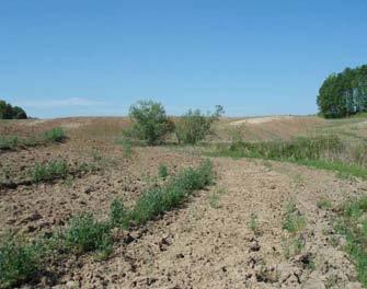
119 Page 106 Plate 53: Conditions for the pedestrian survey within ploughed land. Looking northwest at location of AgHb-421 (P5). Plate 54: Conditions for the pedestrian survey within ploughed land. Looking south along the western boundary of the study area. Plate 55: Looking south along the western boundary of the study area. Plate 56: Looking south at location of AgHb-420 (P4).


120 Page 107 Plate 57: Field crew conducting a pedestrian survey of ploughed land. Looking west at the location of findspot P139. Plate 58: Looking north from the location of findspot AgHb-470 (P138). Plate 59: Looking north from the location of findspot P143 and P144. Plate 60: Looking southeast at the location of findspot P11.


121 Page 108 Plate 61: Looking east at the location of findspot P13 and P14. Plate 62: Looking north at the location of findspots P47 and P48. Plate 63: Looking south at the location of findspots P49, P50, and site AgHb-438 (P51). Plate 64: Looking southeast at the location of findspots P54 and P55.


122 Page 109 Plate 65: Conditions for the pedestrian survey within the relatively flat ploughed area in the northern portion of the property. Looking southeast from the north corner of the study area. Plate 66: Looking south from the northern boundary of the study area at the field crew conducting the pedestrian survey. Plate 67: Conditions for the pedestrian survey within the relatively flat ploughed fields of the northern portion of the study area. Looking southeast at the location of findspot P86. Plate 68: Looking northeast at the location of findspots P70 and P72.


123 Page 110 Plate 69: Looking west at the location of findspots P78 and P80. Plate 70 : A view north along the driveway. Plate 71: A view north along the treed and grassed area long the driveway. Plate 72 : Artifact scatter of site AgHb-446 (P83).
 and findspot P82.")


124 Page 111 Plate 73: Artifact scatter of site AgHb-413 and AgHb-445 (P81) and findspot P82. Plate 74: Looking south at driveway leading to farm complex in the vicinity of site AgHb-417 Plate 75: Looking south at area test pitted around outbuilding in the vicinity of site AgHb-417 Plate 76: Looking south along back of outbuilding at grassed area test pitted in the vicinity of AgHb-417


125 Page 112 Plate 77: Soil profile of test pit at site AgHb-417 Plate 78: Grassed area around silo where test pit survey was conducted in the vicinity of site AgHb-416 Plate 79: Grassed area around demolished house where test pit survey was conducted. Plate 80: View of demolished house in vicinity of site AgHb-416


126 Page 113 Plate 81: Soil profile of test pit at site AgHb-416 Plate 82: Looking northeast at the location of AgHb-416. Plate 83: Field crew conducting pedestrian survey around the location of findspot P56. Plate 84: Looking west at the location of findspot P60.


.")
 and")
127 Page 114 Plate 85: Conditions of pedestrian survey in sloping ploughed field, looking northwest. Plate 86: Field crew conducting a pedestrian survey of ploughed land. Looking south at the location of the site AgHb-436 (P41). Plate 87: Conditions of pedestrian survey of ploughed land. Looking south at the location of the sites AgHb-435 (P40) and AgHb-434 (P39). Plate 88: Looking north at location of P63 on top of gently sloping ploughed area.
.")
 and findspots P29")


128 Page 115 Plate 89: Looking northwest at the location of site AgHb-432 (P32). Plate 90: Looking southwest at the location of site AgHb-430 (P28) and findspots P29 and P30. Plate 91: Looking northeast at the location of site AgHb-430 (P28) and findspot P30. Plate 92: Looking north at the location of site AgHb-433 (P33) and findspots P34 and P38.


129 Page 116 Plate 93: Looking north at the location of findspot P20. Plate 94: Looking north at the location of findspots P16, P22 and P24. Plate 95: Looking south at the location of findspot P147. Plate 96: Conditions for the pedestrian survey in the southern portion of the study area. Looking across site AgHb-423 (P9).

 and findspot")
.")

130 Page 117 Plate 97: Looking south across findspots P114 and P115. Plate 98: Looking northeast across site AgHb-464 (P125) and findspot P133. Plate 99: Looking southeast towards site AgHb-463 (P122). Plate 100: Looking northwest from the southern boundary of the study area across site AgHb-462 (P120).


131 Page 118 Plate 101: Looking northeast from the southern boundary of the study area across findspot (P119). Plate 102: Looking across the location of site AgHb-455 (P101). Plate 103: Conditions for the pedestrian survey within ploughed land in the southeast corner of the study area.
December 6, Paul Racher (P007) Archaeological Research Associates Ltd. 900 Guelph St. Kitchener ON N2H 5Z6
 Archaeological Research Associates Ltd. 900 Guelph St. Kitchener ON N2H 5Z6") Ministry of Tourism, Culture and Sport Culture Programs Unit Programs and Services Branch Culture Division 401 Bay Street, Suite 1700 Toronto ON M7A 0A7 Tel.: 416-314-2120 Ministère du Tourisme, de la
Ministry of Tourism, Culture and Sport Culture Programs Unit Programs and Services Branch Culture Division 401 Bay Street, Suite 1700 Toronto ON M7A 0A7 Tel.: 416-314-2120 Ministère du Tourisme, de la
Prepared for Douglas McGill McGill Development Services 311 Byron Street N. Whitby, Ontario L1N 4N4. Tel: (905) Fax: (905)
 Fax: (905)") STAGE 1 AND 2 ARCHAEOLOGICAL ASSESSMENT OF THE ARGO PROPERTY, PART OF LOT 15, CONCESSION 1 NDS FORMERLY IN THE TOWNSHIP OF TRAFALGAR SOUTH, NOW IN THE TOWN OF OAKVILLE, REGIONAL MUNICIPALITY OF HALTON
STAGE 1 AND 2 ARCHAEOLOGICAL ASSESSMENT OF THE ARGO PROPERTY, PART OF LOT 15, CONCESSION 1 NDS FORMERLY IN THE TOWNSHIP OF TRAFALGAR SOUTH, NOW IN THE TOWN OF OAKVILLE, REGIONAL MUNICIPALITY OF HALTON
An archaeological evaluation at 16 Seaview Road, Brightlingsea, Essex February 2004
 An archaeological evaluation at 16 Seaview Road, Brightlingsea, Essex February 2004 report prepared by Kate Orr on behalf of Highfield Homes NGR: TM 086 174 (c) CAT project ref.: 04/2b ECC HAMP group site
GoldLight STAGE 1 & 2 ARCHAEOLOGICAL ASSESSMENT
 GoldLight STAGE 1 & 2 ARCHAEOLOGICAL ASSESSMENT Ministry of Tourism, Ministère du Tourisme, Culture and Sport de la Culture et du Sport Culture Division Division de culture Culture Programs Unit Unité
Colchester Archaeological Trust Ltd. A Fieldwalking Survey at Birch, Colchester for ARC Southern Ltd
 Colchester Archaeological Trust Ltd A Fieldwalking Survey at Birch, Colchester for ARC Southern Ltd November 1997 CONTENTS page Summary... 1 Background... 1 Methods... 1 Retrieval Policy... 2 Conditions...
Silwood Farm, Silwood Park, Cheapside Road, Ascot, Berkshire
 Silwood Farm, Silwood Park, Cheapside Road, Ascot, Berkshire An Archaeological Watching Brief For Imperial College London by Tim Dawson Thames Valley Archaeological Services Ltd Site Code SFA 09/10 April
2010 Watson Surface Collection
 2010 Watson Surface Collection Carol Cowherd Charles County Archaeological Society of Maryland, Inc. Chapter of Archeological Society of Maryland, Inc. November 2010 2011 Charles County Archaeological
Test-Pit 3: 31 Park Street (SK )
") -Pit 3: 31 Park Street (SK 40732 03178) -Pit 3 was excavated in a flower bed in the rear garden of 31 Park Street, on the northern side of the street and west of an alleyway leading to St Peter s Church,
-Pit 3: 31 Park Street (SK 40732 03178) -Pit 3 was excavated in a flower bed in the rear garden of 31 Park Street, on the northern side of the street and west of an alleyway leading to St Peter s Church,
Burrell Orchard 2014: Cleveland Archaeological Society Internship Amanda Ponomarenko The Ohio State University June - August 2014
 1 Burrell Orchard 2014: Cleveland Archaeological Society Internship Amanda Ponomarenko The Ohio State University June - August 2014 Selected for the 2014 Cleveland Archaeological Society Internship in
The report documents the assessment of the study area as depicted in Maps of the above titled report and recommends the following:
 Ministry of Tourism, Culture and Sport Culture Programs Unit Programs and Services Branch Culture Division 435 S. James Street, Suite 334 Thunder Bay ON P7E 6S7 Tel.: 807-475-1628 Ministère du Tourisme,
3. The new face of Bronze Age pottery Jacinta Kiely and Bruce Sutton
 3. The new face of Bronze Age pottery Jacinta Kiely and Bruce Sutton Illus. 1 Location map of Early Bronze Age site at Mitchelstown, Co. Cork (based on the Ordnance Survey Ireland map) A previously unknown
An archaeological evaluation in the playground of Colchester Royal Grammar School, Lexden Road, Colchester, Essex
 An archaeological evaluation in the playground of Colchester Royal Grammar School, Lexden Road, Colchester, Essex February 2002 on behalf of Roff Marsh Partnership CAT project code: 02/2c Colchester Museum
An archaeological evaluation at the Lexden Wood Golf Club (Westhouse Farm), Lexden, Colchester, Essex
, Lexden, Colchester, Essex") An archaeological evaluation at the Lexden Wood Golf Club (Westhouse Farm), Lexden, Colchester, Essex January 2000 Archive report on behalf of Lexden Wood Golf Club Colchester Archaeological Trust 12 Lexden
An archaeological evaluation at the Lexden Wood Golf Club (Westhouse Farm), Lexden, Colchester, Essex January 2000 Archive report on behalf of Lexden Wood Golf Club Colchester Archaeological Trust 12 Lexden
2 Saxon Way, Old Windsor, Berkshire
 2 Saxon Way, Old Windsor, Berkshire An Archaeological Watching Brief For Mrs J. McGillicuddy by Pamela Jenkins Thames Valley Archaeological Services Ltd Site Code SWO 05/67 August 2005 Summary Site name:
ARCHAEOLOGICAL EVALUATION AT BRIGHTON POLYTECHNIC, NORTH FIELD SITE, VARLEY HALLS, COLDEAN LANE, BRIGHTON. by Ian Greig MA AIFA.
 ARCHAEOLOGICAL EVALUATION AT BRIGHTON POLYTECHNIC, NORTH FIELD SITE, VARLEY HALLS, COLDEAN LANE, BRIGHTON by Ian Greig MA AIFA May 1992 South Eastern Archaeological Services Field Archaeology Unit White
Wisconsin Sites Page 61. Wisconsin Sites
 Wisconsin Sites Page 61 Silver Mound-A Quarry Site Wisconsin Sites Silver Mound in Jackson County is a good example of a quarry site where people gathered the stones to make their tools. Although the name
Archaeological Material From Spa Ghyll Farm, Aldfield
 Archaeological Material From Spa Ghyll Farm, Aldfield Introduction Following discussions with Linda Smith the Rural Archaeologist for North Yorkshire County Council, Robert Morgan of 3D Archaeological
New Composting Centre, Ashgrove Farm, Ardley, Oxfordshire
 New Composting Centre, Ashgrove Farm, Ardley, Oxfordshire An Archaeological Watching Brief For Agrivert Limited by Andrew Weale Thames Valley Archaeological Services Ltd Site Code AFA 09/20 August 2009
The Archaeology of the Holly Site (BcGw-58)
") The Archaeology of the Holly Site (BcGw-58) Stage 4 Salvage Excavation of the Holly Site, Dykstra Subdivision, Holly Secondary Planning Area (43T-92026), Part of the Northeast Half of Lot 2, Concession
The Archaeology of the Holly Site (BcGw-58) Stage 4 Salvage Excavation of the Holly Site, Dykstra Subdivision, Holly Secondary Planning Area (43T-92026), Part of the Northeast Half of Lot 2, Concession
Church of St Peter and St Paul, Great Missenden, Buckinghamshire
 Church of St Peter and St Paul, Great Missenden, Buckinghamshire An Archaeological Watching Brief for the Parish of Great Missenden by Andrew Taylor Thames Valley Archaeological Services Ltd Site Code
Archaeological Watching Brief (Phase 2) at Court Lodge Farm, Aldington, near Ashford, Kent December 2011
 at Court Lodge Farm, Aldington, near Ashford, Kent December 2011") Archaeological Watching Brief (Phase 2) at Court Lodge Farm, Aldington, near Ashford, Kent December 2011 SWAT. Archaeology Swale and Thames Archaeological Survey Company School Farm Oast, Graveney Road
Archaeological Watching Brief (Phase 2) at Court Lodge Farm, Aldington, near Ashford, Kent December 2011 SWAT. Archaeology Swale and Thames Archaeological Survey Company School Farm Oast, Graveney Road
Cambridge Archaeology Field Group. Fieldwalking on the Childerley Estate, Cambridgeshire. Autumn 2014 to Spring Third interim report
 Cambridge Archaeology Field Group Fieldwalking on the Childerley Estate, Cambridgeshire Autumn 2014 to Spring 2015 Third interim report Summary Field walking on the Childerley estate of Martin Jenkins
A. M. Archaeological Associates
 THE STAGE 1 AND 2 ARCHAEOLOGICAL ASSESSMENT OF THE 407 DUNDAS STREET WEST PROPERTY, TOWN OF OAKVILLE (PART LOT 19, CONCESSION 1, GEO. TWP. TRAFALGAR NORTH, HALTON COUNTY) Prepared for Emil Toma, Distrikt
Submitted to: Mr. Ian MacPherson Mattamy Homes Ltd. 123 Huntmar Drive, Ottawa, ON K2S 1B9 Tel: (613) Fax: (613)
 Fax: (613)") STAGE 4 ARCHAEOLOGICAL ASSESSMENT Mattamy Half Moon Bay South Subdivision Location 1 (BhFw-20), Part of Lot 9, Concession 3 R. F. Location 2 (BhFw-21), Part of Lot 8, Concession 3 R. F. Geographic Township
STAGE 4 ARCHAEOLOGICAL ASSESSMENT Mattamy Half Moon Bay South Subdivision Location 1 (BhFw-20), Part of Lot 9, Concession 3 R. F. Location 2 (BhFw-21), Part of Lot 8, Concession 3 R. F. Geographic Township
An archaeological evaluation at the Blackwater Hotel, Church Road, West Mersea, Colchester, Essex March 2003
 An archaeological evaluation at the Blackwater Hotel, Church Road, West Mersea, Colchester, Essex report prepared by Laura Pooley on behalf of Dolphin Developments (U.K) Ltd NGR: TM 0082 1259 CAT project
Archaeological. Monitoring & Recording Report. Fulbourn Primary School, Cambridgeshire. Archaeological Monitoring & Recording Report.
 Fulbourn Primary School, Cambridgeshire Archaeological Monitoring & Recording Report October 2014 Client: Cambridgeshire County Council OA East Report No: 1689 OASIS No: oxfordar3-192890 NGR: TL 5190 5613
Grim s Ditch, Starveall Farm, Wootton, Woodstock, Oxfordshire
 Grim s Ditch, Starveall Farm, Wootton, Woodstock, Oxfordshire An Archaeological Recording Action For Empire Homes by Steve Ford Thames Valley Archaeological Services Ltd Site Code SFW06/118 November 2006
Cambridge Archaeology Field Group. Fieldwalking on the Childerley Estate Cambridgeshire
 Cambridge Archaeology Field Group Fieldwalking on the Childerley Estate Cambridgeshire 2009 to 2014 Summary Fieldwalking on the Childerley estate of Martin Jenkins and Family has revealed, up to March
Inadvertent Discovery Plan (IDP)
") Inadvertent Discovery Plan (IDP) Permit Number: Project Name: Applicant: Property Address: As the project proponent, I have read this document in full and understand that: 1. I will follow the actions
Inadvertent Discovery Plan (IDP) Permit Number: Project Name: Applicant: Property Address: As the project proponent, I have read this document in full and understand that: 1. I will follow the actions
Tepe Gawra, Iraq expedition records
 Tepe Gawra, Iraq expedition records 1021 Last updated on March 02, 2017. University of Pennsylvania, Penn Museum Archives July 2009 Tepe Gawra, Iraq expedition records Table of Contents Summary Information...
STONE implements and pottery indicative of Late Neolithic settlement are known to
 Late Neolithic Site in the Extreme Northwest of the New Territories, Hong Kong Received 29 July 1966 T. N. CHIU* AND M. K. WOO** THE SITE STONE implements and pottery indicative of Late Neolithic settlement
Monitoring Report No. 99
 Monitoring Report No. 99 Enniskillen Castle Co. Fermanagh AE/06/23 Cormac McSparron Site Specific Information Site Name: Townland: Enniskillen Castle Enniskillen SMR No: FER 211:039 Grid Ref: County: Excavation
Chapter 2. Remains. Fig.17 Map of Krang Kor site
 Chapter 2. Remains Section 1. Overview of the Survey Area The survey began in January 2010 by exploring the site of the burial rootings based on information of the rooted burials that was brought to the
7. Prehistoric features and an early medieval enclosure at Coonagh West, Co. Limerick Kate Taylor
 7. Prehistoric features and an early medieval enclosure at Coonagh West, Co. Limerick Kate Taylor Illus. 1 Location of the site in Coonagh West, Co. Limerick (based on the Ordnance Survey Ireland map)
Greater London GREATER LONDON 3/606 (E ) TQ
 TQ") GREATER LONDON City of London 3/606 (E.01.6024) TQ 30358150 1 PLOUGH PLACE, CITY OF LONDON An Archaeological Watching Brief at 1 Plough Place, City of London, London EC4 Butler, J London : Pre-Construct
GREATER LONDON City of London 3/606 (E.01.6024) TQ 30358150 1 PLOUGH PLACE, CITY OF LONDON An Archaeological Watching Brief at 1 Plough Place, City of London, London EC4 Butler, J London : Pre-Construct
Essex Historic Environment Record/ Essex Archaeology and History
 Essex Historic Environment Record/ Essex Archaeology and History CAT Report 578 Summary sheet Address: Kingswode Hoe School, Sussex Road, Colchester, Essex Parish: Colchester NGR: TL 9835 2528 Type of
A Fieldwalking Project At Sompting. West Sussex
 by John Funnell Introduction A Fieldwalking Project At Sompting. West Sussex During March -and April 1995 the Brighton and Hove Archaeological Society conducted fie1dwa1king in a field at Sompting West
Chapter 5 Block 7, Lot 1
 Chapter 5 Block 7, Lot 1 Christopher Fennell 1 and Christopher Valvano 2 One of our 2008 excavation teams focused on Block 7, Lot 1, based on multiple points of information, including previously known
An archaeological watching brief and recording at Brightlingsea Quarry, Moverons Lane, Brightlingsea, Essex October 2003
 An archaeological watching brief and recording at Brightlingsea Quarry, Moverons Lane, Brightlingsea, Essex commissioned by Mineral Services Ltd on behalf of Alresford Sand & Ballast Co Ltd report prepared
Limited Archaeological Testing at the Sands House Annapolis, Maryland
 Limited Archaeological Testing at the Sands House Annapolis, Maryland Report Submitted to Four Rivers Heritage Area by John E. Kille, Ph.D., Shawn Sharpe, and Al Luckenbach, Ph.D February 10, 2012 In May-June
Grange Farm, Widmer End, Hughenden, Buckinghamshire
 Grange Farm, Widmer End, Hughenden, Buckinghamshire An Archaeological Evaluation for British Flora by Andy Taylor Thames Valley Archaeological Services Ltd Site Code GFH 05/63 July 2005 Summary Site name:
39, Walnut Tree Lane, Sudbury (SUY 073) Planning Application No. B/04/02019/FUL Archaeological Monitoring Report No. 2005/112 OASIS ID no.
 Planning Application No. B/04/02019/FUL Archaeological Monitoring Report No. 2005/112 OASIS ID no.") 39, Walnut Tree Lane, Sudbury (SUY 073) Planning Application No. B/04/02019/FUL Archaeological Monitoring Report No. 2005/112 OASIS ID no. 9273 Summary Sudbury, 39, Walnut Tree Lane, Sudbury (TL/869412;
39, Walnut Tree Lane, Sudbury (SUY 073) Planning Application No. B/04/02019/FUL Archaeological Monitoring Report No. 2005/112 OASIS ID no. 9273 Summary Sudbury, 39, Walnut Tree Lane, Sudbury (TL/869412;
Archaeological evaluation at the Onley Arms, The Street, Stisted, Essex
 Archaeological evaluation at the Onley Arms, The Street, Stisted, Essex November 2014 report by Pip Parmenter and Adam Wightman with a contribution from Stephen Benfield and illustrations by Emma Holloway
To foster a city with strong social cohesion, an engaging arts scene, and a clear sense of its culture and heritage.
 HERITAGE VAUGHAN COMMITTEE MARCH 20, 2013 8222-8248 KIPLING AVENUE HERITAGE REVIEW OF PROPOSED NEW TOWNHOMES, NEW SINGLE FAMILY HOME, TWO SEMI-DETACHED HOMES AND DEMOLITION OF EXISTING STRUCTURES AT 8222
BLACK HISTORY MONTH - Week 1 #BlackHistoryMatters
 BLACK HISTORY MONTH - Week 1 #BlackHistoryMatters classroomconnection.ca WEEK 1: AFRICAN CIVILIZATIONS Africa is the cradle of humankind and Nubia, an early African society, is the oldest civilization
Peace Hall, Sydney Town Hall Results of Archaeological Program (Interim Report)
") Results of Archaeological Program (Interim Report) Background The proposed excavation of a services basement in the western half of the Peace Hall led to the archaeological investigation of the space in
Results of Archaeological Program (Interim Report) Background The proposed excavation of a services basement in the western half of the Peace Hall led to the archaeological investigation of the space in
ARCHAEOLOGICAL MONITORING REPORT
 ARCHAEOLOGICAL MONITORING REPORT SCCAS REPORT No. 2009/324 Thorington Hall, Stoke by Nayland SBN 087 HER Information Date of Fieldwork: November 2009 - January 2010 Grid Reference: TM 0131 3546 Funding
An archaeological watching brief at St Leonard s church, Hythe Hill, Colchester, Essex
 An archaeological watching brief at St Leonard s church, Hythe Hill, Colchester, Essex report prepared by Adam Wightman on behalf of Dorvell Construction CAT project ref.: 10/5d Colchester and Ipswich
SUMMARY REPORT OF 2009 INVESTIGATIONS AT OLD TOWN, LANCASTER COUNTY, SOUTH CAROLINA
 SUMMARY REPORT OF 2009 INVESTIGATIONS AT OLD TOWN, LANCASTER COUNTY, SOUTH CAROLINA by R. P. Stephen Davis, Jr. Brett H. Riggs, and David J. Cranford 2012 Between April 29 and June 12, 2009, archaeological
An archaeological watching brief at Sheepen, Colchester, Essex November-December 2003
 An archaeological watching brief at Sheepen, Colchester, Essex November-December 2003 report prepared by Ben Holloway on behalf of Colchester Borough Council CAT project ref.: 03/11c Colchester Museums
Novington, Plumpton East Sussex
 Novington, Plumpton East Sussex The Flint Over 1000 pieces of flintwork were recovered during the survey, and are summarised in Table 0. The flint is of the same types as found in the previous survey of
Erection of wind turbine, Mains of Loanhead, Old Rayne, AB52 6SX
 Erection of wind turbine, Mains of Loanhead, Old Rayne, AB52 6SX Ltd 23 November 2011 Erection of wind turbine, Mains of Loanhead, Old Rayne, AB52 6SX CONTENTS 1 INTRODUCTION 3 2 ARCHAEOLOGICAL BACKGROUND
Archaeological sites and find spots in the parish of Burghclere - SMR no. OS Grid Ref. Site Name Classification Period
 Archaeological sites and find spots in the parish of Burghclere - SMR no. OS Grid Ref. Site Name Classification Period SU45NE 1A SU46880 59200 Ridgemoor Farm Inhumation Burial At Ridgemoor Farm, on the
PENDERGAST: THE MacDOUGALD SITE 29 J. F. P E N D E R G A S T ( A C C E P T E D FEB R U AR Y 1969 ) THE MACDOUGALD SITE
 THE MACDOUGALD SITE") PENDERGAST: THE MacDOUGALD SITE 29 J. F. P E N D E R G A S T ( A C C E P T E D FEB R U AR Y 1969 ) THE MACDOUGALD SITE ABSTRACT The report sets out a detailed description of the site location and the artifacts
PENDERGAST: THE MacDOUGALD SITE 29 J. F. P E N D E R G A S T ( A C C E P T E D FEB R U AR Y 1969 ) THE MACDOUGALD SITE ABSTRACT The report sets out a detailed description of the site location and the artifacts
The Papar Project Hebrides
 The Papar Project Hebrides Barbara E. Crawford and Ian Simpson H1. Pabay/Pabaigh (Uig, Lewis) Parish History H2. Pabbay/Pabaigh (Harris) Ecclesiastical Monuments Other Archaeological Sites Fieldwork 2005
An archaeological evaluation by trial-trenching at Playgolf, Bakers Lane, Westhouse Farm, Colchester, Essex
 An archaeological evaluation by trial-trenching at Playgolf, Bakers Lane, Westhouse Farm, Colchester, Essex commissioned by Mr Stephen Belchem on behalf of ADP Ltd. report prepared by Chris Lister Planning
I I I I I I I I I I I I. Cultural Resources. History
 32 Cultural Resources History The petrog1yphs site was discovered in 1924 by Mr. Charles Kingam, a local resident and a member of the Peterborough Historical Society. His discovery was not widely publicized.
NGSBA Excavation Reports
 ISSN 2221-9420 NGSBA Excavation Reports Volume 1 (2009) Salvage Excavation at Nahal Saif 2004 Final Report Excavation Permit: B - 293/2004 Excavating Archaeologist: Yehuda Govrin Y. G. Contract Archaeology
16 members of the Fieldwalking Group met York Community Archaeologist Jon Kenny at Lou Howard s farm, Rose Cottage Farm, at
 Terrington History Group Fieldwalking Group Field 1 Final report 21 October 2011 - fieldwalking 16 members of the Fieldwalking Group met York Community Archaeologist Jon Kenny at Lou Howard s farm, Rose
1 The East Oxford Archaeology and History Project
 1 The East Oxford Archaeology and History Project EXOP TEST PIT 72 Location: Bartlemas Chapel, Cowley Date of excavation: 6-8 November 2013. Area of excavation: 0.8m x 1.2m, at the eastern end of the chapel.
A Preliminary Archaeological Survey of the Spencer Marsh House, Walker County, Georgia
 A Preliminary Archaeological Survey of the Spencer Marsh House, Walker County, Georgia By Nicholas Honerkamp, PhD Jeffrey L. Brown Institute of Archaeology University of Tennessee at Chattanooga Chattanooga,
Lanton Lithic Assessment
 Lanton Lithic Assessment Dr Clive Waddington ARS Ltd The section headings in the following assessment report refer to those in the Management of Archaeological Projects (HBMC 1991), Appendix 4. 1. FACTUAL
Centre for Archaeological Fieldwork School of Geography, Archaeology and Palaeoecology Queen s University Belfast
 Centre for Archaeological Fieldwork School of Geography, Archaeology and Palaeoecology Queen s University Belfast Data Structure Report No. 73 (preliminary report) On behalf of # Queen s University Belfast
An early pot made by the Adena Culture (800 B.C. - A.D. 100)
") Archaeologists identify the time period of man living in North America from about 1000 B.C. until about 700 A.D. as the Woodland Period. It is during this time that a new culture appeared and made important
Archaeologists identify the time period of man living in North America from about 1000 B.C. until about 700 A.D. as the Woodland Period. It is during this time that a new culture appeared and made important
M ereside, H anmer, Clwyd
 THE CLWYD-POWYS ARCHAEOLOGICAL TRUST M ereside, H anmer, Clwyd ARCHAEOLOGICAL EVALUATION CPAT Report No 81 CPAT Report No 81 Mereside, Hanmer, Clwyd ARCHAEOLOGICAL EVALUATION bywg Owen November 1993 Report
(photograph courtesy Earle Seubert)
") THE ARCHAEOLOGY OF A CEMETERY THE TRIALS AND TRIBULATIONS OF FINDING THE LOST GRAVES OF WOODMAN POINT QUARANTINE STATION This presentation is about a project initiated by the Friends of Woodman Point and
THE ARCHAEOLOGY OF A CEMETERY THE TRIALS AND TRIBULATIONS OF FINDING THE LOST GRAVES OF WOODMAN POINT QUARANTINE STATION This presentation is about a project initiated by the Friends of Woodman Point and
The lithic assemblage from Kingsdale Head (KH09)
") 1 The lithic assemblage from Kingsdale Head (KH09) Hannah Russ Introduction During excavation the of potential Mesolithic features at Kingsdale Head in 2009 an assemblage of flint and chert artefacts were
1 The lithic assemblage from Kingsdale Head (KH09) Hannah Russ Introduction During excavation the of potential Mesolithic features at Kingsdale Head in 2009 an assemblage of flint and chert artefacts were
Drills, Knives, and Points from San Clemente Island
 Drills, Knives, and Points from San Clemente Island Frank W. Wood Limited numbers of chipped stone artifacts that might be called finished forms were recovered from the 3- excavations by UCLA. These artifacts
Pilot Point Site Revisited
 Pilot Point Site Revisited Copyright 6/22/05, Revised 5-29-09, Mary E. Gage Historical Documentation In 1705 Captain Joel Chandler surveyed the Mohegan hunting bounds. During the survey he recorded and
Former Whitbread Training Centre Site, Abbey Street, Faversham, Kent Interim Archaeological Report Phase 1 November 2009
 Former Whitbread Training Centre Site, Abbey Street, Faversham, Kent Interim Archaeological Report Phase 1 November 2009 SWAT. Archaeology Swale and Thames Archaeological Survey Company School Farm Oast,
Barnet Battlefield Survey
 In terim report on the progress of the Barnet Battlefield Survey December 2016 The Barnet Battlefield Survey is an archaeological investigation into the 1471 Battle of Barnet. It aims to define more accurately
Fieldwalking at Cottam 1994 (COT94F)
") Fieldwalking at Cottam 1994 (COT94F) Tony Austin & Elizabeth Jelley (19 Jan 29) 1. Introduction During the winter of 1994 students from the Department of Archaeology at the University of York undertook
Fieldwalking at Cottam 1994 (COT94F) Tony Austin & Elizabeth Jelley (19 Jan 29) 1. Introduction During the winter of 1994 students from the Department of Archaeology at the University of York undertook
Foreword. Archaeology is all about context.
 Foreword Archaeology is all about context. Archaeologists lament the loss of context when an artifact is plucked out of a site without recording and mapping its relationship with all of the other artifacts
CITY CLERK. Draft By-law: Renaming a Portion of Kipling Avenue as Colonel Samuel Smith Park Drive (Ward 6 - Etobicoke-Lakeshore)
") CITY CLERK Clause embodied in Report No. 2 of the, as adopted by the Council of the City of Toronto at its meeting held on March 6, 7 and 8, 2001. 12 Draft By-law: Renaming a Portion of Kipling Avenue
CITY CLERK Clause embodied in Report No. 2 of the, as adopted by the Council of the City of Toronto at its meeting held on March 6, 7 and 8, 2001. 12 Draft By-law: Renaming a Portion of Kipling Avenue
Old Brewery Close and Walton Street, Aylesbury, Buckinghamshire
 Old Brewery Close and Walton Street, Aylesbury, Buckinghamshire An Archaeological Evaluation for Berkeley Homes (Oxford and Chiltern) Ltd by Sian Anthony Thames Valley Archaeological Services Ltd Site
Opium Cabin excavation Passport In Time July 21-25, 2014
 Opium Cabin excavation Passport In Time July 21-25, 2014 Page 1 of 14 Non-American Indian settlement of the southern Blue Mountains began with the discovery of gold in drainages of the John Day River in
Is this the Original Anglo-Saxon period site of Weathercote?
 Is this the Original Anglo-Saxon period site of Weathercote? A Batty & N Crack 2016 Front Cover. Looking south east across proposed original site of Weathercote. Photograph A 2 3 Weathercote Anglo-Saxon
Excavation. Post-Medieval Ditches. Land off Norwich Common Road Wymondham Norfolk. Excavation. Client: November 2013
 Land off Norwich Common Road Wymondham Norfolk. Excavation November 2013 Client: OA East Report No: 1546 OASIS No: oxfordar3-163105 NGR: TG 12770 02684 Excavation Post-Medieval Ditches Post-Medieval Ditches
Archaeological trial-trenching evaluation at Chappel Farm, Little Totham, Essex. April 2013
 Archaeological trial-trenching evaluation at Chappel Farm, Little Totham, Essex April 2013 report prepared by Ben Holloway commissioned by Tim Harbord Associates on behalf of Mr Tom Howie Planning reference:
EVALUATION REPORT No. 273
 EVALUATION REPORT No. 273 Freeduff Presbyterian Church, 3 Oldtown road, Freeduff, Cullyhanna, County Armagh Licence No.: AE/13/133E Sapphire Mussen Report Date: 20/09/2013 Contents List of Figures... 2
The Surma Site, Fort Erie, Ontario
 EMERSON & NOBLE: THE SURMA SITE 69 J. N. EMERSON Professor of Anthropology University of Toronto and WILLIAM C. NOBLE Field Director of the Excavation (Accepted March 4th, 1966) The Surma Site, Fort Erie,
Report to the Arizona Archaeological and Historical Society on Jakob W. Sedig s Trip to Fife Lake, Michigan to Assess Archaeological Collections
 Report to the Arizona Archaeological and Historical Society on Jakob W. Sedig s Trip to Fife Lake, Michigan to Assess Archaeological Collections This report details the trip I took to Fife Lake, Michigan
Museum of London Archaeological Archive: standards 2 Archive Components: Standards and Specifications 2.3 Finds
 Author Maloney, Cath. LAARC Version 3 Date 08/05/2013 Status Pre-publication Change History 2.9. Replacement of Registered Finds cards with image 2.3.4.3 2.8 Additions to Appendix: sample Finds Inventory
BALNUARAN. of C LAVA. a prehistoric cemetery. A Visitors Guide to
 A Visitors Guide to BALNUARAN of C LAVA a prehistoric cemetery Milton of Clava Chapel (?) Cairn River Nairn Balnuaran of Clava is the site of an exceptionally wellpreserved group of prehistoric burial
12 October 14, 2015 Public Hearing
 12 October 14, 2015 Public Hearing APPLICANT: SECOND SHOT, LLC PROPERTY OWNER: ALBERT VINCIGUERRA STAFF PLANNER: Kevin Kemp REQUEST: Conditional Use Permit (Tattoo Parlor) ADDRESS / DESCRIPTION: 5759 Princess
Foreign Whaling in Iceland Archaeological Excavations at Strákatangi in Hveravík, Kaldrananeshreppi 2007 Data Structure Report
 Foreign Whaling in Iceland Archaeological Excavations at Strákatangi in Hveravík, Kaldrananeshreppi 2007 Data Structure Report Caroline Paulsen, Magnús Rafnsson and Ragnar Edvardsson February 2008 NV nr.
Chapel House Wood Landscape Project. Interim Report 2013
 Chapel House Wood Landscape Project Interim Report 2013 Chapel House Wood Landscape Project Interim Report 2013 The annual Dales Heritage Field School was held at Chapel House Wood again this year, and
A Sense of Place Tor Enclosures
 A Sense of Place Tor Enclosures Tor enclosures were built around six thousand years ago (4000 BC) in the early part of the Neolithic period. They are large enclosures defined by stony banks sited on hilltops
The St. George s Caye Archaeology Project:
 The St. George s Caye Archaeology Project: Results of the 2015 Field Season Edited by James F. Garber Texas State University June, 2016 2 THE ST. GEORGE S CAYE ARCHAEOLOGY PROJECT: RESULTS OF THE 2015
Evidence for the use of bronze mining tools in the Bronze Age copper mines on the Great Orme, Llandudno
 Evidence for the use of bronze mining tools in the Bronze Age copper mines on the Great Orme, Llandudno Background The possible use of bronze mining tools has been widely debated since the discovery of
A visit to the Wor Barrow 21 st November 2015
 A visit to the Wor Barrow 21 st November 2015 Following our exploration of Winkelbury a few weeks previously, we fast forwarded 12 years in Pitt Rivers remarkable series of excavations and followed him
Hembury Hillfort Lesson Resources. For Key Stage Two
 Hembury Hillfort Lesson Resources For Key Stage Two 1 Resource 1 Email 1 ARCHAEOLOGISTS NEEDED Dear Class, I recently moved to Payhembury and I have been having fun exploring the beautiful Blackdown Hills.
Unit 6: New Caledonia: Lapita Pottery. Frederic Angleveil and Gabriel Poedi
 Unit 6: New Caledonia: Lapita Pottery Frederic Angleveil and Gabriel Poedi Facts Capital Main islands Highest point Language Government Noumea Grande Terre, 3 Loyalty Islands and numerous reefs and atolls
Changing People Changing Landscapes: excavations at The Carrick, Midross, Loch Lomond Gavin MacGregor, University of Glasgow
 Changing People Changing Landscapes: excavations at The Carrick, Midross, Loch Lomond Gavin MacGregor, University of Glasgow Located approximately 40 kilometres to the south-west of Oban, as the crow flies
Revised Report. Prepared for: YAP Films 96 Spadina Ave. Toronto, Ontario M5V 2J6 T F
 Stage 3 GPR Survey and Archaeological Trench Exploration For the Government House at the Fort York National Historic Site (AjGu-26) 250 Fort York Blvd., City of Toronto, Ontario Revised Report Prepared
The National Board of Antiquities guidelines and instructions 13. Antiquities, ancient monuments and metal detectors: an enthusiast s guide
 The National Board of Antiquities guidelines and instructions 13 Antiquities, ancient monuments and metal detectors: an enthusiast s guide ANTIQUITIES, ANCIENT MONUMENTS AND METAL DETECTORS: AN ENTHUSIAST
FEATURE DESCRIPTIONS: PART 1. SAN AGUSTÍN MISSION LOCUS, THE CLEARWATER SITE, AZ BB:13:6 (ASM)
") CHAPTER 4 FEATURE DESCRIPTIONS: PART 1. SAN AGUSTÍN MISSION LOCUS, THE CLEARWATER SITE, AZ BB:13:6 (ASM) Thomas Klimas, Caramia Williams, and J. Homer Thiel Desert Archaeology, Inc. Archaeological work
CHAPTER 4 FEATURE DESCRIPTIONS: PART 1. SAN AGUSTÍN MISSION LOCUS, THE CLEARWATER SITE, AZ BB:13:6 (ASM) Thomas Klimas, Caramia Williams, and J. Homer Thiel Desert Archaeology, Inc. Archaeological work
BUTE MAP 8: ST NINIAN S POINT to ETTRICK BAY
 BUTE MAP 8: ST NINIAN S POINT to ETTRICK BAY Hinterland Geology and Coastal Geomorphology: The stretch of coastline between Rubha An Amair and Island McNeil sees Dunoon Phylites emerge towards the north
Report on archaeological fieldwalking and metal-detecting survey on land adjacent to Breck Farm, Stody, Norfolk
 Report on archaeological fieldwalking and metal-detecting survey on land adjacent to Breck Farm, Stody, Norfolk report prepared by Howard Brooks and Ben Holloway with contributions by Emma Spurgeon and
An archaeological evaluation by trial-trenching at Scotts Farm, Lodge Lane, Purleigh, Essex October 2011
 An archaeological evaluation by trial-trenching at Scotts Farm, Lodge Lane, Purleigh, Essex October 2011 report prepared by Adam Wightman on behalf of Richard Emans CAT project ref.: 11/10a NGR: TL 582719