Archaeological Test Pit Excavations in Acle, Norfolk, in
|
|
|
- Hollie Walton
- 5 years ago
- Views:
Transcription


1 Archaeological Test Pit Excavations in Acle, Norfolk, in Catherine Collins 1
2 2
 3")
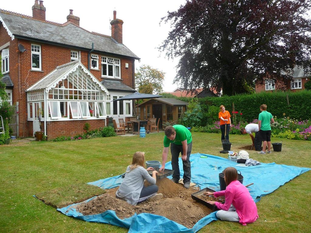
3 Archaeological Test Pit Excavations in Acle, Norfolk, in 2009, 2010, 2011, 2013 and 2014 Catherine Collins 2017 Access Cambridge Archaeology Department of Archaeology University of Cambridge Pembroke Street Cambridge CB2 3QG (Front cover image: The excavation underway at ACL/10/2; Copyright ACA) 3
4 4
5 Contents 1 SUMMARY INTRODUCTION ACCESS CAMBRIDGE ARCHAEOLOGY THE HIGHER EDUCATION FIELD ACADEMY (HEFA) TEST PIT EXCAVATION AND RURAL SETTLEMENT STUDIES AIMS, OBJECTIVES AND DESIRED OUTCOMES AIMS OBJECTIVES OUTCOMES METHODOLOGY LOCATION THE VILLAGE TODAY GEOLOGY AND TOPOGRAPHY ARCHAEOLOGICAL AND HISTORICAL BACKGROUND HISTORICAL BACKGROUND ARCHAEOLOGICAL BACKGROUND Prehistoric Romano-British Anglo-Saxon Medieval Post medieval and later Undated RESULTS OF THE TEST PIT EXCAVATIONS IN ACLE THE 2009 EXCAVATIONS THE 2010 EXCAVATIONS THE 2011 EXCAVATIONS THE 2013 EXCAVATIONS THE 2014 EXCAVATIONS DISCUSSION PREHISTORIC ROMANO-BRITISH ANGLO SAXON MEDIEVAL POST MEDIEVAL AND LATER CONCLUSION ACKNOWLEDGEMENTS REFERENCES APPENDICES POTTERY REPORTS PAUL BLINKHORN Pottery Results Pottery Report Pottery Report Pottery Report Pottery Report
6 12.2 OTHER FINDS CATHERINE COLLINS test pit finds test pit finds test pit finds test pit finds test pit finds MAPS List of Figures Figure 1: Map of England with close up insert of East Anglia and the approximate location of the village of Acle highlighted in red Figure 2: The extent of the parish of Acle Crown Copyright/database right An Ordnance Survey/EDINA supplied service, 1: 40, Figure 3: Modern OS map of the settlement of Acle Crown Copyright/database right An Ordnance Survey/EDINA supplied service, 1: 10, Figure 4: Extract of Fadens 1797 map of Norfolk, with a close up of Acle (from 21 Figure 5: Tithe map of Acle c.1840 Norfolk County Council (available at: 21 Figure 6: First OS Map of Acle Copyright Norfolk County Council and Crown Copyright and Database rights 2011 Ordnance Survey Figure 7: The extent of the great estuary Gariensis during the Roman period in East Norfolk Figure 8: Likely extent of the Gariensis estuary in the Roman period at Acle and the location of all the test pits (NB test pits not to scale) 2009: yellow, 2010: purple, 2011: orange, 2013: green and 2014: red. Brian Grint and Crown Copyright/database right An Ordnance Survey/EDINA supplied service, 1: 10, Figure 9: The locations of the five years of test pitting in Acle (NB test pits not to scale) 2009: yellow, 2010: purple, 2011: orange, 2013: green and 2014: red. Crown Copyright/database right An Ordnance Survey/EDINA supplied service, 1: 10, Figure 10: Location map of the Acle test pits from 2009 (NB test pits not to scale) Crown Copyright/database right An Ordnance Survey/EDINA supplied service, 1: 10, Figure 11: Location map of ACL/09/ Figure 12: Location map of ACL/09/ Figure 13: Location map of ACL/09/ Figure 14: Location map of ACL/09/ Figure 15: Location map of ACL/09/ Figure 16: Location map of ACL/09/ Figure 17: Location map of ACL/09/ Figure 18: Location map of ACL/09/ Figure 19: Location map of ACL/09/ Figure 20: Location map of ACL/09/ Figure 21: Location map of ACL/09/ Figure 22: Location map of the Acle test pits from 2010 (NB test pits not to scale) Crown Copyright/database right An Ordnance Survey/EDINA supplied service, 1: 10, Figure 23: Location map of ACL/10/ Figure 24: Location map of ACL/10/ Figure 25: Location map of ACL/10/ Figure 26: Location map of ACL/10/ Figure 27: Location map of ACL/10/
7 Figure 28: Location map of ACL/10/ Figure 29: The pit feature under excavation at ACL/10/6 ( Access Cambridge Archaeology) Figure 30: Location map of ACL/10/ Figure 31: Location map of ACL/10/ Figure 32: Location map of ACL/10/ Figure 33: Location map of ACL/10/ Figure 34: Location map of the Acle test pits from 2011 (NB test pits not to scale) Crown Copyright/database right An Ordnance Survey/EDINA supplied service, 1: 10, Figure 35: Location map of ACL/11/ Figure 36: Location map of ACL/11/ Figure 37: The British Red Cross Society brooch excavated from ACL/11/2, context 3 (scale in cm) Access Cambridge Archaeology Figure 38: Location map of ACL/11/ Figure 39: Location map of ACL/11/ Figure 40: Location map of ACL/11/ Figure 41: Location map of ACL/11/ Figure 42: Location map of the Acle test pits from 2013 (NB test pits not to scale) Crown Copyright/database right An Ordnance Survey/EDINA supplied service, 1: 10, Figure 43: Location map of ACL/13/ Figure 44: Location map of ACL/13/ Figure 45: Location map of ACL/13/ Figure 46: Location map of ACL/13/ Figure 47: Location map of ACL/13/ Figure 48: Location map of ACL/13/ Figure 49: Location map of ACL/13/ Figure 50: Location map of ACL/13/ Figure 51: Location map of ACL/13/ Figure 52: Location map of the Acle test pits from 2014 (NB test pits not to scale) Crown Copyright/database right An Ordnance Survey/EDINA supplied service, 1: 10, Figure 53: Location map of ACL/14/ Figure 54: Location map of ACL/14/ Figure 55: Location map of ACL/14/ Figure 56: Location map of ACL/14/ Figure 57: Location map of ACL/14/ Figure 58: Location map of ACL/14/ Figure 59: Location map of ACL/14/ Figure 60: The worked bone from ACL/14/7, context 2 (scale in cm) Access Cambridge Archaeology Figure 61: Location map of ACL/14/ Figure 62: The floor surface and wall foundation from ACL/14/8 ( Access Cambridge Archaeology) Figure 63: Location map of ACL/14/ Figure 64: Location map of ACL/14/ Figure 65: Distribution of possible worked flints from the Acle test pits with the likely position of the great estuary in blue (NB test pits not to scale) 2009: yellow, 2010: purple, 2011: orange, 2013: green and 2014: red Crown Copyright/database right An Ordnance Survey/EDINA supplied service, 1: 10, Figure 66: Distribution of possible burnt stone from the Acle test pits with the likely position of the great estuary in blue (NB test pits not to scale) 2009: yellow, 2010: purple, 2011: orange, 2013: green and 2014: red Crown Copyright/database right An Ordnance Survey/EDINA supplied service, 1: 10, Figure 67: The distribution of Romano-British pottery from the Acle test pits and the approximate extent of the Gariensis in blue (NB test pits not to scale) 2009: yellow, 2010: purple, 2011: orange, 2013: green and 2014: red Crown Copyright/database right An Ordnance Survey/EDINA supplied service, 1: 10,
8 Figure 68: The distribution of imported German Stoneware pottery from the Acle test pits (NB test pits not to scale) 2009: yellow, 2010: purple, 2011: orange, 2013: green and 2014: red Crown Copyright/database right An Ordnance Survey/EDINA supplied service, 1: 10, Figure 69: Distribution of Cologne Stoneware pottery through the Acle test pits (NB test pits are not to scale) 2009: yellow, 2010: purple, 2011: orange, 2013: green and 2014: red Crown Copyright/database right An Ordnance Survey/EDINA supplied service, 1: 10, Figure 70: Distribution of Chinese Porcelain pottery from the Acle test pits (NB test pits are not to scale) 2009: yellow, 2010: purple, 2011: orange, 2013: green and 2014: red Crown Copyright/database right An Ordnance Survey/EDINA supplied service, 1: 10, Figure 71: Romano-British pottery distribution map from the Acle test pits Crown Copyright/database right An Ordnance Survey/EDINA supplied service Figure 72: Late Anglo Saxon pottery distribution map from the Acle test pits Crown Copyright/database right An Ordnance Survey/EDINA supplied service Figure 73: High medieval pottery distribution map from the Acle test pits Crown Copyright/database right An Ordnance Survey/EDINA supplied service Figure 74: Late medieval pottery distribution map from the Acle test pits Crown Copyright/database right An Ordnance Survey/EDINA supplied service Figure 75: Post medieval pottery distribution map from the Acle test pits Crown Copyright/database right An Ordnance Survey/EDINA supplied service Figure 76: 19 th century pottery distribution map from the Acle test pits Crown Copyright/database right An Ordnance Survey/EDINA supplied service List of Tables Table 1: The pottery excavated from ACL/09/ Table 2: The pottery excavated from ACL/09/ Table 3: The pottery excavated from ACL/09/ Table 4: The pottery excavated from ACL/09/ Table 5: The pottery excavated from ACL/09/ Table 6: The pottery excavated from ACL/09/ Table 7: The pottery excavated from ACL/09/ Table 8: The pottery excavated from ACL/09/ Table 9: The pottery excavated from ACL/09/ Table 10: The pottery excavated from ACL/09/ Table 11: The pottery excavated from ACL/09/ Table 12: The pottery excavated from ACL/10/ Table 13: The pottery excavated from ACL/10/ Table 14: The pottery excavated from ACL/10/ Table 15: The pottery excavated from ACL/10/ Table 16: The pottery excavated from ACL/10/ Table 17: The pottery excavated from ACL/10/ Table 18: The pottery excavated from ACL/10/ Table 19: The pottery excavated from ACL/10/ Table 20: The pottery excavated from ACL/10/ Table 21: The pottery excavated from ACL/10/ Table 22: The pottery excavated from ACL/11/ Table 23: The pottery excavated from ACL/11/ Table 24: The pottery excavated from ACL/11/ Table 25: The pottery excavated from ACL/11/ Table 26: The pottery excavated from ACL/11/ Table 27: The pottery excavated from ACL/11/ Table 28: The pottery excavated from ACL/13/ Table 29: The pottery excavated from ACL/13/
9 Table 30: The pottery excavated from ACL/13/ Table 31: The pottery excavated from ACL/13/ Table 32: The pottery excavated from ACL/13/ Table 33: The pottery excavated from ACL/13/ Table 34: The pottery excavated from ACL/13/ Table 35: The pottery excavated from ACL/13/ Table 36: The pottery excavated from ACL/13/ Table 37: The pottery excavated from ACL/14/ Table 38: The pottery excavated from ACL/14/ Table 39: The pottery excavated from ACL/14/ Table 40: The pottery excavated from ACL/14/ Table 41: The pottery excavated from ACL/14/ Table 42: The pottery excavated from ACL/14/ Table 43: The pottery excavated from ACL/14/ Table 44: The pottery excavated from ACL/14/ Table 45: The pottery excavated from ACL/14/ Table 46: The pottery excavated from ACL/14/ Table 47: The non-pottery finds excavated from ACL/09/ Table 48: The non-pottery finds excavated from ACL/09/ Table 49: The non-pottery finds excavated from ACL/09/ Table 50: The non-pottery finds excavated from ACL/09/ Table 51: The non-pottery finds excavated from ACL/09/ Table 52: The non-pottery finds excavated from ACL/09/ Table 53: The non-pottery finds excavated from ACL/09/ Table 54: The non-pottery finds excavated from ACL/09/ Table 55: The non-pottery finds excavated from ACL/09/ Table 56: The non-pottery finds excavated from ACL/09/ Table 57: The non-pottery finds excavated from ACL/09/ Table 58: The non-pottery finds excavated from ACL/10/ Table 59: The non-pottery finds excavated from ACL/10/ Table 60: The non-pottery finds excavated from ACL/10/ Table 61: The non-pottery finds excavated from ACL/10/ Table 62: The non-pottery finds excavated from ACL/10/ Table 63: The non-pottery finds excavated from ACL/10/ Table 64: The non-pottery finds excavated from ACL/10/ Table 65: The non-pottery finds excavated from ACL/10/ Table 66: The non-pottery finds excavated from ACL/10/ Table 67: The non-pottery finds excavated from ACL/10/ Table 68: The non-pottery finds excavated from ACL/11/ Table 69: The non-pottery finds excavated from ACL/11/ Table 70: The non-pottery finds excavated from ACL/11/ Table 71: The non-pottery finds excavated from ACL/11/ Table 72: The non-pottery finds excavated from ACL/11/ Table 73: The non-pottery finds excavated from ACL/11/ Table 74: The non-pottery finds excavated from ACL/13/ Table 75: The non-pottery finds excavated from ACL/13/ Table 76: The non-pottery finds excavated from ACL/13/ Table 77: The non-pottery finds excavated from ACL/13/ Table 78: The non-pottery finds excavated from ACL/13/ Table 79: The non-pottery finds excavated from ACL/13/ Table 80: The non-pottery finds excavated from ACL/13/ Table 81: The non-pottery finds excavated from ACL/13/ Table 82: The non-pottery finds excavated from ACL/13/ Table 83: The non-pottery finds excavated from ACL/14/ Table 84: The non-pottery finds excavated from ACL/14/ Table 85: The non-pottery finds excavated from ACL/14/ Table 86: The non-pottery finds excavated from ACL/14/
10 Table 87: The non-pottery finds excavated from ACL/14/ Table 88: The non-pottery finds excavated from ACL/14/ Table 89: The non-pottery finds excavated from ACL/14/ Table 90: The non-pottery finds excavated from ACL/14/ Table 91: The non-pottery finds excavated from ACL/14/ Table 92: The non-pottery finds excavated from ACL/14/
11 1 Summary Two-day test pit excavations were undertaken in the small town of Acle in east Norfolk between 2009 and In that time a total of 46 1m 2 archaeological test pits were excavated by 164 local secondary school children as of the Higher Education Field Academy (HEFA) programme run by Access Cambridge Archaeology (ACA) out of the Department of Archaeology at the University of Cambridge. The excavations were also coordinated with members of the Acle Community Archive Group. The test pitting in Acle revealed a range of activity dating from the later prehistoric period through to the modern day, both supporting what has already been found through the parish as well as providing new archaeological evidence. The nature of the test pits allows excavations in otherwise inaccessible places for the normal methods of commercial archaeological investigation, and it showed that some earlier phases of occupation in Acle are still present under the town, despite the prevalent level of disturbances. A large amount of prehistoric lithics that were found scattered through the majority of the test pits suggest that the River Bure and the lighter soils of east Norfolk played a significant part in the early settlement of Acle that also seemed to increase when the great estuary (Gariensis) formed during the Iron Age and persisted through the majority of the Roman period. Additional areas of Romano-British settlement were identified from the test pitting and extending west from the known area of occupation that was sited closer to the estuary. The origins of Acle as a settlement that we know it today developed through the Anglo Saxon period, with particular growth likely during the later Saxon period, from which the earliest of the Saxon pottery from the test pitting dates. After which the settlement continued to expand and grow through the medieval period as a large Royal manor with a market and a priory and was on one of the few crossing of the River Bure. Acle seems to have been marginally affected by the various socio-economic factors of the 14 th century, including the Black Death as a shift in the settlement was noted from the test pitting but was also quick to recover through the post medieval and continued to grow and thrive into the small town that can be seen today. 11
12 2 Introduction A total of 46 1m 2 archaeological test pits were excavated over five, two-day digging events in five years in the village of Acle in east Norfolk. Yearly this breaks down as 11 test pits being excavated in June 2009, 10 test pits in July 2010, six test pit s in July 2011, nine test pits in April 2013 and 10 test pits excavated in March All the test pits were excavated in residential gardens where local residents offered spaces to dig. The excavations were undertaken by 164 local secondary school students from 12 local schools. The excavation was funded by Aim Higher Norfolk and the European Social Fund and was undertaken as part of the Higher Education Field Academy (HEFA) to investigate currently occupied rural settlements (CORS) and was organised and supervised by Access Cambridge Archaeology, based in the Department of Archaeology and Anthropology, in the University of Cambridge, with additional support from Acle Community Archive Group. 2.1 Access Cambridge Archaeology Access Cambridge Archaeology (ACA) ( is an archaeological outreach organisation based in the Department of Archaeology in the University of Cambridge which aims to enhance economic, social and personal well-being through active engagement with archaeology. It was set up in 2004 and specialises in providing opportunities for members of the public to take part in purposeful, researchorientated archaeological investigations including excavation. Educational events and courses range in length from a few hours to a week or more, and involve members of the public of all ages. Thousands of members of the public have taken part in scores of programmes run by ACA, including teenagers involved in Higher Education Field Academy (HEFA) test pit excavation programmes intended since 2005 to build academic skills, confidence and aspirations. More widely, ACA has involved thousands of members of the public of all ages and backgrounds, including those with special needs, in a wide range of archaeological activities including fieldwalking, excavation, analysis and reporting. These have included projects funded by the Heritage Lottery Fund and events in as part of the Cultural Olympiad for the 2012 London Olympic Games. 2.2 The Higher Education Field Academy (HEFA) The Higher Education Field Academy (HEFA) programme aims to raise the aspirations, enthusiasm and attainment of year-olds with regard to higher education by making a valuable contribution to current academic research at the University of Cambridge. The threeday learning-extension course has been run by Access Cambridge Archaeology (ACA) since 2005, aimed at UK students in state school years 9, 10 and 12. HEFA was developed as a collaboration between ACA, AimHigher and the Assessment Research Division at Cambridge Assessment. On HEFA, participants spend two days running their own small (1m 2 ) archaeological excavation within living villages, just like thousands did in TV's Big Dig in 2003 and Michael Wood's Great British Story in 2012, with the aim of applying and developing a wide range of learning skills, boosting their academic confidence and giving them a taste of life and learning at university level. They make new discoveries for and about themselves, and in the process contribute to the university's CORS research into the development of rural communities and settlements in the past. The third day is spent in the University of Cambridge analysing the excavation results in discussive learning sessions which aim to engage and challenge 12
13 participants, prepare them to produce a written analysis for assessment as well as provide an inspirational and positive experience of higher education. After the field academy, learners receive detailed individual feedback on their data collection, personal, learning and thinking skills developed during the fieldwork as well as their reporting and research skills exhibited in the written assignment, which will support applications to further and higher education. 2.3 Test pit excavation and rural settlement studies Rural settlement has long been a crucial area of research for medieval archaeology (Gerrard 2003: Lewis et al 2001), notably since the pioneering work of W. G. Hoskins, Maurice Beresford and John Hurst in the 1940s and 1950s (Hoskins 1955; Beresford 1957; Beresford & Hurst 1971), but until recently attention was focused largely on the minority of medieval settlements which are today deserted or extensively shrunken. Currently occupied rural settlements (CORS), overlain by domestic housing and related buildings of living secular communities the villages, hamlets and small towns of today were generally largely disregarded as targets for research-driven excavation. Very few regions have seen any systematic research-driven primary investigation aimed at CORS, and most of that which has taken place has not involved excavation, including those of a survey based nature (Roberts 1987; Roberts and Wrathmell 2000; Roberts and Wrathmell 2003). However, recent attempts to redress this bias in favour of the majority of medieval rural settlements which are still inhabited have opened up new areas for debate which are beginning to call into question established theories about the development of rural settlement in the historic period (Aston & Gerrard 1999; Jones & Page 2007). However, despite these recent advances, the number of CORS to have seen methodical research-orientated investigation including excavation remains very small. In order to begin to resolve this problem, Access Cambridge Archaeology, working with members of the public including school pupils, has carried out test pit excavations in more than 30 CORS, most in eastern England. This will help allow the evidence upon which knowledge and understanding of the origins and development of the medieval rural settlement pattern of eastern England is based, to be more representative of the entire range of medieval settlements, not just on the minority of sites which are currently deserted (Lewis 2005, 2006; 2007a; 2007b, 2008, 2009, 2012 and 2013). 13
14 3 Aims, objectives and desired outcomes 3.1 Aims The aims of the test pit excavations in Acle were as follows: Raise the educational aspirations of participants by providing the opportunity to acquire, develop, refine and demonstrate new skills, experience and confidence. Increase learners capacity to succeed in applying to and studying at university by providing activities which enable them to reinforce generic skills in team-working, problem solving, communication, presentation and planning. To engage with local communities and widen the participation of people in the heritage of the area. To increase knowledge, understanding and appreciation of the setting, origins and development of Acle and its environs. 3.2 Objectives The objectives of test pit excavations in Acle were as follows: To provide the opportunity for participants to learn and develop cognitive, practical, personal and technical skills. To support and engage with members of local communities through involvement with the project. To investigate the archaeology of the environs of Acle through test-pitting carried out by school students in properties throughout the village. 3.3 Outcomes The desired outcomes of the test pit excavations in Acle were as follows: Raise the educational aspirations of participants. Provide an educational and vocational challenge allowing participants to develop transferable skills for life and learning in school and for higher education. An improved knowledge and understanding of the archaeological resource of the village of Acle. 14
15 4 Methodology The five-years of test pitting in Acle was organised by ACA in conjunction with the Acle Community Archive Group, with both the excavation and recording following the standard Higher Education Field Academy (HEFA) instruction handbook and recording booklet. The test pit digging takes place over two days, which begins with an initial lecture explaining the aims of the excavation, the procedures in digging and recording the test pit and the correct and safe use of equipment. Participants are then divided into teams of three or four individuals, with a mix of students from different schools. Each team is provided with a complete set of test pit excavation equipment, copies of the HEFA instruction handbook and a record booklet into which all excavation data are entered. The test pits are all 1m 2 and the turf, if present, was removed in neat squares by hand. Each test pit is excavated in a series of 10cm spits or contexts, to a maximum depth of 1.2m. The horizontal surface of each context/spit is then drawn at 1:10 scale before excavation, a photograph taken and the colour recorded with reference to a standardised colour chart, included in the written handbook. A pro-forma recording system was used by the students to record their test pit excavation. This comprises a 16-page pro-forma Test Pit Record booklet which has been developed by ACA for use with students and members of the public with no previous archaeological experience. The site code is ACL/year, so ACL/09 for 2009, ACL/10 for 2010, ACL/11 for 2011, ACL/13 for 2013 and ACL/14 for During the excavation 100% of the spoil is sieved through a 10mm mesh (with the occasional exception of very heavy clay soils which have to be hand-searched). All artefacts are retained, cleaned and bagged by context. Cut and built features are planned at 1:10 and excavated sequentially with latest deposits removed first. Pottery and most other finds are identified promptly by archaeological experts who are on site for the duration of the field academy and visit the test pits regularly; and at the same time provide advice and check that the excavation is being carried out and recorded to the required standard. Test pits are excavated down to natural or the maximum safe depth of 1.2m, whichever is encountered first. A minority of test pits will stop on encountering a feature, (ancient or modern) which archaeological staff deem inadvisable or impossible to remove, and occasionally excavation may cease at a level above natural due to time constraints. On completion of each test pit excavation, all four sections are drawn at 1:10 along with the unexcavated base of the test pit prior to backfilling by hand and the turf replaced neatly to restore the site. After the two days of excavation are completed, the archaeological records and finds (all of which are kept and cleaned on site) are retained by ACA at the University of Cambridge for analysis, reporting, archiving and submission to HER s, publication and ongoing research into the origins and development of rural settlement. Ownership of objects rests in the first instance with the landowner, except where other law overrides this (e.g. Treasure Act 1996, 2006, Burials Act 1857). ACA retain all finds in the short term for analysis and ideally also in the longer term in order that the excavation archives will be as complete as possible, but any requests to return finds to owners will be agreed. 15

16 5 Location 5.1 The village today The parish of Acle sits in east Norfolk between Norwich, 17km to the west and Great Yarmouth on the coast, c.12km to the southeast as the crow flies. The village is also sited on the edge of the Norfolk Broads, an entirely man-made area that was the result of peat digging as a new fuel source during the medieval period, until each site was gradually flooded. The church of St Edmund is located in the south of the village and centred on TG Figure 1: Map of England with close up insert of East Anglia and the approximate location of the village of Acle highlighted in red As of 2015 the Norfolk and Suffolk Broads were to be known as the Broads National Park 1, the boundary of which runs through the eastern half of the parish of Acle and up to the settlement edge (figure 2). The parish itself is largely rural, the village sits centrally within it and has developed along the major transport routes between Norwich and the coast as a nucleated settlement, today known as the A47 (figure 3) and continues to be served by excellent bus and rail routes. Acle today is a small market town that also boasts a variety of amenities, including pubs and café s, a supermarket, butchers, chemist, hardware store, a post office, newsagents, a vets, doctors and opticians with also two banks, solicitors, library, church, primary and secondary schools and numerous recreation and sport facilities 2. The population of Acle in the 2011 census was at 2,824, only a small rise of 100 individuals from the 2001 census (Acle Neighbourhood Plan 2015). 1 (Accessed October 2017) 2 (Accessed October 2017) 16


17 Figure 2: The extent of the parish of Acle Crown Copyright/database right An Ordnance Survey/EDINA supplied service, 1: 40,000 Figure 3: Modern OS map of the settlement of Acle Crown Copyright/database right An Ordnance Survey/EDINA supplied service, 1: 10,000 17
18 There is no conservation area within Acle, but a preference of building materials and style has been characterised for this part of the Norfolk with use of red brick and flint in buildings and pre-19 th century structures were roofed with either Norfolk reed thatch or pantiles. A Flemish influence has been noted in the larger settlements of the area and the flint churches are dominant in this landscape Geology and Topography Acle sits on the edge of the Norfolk and Suffolk Broads, which encompasses the eastern half of the parish on low-lying ground at 0m OD. The River Bure borders the parish on its north eastern extent, rising just north of Foulsham, then flowing through Aylsham and past Acle to meet the North Sea at Gorleston and is the longest of all the rivers on the Broads 4. This rural parish is further characterised by arable farmland on the higher ground to the west, at a max of 20m OD in the far west of the parish and the low-lying marshland and pasture in the east, between 0m and 5m OD. The geology is mixed with a bedrock of Crag Group sand and gravel with a range of superficial deposits ranging from Breydon Formation peat in the east of the parish, to clays and silts along the River Bure, with a mix of sands, gravels and tills westwards through the village 5. Through the National Character Areas of England, Acle is included in No.79: North East Norfolk and Flegg 6. The key characteristics of this type of area are defined by generally flat and low-lying landscapes with deep, very fertile, free draining soils with a more enclosed character of fields on the Broads margin due to the blocks of woodland and high hedgerows. Landscape Character Assessments were also undertaken for the Broads themselves to promote management and any future decision making. Acle sits in Local Character Area No.24 The Bure Valley South Walsham to Acle Marshes and Fens 7. This covers an area bounded by the River Bure to the north, the Fleet Dyke to the west, the edge of the floodplain to the south and west and a line between Marsh Farm, Acle and Tunstall Dyke to the east. Land cover is predominately grazing marsh with areas of woodland towards the uplands and along the tributary valley and is a mix of both arable and pastoral farming and nature conservation management with some recreational use. This overlap with the Broads Authority and Acle Parish also means that a number of sites are recognised, particular Decoy Carr that is a Site of Special Scientific Interest (SSSI). 8 This site is to the south of the town, beyond the area of Damgate and is a large area of wet carr woodland and open fen occupying a side-valley of the River Bure that is spring fed and isolated from the main Broadland river systems and supports a number of both vegetation and animal life. 3 (Accessed October 2017) 4 (Accessed October 2017) 5 (Access October 2017) 6 (Accessed October 2017) 7 (Accessed October 2017) 8 (Accessed October 2017) 18
19 6 Archaeological and Historical Background 6.1 Historical Background The name of Acle comes from the Old English words of ac and leah to mean oak wood or clearing (Mills 2011) and was recorded as Acle in Domesday Book on 1086 for which there is one reference and the name has not changed since. Acle has been part of Walsham Hundred since the 11 th century and the land was held by the King at the time of the Domesday survey, which compares the land, people, resources and its value before and after the Conquest. The Domesday translation states: Acle was held by Earl Ralph the elder as five carucates of land before the Conquest. There have always been 23 villans; then there were 38 bordars, afterwards 30 and now 38 and then there were three slaves. There have always been 3 ploughs in demesne; then and afterwards there were 10 ploughs belong to the men, now there are 12 and 50 ½ acres of meadow. There is woodland for 40 pigs, afterwards and now there was one mill. There have always been three horses and two head of cattle, 20 pigs and 120 sheep; afterwards there were 11 hives of bees, now there are 15 and there are four sokemen with half a carucates of land. Then it was worth 8 and afterwards 12; now it is worth 14.13s.4d and of this 53s are by tale and it pays the rest blanched. And it is one league in length and one in breadth and pays 25s in geld (Williams and Martin 2003). Acle would have been a large manor for the time at the Domesday survey, with an estimated total population of 65 households; 23 villagers, 38 smallholders and four freemen 9, and although it is not known how long this manor stayed with the crown through the early medieval period, it has been suggested that Acle belonged to the crown until the 1130 s or 1140 s when it was probably granted to Hugh Bigot or Bigod, when he was created Earl of Norfolk by King Stephen and remained with the Bigot family through the 13 th century. On the death of another Roger Bigot in 1305, he granted the manor to King Edward I in his will and then it was the fifth son of Edward I, Thomas de Brotherton, who was given the Earldom of Norfolk and with it the manor of Acle. It was through the daughters of Thomas and their marriage that the manor came to Lord John Mowbray in the early 14 th century and was still in the family when a decedent, Thomas Mowbray died as Lord of the manor in the year From the Mowbray family the manor passed through marriage to the Howard family and when John Howard was made Duke of Norfolk by Richard III in It stayed within this branch of the Howard s until 1572 when it came to the crown again and it was James I in the early 17 th century who granted the manor here to Thomas Howard, Duke of Suffolk and Henry Howard, Earl of Northampton. The latter was in procession of the manor upon his death in 1619 when it passed to his heir and cousin, Thomas Howard, Earl of Arundel, who subsequently sold it to Sir Robert Bancaster. After this it passed to the Calthorp family, with whom James Calthorp was Lord of the manor in 1660 and an R. Calthorp in 1742 and it remained with the Calthorp family as part of their other manors in north Norfolk until the estate was broken up during the early 20 th century 10 (Crouse 1781, Parkin 1810). It was the Bigot family who held the first market in Acle in 1253, which was granted by Edward I (Dymond 1994), but was reported as absolute during the 19 th century; an exact date of when it stopped is not recorded. An annual fair was also known to have taken place in Acle, that was again recorded during the 19 th century to still be continuing and was held on midsummer day (Barringer 1994). Richard II during the 1360 s also granted the inhabitants of Acle freedom from all tolls, suits of shire and of hundred as well as other unstated concessions and granted the villagers the right to cut peat for fuel on the common land, known as turbaries (Britton and Wedlake Brayley 1810) and suggests that there was already a lack of woodland here by the medieval period. 9 (Accessed October 2017) 10 (Accessed October 2017) 19
20 It was the charter of 1364 regarding the rights over turbaries that also gave an indication of the presence of a deer park in Acle due to the use of the land to cut peat. The deer park was sited to the south of the settlement, now beyond Damgate, the boundary of which is represented on a map of 1633, and it was reported that Acle wood covered one third of the park and was also located centrally within it (NHER 55841). It has been suggested that the first use of the area as a deer park for hunting would have been during the 12 th century and that perhaps even at that time the enclosure of the park would have been an attempt to preserve what was left of the ancient woodland for which Acle was named (Liddiard 2010). There is however no ancient woodland left in the parish of Acle today. Roger Bigot also founded a small priory here by the year 1272 (most probably during the late 1260 s) that was sited out to the north of the town alongside Old Road and on the southern banks of the River Bure, on a crossing point of the river (NHER 8601). It was a cell of the Augustinian order, known as Weybridge priory and dedicated to St Mary after the church of the same dedication in Weyburgh (Crouse 1781) and the first warden, Robert was granted all the marsh land held in Acle by Roger Bigot at that time. The amount of land owned by the priory also soon accumulated, though only as small individual parcels of land and these were scattered through the county. A record of taxation in 1291 stated that the priory held land in 15 Norfolk parishes and was valued at 8.7s.4¾d 11. Just before the dissolution in 1535 the annual value of the priory was assessed at 7.13s.4d and at the dissolution the priory and all its possessions were granted to Richard Fulmerston of Thetford 12. The earthworks visible today comprise a possible hollow way with at least two rectangular platforms or enclosures, partly surrounded by a bank that may be the remains of the precinct wall. Medieval pottery, tile and brick have been found here as well as numerous inhumation burials, though no formal excavations have taken place. The priory was positioned away from the town, closer to the river, but the parish church of St Edmund (NHER 8600), was sited along the higher ground, now The Street, and was probably founded in the 12 th century, as the round tower is of that date, although the octagonal upper section was added in the 13 th century. The bulk of the rest of the construction dates from the 14 th century when the nave was expanded and the chancel added. The nave is roofed in thatch and the chancel is slated and the outside is dressed with flint, limestone and bricks and is part of the Diocese of Norwich 13. The site of a hermitage is known from Acle (NHER 15130) that would have sat alongside the main road into town from the north after crossing the river and passing the priory. The Lay Subsidy tax records of 1334 assess the town for 117 in tax, but there are little records elsewhere for the population since the Domesday survey. The first census was recorded in Acle in 1801 where the population was roughly at 600 that then steadily rose through the first half of the 19 th century to 864 individuals in The population then fluctuated over the next 50 years or so, with a population low recorded in 1851 at 816 to a number of 942 in After then the population has steadily risen in the town to 1,155 in 1951 and 2,230 in There are various directories published through the 19 th century in particular that give an indication of life in the village, including those individuals who lived in the parish of Damgate. Acle attracted a variety of trade and industries and it became an important trade centre for the surrounding area. White s Directory of 1836 mentions a wide range of occupations of those living in Acle, including printer, bookseller, tailors, pattern makers, drapers, surgeons, confectioner, wheelwright, grocer, joiner, fellmonger, glover, basket maker, shopkeeper, wherry owner, lime burner, saddler, watchmakers, blacksmiths, yeoman, teachers, farmers 11 (Accessed October 2017) 12 Ibid 13 (Accessed October 2017) 14 (Accessed October 2017) 20


21 Figure 4: Extract of Fadens 1797 map of Norfolk, with a close up of Acle (from Figure 5: Tithe map of Acle c.1840 Norfolk County Council (available at: 21
22 and shoemakers (White 1836). There was also a workhouse in Acle (NHER 12198) for the poor who had no home or work that was erected in 1788 just southeast of the green (in the now centre of the Town) that was also recorded as workhouse field on the tithe map of It was destroyed by a fire in 1834 and not rebuilt. Also within the centre of the town today is the site of Acle foundry (NHER 55290), now known as Old Foundry Court, and was moved here after the Smithdale St Ann s works filed for Bankruptcy in Norwich and Acle was seen as a positive move due to the towns new rail connections. An old slaughter house was converted for new foundry in Acle during the 1890 s which made a range of iron machinery and parts and at its peak employed 87 people. It was mentioned in Kelly s Directory of 1892 as a manufacturer of iron and brass and then specialising in mustard machinery by During the early 20 th century then company was still building and maintaining the wind pumps of the Broads that continued to drain the surrounding marshland. 15 The firm continued on site until 1974, which at that time had ceased manufacture and was only a repair business. It was not only the presence of written documents that increased during the 19 th century, new mapping techniques enabled the most accurate drawing of the whole landscape. It was also the Tithe Commutation Act of 1836 that meant that more detailed maps were produced for each tithe district, to value the land. Traditionally a tithe payment, usually one tenth of all produce, went to the church but the Tithe Commutation Act of 1836 enabled a change so that payments of tithe, i.e. the produce, was to be replaced by monetary payments. The map (a close up of Acle can be seen in figure 5 above), was also utilised to clarify the system of payment, as since the 1530s and the Dissolution of the Monasteries, some tithes were being paid to landlords rather than to the church. Around the same time, Parliamentary Enclosure was also taking place through numerous private acts of parliament that enabled landowners to enclose their land that put an end to the open agricultural system that had been in place for hundreds of years. This also often meant the loss of common land but would have also have brought in waste or unused areas under cultivation for the first time and it has been reported that between 60%-74% of land in the parish of Acle was enclosed (Turner 1994). Unfortunately, no enclosure map is available for Acle at the time of writing. 16 The River Bure has always been navigable well past Acle and up to Coltishall that at one time also continued to Aylsham due to work undertaken during the later 18 th century, although this stretch is now closed to boats after a disastrous flood in The River Bure was the main way to transport goods and people through the broads until the railways came to Norfolk in the later 19 th century and were quickly found to be more efficient and faster and competed directly with the navigation, particularly as the route was also very similar and took the majority of the trade away from the rivers. The goods that were being transported on the Bure consisted mainly of agricultural produce, including flour, with coal, timber, bricks and marl (Chris Blandford Associates 2013). The Norfolk Railway Acle Division was opened in 1883 by Eastern Counties Railway and had stations at Lingwood and Acle (NHER 13572) to connect Norwich to Great Yarmouth. The railway separated the main component of the town with Damgate, and the new A47 bypass now runs alongside the railway on its northern side. The line was later continued to Brundall to link with the already existing Norwich to Great Yarmouth line to the south of Acle and opened in The station is still in use today, situated just west of Damgate and the line here became part of the London and North Eastern Railway (LNER) in 1923 and is now part of the Abellio Greater Anglia line that operates between Norwich and Great Yarmouth 19. The presence of the railways also affected the road network; the various turnpike trusts across 15 (Accessed October 2017) 16 (Accessed September 2017) 17 (Accessed October 2017) 18 (Accessed October 2017) 19 (Accessed October 2017) 22
.")
23 the county were wound up and the roads became for local traffic only as more goods and people were moved on the railway (Joby 1994). The Norwich to Yarmouth turnpike was opened in 1769 and was one of the earliest turnpikes in east Norfolk and the only turnpiked road heading directly east out of Norwich to the coast (Taylor 2009). Turnpike trusts were set up in England and Wales to address the poor state and lack of upkeep of the majority of the road network and were manned with toll gates and houses to charge those travelling along them, which would have been the most direct and easiest of routes due to its maintenance. The Norwich to Yarmouth turnpike came through Acle; the site of a toll gate was located on Reedham Road to the south of Damgate (NHER 12201) that is also recorded on Fadens Map of 1797 (figure 4 above) and then continued out of the settlement to the north along Old Road and crossing the River Bure at Weybridge. It then took a winding route along the northern banks of the river to finish at Caister causeway, just north of Yarmouth. This was subsequently disturnpiked in 1874 (NHER 56580). During the 1820 s an Act of Parliament allowed the construction of a new road to be built across the marshes to Great Yarmouth from Acle in order to significantly shorten the journey time and length between Norwich and Yarmouth. Acle New Road (NHER 59972), a new turnpiked road and one of the last turnpikes in the county was complete by April 1831 and toll houses were set up at both ends of the main branch roads. In Acle a toll gate and house were positioned in Calthorpe Level Marshes on the north side of the road and on the eastern parish boundary (NHER 55839) and is marked on the Tithe map of The road was disturnpiked in 1863, although a charge to new this road was in place until Figure 6: First OS Map of Acle Copyright Norfolk County Council and Crown Copyright and Database rights 2011 Ordnance Survey 23
24 6.2 Archaeological Background There are a range of both finds and monuments recorded on the HER (Historic Environment Record) for Acle dating from the Upper Palaeolithic through to the modern day and have mainly been identified from metal detecting around the parish. The following sections are summaries of the HER results that have been identified on the Norfolk Heritage Explorer Website, using a parish search for Acle Prehistoric The location of Acle on the southern valley of the River Bure and on a slight rise of higher ground would have been an attractive place to occupy during prehistory, although it is known that this area was very heavily wooded. Archaeology has shown that the whole county has widespread evidence for activity during prehistory, particularly given the abundance of good flint for tool making and within the broads especially a summary of the archaeological finds and features have been mapped and a range of Neolithic and Bronze Age monuments are known from across the broads that were in particular sited on valley sides close to tributary rivers (Albone et al 2007). By the Iron Age, communities were exploiting both the lowland fens as well as the uplands and with the introduction of Iron settlements were able to expand beyond the lighter soils to the more heavily wooded clayey areas that include around Acle (Chris Blandford Associates 2013). The earliest datable finds from Acle were found at the same location during metal detecting to the south west of the village and were recorded with a wide variety of later artefacts. Two very early lithic implements were identified here as a possible Upper Palaeolithic flint core dating to between 50,000-10,000 BC and a Mesolithic or Early Neolithic (10,000-4,000 BC) flint blade core (NHER 30183). A Late Mesolithic blade core was found during metal detecting to the west of Acle (NHER 42031) and another find of Mesolithic or Early Neolithic date was a retouched flint flake that was rediscovered in Norwich Castle Museum and believed to have originally derived from Acle, though this remains unproven (NHER 58759). The rest of the lithics have been dated to the later prehistoric, but a number were able to be identified as either Neolithic or Bronze Age in date. The tools recorded as Neolithic ( BC) include finds of axeheads, both from within the town itself (NHER 8593) and the surrounding fields (NHER 10386, and 39314). An Early Neolithic side scraper was found to the south west of the town (NHER 49800) with Neolithic scrapers, awls and flakes from a nearby area (NHER 42590). A large scatter of flints was also found in the Damgate/Decoy Carr area, two of which date as Neolithic; a scraper and adze (NHER 40570). To the west of the town was found another range of lithics and later finds that included a Neolithic or Bronze Age flint flake (NHER 42031), flakes, an end scraper, and a polished axehead (NHER 50193), and at an undisclosed location a large amount of lithic material was recorded to include Neolithic cores, flakes, blades, a laurel leaf, a polished axehead, a retouched flake, scraper and a Late Neolithic Levallois core (NHER 42032). Lithics identified on the HER and specifically dated to the Bronze Age ( BC) consist of a barbed and tanged flint arrowhead (NHER 8595) from within a garden in the east of the village and a single flint blade was recorded from a field adjacent to the then new A1604 road (NHER 24118). A Late Bronze Age flint core was found with other prehistoric artefacts from along the line of the railway to the southwest of the town (NHER 49800) and nearby was also found an awl and scraper (NHER 42590). To the south of Acle were found Bronze Age cores and flakes (NHER 40570) and a Bronze Age knife was found at an undisclosed location with a large amount of other lithic and later finds (NHER 42032). During excavations by Acle High School at the Springfield site, a barbed and tanged arrowhead (NHER 50513) was identified 20 (Accessed October 2017) 24
25 and a single Bronze Age metalwork find has so far recovered from the parish that was found metal detecting and has been identified as a copper alloy chisel to date to the Middle Bronze Age (NHER 39900). A smaller amount of artefacts dating to the Iron Age (700 BC AD 43) have also been found in Acle and include a gold Icenian coin was found in the mid-19 th century, although no definitive location was given (NHER 8596) and a Late Iron coin was found with a variety of other prehistoric and later artefacts during a series of metal detecting (NHER 42032). On the same area was found a very Late Iron Age or Early Roman brooch. Iron Age lithics were also recorded from the Damgate/Decoy Carr area to the south of Acle and identified as both a core and flake that was found with multiple sherds of Iron Age pottery and a spindle whorl (NHER 40570), perhaps indicative of a settlement nearby. Additional pottery sherds were recorded to the southwest of the town (NHER 42590). The lithics that were not able to be specifically dated have just been recorded as prehistoric and include flint cores, blades, notched and retouches flakes, a fabricator, borers, scrapers, a knife and flint flakes (NHER 30183, 42649, 49800, 40570, 40860, 42031, 42032, 42590, and 50513). These were found from a variety of locations through the parish and often with other Neolithic and Bronze Age implements. Prehistoric lithic debitage sites have also been identified from three areas (NHER 42031, and 42590) and further work would be needed on these to yield a more accurate date. Features that were just dated as prehistoric were also recorded on the HER as cropmarks. One site was found through aerial photography to the west of Acle (NHER 49503) and consists of likely former field boundaries and possible enclosures, but a Romano-British date for this cannot also be ruled out. A similar multi-phase cropmark site has also been recorded to the west of the church and south of Mill Lane (NHER 49499) and are again probably late prehistoric or Roman in date Romano-British Romano-British (AD ) activity in Acle is quite extensive from what has already been recorded on the HER and evidence from across the Broads shows that the landscape during this time was mainly cleared and farmed, although it would have looked very different from the landscape of today. The presence of a large estuary, named by the Romans as Gariensis, was tidal and enabled sea faring vessels to travel as far inland to Acle that covered the marshland area that exists immediately to the east of the settlement; see figures 7 and 8 below (Chris Blandford Associates 2013). Given the wealth of Romano-British evidence for occupation in the parish it is possible that ships may have banked on the side of the estuary at Acle, particularly given this would have been a prominent area of higher ground, although there has so far been no definitive archaeological evidence for a port or designated harbour area here during the Roman period. Excavations during the 1980 s in advance of the bypass, the likely shore line was recorded through The Street, along which front gardens were on the beach sand whereas the back gardens were on much more substantial flint 21. Despite the presence of this large estuary it has been noted that the Broads also lack the larger military sites that were confined to the coastline, with smaller camps and fortlets mainly recorded in the Broads (Albone et al 2007). A number of Roman coins have been found through the parish (NHER 8597, 15474, 17262, 35200, 25023, 30182, and 49800) and if recorded where made from both silver and copper alloys. Various scatters of pottery only have also been recorded at various locations 21 (Accessed October 2017) 25

26 (NHER 23167, 25023, 35201, 35995, 40570, and 51541) as well as sherd of Mortarium (NHER 30183). Records of some identified cropmarks on the HER are thought to perhaps be Romano-British date, including those mentioned above in section 6.2.1, as well as cropmarks of a field system and possible enclosure that were identified to the north of South Walsham Broad (NHER 18129) as from close by were also found sherds of Roman pottery. A small amount of Roman pottery (NHER 40860) was found nearby to cropmarks of enclosures and field boundaries alongside South Walsham Road (NHER 49487) that may also be medieval or post medieval in date, further work would be needed to confirm this. Figure 7: The extent of the great estuary Gariensis during the Roman period in East Norfolk 26
27 Figure 8: Likely extent of the Gariensis estuary in the Roman period at Acle and the location of all the test pits (NB test pits not to scale) 2009: yellow, 2010: purple, 2011: orange, 2013: green and 2014: red. Brian Grint and Crown Copyright/database right An Ordnance Survey/EDINA supplied service, 1: 10,000 During work prior to the new A1604 road were found both Roman pottery and coins, but also a bronze spoon, a spearhead and a ringer ring (NHER 24118). Metal detecting to the northwest of Acle also found a range of Roman artefacts (NHER 40680), consisting of a number of brooches, including a dolphin brooch and a bow and fantail brooch, coins, pottery and a hair pin. Repeated metal detecting in an undisclosed location also revealed a range of artefacts to include pottery, coins, tile, flue tile, a figurine, a spear and a steelyard weight (NHER 42032) and likely indicates the presence of Roman activity on or close to the site. Roma settlement may also be prevalent at a metal detected area to the south west of the town (NHER 42590) where a variety of Roman artefacts were also found and identified as coins, pottery, a brooch, a chisel, gouge, tile, a weight and a strap fitting as well as to the west of Acle (NHER 50193) with the finds of pottery, a figurine, a furniture fitting, brooch and a number of coins. Work by Acle High School over a number of years yielded moderate quantities of Roman pottery, including Mortarium with evidence for a kiln on site as well as a number of coins (NHER 50513) with in particular a coin of Constantinvs dated AD 312 that a rare find in Britain, as the only other known example of which was found in Portugal (Grint pers comm). It has been concluded that this area in particular was prominent high ground, overlooking the Gariensis and may have actually been the site of a trading port, given that easy access to the continent would have been possible for hundreds of years. 27
28 6.2.3 Anglo-Saxon A relatively small amount of Anglo Saxon (AD ) archaeological evidence for occupation has been recorded on the HER, despite the known presence of a likely substantial settlement here by the late Anglo Saxon period at least, with its reference in the Domesday Book of 65 households 22. No Anglo Saxon features have so far been excavated in the parish but a number of artefacts have been recorded that area also mainly personal in nature and so do point to domestic occupation at Acle to have continued after the Roman withdrawal from Britain and through the Saxon period. The great estuary, as Gariensis was also referred to, did reduce in size after the Roman period due to changing sea levels and resulted in areas which were previously the estuary becoming inland rivers (Chris Blandford Associates 2013). Mid to Late Anglo Saxon pottery was found as surface finds from around the A1604 road development (NHER24118) that were identified with a with a mix of both earlier and later finds. During metal detecting to the northwest of the town was found a very worn Middle Anglo Saxon animal disc brooch (NHER 31354) and additional metal detected Anglo Saxon finds have been recorded at various locations around the parish. These identified finds consist of multiple early Anglo Saxon brooches, including cruciform and small long brooches (NHER 40860, 42032, 42590, 50193), middle and late Anglo Saxon brooches (NHER 42032), a mid to late Saxon pin (NHER 40860), late Anglo Saxon strap ends and fittings (NHER 40860, 42032, 42590) and a late Saxon or medieval whetstone (NHER 50193). Additional scatters of early Saxon pottery (NHER 42032, and 50193), mid Saxon pottery (NHER and 42590), and late Anglo Saxon pottery (NHER 42031) were also recorded from these areas of metal detecting Medieval Medieval activity in Acle is quite extensive as the settlement here continued to thrive. The parish church of St Edmund (NHER 8600) was built as was the prior cell of St Mary s at Weybridge (NHER 8601), both of which have been discussed above in section 6.1. It was during the medieval period that peat cutting began, the large pits forming the Broads as we known them today and farming remained important within the county. The site of the medieval manor in Acle (NHER 8608) was located to the east of the church and from around which have also been found sherds of medieval and later pottery. It is thought that structural remnants of Weybridge Priory are located elsewhere in the parish after the dissolution as the valuable stonework would have been utilised elsewhere. One possible example of this reused masonry is from a barn to the east of Calthorpe Cottages in the centre of the town (NHER 14707). A medieval hermitage is also known from Acle to the east of the town (NHER 15130) that was still visible in the 18 th century as it was recorded on Fadens Map of 1797 (see figure 4 above) to be located on the edge of the marshes. Areas of ancient woodland are known from across this part of Norfolk. Remnants still survive in the form of Roman Wood in the east of the town (NHER 12202) and there are historical records that state oak from the woodlands of Norfolk were utilised for shipbuilding, particularly during the 16 th century. The site of a medieval deer park (NHER 55841) is recorded in 1364 to the south of Damgate and Decoy Carr, close to Wood Farm, but may have been in use as early as A large amount of finds was recorded on the HER, both domestic in nature as well as utilised in commerce. A silver short cross penny of Henry II (NHER 8598) was found centrally in the town and was minted in Canterbury, with a short cross medieval silver half penny also 22 (Accessed October 2017) 28
29 recorded that was minted in Winchester (NHER 23167). A silver penny of King John (NHER 28664) was found within a new estate to the north of South Walsham Road and from within the town was found a sterling imitation coin of Gaucher of Chatillon, the Count of Porcien in France and dated to between (NHER 23167). There are also additional find spots noted of coins just recorded as medieval in date (NHER 24118, 25023, 41985, 49800, 40860, 42031, 42032, 42590, and 57953) through the parish. A medieval jetton has been found with a large amount of other metalwork finds, the location of which has been kept undisclosed (NHER 42032). Medieval pottery was recorded from a variety of sites from both fieldwalking and metal detecting sites across Acle (NHER 24118, 30182, 30183, 35201, 39314, 39644, 49800, 40570, 40860, 42031, 42032, and 50193), one sherd of which was recorded as being imported. This was a fragment of ladle that was found from the marshes and was imported from the Rhineland in Germany (NHER 8599). Fragments of medieval bricks have also been found (NHER 30183, 42032, and 50193), some from the southwest of town as have fragments of roof tile (NHER 49800, 42032, and 50193). Numerous finds of pot mends have also been noted (NHER 40860, 42031, and 42590) along with an ampulla (NHER 42590) and a papal bull of Urban III dated to the late 12 th /early 13 th century and found within the town (NHER 58169). Medieval pottery has also been found with post medieval wares during fieldwalking near to cropmark sites that are believed to be the successive locations of post medieval mills to the west of the church (NHER 8510). To the south of Mil Lane were found a multi-phase cropmark site that likely spans the later prehistoric and Roman periods but may have had some use into the medieval period given the medieval finds noted nearby (NHER 49499). Another small group of enclosures and former field boundaries alongside South Walsham Road have a supposed date of Romano-British or perhaps medieval to post medieval (NHER 49487) as finds of all dates were found nearby. From the east of the town and during dredging of a dyke in the marshes was found a medieval lead or pewter seal, dating likely to the 13 th century (NHER 21717) and at the edge of the parish toward Beighton was found another 13 th century lead seal matrix and part of an iron door hinge or lock (NHER 34626). Additional seal matrices have also been found at various locations (NHER 49821, 49800, and 42032). Other metal finds from Acle have mainly been recorded through areas of metal detecting and include an oval gilt bronze harness pendent found from within the town (NHER 23167), additional harness pendants (NHER 24118, 30183, 49821, 40860, and 58745), strap fittings (NHER 24118, and 50193), strap ends (NHER 42032, and 50193), a find of a three armed attachment stud for a harness pendant (NHER 31354), a horse harness mount (NHER 42590) and a cauldron (NHER 24118). Other finds include buckles (NHER 25023, 40860, 42031, 42032, and 50193), thimbles (NHER 25023, and 42032), tweezers (NHER 40570), buttons (NHER and 50193), a pendant (NHER 50193), a mirror case (NHER 40860), purse fragments (NHER 40860), a lead pot mend (NHER 30183), a lead weight or spindle whorl (NHER 30183, 42031), spindle whorls (NHER and 50193), a later medieval copper alloy ring and vessel fragment (NHER 30183), weights (NHER 40860, 42031, 42032, 42590, and 57953), furniture fittings (NHER 42590), a locking key (NHER 42590), a crotal bell (NHER 50193) and a stud (NHER 42032). A medieval scabbard is also known from the northwest of the town (NHER 40860) with another at an undisclosed location that may be medieval or post medieval in date (NHER 42032). A medieval or post medieval lead weight was also recorded to the southwest of Acle (NHER 49800) and a medieval or post medieval harness mount and Jews harp have also been recorded (NHER 42032). Other finds that may be medieval or post medieval in date and require further analysis consist of a candlestick (NHER 42590), a chafing dish (NHER 42590), a knife (NHER 42590), purse fragments (NHER 42590, 50193), a rivet (NHER 42590), a spindle whorl (NHER 42590), a spur (NHER 42590), a token (NHER 42590), a weight (NHER 29
30 42590), a buckle (NHER 42590), a button (NHER 42590), a cauldron (NHER 50193), jettons (NHER 50193), a spoon (NHER 50193). The find of a gilded silver ring bezel decorated with the figure of St John the Baptist (NHER 35201) was found from the southwest of the town and has been designated as Treasure (Portable Antiquity Scheme ID No. NM59) under The Treasure Act of Post medieval and later The sites of many post medieval industrial features have been recorded through Acle. The remains of a lime kiln were found attached to the Bridge Inn to the north of the main settlement (NHER 8602), the chalk having to be brought into the area for burning to make mortar. Areas of brickworks with a kiln and yard are marked on the tithe map of 1838 (NHER 14224) that is now under housing to the east of the library. The site of some earthworks are known from the west of the church to be the site of numerous phases of mills (NHER 8510), a windmill is known from here in 1768 and a tower mill in 1821, from around which sherds of post medieval pottery have also been found. Immediately east of this site are further cropmarks that may be the earliest phase of mill in this area, a post mill that was known to be here in 1633 (NHER 49498), before the site shifted further west. A mill is marked on the 1838 Tithe map and the first OS map (figures 4 and 6 above) along Mill Lane to the west of the Kings Head pub. Its initial construction is not known as it was sold and subsequently demolished in 1907 and is now under housing (NHER 55840). Possible late post medieval to early modern earthworks were noted from aerial photographs between the railway line and Damgate (NHER 49438) and is thought to be associated with agriculture or stock or poultry rearing, although further work on site would be needed to confirm this. Activities related to the drainage of the marshes is known from the east of the town, along the River Bure by what is now known as Marsh Farm and Old Mill Cottage, where there was both a steam engine house (NHER 8611) and a drainage mill (NHER 8612), the latter of which is recorded on Fadens map of 1797 below. A drainage mill is also known from the south of New Road by Acle Service Station (NHER 15119) that was in use until the 1920 s before it was removed to Upton for restoration and the remains of a skeleton drainage windmill (NHER 23851) were found in an area of dyke s just north of the A47 and Acle station. Decoy Carr (NHER 40380), sited to the south of Damgate is post medieval in origin and likely in use from the early 17 th century onwards. This would have been a former decoy pond, to lure ducks to the pond and then capture them. A tunnel is known to have been located under Old Road out of the town towards the old priory site (NHER 55919) and is marked on the 1799 Enclosure Map of Acle. Its purpose is unclear, but it has been speculated that is connects the marshland drainage systems on both sides of the road. In Bryant s map of Norfolk in the 1820 s Maudland Bridge is marked at the eastern end of Damgate Lane and crosses a significant watercourse that flows into the River Bure. The bridge is also mapped on the 1838 Tithe map but its origin is unknown. Scatters of post medieval pottery have been found through the parish (NHER 23167, 24118, 25023, 30183, 35201, 39314, 39644, 49800, 40570, 40860, 42032, and 50193), the majority found through fieldwalking, but some has also been collected during metal detecting surveys. A number of post medieval coins are also known, one has been specifically dated, as a James I silver half groat (NHER23167) whereas the rest have just been recorded as just post medieval in date (NHER 25023, 41985, 40860, and 50193). A coin weight (NHER 42590), jettons (NHER and 42032) and tokens (NHER 30183, 42031, 42032, 42590, and 57953) have also been recorded. 30
31 The various locations of metal detecting through the village have once again yielded a range of finds dated to the post medieval and consist of lead cloth seals (NHER 30183, 42032, 42590, and 50193), a seal matrix (NHER 40860), a stamp (NHER 42590), harness mounts (NHER 40860, and 42590), knives (NHER and 50193), hooked tags (NHER 40860, and 50193), a strap fitting (NHER and 42590), a nail (NHER 42590), with a number of buckles (NHER 24118, 25023, 30183, 40860, 42032, and 50193), a shoe buckle (NHER 49800), buttons (NHER and 42590), a spoon (NHER 24118), a rowel spur (NHER 30183), crotal bells (NHER 30183, 40860, 42031, 42032, and 50193), lead weights (NHER 30183, 42649, 42031, 42032, 42590, and 57953), a steelyard weight (NHER 42031), an apothecary weight (NHER 2031), a purse bar (NHER 30183), a dress fastener (NHER 49800), book fittings (NHER and 42590), furniture fittings (NHER 40860, 42032, and 50193), a plumb bob (NHER 42031), bird feeders (NHER and 42590), a locking key (NHER 42032) and toys (NHER and 50193). Other unidentified pieces of post medieval metalwork (NHER 25023) have also been recorded with fragments of glass (NHER 35201) and a quern stone (NHER 42032). The location of The Bridewell today in the centre of the town may have been the site of the original police station as the cellar of the building is said to have been a former prison cell (NHER 12197), although the Old Police House is known from Reedham Road to the south of the church (NHER 41225) that dates to the 19 th century and still also have the remnants of cells inside. The site of a Primitive Methodist Chapel is also known (NHER 55923) from along Reedham Road, just north of the now A47 by-pass that was built in 1883 and the Former Wesleyan Methodist Chapel was on Middlesex Lane and built in 1860 (NHER 41222). Acle Church of England School was located along The Street, between the church and the Kings Head pub (NHER 56001) from A milestone is still present in the centre of the town today that was erected as a memorial for the Jubilee of Queen Victoria s reign in 1887 (NHER 14221). An early 20 th century millstone marking Norwich 10 miles and Yarmouth 12 miles (NHER 56577) was sited along Norwich Road east of the town on the former Norwich to Great Yarmouth turnpike, but has since been lost since the road was duelled. A relatively large number of 20 th century features are noted on the HER, mainly dating to the Second World War and although they are not part of a continuous line of defence as seen along the coastline, Acle was designated a strategic defensive point in the event of an invasion. Pillboxes are multiple (NHER 16801, 16802, 16803, 16804, 32637, 36661, 39233, 39239, and 49443) and there are also spigot mortar emplacements in the parish (NHER 20595, 36771, 36770, 36769, and 49405), an area of barbed wire (NHER 49405), an anti-tank obstacle (NHER 49605), tank traps (NHER 37597, 39241, 39242, and 39244) and a gun emplacement (NHER 39240). The site possible weapons pits are known from Damgate (NHER 39231), an Anderson shelter was known from a garden in Sandy Lane (NHER 53975) until it was moved and in the centre of town was a shelter and water tank (NHER 39245) and a large air raid shelter is known from Virginia Bank on Reedham Road (NHER 41225) Undated Undated features have been recorded on the HER in Acle, mainly as cropmarks that have been sited through aerial photography and so have had no archaeological investigation. A number of sites of likely backfilled pits have been recorded to the south of Jolly s Lane in Damgate (NHER 10282, and 10284). The excavations by Acle High School also found some undated features (NHER 50513), although the majority were known to be Roman in date. Post medieval maps of Acle have also shown the presence of features that have unknown origins, including a road marked on Fadens map of 1797 (NHER 12200) that continues to the south of Jolly s Lane at Damgate and is not on any modern maps. Another undated road was 31
32 noted during metal detecting and fieldwalking to the east of Damgate where evidence was found to suggest it ran east-west (NHER 30182), and despite the Roman, medieval and post medieval finds also found from the same field, remains undated. A small number of undated finds have also been recorded with larger collections of prehistoric, Romano-British, medieval and post medieval finds picked up through metal detecting and consist of an undated millstone (NHER 24118), a hammerstone (NHER 50193), animal bone (NHER 50513), pottery (NHER 42590), and lead weights (NHER 30183, 50193), as well as more general pieces of undated metalwork that have been found (NHER 39314, 40570, 42031, 42032, 42590, 50193) 32
33 7 Results of the test pit excavations in Acle The approximate locations of the 46 test pits excavated between June 2009 and March 2014 can be seen figure 9 below. Yearly this figure breaks down to 11 pits excavated in 2009, 10 in 2010, six in 2011, nine in 2013 and 10 test pits excavated in The data from each test pit is discussed in this section and set out in numerical order and by year. Most excavation was in spits measuring 10cm in depth, but in cases when a change in the character of deposits indicated a change in context, a new spit was started before 10cm. An assessment of the overall results, synthesizing the data from all the pits, including deductions about the historic development of Acle and the potential of the buried heritage resource of the village is presented in the following Discussion section (Section 8). Finds from each test pit are discussed in summary in this section, and listed in detail in the relevant appendices (Section 12). Photographs of sites under excavation and of all finds are included in the archive, but not included in this report for reasons of space. Figure 9: The locations of the five years of test pitting in Acle (NB test pits not to scale) 2009: yellow, 2010: purple, 2011: orange, 2013: green and 2014: red. Crown Copyright/database right An Ordnance Survey/EDINA supplied service, 1: 10,000 33
34 7.1 The 2009 excavations The 2009 excavations in Acle took place over the 24 th and 25 th of June by 42 HEFA participants from Acle High School, Caister High School, Flegg High School, Great Yarmouth High School and Cliff Park High School (school names correct at the time of participation) who excavated 11 test pits. The test pits were scattered through the length of the village where residents in Acle offered their gardens. Figure 10: Location map of the Acle test pits from 2009 (NB test pits not to scale) Crown Copyright/database right An Ordnance Survey/EDINA supplied service, 1: 10,000 34
. Test pit one was excavated to a depth of 0.5m.")
35 Test Pit one (ACL/09/1) Test pit one was excavated in the large open rear garden of a likely 19 th century farm house in the far south of the village. It was also the southern of two test pits excavated within the property; see also ACL/09/2 (Hill Farm, Reedham Road, Acle. TG ). Test pit one was excavated to a depth of 0.5m. Natural was not recorded at this depth but due to time constraints, excavations were halted at this level and the test pit was recorded and backfilled. The pottery excavated from ACL/09/1 suggests a lot of ground disturbance with all the contexts containing increasing numbers of Victorian pottery. A number of 16 th century Glazed Red Earthenware sherds were also recovered from each context and mixed in with the Victorian pottery. A small number of Early Medieval Sandy Ware, Grimston Ware and Late Medieval Wares were also excavated from the lower half of the test pit. Figure 11: Location map of ACL/09/1 EMW GRIM LMT GRE VIC TP Context No Wt No Wt No Wt No Wt No Wt Date Range Table 1: The pottery excavated from ACL/09/1 The medieval pottery excavated from ACL/09/1 suggests that there was activity on site here throughout the medieval period but the small amount excavated may suggest the area around Hill Farm was open fields rather than an area of settlement, potentially due to the heavy clays found and was situated on the southern edge of a wider range of medieval occupation stretching across the extent of Acle. The current building of Hill Farm was built in the early 17 th century, after an apparent gap in occupation at the end of the medieval period. The finds support later activity on site with metal wire, bottle and window glass, iron nails, fragments of ceramic building material (from no on referred to as CBM) and coal with a small amount of animal bone and single piece of clay pipe mixed through the four contexts with later Victorian pottery. Both burnt stone and worked flints were however also recovered from context one and may indicate prehistoric activity in the area, although additional analysis on the lithics would be needed to confirm this. 35
.")
36 Test Pit two (ACL/09/2) Test pit two was excavated in the large open rear garden of a likely 19 th century farm house in the far south of the village. It was also the northern of two test pits excavated within the property, and closest to the rear of the house; see also ACL/09/1 (Hill Farm, Reedham Road, Acle. TG ). Test pit two was excavated to a depth of 0.7m, at which natural was found. Excavations were halted at this level and the test pit was recorded and backfilled. A range of pottery types were excavated from Figure 12: Location map of ACL/09/2 ACL/09/2, although the majority dates to the Victorian period and were found through the upper five contexts. Small numbers of post medieval wares were also recovered through the lower half of the test pit, including Glazed Red Earthenware, Delft Ware, Cologne Stoneware and White Salt-Glazed Stoneware. Four sherds of Early Medieval Sandy Ware were also found in the bottom two contexts of ACL/09/2. EMW GRE TGE WCS SWSG VIC TP Context No Wt No Wt No Wt No Wt No Wt No Wt Date Range Table 2: The pottery excavated from ACL/09/2 The finds and pottery excavated from ACL/09/2 appear to mirror those of ACL/09/1, with continued evidence for activity on site during the medieval period that was also potentially the southern extent of this activity during that time, and again perhaps due to the presence of heavy clay soils (although further archaeological work is needed to confirm this). The mix of finds, including CBM fragments, glass, iron nails, coal with modern tile and drain fragments are also again mixed through the test pit due to the later Victorian disturbance. Burnt stone was again found from context two with a potential piece of worked flint that may again indicate earlier prehistoric activity on site. 36
. Test pit three was excavated to a depth of 0.")
37 Test Pit three (ACL/09/3) Test pit three was excavated on the grassed western edge of a field to the south of a likely 18 th or 19 th century farmhouse. It was the southern of two test pits excavated within the property; see also ACL/09/4 (Hillside Farm, Reedham Road, Acle. TG ). Test pit three was excavated to a depth of 0.6m, at which natural was found. Excavations were halted at this level and the test pit was recorded and backfilled. The vast majority of the pottery excavated from ACL/09/3 dates to the medieval period, with Early Medieval Sandy Ware, Grimston Ware and Late Medieval Wares all excavated from the lower half of the test pit. A single sherd of Victorian pottery was also recovered from context one, which does not suggest the ground has been disturbed much in recent times. Figure 13: Location map of ACL/09/3 EMW GRIM LMT VIC TP Context No Wt No Wt No Wt No Wt Date Range Table 3: The pottery excavated from ACL/09/3 The large amount of medieval pottery excavated from the field suggests that there was most likely settlement here throughout the medieval period and has potentially remained as open fields since then. The presence of coal, CBM fragments and iron nails in the lower contexts suggests that there has been some disturbance; most likely due to ploughing, especially as both concrete and plastic were also excavated from the upper two contexts of the test pit. This later activity correlates with the construction of the farm house during the 18 th /19 th century. Eight pieces of worked flint and three pieces of burnt stone were also recorded from the middle contexts of the test pit but do imply that there was a reasonable amount of prehistoric activity in the south of the village, with flints also recovered from ACL/09/1, 09/2 and 09/4. 37
. Test pit four was excavated to a depth of 0.")
38 Test Pit four (ACL/09/4) Test pit four was excavated on a small area of lawn between the likely 19 th century farmhouse and associated barn. It was also the northern of two test pits excavated within the property; see also ACL/09/3 (Hillside Farm, Reedham Road, Acle. TG ). Test pit four was excavated to a depth of 0.9m, at which natural was found. Excavations were halted at this level and the test pit was recorded and backfilled. All the pottery excavated from ACL/09/4 dates to the Victorian period, which suggests there was very little activity on site prior to the 19 th century, although this has also caused a great deal of disturbance through all the contexts. VIC TP Context No Wt Date Range Table 4: The pottery excavated from ACL/09/4 Figure 14: Location map of ACL/09/4 A large amount of brick rubble was excavated in the upper contexts of ACL/09/4, but as all the pottery dates to the Victorian period it seems likely that all activity on site dates to the 19 th century or later. A range of finds were recovered, also mixed through the test pit, including glass, iron nails, coal, scrap iron, including a possible bucket handle. Fragments of marble were also found with pieces of slag, animal bone, fragments of plaster and mortar, cockle shells and a single piece of plastic from context nine. Two pieces of burnt stone and a single potential worked flint were excavated from contexts four and seven and with ACL/09/3 may suggest a cluster of later prehistoric activity in the south of the village. 38

39 Test Pit five (ACL/09/5) Test pit five was excavated in a small enclosed rear garden of a modern house in the far west of the village (Westbury, Norwich Road, Acle. TG ). Test pit five was excavated to a depth of 0.8m. Natural was not found, but due to time constraints, excavations were halted at this level and the test pit was recorded and backfilled. Single small sherds of both Glazed Red Earthenware and Staffordshire Slipware were found mixed in context one, whilst the rest of the pottery dates to the Victorian period and was found through the upper four contexts of ACL/09/5. Figure 15: Location map of ACL/09/5 GRE SS VIC TP Context No Wt No Wt No Wt Date Range Table 5: The pottery excavated from ACL/09/5 The area of the test pit to the rear Westbury house appears to have been used as a dumping ground for rubbish, potentially when the house was built during the 20 th century. The largest find that was buried was a barrel, the metal bands of which were visible from 0.4m; from inside which a large number of finds were also found. Coal, CBM fragments, a range of bottle and window glass, concrete, slate, flowerpots, plastic lids, including a Palmolive and Ponds Angel cream lids, battery components, parts of a light bulb and a wooden cutlery handle were all excavated from ACL/09/5. Small amounts of clay pipe stem, slag and animal bone were also found mixed with the later finds and may be related to earlier post medieval activity on site and the two sherds of pottery identified potentially when the site was open fields. Three sherds of potential worked flint flakes were also recovered with a possible piece of burnt stone were also mixed with the later finds. 39
. Test pit six was excavated to a depth of 0.8m, at which natural was found.")
40 Test Pit six (ACL/09/6) Test pit six was excavated in the enclosed rear garden of a likely 17 th century cottage set back from the main north-south road in the village that was also once the Red Lion Pub (Katy s Cottage, Reedham Road, Acle. TG ). Test pit six was excavated to a depth of 0.8m, at which natural was found. Excavations were halted at this level and the test pit was recorded and backfilled. The vast majority of the pottery excavated from ACL/09/6 dates to the Victorian period and was found through the upper seven contexts. A single sherd of Late Medieval Ware was also recovered from context four, mixed with German Stoneware and Glazed Red Earthenware which were identified throughout the test pit. Figure 16: Location map of ACL/09/6 LMT GS GRE VIC TP Context No Wt No Wt No Wt No Wt Date Range Table 6: The pottery excavated from ACL/09/6 The lack of early pottery and finds from ACL/09/6 suggest that the site was most probably open fields until the cottage was built in the 17 th century, although a large amount of burnt stone with five possible flint flakes were excavated mainly from the lower half of the test pit and may indicate prehistoric activity extending from ACL/09/4 still in the south of the village. A large amount of 19 th and 20 th century finds were excavated with the Victorian pottery through all nine contexts, with concrete, CBM fragments and lumps of iron excavated with the majority of flints and burnt stone in the bottom most contexts. The range of other finds consist of coal, wire, roof and floor tile, oyster shell, glass, slag, oyster shell, Perspex, plastic, modern tile, a tent peg and some amounts of clay pipe stem, most of which relate to 19 th and 20 th landscaping and possible rubbish from when the property was utilised as a pub. 40
. Test pit seven was excavated to a depth of 0.9m, at which natural was found. Excavations were halted at this level and the test pit was recorded and backfilled.")
41 Test Pit seven (ACL/09/7) Test pit seven was excavated in the enclosed rear garden of the modern Post Office building, on a flat area of lawn close to the back fence (Post Office, The Street, Acle. TG ). Test pit seven was excavated to a depth of 0.9m, at which natural was found. Excavations were halted at this level and the test pit was recorded and backfilled. The vast majority of the pottery excavated from ACL/09/7 dates to the Victorian period and was identified through all upper eight contexts. Four additional sherds of German Stoneware and Glazed Red Earthenware were also recovered mixed through the test pit, most of which also appears to be sherds of beer mugs, which suggests a potential inn on the site. GS GRE VIC Figure 17: Location map of ACL/09/7 TP Context No Wt No Wt No Wt Date Range Table 7: The pottery excavated from ACL/09/7 Although ACL/09/7 was sited opposite the church close to the centre of the village, there appears to be no evidence of occupation prior to the 16 th century and even then very limited activity until the 19 th century, after which most of the finds and pottery appear to date. The finds include CBM, glass, coal, iron nails, plastic, slate, concrete, tile fragments, small numbers of mortar and animal bone that were also mixed in with 17 pieces of slag found in the lower half of the pit and may indicate industrial activity on site. 41
. Test pit eight was excavated to a depth of 0.8m, at which natural was found. Excavations were halted at this level and the test pit was recorded and backfilled.")
42 Test Pit eight (ACL/09/8) Test pit eight was excavated in the large enclosed side garden to the south of modern Rectory and close to the boundary wall with the churchyard. (The Rectory, Acle. TG ). Test pit eight was excavated to a depth of 0.8m, at which natural was found. Excavations were halted at this level and the test pit was recorded and backfilled. Two small sherds of Roman pottery were excavated mixed through the middle contexts of ACL/09/8. The rest of the pottery shows an almost constant occupation of the site from the medieval period (with Grimston Ware, Siegburg Figure 18: Location map of ACL/09/8 Stoneware and Late Medieval Wares) and through the post medieval with single sherds of German Stoneware, Glazed Red Earthenware and Delft Ware, all of which were recovered from the lower half of the test pit. Most of the pottery dates to the Victorian period and was identified mixed through the upper six contexts of the test pit. RB GRIM SIEG LMT GS GRE TGE VIC TP Context No Wt No Wt No Wt No Wt No Wt No Wt No Wt No Wt Date Range Table 8: The pottery excavated from ACL/09/8 ACL/09/8 produced two sherds of Roman pottery, the only evidence of Roman activity so far identified in Acle through the test pitting strategy, although the small amount recovered suggests that it may have been fields at that time, rather than an area of occupation. An additional six pieces of burnt stone were excavated with a single potential worked flint, mainly identified from the upper half of the pit which may indicate earlier prehistoric activity on site. The pottery and finds suggest that the site, immediately north of the church, has been in continuous occupation since the 13 th century, although the majority of the finds appear to date to the construction and use of the Rectory from the 19 th century. Coal, glass, CBM and tile, slate, scrap iron, animal bone, clay pipe stem and two pieces of slag were all identified together, due to the later 19 th and 20 th century landscaping. 42
. Test pit nine was excavated to a depth of 0.")
43 Test Pit nine (ACL/09/9) Test pit nine was excavated in the large enclosed rear garden of an early 20 th century house in the north west of the village. The pit was sited centrally in the lawn to the north west of the house (Robin Hill, 16 South Walsham Road, Acle. TG ). Test pit nine was excavated to a depth of 0.9m, at which natural was found. Excavations were halted at this level and the test pit was recorded and backfilled. The vast majority of the pottery excavated from ACL/09/9 dates to the Victorian period and was found through the upper six contexts of the test pit. Small numbers of post medieval Glazed Red Earthenware and Creamware were also recovered mixed through the upper contexts but also undisturbed in context eight. A single sherd of Early Medieval Sandy Ware was found in context two. Figure 19: Location map of ACL/09/9 EMW GRE CRM VIC TP Context No Wt No Wt No Wt No Wt Date Range Table 9: The pottery excavated from ACL/09/9 Three pieces of burnt stone and four pieces of possible worked flints were all excavated from the lower half of the ACL/09/9, which may be indicative of prehistoric activity in the north west extent of the village. The small sherds of both the medieval and post medieval pottery and few sherds of clay pipe stem, suggest that the site was most probably open fields with no occupation until the current house was built for the local doctor in the 1920 s. The majority of the finds relate to the construction and subsequent use of the property and consist of coal, glass, slate, CBM and tile, modern drain fragments, plastic, modern sweet wrappers, a plastic toy cowboy, with slag, animal bone, scrap iron, oyster shells, part of a metal valve and a silver foil milk bottle lid. 43
. Test pit 10 was excavated to a depth of 0.9m, at which natural was found. Excavations were halted at this level and the test pit was recorded and backfilled.")
44 Test Pit 10 (ACL/09/10) Test pit 10 was excavated in the vegetable patch in the far south western corner of the property, next to the back fence of a modern semidetached house (West Holme, 58 Old Road, Acle. TG ). Test pit 10 was excavated to a depth of 0.9m, at which natural was found. Excavations were halted at this level and the test pit was recorded and backfilled. The vast majority of the pottery excavated from ACL/09/10 dates to the Victorian period and was found through all upper eight contexts which suggests a great deal of disturbance on site. Small numbers of both Glazed Red Earthenware and Creamware were also excavated mixed in with three sherds of Early Medieval Sandy Ware in the upper half of the test pit. Figure 20: Location map of ACL/09/10 EMW GRE CRM VIC TP Context No Wt No Wt No Wt No Wt Date Range Table 10: The pottery excavated from ACL/09/10 A great deal of disturbance was evident throughout ACL/09/10, dating to 19 th and 20 th century occupation that also appears to be the main phases of activity on site. The finds support these dates with lumps of concrete, CBM, tile, coal, iron nails, slate, breeze block fragments, glass, plaster, scraps of iron, including the base of a can, modern tile. The three pieces of slag recovered from the middle contexts of the test pit and may relate to earlier medieval or post medieval industrial activity on site, although given the small amounts of pottery identified to that date; it seems likely that the site was open fields at that time. 44

45 Test Pit 11 (ACL/09/11) Test pit 11 was excavated in the long enclosed rear garden of a large, likely 19 th century house fronting the road close to the centre of the village. The pit was excavated close to the northern fence boundary away from the house, which was also next to an old thoroughfare which ran along the northern edge of the property (Salisbury House, New Road, Acle. TG ). Test pit 11 was excavated to a depth of 0.7m. Natural was not found, but due to time constraints, excavations were halted at this level and the test pit was recorded and backfilled. Figure 21: Location map of ACL/09/11 The pottery recovered all dates from the post medieval and Victorian period and was mixed together through all seven contexts of ACL/09/11. Most of the post medieval pottery was identified as Glazed Red Earthenware, but small numbers of English Stoneware, Staffordshire Manganese Ware, White Salt-Glazed Stoneware and Creamware were also recovered. GRE EST SMW SWSG CRM VIC TP Context No Wt No Wt No Wt No Wt No Wt No Wt Date Range Table 11: The pottery excavated from ACL/09/11 All the finds and pottery suggest very little activity on site prior to the 16 th century, although 19 th century and later activity has greatly disturbed the earlier layers, mixing both the finds and the pottery. A number of tile and CBM fragments were excavated with coal, iron nails, slate, concrete, oyster shell, bottle glass and old degraded glass, cockle and mussel shell and clay pipe stem. Two pieces of burnt stone were also recovered from the upper half of the pit and may indicate prehistoric activity in the centre of the village. 45
46 7.2 The 2010 excavations The 2010 excavations in Acle were undertaken on the 6 th and 7 th of July when 10 1m 2 archaeological test pits were excavated by 39 HEFA participants from Oriel College, Caister High School, Acle High School and Cliff Park High School (school names correct at the time of participation). In 2010 the test pitting was focused in the northern half of the village only, mainly in gardens although one test pit was sited in the allotment area in the far east of the village. With the 10 test pits excavated in 2010 it brought the total so far dug in the village to 21 pits. Figure 22: Location map of the Acle test pits from 2010 (NB test pits not to scale) Crown Copyright/database right An Ordnance Survey/EDINA supplied service, 1: 10,000 46
. Test pit one was excavated to a depth of 0.7m, at which natural was found.")
47 Test Pit one (ACL/10/1) Test pit one was excavated in the enclosed side garden immediately to the north of a modern house build in The property is situated in the far north-western edge of the village (27 Charles Close, Acle. TG ). Test pit one was excavated to a depth of 0.7m, at which natural was found. Excavations were halted at this level and the test pit was recorded and backfilled. Figure 23: Location map of ACL/10/1 A single small sherd of Roman pottery was excavated from the upper contexts of ACL/10/1, but was mixed in with later deposits. Small numbers of Early Medieval Sandy Ware, Glazed Red Earthenware and Delft Ware were also recovered mixed through the test pit. The largest amount of pottery dates to the Victorian period and was recovered through the upper four contexts of test pit one. RB EMW GRE TGE VIC TP Context No Wt No Wt No Wt No Wt No Wt Date Range Table 12: The pottery excavated from ACL/10/1 The location of ACL/10/1 is the most north westerly test pit of those so far excavated in Acle and sits on the very edge of the modern development. Despite this, there is evidence for limited Roman activity although the site is over 1km from the known Roman site in the far east of the village and was most probably utilised as farmland. Continual periods of use and abandonment are also evident on site, with activity during the medieval period until the 14 th century, then no use until around the 16 th or 17 th century and again during the 19 th century. Although the pottery suggests activity on site, it was most likely used as farmland given its location far out from the main core of the village. A small number of finds were also excavated from test pit one and consist of CBM, coal, iron scraps, glass, oyster shell, slate, concrete, iron nails and clay pipe with a number of pieces of slag, suggestive of metal working on or close to site. The majority of these finds relate to the construction of the current house, but a few finds most probably relate to manuring and working the fields. A number of pieces of burnt stone were also recovered with possible worked flint flakes that may also indicate later prehistoric activity in this part of the village, although analysis of the lithics would be needed to confirm this. 47
. Test pit two was excavated to a depth of 0.8m, at which natural was found.")
48 Test Pit two (ACL/10/2) Test pit two was excavated in the large enclosed rear garden of detached house built in 1907, set back slightly from the main road heading northwest out of the village (Braidwood, 25 South Walsham Road, Acle. TG ). Test pit two was excavated to a depth of 0.8m, at which natural was found. Excavations were halted at this level and the test pit was recorded and backfilled. All the pottery recovered from ACL/10/2 dates to the post medieval, with a range of sherds identified as German Stoneware, Glazed Red Earthenware, Delft Ware, Chinese Porcelain and English Stoneware. A small amount of Victorian pottery was also excavated through the upper half of the test pit. Figure 24: Location map of ACL/10/2 GS GRE TGE PORC EST VIC TP Context No Wt No Wt No Wt No Wt No Wt No Wt Date Range Table 13: The pottery excavated from ACL/10/2 Despite the presence of medieval activity identified through the test pitting strategy along South Walsham Road, there is no evidence for any activity on site prior to the 16 th century, after which there seems to be continual occupation and activity until the current house was built in the very early 20 th century. The majority of the finds date to the construction and subsequent occupation of the house and consist of CBM, coal, iron nails, glass and tile with clay pipe. A number of pieces of burnt stone and a single worked flint flake were also excavated from ACL/10/2 that may be indicative of prehistoric activity on site. 48
. Test pit three was excavated to a depth of 0.7m.")
49 Test Pit three (ACL/10/3) Test pit three was excavated in the large rear garden of a 1950 s bungalow in the north of the village. It was also the western of two test pits excavated here; see also ACL/10/4 (Wyncot, Pyebush Lane, Acle. TG ). Test pit three was excavated to a depth of 0.7m. Natural was not found, but due to time constraints, excavations were halted at this level and the test pit was recorded and backfilled. The vast majority of the pottery excavated from ACL/10/3 dates to the Victorian period and was Figure 25: Location map of ACL/10/3 found mixed through all the contexts. Small amounts of both medieval and post medieval pottery sherds were also found including Early Medieval Sandy Ware, Late Medieval Ware, Glazed Red Earthenware and Staffordshire Slipware. An additional four sherds of Roman pottery were also identified through the middle contexts of test pit three. RB EMW LMT GRE SS VIC TP Context No Wt No Wt No Wt No Wt No Wt No Wt Date Range Table 14: The pottery excavated from ACL/10/3 The presence of a number of Roman sherds excavated from ACL/10/3 as well as from ACL/10/4 to the front of the property, suggests that there was occupation on site during the Roman period that may also be part of the known Roman site in the far east of the village. Occupation was again evident on site into the medieval period with almost continual activity through to the present day that certainly also seemed to peak into the 19 th century. A great deal of later disturbance is also evident on site, which most probably relates to the construction of the current house in the mid-20 th century. The finds consist of coal, tile, CBM, glass, pieces of scrap metal, iron bolts, slate and clay pipe with possible small pieces of slag, suggestive of metal working on or close to site. The presence of both worked flint flakes and burnt stone may also indicate the presence of prehistoric activity on site. 49
50 Test Pit four (ACL/10/4) Test pit four was excavated in the open front garden of a 1950 s bungalow set in the north of the village. It was also the eastern of two test pits excavated at the property; see also ACL/10/3. (Wyncot, Pyebush Lane, Acle. TG ). Test pit four was excavated to a depth of 0.8m, at which natural was found. Excavations were halted at this level and the test pit was recorded and backfilled. All the pottery excavated from ACL/10/4 dates to the post medieval apart from two sherds of Roman pottery identified from context six. A single sherd of German Stoneware was also found mixed in with large amounts of Glazed Red Earthenware and Victorian pottery. RB GS GRE VIC Figure 26: Location map of ACL/10/4 TP Context No Wt No Wt No Wt No Wt Date Range Table 15: The pottery excavated from ACL/10/4 Much like the results from ACL/10/3, the Roman pottery excavated from the lower contexts of ACL/10/4 suggest that there was occupation on site during the Roman period, which may also be related to the known Roman site in the far east of the village. But unlike ACL/10/3 just to the west, there is no evidence for medieval occupation along the roadside of Pyebush Lane with only limited use evident during the 15 th century, but greatly increasing into the 16 th century. The peak of activity was again during the 19 th century and later when there is also a lot of disturbance apparent with a mix of finds, including tile, iron nails and bolts, glass, coal, CBM, plastic, iron scraps, slate, oyster shell and a metal button, most of which relate to the construction of the current house in the mid-20 th century. A single small possible piece of worked flint was also excavated from context two and may be later prehistoric in date. 50
. Test pit five was excavated to a depth of 0.")
51 Test Pit five (ACL/10/5) Test pit five was excavated in the small enclosed rear garden of a modern built house very early on in the 21 st century. The house was built on the site of the old foundry (Bethany, 3 Old Foundry Court, Old Road, Acle. TG ). Test pit five was excavated to a depth of 0.45m, at which a gas pipe was found so excavations continued in the southern half of the pit to a depth of 0.65m. Natural was not found but due to time constraints and the large amount of rubble present, excavations were halted at this level and the test pit was recorded and backfilled. Figure 27: Location map of ACL/10/5 All the pottery excavated from ACL/10/5 dates from the 15 th century onwards with a number of both later medieval and post medieval sherds identified and include Late Medieval Ware, German Stoneware, Glazed Red Earthenware, Delft Ware, English Stoneware and Staffordshire White Salt-Glazed Stoneware. The majority of the pottery however dates to the Victorian period and was found through each context of test pit five. LMT GS GRE TGE EST SWSG VIC TP Context No Wt No Wt No Wt No Wt No Wt No Wt No Wt Date Range Table 16: The pottery excavated from ACL/10/5 The large amount of modern rubble and finds that were excavated through ACL/10/5 relate to the construction of the current house during the early 21 st century and consist of modern drain, tile, CBM, modern fragments of linoleum, asbestos, glass, iron nails, mortar, lumps of iron, plastic wrappers, foil milk bottle tops, the centre parts of battery, plastic wire covering, modern nails and screws, tarmac, plastic, a piece of black cloth, an aluminium lid fragment and coal with oyster shell, clay pipe and a number of pieces of slag, most likely left over from the foundry that was originally on site before the modern housing development. The early activity on site dates from the 15 th century onwards, after which there is evidence for continual occupation on site through to the present day, peaking into the 19 th century, and most likely relating to the original foundry that occupied the site. 51

52 Test Pit six (ACL/10/6) Test pit six was excavated in a small enclosed rear garden of an 18 th century cottage set centrally in the village (Clover Cottage, Bridewell Lane, Acle. TG ). Test pit six was excavated to a depth of 0.7m, at which a feature was identified in the northern half of the pit and was subsequently excavated to a depth of 1.5m, at which natural was found. Excavations were halted at this level and the test pit was recorded and backfilled. Figure 28: Location map of ACL/10/6 The pit that was excavated in ACL/10/6 yielded Tudor Green Ware, Late Medieval Ware and German Stonewares with also a single sherd of late Saxon Thetford Ware. Early Medieval Sandy Ware was also recovered above the pit and mixed with more Late Medieval Ware and Victorian pottery. THET EMW TG LMT GS VIC TP Context No Wt No Wt No Wt No Wt No Wt No Wt Date Range Table 17: The pottery excavated from ACL/10/6 A probable pit was identified and excavated from between 0.5m and 0.8m in depth in the northern half of ACL/10/6 and continued to a depth of 1.5m but natural was not reached due to the confines of the 1m square excavations, but seems to be quite large based on the dimensions already identified (below). A large amount of 15 th to 16 th century pottery was excavated from the pit with a sherd of Late Saxon pottery that may have fallen into the pit during excavation. The pottery was found with a number of pieces of domestic rubbish, including lots of animal bone, tile, CBM, iron nails, oyster shell, mortar and a number of pieces of slag, suggestive of metal working on or close to site. There was also limited evidence for medieval activity on site, which continued until the pit went out of use in the 16 th century, after which the site was likely abandoned until activity increased again into the 19 th century after the construction of the current house. A lot of the later disturbances relate to the construction and subsequent occupation of the house, the finds from which include tile, CBM, modern nails, snail and oyster shells, clay pipe, coal, iron nails, concrete/mortar, glass and chalk, all of which were mixed through the test pit. Burnt stone and worked flint were also identified and may indicate the presence of later prehistoric activity on site. 52
")
53 Figure 29: The pit feature under excavation at ACL/10/6 ( Access Cambridge Archaeology) 53
. Test pit seven was excavated to a depth of 0.")
54 Test Pit seven (ACL/10/7) Test pit seven was excavated within the grounds to the east of a care home for the elderly and set in a modern complex in the north of the village. It was also the southern of two pits excavated within the grounds; see also ACL/10/8 (Herondale Care Home, Bridewell Lane, Acle. TG ). Test pit seven was excavated to a depth of 0.5m, at which natural was found. Excavations were halted at this level and the test pit was recorded and backfilled. The majority of the pottery excavated from ACL/10/7 dates to the Victorian period and was found through the upper half of the pit. A small amount of earlier medieval and post medieval pottery were also identified, and consist of Early Medieval Sandy Ware, German Stoneware and Glazed Red Earthenware. Figure 30: Location map of ACL/10/7 EMW GS GRE VIC TP Context No Wt No Wt No Wt No Wt Date Range Table 18: The pottery excavated from ACL/10/7 Few finds and pottery were excavated from ACL/10/7 and suggest that there was limited use of the site from the medieval period onwards and it seems likely that the site was utilised as open fields, with an increase in activity only evident into the 19 th century, before redevelopment of the site in the 20 th century. The finds excavated consist of coal, glass, CBM, scrap metal, a plastic button and clay pipe, although a number of pieces of burnt stone were also recovered, indicating the possible presence of later prehistoric activity also on site. 54
. Test pit eight was excavated to a depth of 0.")
55 Test Pit eight (ACL/10/8) Test pit eight was excavated within the grounds to the east of a care home for the elderly and set in a modern complex in the north of the village. It was also the northern of two pits excavated within the grounds; see also ACL/10/7 (Herondale Care Home, Bridewell Lane, Acle. TG ). Test pit eight was excavated to a depth of 0.7m, at which natural was found. Excavations were halted at this level and the test pit was recorded and backfilled. Much like test pit seven the vast majority of the pottery excavated from ACL/10/8 dates to the Figure 31: Location map of ACL/10/8 Victorian period and was found mixed through the upper half of the test pit. A single sherd of medieval Grimston Ware pottery was also recovered with two sherds of post medieval Glazed Red Earthenware. GRIM GRE VIC TP Context No Wt No Wt No Wt Date Range Table 19: The pottery excavated from ACL/10/8 Much like ACL/10/7 to the south, the results from ACL/10/8 reflect similar land usage from the medieval period onwards. The few finds and pottery that were excavated from test pit eight suggest that the site was most likely utilised as open fields, until the 19 th century when there is an increase in activity until modern redevelopment during the 20 th century and further disturbances are evident. The finds consist of glass, an iron hook, coal, chalk, clay pipe, iron nails, CBM, metal wire, slate, modern nails, Perspex, tile and fragments of sea shell. Two possible worked flint flakes were also identified that may be later prehistoric in date. 55
. Test pit nine was excavated to a depth of 0.74m, at which natural was found. Excavations were halted at this level and the test pit was recorded and backfilled.")
56 Test Pit nine (ACL/10/9) Test pit nine was excavated in the large enclosed rear garden of a 1930 s house set back from the main road in the north-east of the village (Crosswinds, 1 The Drive, Acle. TG ). Test pit nine was excavated to a depth of 0.74m, at which natural was found. Excavations were halted at this level and the test pit was recorded and backfilled. A small amount of pottery has been excavated from the upper contexts of ACL/10/9 and include later medieval Siegburg Stoneware and German Stoneware identified with Chinese Porcelain and a number of Victorian sherds. Figure 32: Location map of ACL/10/9 SIEG GS PORC VIC TP Context No Wt No Wt No Wt No Wt Date Range Table 20: The pottery excavated from ACL/10/9 The top soil across the whole property was removed by the local quarry in the 1930 s when the current house was being built, so the top soil that was excavated in ACL/10/9 was brought in from elsewhere. Few early finds and pottery were identified from the test pit, most likely because of these later disturbances, when also a lot of modern rubbish has been deposited on site. The finds consist of coal, glass, CBM, part of a tiny plastic toy figure, Perspex, slate, iron nails, scrap metal, tile, mortar, part of a battery, a modern bolt and a number of pieces of slag, indicative of metal working on or close to site. Limited activity is evident on site from the later medieval, suggesting that the site remained as open fields until construction in the early 20 th century. The presence of both burnt stone and possible worked flint flakes also suggest the possibility of prehistoric activity on site. 56
. Test pit 10 was excavated to a depth of 0.5m. Natural was not found, but due to time constraints, excavations were halted at this level and the test pit was recorded and backfilled.")
57 Test Pit 10 (ACL/10/10) Test pit 10 was excavated in an unused patch of allotments in the far east of the village and just north-east of Roman Wood (Allotments, Boat Dyke Lane, Acle. TG ). Test pit 10 was excavated to a depth of 0.5m. Natural was not found, but due to time constraints, excavations were halted at this level and the test pit was recorded and backfilled. A large quantity of Roman pottery was identified from ACL/10/10 but was mixed through the test pit with later sherds. Early Medieval Sandy Ware and Grimston Ware were all recovered with small numbers of Brill Ware, Staffordshire Manganese Ware, English Stoneware and Victorian pottery. Figure 33: Location map of ACL/10/10 RB EMW GRIM BB SMW EST VIC TP Context No Wt No Wt No Wt No Wt No Wt No Wt No Wt Date Range 10 U/S Table 21: The pottery excavated from ACL/10/10 The large amount of Roman pottery excavated from ACL/10/10 does suggest quite intensive land use at that time and the site is most probably related to the nearby known Roman site that is situated just to the west. The site is also situated on the edge of the higher ground, at the top of the slope leading down to the estuary so agricultural land use seems the most likely. The land was utilised again into the high medieval period, most likely again for agriculture given the few finds and pottery recovered, but there seems to be less intensive land usage into the post medieval and later, when maybe the land was abandoned for more favourable sites elsewhere. The few finds excavated consist of coal, CBM, tile, mortar, plastic and two possible pieces of slag, indicative of metal working on or close to site. The presence of both burnt stone and possible worked flint flakes also suggest the possibility of prehistoric activity evident overlooking the estuary. 57
58 7.3 The 2011 excavations The 2011 excavations in Acle were undertaken over the 4 th and 5 th of July when a total of six archaeological test pits were excavated by 15 HEFA participants from Stalham High School and Caister High School (school names correct at time of participation). The 2011 test pits were again sited centrally in the north of the village only in between previous years excavations and where the residents of Acle were happy to have an excavation. This brought the total so far excavated in Acle to 27. Figure 34: Location map of the Acle test pits from 2011 (NB test pits not to scale) Crown Copyright/database right An Ordnance Survey/EDINA supplied service, 1: 10,000 58
. Test pit one was excavated to a depth of 0.")
59 Test Pit one (ACL11/1) Test pit one was excavated in the beer garden to the rear of the Kings Head pub, a likely 19 th century building fronting the main road in the centre of the village. It was also the northern of two pits excavated within the beer garden; see also ACL/11/6 (Kings Head Inn Public House, The Street, Acle. TG ). Test pit one was excavated to a depth of 0.4m. Natural was not found, but due to the presence of concrete, the test pit excavations were halted at this level and the test pit was recorded and backfilled. All the pottery excavated from ACL/11/1 dates to the 18 th century and later with the majority identified as Victorian, although both English Stoneware and Staffordshire White Slat-Glazed Stoneware were also recovered. EST SWSG VIC Figure 35: Location map of ACL/11/1 TP Context No Wt No Wt No Wt Date Range Table 22: The pottery excavated from ACL/11/1 The presence of the concrete that was found across the test pit has meant that all the soil above it has been greatly disturbed and potentially even bought in from elsewhere, either within the pub garden or from outside. The finds and pottery are generally all quite late in date with only 18 th century and later pottery identified and the finds consist of glass, clay pipe, metal screw bottle cap with 3d Refund on Bottle written on it, CBM, a coin dated to 1938, tile, coal, iron nails, modern burnt wood, modern glazed tile, melted plastic, slate, oyster shell and a number of black bottle stoppers, three of which have Young s & Crawhay Ltd Norwich on their tops. Three pieces of slag were also recovered that suggest earlier metal working was potentially present on site. 59
. Test pit two was excavated to a depth of 1m.")
60 Test Pit two (ACL/11/2) Test pit two was excavated in the enclosed rear garden of the Acle coffee bar and potentially 17 th century house in the centre of the village (Acle Coffee Bar, The Street, Acle. TG ). Test pit two was excavated to a depth of 1m. Natural was not found, but due to time constraints, excavations were halted at this level and the test pit was recorded and backfilled. The vast majority of the pottery excavated from ACL/11/2 dates to the 16 th century and later Figure 36: Location map of ACL/11/2 with a range of wares identified. These include German Stoneware s, Glazed Red Earthenware, Delft Ware, Cologne Stoneware, Harlow Slipware, Chinese Porcelain, Staffordshire White Salt-Glazed Stoneware and Victorian sherds. Small amounts of both medieval Grimston Ware and Late Medieval Wares were both also identified in the upper contexts of the test pit. GRIM LMT GS GRE TGE WCS HSW CP SWSG VIC TP Context No Wt No Wt No Wt No Wt No Wt No Wt No Wt No Wt No Wt No Wt Date Range Table 23: The pottery excavated from ACL/11/2 Despite the location of the test pit close to the centre of the village, there is only minimal evidence for medieval occupation on site, potentially due to the large amount of later post medieval and Victorian disturbances and the build-up of rubbish. If the pit was excavated to natural there is always a possibility that earlier material may still be found at a greater depth. Some of the post medieval wares are actually quite unusual for Acle and this part of Norfolk. The Delft Ware, Harlow Slipware, Chinese Porcelain and the Cologne Stoneware potentially all indicate the presence of someone with above average wealth living here during the 17 th century. The finds also recovered have been greatly mixed up and consist of slate, tile, coal, glass, concrete, mortar, iron nails and bolts, fragments of plastic, modern tile, a Hammonds Tomato Ketchup sachet, a number of plastic and wooden clothes pegs, a black metal hinge with lock loop, brick and CBM with part of a horseshoe, a metal button, clay pipe, a possible 19 th or early 20 th century British Red Cross Society brooch (pictured below), central core of a battery, black roof lining, a thin aluminium bottle lid, plastic wrappers, modern screws and nails, fragments of Perspex, snail and oyster shell, part of a plastic fruit label, a slate pencil and degraded glass found from the lowest contexts. Burnt stone and potential worked flint flakes were also recovered that may be prehistoric in date. 60
 Access Cambridge Archaeology")
61 Figure 37: The British Red Cross Society brooch excavated from ACL/11/2, context 3 (scale in cm) Access Cambridge Archaeology 61
. Test pit three was excavated to a depth of 0.9m.")
62 Test Pit three (ACL/11/3) Test pit three was excavated in the open front garden of a modern semi-detached house set along the main east-west road in the north of the village (Jasmine Cottage, Bridewell Lane, Acle. TG ). Test pit three was excavated to a depth of 0.9m. Natural was not found, but due to time constraints, excavations were halted at this level and the test pit was recorded and backfilled. The vast majority of the pottery excavated from ACL/11/3 dates to the Victorian period with a Figure 38: Location map of ACL/11/3 few sherds of a range of medieval and post medieval wares were also identified. These include Early Medieval Sandy Ware, Late Medieval Ware, Delft Ware, Staffordshire Slipware, Staffordshire Manganese Ware, English Stoneware and a single small sherd of Chinese Porcelain. EMW LMT TGE SS SMW EST CP VIC TP Context No Wt No Wt No Wt No Wt No Wt No Wt No Wt No Wt Date Range Table 24: The pottery excavated from ACL/11/3 The minimal early pottery that was excavated from ACL/11/3 suggests there was limited activity on site during the medieval period, with perhaps a gap in use altogether during the 13 th and 14 th centuries. The limited post medieval wares also suggest that the site was most likely open fields or a green until the 19 th century when housing was being built along this road. A mix of finds are also present, including from when the current house was built during the 20 th century and its subsequent habitation. Tile, CBM, part of a flowerpot, iron nails, glass, iron rods, coal, concrete, a small yellow plastic pellet, pieces of scrap metal, part of a horseshoe, slate and mortar were all found with clay pipe, oyster shell and butchered animal bone. Burnt stone and worked flint flakes were also recovered that may be later prehistoric in date. 62
. Test pit four was excavated to a depth of 1.2m, at which natural was found. Excavations were halted at this level and the test pit was recorded and backfilled.")
63 Test Pit four (ACL/11/4) Test pit four was excavated in the enclosed rear garden of a modern house set along the main east-west road in the north of the village (Herewood House, 44 Old Road, Acle. TG ). Test pit four was excavated to a depth of 1.2m, at which natural was found. Excavations were halted at this level and the test pit was recorded and backfilled. A small amount of pottery was excavated from ACL/11/4, with the majority identified as Late Saxon Thetford Ware and Early Medieval Sandy Ware. Small amounts of post medieval Brill Ware, Glazed Red Earthenware, Delft Ware, Cologne Stoneware and Victorian wares were also all recovered. Figure 39: Location map of ACL/11/4 THET EMW BB GRE TGE WCS VIC TP Context No Wt No Wt No Wt No Wt No Wt No Wt No Wt Date Range Table 25: The pottery excavated from ACL/11/4 The test pit at ACL/11/4 is one of only two that have been excavated so far in Acle to contain Late Saxon pottery and the site here is the eastern most one and suggests that there may have been isolated farmsteads in this area at that time. This occupation continued into the medieval period until the site was abandoned until the later 16 th or 17 th century was the site was likely used as fields until the current house was built in the 20 th century. Very few finds were excavated from test pit four and these were only from the upper three contexts with the later disturbances. It seems likely that the lower contexts are Late Saxon and high medieval undisturbed occupation layers. The finds found consist of coal, modern CBM, iron stone, glass, tile, CBM and a corroded iron lump. Two pieces of burnt stone also found may be later prehistoric in date. 63

64 Test Pit five (ACL/11/5) Test pit five was excavated in the enclosed rear garden of a modern house set along the main east-west road in the east of the village (56 Old Road, Acle. TG ). Test pit five was excavated to a depth of 0.4m, at which natural was found. Excavations were halted at this level and the test pit was recorded and backfilled. Three sherds of pottery were only excavated from ACL/11/5, including two sherds of Early Medieval Sandy Ware and single small sherd of Victorian pottery. EMW VIC TP Context No Wt No Wt Date Range Table 26: The pottery excavated from ACL/11/5 Figure 40: Location map of ACL/11/5 The lack of finds and pottery excavated from ACL/11/5 and the fact that natural was encountered at such a shallow depth suggests that the site has most likely been open fields, more likely pasture rather than arable, until the current house was built in the 20 th century. The site was certainly utilised in the 12 th century and again during the 19 th century, but was likely left untouched in between. The few finds recovered also all came from context two and consist of curved tile, CBM and clay pipe. 64
.")
65 Test Pit six (ACL/11/6) Test pit six was excavated in the south western corner of the beer garden to the rear of the Kings Head pub, a probable 19 th century building fronting the main road in the centre of the village. It was also the southern of two pits excavated here; see also ACL/11/1 (Kings Head Inn Public House, The Street, Acle. TG ). Test pit six was excavated to a depth of 0.6m. Natural was not found, but due to time constraints, excavations were halted at this level and the test pit was recorded and backfilled. Figure 41: Location map of ACL/11/6 The vast majority of the pottery excavated from ACL/11/6 dates to the Victorian period, with single sherds of post medieval Glazed Red Earthenware, Delft Ware and English Stoneware also identified mixed in with Early Medieval Sandy Ware and Grimston Ware. EMW GRIM GRE TGE EST VIC TP Context No Wt No Wt No Wt No Wt No Wt No Wt Date Range Table 27: The pottery excavated from ACL/11/6 The site was likely marginally used during the high medieval period, perhaps as paddocks or small fields which then continued again, after a period of abandonment, into the 16 th and 17 th centuries. The building likely dates to the 19 th century, when it seems that the majority of the finds and pottery date from. The finds consist of fragments of modern drain, coal, glass, clay pipe, oyster and cockle shell, CBM, the central part of a battery, pieces of scrap metal, tile, mortar and a possible small piece of slag, suggestive of metal working on or close to site. Possible worked flint flakes that were also found may also be later prehistoric in date. 65
66 7.4 The 2013 excavations No excavations were undertaken in Acle in 2012, but in HEFA participants from Aylsham High School, Taverham High School and East Norfolk Sixth from (school names correct at time of participation) excavated 9 test pits over the 24 th and 25 th of April. The majority of the test pits were again sited in the north of the village, in gardens between previous years excavations, but a couple of pits were also again opened in Damgate in the far south of the settlement. The total of test pits excavated by the end of 2013 is Acle is 36. Figure 42: Location map of the Acle test pits from 2013 (NB test pits not to scale) Crown Copyright/database right An Ordnance Survey/EDINA supplied service, 1: 10,000 66

67 Test Pit one (ACL/13/1) Test pit one was excavated in the open front garden of a modern house set on high ground in the far north west of the village (13 Fishley View, Acle. TG ). Test pit one was excavated to a depth of 0.5m, at which natural was found. Excavations were halted at this level and the test pit was recorded and backfilled. All the pottery excavated from ACL/13/1 dates from the 16 th century and later, with small amounts of Glazed Red Earthenware, Cologne Stoneware and Victorian pottery all identified. GRE WCS VIC Figure 43: Location map of ACL/13/1 TP Context No Wt No Wt No Wt Date Range Table 28: The pottery excavated from ACL/13/1 The general small amount of both finds and pottery that were excavated from ACL/13/1 suggest that the site was likely kept as open fields, given its position away from the core of the village, which sits to the south and east, until the modern housing estate was built. The few finds found consist of CBM, asbestos, clay pipe, coal and iron nail. Possible worked flints were also recorded that may indicate the presence of later prehistoric activity on site, although analysis of the lithics would be needed to confirm this. 67

68 Test Pit two (ACL/13/2) Test pit two was excavated in the enclosed rear garden of a modern house set on high ground in the far north west of the village (11 Fishley View, Acle. TG ). Test pit two was excavated to a depth of 0.54m, at which natural was found. Excavations were halted at this level and the test pit was recorded and backfilled The vast majority of the pottery excavated from ACL/13/2 dates to the 16 th century and later with a range of wares also recorded. These consist of Glazed Red Earthenware, Cologne Stoneware, English Stoneware, Staffordshire Manganese Ware, Staffordshire White Salt- Figure 44: Location map of ACL/13/2 Glazed Stoneware and Victorian. Four sherds of medieval pottery were also recorded from context four as Early Medieval Sandy Ware and Grimston Ware. EMW GRIM GRE WCS EST SMW SWSG VIC TP Cxt No Wt No Wt No Wt No Wt No Wt No Wt No Wt No Wt Date Range Table 29: The pottery excavated from ACL/13/2 Much like the results from ACL/13/1, the small amount of both pottery and finds that were excavated from ACL/13/2, again suggest that the site was potentially open fields from the 12 th century and until the modern housing estate was built in the mid-20 th century. The few finds also recorded consist of a metal tube fragment, CBM, mortar, tile, glass, a copper nail, oyster shell, clay pipe, coal, animal bone and pieces of scrap metalwork as well as possible pieces of worked flint that may be later prehistoric in date. 68
. Test pit three was excavated to a depth of 1m, at which natural was found.")
69 Test Pit three (ACL/13/3) Test pit three was excavated in the enclosed side garden of a modern house set along the main road, quite centrally in the village (Redlands, Bridewell Lane, Acle. TG ). Test pit three was excavated to a depth of 1m, at which natural was found. Excavations were halted at this level and the test pit was recorded and backfilled A single sherd of Roman pottery was excavated from the upper contexts of ACL/13/3 and was mixed in with a small number of Late Saxon Thetford Ware, Figure 45: Location map of ACL/13/3 Early medieval Sandy Ware and Late medieval ware. The vast majority of the pottery identified however dates to the 16 th century and later with a range of wares recorded, including Glazed Red Earthenware, Delft Ware, English Stoneware, Chinese Porcelain, Staffordshire White Salt-Glazed Stoneware and Victorian. RB THET EMW LMT GRE TGE EST CP SWSG VIC TP Cxt No Wt No Wt No Wt No Wt No Wt No Wt No Wt No Wt No Wt No Wt Date Range Table 30: The pottery excavated from ACL/13/3 The single sherd of Roman pottery that was excavated from ACL/13/3 is potentially part of a small cluster of Roman activity in this part of the village, as identified through the test pitting strategy. Although it is also possible that the area was utilised as open fields away from the main concentration of Roman activity further east. There seems to then be settlement on site from the Late Saxon period until the later medieval in perhaps the 14 th century, potentially due to its central location in the village. The site then appears to have been re-occupied during the 16 th century, after which there seems to have been continual occupation on site through to the present day. A mix of finds were also recorded through the test pit, the majority of which probably relate to the later disturbances noted and consist of CBM, tile, clay pipe, iron nails and bolts, glass, slag, coal, a slate pencil, melted plastic, the metal spring from a clothes peg, an iron rod, oyster shell, partial horseshoe fragment, a metal button, a metal wedge shaped object and other pieces of scrap metalwork. Possible worked flints were also recorded from test pit three that may be later prehistoric in date. 69

70 Test Pit four (ACL/13/4) Test pit four was excavated in the enclosed rear garden of a modern house, quite close to centre of the village (3 Bensley Close, Acle. TG ). Test pit four was excavated to a depth of 0.35m, at which natural was found. Excavations were halted at this level and the test pit was recorded and backfilled All the pottery excavated from ACL/13/4 dates to the 17 th century and later with single sherds of both Cologne Stoneware and English Stoneware recorded with three sherds of Victorian pot. Figure 46: Location map of ACL/13/4 WCS EST VIC TP Context No Wt No Wt No Wt Date Range Table 31: The pottery excavated from ACL/13/4 The small amount of both finds and pottery that were excavated from ACL/13/4 suggest that the site was potentially open fields until the modern housing development was built in the latter half of the 20 th century. The finds consist of modern CBM, glass, coal, tile, clay pipe, slate, CBM, possible vitrified material and a possible lava stone fragment. The presence of a small amount of worked flints also recorded from test pit four may also indicate later prehistoric activity on site. 70

71 Test Pit five (ACL/13/5) Test pit five was excavated in the enclosed rear garden of a modern house set towards the northeast of the village (14 Fletcher Way, Acle. TG ). Test pit five was excavated to a depth of 0.5m, at which natural was found. Excavations were halted at this level and the test pit was recorded and backfilled All the pottery excavated from ACL/13/5 dates to the 16 th century and later with a range of wares recorded. These include Glazed Red Earthenware, Midland Blackware, Delft Ware, Cologne Stoneware, English Stoneware, Staffordshire White Salt-Glazed Stoneware and Victorian. Figure 47: Location map of ACL/13/5 GRE MB TGE WCS EST SWSG VIC TP Context No Wt No Wt No Wt No Wt No Wt No Wt No Wt Date Range Table 32: The pottery excavated from ACL/13/5 The location of ACL/13/5 away from the core of the village and that it sits on heavy clay may suggest why there is little activity on site prior to the current houses were built in the latter 20 th century, although the area may have been intensively farmed during the post medieval period onwards. A small number of finds were also recorded and consist of iron nails, CBM, oyster shell, coal, glass and clay pipe, as well as some worked flints that may be later prehistoric in date. 71
. Test pit six was excavated to a depth of 0.")
72 Test Pit six (ACL/13/6) Test pit six was excavated in the long enclosed rear garden of a likely 19 th /early 20 th century cottage set in the far east of the village and close to the river. It was the eastern of two pits excavated here; see also ACL/13/9. (The Willows, Boat Dyke Lane, Acle. TG ). Test pit six was excavated to a depth of 0.7m, with a sondage in one corner to 0.8m. Natural was not found, but due to time constraints, excavations were halted at this level and the test pit was recorded and backfilled The vast majority of the pottery excavated from ACL/13/6 dates to the Victorian period, although a number of 15 th century and later sherds were also recovered. These include German Stoneware, Glazed Red Earthenware and Staffordshire White Salt-Glazed Stoneware. An additional two sherds of Roman pottery were also identified from through the test pit. RB GS GRE SWSG VIC Figure 48: Location map of ACL/13/6 TP Context No Wt No Wt No Wt No Wt No Wt Date Range Table 33: The pottery excavated from ACL/13/6 The very few earlier pottery sherds that were found from ACL/13/6 are potentially due to the fact that this area used to flood, given its proximity to the estuary so was likely kept as open fields until the current house was built in the 19 th century. A number of later disturbances have also been noted with the large deposit of later finds and pottery through the test pit. The finds consist of coal, CBM, mortar, pieces of scrap metalwork, glass, a lead rod, clay pipe, iron nails, oyster, cockle and mussel shell, animal bone, slate, a thin metal hoop, fragments of foil and slag, suggestive of metal working on or close to site. The presence of both burnt stone and worked flints also indicate the presence of later prehistoric activity on site, although analysis of the lithics would be needed to confirm this. 72
. Test pit seven was excavated to a depth of 0.4m, at which natural was found.")
73 Test Pit seven (ACL/13/7) Test pit seven was excavated in the enclosed side garden of a modern house set on higher ground next to the main road in the far south of the village (The Oaks, 2 Damgate Lane, Acle. TG ). Test pit seven was excavated to a depth of 0.4m, at which natural was found. Excavations were halted at this level and the test pit was recorded and backfilled A small amount of pottery was excavated from ACL/13/7, the majority dating to the medieval with both Early Medieval Sandy Ware and Grimston Ware both recorded. An additional two sherds of Victorian pottery were also excavated from context three. Figure 49: Location map of ACL/13/7 EMW GRIM VIC TP Context No Wt No Wt No Wt Date Range Table 34: The pottery excavated from ACL/13/7 A possible pit feature was recorded in ACL/13/7, although it was very shallow and contained no finds, but given the presence of medieval pottery in the soil above it is possible that the feature was associated with activity at that time, although further work would be needed to support this. The small amount of later pottery and the few finds that were also recorded suggest that the site has remained as open fields until the 20 th century when the current houses were built. The finds consist of animal bone, CBM, slag, iron nails, coal, modern CBM, mortar, twine and pieces of scrap metalwork. 73

74 Test Pit eight (ACL/13/8) Test pit eight was excavated in the enclosed rear garden of a modern house set in the far south of the village (Holy House, 6 Carters Loke, Acle. TG ). Test pit eight was excavated to a depth of 0.5m. Natural was not found, but due to time constraints, excavations were halted at this level and the test pit was recorded and backfilled The vast majority of the pottery excavated from ACL/13/8 dates to the 19 th century and later although a number of post medieval wares were also recovered. These include Glazed Red Earthenware, Midland Blackware and Delft Ware and were mixed through the test pit with single sherds of both medieval Grimston ware and Late medieval ware. An additional three sherds of Roman pot were also identified towards the base of the test pit. Figure 50: Location map of ACL/13/8 RB GRIM LMT GRE MB TGE VIC TP Context No Wt No Wt No Wt No Wt No Wt No Wt No Wt Date Range Table 35: The pottery excavated from ACL/13/8 The Roman pottery that was identified through the lower contexts of ACL/13/7 are the first identified through the test pitting process from the south of the village and potentially suggests that although the main focus of Roman occupation was to the north, there was activity on both sides of the river. The limited medieval pottery that was also recorded suggests there was minimal activity on site during that time, potentially due to its position away from the core of the settlement and was probably utilised as open fields. An increase of activity is however noted from the 16 th century onwards with a greater disturbance evident from the 19 th century. A mix of finds were also recorded through the test pit and consist of tile, CBM, paper wrapper fragments, iron nails, metal wire, pieces of scrap metalwork, glass, a metal rod, glazed tile, clay pipe, animal bone, slate and coal. The presence of both worked flints and burnt stone may also suggest there was later prehistoric activity on site also. 74
 Test pit nine was excavated to a depth of 0.4m.")
75 Test Pit nine (ACL/13/9) Test pit nine was excavated in the long enclosed rear garden of a likely 19 th /early 20 th century cottage set in the far east of the village and close to the river. It was also the western of two pits excavated here; see also ACL/13/6 (The Willows, Boat Dyke Lane, Acle. TG ) Test pit nine was excavated to a depth of 0.4m. Natural was not found, but due to time constraints, excavations were halted at this level and the test pit was recorded and backfilled A single sherd of Victorian pottery was excavated from the upper context of ACL/13/9. An additional two sherds of Roman pottery were also recovered from the lower contexts of the test pit. RB VIC TP Context No Wt No Wt Date Range Table 36: The pottery excavated from ACL/13/9 Figure 51: Location map of ACL/13/9 Much like the results from ACL/13/6, the Roman pottery that was recorded from ACL/13/9 suggest that there was activity on site at that time, perhaps related to the known nearby Roman settlement just to the west and despite the fact that this land was also likely prone to flooding. That may also be the reason why no other finds were recorded that pre-date the 19 th century and the construction of the current house, due to its proximity to the estuary the site was probably kept as open fields. The few finds found consist of coal, tile, CBM, and an iron bolt with the presence of burnt stone that may hint at later prehistoric activity also on site. 75
76 7.5 The 2014 excavations The final year of excavations in Acle took place on the 26 th and 27 th March in 2014, where 38 HEFA participants from Aylsham High School, Taverham High School, Broadland High School and Sheringham Woodfields School (school names correct at time of participation) excavated a total of 10 archaeological test pits. The 2014 test pits were all sited in the north of the village and generally quite clustered close to the centre where residents of Acle were happy to have the excavations and they brought the total dug in Acle to 46 test pits. Figure 52: Location map of the Acle test pits from 2014 (NB test pits not to scale) Crown Copyright/database right An Ordnance Survey/EDINA supplied service, 1: 10,000 76
. Test pit one was excavated to a depth of 1m. Natural was not found, but due to time constraints, excavations were halted at this level and the test pit was recorded and backfilled.")
77 Test Pit one (ACL/14/1) Test pit one was excavated in the large front garden of the modern rectory set opposite the church to the north (see also ACL/09/8) (The Rectory, The Street, Acle. TG ). Test pit one was excavated to a depth of 1m. Natural was not found, but due to time constraints, excavations were halted at this level and the test pit was recorded and backfilled. Single sherds of both Roman and Late Saxon Thetford Ware were both excavated from ACL/14/1. These were mixed in with two sherds of Early Medieval Sandy Ware and a number of pieces identified as Victorian. Figure 53: Location map of ACL/14/1 RB THET EMW VIC TP Context No Wt No Wt No Wt No Wt Date Range Table 37: The pottery excavated from ACL/14/1 The limited Roman activity recorded at ACL/14/1 suggests that the site was likely utilised as open fields as part of probable scattered local farmsteads. Limited Late Saxon activity has also been identified in Acle through the test pitting strategy and the area around the rectory seems to be the southernmost extent of the settlement at that time. The same is likely true for the medieval period as well that despite its location next to the church the focus of the medieval village seems to have been further to the north. A great deal of disturbance was then noted during the 19 th century and later, with a mix of finds and pottery, particularly through the upper half of the test pit. The finds recorded from test pit one consist of coal, glass, tile, CBM, iron nails, pieces of scrap metal, a slate pencil and a probable bridle fitting. A number of pieces of animal bone were also recorded with fragments of burnt stone that may be later prehistoric in date, although analysis of the lithics would be needed to confirm this. 77
. Test pit two was excavated to a depth of 0.83m.")
78 Test Pit two (ACL/14/2) Test pit two was excavated in the enclosed rear garden of a Grade II listed 18 th century cottage set in the centre of the village. It was also the northern of two pits excavated here; see also ACL/14/3 (The Ivy House, The Street, Acle. TG ). Test pit two was excavated to a depth of 0.83m. Natural was not found, but due to time constraints, excavations were halted at this level and the test pit was recorded and backfilled. The majority of the pottery excavated from ACL/14/2 dates to the Late Saxon and medieval periods with a large number of sherds recorded through the test pit. These were identified as Thetford Ware, Early Medieval Sandy Ware, Grimston Ware and Late Medieval Ware. A few Figure 54: Location map of ACL/14/2 post medieval wares of German Stoneware, Glazed Red Earthenware, Staffordshire Slipware and Creamware were also recorded with a number of Victorian wares that were found through the upper half of the test pit. A single additional sherd of Roman pottery was also identified from context five. RB THET EMW GRIM LMT GS GRE SS CRM VIC TP Cxt No Wt No Wt No Wt No Wt No Wt No Wt No Wt No Wt No Wt No Wt Date Range Table 38: The pottery excavated from ACL/14/2 The results from ACL/14/2 were similar to those from ACL/14/3 also excavated in the same garden and suggest that there was occupation on site from the 10 th century through to the 16 th century, after which the site was likely abandoned until the current property was built in the 18 th century. The majority of the finds recorded from the test pit and the disturbances are related to this later activity on site, particularly given the large amount of brick rubble recorded. The rest of the finds consist of CBM, glass, coal, iron nails, clay pipe, a thin metal hoop, fragments of plastic, twisted strips of possible window lead lining, oyster and cockle shell, possible fragments of tarmac, tile, slag, a copper toy iron, concrete and a metal hook or part of a horseshoe. A few fragments of animal bone were also recorded with worked flints that may be prehistoric in date. 78
79 Test Pit three (ACL/14/3) Test pit three was excavated in the enclosed rear garden of a Grade II listed 18 th century cottage set in the centre of the village. It was also the southern of two pits excavated here; see also ACL/14/2 (The Ivy House, The Street, Acle. TG ). Test pit three was excavated to a depth of 0.9m, with a sondage in corner 4 to 1m at which natural was found. Excavations were halted at this level and the test pit was recorded and backfilled. The vast majority of the pottery excavated from ACL/14/3 dates to the medieval period as Early Medieval Sandy Ware, Grimston Ware and Late Medieval Ware. Three sherds of Late Saxon Thetford Ware were also recorded. These were mixed in with a small number of post medieval Figure 55: Location map of ACL/14/3 wares identified as German Stoneware, Glazed Red Earthenware, Staffordshire Manganese Ware, Staffordshire White Salt-Glazed Stoneware and Creamware. A number of Victorian wares were also recorded through the upper half of the test pit. THET EMW GRIM LMT GS GRE SMW SWSG CRM VIC TP Cxt No Wt No Wt No Wt No Wt No Wt No Wt No Wt No Wt No Wt No Wt Date Range Table 39: The pottery excavated from ACL/14/3 Similar to the results of ACL/14/2 just to the north, the results from ACL/14/3 suggest that there was occupation on site from the 10 th century through the 16 th century, after which the site was likely abandoned until the current house was built in the 18 th century. A lot of the disturbances noted on site relate to the construction of the current house and its outbuildings, as well as the water pipe that was found at 0.4m running east-west through the test pit. The finds also excavated consist of tile, CBM, coal, fragments of plastic, mortar, slate, pieces of unidentifiable scrap metal, iron nails, oyster, cockle and whelk shell, a metal bike valve, slag, clay pipe and glass. A number of pieces of animal bone were also recorded with flint flakes and burnt stone that may also be later prehistoric in date. 79
. Test pit four was excavated to a depth of 0.5m.")
80 Test Pit four (ACL/14/4) Test pit four was excavated in the enclosed garden area of a former Grade II listed 18 th century house, now a care home, set in the centre of the village. It was also the western of three pits excavated in the grounds; see also ACL/14/5 and ACL/14/6 (The Limes, The Street, Acle. TG ). Test pit four was excavated to a depth of 0.5m. Natural was not found, but due to time constraints, excavations were halted at this level and the test pit was recorded and backfilled. Victorian wares were only identified from ACL/14/4. VIC TP Context No Wt Date Range Table 40: The pottery excavated from ACL/14/4 Despite the location of ACL/14/4 being in the grounds Figure 56: Location map of ACL/14/4 of an 18 th century property, the test pit was actually sited close to a large modern extension when the site was converted into a care home. A large amount of builder s rubble and metal work had been left across the garden and was mixed in with the 19 th century finds relating to the initial use of the property as a house. The finds consist of glass, concrete, cement, pieces of scrap metal, a biro pen, mortar, modern brick and tile, coal, slag, metal wire, CBM, tile, slate and an Eiffel Tower Fruit Juice bottle by G. Foster Clarks and Co, Maidstone, dating to the late 19 th century. Also found were slate, an aluminium screw cap, melted glass and a metal bracket. A few worked flints were also recorded from the test pit that may be later prehistoric in date. 80
. Test pit five was excavated to a depth of 0.52m.")
81 Test Pit five (ACL/14/5) Test pit five was excavated in the enclosed garden area of a former Grade II listed 18 th century house, now a care home, set in the centre of the village. It was also the middle of three pits excavated in the grounds; see also ACL/14/4 and ACL/14/6 (The Limes, The Street, Acle. TG ). Test pit five was excavated to a depth of 0.52m. Natural was not found, but due to time constraints, excavations were halted at this level and the test pit was recorded and backfilled. The vast majority of the pottery excavated from ACL/14/5 dates as Victorian, although a small number of both medieval and post medieval wares were also identified as Early Medieval Sandy Ware, Late Medieval Ware and English Stoneware. EMW LMT EST VIC Figure 57: Location map of ACL/14/5 TP Context No Wt No Wt No Wt No Wt Date Range a b Table 41: The pottery excavated from ACL/14/5 Despite the location of ACL/14/5 close to the likely centre of the medieval village, as identified through the test pitting strategy, the site seems to have had marginal usage from the 12 th century and likely until the house was built in the 18 th century. It was after the construction of the property that the majority of the finds date from and the presence of a large amount of animal bone may relate to when a vet lived on site. Other finds consist of CBM, modern brick, clay pipe, metal buckles, iron nails, coal, glass, a metal hoop, pieces of scrap metal, tile, mortar, oyster shell and a small box of Bakelite, potentially utilised to cover pieces of wiring. Additional finds of both burnt stone and worked flint may indicate the presence of later prehistoric activity on site. 81
. Test pit six was excavated to a depth of 0.9m.")
82 Test Pit six (ACL/14/6) Test pit six was excavated in the enclosed garden area of a former Grade II listed 18 th century house, now a care home, set in the centre of the village. It was also the eastern of three pits excavated in the grounds; see also ACL/14/4 and ACL/14/5 (The Limes, The Street, Acle. TG ). Test pit six was excavated to a depth of 0.9m. Natural was not found, but due to time constraints, excavations were halted at this level and the test pit was recorded and backfilled. A range of pottery wares were excavated from ACL/14/6, consisting of a three sherds of Roman pottery that was mixed in with Early Medieval Sandy Ware, Late Medieval Ware, Glazed Red Earthenware, Midland Blackware and English Stoneware. A number of sherds dating as Victorian were also recorded. Figure 58: Location map of ACL/14/6 RB EMW LMT GRE MB EST VIC TP Context No Wt No Wt No Wt No Wt No Wt No Wt No Wt Date Range Table 42: The pottery excavated from ACL/14/6 Much like the results recorded from ACL/14/5 and ACL/14/4 to the west, the site of The Limes was likely marginal to the core of both the medieval and post medieval village, until the current house was built in the 18 th century. It was relating to this later activity on site that the majority of the finds date from and consist of tile, CBM, clay pipe, glass, slag, iron nails, animal bone, mortar, coal, brick and pieces of scrap metal. Possible worked flint flakes and burnt stone were also recorded that may be later prehistoric in date. The presence of Roman pottery may also relate to a line of scattered settlement that has been recorded through the test pitting strategy along The Street, as well as more concentrated settlement at Roman Wood to the east. 82
. Test pit seven was excavated to a depth of 0.7m, at which natural was found. Excavations were halted at this level and the test pit was recorded and backfilled.")

83 Test Pit seven (ACL/14/7) Test pit seven was excavated in the enclosed rear garden of a probable early 20 th century cottage set back from the road in the centre of the village (The Cottage, The Street, Acle. TG ). Test pit seven was excavated to a depth of 0.7m, at which natural was found. Excavations were halted at this level and the test pit was recorded and backfilled. All the Pottery excavated from ACL/14/7 dates from the 16 th century and later as Glazed Red Earthenware, Cologne Stoneware and English Stoneware. The vast majority of the pottery identified though dates as Victorian. Figure 59: Location map of ACL/14/7 GRE WCS EST VIC TP Context No Wt No Wt No Wt No Wt Date Range Table 43: The pottery excavated from ACL/14/7 A great deal of disturbance had been noted in ACL/14/7, mainly dating from when the current house was built, as well as the electricity pipe trench that was also noted in one corner of the test pit, which had been dug to a depth of 0.7m. Prior to this, the site had likely been left open, despite its location within the extent of both the medieval and post medieval villages. The mix of finds also found consist of concrete, cement, mortar, modern drain fragments, CBM, coal, glass, iron nails and bolts, tile, tarmac, pieces of scrap metal, modern tile, oyster shell, clay pipe, melted plastic, foil, a metal bracket, slate and a slate pencil. The worked flint flakes may be later prehistoric in date and two possible worked bone finds were also recorded, both of which had diagonal grooves marked onto them and may have been either part of a handle or perhaps used as pins. Figure 60: The worked bone from ACL/14/7, context 2 (scale in cm) Access Cambridge Archaeology 83
. Test pit eight was excavated to a depth of 0.8m.")

84 Test Pit eight (ACL/14/8) Test pit eight was excavated in the enclosed rear garden of an original early 17 th century house set along the road in the centre of the village. It was also the northern of two pits excavated here; see also ACL/14/9 (Whitethorns Cottage, Old Road, Acle. TG ). Test pit eight was excavated to a depth of 0.8m. Natural was not found, but due to time constraints, excavations were halted at this level and the test pit was recorded and backfilled. All the pottery excavated from ACL/14/8 dates as Victorian. VIC TP Context No Wt Date Range Table 44: The pottery excavated from ACL/14/8 A mortar wall was recorded at 0.3m running along the western edge of the test pit that may have been part of the stable block that was originally situated in this Figure 61: Location map of ACL/14/8 part of the garden. On the eastern side of the wall were a number of placed red brick possibly to form part of a rough floor surface, or may be related to the demolition of the site (below). Due to the amount of brick rubble present and the large amount of disturbance that is evident across site, only later activity was identified within the time allowed to excavate the test pit. The finds consist of CBM, tile, a complete glass jar, coal, milk bottle tops, metal wire, iron nails, animal bone, glass, clay pipe, a plastic lid, pieces of scrap metal and a long metal rod. A lot of possible worked flints were also recorded that may have been used to face the building originally or could be later prehistoric in date, analysis of the lithics would be needed to confirm this. Figure 62: The floor surface and wall foundation from ACL/14/8 ( Access Cambridge Archaeology) 84
. Test pit nine was excavated to a depth of 0.")
85 Test Pit nine (ACL/14/9) Test pit nine was excavated in the enclosed rear garden of an original early 17 th century house set along the road in the centre of the village. It was also the southern of two pits excavated here; see also ACL/14/8 (Whitethorns Cottage, Old Road, Acle. TG ). Test pit nine was excavated to a depth of 0.7m, at which natural was found. Excavations were halted at this level and the test pit was recorded and backfilled. A range of pottery types were recorded from ACL/14/9, the majority of which has been recorded as Victorian. Also mixed through the test pit were sherds of Late Saxon Thetford Ware, Early Medieval Sandy Ware, Glazed Red Earthenware, Delft Ware, English Stoneware and Staffordshire White Salt-Glazed Stoneware. Figure 63: Location map of ACL/14/9 THET EMW GRE TGE EST SWSG VIC TP Context No Wt No Wt No Wt No Wt No Wt No Wt No Wt Date Range Table 45: The pottery excavated from ACL/14/9 Despite the location of the test pit within the extent of the probable Late Saxon, medieval and post medieval village (as identified through the test pitting strategy), the site seems to have been marginal to activity at that time, until the current house was built in the early 17 th century. During later additions and alterations to the property is when there seems to have been the greatest amount of disturbances evident on site and a mix of finds were also recorded through the test pit. These consist of pieces of twine and plastic bags, foil, glass, pieces of scrap metal, including a bracket, CBM, tile, clay pipe, mortar, part of a plastic tag, melted plastic, mortar, plaster, Perspex, slate, a slate pencil, whelk and oyster shell, iron nails, a probable light pull handle and the bung and lid of a tiny glass bottle. A number of pieces of animal bone were also recorded with worked flint flakes, the latter of which may indicate the presence of later prehistoric activity on site. 85

86 Test Pit 10 (ACL/14/10) Test pit 10 was excavated in the enclosed rear garden of a modern house set back from the road in the north-east of the village (Bryher, 59 Old Road, Acle. TG ). Test pit 10 was excavated to a depth of 0.7m, at which natural was found. Excavations were halted at this level and the test pit was recorded and backfilled. All the pottery excavated from ACL/14/10 dates from the 16 th century and later with small amounts of both Glazed Red Earthenware and Delft Ware identified. The majority of the pottery recorded though has been dated as Victorian. GRE TGE VIC TP Context No Wt No Wt No Wt Date Range Table 46: The pottery excavated from ACL/14/10 Figure 64: Location map of ACL/14/10 Despite the presence of medieval pottery that has been found close to ACL/14/10 from previous years test pitting, there was no evidence for any pre-16 th century activity on site, suggesting that the site was likely fields until the 19 th century. A small number of finds were also recorded as CBM, modern cement/mortar, glass, breeze block type fragments, modern tile and CBM, polystyrene, clear plastic sheeting, mortar, fragments of plastic and clay pipe. The presence of worked flint also recorded from test pit 10 may also be later prehistoric in date. 86
87 8 Discussion The test pitting in Acle has contributed greatly to the wider understanding of the history and archaeology of the parish a well as within the broader context of east Norfolk and the Broads. The results from the five years of test pitting in Acle are included in the analysis below, with the pottery finds utilised as the main source of dating. This is because pottery can be the most accurately dated, often within a hundred years of so and is one of the most frequent finds recovered from the test pitting strategy. The results will be discussed in historical order below. 8.1 Prehistoric Although no prehistoric features or pottery were excavated from any of the 46 archaeologial test pits in Acle, a large amount of both worked flints and burnt stone were however recorded from 34 and 27 test pits respectively; the distribution of these can be seen from figures 65 and 66 below. As the format of this writing is at the grey report stage a full analysis of the lithics has not been undertaken and only the presence of any worked flint or burnt stone has been recorded here. Because of this a definitive date cannot be assigned to the test pit lithics at the time of writing, but a later prehistoric date, such as Neolithic or Bronze Age is most likely, particularly given the date of the majority of the finds already recorded on the HER. A proximity to river valleys and the coast are widely known to be favoured locations for settlement in prehistory, and this part of east Norfolk would have been ideal for both transient and more permanent settlements given the light soils of the area, abundant woodlands and the numerous south facing and elevated slopes overlooking wide rivers and estuaries. The few Palaeolithic and Mesolithic finds on the HER hint that there would have been passing bands of people through Acle, following the river courses. The majority of the rest of the prehistoric activity is later in date, dating to the Neolithic, Bronze Age and Iron Age at a time when land clearances, permanent settlements and territories were appearing in the landscape. The distribution of the lithics from the test pitting is seen across the spread of test pits in Acle; over the higher ground upon which the current settlement is based and the lower ground to the south at Damgate and suggests that Neolithic and Bronze Age communities utilised all of this landscape. The great estuary, Gariensis, was at its peak during the later Iron Age and Roman period, prior to which there probably would have been areas of fen and marsh alongside the wide river valleys, providing a wealth of resources that the settlements sited in this area would have been able to take full advantage of as well as being natural routeways for trade and travel. Previous finds in Acle have suggested a site of Iron Age settlement near Reedham Road to the south of Damgate. This area is low lying and may have been on the marsh edge until the rise of the Gariensis through the later Iron Age and although no archaeology has been undertaken here, which means the type and size of the settlement is not yet known, there has been a large amount of Iron Age pottery recorded, and so it seems probable that a substantial settlement may have been present. The find of a spindle whorl too indicates additional domestic activities taking place as well as the keeping of animals (NHER 40570). The test pits that were excavated in Damgate may have been sited too far north and so perhaps beyond the extent of this Iron Age settlement that may be one of the reasons why no evidence for Iron Age activity was found during these excavations. The presence of the wide range of earlier lithics however does hint at the presence for further prehistoric activity still identifiable under the current town. 87

88 Figure 65: Distribution of possible worked flints from the Acle test pits with the likely position of the great estuary in blue (NB test pits not to scale) 2009: yellow, 2010: purple, 2011: orange, 2013: green and 2014: red Crown Copyright/database right An Ordnance Survey/EDINA supplied service, 1: 10,000 Figure 66: Distribution of possible burnt stone from the Acle test pits with the likely position of the great estuary in blue (NB test pits not to scale) 2009: yellow, 2010: purple, 2011: orange, 2013: green and 2014: red Crown Copyright/database right An Ordnance Survey/EDINA supplied service, 1: 10,000 88
89 8.2 Romano-British A total of 34 sherds of Romano-British pottery were excavated from 12 of the 46 test pits in Acle, accounting for only 1.5% of all the pottery from five years of excavations. The distribution of the pottery can be seen from figure 67 below. Sixteen of these sherds were found to the far east of the town (ACL/10/10, ACL/13/6 and ACL/13/9) that would have been close to or on the edge of the extent of the great estuary, Gariensis and maybe even where ships would have banked to load and unload goods for trade with other parts of the Roman Empire here and abroad. Unfortunately, as yet there is no archaeology to prove this, but the presence of the Roman pottery as far east as here does hint at the presence of Roman activity along the banks of the estuary. ACL/13/6 also showed evidence of previous flooding within the stratigraphy of the test pit that may give some clue as to why no settlement evidence has yet been found here; activity may have been seasonal and therefore also left little trace. The known area of Romano-British settlement in Acle was sited to the immediate west of these test pits, at the Springfield site excavated by Acle High School, but the test pitting has shown that this area of settlement did probably not extend further to the torth as the test pits along Old Road yielded no pottery of Roman date. Additional activity was however recorded further to the east, off the promintary and through the current centre of the town, perhaps hinting at a separate area of settlement to the Springfield site, whilst the rest of the test pitting results support the notion that occupation in Acle during the Roman period was mainly focused of the higher ground, a significant shift from the focus of Iron Age settlement that was further south beyond Damgate. Figure 67: The distribution of Romano-British pottery from the Acle test pits and the approximate extent of the Gariensis in blue (NB test pits not to scale) 2009: yellow, 2010: purple, 2011: orange, 2013: green and 2014: red Crown Copyright/database right An Ordnance Survey/EDINA supplied service, 1: 10,000 89
90 The presence of a few outlying sherds of Roman pottery, such as ACL/10/1 in the far northwest of the town and ACL/13/8 in Damgate however do still hint that activity extended beyond the area of higher ground, but it is likely that it would have been utilised for agriculture and the grazing of animals only and not settlement. No evidence for any industrial or other types of activity were noted through the test pitting, as domestic sherds of pottery were only recorded. Different types of activity during the Roman period have already been recorded on the HER, either through excavation, such as at the Springfield site, where evidence for a kiln was found, or through metal detecting, with a range of artefacts for example demonstrating industry and food processing. Evidence for trade was also already known on the HER; the nature of the test pitting strategy may have meant that artefacts such as coins may not have been seen, particularly because metal detectors were not utilised, but as a number of coins and even weights have been already recorded, including the presence of a very unusual coin from the Springfield site, it seems evident that Acle would have been well connected with the rest of the Roman Empire, both within Britain and beyond and that has to be because of its location on the edge of the Gariensis. Acle was otherwise off the beaten track a little with the known network of Roman roads extending in a wide ring around the town and the only crossing of the River Bure for foot traffic and wagons would have been much further upstream at Brampton 23. Access to the Roman centre of northern East Anglia however would have been relatively easy by water as it was situated just downstream on the River Yare at Caister-St-Edmund and so the settlement here may not have been as isolated as it perhaps would appear to be in the landscape. 8.3 Anglo Saxon The evidence for Anglo Saxon activity as noted through the test pitting strategy is quite sparse and less that the indications for Romano-British settlement in Acle. A total of only 22 sherds of Late Anglo Saxon Thetford Ware were found from seven of the test pits (and just 0.97% of all the pottery recorded). The late Anglo Saxon pottery were found concentrated in the centre of the current town, see map section 12.3, which does suggest that this area of Acle was likely the historic core of the town that extended north from the position of the church. Although no church was mentioned in Domesday, it is possible that the current church was located on the site of an earlier religious place, or that as a settlement was already established further to the north, the site of the church was chosen to be slightly out of the way where there was little activity. The fact that Acle was a known large Royal manor in the Late Anglo Saxon period is not reflected in the number of finds that were excavated from the five years of test pitting and it is possible that the continual occupation of Acle since this time has created too much disturbance so that any finds that were left have since been removed or lost due to repeated development. It also often the case with Anglo Saxon archaeology that it also does not survive well in the ground or it is difficult to spot, so additional Anglo Saxon remains may still exist under Acle, but were not seen within the confines of the test pits. The presence of a range of Early, Middle and Late Anglo Saxon finds however that had previously been found through the parish suggest that this landscape continued to be utilised after the Roman withdrawal from Britain, although the focus may have been away from the original main Roman settlement area identified at Springfield. The range of natural resources that would have been available, particularly the woodland for which Acle was named and despite the shrinkage of the Gariensis, returning the landscape once again to wide river valleys and marshland, the prominent piece of land that Acle was founded on would have continued to be a desirable and prosperous place to live (Accessed October 2017) 90
91 8.4 Medieval Ten percent of all the pottery excavated from the Acle test pitting dated to the medieval period. Of this 197 sherds were recorded as high medieval in date (AD ), 8.69% of all the pottery recorded and was found from 28 of the 46 test pits. As the historical records have shown, Acle flourished during the medieval period, it had a market and annual fair, and sat in a rich agricultural landscape, with the settlement itself located on high ground overlooking the River Bure and close to a crossing of this river, where the Augustinian priory was also located. The results from the test pitting have shown the likely extent of the village at this time, the majority of which was concentrated around the green, the centre of the town today and particularly along The Street, Old Road and Bridewell Lane. This was an expansion of activity that was recorded dating to the late Anglo Saxon from the same area and there was also a cluster of activity recorded in Damgate for the first time, as the settlement extended further south to the lower ground, along Reedham Road. It may have been that this area was now able to be occupied as water levels dropped and the land cleared. These areas of medieval settlement were also along likely along the main route through the settlement, much as it was during the post medieval period and on the earliest maps for Acle. There was no specific indication of wealth and prosperity through any of the test pit results, the high medieval pottery found would have been produced at a variety of sites in England, including more specifically at Grimston near Kings Lynn and on the Oxfordshire/Buckinghamshire border. A small amount of imported pottery was however recorded as Siegburg Stoneware that was made from AD1330 onwards in Germany and was imported into a larger British towns and then ports and were usually tall narrow drinking vessels. A total of three sherds of this were found from the same test pit (ACL/10/9) and from a single context. This pit was sited along Old Road, along the original main road through the settlement in the east of the town and may have been the home of a medieval merchant or trader with contacts to the continent. During the medieval period Acle would not have been a port, unlike through the Roman period when the great estuary was at its peak. The rivers would have been navigable here so trade would have still been possible, and the presence of the market may have meant that the settlement would have been considered a town during the medieval period so imports and more luxurious items would have perhaps been easier to obtain than the more rural settlements of the day. If Acle was a town during the medieval period, this may explain the presence of Tudor Green pottery from one of the test pits. This is a later medieval ware that is commonly found in towns, but is much rarer in the countryside, with only the wealthiest of individuals there would have been able to acquire this pottery. A single sherd was however only found from ACL/10/6 so may instead hint that the owner of this property during the 15 th century may have had above average wealth. The excavations from this test pit also yielded a likely rubbish dump of material also dating to the 15 th and 16 th centuries that consisted of a lot of pottery and animal bone as well as other finds. The property would have been situated between Bridewell Lane and Old Road, so close to the centre of the settlement and the market place, perhaps the location itself an indication of prestige. The rest of the pottery dated to the later medieval period was much fewer in number compared to the high medieval, only 3.92% of the pottery found dated to the later medieval (AD ), a total of just 89 sherds from 17of the test pits. This is significant decline and the distribution maps in section 12.3 show how Acle actually shrunk during this period. There were a lot of factors during the 14 th century that may have contributed to a decline in the settlement here that may have started with a population boom, which unfortunately led to over population in some areas as well as land shortages and depleted soils. This was not helped by a series of both poor harvests and bad winters, famine and then of course the Black Death which swept through the country. Although the amount of pottery found from the test pits cannot be equated to population figures at that time, the decline in the amount of pottery recovered from the test pits likely does reflect a population decline due to the Black Death and a subsequent shift in the settlement that would also affect where the pottery was deposited. From the later medieval pottery distribution map, 91

92 the focus of the village seems to be very much restricted to the immediate area around The Street, Bridewell Lane and Old Road, back to the original core of the settlement, as well extending south into Damgate, although to a much lesser extent. Additional imported wares were also found in the form of German Stoneware, of which 24 sherds of this were found 13 of the test pits in Acle (see figure 68 below). This was manufactured at a number of sites along the River Rhine in Germany from AD1450 onwards and although production of this pottery began during the later medieval period, it also continued through the post medieval and is still being made at some places today, so an exact date of either late medieval or post medieval cannot be assigned to this as they cover both periods. For the purpose of this report, the German Stoneware excavated from the test pits is included in the later medieval section, as that is when production began. Figure 68: The distribution of imported German Stoneware pottery from the Acle test pits (NB test pits not to scale) 2009: yellow, 2010: purple, 2011: orange, 2013: green and 2014: red Crown Copyright/database right An Ordnance Survey/EDINA supplied service, 1: 10,000 The distribution of the German Stoneware pottery through the test pits however does appear in test pits where a number of post medieval wares were also recorded and beyond the more contracted limit of the settlement as identified by the rest of the later medieval pottery. This suggests that actually the majority of the German Stoneware may actually date to the earlier post medieval period when the settlement had started to recover from the upheavals of the 14 th century. 92
93 8.5 Post Medieval and later The vast majority of the pottery excavated from the Acle test pits have been dated as post medieval and later, and most of which was classified as Victorian to date to the 19 th century onwards, with a total of 1,613 sherds found from all but one of the 46 test pits (and accounting for 71.18% of all the pottery found). A total of 311 sherds of post medieval (AD ) pottery sherds were found from 38 of the 46 test pits and 13.72% of all the pottery found. The distribution of this pottery was much more extensive through the test pits compared to all of the medieval period and shows the quite rapid growth and recovery of the settlement into the post medieval period as well as expansion into new, previously unoccupied areas in the north, west and south of the town. This was enabled by new technology from the continent to reclaim land and was successfully utilised in the draining of the Norfolk and Cambridgeshire fens, so was also adopted to drain the marshes and fens in the wide river valleys on the Norfolk Broads around Acle, the remains of some of these pumps can still be seen today. The post medieval pottery identified was mainly domestically made from sites all over England, including some specific areas in the Midlands, Essex and Staffordshire. Of these post medieval wares, a small number of imports were also identified (excluding German Stoneware as that has already been discussed above), but does include Cologne Stoneware, made from AD1600 onwards in Germany and Chinese Porcelain that was manufactured from AD1650 onwards. Nine sherds of Cologne Stoneware were found from eight test pits and six sherds of Chinese Porcelain was found from five of the excavated test pits, the distribution of these can be seen in figures 69 and 70 below and they were all mainly found though the north of the settlement, the original core of the town, although one sherd of Cologne Stoneware was found in Damgate (ACL/09/2). In the context that some of these were found it is likely that these sherds had mainly been utilised in the manuring of arable fields, particularly those that were found outside the settlement core, although some of the finds from within the original village may have been deposited in back garden rubbish. One or more residents of the time in Acle may have been a merchant or perhaps slightly wealthier with the ability to purchase imports. Another test pit, ACL/11/2 that at the time of excavation was a coffee shop, today is a café, has also suggested it was also the site of a wealthier than average inhabitant during the 17 th century with the presence of Delft Ware, Harlow Slipware, Chinese Porcelain and German Stoneware pottery all recorded. As stated above the majority of the datable finds excavated from the Acle test pits were 19 th century and later in date with over three quarters of all the pottery excavated identified as Victorian. Again, this high number of pottery does not necessarily equate to an increase in the population of the settlement, although the census records through the 19 th century have recorded the population as constantly over 800, although the number did fluctuate, it does support the notion that Acle was a thriving small town during the 19 th century that continued to grow and expand during the 20 th century. One feature of this date was found from ACL/14/8 in the form of a mortar wall and possible floor feature. The floor was roughly laid bricks to make a possible yard or it may have been demolition debris, but all the pottery above it dated as Victorian so may have derived from the stable block that was known to have been here that was probably of a similar date. 93
94 Figure 69: Distribution of Cologne Stoneware pottery through the Acle test pits (NB test pits are not to scale) 2009: yellow, 2010: purple, 2011: orange, 2013: green and 2014: red Crown Copyright/database right An Ordnance Survey/EDINA supplied service, 1: 10,000 Figure 70: Distribution of Chinese Porcelain pottery from the Acle test pits (NB test pits are not to scale) 2009: yellow, 2010: purple, 2011: orange, 2013: green and 2014: red Crown Copyright/database right An Ordnance Survey/EDINA supplied service, 1: 10,000 94
95 9 Conclusion The 46 archaeological test pits that were excavated in the village of Acle, as part of the University of Cambridge s Higher Education Field Academy (HEFA) with the Acle Community Archive Group, have yielded archaeological evidence for settlement in the parish dating from the later prehistoric period through to the modern day. All the test pit results have also added to the bigger picture of Acle undertaken by ACA to add to both previous archaeology and historical references to the settlement as well as also providing a new insight into the level of archaeological remains that are still present under the current village and in the Norfolk Broads. The location of Acle on a promontory of higher ground overlooking the River Bure has made a significant contribution to the development of a settlement here and particularly during later prehistory and through the Roman period when the wide tidal estuary known as Gariensis brought seafaring vessels as far inland as Acle. The test pitting has confirmed the presence of a small probably rural settlement here during the Roman period. Although sea levels dropped into the Saxon period, Acle was still on an area of high ground overlooking the marshes and river valleys and would have been abundant with natural resources, including vast areas of woodland for which the settlement was named during the Anglo Saxon. The test pitting only showed evidence for early village core from the late Saxon period onwards to be focused around The Street, Bridewell Lane and Old Road. This continued to expand into the high medieval period as the village prospered, initially as a Royal manor, with a market and fair and the construction of a priory on the river crossing would have also brought more people to the area. It seems that Acle was affected by the various socio and economic factors of the 14 th century that caused the settlement to shrink, likely including the Black Death, but it was quick to recover through the post medieval as it continued to grow and develop. It is known that by the 18 th century, Norfolk was one of the wealthiest and most densely populated counties in Britain and this has been reflected in the results from the test pitting in Acle. There is plenty of scope for further archaeological work in Acle. It is recommended that all the lithics from the test pits are analysed by a lithic expert, which will more accurately pin point the date and spread of prehistoric activity in Acle. It would also be useful to have the Romano-British pottery analysed by a Roman pottery expert to better determine where the Roman pottery derived from that will give an indication of trade at that time and its use. Further work would also be useful to fully determine the extent of the Anglo Saxon and medieval settlements, as the only occupational evidence from the test pitting was found on Bridewell Lane in the form of a 15 th and 16 th century rubbish dump. The lack of any other features from the test pitting may mean that the constant occupation of Acle has destroyed a lot of the earlier archaeology, the presence of additional archaeological finds still likely exist under the current town and through the 19 of the 46 test pits that were not able to be excavated to natural in the time available. 95
96 10 Acknowledgements All the excavations in Acle were directed by Carenza Lewis, with on-site supervision provided by Catherine Collins, Natalie White, Clemency Cooper, Jessica Rippengal, Sarah Joran, Rob Evans, Jemima Woolverton, Sue Anderson and Paul Blinkhorn who also analysed the pottery. Up until 2011, the Higher Education Field Academy was funded by Aim Higher Norfolk, managed by Lorraine Sturman and the European Social Fund. Additional test pit supervision was provided by Undergraduate Student Ambassadors from the University of East Anglia in Norwich and we are very grateful for their assistance. From 2012 onwards ACA was funded by the Admissions Office at the University of Cambridge and we are very grateful for their continued support. Our local coordinator in the village was Brian Grint, who with other members of the Acle Community Archive Group found all the test pit sites prior to each excavation. Brian was also on hand during each two-day digging event for further advice and support and he also kindly consulted on this report. Our base for each year s excavation was the Acle Recreation Centre and Social Club. Our gratitude must go to all the property owners in Acle who allowed the excavations to continue in their gardens and open spaces. Thank you also to the 164 Year 9 and Year 10 school students who excavated the test pits and the staff and volunteers who supervised them. The schools involved with the excavations were Acle High School, Caister High School, Flegg High School, Great Yarmouth High School, Cliff Park High School, Oriel College, Stalham High School, Aylsham High School, Taverham High School, East Norfolk Sixth Form, Broadland High school and Sheringham Woodfields School (school names correct at the time of the excavations). 96
97 11 References Acle Neighbourhood Plan Working Group Acle Neighbourhood Plan. Acle Parish Council; available at: Albone, J; Massey, S and Tremlett, S The Archaeology of Norfolk s Broads Zone: Results of the National Mapping Programme. English Heritage Project No Aston, M.A. and Gerrard, C Unique, traditional and charming: The Shapwick Project, Somerset The Antiquaries Journal, 79, 1-58 Barringer, C Markets and Fairs in the 18 th and 19 th centuries. In Wade-Martins, P (Ed) An Historical Atlas of Norfolk, Second Edition. Norwich: Norfolk Museums Service. Beresford, M.W The Lost Villages of England. London Beresford, M.W. and Hurst, J.G Deserted Medieval Villages. London Britton, J and Wedlake Brayley, E Topographical and Historical Description of Norfolk. London: Sherwood, Neely and Jones. Chris Blandford Associates. Updated Broadland District Landscape Character Assessment. Broadland District Council Crouse, J History and Antiquities of the County of Norfolk, Volume IX, containing the Hundreds of Smithdon, Taverham, Tunstead, Walsham and Wayland. Norwich: M. Booth Dymond, D Medieval and Later Markets. In Wade-Martins, P (Ed) An Historical Atlas of Norfolk, Second Edition. Norwich: Norfolk Museums Service. Gerrard, C Medieval Archaeology: understanding traditions and contemporary approaches. London Hoskins, W.G The Making of the English Landscape. London Joby, R Turnpikes and Roads. In Wade-Martins, P (Ed) An Historical Atlas of Norfolk, Second Edition. Norwich: Norfolk Museums Service. Jones, R and Page, M Medieval Villages, Beginning and Ends. Windgather Press Lewis, C Test pit excavation within occupied settlements in East Anglia in 2005, MSRG Annual Report 20, 9-16 Lewis, C Test pit excavation within occupied settlements in East Anglia in 2006, MSRG Annual Report 21, Lewis, C. 2007a Test pit excavation within occupied settlements in East Anglia in 2007, MSRG Annual Report 22, Lewis, C. 2007b. New Avenues for the Investigation of Currently Occupied Medieval Rural Settlement Preliminary Observations from the Higher Education Field Academy. Medieval Archaeology 51, Lewis, C Test pit excavation within occupied settlements in East Anglia in 2008, MSRG Annual Report 23, Lewis, C Test pit excavation within currently occupied rural settlements: results of the HEFA CORDS project in MSRG Annual Report 24:
98 Lewis, C Test pit excavation within currently occupied rural settlements results of the University of Cambridge CORS project in MSRG Annual Report 27, Lewis, C Test pit excavation within currently occupied rural settlements results of the University of Cambridge CORS project in MSRG Annual Report 28, Lewis, C., Mitchell Fox, P., and Dyer, C. C Village, Hamlet and Field. Macclesfield: Windgather Liddiard, R The Norfolk Deer Parks Project: Report for the Norfolk Biodiversity Partnership. Norwich: University of East Anglia Mills, A.D A Dictionary of British Place Names. First Edition Revised Oxford: University Press Parkin, C An Essay Towards a Topographical History of the County of Norfolk. London: W. Miller Roberts, B.K The Making of the English Village. Harlow Roberts, B.K. and Wrathmell, S An Atlas of Rural Settlement in England. London Roberts, B.K. and Wrathmell, S Region and Place. London Taylor, P The Toll-Houses of Norfolk. Ipswich: Polystar Press Turner, M Parliamentary Enclosure. In Wade-Martins, P (Ed) An Historical Atlas of Norfolk, Second Edition. Norwich: Norfolk Museums Service. Williams, A & Martin, G.H (Eds) Domesday Book: A Complete Translation. Volume III Little Domesday & Index of Places. London: The Folio Society White, W History, Gazetteer and Directory of Norfolk. Sheffield: R Leader 98
99 12 Appendices 12.1 Pottery Reports Paul Blinkhorn All Pottery Types RB: Roman Greyware. This was one of the most common types of Roman pottery, and was made in many different places in Britain. Many different types of vessels were made, especially cooking pots. It was most common in the 1 st and 2 nd centuries AD, but in some places, continued in use until the 4 th century. RB: Roman (2013 onwards). An assortment of common types of Roman pottery such as grey ware and Nene Valley Colour-Coated Ware, and was used in many different places in Britain. Lots of different types of vessels were made. THET: Thetford ware. So-called because archaeologists first found it in Thetford, but the first place to make it was Ipswich, around AD850. Potters first began to make it in Thetford sometime around AD925, and carried on until around AD1100. Many kilns are known from the town. It was made in Norwich from about AD1000, and soon after at many of the main towns in England at that time. The pots are usually grey, and the clay has lots of tiny grains of sand in it, making the surface feel a little like fine sandpaper. Most pots were simple jars, but very large storage pots over 1m high were also made, along with jugs, bowls and lamps. It is found all over East Anglia and eastern England as far north as Lincoln and as far south as London. EMW: Early Medieval Sandy Ware: AD Hard fabric with plentiful quartz sand mixed in with the clay. Manufactured at a wide range of generally unknown sites all over eastern England. Mostly cooking pots, but bowls and occasionally jugs also known. GRIM: Grimston Ware. Made at Grimston, near King s Lynn. It was made from a sandy clay similar to that used for Thetford ware, and has a similar sandpaper texture. The clay is usually a dark bluish-grey colour, sometimes with a light-coloured, buff or orange inner surface. It was made between about AD1080 and All sorts of different pots were made, but the most common finds are jugs, which usually have a slightly dull green glaze on the outer surface. Between AD1300 and 1400, the potters made very ornate jugs, with painted designs in a reddish brown clay, and sometimes attached models of knights in armour or grotesque faces to the outside of the pots. It is found all over East Anglia and eastern England. A lot of Grimston ware has been found in Norway, as there is very little clay in that country, and they had to import their pottery. Nearly half the medieval pottery found in Norway was made at Grimston, and was shipped there from King s Lynn. BB: Brill Ware, AD Very high quality pottery made at the village of Brill on the Oxfordshire - Buckinghamshire border. Main product was highly decorated glazed jugs, usually with lavish decoration. SIEG: Siegburg Stoneware. First made around 1350, in the town of Siegburg in Germany and imported into large British towns and ports soon afterwards. The pots were unusual, tall narrow drinking vessels known as a Jacobakannen. LMT: Late Medieval Ware: Hard, reddish-orange pottery with lots of sand mixed in with the clay. Made from about in lots of different places in East Anglia. Used for everyday pottery such as jugs and large bowls, and also large pots ( cisterns ) for brewing beer. 99
100 GS: German Stonewares. First made around AD1450, and still made today. Made at lots of places along the river Rhine in Germany, such as Cologne, Siegburg and Frechen. Very hard grey clay fabric, with the outer surface of the pot often having a mottled brown glaze. The most common vessel type was the mug, used in taverns in Britain and all over the world. Surviving records from the port of London ( port books ) show that millions such pots were brought in by boat from Germany from around AD1500 onwards. TG: Tudor Green Ware. Very fine pottery with a bright green glaze. Made from the end of the 14 th century until around Mainly tablewares such as mugs, cups and drinking bowls, and also small jugs. Common in towns, but rare in the countryside, where only the richer inhabitants probably used it. GRE: Glazed Red Earthenwares: Fine sandy earthenware, usually with a brown or green glaze, usually on the inner surface. Made at numerous locations all over England. Occurs in a range of practical shapes for use in the households of the time, such as large mixing bowls, cauldrons and frying pans. It was first made around the middle of the 16th century, and in some places continued in use until the 19th century. MB: Midland Blackware. AD Similar to GRE, but has a black glaze on one or both surfaces. Vessels usually tall cups, jugs and bowls. TGE: Delft ware. The first white-glazed pottery to be made in Britain. Called Delft ware because of the fame of the potteries at Delft in Holland, which were amongst the first to make it. Soft, cream coloured fabric with a thick white glaze, often with painted designs in blue, purple and yellow. First made in Britain in Norwich around AD1600, and continued in use until the 19 th century. The 17 th century pots were expensive table wares such as dishes or bowls, but by the 19 th century, better types of pottery was being made, and it was considered very cheap and the main types of pot were such as chamber pots and ointment jars. WCS: Cologne Stoneware. Hard, grey pottery made in the Rhineland region of Germany from around 1600 onwards. Usually has lots of ornate moulded decoration, often with blue and purple painted details. Still made today, mainly as tourist souvenirs. HSW: Harlow Slipware. Similar to glazed red earthenware (GRE), but with painted designs in yellow liquid clay ( slip ) under the glaze. Made at many places between 1600 and 1700, but the most famous and earliest factory was at Harlow in Essex. PORC/CP: Chinese Porcelain. Very hard, thin and light white pottery, usually with blue painted decoration. First imported from China around AD1650, and still is nowadays. SS: Staffordshire Slipware. AD Fine cream fabric with white slip and pale yellow lead glaze, commonest decoration is dark brown trails which were sometimes brushed with a feather while wet. Chiefly made flat wares such as plates and dishes, although small bowls and mugs etc. are known. EST: English Stoneware: Very hard, grey fabric with white and/or brown surfaces. First made in Britain at the end of the 17 th century, usually for inn tankards, then became very common in the 18 th and 19 th century, particularly for mineral water or ink bottles and beer jars. SMW: Staffordshire Manganese Ware, late 17 th 18 th century. Made from a fine, buff- or red-coloured clay, with the pots usually covered with a mottled purple and brown glaze, which was coloured by the addition of powdered manganese. A wide range of different types of pots were made, but mugs and chamber pots are particularly common. 100
101 SWSG: White Salt-Glazed Stoneware. Delicate white pottery made between 1720 and 1780, usually for tea cups and mugs. Has a finely pimpled surface, like orange peel. CRM: Creamware. This was the first pottery to be made which resembles modern china. It was invented by Wedgewood, who made it famous by making a dinner service for the Queen of Russia. Made between 1740 and 1880, it was a pale cream-coloured ware with a clear glaze, and softer than bone china. There were lots of different types of pots which we would still recognise today: cups, saucers, plates, soup bowls etc. In the 19 th century, it was considered to be poor quality as better types of pottery were being made, so it was often painted with multi-coloured designs to try and make it more popular. VIC: Victorian. A wide range of different types of pottery, particularly the cups, plates and bowls with blue decoration which are still used today. First made around AD Pottery Results No = number of sherds Wt = weight of sherds in grams Test Pit 1 EMW GRIM LMT GRE VIC TP Context No Wt No Wt No Wt No Wt No Wt Date Range The pottery from this test-pit shows that the site was occupied throughout the medieval period from about 1100 onwards. People were still living here in the 16 th and maybe the 17 th century, but then it seem sot have been unoccupied until Victorian times. Test Pit 2 EMW GRE TGE WCS SWSG VIC TP Context No Wt No Wt No Wt No Wt No Wt No Wt Date Range People seem to have been living at this site in the early medieval period, perhaps the 12 th and 13 th centuries, but it then seems to have been abandoned until the 16 th century, but has been occupied ever since. 101
102 Test Pit 3 EMW GRIM LMT VIC TP Context No Wt No Wt No Wt No Wt Date Range The pottery from this test-pit shows that people were living here in the earlier part of the medieval period, and were probably still here in the 1400 s. The site seems to have been abandoned after that time, with very little activity until quite recently. Test Pit 4 VIC TP Context No Wt Date Range The pottery from this test-pit indicates that people did not really use this site at all before Victorian times. Test Pit 5 GRE SS VIC TP Context No Wt No Wt No Wt Date Range There appears to have been no human activity at this site before 1550, but people were probably using it as fields after that time. Most of the pottery is Victorian, suggesting that people were living here then. Test Pit 6 LMT GS GRE VIC TP Context No Wt No Wt No Wt No Wt Date Range
103 The earliest pottery from this site dates to the 15 th century, and there is also some 16 th 17 th century material, but most of it is Victorian, suggesting the site was only used for a short time before then. Test Pit 7 GS GRE VIC TP Context No Wt No Wt No Wt Date Range Most of the pottery from this site is Victorian, but the rest dates to the 16 th century. A lot of the pottery from that time is from beer-mugs, so there may have been an inn here then. Test Pit 8 RB GRIM SIEG LMT GS GRE TGE VIC TP Context No Wt No Wt No Wt No Wt No Wt No Wt No Wt No Wt Date Range This test-pit produced a few pieces of Roman pottery, showing that the site was used at that time. It was then abandoned until the 13 th or 14 th centuries, after which it has been in use ever since. Test Pit 9 EMW GRE CRM VIC TP Context No Wt No Wt No Wt No Wt Date Range There is just one very small and worn piece of medieval pottery from this test-pit, so it seems likely that the site was used as fields then. The small amount of pottery from the 16 th century onwards means that the same may be true for that time, with people not living here until quite recently. 103
104 Test Pit 10 EMW GRE CRM VIC TP Context No Wt No Wt No Wt No Wt Date Range There is a small amount of pottery dating to the 12 th or 13 th century, so people may have been living here then, or it may have been fields. The fact that it is all in the upper layers means any medieval deposits may have been destroyed by later digging, or it is even possible that the soil was brought in from somewhere for landscaping the garden in recent times. There is very little other evidence of occupation until quite recently. Test Pit 11 GRE EST SMW SWSG CRM VIC TP Context No Wt No Wt No Wt No Wt No Wt No Wt Date Range None of the pottery from this site dates to before 1550, so it unlikely people used this site before then. The pottery which was found shows that it is likely that people have lived here since then. 104
105 Pottery Report No = number of sherds Wt = weight of sherds in grams Test Pit 1 RB EMW GRE TGE VIC TP Context No Wt No Wt No Wt No Wt No Wt Date Range The pottery from this test-pit shows that the site was used by the Romans, but then deserted until medieval times, probably the 12 th 14 th century. It was then abandoned again until the 16 th or 17 th century, and was not used much until Victorian times. Test Pit 2 GS GRE TGE PORC EST VIC TP Context No Wt No Wt No Wt No Wt No Wt No Wt Date Range This site does not appear to have been used by people until the 16 th century, but then appears to have been occupied ever since. Test Pit 3 RB EMW LMT GRE SS VIC TP Context No Wt No Wt No Wt No Wt No Wt No Wt Date Range The pottery from this test-pit shows that the site was used by the Romans, but then deserted until medieval times, and has been in use ever since. 105
106 Test Pit 4 RB GS GRE VIC TP Context No Wt No Wt No Wt No Wt Date Range The pottery from this test-pit shows that the site was used by the Romans, but then deserted until the mid-15 th century, and has probably been in use ever since.. Test Pit 5 LMT GS GRE TGE EST SWSG VIC TP Context No Wt No Wt No Wt No Wt No Wt No Wt No Wt Date Range This site does not appear to have been used by people until the 15 th century, but then appears to have been occupied ever since. Test Pit 6 THET EMW TG LMT GS VIC TP Context No Wt No Wt No Wt No Wt No Wt No Wt Date Range The pottery from this site shows that it was first used by people from the 10 th 16 th centuries, and then abandoned until Victorian times. The pit, contexts 20 and 21, produced large quantities of pottery and other household rubbish, and shows that people were living at the site in the 15 th century. 106
107 Test Pit 7 EMW GS GRE VIC TP Context No Wt No Wt No Wt No Wt Date Range This site was used by people in the 12 th 13 th centuries, but it was then deserted until the 16 th century, but was not used much generally until Victorian times. Test Pit 8 GRIM GRE VIC TP Context No Wt No Wt No Wt Date Range This site was used by people in the 13 th 14 th centuries, but it was then deserted until the 16 th century, but was not used much generally until Victorian times. Test Pit 9 SIEG GS PORC VIC TP Context No Wt No Wt No Wt No Wt Date Range This site was used by people in the 14 th 16 th centuries, but it was then probably deserted until Victorian times. Test Pit 10 RB EMW GRIM BB SMW EST VIC TP Context No Wt No Wt No Wt No Wt No Wt No Wt No Wt Date Range 10 U/S This test-pit produced a lot of Roman and medieval pottery, showing that the site was used by the Romans, and also in the 12 th 14 th centuries. It then appears to have been deserted until the late 17 th or 18 th century. 107
108 Pottery Report No = number of sherds Wt = weight of sherds in grams Test Pit 1 EST SWSG VIC TP Cntxt No Wt No Wt No Wt Date Range All the pottery from this test-pit dated to the 18 th century or later, but as excavation was stopped by the presence of a thick layer of modern concrete, it is possible that the soil came from elsewhere. Test Pit 2 GRIM LMT GS GRE TGE WCS HSW CP SWSG VIC TP Cntxt No Wt No Wt No Wt No Wt No Wt No Wt No Wt No Wt No Wt No Wt Date Range This test-pit produced a wide range of pottery types which suggest that the site was in use from the 13 th or 14 th century right through to the present. Some of the pottery types, particularly the TGE, HGW, CP and WCS are unusual finds in Acle, and suggest that the occupants of the site in the 17 th century may have been a little wealthier than the average inhabitants. Test Pit 3 EMW LMT TGE SS SMW EST CP VIC TP Cntxt No Wt No Wt No Wt No Wt No Wt No Wt No Wt No Wt Date Range
109 The pottery from this test-pit suggests that the site was occupied from fairly early in the medieval period, perhaps the 12 th century, more or less through to the present, although the lack of 13 th and 14 th century wares indicate that there may have been a gap in activity at that time. Test Pit 4 THET EMW BB GRE TGE WCS VIC TP Cntxt No Wt No Wt No Wt No Wt No Wt No Wt No Wt Date Range The pottery from this test-pit shows that there were people living at the site from around the time of the Norman Conquest, and probably before then, perhaps as early as the 10 th century. This continued into the 13 th century, but it was then abandoned until the later 16 th or 17 th century. After the 17 th century, the site appears to have been unused until Victorian times. Test Pit 5 EMW VIC TP Cntxt No Wt No Wt Date Range This test-pit produced very little pottery, so the site was probably fields until very recently, although it was used in medieval times, probably the 12 th 13 th century. Test Pit 6 EMW GRIM GRE TGE EST VIC TP Cntxt No Wt No Wt No Wt No Wt No Wt No Wt Date Range The pottery from this test-pit shows that there were people using the site in the 12 th - 13 th century, but it was then abandoned until the later 16 th or 17 th century. After the 17 th century, the site appears to have been more or less unused until Victorian times. 109
110 Pottery Report No = number of sherds Wt = weight of sherds in grams Test Pit 1 GRE WCS VIC TP Cntxt No Wt No Wt No Wt Date Range This test-pit did not produce very much pottery, which suggests that the site was used as fields until very recently. Test Pit 2 EMW GRIM GRE WCS EST SMW SWSG VIC TP Cntxt No Wt No Wt No Wt No Wt No Wt No Wt No Wt No Wt Date Range This test-pit produced a very wide range of pottery, which shows that it has been used since the early part of the medieval period. A lot of the sherds are quite worn, so appears to have been used as fields throughout that time. Test Pit 3 RB THET EMW LMT GRE TGE EST CP SWSG VIC TP Cntxt No Wt No Wt No Wt No Wt No Wt No Wt No Wt No Wt No Wt No Wt Date Range This test-pit produced lots of different types of pottery. The sherd of Roman pot suggests that the site was fields at that time, then it was abandoned until the late Saxon period, when people were likely to have been living there until the 13 th or 14 th century. It may have been abandoned until the 16 th century, but people have been using the site ever since then. 110
111 Test Pit 4 WCS EST VIC TP Cntxt No Wt No Wt No Wt Date Range This test-pit did not produce very much pottery, which suggests that it was used as fields until very recently. Test Pit 5 GRE MB TGE WCS EST SWSG VIC TP Cntxt No Wt No Wt No Wt No Wt No Wt No Wt No Wt Date Range This test-pit produced a fairly wide range of pottery, but it all dates to the 17 th century or later, indicating that the site was not used by people before that time. Test Pit 6 RB GS GRE SWSG VIC TP Cntxt No Wt No Wt No Wt No Wt No Wt Date Range This test-pit produced a few sherds of Roman pottery, so people were using the site at that time, but it then seems to have been largely unused until the 18 th century. Test Pit 7 EMW GRIM VIC TP Cntxt No Wt No Wt No Wt Date Range The pottery from this site shows that people were using it in the earlier part of the medieval period, but it then seems to have been abandoned until the 19 th century. 111
112 Test Pit 8 RB GRIM LMT GRE MB TGE VIC TP Cntxt No Wt No Wt No Wt No Wt No Wt No Wt No Wt Date Range This test-pit produced a few sherds of Roman pottery, so people were using the site at that time, but it then seems to have been abandoned until the 13 th century, and has probably been in use ever since. Test Pit 9 RB VIC TP Cntxt No Wt No Wt Date Range This test-pit produced a few sherds of Roman pottery, so people were using the site at that time, but it then seems to have been abandoned until very recently. 112
113 Pottery Report No = number of sherds Wt = weight of sherds in grams Test Pit 1 RB THET EMW VIC TP Context No Wt No Wt No Wt No Wt Date Range Most of the pottery from this test-pit is Victorian, but the small amounts of Roman, late Saxon and early medieval material suggest that the site was used as fields at those times. Test Pit 2 RB THET EMW GRIM LMT GS GRE SS CRM VIC TP Context No Wt No Wt No Wt No Wt No Wt No Wt No Wt No Wt No Wt No Wt Date Range The results from this test-pit show that people were living at the site from the late Saxon period to the end of the medieval era. It then seems to have had a more marginal use in the post-medieval period until Victorian times. The single sherd of Roman pottery suggests it may have been used as fields at that time. 113
114 Test Pit 3 THET EMW GRIM LMT GS GRE SMW SWSG CRM VIC TP Context No Wt No Wt No Wt No Wt No Wt No Wt No Wt No Wt No Wt No Wt Date Range The results from this test-pit show that people were living at the site throughout the medieval era. It then seems to have had a more marginal use in the post-medieval period until Victorian times. Test Pit 4 VIC TP Context No Wt Date Range This test-pit only produced a small amount of pottery, and it is all Victorian, indicating that people did not use the site before that time. Test Pit 5 EMW LMT EST VIC TP Context No Wt No Wt No Wt No Wt Date Range a b The pottery from this test-pit shows that the site probably had a marginal use, such as fields, in the medieval period, and was then abandoned until the Victorian era. Test Pit 6 RB EMW LMT GRE MB EST VIC TP Context No Wt No Wt No Wt No Wt No Wt No Wt No Wt Date Range
115 The pottery from this test-pit suggests that the site was somewhat marginal in the Roman, medieval and post-medieval periods, and was probably used as fields before the Victorian era. Test Pit 7 GRE WCS EST VIC TP Context No Wt No Wt No Wt No Wt Date Range All the pottery from this test-pit is post-medieval, showing that people did not use the site before that time. It was probably used as fields until the Victorian era. Test Pit 8 VIC TP Context No Wt Date Range This test-pit only produced a small amount of pottery, and it is all Victorian, indicating that people did not use the site before that time. Test Pit 9 THET EMW GRE TGE EST SWSG VIC TP Context No Wt No Wt No Wt No Wt No Wt No Wt No Wt Date Range The pottery from this test-pit suggests that the site was somewhat marginal in the Late Saxon, medieval and post-medieval periods, and was probably used as fields before the Victorian era. 115
116 Test Pit 10 GRE TGE VIC TP Context No Wt No Wt No Wt Date Range All the pottery from this test-pit is post-medieval, showing that people did not use the site before that time. It was probably used as fields until the Victorian era. 116
117 12.2 Other Finds Catherine Collins test pit finds Test Pit 1 Ceramic (excluding pottery) Glass Metal & metalworking Stone Other C. 1 clay pipe stem x1 =2g, red CBM fragments x12 = 31g iron nails x1 = 6g coal x10 = 16g, burnt stone x1 = 5g, waste flint x1 = 3g animal bone x3 = 4g C. 2 red CBM fragments x9 = 113g green bottle glass x3 = 18g metal wire x2 = 28g coal x5 = 9g C.3 red CBM fragments x9 = 54g twisted metal wire x1 =21g, metal wire x2 =22g coal x16 = 21g animal bone x2 = 1g C.4 red CBM fragments x11 =45g, flat red tile fragment x1 = 26g clear window glass x1 =2g Table 47: The non-pottery finds excavated from ACL/09/1 thin flat metal tag with small hole at rounded end = 2g, iron nail x1 = 21g coal x36 =49g animal bone x2 = 5g Test Pit 2 Ceramic (excluding pottery) Glass Metal & metalworking Stone Other C. 1 red CBM fragments x2 = 14g green bottle glass x1 = 4g iron nails x2 = 9g coal =<1g C. 2 red CBM fragments x7 = 74g, modern grey flat tile x1 = 25g clear container glass x1 = 3g iron nails x2 = 3g coal x9 = 20g, burnt stone x1 =3g,, flint? x2 = 9g C.3 modern drain fragments x2 = 67g, red CBM fragments x8 = 74g green bottle glass x1 =2g coal x4 =2g, chalk lumps x1 = <1g wood x1 =2g C.4 red CBM fragments x6 = 38g, curved red tile fragments x1 = 56g chalk lumps x5 = 46g, coal x2 = 6g C.5 red CBM fragments x8 = 93g coal x2 =27g C.6 iron nails x1 =13g Table 48: The non-pottery finds excavated from ACL/09/2 117
118 Test Pit 3 C. 1 C. 2 C.3 C.4 C.5 Ceramic (excluding pottery) red CBM fragments x7 = 17g red CBM fragments x10 = 50g red CBM fragments x8 = 43g red CBM fragments x5 = 16g Glass red CBM fragments C.6 x3= 2g Table 49: The non-pottery finds excavated from ACL/09/3 Metal & metalworking iron nails x2 = 16g iron nails x1 = 10g lumps of iron x3 = 18g iron nails x1 = 7g Stone coal x6 = 7g coal x3 = 3g, flint x1 = 2g coal x4 = 7g, burnt stone x1 =4g, flint x1 =4g coal x1 = 2g, flint? x5 = 26g burnt stone x2 = 13g, flint x1 = 3g coal x1 = 1g Other concrete/mortar x2 = 17g green plastic comb = 5g Test Pit 4 C. 1 C. 2 C.3 C.4 C.5 C.6 C.7 C.9 Ceramic (excluding pottery) slightly curved red tile fragments x1 = 31g clay pipe stem x2 = 4g red CBM fragments x1 = 3g, CBM? with slag attached x1 =3g Glass partial base of clear glass tumbler = 15g clear window glass x1 = 1g, marble fragment? x1 = 4g, clear container glass x1 =1 g light green bottle glass x1= <1g marble? fragments x1 = 57g marble fragment? x1 = 43g melted glass blob = 11g, degraded light green bottle glass x1 = 5g clear window glass x2 = 4g, clear container glass x1 = 2g Table 50: The non-pottery finds excavated from ACL/09/4 Metal & metalworking iron nails x2 = 19g, metal hook for door = 22g iron nails x3 = 28g, metal screw x1 = 5g metal handle (to bucket or something similar?) = 272g, scrap iron x2 = 60g, iron nails x3 =15g, metal wire with hook at one end = 11g thin flat strip of metal with CBM fragments attached = 703g, part of metal railings? = 1276g (metal strip with prongs coming out of it), thin flat strips of metal x3 = 598g, small rectangular metal handle = 57g, iron nails x12 = 58g, scrap iron x8 = 25g, metal screw x1 = 6g iron nails x1 =4g, thin small wedge shaped strip of metal 14g Stone chalk lumps x1 = 26g, coal x2 = 24g coal x2 = 2g coal x2 =<1g coal x18 = 73g, waste flint? x1 =10g, burnt stone x1 =2g iron nails x2 = 21g coal x8 =10g slag x1 = 91g, iron nails x3 = 14g coal x3 =2g, burnt stone x1=2g Other cockle shell fragment x3 = 3g, chalk/mortar? x1 = 4g cockle shell fragments x3 =2g asbestos x2 = 66g, cockle shell fragment x1 =1g asbestos x2 = 39g asbestos x2 = 16g, plaster x1 =2g, mortar x2 = 71g (one with plaster attached), animal bone x2 = 3g green plastic fragment x1 = <1g 118
119 Test Pit 5 C. 1 C. 2 Ceramic (excluding pottery) red CBM fragments x3 = 10g, modern yellow/red CBM fragments x2 =14g red CBM fragments x3 = 6g Glass clear container glass x1 = <1g green bottle glass x1 = 6g Metal & metalworking Stone coal x4 = 5g, chalk lumps x4 = 2g, flint?x2 = 2g coal x7 = 10g, chalk lumps x5 = 6g Other animal bone x1 = <1g C.3 C.4 C.4b (inside barrel) C.5 C.7 red CBM fragments x3 = 6g clay pipe stem x1 =3g, red CBM fragments x7 = 57g red CBM fragments x1 =2g small complete clear glass bottle with Shippams on the side = 73g, small complete clear glass bottle = 81g, clear glass bottle neck with black plastic screw cap in place = 39g, clear container glass x23 = 121g, green bottle glass x2 = 30g, clear window glass x2 =4g orange bottle glass x6 = 127g, orange bottle glass neck = 85g, orange bottle glass base = 154g, clear container glass x13 = 134g, clear square glass base of bottle = 42g, clear round glass base of bottle = 46g, clear glass test tube = 4g clear container glass x11 = 78g clear container glass x9 = 43g, orange bottle glass x1 =5g Table 51: The non-pottery finds excavated from ACL/09/5 metal ring with small hoop on top (part of pocket watch or something similar) = 7g, scrap iron x6 = 23g, iron nails x1 =4g metal lid with Palmolive across top = 8g, flat base/top metal can x3 = 26g, metal bottle top Lemon Ha_ Rum = 3g, scrap metal x8 = 29g, metal screw bit of light bulb = 5g scrap metal x4 =29g slate x1 = 8g, chalk lumps x3 =21g slate x2 =16g, coal x8 = 14g, chalk lumps x6 = 19g, burnt stone? x1= 68g, flint? x1 =5g chalk lumps x1 =2g chalk lumps x3 = 18g, coal x3 =2g chalk lump x1 =4g concrete x1 = 9g green small plastic measurer, with Squash Measure CALEY on base = 10g, fragment of flower pot x1 = 54g, pink plastic x1 =4g, orange plastic screw in fixing = 2g, white Perspex x1 = <1g, wooden handle = 5g green plastic lid with Hygienic Cover across it = 6g, small white plastic container for cream Ponds Angel Face = 14g, flower pot fragments x17 = 723g, battery components x2 = 10g wooden handle? = 5g, plastic? x6 = 7g 119
120 Test Pit 6 Ceramic (excluding pottery) Glass Metal & metalworking Stone Other C. 1 clay pipe stem x1 =2g, red CBM fragments x2 = 6g clear window glass x2 =4g, clear container glass x4 = 18g, green bottle glass x2 = 3g metal tent peg = 36g, metal square part of belt buckle = 18g, large iron nails x1 =40g burnt stone x1 =2g, flint x1 =3g, coal x7 = 22g brown plastic lid = 6g, concrete x4 = 15g, oyster shell x1 = 1g C. 2 curved red roof tile fragment x3 = 276g, flat red tile fragment x2 = 101g, modern dark red flat tile fragments x1 = 69g, red CBM fragments x13 = 347g, dark yellow CBM fragments x1 = 13g clear container glass x2 =4g, clear window glass x1 =1g, green bottle glass x2 =3g iron nails x1 = 14g, scrap iron x2 =4g coal x6 =21g mortar x6 = 14g, yellow flat plastic tag = <1g C.3 red CBM fragments x9 = 46g, clay pipe stem x1 =1g, clay pipe bowl fragment x1 = <1g, dark red modern flat tile with mortar = 9g,, dark yellow/red CBM fragments x4 = 183g clear container glass x12 = 75 (includes a bottle neck), clear rectangular glass base of bottle = 37g, green bottle glass x2 = 19g, clear window glass x2 = <1g metal wire = 15g, iron nail x1 =2g, scrap iron x1 = 7g coal x7 = 21g, modern flat grey stone tile = 17g oyster shell x1 = <1g, concrete x4 = 172g C.4 curved red roof tile x3 = 197g, flat red roof tile x1 = 35g, red CBM fragments x6 = 64g, clay pipe stem x2 = 4g, clay pipe bowl fragments x1 =2g, dark yellow CBM fragments x5 = 11g green bottle glass x6 = 44g, orange bottle glass x1 = 8g, clear window glass x1 =4g, clear container glass x9 = 27g iron nails x1 =4g, slag? x1 = 162g, flat metal grill shaped object = 6g coal x 10 = 16g, slate x2 = 6g, burnt stone x1 = 14g bit of newspaper = <1g, oyster shell fragments x1 = <1g, white Perspex x2 = 2g, mortar x1 = 8g C.5 C.6 red CBM fragments x11 = 29g, clay pipe stem x1 =4g red brick fragment x1 = 74g, clay pipe stem x2 = 4g, red CBM fragments x9 = 48g, dark yellow flat tile fragment x1 =45g clear window glass x1 = 3g, clear container glass x2 =2 5g, green bottle glass x1 = 6g clear container glass x1 = 2g, clear window glass x1 = 1g metal wire x1 =14g metal wire = 20g, lumps iron x2 = 18g, metal button = 2g, coal x9 = 19g, chalk x1 =5g, waste flint? x3 = 17g, burnt stone? x1 = 2g burnt stone x4 = 23g, coal x2 =2g large oyster shell x1 = 62g, oyster shell fragment x1 = 2g, black bottle stopper = 14g C.7 red CBM fragments x3 = 15g lump of iron =5g flint flake? x1 =2g, coal x4 =7g, burnt stone x2 =57g concrete x1 =13g C.8 burnt stone x3 = 55g, natural flint x1 =1g red CBM fragments x3 C.9 = 40g Table 52: The non-pottery finds excavated from ACL/09/6 burnt stone x1 = 9g 120
121 Test Pit 7 Ceramic (excluding pottery) Glass Metal & metalworking Stone Other C. 1 red CBM fragment x21 = 118g clear window glass x4 = 4g, clear container glass x1 = 7g slag x8 = 43g, iron nails x1 =9g coal x6 =18g mortar x1 =11g, plaster? x2 =4g, plastic =3g C. 2 red brick fragments x11 = 2012g, red CBM fragments x42 = 536g green bottle glass x2 =5g, blob of melted glass = 6g, clear window glass x35 = 126g, clear container glass x6 =22g part of metal valve? = 4g, L shaped metal bolt = 118g, slag x2 = 59g slate x3 = 22g, coal x10 = 36g asbestos x1 = 7g, concrete x1 = 27g, animal bone x1 =9g C.3 red brick fragments x2 = 1282g, red CBM fragments x7 = 505g clear window glass x25 = 229g, clear container glass x4 = 42g, green bottle glass x2 = 6g large iron nails x2 =64g, unidentified metal object = 13g, slag x6 = 62g, iron nails x1 = 10g, lumps iron x2 = 77g coal x8 = 104g, sand stone x1 = 93g concrete x1 =341g, mortar x2 = 66g, animal bone x1 = <1g C.4 slag x1 = 90g, lump iron x1 =214g, iron nails x2 =26g C.5 clear window glass x3 = 8g metal token/button = 2g coal x4 = 4g C.6 curved red tile fragments x2 = 251g, red CBM fragment x1 = 8g, flat red tile fragment x1 =24g, dark yellow/red CBM fragment x1 =24g scrap iron x1 =4g coal x2 = 8g red CBM fragment x1 = C.7 39g Table 53: The non-pottery finds excavated from ACL/09/7 concrete x1 = 130g 121
122 Test Pit 8 Ceramic (excluding pottery) Glass Metal & metalworking Stone Other C. 1 C. 2 red CBM fragments x4 = 10g, flat red tile fragments x2=23g red CBM fragments x4 =16g orange bottle glass x1 = 11g, green bottle glass x1 =4g, clear window glass x2 =4g, clear container glass x1 = 6g blue flat glass x1 = <1g, green bottle glass x1 =15g, clear container glass x3 = 8g scrap iron x3 = 17g, slag x1 = 7g coal x20 = 37g, burnt stone x1 =2g chalk lumps x2 = 3g, burnt stone x2 = 18g, coal x18 = 22g C.3 red CBM fragments x7 =21g, clay pipe stem x1 =1 g, dirty yellow CBM fragments x3 =3g clear window glass x1 =1 g, green bottle glass x1=3g, clear container glass x1 = 7g coal x3 = 17g, burnt stone x2 =4g, slate x2 = 9g, flint =2g C.4 red CBM fragments x4 = 20g clear container glass x1 = 2g, green bottle glass x1 = 2g slag x1 = 42g C.5 curved red roof tile fragments x2 = 65g, flat red tile fragments x1 = 6g, red CBM fragments x2 =4g, dark yellow CBM fragments x1 = 8g green bottle glass x1 = 3g C.6 flat red tile fragments x9 = 103g, red CBM fragments x5 = 14g, clay pipe stem x1 =3g iron nails x2 =11g Table 54: The non-pottery finds excavated from ACL/09/8 coal x2 = 3g, chalk lumps x1 =2g, burnt stone? x1 =7g animal bone x1 <1g 122
123 Test Pit 9 Ceramic (excluding pottery) Glass Metal & metalworking Stone Other C. 1 red CBM fragments x6 = 20g clear container glass x1 = 9g, light green bottle glass x1 =2g iron nails x1 =1g coal x8 = 10g, slate x1 =3g part of thin black plastic flower pot = <1g, headless toy plastic cowboy = 3g, end of chocolate bar/sweet wrapper = <1g, nut shell x1 = <1g C. 2 modern drain fragments x10 = 213g, red CBM fragments x5 = 125g, red CBM fragment with corrugated effect on one side (box flue tile??) = 31g clear window glass x3 = 3g coal x13 = 63g, slate x4 = 34g, chalk lumps x2 = 11g small plastic bird on a spring = 7g, concrete x1 =21g, oyster shell fragments x2 =5g, plastic tube = 8g, cockle shell fragment x1 = <1g C.3 flat red tile fragments x3 = 84g, red CBM fragments x7 = 75g, modern drain fragments x1 = 36g clear container glass x1 =6g slag x1 = 34g, square flat metal plate = 27g, small flat rectangular plate of metal with cotton? wound around it = 2g coal x15 = 63g, flat grey stone tile? = 91g, chalk lumps x6 = 23g, flint? x1 =2g, burnt stone x1 = 7g animal bone x1 = <1g C.4 red CBM fragments x8 = 43g, clay pipe stem x3 = 8g clear container glass x2 = 10g silver foil milk bottle = <1g, part of metal valve? = 4g burnt stone x1 = 58g, coal x7 = 11g, chalk lumps x2 = 12g oyster shell fragments x1 = <1g C.5 red CBM fragments x1 = 10g green bottle glass (part of neck) = 30, clear container glass x1 =2g coal x3 = 8g C.6 dark yellow CBM fragments x1 = 2g clear window glass x1 =2g yellow plastic x2 = 2g C.7 dirty yellow CBM fragment x1 =3g, flat red tile fragment x1 = 25g scrap iron x2 = 7g part of a toy? x1 =2g C.8 red CBM fragments x1 = 5g Table 55: The non-pottery finds excavated from ACL/09/9 coal x2 = 7g, burnt stone? x1 =27g, flint? x3 = 12g 123
124 Test Pit 10 Ceramic (excluding pottery) Glass Metal & metalworking Stone Other C. 1 red CBM fragments x6 = 39g, curved red tile fragments x1 = 36g clear container glass x2 = 5g, clear window glass x1 =1g, green bottle glass x1 = 1g iron nails x4 = 27g, scrap iron x5 =12g coal x9 = 9g, slate x2 = 6g breeze block fragments x1 = 13g, concrete x16 = 357g, animal bone x1 = 4g C. 2 red CBM fragments x9 = 14g, tile? x1 = <1g coal x14 = 15g C.3 red CBM fragments x6 =24g, flat modern dark red tile fragments x1=39g coal x4 = 48g concrete x2 = 3g C.4 curved red tile fragments x3 = 70g, modern drain fragments x1 =42g, red CBM fragments x13 = 80g, modern flat dark red tile fragments x1 =24g clear container glass x2 = 5g, clear window glass x2 = 6g iron nails x4 =21g, slag x1 = 12g coal x4 = 8g plaster? x1 = 5g, concrete x1 =7g C.5 red brick fragment x1 = 68g, red CBM fragments x20 = 115g green bottle glass x1 =5g iron nails x2 =17g, scrap iron x4 = 7g, slag x2 =13g coal x17 = 59g, chalk lumps x3 =9g breeze block fragments x1 =3g C.6 red CBM fragments x5 =25g clear container glass x4 = 44g iron nails x2 = 24g, large iron bolt x1 = 108g, scrap iron x3 = 38g coal x7 = 35g C.7 red CBM fragments x5 =16g clear container glass x2 = 25g iron nails x4 = 105g, base of metal can = 71g, scrap iron x13 = 54g C.8 modern white tile fragments x3 =23g, modern flat dark red tile fragment (with hole) x1 =31g, red CBM fragments x2 =22g base clear glass tumbler = 164g, clear container glass x6 = 23g coal x1 =1g Table 56: The non-pottery finds excavated from ACL/09/10 124
125 Test Pit 11 Ceramic (excluding pottery) Glass Metal & metalworking Stone Other C. 1 dirty yellow curved tile fragment x1 = 12g, red CBM fragment x1 =4g clear window glass x1 = 4g slag x1 = 7g coal x12 = 24g C. 2 red CBM fragments x3 = 27g, dirty yellow CBM fragments x6 = 50g green bottle glass x4 = 37g, clear window glass x5 =5g, clear container glass x2 =14g iron nails x1 = 7g coal x17 = 78g, slate x1 =23g, chalk x2 =3g concrete x1 = 8g C.3 red CBM fragments x11= 165g,, dark yellow CBM fragments x3 = 25g clear container glass x4 = 20g, light green bottle glass x1 =2g, clear window glass x2 = 9g iron nails x2 = 31g, coal x19 = 109g, sand stone x1 = 97g, burnt stone x2 = 60g, slate x1 =24g, chalk lumps x2 = 10g mussel shell fragments x1 =1g, oyster shell fragments x1 = 2g C.4 dark yellow CBM fragments x10 = 347g, clay pipe stem x1 =2g, dark yellow thin brick fragment x1 = 162g, red CBM fragment x1 = 37g clear window glass x1 =1g iron bolts =35g coal x7 = 47g, chalk lumps x3 = 25g oyster shell x1 =12g, cockle shell x1 =3g, mortar x7 = 138g C.5 curved red tile fragments x2 = 171g, flat red tile fragments x1 = 53g, red CBM fragments x8 = 78g, pinky/yellow CBM fragments x1 = 9g green bottle glass x1 =2g, clear container glass x1 = 3g slate x1 = 82g, coal x8 = 26g, chalk lumps x3 = 19g C.6 dark yellow brick fragment = 809g, red CBM fragments x1 =2g, clay pipe stem x1 =4g, dirty yellow CBM fragments x4 = 14g, flat red tile fragment x1 =21g degraded clear window glass x1 = 1g, green bottle glass x1 =1g lumps iron x2 = 16g coal x2 =26g C.7 clay pipe stem =2g Table 57: The non-pottery finds excavated from ACL/09/11 125
126 test pit finds Test Pit 1 Ceramic (excluding pottery) Glass Metal & metalworking Stone Other C. 1 red CBM fragments x5 =8g slag? x4 =13g, corroded iron scraps x2 =3g waste flint? x1 =0g, coal x9 =2g C. 2 red CBM fragments x7 =30g, clay pipe stem x1 =1g clear container glass x2 =12g, green bottle glass x2 =9g corroded flat circular disc =5g, corroded iron nail? X1 =13g slate x1 =<1g, coal x9 =11g C.3 coal =<1g C.4 red CBM fragments x7 =20g, clay pipe stem x1 =1g coal x4 =8g, burnt stone x2 =7g oyster shell fragments x1 =<1g, concrete x4 =102g oyster shell x1 =1g C.5 flat red tile fragments x1 =16g, red CBM fragments x1 =1g coal x1 =<1g, waste flint flakes? x2 =2g C.6 Table 58: The non-pottery finds excavated from ACL/10/1 burnt stone x1 =8g Test Pit 2 Ceramic (excluding pottery) Glass Metal & metalworking Stone Other C.3 red CBM fragments x1 =24g corroded iron nails x2 =9g coal x5 =3g, burnt stone x1 =16g C.4 red CBM fragments x2 =10g corroded iron scraps x3 =28g coal x3 =1g, burnt stone x2 =8g C.5 red CBM fragments x7 =40g, clay pipe stem x2 =7g, clay pipe bowl fragment x1 =1g green bottle glass x1 =1g, clear container glass x1 =<1g corroded iron nails x2 =16g coal x1 =4g, burnt stone x3 =12g C.6 clay pipe stem x2 =<1g, flat red tile fragments x1 =9g, red CBM fragments x3 =1g coal x4 =3g C.7 red CBM fragments x1 =3g Table 59: The non-pottery finds excavated from ACL/10/2 burnt stone x2 =11g, waste flint x1 =4g 126
127 Test Pit 3 Ceramic (excluding pottery) Glass Metal & metalworking Stone Other C. 1 flat red tile fragments x3 =19g, red CBM fragments x6 =13g clear container glass x2 =11g corroded iron scraps x1 =2g coal x19 =27g C. 2 red CBM fragments x18 =49g, cream glazed flat tile x1 =5g, clay pipe stem x1 =1g clear flat glass x1 =<1g, green bottle glass x1= 1g, clear container glass x3 =8g fragment of a small metal rounded object (like a thimble) =<1g, corroded iron scraps x2 =7g, corroded iron bolt x1 =25g, slag? x4 =14g coal x8 =12g, waste flint flake? x1 =3g, slate x1 =2g, burnt stone x1 =7g C.3 red CBM fragments x6 =14g, orange CBM fragments x1 =1g, clay pipe bowl fragment? x1 =1g clear container glass x3 =4g corroded iron scraps x1 =5g coal x3 =2g, burnt stone x3 =12g C.4 red CBM fragments x14 =34g clear container glass x2 =2g slate x2 =2g, chalk x1 =<1g, coal x2 =5g C.5 orange CBM fragments x1 =3g, red CBM fragments x1 =1g part of a thick metal chain link? =227g coal x1 =2g, burnt stone x2 =9g corroded iron scraps x4 C.6 =7g Table 60: The non-pottery finds excavated from ACL/10/3 Test Pit 4 Ceramic (excluding pottery) Glass Metal & metalworking Stone Other C. 1 flat red tile fragments x1 =53g clear flat glass x1 =<1g corroded iron nails x1 =5g, corroded iron scraps x1 =<1g, corroded iron bolt x1 =21g coal x2 =1g C. 2 red CBM fragments x1 =16g clear container glass x1 =5g, clear flat glass x2 =10g corroded iron flat strip =21g waste flint? x1 =<1g C.3 grey tile x2 =57g, red CBM fragment =<1g clear container glass x2 =19g corroded iron lumps =70g, corroded iron scraps x2 =<1g slate x1 =1g, coal x2 =<1g pink plastic x1 =<1g C.4 red CBM fragments x1 =47g green bottle glass x2 =5g, clear flat glass x2 =1g corroded iron nails x1 =5g coal x1 =<1g C.5 red CBM fragments x5 =24g clear container glass x2 =6g, clear window glass x1 =<1g metal button =2g coal x4 =6g oyster shell x1 =3g C.6 curved red tile fragments x1 =18g, red CBM fragments x5 =23g green bottle glass =1g corroded iron bolt x1=39g, corroded iron nails x3 =12g, corroded iron scraps x1 =10g coal x4 =6g Table 61: The non-pottery finds excavated from ACL/10/4 127
128 Test Pit 5 Ceramic (excluding pottery) Glass Metal & metalworking Stone Other C. 1 curved modern drain fragments x2 =191g, curved red tile fragments x1 =100g, red CBM fragments x23 = 961g, modern flat lino fragments x2 =2g clear container glass x2 =14g, clear flat glass x5 =13g corroded iron lump x3 =152g, corroded iron nails x1 =5g, slag? x2 =423g coal x3=2g asbestos x1 =19g, oyster shell fragment x1 =<1g, mortar x6 =67g C. 2 curved red tile fragments x3 =258g, red CBM fragments x5 = 354g, red CBM and mortar x1 =15g, clay pipe stem x1 =1g, dark yellow CBM fragments x2 =122g, cream/brown modern tile fragments x2 =34g, grey CBM fragments x1 =42g clear container glass x2 =4g, orange container glass x1 =2g, clear flat glass x2 =4g corroded iron nails x1 =10g, corroded iron lump x1=50g, gold foil milk bottle top =<1g, flat corroded metal disc =2g coal x9 =16g black plastic button fragment? x1 =<1g, plastic wrapper =<1g, centre part of battery =2g, pink mortar x1 =34g C.3 C.4 curved red tile fragments x1 =198g, red brick fragment x1 =493g, red CBM fragments x4 =32g modern curved drain fragments x3 =208g, red CBM fragments x3 =333g clear container glass x1 =2g, clear flat glass x1 =2g clear flat glass x2 =8g, clear container glass x3 =13g, green bottle glass x2 =10g corroded iron nails x2 =19g, corroded iron scraps x9 =14g, modern nails x2 =21g square flat metal plate with rounded metal peg coming out through the centre =791g, corroded iron nails x2 =35g, corroded iron scraps x2 =8g, aluminium lid fragment x1 =<1g coal x2 =100g grey breeze block/quern stone fragment?? =2g white plastic x1 =<1g plastic wrapper =1g, red plastic wire covering =1g, oyster shell x1=5g, tarmac x1=293g, lumps of tarmac x13 =27g C.5 modern curved drain fragments x7 =639g, flat red tile fragments x1 =69g, clay pipe stem x1 =<1g,, red tile with black glaze =40g, red CBM fragments x4 =39g, dark yellow CBM fragments x1 =11g modern nails x1 =2g, modern screw x1 =1g, corroded iron nails x5 =37g, flat strip of metal wire =2g, corroded iron lumps x4 =96g, slag? x1 =6g coal x6 =26g grey plastic window lining? =<1g, oyster shell x1 =5g, red plastic metal wire covering =<1g, modern lino fragment =<1g C.5&6 curved red tile x5 = 490g, flat red tile x4 =140g, modern drain fragment x1 =29g, dark yellow CBM fragments x1 =16g, red tile fragment with black glaze x1 =7g, red CBM fragments x6 =79g, clay pipe stem x1 =<1g green glass bottle base = 38g, clear container glass x14 =61g, clear flat glass x21 =35g, green container glass x2 =3g, degraded green bottle glass x1 =4g corroded iron lumps x4 =299g, flat strip of metal =53g, fragment of corroded metal tubing =76g, corroded iron scraps x2 =52g, corroded iron nails x5 =56g, modern nail x1 =3g curved red tile fragments x2 =176g, red CBM corroded iron nails fragments x16 =68g, dark green container x2 =9g, slag? x1 C.6 yellow CBM fragments x2 glass x2 =2g =2g, corroded plate =91g, clay pipe stem x1 scrap iron =11g =2g Table 62: The non-pottery finds excavated from ACL/10/5 chalk x1 =55g coal x2 =1g grey plastic window lining? x2 =5g, oyster shell x1 =1g, black cloth =8g, asbestos x1=17g, tarmac x8 =272g, grey plastic x1 =8g, black plastic wire covering =1g 128
129 Test Pit 6 Ceramic (excluding pottery) Glass Metal & metalworking Stone Other C. 1 curved red tile x2 =49g, red CBM fragments x2 =11g, clay pipe stem x1 =3g clear container glass x1 =4g corroded modern nails x1 =2g, corroded iron nails x2 =25g small round stone ball =5g, coal x2 =5g snail shell fragment x1 =<1g C. 2 curved red tile fragments x2 =47g, modern curved red tile with black glaze =37g clear flat glass x1 =3g, clear container glass x1 =10g corroded iron scraps x1 =7g burnt stone x1 =3g, waste flint? x1 =4g concrete/mortar x1 =11g C.3 flat red tile fragments x3 =69g, curved red tile fragments x2 =28g, red CBM fragments x1 =4g green bottle glass x1 =3g, clear container glass x1 =2g coal x1 =2g C.4 flat red tile fragments x1 =23g, red CBM fragments x1 =4g corroded iron nails x1 =4g chalk x2 =4g, coal x2 =2g C.5 red flat tile fragments x2 =49g, red CBM fragments x3 =138g coal x4 =6g C.7 red/pink CBM fragments x1 =15g corroded iron nails? x1 =12g, corroded iron scraps x1=8g oyster shell x1 =6g C.20 dark yellow flat tile fragments x1 =112g, red CBM fragments x6 = 266g slag? x1 =12g, corroded iron nails x1 =3g oyster shell x3 =11g C.21 red CBM fragments x5 =91g Table 63: The non-pottery finds excavated from ACL/10/6 slag x2 =149g, lumps of corroded iron x5 =107g mortar x1 =4g, oyster shell x3 =4g Test Pit 7 Ceramic (excluding pottery) Glass Metal & metalworking Stone Other C. 1 dark yellow CBM fragments x1 =<1g, red CBM fragments x5 =12g clear container glass x4 =9g fragment of scrap metal =<1g coal x20 = 17g, burnt stone x1 =3g white plastic button =<1g C. 2 dark yellow CBM fragments x1 =<1g, red CBM fragments x1 =<1g clear container glass x1 =<1g corroded iron scraps x1 =2g coal x5 =6g, burnt stone x3 =5g mortar x1 =<1g C.3 clay pipe stem x1 =2g, red CBM fragments x26 =71g clear flat glass x1 =<1g coal x16 =11g C.4 red CBM fragments x5 =2g clear flat glass x1 =1g Table 64: The non-pottery finds excavated from ACL/10/7 coal x5 =5g 129
130 Test Pit 8 Ceramic (excluding pottery) Glass Metal & metalworking Stone Other C. 1 clay pipe stem x1 =1g, red CBM fragments x2 =6g clear container glass x11 = 29g, clear flat glass x1 =6g corroded iron hook =3g, corroded iron nails x1 =4g coal x2 =1g, chalk x1 =1g, waste flint? x2 =10g sea shell fragments x5 =1g C. 2 red CBM fragments x2 =2g clear flat glass x2 =1g, clear container glass x5 =7g, green container glass x1=1g metal wire =4g, corroded iron nails? x2 =8g, modern nail =3g coal x2 =2g, slate x1 =0g white Perspex =<1g C.3 flat red tile fragments x1 =56g, red CBM fragments x3 =10g, clay pipe stem x1 =<1g, clay pipe bowl fragments x1 =<1g clear container glass x1 =4g, clear flat glass x3 =3g slate? x1 =10g C.4 clear flat glass x1 =2g flat red tile fragments C.5 x1 =18g Table 65: The non-pottery finds excavated from ACL/10/8 Test Pit 9 Ceramic (excluding pottery) Glass Metal & metalworking Stone Other C. 1 red CBM fragments x3 =2g clear window glass x1 =6g, clear container glass x7 =9g slag x10 =23g, corroded iron nails x1 =3g, corroded iron scraps x6 =6g coal x54 =76g, burnt stone x3 =20g, slate x1 =8g, waste flint =<1g part of tiny plastic toy figure? =<1g, orange Perspex x1 =<1g C. 2 flat red tile fragments x2 =11g clear container glass x4 =9g, clear window glass x1 =<1g corroded iron nails x1 =12g, slag x6 =30g, corroded iron scraps x1 =<1g coal x1 =2g, waste flint? x1 =<1g white Perspex x1 =<1g C.3 red CBM fragments x3 =14g clear container glass x4 =8g, clear window glass x6 =9g slag x7 = 124g, corroded iron nails x1 =8g, corroded iron scraps x1 =2g coal x19 =43g, chalk x1 =4g part of battery =7g, grey mortar? x1 =10g C.4 red CBM fragments x1 =3g clear flat glass x3 =6g, white, non-see through glass x2 =6g, orange bottle glass x2 =9g, clear glass flat and round cutlery? handle =5g, clear container glass x10 =28g slag x3 =28g, corroded iron lumps x2 =56g, modern metal bolt =4g coal x57 =77g centre part of battery x2 =17g, mortar x1 =17g Table 66: The non-pottery finds excavated from ACL/10/9 130
131 Test Pit 10 Ceramic (excluding pottery) Glass Metal & metalworking Stone Other C. 1 red and grey CBM fragments x2 =8g, red tile fragment (decorated?) x1 =18g coal x11 =7g C. 2 slag? x2 =14g C.3 red CBM fragments x3 =4g coal x1 =1g, waste flint? x1 =2g mortar? x1 =3g C.4 red CBM fragments x3=7g, curved red tile with black glaze x3 = 72g burnt stone x1 =2g, coal x5 =3g cream curved plastic fragments x2 =4g C.5 coal x1 =1g Table 67: The non-pottery finds excavated from ACL/10/ test pit finds Test Pit 1 Ceramic (excluding pottery) Glass Metal & metalworking Stone Other C. 1 clay pipe stem x5 =10g green bottle glass x2= 20g, clear flat glass x23 =61g, orange bottle glass x3 =25g, clear container glass x6 =33g metal screw bottle cap 3d Refund on Bottle =4g, metal disc? =5g black bottle stoppers x3 =62g (all have Young s & Crawhay Ltd Norwich on them) C. 2 red CBM x22 = 1219g, red flat tile x2 =94g, clay pipe stem =2g orange bottle glass x7 =59g, clear container glass x22 =143g, green bottle glass x4 =24g, clear flat glass x31 =75g corroded rectangular metal handle =156g, coin dated 1938? =3g, corroded iron scraps x4 =101g, slag x3 =115g, corroded iron nails =2g, metal bottle cap =2g chalk =6g, coal x21 =136g, slate =31g black bottle stopper =20g, sea shell x2 =1g, black plastic =2g C.3 red CBM x11 =225g, modern white glazed flat tile =6g clear container glass x7 =53g, green bottle glass x1= 7g, clear flat glass x6 =16g, orange bottle glass x2 =4g Table 68: The non-pottery finds excavated from ACL/11/1 corroded iron nails x4 =24g slate =2g oyster shell =2g, melted plastic =<1g, burnt wood x8 =5g 131
132 Test Pit 2 Ceramic (excluding pottery) Glass Metal & metalworking Stone Other C. 1 curved red tile =51g, red CBM x16 =233g, black glazed red flat tile =40g clear flat glass x2 =11g, orange bottle glass =2g long corroded iron nails x2 =24g slate x5 =130g, coal x5 =4g concrete x2 =31g, cream painted concrete? =10g, pink mortar =6g, mortar x3 =96g, blue plastic =<1g C. 2 pink glazed flat modern tile x5 =144g, red CBM x10 =49g, red flat tile =24g green bottle glass x2 =3g, clear flat glass x2=13g metal clothes peg springs x2 =4g, black metal hinge and lock loop =17g, corroded iron nails x2 =8g coal x2 =2g, slate x2 =3g, waste flint flakes x3 =7g Hammonds Tomato Ketchup sachet = <1g, white soft grip clothes peg=3g, yellow plastic clothes peg =3g, fragment of wooden clothes peg =4g, mortar x2 =4g, black Bakelite? =9g C.3 red brick = 747g, red CBM x7 =77g, dark yellow CBM =17g, clay pipe stem =5g clear container glass x6 =31g, green bottle glass =3g, clear flat glass x11 =22g, orange bottle glass x2 =18g, blue container glass =1g part of horseshoe? =22g, corroded iron nails x5 =49g, metal button =2g, metal brooch? circular, blue outer ring with writing and inner white circle with a red cross in the centre. A crown sits on top =9g, corroded iron scraps x9 =39g burnt stone =1g, slate x3 =15g, coal x6 =17g black roof felt? =2g C.4 red flat tile x3 =146g, red CBM x23 =162g, clay pipe stem =2g green bottle glass x4 =12g, orange bottle glass =2g, clear container glass x5 =10g, clear flat glass x8 =11g flat oval thin plate of metal =8g, thin aluminium bottle lid? =2g, partially melted metal? =7g, corroded iron nails x12 =67g, corroded iron nails x3 =34g, modern screw =6g slate x3=5g, round clay/stone ball =3g, coal x12 =24g thin central core of battery =3g, mortar =4g, clear plastic wrapper =<1g, concrete =8g, blue Perspex? =1g C.5 red CBM x5 =14g, dark yellow CBM =2g degraded green bottle glass x3 =12g, clear flat glass x2 =2g thin wire small hole mesh x2 =5g, corroded iron lumps x5 =69g, corroded iron nail =1g coal x16 =20g, slate x3 =9g snail shell =2g, concrete? =2g C.6 red CBM x33 =206g, red flat tile x4 =98g, clay pipe stem x3 =10g, dark yellow CBM x2 =20g green bottle glass x6 =17g, clear container glass x3 =17g, clear flat glass x5 =8g corroded iron scraps x9 =144g, long corroded iron bolt =37g, thick corroded iron nails x5 =73g, modern screw =8g, modern nail =2g, twisted lead =7g coal x7 =11g oyster shell x3 =6g, part of plastic fruit label =<1g, slate =4g, mortar x3 =51g C.7 red flat tile x3 =88g, red CBM x35 =125g, clay pipe stem x6 =20g, clay pipe bowl fragments x2 =4g, part of clay? figurine? x4 =6g, dark yellow CBM x2 =10g clear flat glass x8 =14g, green bottle glass x3 =7g, clear container glass x4 =19g large corroded iron bolts x4 =155g, corroded iron nails x3 =13g slate x5 =57g, coal x7 =11g, burnt stone =2g mortar =7g, oyster shell x3 =78g 132
133 C.8 pink/orange CBM x2 =6g, clay pipe bowl fragments x2 =4g, red CBM x6 =30g, dirty yellow CBM x3 =15g clear container glass =5g, clear flat glass x3 =5g, green bottle glass x3 =4g, degraded old glass =2g thick corroded iron bolts x3 =69g, corroded iron scraps x6 =50g slate =2g, slate pencil =3g mortar? =2g C.9 clay pipe stem x6 =21g, vitrified material/burnt CBM? =3g, glazed pot/tile x2 =6g, red CBM x15 =41g green bottle glass =14g, clear flat glass =2g thick corroded iron bolts x2 =50g, corroded iron scrap =8g slate x2 =3g C.11 red flat tile =103g, red curved tile =36g, red CBM x7 =46g, dark yellow CBM x2 =62g, clay pipe bowl fragments x2 =4g, clay pipe stem x8 =43g, pink/orange/yellow CBM x3 =11g degraded green bottle glass x2 =55g, degraded old glass =1g coal x1 =5g, slate =2g, Table 69: The non-pottery finds excavated from ACL/11/2 133
134 Test Pit 3 Ceramic (excluding pottery) Glass Metal & metalworking Stone Other C. 1 red flat tile x3 =41g, red CBM x14 =46g, modern white glazed flat tile =3g clear container glass x2 =4g, green bottle glass x2 =46g, clear flat glass x7 =13g slag x2 =12g, corroded iron nails x6 =36g, corroded iron scraps x5=25g, metal rim round a glass bottle =10g, long corroded iron rods x3 =239g coal x14 =31g red plastic flowerpot? x5 =2g, concrete =7g, yellow plastic pellet? =<1g C. 2 red flat tile x3 =188g, red CBM x3 =50g clear container glass x6 =23g, clear flat glass x2= 4g, green bottle glass x2 =6g thick rectangular corroded metal handle =189g, thin sheet metal =23g, strip twisted lead =51g, corroded iron scraps x4 =58g, corroded iron nails x3 =37g, horseshoe? =55g, thin strip lead? =20g, modern nail =3g coal x4 =11g C.3 red flat tile =504g, red CBM x25 =95g, glazed small figure of animal =9g, clay pipe stem x3 =6g, dirty yellow/orange CBM x23 =65g clear container glass x2 =18g corroded iron scraps x10 =215g, corroded iron nails x3 =18g, corroded iron bolt? =123g coal x4 =10g, slate =7g, waste flint flake =6g, burnt stone x2 =18g yellow mortar? =12g, oyster shell x4 =24g C.4 red flat tile =42g, pink CBM =34g, clay pipe stem =2g clear flat glass =2g, green bottle glass =4g waste flint flake? =2g, coal x2 =2g oyster shell =2g C.5 red flat tile x2 =37g, red curved tile =80g, dirty yellow CBM =21g, red CBM x9 =146g green bottle glass x2 =5g coal x3 =4g C.6 clear flat glass x2 =5g coal x2= 2g C.7 red curved tile =89g, red flat tile =24g, red CBM =80g green bottle glass =10g corroded iron scraps x3 =94g coal =5g C.9 corroded iron lump =17g C.10 red/orange CBM =2g Table 70: The non-pottery finds excavated from ACL/11/3 coal =<1g, waste flint flakes? x4 =6g 134
135 Test Pit 4 Ceramic (excluding pottery) Glass Metal & metalworking Stone Other C. 1 modern pink/yellow CBM x3 =24g clear container glass =<1g coal x6 =37g, burnt stone =1g C. 2 red CBM =2g, red/orange CBM x2 =33g green bottle glass =3g corroded iron lump =32g coal =<1g, burnt stone =3g red flat tile =10g, red C.3 CBM =5g Table 71: The non-pottery finds excavated from ACL/11/4 coal x2 =2g Test Pit 5 Ceramic (excluding pottery) Glass Metal & metalworking Stone Other C.2 curved red tile =42g, red CBM x6 =23g, grey curved tile =53g, clay pipe stem x2 =6g, pink CBM =13g Table 72: The non-pottery finds excavated from ACL/11/5 Test Pit 6 Ceramic (excluding pottery) Glass Metal & metalworking Stone Other C. 1 yellow modern drain fragment =218g, clay pipe stem x4 =7g, red CBM x5 =90g clear octagonal glass bottle base =28g, orange bottle glass x2 =9g, clear flat glass =4g corroded iron scraps x3 =2g coal x5 =21g, burnt stone? =2g oyster shell x5 =29g, centre core of battery =27g C. 2 red CBM x111 =88g, clay pipe stem x4 =10g, cream glazed red tile =12g green bottle glass =12g, white glass? =1g corroded iron nails =4g coal x2= 5g oyster shell x5 =17g, central core of battery =14g, mortar =2g, cockle shell x2 =2g C.3 clay pipe stem x7 =13g, clay pipe bowl fragment =<1g, red CBM x2 =4g clear container glass =14g corroded iron nail =8g cockle shell =<1g C.4 red CBM x8 =195g, clay pipe stem x2 =3g clear container glass x3 =36g, green bottle glass =1g slag? =4g, corroded iron bolt? =66g coal x5 =5g, round stone ball =9g, waste flint flakes x2 =6g oyster shell x2 =2g C.7 red flat tile =58g, red CBM x2 =12g, clay pipe stem x8 =23g clear flat glass x2 =30g coal x4 =11g Table 73: The non-pottery finds excavated from ACL/11/6 135
136 test pit finds Test Pit 1 C. 1 C. 2 C.3 C.4 Ceramic (excluding pottery) yellow/orange CBM =25g, red CBM x5 =11g clay pipe stem =1g, red CBM x2 =2g red/orange CBM x3 =7g, red CBM =2g, pink CBM =2g red CBM x2 =32g, red flat tile burnt? =34g, clay pipe stem =1g Glass Table 74: The non-pottery finds excavated from ACL/13/1 Metal & metalworking Stone coal x3 =2g corroded iron nail =3g coal =1g Other asbestos =6g Test Pit 2 Ceramic (excluding pottery) Glass Metal & metalworking Stone Other C. 1 red/pink CBM x9 =11g bent metal tube fragment =18g coal =<1g mortar x2 =38g C. 2 small square copper? nail =3g C.3 red flat tile x2 =46g, red CBM x9 =56g clear container glass x5 =15g, clear flat glass x4 =5g coal x3 =12g C.4 clay pipe stem x3 =6g, red CBM x2 =3g clear flat glass =1g, clear container glass x2 =4g corroded iron scraps x2 =2g oyster shell =1g C.5 red CBM =4g, clay pipe stem =1g coal =<1g Table 75: The non-pottery finds excavated from ACL/13/2 136
137 Test Pit 3 Ceramic (excluding pottery) Glass Metal & metalworking Stone Other C. 1 dark red CBM x4 =34g, red/orange tile x4 =48g, red/orange CBM x18 =26g, modern pink/red CBM =3g, modern thin grey tile x4 =10g, clay pipe bowl fragment =<1g green bottle glass =8g, clear flat glass x5 =5g, clear container glass =4g slag =6g, long corroded iron bolt =38g coal x9 =9g C. 2 red CBM x11 =57g, clay pipe stem x8 =14g, modern thin grey tile x12 =28g, dark yellow CBM x3 =10g clear glass bottle neck =13g, clear container glass x5 =7g metal spring of a clothes peg =4g square flat bolt with hole through the centre =6g, corroded iron nail =8g, corroded iron rod =37g slate pencil =2g, coal x21 =25g melted plastic =6g C.3 red flat tile = 49g, modern red CBM =47g, red/orange CBM x15 =64g, clay pipe stem =3g, clay pipe bowl fragment =2g clear glass bottle neck =11g, clear flat glass x2 =2g, green bottle glass =2g, clear container glass = 4g metal button? =5g, partial horseshoe fragment? =21g, flat metal wedge shaped object with hole at one end =15g coal x9 =14g, slate =6g oyster shell =6g C.4 red flat tile x5 = 121g, red CBM x10 =35g, clay pipe stem x6 =10g, clay pipe bowl =7g clear flat glass x3 =4g, green bottle glass =<1g, decorated container glass =4g corroded iron lumps x2 =10g, corroded iron nails x2 =23g coal x17 =20g C.5 red flat tile =13g, red CBM x8 =16g, clay pipe stem =2g green bottle glass x4 =11g, clear flat glass x3 =3g corroded iron nail =7g coal x11 =18g mortar =4g C.6 red/orange flat tile x2 =44g, red CBM =11g, clay pipe stem =3g clear flat glass x2 =6g, clear decorated glass container fragment =35g corroded lump of metal =43g coal x12 =22g C.7 red/orange CBM x2 =11g, red CBM =9g, clay pipe stem =2g clear flat glass =2g coal =5g C.8 red CBM x4 =43g coal x3 =12g C.9 red CBM =2g Table 76: The non-pottery finds excavated from ACL/13/3 137
138 Test Pit 4 Ceramic (excluding pottery) Glass Metal & metalworking Stone Other C. 1 modern red CBM =17g C. 2 red CBM x9 =84g clear container glass =24g coal x4 =32g, grey lava stone? fragment = 15g C.3 red flat tile =39g, red CBM x8 =46g, clay pipe stem =3g slate =6g, grey lava stone fragment? =2g C.4 red CBM x2 =2g, red flat tile =16g, CBM/vitrified material? =9g Table 77: The non-pottery finds excavated from ACL/13/4 Test Pit 5 Ceramic (excluding pottery) Glass Metal & metalworking Stone Other C. 1 orange/red CBM =3g corroded iron nails x2 =17g C. 2 red CBM x2 =37g coal =26g C.3 red CBM x2 =5g C.4 clay pipe stem =<1g, red CBM x3 =6g green bottle glass =<1g Table 78: The non-pottery finds excavated from ACL/13/5 coal =1g oyster shell =1g oyster shell x2 =<1g 138
139 Test Pit 6 Ceramic (excluding pottery) Glass Metal & metalworking Stone Other C. 1 red CBM =3g clear container glass =2g corroded lump of metal =6g coal x9 =19g mortar =4g C. 2 clay pipe stem x2 =8g, red CBM x4 =14g clear container glass x5 =27g, clear flat glass x4 =4g slag x2 =23g, twisted flat lead rod? =20g, corroded iron nails x2 =17g coal x24 =43g oyster shell =<1g C.3 red CBM x7 =23g, clay pipe stem =2g clear container glass x4 =17g, clear flat glass x5 =22g, green bottle glass =8g, orange/brown bottle glass =8g thin metal hoop =<1g, long corroded iron nail? =25g, corroded iron nails x2 =1g, scrunched foil x2 =<1g, slag =11g coal x55 =76g, slate x2 =4g C.4 red CBM x4 =16g clear container glass x5 =18g, clear flat glass x8 =10g metal leaf and berries brooch? =6g, scrunched foil =<1g, corroded iron nails x2 =15g coal x27 =54g, slate =8g, chalk? x5 =63g mussel shell =3g, cockle shell =<1g C.5 red CBM x6 =31g, burnt? red CBM x2 =64g, pink/brown CBM =6g clear container glass x2 =6g, clear flat glass =2g, green bottle glass =<1g corroded metal lumps x2 =27g coal x30 =49g mortar =2g C.6 red CBM =3g clear flat glass =1g coal x3 =4g C.7 red CBM =59g coal x2 =3g Table 79: The non-pottery finds excavated from ACL/13/6 Test Pit 7 Ceramic (excluding pottery) Glass Metal & metalworking Stone Other C. 1 red CBM x4 =44g, pink/orange CBM x2 =30g slag x4 =65g, corroded iron nails =7g C. 2 red/orange CBM x6 =33g, modern red CBM =11g, modern pink/yellow CBM =8g slag x5 =206g, corroded iron nail =6g coal x5 =13g C.3 modern red CBM =7g corroded iron lumps x2 =19g, slag x3 =188g C.4 red CBM =8g slag? =5g coal =3g C.20 slag x2 =25g Table 80: The non-pottery finds excavated from ACL/13/7 mortar =28g braded string/twine =<1g 139
140 Test Pit 8 Ceramic (excluding pottery) Glass Metal & metalworking Stone Other C. 1 red/orange flat tile x2 =112g, red/orange CBM x5 =94g, yellow CBM =14g, yellow/orange CBM =19g, clay pipe bowl fragment =1g, black glazed tile? =11g green bottle glass x4 =68g, clear container glass x2 =6g, clear flat glass x2 =1g corroded iron nails x5 =29g, metal wire =1g, large corroded metal object =77g, curved corroded metal plate fragment =71g, corroded metal rod with hoop at one end= 10g, tiny metal rod =3g coal x3 =6g degraded paper wrappers x10 =<1g C. 2 black glazed tile? x2 =37g, flat grey tile? =26g, clay pipe stem =1g, red CBM =2g, orange/yellow CBM =9g, pot/cbm? =1g clear container glass x3 =13g, clear flat glass x2 =4g, green bottle glass =3g bullet casing =9g, slag? x2 =3g, corroded iron nails x5 =22g, corroded iron lump =5g coal x6 =6g fragment of wrapper =<1g C.3 thick grey tile x2 =220g, clay pipe stem x4 =10g, clay pipe bowl fragments x2 =2g, red CBM x5 =7g, yellow CBM =2g clear container glass x8 =52g, clear flat glass x4 =4g, blue container glass =<1g coal x13 = 27g, slate x2 =2g C.4 clay pipe stem x7 =25g, clay pipe bowl fragment =1g, red/orange CBM x3 =3g, glazed flat tile x4 =33g green bottle glass x5 =13g, clear container glass x3 =6g corroded iron nail =4g coal x4 =30g C.5 clay pipe stem =6g, red CBM x2 =3g green bottle glass x4 =4g, clear flat glass x12 =8g Table 81: The non-pottery finds excavated from ACL/13/8 corroded iron nail =6g, corroded iron lumps x4 =21g coal x23 =33g Test Pit 9 Ceramic (excluding pottery) Glass Metal & metalworking Stone Other C. 1 red roof tile =10g, red/orange CBM =2g coal x2 =2g C. 2 red CBM x2 =2g corroded iron bolt? =19g coal x5 =13g C.3 coal x4 =6g C.4 coal x4 =6g Table 82: The non-pottery finds excavated from ACL/13/9 140
141 test pit finds Test Pit 1 Ceramic (excluding pottery) Glass Metal & metalworking Stone C. 1 coal =6g C. 2 red flat tile = 32g, red CBM x11 =30g C.3 red CBM x2 =15g C.4 red CBM =1g clear flat glass x2 =3g, clear container glass x3 =8g green bottle glass =3g, clear flat glass x2 =2g green bottle glass x2 =45g, clear flat glass =1g corroded iron nails x3 =21g, corroded iron lump =11g corroded iron nails x2 =18g coal x12 =22g slate pencil =2g, coal x2 =10g Other C.5 red flat tile x4 =60g, red CBM x4 =12g, pink/purple CBM? =6g coal x3 =19g C.6 red flat tile x3 =113g, red CBM x6 =24g corroded metal bridle fitting =40g, corroded iron lumps x2 =57g coal x2 =73g C.7 red flat tile x4 =182g, square peg flat roof tile =52g, round peg flat roof tile =98g corroded iron nail =4g, corroded iron scrap =9g C.9 burnt flat red tile =41g C.10 pink/red CBM =21g Table 83: The non-pottery finds excavated from ACL/14/1 141
142 Test Pit 2 Ceramic (excluding pottery) Glass Metal & metalworking Stone Other C. 1 red CBM x20 =112g orange bottle glass =<1g, clear flat glass =1g small corroded iron nail? =4g coal =<1g C. 2 red CBM x4 =9g, clay pipe stem =1g, yellow CBM =1g green bottle glass =<1g, clear flat glass =<1g thin metal hoop =<1g coal x4 =5g tarmac? x2 =9g, oyster shell =<1g, orange plastic =<1g C.4 red flat tile x5 =126g, clay pipe stem x3 =6g green bottle glass =17g, clear container glass x2 =12g twisted strips of lead x2 =15g, pieces of scrap iron x5 =27g, half a horse shoe/metal hook? =113g, corroded rectangular metal handle =57g coal x7 =23g oyster shell x7 =26g, cockle shell x2 =2g C.5 red flat tile =172g, red CBM x12 =91g, clay pipe stem x5 =12g green bottle glass x3 =4g, clear square glass bottle base =7g corroded iron nails x5 =50g, corroded iron scraps x5 =22g coal x52 =65g oyster shell =1g, concrete =32g C.6 red flat tile =66g, red CBM x4 =16g degraded green bottle glass x3 =6g, clear container glass =2g slag? x7 =231g, corroded iron scraps x2 =14g, copper? toy iron? =25g coal x4 =6g C.7 red CBM x6 =26g, clay pipe stem =2g C.8 red flat tile =13g corroded iron nails x2 =17g, corroded iron scraps x3 =33g coal x3 =7g C.9 red CBM x4 =31g, clay pipe bowl fragment =<1g, red/orange CBM =9g Table 84: The non-pottery finds excavated from ACL/14/2 142
143 Test Pit 3 Ceramic (excluding pottery) Glass Metal & metalworking Stone Other C. 1 red flat tile =22g, red CBM x8 =15g corroded iron lump =12g coal x4 =4g, slate =1g grey plastic =<1g, white mortar =5g C. 2 red CBM x18 =77g, yellow CBM = 39g degraded green bottle glass =1g, clear flat glass =1g coal x25 =60g white mortar =4g, yellow mortar =8g C.3 red flat tile x2 =58g, red CBM x43 =234g, orange/brown CBM =81g, orange CBM =4g clear container glass x4 =27g, clear flat glass x4 =6g corroded iron nails x5 =19g coal x43 =50g oyster shell =5g, cockle shell = <1g, whelk shell? =3g C.4 red CBM x41 =199g, clay pipe stem =2g clear container glass x2 =1g, clear flat glass =1g, degraded green bottle glass =4g square corroded iron nail =15g, corroded iron scraps x2 =8g coal x48 =98g white mortar x6 =24g, pink mortar =1g, oyster shell x2 =4g C.5 red flat tile =31g, red CBM x35 =354g, clay pipe stem x3 =6g, yellow CBM x3 =82g, clay pipe bowl fragment =2g degraded green bottle glass x3 =6g, clear flat glass x2 =2g, clear container glass =<1g corroded iron nail =6g, corroded iron lump =13g, strip of scrap copper? =5g, coal x18 =33g cockle shell x2 =<1g, oyster shell x2 =<1g, white mortar =2g C.6 red CBM x35 =350g, clay pipe stem x4 =14g, clay pipe stem and bowl fragment =10g, red curved tile x2 =66g clear flat glass x3 =22g, degraded green bottle glass =2g corroded iron nails =18g, corroded iron lump =68g, oddly shaped piece of scrap lead? =19g coal x43 =55g white mortar x4 =29g, cockle shell =1g, oyster shell =<1g C.7 red CBM x14 =158g, yellow CBM =8g degraded flat glass =1g, clear flat glass =<1g slag? =54g, coal x8 =8g C.8 red CBM x22 =142g, clay pipe stem x4 =11g corroded iron nail =4g coal x4 =4g, slate =2g oyster shell =6g, white mortar =4g C.9 clay pipe stem x2 =2g, red CBM x2 =3g, pink CBM =24g corroded iron nails x3 =14g coal x5 =10g Table 85: The non-pottery finds excavated from ACL/14/3 143
144 Test Pit 4 Ceramic (excluding pottery) Glass Metal & metalworking Stone Other C. 2 modern red flat tile =11g, red CBM x9 =242g, modern red brick = 486g, yellow/orange CBM x3 =78g clear container glass =<1g, green glass bottle base =256g, green bottle glass x4 =12g concrete/cement x6 =602g, corroded iron lumps x4 =122g large flint with mortar in it =292g, coal x3 =2g half a plastic biro casing and biro nib =2g C.3 clay pipe stem x2 =1g green bottle glass x5 =151g, clear container glass =4g, clear flat glass 2 =15g, small complete rectangular glass bottle EIFFEL TOWER FRUIT JUICE on one side and G.FOSTER CLARKS & CO MAIDSTONE on the other =112g C.4 black glazed red flat tile =19g partially melted green glass blob =4g, clear flat glass x4 =10g, clear container glass x2 =11g, green bottle glass =8g metal wire =4g, corroded iron nail =6g, corroded iron lump 14g, slag? =112g, L shaped metal bracket? =88g, aluminium screw cap =1g slate =4g C.5 thick degraded bottle fragment =29g C.6 green bottle glass =5g Table 86: The non-pottery finds excavated from ACL/14/4 corroded iron scraps x4 =43g, corroded iron nail =8g coal =10g 144
145 Test Pit 5 C. 1 C. 2 C.3 C.4 Ceramic (excluding pottery) red CBM x19 =71g, modern red brick fragment =88g, half a clay pipe stem =1g, yellow/pink CBM =6g red CBM x20 =136g, red flat tile =11g, clay pipe stem =4g red flat tile x5 =52g, red CBM x9 =58g red/orange CBM x2 =225g, red CBM =106g, yellow CBM x2 =79g Glass clear container glass x3 =9g, clear flat glass =2g clear container glass x2 =17g, clear flat glass =3g degraded green bottle glass =39g, clear container glass x3 =7g, clear flat glass x2 =13g clear container glass =<1g Metal & metalworking small corroded metal buckle =6g, corroded iron nails x2 =11g, small D shaped corroded metal hoop =3g corroded iron scraps x6 =16g corroded iron square nail =13g, D shaped corroded metal buckle =30g, corroded iron scraps x3 =27g thick corroded iron lumps x4 =286g Stone coal x4 =5g coal x12 =33g coal =3g C.5a coal =2g C.5b red CBM x20 =222g Table 87: The non-pottery finds excavated from ACL/14/5 Other small rectangular black Bakelite wire covering? =25g oyster shell x2 =1g, white mortar =2g white mortar x4 =23g, oyster shell =4g Test Pit 6 Ceramic (excluding pottery) Glass Metal & metalworking Stone Other C. 1 red flat tile =27g, red CBM x15 =131g, pink/yellow CBM =3g, clay pipe stem x2 =3g degraded green bottle glass =4g slag =40g coal x3 =7g, C. 2 red CBM x7 =234g degraded green bottle glass =9g, clear flat glass =1g corroded iron nails x2 =10g, slag =12g coal x3 =3g C.4 red flat tile x3 =64g, red CBM x27 =270g, red curved tile =24g, clay pipe stem x2 =4g, clay pipe bowl fragments x2 =7g green bottle glass =2g, clear container glass =5g scrunched up thin metal? =14g, slag x3 =15g, coal x18 =53g white mortar =29g C.5 pink/yellow CBM =8g, black glazed red tile =65g, red curved tile =52g, red/yellow brick fragment =42g, red CBM x19 =197g, clay pipe stem =2g clear flat glass x3 =5g, green bottle glass x2 =4g slag x3 =68g coal x12 =36g oyster shell = 31g, white mortar x5 =99g No context red CBM x5 =164g, red flat tile = 62g degraded green bottle glass =52g, coal =<1g white mortar x3 =40g Table 88: The non-pottery finds excavated from ACL/14/6 145
146 Test Pit 7 Ceramic (excluding pottery) Glass Metal & metalworking Stone Other C. 1 modern black drain fragments x3 =365g, red CBM x28 =208g green bottle glass =2g square corroded iron nail =39g, slag =6g, corroded iron nail =11g coal =<1g concrete x3 =500g, cement x6 =264g, white mortar x40 =147g, pink mortar x32 =108g C. 2 red CBM x10 =141g, red flat tile x3 =90g, red curved tile x2 =83g green bottle glass =6g, clear container glass =21g long corroded iron bolt =91g, corroded iron nails x2 =13g, square corroded iron nails x2 =16g, slag? x2 =86g, lumps of metal x3 =255g worked bone? fragment with diagonal grooves across the top perhaps a handle? =3g, concrete x5 =213g, cement x4 =115g, white mortar x32 =262g, pink mortar x6 =38g, tarmac? =39g C.3 yellow glazed modern flat tile =28g, clay pipe stem x14 =28g, clay pipe stem x14 =28g, clay pipe bowl fragments x5 =8g, red CBM x2=2g clear flat glass x10 =16g, clear container glass x14 =48g, green bottle glass x6 =14g corroded plate of metal =116g, corroded iron nails x15 =185g, pieces of scrap metal x2 =35g slate x2 =24g, coal x3 =11g oyster shell =8g, white mortar x5 =34g C.4 red flat tile = 128g, clay pipe stem x4 =10g, clay pipe bowl fragments x4 =6g green bottle glass x6 =34g, clear container glass x2 =2g, clear flat glass =<1g scrunched foil =<1g, square U shaped metal bracket? =44g, corroded bent strip of flat metal =249g, corroded flat plate of metal =131g, corroded iron nails x5 =40g oyster shell x2 =36g C.5 yellow CBM =<1g green bottle glass x2 =82g corroded metal handle for a bucket =130g, corroded iron nails x3 =19g, pieces of corroded iron scrap x3 =19g oyster shell x7 =7g, melted plastic = <1g, white mortar =<1g, bone handle? (concentric grooves around half of handle) = 7g C.6 clay pipe stem =2g corroded iron nails x4 =28g, corroded lump of metal =109g coal x2 =8g concrete and pink mortar =22g, white mortar =41g, oyster shell x3 =4g C.7 clay pipe stem x3 =6g, red BM x2 =6g corroded iron nails x2 =29g, corroded iron scraps x2 =22g possible slate pencil?? (has faint diagonal grooves on base, also slightly burnt) =5g Table 89: The non-pottery finds excavated from ACL/14/7 146
147 Test Pit 8 Ceramic (excluding pottery) Glass Metal & metalworking Stone Other C. 1 red CBM x3 =18g, brown/yellow and red CBM x3 =26g C. 2 red CBM x8 =90g, yellow/pink CBM x2 =159g complete rounded clear glass jar (M S on base) =214g, orange bottle glass x7 =68g, clear container glass x4 =21g, clear flat glass =8g milk bottle tops x2 =<1g, metal wire =1g, corroded iron nails x3 =19g, corroded iron scraps x2 =33g coal =<1g small rounded brown plastic lid =9g C.3 clay pipe stem =2g green bottle glass x9 =233g, clear flat glass x3 =11g C.4 clay pipe stem =4g, red CBM =16g green bottle glass x9 =79g, clear flat glass x3 =10g slightly curved long corroded metal rod with loops at either end and a rusty nail through one of those =181g, corroded iron nail =23g C.6 red flat tile =85g, red brick fragment =146g degraded green bottle glass =4g corroded iron nail =14g, corroded iron lump =31g C.7 red flat tile =131g, red CBM =25g green bottle glass x4 =42g C.8 red brick x2 =646g, red flat tile = 123g degraded green bottle glass =5g Table 90: The non-pottery finds excavated from ACL/14/8 147
148 Test Pit 9 Ceramic (excluding pottery) Glass Metal & metalworking Stone Other C. 1 red CBM x34 =164g, red flat tile x2 =49g, clay pipe stem =2g, yellow CBM x8 =96g green bottle glass x4 =7g, clear container glass x7 =33g, clear flat glass x5 =6g, bung and lid on glass neck fragment of a tiny bottle? =2g scrunched silver foil =<1g, corroded iron lumps x2 =44g, flat metal pronged bracket? =4g coal x13 =55g grey twine =<1g, orange twine = <1g, fragment of clear plastic bag =<1g, white mortar x6 =49g, whelk shell x2 =4g, white plastic tag fragment =<1g C. 2 red flat tile x7 198g, red CBM x31 =110g, yellow CBM x6 =37g, clay pipe stem =2g clear container glass x7 =35g, green bottle glass x 4 =18g, clear flat glass x3 2g, blue container glass 1g long corroded iron nail =13g, corroded metal toy rusted around a ceramic wheel? =80g, lead decorated handle? (light pull?) =45g, unidentified lead object =24g slate x4 =23g, coal x3 =3g melted plastic =11g, red plastic fragment =2g, white mortar x17 =37g C.3 clay pipe stem x2 =6g, red curved tile =41g, red CBM x3 =44g, yellow CBM =6g clear container glass x3 =22g, clear flat glass x2 =7g, blue container glass =1g, degraded green bottle glass =2g corroded iron scraps x3 =29g, corroded iron nail =13g white plaster? x2 =18g, white mortar =10g, blue Perspex? =<1g C.4 red flat tile x3 =103g, red CBM x5 = 129g, yellow CBM x2 =15g, clay pipe stem =5g degraded green bottle glass neck =5g corroded iron lumps x2 =72g coal =8g, slate x3 =30g, slate pencil =2g oyster shell x2 =20g, white mortar x5 =43g C.5 red flat tile =26g, red CBM x9 =22g C.6 red CBM x17 =116g, red flat tile =30g, yellow CBM x2 =17g, clay pipe stem =4g clear flat glass =<1g Table 91: The non-pottery finds excavated from ACL/14/9 corroded iron nails x7 =41g, corroded iron lump =11g coal x14 =37g, slate x2 =7g oyster shell x4 =22g, white mortar x10 =35g, 148
149 Test Pit 10 Ceramic (excluding pottery) Glass Metal & metalworking Stone Other C. 1 red CBM =3g C. 2 white breeze block type fragments x2 =18g clear flat glass =1g coal =1g modern cement/mortar x2 =105g C.3 modern red CBM =22g, modern black and red flat tile =66g C.4 red CBM =18g cement? =49g, polystyrene balls x3 =<1g, yellow mortar x2 =97g C.5 red flat tile =17g, clay pipe stem =2g, red CBM x3 =13g clear plastic sheet fragments x4 =<1g, black plastic fragment =1g, white mortar =45g, grey mortar? x2 =56g, modern cement? =17g C.6 clay pipe stem x2 =3g, red CBM =<1g green bottle glass =1g grey mortar? x5 =354g Table 92: The non-pottery finds excavated from ACL/14/ Maps Much of the value of the test pit data from currently occupied rural settlements are derived from a holistic consideration across the entire settlement. Maps showing a range of the data from the test pit excavations in Acle between 2009 and 2014 are included below. These may be read in conjunction with relevant sections of the main report. Some of these maps are available online at: maps showing the distribution of other classes of data not depicted in this appendix. 149

150 Figure 71: Romano-British pottery distribution map from the Acle test pits Crown Copyright/database right An Ordnance Survey/EDINA supplied service 150

151 Figure 72: Late Anglo Saxon pottery distribution map from the Acle test pits Crown Copyright/database right An Ordnance Survey/EDINA supplied service 151
152 Figure 73: High medieval pottery distribution map from the Acle test pits Crown Copyright/database right An Ordnance Survey/EDINA supplied service 152

153 Figure 74: Late medieval pottery distribution map from the Acle test pits Crown Copyright/database right An Ordnance Survey/EDINA supplied service 153
154 Figure 75: Post medieval pottery distribution map from the Acle test pits Crown Copyright/database right An Ordnance Survey/EDINA supplied service 154

155 Figure 76: 19 th century pottery distribution map from the Acle test pits Crown Copyright/database right An Ordnance Survey/EDINA supplied service 155
Church of St Peter and St Paul, Great Missenden, Buckinghamshire
 Church of St Peter and St Paul, Great Missenden, Buckinghamshire An Archaeological Watching Brief for the Parish of Great Missenden by Andrew Taylor Thames Valley Archaeological Services Ltd Site Code
2 Saxon Way, Old Windsor, Berkshire
 2 Saxon Way, Old Windsor, Berkshire An Archaeological Watching Brief For Mrs J. McGillicuddy by Pamela Jenkins Thames Valley Archaeological Services Ltd Site Code SWO 05/67 August 2005 Summary Site name:
Archaeological Test Pit Excavations in Willingham, Cambridgeshire 2009 and Catherine Collins
 Archaeological Test Pit Excavations in Willingham, Cambridgeshire 2009 and 2013 Catherine Collins 2 Archaeological Test Pit Excavations in Willingham, Cambridgeshire, in 2009 and 2013 Catherine Collins
Cambridge Archaeology Field Group. Fieldwalking on the Childerley Estate Cambridgeshire
 Cambridge Archaeology Field Group Fieldwalking on the Childerley Estate Cambridgeshire 2009 to 2014 Summary Fieldwalking on the Childerley estate of Martin Jenkins and Family has revealed, up to March
Archaeological Test Pit Excavations in Walberswick, Suffolk, Catherine Collins
 Archaeological Test Pit Excavations in Walberswick, Suffolk, 2013-2016 Catherine Collins ii Carenza Lewis & Catherine Ranson Archaeological Test Pit Excavations in Walberswick, Suffolk 2013, 2014, 2015
Archaeological Test Pit Excavations in Thorney, Cambridgeshire 2006, 2007 and Catherine Collins
 Archaeological Test Pit Excavations in Thorney, Cambridgeshire 2006, 2007 and 2010 Catherine Collins ii Carenza Lewis & Catherine Ranson Archaeological Test Pit Excavations in Thorney, Cambridgeshire 2006,
An archaeological evaluation at 16 Seaview Road, Brightlingsea, Essex February 2004
 An archaeological evaluation at 16 Seaview Road, Brightlingsea, Essex February 2004 report prepared by Kate Orr on behalf of Highfield Homes NGR: TM 086 174 (c) CAT project ref.: 04/2b ECC HAMP group site
Cambridge Archaeology Field Group. Fieldwalking on the Childerley Estate, Cambridgeshire. Autumn 2014 to Spring Third interim report
 Cambridge Archaeology Field Group Fieldwalking on the Childerley Estate, Cambridgeshire Autumn 2014 to Spring 2015 Third interim report Summary Field walking on the Childerley estate of Martin Jenkins
7. Prehistoric features and an early medieval enclosure at Coonagh West, Co. Limerick Kate Taylor
 7. Prehistoric features and an early medieval enclosure at Coonagh West, Co. Limerick Kate Taylor Illus. 1 Location of the site in Coonagh West, Co. Limerick (based on the Ordnance Survey Ireland map)
Colchester Archaeological Trust Ltd. A Fieldwalking Survey at Birch, Colchester for ARC Southern Ltd
 Colchester Archaeological Trust Ltd A Fieldwalking Survey at Birch, Colchester for ARC Southern Ltd November 1997 CONTENTS page Summary... 1 Background... 1 Methods... 1 Retrieval Policy... 2 Conditions...
Archaeological Test Pit Excavations in Nayland, Suffolk, 2012 and 2014
 Carenza Lewis, Carenza Catherine Lewis Ranson and Catherine and Alex Ranson Pryor Archaeological Test Pit Excavations in Nayland, Suffolk, 2012 and 2014 Catherine Collins, Carenza Lewis and Alex Pryor
3. The new face of Bronze Age pottery Jacinta Kiely and Bruce Sutton
 3. The new face of Bronze Age pottery Jacinta Kiely and Bruce Sutton Illus. 1 Location map of Early Bronze Age site at Mitchelstown, Co. Cork (based on the Ordnance Survey Ireland map) A previously unknown
Evidence for the use of bronze mining tools in the Bronze Age copper mines on the Great Orme, Llandudno
 Evidence for the use of bronze mining tools in the Bronze Age copper mines on the Great Orme, Llandudno Background The possible use of bronze mining tools has been widely debated since the discovery of
An archaeological evaluation at the Blackwater Hotel, Church Road, West Mersea, Colchester, Essex March 2003
 An archaeological evaluation at the Blackwater Hotel, Church Road, West Mersea, Colchester, Essex report prepared by Laura Pooley on behalf of Dolphin Developments (U.K) Ltd NGR: TM 0082 1259 CAT project
Lanton Lithic Assessment
 Lanton Lithic Assessment Dr Clive Waddington ARS Ltd The section headings in the following assessment report refer to those in the Management of Archaeological Projects (HBMC 1991), Appendix 4. 1. FACTUAL
The lithic assemblage from Kingsdale Head (KH09)
") 1 The lithic assemblage from Kingsdale Head (KH09) Hannah Russ Introduction During excavation the of potential Mesolithic features at Kingsdale Head in 2009 an assemblage of flint and chert artefacts were
1 The lithic assemblage from Kingsdale Head (KH09) Hannah Russ Introduction During excavation the of potential Mesolithic features at Kingsdale Head in 2009 an assemblage of flint and chert artefacts were
This is a repository copy of Anglo-Saxon settlements and archaeological visibility in the Yorkshire Wolds.
 This is a repository copy of Anglo-Saxon settlements and archaeological visibility in the Yorkshire Wolds. White Rose Research Online URL for this paper: http://eprints.whiterose.ac.uk/1172/ Book Section:
An archaeological watching brief and recording at Brightlingsea Quarry, Moverons Lane, Brightlingsea, Essex October 2003
 An archaeological watching brief and recording at Brightlingsea Quarry, Moverons Lane, Brightlingsea, Essex commissioned by Mineral Services Ltd on behalf of Alresford Sand & Ballast Co Ltd report prepared
39, Walnut Tree Lane, Sudbury (SUY 073) Planning Application No. B/04/02019/FUL Archaeological Monitoring Report No. 2005/112 OASIS ID no.
 Planning Application No. B/04/02019/FUL Archaeological Monitoring Report No. 2005/112 OASIS ID no.") 39, Walnut Tree Lane, Sudbury (SUY 073) Planning Application No. B/04/02019/FUL Archaeological Monitoring Report No. 2005/112 OASIS ID no. 9273 Summary Sudbury, 39, Walnut Tree Lane, Sudbury (TL/869412;
39, Walnut Tree Lane, Sudbury (SUY 073) Planning Application No. B/04/02019/FUL Archaeological Monitoring Report No. 2005/112 OASIS ID no. 9273 Summary Sudbury, 39, Walnut Tree Lane, Sudbury (TL/869412;
Archaeological Material From Spa Ghyll Farm, Aldfield
 Archaeological Material From Spa Ghyll Farm, Aldfield Introduction Following discussions with Linda Smith the Rural Archaeologist for North Yorkshire County Council, Robert Morgan of 3D Archaeological
Moray Archaeology For All Project
 School children learning how to identify finds. (Above) A flint tool found at Clarkly Hill. Copyright: Leanne Demay Moray Archaeology For All Project ational Museums Scotland have been excavating in Moray
ARCHAEOLOGICAL EVALUATION AT BRIGHTON POLYTECHNIC, NORTH FIELD SITE, VARLEY HALLS, COLDEAN LANE, BRIGHTON. by Ian Greig MA AIFA.
 ARCHAEOLOGICAL EVALUATION AT BRIGHTON POLYTECHNIC, NORTH FIELD SITE, VARLEY HALLS, COLDEAN LANE, BRIGHTON by Ian Greig MA AIFA May 1992 South Eastern Archaeological Services Field Archaeology Unit White
Archaeological Test Pit Excavations in Ipswich, Suffolk, 2011
 Archaeological Test Pit Excavations in Ipswich, Suffolk, 2011 Catherine Collins and Alex Pryor 2 Archaeological Test Pit Excavations in Ipswich, Suffolk, 2011 Catherine Collins & Alex Pryor Access Cambridge
Test-Pit 3: 31 Park Street (SK )
") -Pit 3: 31 Park Street (SK 40732 03178) -Pit 3 was excavated in a flower bed in the rear garden of 31 Park Street, on the northern side of the street and west of an alleyway leading to St Peter s Church,
-Pit 3: 31 Park Street (SK 40732 03178) -Pit 3 was excavated in a flower bed in the rear garden of 31 Park Street, on the northern side of the street and west of an alleyway leading to St Peter s Church,
ARCHAEOLOGICAL S E R V I C E S. St Nicholas' Church, Barrack Hill, Nether Winchendon, Buckinghamshire. Archaeological Watching Brief.
 T H A M E S V A L L E Y ARCHAEOLOGICAL S E R V I C E S St Nicholas' Church, Barrack Hill, Nether Winchendon, Buckinghamshire Archaeological Watching Brief by Steven Crabb Site Code: STW17/229 (SP 7735
New Composting Centre, Ashgrove Farm, Ardley, Oxfordshire
 New Composting Centre, Ashgrove Farm, Ardley, Oxfordshire An Archaeological Watching Brief For Agrivert Limited by Andrew Weale Thames Valley Archaeological Services Ltd Site Code AFA 09/20 August 2009
Grange Farm, Widmer End, Hughenden, Buckinghamshire
 Grange Farm, Widmer End, Hughenden, Buckinghamshire An Archaeological Evaluation for British Flora by Andy Taylor Thames Valley Archaeological Services Ltd Site Code GFH 05/63 July 2005 Summary Site name:
Bronze Age 2, BC
 Bronze Age 2,000-600 BC There may be continuity with the Neolithic period in the Early Bronze Age, with the harbour being used for seasonal grazing, and perhaps butchering and hide preparation. In the
Fort Arbeia and the Roman Empire in Britain 2012 FIELD REPORT
 Fort Arbeia and the Roman Empire in Britain 2012 FIELD REPORT Background Information Lead PI: Paul Bidwell Report completed by: Paul Bidwell Period Covered by this report: 17 June to 25 August 2012 Date
Silwood Farm, Silwood Park, Cheapside Road, Ascot, Berkshire
 Silwood Farm, Silwood Park, Cheapside Road, Ascot, Berkshire An Archaeological Watching Brief For Imperial College London by Tim Dawson Thames Valley Archaeological Services Ltd Site Code SFA 09/10 April
THE UNFOLDING ARCHAEOLOGY OF CHELTENHAM
 THE UNFOLDING ARCHAEOLOGY OF CHELTENHAM The archaeology collection of Cheltenham Art Gallery & Museum contains a rich quantity of material relating to the prehistoric and Roman occupation of the North
STONES OF STENNESS HISTORIC ENVIRONMENT SCOTLAND STATEMENT OF SIGNIFICANCE
 Property in Care (PIC) ID: PIC321 Designations: Scheduled Monument (SM90285); Taken into State care: 1906 (Guardianship) Last reviewed: 2003 HISTORIC ENVIRONMENT SCOTLAND STATEMENT OF SIGNIFICANCE STONES
Grim s Ditch, Starveall Farm, Wootton, Woodstock, Oxfordshire
 Grim s Ditch, Starveall Farm, Wootton, Woodstock, Oxfordshire An Archaeological Recording Action For Empire Homes by Steve Ford Thames Valley Archaeological Services Ltd Site Code SFW06/118 November 2006
An archaeological evaluation at the Lexden Wood Golf Club (Westhouse Farm), Lexden, Colchester, Essex
, Lexden, Colchester, Essex") An archaeological evaluation at the Lexden Wood Golf Club (Westhouse Farm), Lexden, Colchester, Essex January 2000 Archive report on behalf of Lexden Wood Golf Club Colchester Archaeological Trust 12 Lexden
An archaeological evaluation at the Lexden Wood Golf Club (Westhouse Farm), Lexden, Colchester, Essex January 2000 Archive report on behalf of Lexden Wood Golf Club Colchester Archaeological Trust 12 Lexden
2010 Watson Surface Collection
 2010 Watson Surface Collection Carol Cowherd Charles County Archaeological Society of Maryland, Inc. Chapter of Archeological Society of Maryland, Inc. November 2010 2011 Charles County Archaeological
16 members of the Fieldwalking Group met York Community Archaeologist Jon Kenny at Lou Howard s farm, Rose Cottage Farm, at
 Terrington History Group Fieldwalking Group Field 1 Final report 21 October 2011 - fieldwalking 16 members of the Fieldwalking Group met York Community Archaeologist Jon Kenny at Lou Howard s farm, Rose
Carenza Lewis and Catherine Ranson
 Carenza Lewis and Catherine Ranson Archaeological Excavations in Mount Bures, Essex, 2011 Carenza Lewis and Catherine Ranson Archaeological excavations in Mount Bures, Essex, 2011 Carenza Lewis and Catherine
Changing People Changing Landscapes: excavations at The Carrick, Midross, Loch Lomond Gavin MacGregor, University of Glasgow
 Changing People Changing Landscapes: excavations at The Carrick, Midross, Loch Lomond Gavin MacGregor, University of Glasgow Located approximately 40 kilometres to the south-west of Oban, as the crow flies
Former Whitbread Training Centre Site, Abbey Street, Faversham, Kent Interim Archaeological Report Phase 1 November 2009
 Former Whitbread Training Centre Site, Abbey Street, Faversham, Kent Interim Archaeological Report Phase 1 November 2009 SWAT. Archaeology Swale and Thames Archaeological Survey Company School Farm Oast,
Erection of wind turbine, Mains of Loanhead, Old Rayne, AB52 6SX
 Erection of wind turbine, Mains of Loanhead, Old Rayne, AB52 6SX Ltd 23 November 2011 Erection of wind turbine, Mains of Loanhead, Old Rayne, AB52 6SX CONTENTS 1 INTRODUCTION 3 2 ARCHAEOLOGICAL BACKGROUND
An archaeological evaluation in the playground of Colchester Royal Grammar School, Lexden Road, Colchester, Essex
 An archaeological evaluation in the playground of Colchester Royal Grammar School, Lexden Road, Colchester, Essex February 2002 on behalf of Roff Marsh Partnership CAT project code: 02/2c Colchester Museum
THE PRE-CONQUEST COFFINS FROM SWINEGATE AND 18 BACK SWINEGATE
 THE PRE-CONQUEST COFFINS FROM 12 18 SWINEGATE AND 18 BACK SWINEGATE An Insight Report By J.M. McComish York Archaeological Trust for Excavation and Research (2015) Contents 1. INTRODUCTION... 3 2. THE
ST PATRICK S CHAPEL, ST DAVIDS PEMBROKESHIRE 2015
 ST PATRICK S CHAPEL, ST DAVIDS PEMBROKESHIRE 2015 REPORT FOR THE NINEVEH CHARITABLE TRUST THE UNIVERSITY OF SHEFFIELD AND DYFED ARCHAEOLOGICAL TRUST Introduction ST PATRICK S CHAPEL, ST DAVIDS, PEMBROKESHIRE,
Archaeological. Monitoring & Recording Report. Fulbourn Primary School, Cambridgeshire. Archaeological Monitoring & Recording Report.
 Fulbourn Primary School, Cambridgeshire Archaeological Monitoring & Recording Report October 2014 Client: Cambridgeshire County Council OA East Report No: 1689 OASIS No: oxfordar3-192890 NGR: TL 5190 5613
Fieldwalking at Cottam 1994 (COT94F)
") Fieldwalking at Cottam 1994 (COT94F) Tony Austin & Elizabeth Jelley (19 Jan 29) 1. Introduction During the winter of 1994 students from the Department of Archaeology at the University of York undertook
Fieldwalking at Cottam 1994 (COT94F) Tony Austin & Elizabeth Jelley (19 Jan 29) 1. Introduction During the winter of 1994 students from the Department of Archaeology at the University of York undertook
FURTHER MIDDLE SAXON EVIDENCE AT COOK STREET, SOUTHAMPTON (SOU 567)
") Roc. Hampshire Field Club Archaeol. Soc 52,1997, 77-87 (Hampshire Studies 1997) FURTHER MIDDLE SAXON EVIDENCE AT COOK STREET, SOUTHAMPTON (SOU 567) By M F GARNER andj VINCENT with a contribution byjacqueline
Roc. Hampshire Field Club Archaeol. Soc 52,1997, 77-87 (Hampshire Studies 1997) FURTHER MIDDLE SAXON EVIDENCE AT COOK STREET, SOUTHAMPTON (SOU 567) By M F GARNER andj VINCENT with a contribution byjacqueline
An archaeological evaluation by trial-trenching at Playgolf, Bakers Lane, Westhouse Farm, Colchester, Essex
 An archaeological evaluation by trial-trenching at Playgolf, Bakers Lane, Westhouse Farm, Colchester, Essex commissioned by Mr Stephen Belchem on behalf of ADP Ltd. report prepared by Chris Lister Planning
Greater London GREATER LONDON 3/606 (E ) TQ
 TQ") GREATER LONDON City of London 3/606 (E.01.6024) TQ 30358150 1 PLOUGH PLACE, CITY OF LONDON An Archaeological Watching Brief at 1 Plough Place, City of London, London EC4 Butler, J London : Pre-Construct
GREATER LONDON City of London 3/606 (E.01.6024) TQ 30358150 1 PLOUGH PLACE, CITY OF LONDON An Archaeological Watching Brief at 1 Plough Place, City of London, London EC4 Butler, J London : Pre-Construct
Advanced archaeology at the archive. Museum of London Support materials AS/A2 study day
 Advanced archaeology at the archive Support materials AS/A2 study day Contents National Curriculum links and session description 1-2 Example timetable 3 Practical guidelines 4 Visit preparation and pre-visit
Barnet Battlefield Survey
 In terim report on the progress of the Barnet Battlefield Survey December 2016 The Barnet Battlefield Survey is an archaeological investigation into the 1471 Battle of Barnet. It aims to define more accurately
A Fieldwalking Project At Sompting. West Sussex
 by John Funnell Introduction A Fieldwalking Project At Sompting. West Sussex During March -and April 1995 the Brighton and Hove Archaeological Society conducted fie1dwa1king in a field at Sompting West
A Sense of Place Tor Enclosures
 A Sense of Place Tor Enclosures Tor enclosures were built around six thousand years ago (4000 BC) in the early part of the Neolithic period. They are large enclosures defined by stony banks sited on hilltops
YCCCART is very grateful to Richard Broomhead for permission to publish this report online.
 YCCCART 2017/Y2 Yatton & Congresbury Wildlife Action Group A Documentary & Archaeological Survey Of Two Moorland Sites In Yatton & Congresbury R.A.Broomhead BA Field Archaeologist RAB/15/9 YCCCART is very
THE RAVENSTONE BEAKER
 DISCOVERY THE RAVENSTONE BEAKER K. J. FIELD The discovery of the Ravenstone Beaker (Plate Xa Fig. 1) was made by members of the Wolverton and District Archaeological Society engaged on a routine field
A visit to the Wor Barrow 21 st November 2015
 A visit to the Wor Barrow 21 st November 2015 Following our exploration of Winkelbury a few weeks previously, we fast forwarded 12 years in Pitt Rivers remarkable series of excavations and followed him
WESTSIDE CHURCH (TUQUOY)
") Property in Care (PIC) ID: PIC324 Designations: Scheduled Monument (SM90312) Taken into State care: 1933 (Guardianship) Last reviewed: 2004 HISTORIC ENVIRONMENT SCOTLAND STATEMENT OF SIGNIFICANCE WESTSIDE
Property in Care (PIC) ID: PIC324 Designations: Scheduled Monument (SM90312) Taken into State care: 1933 (Guardianship) Last reviewed: 2004 HISTORIC ENVIRONMENT SCOTLAND STATEMENT OF SIGNIFICANCE WESTSIDE
Monitoring Report No. 99
 Monitoring Report No. 99 Enniskillen Castle Co. Fermanagh AE/06/23 Cormac McSparron Site Specific Information Site Name: Townland: Enniskillen Castle Enniskillen SMR No: FER 211:039 Grid Ref: County: Excavation
Fieldwalking at Covehithe, Suffolk, January Carenza Lewis and Catherine Ranson
 Fieldwalking at Covehithe, Suffolk, January 05 Carenza Lewis and Catherine Ranson Fieldwalking at Covehithe, Suffolk, January 05 Carenza Lewis and Catherine Ranson Access Cambridge Archaeology McDonald
Excavation. Post-Medieval Ditches. Land off Norwich Common Road Wymondham Norfolk. Excavation. Client: November 2013
 Land off Norwich Common Road Wymondham Norfolk. Excavation November 2013 Client: OA East Report No: 1546 OASIS No: oxfordar3-163105 NGR: TG 12770 02684 Excavation Post-Medieval Ditches Post-Medieval Ditches
Archaeological Watching Brief (Phase 2) at Court Lodge Farm, Aldington, near Ashford, Kent December 2011
 at Court Lodge Farm, Aldington, near Ashford, Kent December 2011") Archaeological Watching Brief (Phase 2) at Court Lodge Farm, Aldington, near Ashford, Kent December 2011 SWAT. Archaeology Swale and Thames Archaeological Survey Company School Farm Oast, Graveney Road
Archaeological Watching Brief (Phase 2) at Court Lodge Farm, Aldington, near Ashford, Kent December 2011 SWAT. Archaeology Swale and Thames Archaeological Survey Company School Farm Oast, Graveney Road
Greater London Region GREATER LONDON 3/567 (E.01.K099) TQ BERMONDSEY STREET AND GIFCO BUILDING AND CAR PARK
 TQ BERMONDSEY STREET AND GIFCO BUILDING AND CAR PARK") GREATER LONDON 3/567 (E.01.K099) TQ 33307955 156-170 BERMONDSEY STREET AND GIFCO BUILDING AND CAR PARK Assessment of an Archaeological Excavation at 156-170 Bermondsey Street and GIFCO Building and Car
GREATER LONDON 3/567 (E.01.K099) TQ 33307955 156-170 BERMONDSEY STREET AND GIFCO BUILDING AND CAR PARK Assessment of an Archaeological Excavation at 156-170 Bermondsey Street and GIFCO Building and Car
Stanhope a short history
 Stanhope a short history by Jane Hatcher General Background History The place name Stanhope comes from two Old English elements, stan or stone, and hop or side valley, thus it means the stone side valley
Hembury Hillfort Lesson Resources. For Key Stage Two
 Hembury Hillfort Lesson Resources For Key Stage Two 1 Resource 1 Email 1 ARCHAEOLOGISTS NEEDED Dear Class, I recently moved to Payhembury and I have been having fun exploring the beautiful Blackdown Hills.
Archaeological evaluation at the Onley Arms, The Street, Stisted, Essex
 Archaeological evaluation at the Onley Arms, The Street, Stisted, Essex November 2014 report by Pip Parmenter and Adam Wightman with a contribution from Stephen Benfield and illustrations by Emma Holloway
CHAPTER 14. Conclusions. Nicky Milner, Barry Taylor and Chantal Conneller
 PA RT 6 Conclusions In conclusion it is only fitting to emphasise that, useful though the investigations at Star Carr have been in helping to fill a gap in the prehistory of north-western Europe, much
Oil lamps (inc early Christian, top left) Sofia museum
 Sofia museum") Using the travel award to attend a field school in Bulgaria was a valuable experience. Although there were some issues with site permissions which prevented us from excavating, I learned much about archaeological
Using the travel award to attend a field school in Bulgaria was a valuable experience. Although there were some issues with site permissions which prevented us from excavating, I learned much about archaeological
Please see our website for up to date contact information, and further advice.
 On 1st April 2015 the Historic Buildings and Monuments Commission for England changed its common name from to Historic England. We are now re-branding all our documents. Although this document refers to,
STONE implements and pottery indicative of Late Neolithic settlement are known to
 Late Neolithic Site in the Extreme Northwest of the New Territories, Hong Kong Received 29 July 1966 T. N. CHIU* AND M. K. WOO** THE SITE STONE implements and pottery indicative of Late Neolithic settlement
DEMARCATION OF THE STONE AGES.
 20 HAMPSHIRE FLINTS. DEMARCATION OF THE STONE AGES. BY W, DALE, F.S.A., F.G.S. (Read before the Anthropological Section of -the British Association for the advancement of Science, at Birmingham, September
Fieldwalk On Falmer Hill, Near Brighton - Second Season
 Fieldwalk On Falmer Hill, Near Brighton - Second Season by the Brighton and Hove Archaeological Society This report as well as describing the recent fieldwalks also includes descriptions of previous discoveries
h i s t om b an d h i s t r e a su r e s Worksheet CArter ArChAeoLoGY
 1 Worksheet CARTER ARCHAEOLOGY 2 1. Howard Carter s discovery Text A The Valley of the Kings The Valley of the Kings is on the west bank of the Nile, opposite the ancient city of Thebes. Thebes is called
The first men who dug into Kent s Stonehenge
 From: Paul Tritton, Hon. Press Officer Email: paul.tritton@btinternet.com. Tel: 01622 741198 The first men who dug into Kent s Stonehenge Francis James Bennett (left) and a colleague at Coldrum Longbarrow
Archaeological sites and find spots in the parish of Burghclere - SMR no. OS Grid Ref. Site Name Classification Period
 Archaeological sites and find spots in the parish of Burghclere - SMR no. OS Grid Ref. Site Name Classification Period SU45NE 1A SU46880 59200 Ridgemoor Farm Inhumation Burial At Ridgemoor Farm, on the
Archaeological trial-trenching evaluation at Chappel Farm, Little Totham, Essex. April 2013
 Archaeological trial-trenching evaluation at Chappel Farm, Little Totham, Essex April 2013 report prepared by Ben Holloway commissioned by Tim Harbord Associates on behalf of Mr Tom Howie Planning reference:
The results of field walking, casual observations, test pitting and an earthwork survey undertaken by CAFG within Haslingfield parish between
 The results of field walking, casual observations, test pitting and an earthwork survey undertaken by CAFG within Haslingfield parish between 1981-2012 The results of field walking, casual observations,
ARCHAEOLOGICAL MONITORING REPORT
 ARCHAEOLOGICAL MONITORING REPORT SCCAS REPORT No. 2009/324 Thorington Hall, Stoke by Nayland SBN 087 HER Information Date of Fieldwork: November 2009 - January 2010 Grid Reference: TM 0131 3546 Funding
Chapter 2. Remains. Fig.17 Map of Krang Kor site
 Chapter 2. Remains Section 1. Overview of the Survey Area The survey began in January 2010 by exploring the site of the burial rootings based on information of the rooted burials that was brought to the
Is this the Original Anglo-Saxon period site of Weathercote?
 Is this the Original Anglo-Saxon period site of Weathercote? A Batty & N Crack 2016 Front Cover. Looking south east across proposed original site of Weathercote. Photograph A 2 3 Weathercote Anglo-Saxon
Novington, Plumpton East Sussex
 Novington, Plumpton East Sussex The Flint Over 1000 pieces of flintwork were recovered during the survey, and are summarised in Table 0. The flint is of the same types as found in the previous survey of
Specialist Report 11 Worked Flint by Hugo Anderson-Whymark
 London Gateway Iron Age and Roman Salt Making in the Thames Estuary Excavation at Stanford Wharf Nature Reserve, Essex Specialist Report 11 Worked Flint by Hugo Anderson-Whymark Specialist Report 11 Worked
Richard Hobbs Power of public: the Portable Antiquities Scheme and regional museums in England and Wales
 Richard Hobbs Power of public: the Portable Antiquities Scheme and regional museums in England and Wales Actas de la VIII reunión del Comité Internacional de Museos Monetarios y Bancarios (ICOMON) = Proceedings
St Germains, Tranent, East Lothian: the excavation of Early Bronze Age remains and Iron Age enclosed and unenclosed settlements
 Proc Soc Antiq Scot, 128 (1998), 203-254 St Germains, Tranent, East Lothian: the excavation of Early Bronze Age remains and Iron Age enclosed and unenclosed settlements Derek Alexander* & Trevor Watkinsf
Moated Site at Manor Farm, Islip, Oxfordshire
 Moated Site at Manor Farm, Islip, Oxfordshire An Archaeological Excavation By Jo Pine Site Code MFI05 December 2007 Summary Site name: Moated Site at Manor Farm, Islip, Oxfordshire Grid reference: SP 5298
EARL S BU, ORPHIR HISTORIC ENVIRONMENT SCOTLAND STATEMENT OF SIGNIFICANCE. Property in Care (PIC) ID: PIC291 Designations:
 ID: PIC291 Designations:") Property in Care (PIC) ID: PIC291 Designations: Scheduled Monument (SM13379) Taken into State care: 1947 (Ownership) Last reviewed: 2004 HISTORIC ENVIRONMENT SCOTLAND STATEMENT OF SIGNIFICANCE EARL S BU,
Property in Care (PIC) ID: PIC291 Designations: Scheduled Monument (SM13379) Taken into State care: 1947 (Ownership) Last reviewed: 2004 HISTORIC ENVIRONMENT SCOTLAND STATEMENT OF SIGNIFICANCE EARL S BU,
Education Pack for Junior Certificate History
 Education Pack for Junior Certificate History Introduction This education pack has been designed by the Brú na Bóinne guides as an aid for teachers and pupils of the Junior Certificate History syllabus.
Annunciation mural. St Martin s is a Grade 2* listed building, because it s important to the nation.
 Welcome to the Church of St Martin of Tours. We hope you enjoy the beauty, peace and wonder of this special place. St Martin s is a Christian church serving the whole community. It has been a place of
December 6, Paul Racher (P007) Archaeological Research Associates Ltd. 900 Guelph St. Kitchener ON N2H 5Z6
 Archaeological Research Associates Ltd. 900 Guelph St. Kitchener ON N2H 5Z6") Ministry of Tourism, Culture and Sport Culture Programs Unit Programs and Services Branch Culture Division 401 Bay Street, Suite 1700 Toronto ON M7A 0A7 Tel.: 416-314-2120 Ministère du Tourisme, de la
Ministry of Tourism, Culture and Sport Culture Programs Unit Programs and Services Branch Culture Division 401 Bay Street, Suite 1700 Toronto ON M7A 0A7 Tel.: 416-314-2120 Ministère du Tourisme, de la
Carenza Lewis & Catherine Ranson. Archaeological Excavations at Clare Castle, Clare, Suffolk, Carenza Lewis and Catherine Ranson
 Carenza Lewis & Catherine Ranson Archaeological Excavations at Clare Castle, Clare, Suffolk, 2013 Carenza Lewis and Catherine Ranson 2 Archaeological excavations at Clare Castle, Clare, Suffolk, 2013 Carenza
Tourism Symposium 2016
 Tourism Symposium 2016 Study Tours 6 th June City Continuum: Celebrating the past developing the future Study Tour 1 Embracing heritage and social media Heritage remains a vital part of the English tourism
SALVAGE EXCAVATIONS AT OLD DOWN FARM, EAST MEON
 Proc. Hants. Field Club Archaeol. Soc. 36, 1980, 153-160. 153 SALVAGE EXCAVATIONS AT OLD DOWN FARM, EAST MEON By RICHARD WHINNEY AND GEORGE WALKER INTRODUCTION The site was discovered by chance in December
1 The East Oxford Archaeology and History Project
 1 The East Oxford Archaeology and History Project EXOP TEST PIT 72 Location: Bartlemas Chapel, Cowley Date of excavation: 6-8 November 2013. Area of excavation: 0.8m x 1.2m, at the eastern end of the chapel.
Control ID: Years of experience: Tools used to excavate the grave: Did the participant sieve the fill: Weather conditions: Time taken: Observations:
 Control ID: Control 001 Years of experience: No archaeological experience Tools used to excavate the grave: Trowel, hand shovel and shovel Did the participant sieve the fill: Yes Weather conditions: Flurries
EARLY HISTORIC SCOTLAND
 EARLY HISTORIC SCOTLAND This artist s reconstruction of a crannog in a loch shows the stony platform on which the timber structures were built, and a small jetty at the gate. The main house here is round,
3.4 The prehistoric lithic assemblage by I.P. Brooks. Introduction. Raw materials. Distribution
 3.4 The prehistoric lithic assemblage by I.P. Brooks Introduction A total of 1656 flint and chert artefacts were recovered during the excavations at Fullerton. The majority of these were found in two trenches,
ECFN/Nomisma, Nieborow The Portable Antiquities Scheme Hoards database and research on radiate hoards from Britain
 ECFN/Nomisma, Nieborow The Portable Antiquities Scheme Hoards database and research on radiate hoards from Britain Roger Bland British Museum Hoarding project Summary of coin hoards from Britain Period
MARSTON MICHAEL FARLEY
 MARSTON MICHAEL FARLEY On 9 March agricultural contractors, laying field drains for Bucks County Council Land Agent's Department, cut through a limestone structure at SP 75852301 in an area otherwise consistently
An archaeological watching brief on one section of an Anglian Water main Spring Lane, Lexden, Colchester
 An archaeological watching brief on one section of an Anglian Water main Spring Lane, Lexden, Colchester April-September 2001 on behalf of Breheny Contractors CAT project ref.: 01/4D Colchester Museum
Oxfordshire. Wallingford. St Mary-le-More. Archaeological Watching Brief Report. Client: JBKS Architects and St Mary s Renewal Campaign.
 St Mary-le-More Wallingford Oxfordshire Archaeological Watching Brief Report February 2010 Client: JBKS Architects and St Mary s Renewal Campaign Issue No:1 OA Job No: 4432 NGR: SU 6071 8933 Archaeological
Digging in the Dirt. Attending an archaeological field school. Neil & Karen Peterson
 Digging in the Dirt Attending an archaeological field school Neil & Karen Peterson Agenda Introduction First dig: Slite Intermission: the hoard Second dig: Helvi Tours Do It Yourself Introduction Neil
PREHISTORIC ARTEFACT BOX
 PREHISTORIC ARTEFACT BOX PREHISTORIC ARTEFACT BOX: COMPLETE BOX 1 Antler Retoucheur 11 Leather Cup 2 Flint Retoucheur 12 Flint Scrapers [1 large & 4 x small] in pouch 3 Hammer Stone 13 Flint Arrowheads