A visit to the Wor Barrow 21 st November 2015
|
|
|
- Charles Parrish
- 5 years ago
- Views:
Transcription
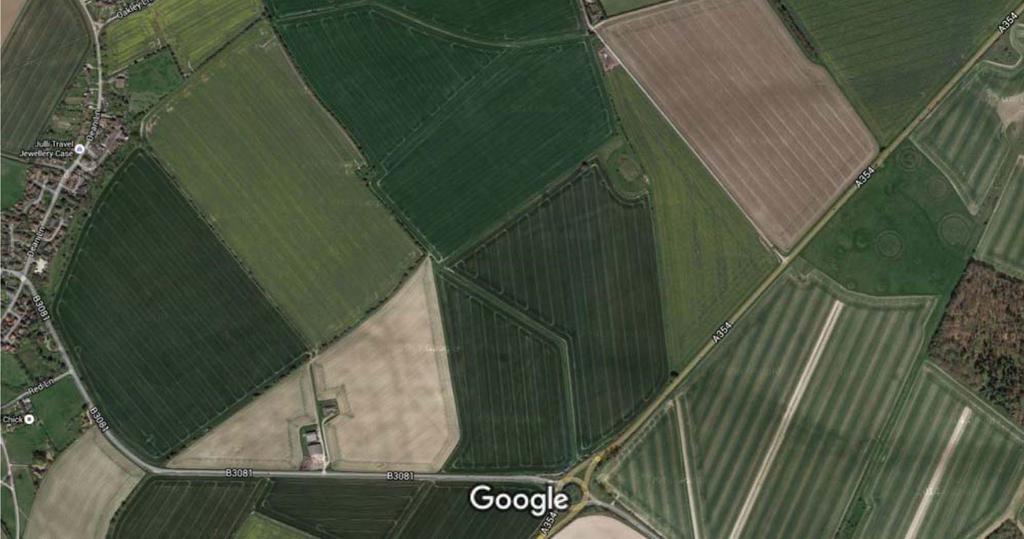
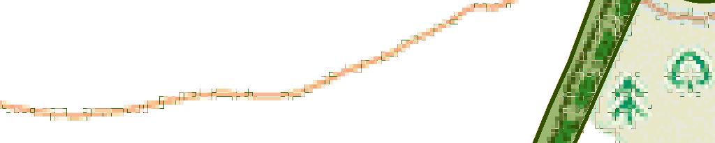
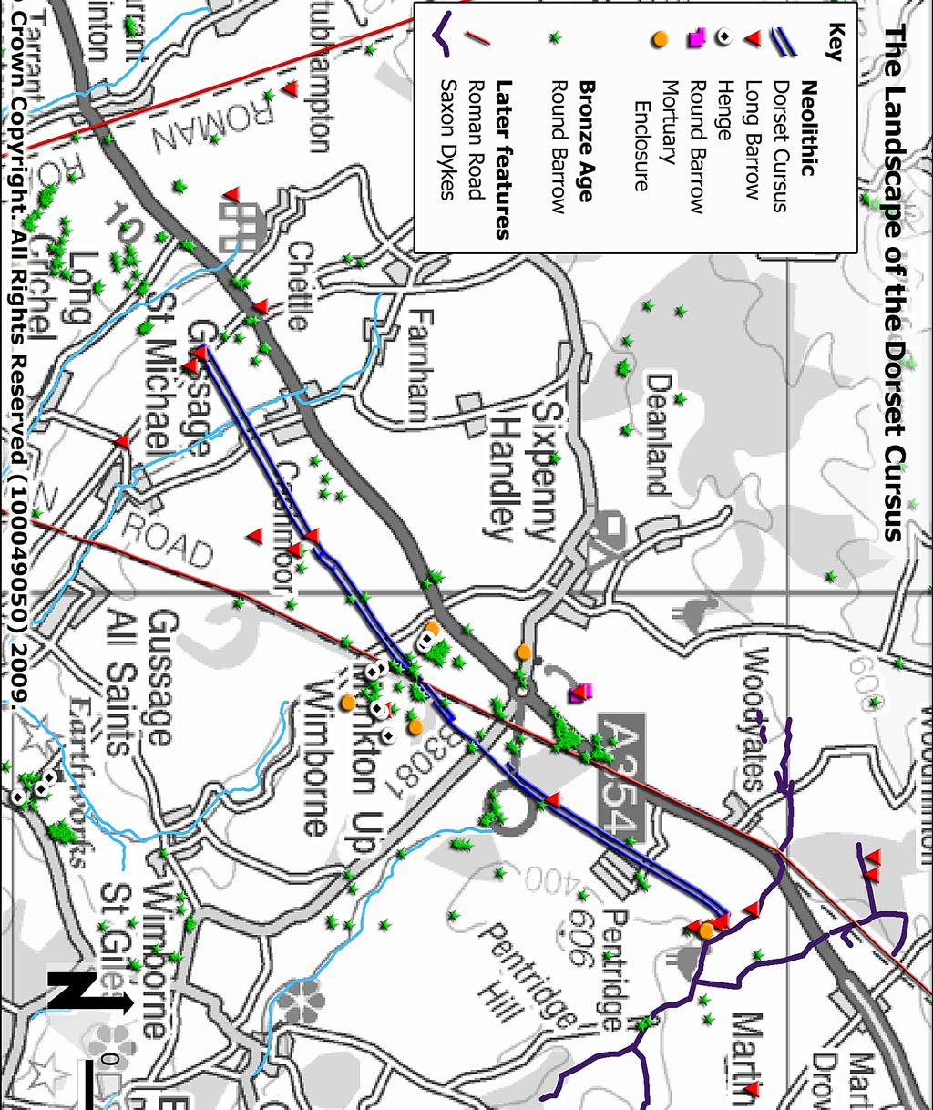
1 A visit to the Wor Barrow 21 st November 2015 Following our exploration of Winkelbury a few weeks previously, we fast forwarded 12 years in Pitt Rivers remarkable series of excavations and followed him to one of his most renowned sites the Wor barrow (right on the boundary of his Rushmore land), where he was at the peak of his powers: lambasting other archaeologists for not recognising the quarry ditches around barrows and proceeding to total excavation of the barrow, to such an extent that today the site consists of a level platform surrounded by the excavated ditches and banked up spoil from both the ditches and the mound itself. Two round barrows within the scheduled area, also investigated by Pitt Rivers, appeared to be good candidates for a vegetation clearance party in the New Year and other opportunities for further work such as field walking and geophysics were also discussed. The field notes Emma prepared for the visit can be consulted below. A key aspect of the significance of these sites is that their use spans the transition between the Neolithic and Bronze Age. Great interest was expressed in further investigating the area around the Bronze Age Angle Ditch also excavated by Pitt Rivers. Given the sunny but very cold conditions, the day would not have been the success it undoubtedly was without the use of Martin Green s finds room at nearby Down Farm and, indeed, the participation of Martin himself in the events of the day. Whilst the morning was devoted to the Wor Barrow, in the afternoon Martin opened his private museum for us and also gave us a guided tour of the excavations he and organisations such as Wessex Archaeology and the University of Southampton have conducted on his farm. Not everyone seemed to be too keen to venture out over the 13 metre deep shaft which can be viewed from a specially constructed, and heavily insured, platform! The opportunity to appreciate and understand the landscape setting of a succession of prehistoric monuments, from the Dorset cursus, through long barrows, round barrows, a pond barrow to settlement sites, and not forgetting a Roman Road all explained by someone who s entire life has been spent in this landscape, would be difficult to replicate. Thank you to David Chick for allowing us access and to Martin for taking the time to accompany us to the Wor Barrow and to show us round his museum. Phil Planel and Emma Rouse (FoA Coordinators)
2


3
4
5

6
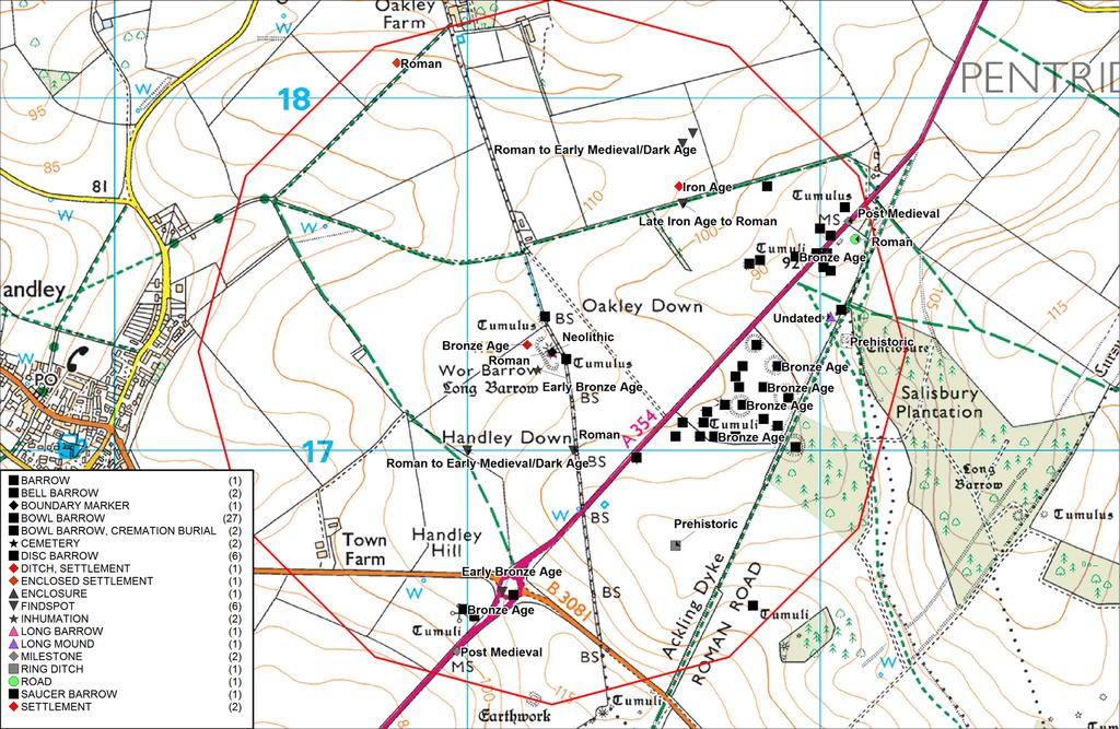
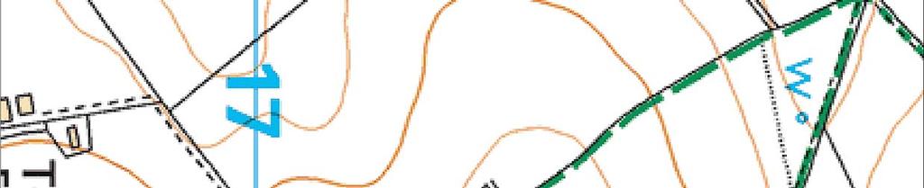
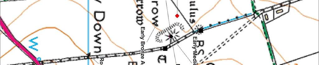
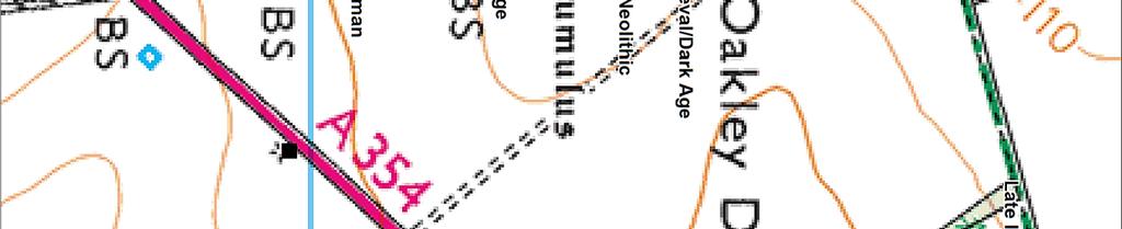
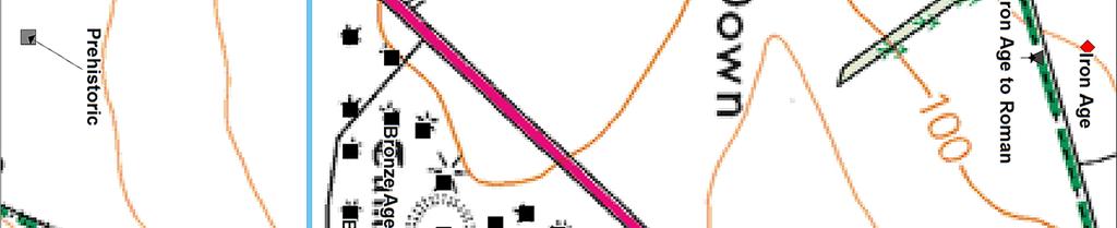
7 SMR Number MDO60 Site Name Wor Barrow, Sixpenny Handley SMR Number Site Name Record Type MDO6074 Wor Barrow, Sixpenny Handley Monument A long barrow excavated by General Pitt-Rivers in Before excavation the barrow was a mound 150 feet long, 75 feet wide and 12 feet high. Removal of the mound revealed a rectangular enclosure with an entrance at one end, formed by a ditch packed with flint into which was set timber posts. Six burials lay beneath a shallow turf mound inside the enclosure. Two more Neolithic burials were placed within the ditch, and seventeen Romano-British burials were found in the mound and ditch. After excavation the barrow was re-formed into an amphitheatre for public events. Monument Types and Dates LONG BARROW (Neolithic BC to 2351 BC) Evidence EARTHWORK Description and Sources Description - None recorded <1> Royal Commission on Historical Monuments (England), 1975, An Inventory of Historical Monuments in the County of Dorset, 71 (Bibliographic reference). SDO129. (29) WOR BARROW, a Neolithic long barrow ( ), was totally excavated by General Pitt-Rivers in The present earthwork, a sort of amphitheatre, was created by him for the holding of exhibitions, games etc (Plate 78, top left). The material from the mound was formed into a terraced bank along the S.W. side and the area within the ditch became an arena. The barrow is prominently sited near the crest of Handley Down and is clearly visible from the large group of barrows (WIMBORNE ST. GILES (94-124)) on Oakley Down to the E., whose siting it may have conditioned. Before the mound, aligned S.E.-N.W., was 150 ft. long, 75 ft. wide and 12 ft. high. Beneath it was found a rectangular enclosure, 90 ft. by 34 ft., with an entrance at the S.E. end. This enclosure was defined by a trench, 1½ ft. to 3 ft. wide and 3 ft. deep, packed with flint nodules which had formerly held timber uprights. Within the enclosure under a low turf mound lay six primary inhumations, three of them articulated and three in disorder. The long barrow was surrounded by a ditch, steep-sided, flat-bottomed and interrupted by one causeway at the N.W. end and by three at the S.E. end. The ditch varied in width from 10 ft. to 25 ft. and for the most part was some 13 ft. deep, except at the N.W. end where it shallowed to 7 ft. Along the inner margin of the ditch on the N.E. and S. were traces of an earlier, shallower ditch, also interrupted; possibly it was contemporary with the rectangular enclosure under the mound. Two early Neolithic burials, an adult and a child, were found 8 ft. down in the main ditch at the S.E. end. The ditch also yielded a stratified sequence of pottery from early to late Neolithic. Seventeen Romano-British burials, eight of them headless, were found in shallow graves inserted into the mound and ditch, and much pottery of this period was found scattered in the upper filling of the ditch. Finds from the excavation are in the Pitt-Rivers Museum, Farnham. Bibliography Pitt-Rivers, Excavations IV (1898), S. Piggott, Neolithic Cultures of the British Isles (1954), 53 ff. P. Ashbee, The Earthen Long Barrow in Britain (1970), passim. <2> Dorset Natural History and Archaeological Society, 1989, Proceedings of the Dorset Natural History and Archaeological Society for 1988, 160 (Serial). SDO88. Sources (1) (2) Bibliographic reference: Royal Commission on Historical Monuments (England) An Inventory of Historical Monuments in the County of Dorset. Volume Five (East Dorset). 71 Serial: Dorset Natural History and Archaeological Society Proceedings of the Dorset Natural History and Archaeological Society for Associated resources - None recorded Location National Grid Reference SU (point) Administrative Areas Civil Parish Address/Historic Names - None recorded SU01NW Sixpenny Handley, East Dorset Point Designations, Statuses and Scorings Associated Designations Scheduled Monument - DO859 Wor Barrow Active DDO17146 Scheduled Monument - SM35208 Wor Barrow and two bowl barrows on Active DDO19606 Handley Down MonFullRpt Report generated by HBSMR from exegesis SDM Ltd Page 7
8 SMR Number MDO60 Site Name Wor Barrow, Sixpenny Handley SMR Number Site Name Record Type MDO6074 Wor Barrow, Sixpenny Handley Monument A long barrow excavated by General Pitt-Rivers in Before excavation the barrow was a mound 150 feet long, 75 feet wide and 12 feet high. Removal of the mound revealed a rectangular enclosure with an entrance at one end, formed by a ditch packed with flint into which was set timber posts. Six burials lay beneath a shallow turf mound inside the enclosure. Two more Neolithic burials were placed within the ditch, and seventeen Romano-British burials were found in the mound and ditch. After excavation the barrow was re-formed into an amphitheatre for public events. Monument Types and Dates LONG BARROW (Neolithic BC to 2351 BC) Evidence EARTHWORK Description and Sources Description - None recorded <1> Royal Commission on Historical Monuments (England), 1975, An Inventory of Historical Monuments in the County of Dorset, 71 (Bibliographic reference). SDO129. (29) WOR BARROW, a Neolithic long barrow ( ), was totally excavated by General Pitt-Rivers in The present earthwork, a sort of amphitheatre, was created by him for the holding of exhibitions, games etc (Plate 78, top left). The material from the mound was formed into a terraced bank along the S.W. side and the area within the ditch became an arena. The barrow is prominently sited near the crest of Handley Down and is clearly visible from the large group of barrows (WIMBORNE ST. GILES (94-124)) on Oakley Down to the E., whose siting it may have conditioned. Before the mound, aligned S.E.-N.W., was 150 ft. long, 75 ft. wide and 12 ft. high. Beneath it was found a rectangular enclosure, 90 ft. by 34 ft., with an entrance at the S.E. end. This enclosure was defined by a trench, 1½ ft. to 3 ft. wide and 3 ft. deep, packed with flint nodules which had formerly held timber uprights. Within the enclosure under a low turf mound lay six primary inhumations, three of them articulated and three in disorder. The long barrow was surrounded by a ditch, steep-sided, flat-bottomed and interrupted by one causeway at the N.W. end and by three at the S.E. end. The ditch varied in width from 10 ft. to 25 ft. and for the most part was some 13 ft. deep, except at the N.W. end where it shallowed to 7 ft. Along the inner margin of the ditch on the N.E. and S. were traces of an earlier, shallower ditch, also interrupted; possibly it was contemporary with the rectangular enclosure under the mound. Two early Neolithic burials, an adult and a child, were found 8 ft. down in the main ditch at the S.E. end. The ditch also yielded a stratified sequence of pottery from early to late Neolithic. Seventeen Romano-British burials, eight of them headless, were found in shallow graves inserted into the mound and ditch, and much pottery of this period was found scattered in the upper filling of the ditch. Finds from the excavation are in the Pitt-Rivers Museum, Farnham. Bibliography Pitt-Rivers, Excavations IV (1898), S. Piggott, Neolithic Cultures of the British Isles (1954), 53 ff. P. Ashbee, The Earthen Long Barrow in Britain (1970), passim. <2> Dorset Natural History and Archaeological Society, 1989, Proceedings of the Dorset Natural History and Archaeological Society for 1988, 160 (Serial). SDO88. Sources (1) (2) Bibliographic reference: Royal Commission on Historical Monuments (England) An Inventory of Historical Monuments in the County of Dorset. Volume Five (East Dorset). 71 Serial: Dorset Natural History and Archaeological Society Proceedings of the Dorset Natural History and Archaeological Society for Associated resources - None recorded Location National Grid Reference SU (point) Administrative Areas Civil Parish Address/Historic Names - None recorded SU01NW Sixpenny Handley, East Dorset Point Designations, Statuses and Scorings Associated Designations Scheduled Monument - DO859 Wor Barrow Active DDO17146 Scheduled Monument - SM35208 Wor Barrow and two bowl barrows on Active DDO19606 Handley Down MonFullRpt Report generated by HBSMR from exegesis SDM Ltd Page 7
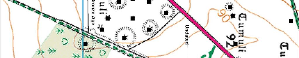
9 SMR Number MDO60 Site Name The Angle Ditch, Handley Down, Sixpenny Handley SMR Number MDO6072 Record Type Bronze Age ditch excavated by Pitt-Rivers. This feature has been interpreted as two sides of the boundary of a settlement. Monument Types and Dates Description and Sources Description Site Name DITCH (Bronze Age BC to 701 BC) Evidence EXCAVATED FEATURE Evidence STRATIFIED FIND Evidence SUB SURFACE DEPOSIT SETTLEMENT (Bronze Age BC to 701 BC) Evidence EXCAVATED FEATURE Evidence STRATIFIED FIND Evidence SUB SURFACE DEPOSIT The Angle Ditch, Handley Down, Sixpenny Handley Monument '(27) Bronze Age Ditch, known as the Angle Ditch and probably part of an occupation site, lies on the summit of Handley Down ( ), some 200 ft. W. of Wor Barrow (29). Not visible as a surface feature, it was discovered by bosing and was excavated by General Pitt-Rivers. It lies in an area of 'Celtic' fields (Group (85), p. 118), now heavily ploughed, and appears to be integrated with their pattern. The ditch, 6½ ft. deep, 7½ ft. wide at the to pand 1 ft. wide at the bottom, followed an irregular line for 165 ft. from S.W. to N.E., then turned at right-angles towards the S.E. and continued for a further 60 ft. Finds from the lower filling of the ditch indicate a date in the later Bronze Age; they include parts of a looped palstave and of a class-ii razor; a bonze awl, a sandstone grain-rubber, a complete barrel urn and fragments of others, and a fragment of a globular urn. Possibly the ditch formed part of a roughly rectangular enclosure with broad gaps in its sides, like that on Martin Down, Hants., also excavated by Pitt-Rivers and found to be of comparable date (Excavations IV (1898), ). That the Angle Ditch had already been obscured by ploughing in the Roman period is clear from the quantity of later pottery, especially Romano-British wares, found in its upper filling and as a surface scatter around it. Pitt-Rivers's excavation also revealed a shallow ditch, 3 ft. wide and 1½ ft. deep, which ran for over 450 ft. from N.N.W. to S.S.E. across the site and was apparently cut by the Angle Ditch. Its position and its apparent relationship with the 'Celtic' fields immedaitely to the W. suggest that it may have served to separate those fields from an uncultivated area sourrounding Wor Barrow, rather than as a drain, as suggested by Pitt-Rivers. Finds from the excavation are in the Pitt-Rivers Museum at Farnham. (Pitt-Rivers, Excavations IV (1898), 58-61, ; Dorset Procs., 46 (1925), 92-3; Arch. J., CXIX (1962), 54, 56).' {1} <1> Royal Commission on Historical Monuments (England), 1975, An Inventory of Historical Monuments in the County of Dorset, 70 (Bibliographic reference). SDO129. Sources (1) Bibliographic reference: Royal Commission on Historical Monuments (England) An Inventory of Historical Monuments in the County of Dorset. Volume Five (East Dorset). 70 Associated resources - None recorded Location National Grid Reference SU (point) Administrative Areas Civil Parish Address/Historic Names - None recorded SU01NW Sixpenny Handley, East Dorset Point Designations, Statuses and Scorings Associated Designations SHINE Other Statuses and Cross-References Angle Ditch. A length of ditch of Middle Bronze Age date excavated in Around 70 metres long, with a near right-angled turn, and likely to be part of an enclosure, probably a settlement. Active DDO18375 MonFullRpt Report generated by HBSMR from exegesis SDM Ltd Page 3

10 Generated on :37 GMT / Public Domain /

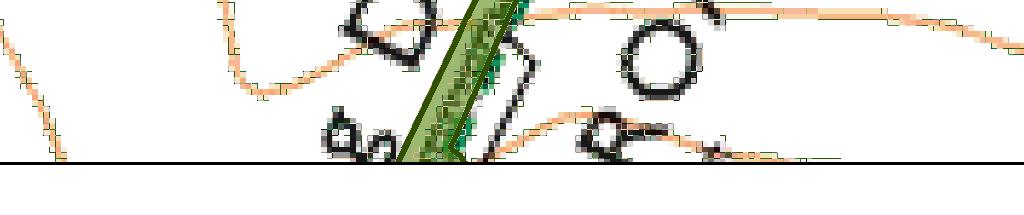
11 PLAN OF WOR BARROW,(STONE AGE)* THE ANGLE DITCH AND BARROWS 26 AND 27, (BRONZE AGE)$ SHOWING THEIR RELATIVE POSITION, AND THE SUPPOSED SITE OF THE CAMP ON HANDLEY DOWN, DORSET. 6'0' S-5f S'd>5V ' Z-5' 3'Of 2'5' 2'0f t'5* I'O' OSf & & O'S' PLATE 248. Generated on :37 GMT / Public Domain / I2'0f US' WO' 10*5' 9-5' 9-0' AREAS TRENCHED TO THE UNDISTURBED CHALK FOR THE DISCOVERY OF PITS OR RELICS. WOR BARROW IS SHOWN WITH THE DITCH EXCAVATED AND THE BARROW UNTOUCHED. SO 9-0' RELICS FOUND IN THE SILTING OF THE ANGLE DITCH A. FRAGMENT OF FLINT HAMMER-STONE, DEPTH IS FX B. BONE AWL, DEPTH 2*3 FX C. BONE CHISEL, DEPTH 2 5FX D. BONE CHISEL 7 DEPTH 3 FX E. BRONZE AWL, DEPTH 4 FX SCALE OF FEET. 100 ISO =±= CONTOURS OF 0'5FT. VERTICAL HEIGHT. F. BLADE OF BRONZE RAZOR, DEPTH 4 FX G. BRONZE PALSTAVE, DEPTH 6FX H. SANDSTONE RUBBER, DEPTH 6* FX J, BRITISH URN FOUND IN FRAGMENTS,DEPTH 7 FX K. PORTION OF HUMAN SKULL AND PELVIS, DEPTH 2'5FX J.AkermaiCPli otolith. London 9-S'
12 Generated on :37 GMT / Public Domain /
Archaeological sites and find spots in the parish of Burghclere - SMR no. OS Grid Ref. Site Name Classification Period
 Archaeological sites and find spots in the parish of Burghclere - SMR no. OS Grid Ref. Site Name Classification Period SU45NE 1A SU46880 59200 Ridgemoor Farm Inhumation Burial At Ridgemoor Farm, on the
Bronze Age 2, BC
 Bronze Age 2,000-600 BC There may be continuity with the Neolithic period in the Early Bronze Age, with the harbour being used for seasonal grazing, and perhaps butchering and hide preparation. In the
A Sense of Place Tor Enclosures
 A Sense of Place Tor Enclosures Tor enclosures were built around six thousand years ago (4000 BC) in the early part of the Neolithic period. They are large enclosures defined by stony banks sited on hilltops
ARCHAEOLOGICAL EVALUATION AT BRIGHTON POLYTECHNIC, NORTH FIELD SITE, VARLEY HALLS, COLDEAN LANE, BRIGHTON. by Ian Greig MA AIFA.
 ARCHAEOLOGICAL EVALUATION AT BRIGHTON POLYTECHNIC, NORTH FIELD SITE, VARLEY HALLS, COLDEAN LANE, BRIGHTON by Ian Greig MA AIFA May 1992 South Eastern Archaeological Services Field Archaeology Unit White
SALVAGE EXCAVATIONS AT OLD DOWN FARM, EAST MEON
 Proc. Hants. Field Club Archaeol. Soc. 36, 1980, 153-160. 153 SALVAGE EXCAVATIONS AT OLD DOWN FARM, EAST MEON By RICHARD WHINNEY AND GEORGE WALKER INTRODUCTION The site was discovered by chance in December
Grim s Ditch, Starveall Farm, Wootton, Woodstock, Oxfordshire
 Grim s Ditch, Starveall Farm, Wootton, Woodstock, Oxfordshire An Archaeological Recording Action For Empire Homes by Steve Ford Thames Valley Archaeological Services Ltd Site Code SFW06/118 November 2006
The Living and the Dead
 The Living and the Dead Round Barrows and cairns The transition from the late Neolithic to the early Bronze Age is traditionally associated with an influx of immigrants to the British Isles from continental
Greater London Region GREATER LONDON 3/567 (E.01.K099) TQ BERMONDSEY STREET AND GIFCO BUILDING AND CAR PARK
 TQ BERMONDSEY STREET AND GIFCO BUILDING AND CAR PARK") GREATER LONDON 3/567 (E.01.K099) TQ 33307955 156-170 BERMONDSEY STREET AND GIFCO BUILDING AND CAR PARK Assessment of an Archaeological Excavation at 156-170 Bermondsey Street and GIFCO Building and Car
GREATER LONDON 3/567 (E.01.K099) TQ 33307955 156-170 BERMONDSEY STREET AND GIFCO BUILDING AND CAR PARK Assessment of an Archaeological Excavation at 156-170 Bermondsey Street and GIFCO Building and Car
THE RAVENSTONE BEAKER
 DISCOVERY THE RAVENSTONE BEAKER K. J. FIELD The discovery of the Ravenstone Beaker (Plate Xa Fig. 1) was made by members of the Wolverton and District Archaeological Society engaged on a routine field
NOTE A THIRD CENTURY ROMAN BURIAL FROM MANOR FARM, HURSTBOURNE PRIORS. by. David Allen with contributions by Sue Anderson and Brenda Dickinson
 Proc. Hampsh. Field Club Archaeol. Soc. 47, 1991, 253-257 NOTE A THIRD CENTURY ROMAN BURIAL FROM MANOR FARM, HURSTBOURNE PRIORS Abstract by. David Allen with contributions by Sue Anderson and Brenda Dickinson
New Composting Centre, Ashgrove Farm, Ardley, Oxfordshire
 New Composting Centre, Ashgrove Farm, Ardley, Oxfordshire An Archaeological Watching Brief For Agrivert Limited by Andrew Weale Thames Valley Archaeological Services Ltd Site Code AFA 09/20 August 2009
3. The new face of Bronze Age pottery Jacinta Kiely and Bruce Sutton
 3. The new face of Bronze Age pottery Jacinta Kiely and Bruce Sutton Illus. 1 Location map of Early Bronze Age site at Mitchelstown, Co. Cork (based on the Ordnance Survey Ireland map) A previously unknown
Church of St Peter and St Paul, Great Missenden, Buckinghamshire
 Church of St Peter and St Paul, Great Missenden, Buckinghamshire An Archaeological Watching Brief for the Parish of Great Missenden by Andrew Taylor Thames Valley Archaeological Services Ltd Site Code
BALNUARAN. of C LAVA. a prehistoric cemetery. A Visitors Guide to
 A Visitors Guide to BALNUARAN of C LAVA a prehistoric cemetery Milton of Clava Chapel (?) Cairn River Nairn Balnuaran of Clava is the site of an exceptionally wellpreserved group of prehistoric burial
Test-Pit 3: 31 Park Street (SK )
") -Pit 3: 31 Park Street (SK 40732 03178) -Pit 3 was excavated in a flower bed in the rear garden of 31 Park Street, on the northern side of the street and west of an alleyway leading to St Peter s Church,
-Pit 3: 31 Park Street (SK 40732 03178) -Pit 3 was excavated in a flower bed in the rear garden of 31 Park Street, on the northern side of the street and west of an alleyway leading to St Peter s Church,
Hembury Hillfort Lesson Resources. For Key Stage Two
 Hembury Hillfort Lesson Resources For Key Stage Two 1 Resource 1 Email 1 ARCHAEOLOGISTS NEEDED Dear Class, I recently moved to Payhembury and I have been having fun exploring the beautiful Blackdown Hills.
Moray Archaeology For All Project
 School children learning how to identify finds. (Above) A flint tool found at Clarkly Hill. Copyright: Leanne Demay Moray Archaeology For All Project ational Museums Scotland have been excavating in Moray
7. Prehistoric features and an early medieval enclosure at Coonagh West, Co. Limerick Kate Taylor
 7. Prehistoric features and an early medieval enclosure at Coonagh West, Co. Limerick Kate Taylor Illus. 1 Location of the site in Coonagh West, Co. Limerick (based on the Ordnance Survey Ireland map)
An archaeological watching brief and recording at Brightlingsea Quarry, Moverons Lane, Brightlingsea, Essex October 2003
 An archaeological watching brief and recording at Brightlingsea Quarry, Moverons Lane, Brightlingsea, Essex commissioned by Mineral Services Ltd on behalf of Alresford Sand & Ballast Co Ltd report prepared
St Germains, Tranent, East Lothian: the excavation of Early Bronze Age remains and Iron Age enclosed and unenclosed settlements
 Proc Soc Antiq Scot, 128 (1998), 203-254 St Germains, Tranent, East Lothian: the excavation of Early Bronze Age remains and Iron Age enclosed and unenclosed settlements Derek Alexander* & Trevor Watkinsf
2 Saxon Way, Old Windsor, Berkshire
 2 Saxon Way, Old Windsor, Berkshire An Archaeological Watching Brief For Mrs J. McGillicuddy by Pamela Jenkins Thames Valley Archaeological Services Ltd Site Code SWO 05/67 August 2005 Summary Site name:
Lanton Lithic Assessment
 Lanton Lithic Assessment Dr Clive Waddington ARS Ltd The section headings in the following assessment report refer to those in the Management of Archaeological Projects (HBMC 1991), Appendix 4. 1. FACTUAL
THE UNFOLDING ARCHAEOLOGY OF CHELTENHAM
 THE UNFOLDING ARCHAEOLOGY OF CHELTENHAM The archaeology collection of Cheltenham Art Gallery & Museum contains a rich quantity of material relating to the prehistoric and Roman occupation of the North
Fieldwalking at Cottam 1994 (COT94F)
") Fieldwalking at Cottam 1994 (COT94F) Tony Austin & Elizabeth Jelley (19 Jan 29) 1. Introduction During the winter of 1994 students from the Department of Archaeology at the University of York undertook
Fieldwalking at Cottam 1994 (COT94F) Tony Austin & Elizabeth Jelley (19 Jan 29) 1. Introduction During the winter of 1994 students from the Department of Archaeology at the University of York undertook
Erection of wind turbine, Mains of Loanhead, Old Rayne, AB52 6SX
 Erection of wind turbine, Mains of Loanhead, Old Rayne, AB52 6SX Ltd 23 November 2011 Erection of wind turbine, Mains of Loanhead, Old Rayne, AB52 6SX CONTENTS 1 INTRODUCTION 3 2 ARCHAEOLOGICAL BACKGROUND
STONES OF STENNESS HISTORIC ENVIRONMENT SCOTLAND STATEMENT OF SIGNIFICANCE
 Property in Care (PIC) ID: PIC321 Designations: Scheduled Monument (SM90285); Taken into State care: 1906 (Guardianship) Last reviewed: 2003 HISTORIC ENVIRONMENT SCOTLAND STATEMENT OF SIGNIFICANCE STONES
An archaeological evaluation at the Lexden Wood Golf Club (Westhouse Farm), Lexden, Colchester, Essex
, Lexden, Colchester, Essex") An archaeological evaluation at the Lexden Wood Golf Club (Westhouse Farm), Lexden, Colchester, Essex January 2000 Archive report on behalf of Lexden Wood Golf Club Colchester Archaeological Trust 12 Lexden
An archaeological evaluation at the Lexden Wood Golf Club (Westhouse Farm), Lexden, Colchester, Essex January 2000 Archive report on behalf of Lexden Wood Golf Club Colchester Archaeological Trust 12 Lexden
Archaeological Material From Spa Ghyll Farm, Aldfield
 Archaeological Material From Spa Ghyll Farm, Aldfield Introduction Following discussions with Linda Smith the Rural Archaeologist for North Yorkshire County Council, Robert Morgan of 3D Archaeological
Greater London GREATER LONDON 3/606 (E ) TQ
 TQ") GREATER LONDON City of London 3/606 (E.01.6024) TQ 30358150 1 PLOUGH PLACE, CITY OF LONDON An Archaeological Watching Brief at 1 Plough Place, City of London, London EC4 Butler, J London : Pre-Construct
GREATER LONDON City of London 3/606 (E.01.6024) TQ 30358150 1 PLOUGH PLACE, CITY OF LONDON An Archaeological Watching Brief at 1 Plough Place, City of London, London EC4 Butler, J London : Pre-Construct
An archaeological evaluation by trial-trenching at Playgolf, Bakers Lane, Westhouse Farm, Colchester, Essex
 An archaeological evaluation by trial-trenching at Playgolf, Bakers Lane, Westhouse Farm, Colchester, Essex commissioned by Mr Stephen Belchem on behalf of ADP Ltd. report prepared by Chris Lister Planning
Colchester Archaeological Trust Ltd. A Fieldwalking Survey at Birch, Colchester for ARC Southern Ltd
 Colchester Archaeological Trust Ltd A Fieldwalking Survey at Birch, Colchester for ARC Southern Ltd November 1997 CONTENTS page Summary... 1 Background... 1 Methods... 1 Retrieval Policy... 2 Conditions...
Grange Farm, Widmer End, Hughenden, Buckinghamshire
 Grange Farm, Widmer End, Hughenden, Buckinghamshire An Archaeological Evaluation for British Flora by Andy Taylor Thames Valley Archaeological Services Ltd Site Code GFH 05/63 July 2005 Summary Site name:
Undley Hall, Lakenheath LKH 307
 ARCHAEOLOGICAL EVALUATION AND MONITORING REPORT SCCAS REPORT No. 2010/005 Undley Hall, Lakenheath LKH 307 E. Muldowney SCCAS January 2010 www.suffolkcc.gov.uk/e-and-t/archaeology Lucy Robinson, County
Fieldwalk On Falmer Hill, Near Brighton - Second Season
 Fieldwalk On Falmer Hill, Near Brighton - Second Season by the Brighton and Hove Archaeological Society This report as well as describing the recent fieldwalks also includes descriptions of previous discoveries
Cambridge Archaeology Field Group. Fieldwalking on the Childerley Estate, Cambridgeshire. Autumn 2014 to Spring Third interim report
 Cambridge Archaeology Field Group Fieldwalking on the Childerley Estate, Cambridgeshire Autumn 2014 to Spring 2015 Third interim report Summary Field walking on the Childerley estate of Martin Jenkins
An archaeological evaluation at 16 Seaview Road, Brightlingsea, Essex February 2004
 An archaeological evaluation at 16 Seaview Road, Brightlingsea, Essex February 2004 report prepared by Kate Orr on behalf of Highfield Homes NGR: TM 086 174 (c) CAT project ref.: 04/2b ECC HAMP group site
RESCUE EXCAVATIONS ON BRONZE AGE SITES IN THE SOUTH WONSTON AREA
 Proc. Hampsh. Field Club Archaeol. Soc. 43, 1987, 5-14 RESCUE EXCAVATIONS ON BRONZE AGE SITES IN THE SOUTH WONSTON AREA By RICHARD WHINNEY ABSTRACT BRONZE AGE BACKGROUND (Fig lc) Four small rescue and
Advanced archaeology at the archive. Museum of London Support materials AS/A2 study day
 Advanced archaeology at the archive Support materials AS/A2 study day Contents National Curriculum links and session description 1-2 Example timetable 3 Practical guidelines 4 Visit preparation and pre-visit
Fort Arbeia and the Roman Empire in Britain 2012 FIELD REPORT
 Fort Arbeia and the Roman Empire in Britain 2012 FIELD REPORT Background Information Lead PI: Paul Bidwell Report completed by: Paul Bidwell Period Covered by this report: 17 June to 25 August 2012 Date
1. Presumed Location of French Soundings Looking NW from the banks of the river.
 SG02? SGS SG01? SG4 1. Presumed Location of French Soundings Looking NW from the banks of the river. The presumed location of SG02 corresponds to a hump known locally as the Sheikh's tomb. Note also (1)
Notes on Two Bronze Age Discoveries 1n Leicestershire by
 Notes on Two Bronze Age Discoveries 1n Leicestershire by T. G. E. Powell (1) Bronze Age Cremation Burial from Earl Shilton In the course of sand digging in 1938, an urn containing cremated bones was found
Changing People Changing Landscapes: excavations at The Carrick, Midross, Loch Lomond Gavin MacGregor, University of Glasgow
 Changing People Changing Landscapes: excavations at The Carrick, Midross, Loch Lomond Gavin MacGregor, University of Glasgow Located approximately 40 kilometres to the south-west of Oban, as the crow flies
Report on the Restoration of Carn Glas, a Neolithic Chambered Cairn,
 Report on the Restoration of Carn Glas, a Neolithic Chambered Cairn, 2014-2015. Location: On the Mulbuie Ridge, north of Kilcoy, Ross-shire. NH 5784 5206 Scheduled Monument index number: 3213 Grid Ref:
Chapter 2. Remains. Fig.17 Map of Krang Kor site
 Chapter 2. Remains Section 1. Overview of the Survey Area The survey began in January 2010 by exploring the site of the burial rootings based on information of the rooted burials that was brought to the
Archaeology and Historic Buildings Record
 Site: 21102 Parish: Hannington SU 452000155300 Y EVET CELTIC FIELD SYSTEM Unassigned Early Iron Age (1)Celtic fields visible on air photographs in area centred overleaf. (1957). HCC 1984 Census AP Run
DEMARCATION OF THE STONE AGES.
 20 HAMPSHIRE FLINTS. DEMARCATION OF THE STONE AGES. BY W, DALE, F.S.A., F.G.S. (Read before the Anthropological Section of -the British Association for the advancement of Science, at Birmingham, September
The Parish of Findon contains archaeology of national and international importance.
 THE ARCHAEOLOGY OF THE PARISH OF FINDON, WEST SUSSEX The Parish of Findon contains archaeology of national and international importance. NEOLITHIC (c. 4,400-2,200 BC) The earliest structural evidence which
Archaeological. Monitoring & Recording Report. Fulbourn Primary School, Cambridgeshire. Archaeological Monitoring & Recording Report.
 Fulbourn Primary School, Cambridgeshire Archaeological Monitoring & Recording Report October 2014 Client: Cambridgeshire County Council OA East Report No: 1689 OASIS No: oxfordar3-192890 NGR: TL 5190 5613
An archaeological evaluation in the playground of Colchester Royal Grammar School, Lexden Road, Colchester, Essex
 An archaeological evaluation in the playground of Colchester Royal Grammar School, Lexden Road, Colchester, Essex February 2002 on behalf of Roff Marsh Partnership CAT project code: 02/2c Colchester Museum
SCOTLAND. Belfast IRISH SEA. Dublin THE REPUBLIC OF IRELAND ENGLAND ENGLISH CHANNEL. Before and After
 ALL ABOUT BRITAIN This book tells the story of the people who have lived in the British Isles, and is packed with fascinating facts and f un tales. The British Isles is a group of islands that consists
Wisconsin Sites Page 61. Wisconsin Sites
 Wisconsin Sites Page 61 Silver Mound-A Quarry Site Wisconsin Sites Silver Mound in Jackson County is a good example of a quarry site where people gathered the stones to make their tools. Although the name
HANT3 FIELD CLUB AND ARCH^OLOGICAL SOCIETY, PLATE 4
 HANT3 FIELD CLUB AND ARCH^OLOGICAL SOCIETY, 1898. PLATE 4 VUU*. ilurti.14 HALF SIZE. BRONZE PALSTAVES, FOUND AT PEAR TREE GREEN. n BRONZE IMPLEMENTS FROM THE. NEIGHBOURHOOD OF SOUTHAMPTON, BY W. DALE,
Former Whitbread Training Centre Site, Abbey Street, Faversham, Kent Interim Archaeological Report Phase 1 November 2009
 Former Whitbread Training Centre Site, Abbey Street, Faversham, Kent Interim Archaeological Report Phase 1 November 2009 SWAT. Archaeology Swale and Thames Archaeological Survey Company School Farm Oast,
The first men who dug into Kent s Stonehenge
 From: Paul Tritton, Hon. Press Officer Email: paul.tritton@btinternet.com. Tel: 01622 741198 The first men who dug into Kent s Stonehenge Francis James Bennett (left) and a colleague at Coldrum Longbarrow
A Fieldwalking Project At Sompting. West Sussex
 by John Funnell Introduction A Fieldwalking Project At Sompting. West Sussex During March -and April 1995 the Brighton and Hove Archaeological Society conducted fie1dwa1king in a field at Sompting West
Tell Shiyukh Tahtani (North Syria)
") Tell Shiyukh Tahtani (North Syria) Report of the 2010 excavation season conducted by the University of Palermo Euphrates Expedition by Gioacchino Falsone and Paola Sconzo In the summer 2010 the University
Tell Shiyukh Tahtani (North Syria) Report of the 2010 excavation season conducted by the University of Palermo Euphrates Expedition by Gioacchino Falsone and Paola Sconzo In the summer 2010 the University
A NOTE FROM THE ERMINE STREET DIG HUNTINGDON September 2013 EDITOR
 A NOTE FROM THE EDITOR This is the first newsletter since the merger of Mid Anglia and East Anglia in 2012. The newsletter will be published bi- annually in March and September. We invite contributions
THE EXCAVATION OF A BURNT MOUND AT HARBRIDGE, HAMPSHIRE
 Proc Hampshire Field ClubArchaeolSoc5i, 1999,172-179 (Hampshire Studies 1999) THE EXCAVATION OF A BURNT MOUND AT HARBRIDGE, HAMPSHIRE by S J SHENNAN ABSTRACT A burnt mound of Late Brome Age date, as indicated
KNAP OF HOWAR HISTORIC ENVIRONMENT SCOTLAND STATEMENT OF SIGNIFICANCE. Property in Care (PIC) ID: PIC301 Designations:
 ID: PIC301 Designations:") Property in Care (PIC) ID: PIC301 Designations: Scheduled Monument (SM90195) Taken into State care: 1954 (Guardianship) Last reviewed: 2004 HISTORIC ENVIRONMENT SCOTLAND STATEMENT OF SIGNIFICANCE KNAP
Property in Care (PIC) ID: PIC301 Designations: Scheduled Monument (SM90195) Taken into State care: 1954 (Guardianship) Last reviewed: 2004 HISTORIC ENVIRONMENT SCOTLAND STATEMENT OF SIGNIFICANCE KNAP
BRONZE AGE BARROWS ON THE HEATHLANDS OF SOUTHERN ENGLAND: CONSTRUCTION, FORMS AND INTERPRETATIONS
 ojoa_338 15..34 RICHARD BRADLEY AND ELISE FRASER BRONZE AGE BARROWS ON THE HEATHLANDS OF SOUTHERN ENGLAND: CONSTRUCTION, FORMS AND INTERPRETATIONS Summary. The Bronze Age barrows on the downs of southern
Cambridge Archaeology Field Group. Fieldwalking on the Childerley Estate Cambridgeshire
 Cambridge Archaeology Field Group Fieldwalking on the Childerley Estate Cambridgeshire 2009 to 2014 Summary Fieldwalking on the Childerley estate of Martin Jenkins and Family has revealed, up to March
Cetamura Results
 Cetamura 2000 2006 Results A major project during the years 2000-2006 was the excavation to bedrock of two large and deep units located on an escarpment between Zone I and Zone II (fig. 1 and fig. 2);
1 The East Oxford Archaeology and History Project
 1 The East Oxford Archaeology and History Project EXOP TEST PIT 72 Location: Bartlemas Chapel, Cowley Date of excavation: 6-8 November 2013. Area of excavation: 0.8m x 1.2m, at the eastern end of the chapel.
An archaeological watching brief at Sheepen, Colchester, Essex November-December 2003
 An archaeological watching brief at Sheepen, Colchester, Essex November-December 2003 report prepared by Ben Holloway on behalf of Colchester Borough Council CAT project ref.: 03/11c Colchester Museums
An early pot made by the Adena Culture (800 B.C. - A.D. 100)
") Archaeologists identify the time period of man living in North America from about 1000 B.C. until about 700 A.D. as the Woodland Period. It is during this time that a new culture appeared and made important
Archaeologists identify the time period of man living in North America from about 1000 B.C. until about 700 A.D. as the Woodland Period. It is during this time that a new culture appeared and made important
Please see our website for up to date contact information, and further advice.
 On 1st April 2015 the Historic Buildings and Monuments Commission for England changed its common name from to Historic England. We are now re-branding all our documents. Although this document refers to,
MARSTON MICHAEL FARLEY
 MARSTON MICHAEL FARLEY On 9 March agricultural contractors, laying field drains for Bucks County Council Land Agent's Department, cut through a limestone structure at SP 75852301 in an area otherwise consistently
AN EARLY MEDIEVAL RUBBISH-PIT AT CATHERINGTON, HAMPSHIRE Bj>J. S. PILE and K. J. BARTON
 AN EARLY MEDIEVAL RUBBISH-PIT AT CATHERINGTON, HAMPSHIRE Bj>J. S. PILE and K. J. BARTON INTRODUCTION THE SITE (fig. 21) is situated in the village of Catherington, one mile north-west of Horndean and 200
A BARROW ON WOOTTON COMMON, HANTS.
 116 HAMPSHIRE FIELD CLUB A BARROW ON WOOTTON COMMON, HANTS. By W. A. SEABY, F.S.A. T Discovery of the Barrow. HE burning of the gorse bushes on the eastern half of Wootton Common, early in 1939, exposed
Chapel House Wood Landscape Project. Interim Report 2013
 Chapel House Wood Landscape Project Interim Report 2013 Chapel House Wood Landscape Project Interim Report 2013 The annual Dales Heritage Field School was held at Chapel House Wood again this year, and
Archaeological trial-trenching evaluation at Chappel Farm, Little Totham, Essex. April 2013
 Archaeological trial-trenching evaluation at Chappel Farm, Little Totham, Essex April 2013 report prepared by Ben Holloway commissioned by Tim Harbord Associates on behalf of Mr Tom Howie Planning reference:
Chapter 2: Archaeological Description
 Chapter 2: Archaeological Description Phase 1 Late Neolithic, c 3000-2400 BC (Figs 6-9) Evidence of Neolithic activity was confined to pits dug across the southern half of the site (Fig. 6). Eighteen pits
Chapter 5: Ringlemere and Ritual and Burial Landscapes of Kent Keith Parfitt
 Chapter 5: Ringlemere and Ritual and Burial Landscapes of Kent Keith Parfitt Kent s lack of prehistoric monuments the price of being the Garden of England The general lack of prehistoric field monuments
Round Barrows in Chalcolithic and Early Bronze Age Yorkshire
 Round Barrows in Chalcolithic and Early Bronze Age Yorkshire Architecture, Burial, and Landscape David G. Cockcroft Doctor of Philosophy School of History, Classics, and Archaeology April 2015 Abstract
Archaeological Evaluation at Alconbury Weald Enterprise Zone
 Archaeological Evaluation at Alconbury Weald Enterprise Zone Archaeological Evaluation Report June 2015 Client: CgMS OA East Report No: 1768 OASIS No: oxfordar3-212519 NGR: TL 1975 7684 Archaeological
Weetwood Moor. What are cup & ring marks?
 Weetwood Moor On this small stretch of moorland you can find some of the most recognisable ancient cup and ring marked stones in the UK. There are three interesting spots we d like to share with you. What
The Neolithic Spiritual Landscape
 The For the earliest inhabitants of the island, certain places had a special significance and these were often marked in some way to highlight the spiritual nature of the place. The earliest known religious
Overview: From Neolithic to Bronze Age, BC
 Overview: From Neolithic to Bronze Age, 8000-800 BC By Dr Francis Pryor Last updated 2011-02-28 The British Isles have been populated by human beings for hundreds of thousands of years, but it was the
Earthworks at Glebe Farm, Tilshead
 Earthworks at Glebe Farm, Tilshead Site Code TL004 Archaeological Field Evaluation And Post-Excavation Assessment Report No. 167.0801 Report date November 2011 Authors R.Holley & L.Amadio 1 Earthworks
Silwood Farm, Silwood Park, Cheapside Road, Ascot, Berkshire
 Silwood Farm, Silwood Park, Cheapside Road, Ascot, Berkshire An Archaeological Watching Brief For Imperial College London by Tim Dawson Thames Valley Archaeological Services Ltd Site Code SFA 09/10 April
An Archaeological Resource Assessment of the Neolithic and Early Bronze Age in Lincolnshire
 Steven Membery An Archaeological Resource Assessment of the Neolithic and Early Bronze Age in Lincolnshire Note: For copyright reasons the figures are currently omitted from the web version of this paper.
Teachers Pack
 Whitehorse Hill: A Prehistoric Dartmoor Discovery 13.09.14-13.12.14 Teachers Pack CONTENTS About the Teachers Pack 05 Introduction to the exhibition 05 Prehistoric Britain - Timeline 05 What changed? Technology,
THE PRE-CONQUEST COFFINS FROM SWINEGATE AND 18 BACK SWINEGATE
 THE PRE-CONQUEST COFFINS FROM 12 18 SWINEGATE AND 18 BACK SWINEGATE An Insight Report By J.M. McComish York Archaeological Trust for Excavation and Research (2015) Contents 1. INTRODUCTION... 3 2. THE
WESTSIDE CHURCH (TUQUOY)
") Property in Care (PIC) ID: PIC324 Designations: Scheduled Monument (SM90312) Taken into State care: 1933 (Guardianship) Last reviewed: 2004 HISTORIC ENVIRONMENT SCOTLAND STATEMENT OF SIGNIFICANCE WESTSIDE
Property in Care (PIC) ID: PIC324 Designations: Scheduled Monument (SM90312) Taken into State care: 1933 (Guardianship) Last reviewed: 2004 HISTORIC ENVIRONMENT SCOTLAND STATEMENT OF SIGNIFICANCE WESTSIDE
FOUR BRONZE IMPLEMENTS.
 FOUR BRONZE IMPLEMENTS 349 FOUR BRONZE IMPLEMENTS. BY EDWIN HOLLIS. The four implements illustrated witli this article have, I believe, not previously been described. Together they form a very interesting
Caistor Roman Project Interim Summary of 2015 Season of Test pits at Caistor Old Hall
 Caistor Roman Project Interim Summary of 2015 Season of Test pits at Caistor Old Hall Introduction This brief report summarises the first results of the 2015 campaign of test-pitting in the grounds of
RITUALS, HOARDS AND HELMETS: a ceremonial meeting place of the Corieltavi
 RITUALS, HOARDS AND HELMETS: a ceremonial meeting place of the Corieltavi Vicki Score with contributions from Jennifer Browning, J. D. Hill & Ian Leins In 2000 when a group of amateur archaeologists were
Excavation of Iron-Age and Roman Occupation at Coln Gravel, Thornhill Farm,Fairford, Gloucestershire, 2003 and 2004.
 From the Transactions of the Bristol and Gloucestershire Archaeological Society Excavation of Iron-Age and Roman Occupation at Coln Gravel, Thornhill Farm,Fairford, Gloucestershire, 2003 and 2004. by Dan
STANYDALE TEMPLE HISTORIC ENVIRONMENT SCOTLAND STATEMENT OF SIGNIFICANCE. Property in Care (PIC) ID: PIC267
 ID: PIC267") Property in Care (PIC) ID: PIC267 Designations: Scheduled Monument (SM3314) Taken into State care: 1956 (Guardianship) Last reviewed: 2014 HISTORIC ENVIRONMENT SCOTLAND STATEMENT OF SIGNIFICANCE STANYDALE
Property in Care (PIC) ID: PIC267 Designations: Scheduled Monument (SM3314) Taken into State care: 1956 (Guardianship) Last reviewed: 2014 HISTORIC ENVIRONMENT SCOTLAND STATEMENT OF SIGNIFICANCE STANYDALE
ARCHAEOLOGICAL S E R V I C E S. St Nicholas' Church, Barrack Hill, Nether Winchendon, Buckinghamshire. Archaeological Watching Brief.
 T H A M E S V A L L E Y ARCHAEOLOGICAL S E R V I C E S St Nicholas' Church, Barrack Hill, Nether Winchendon, Buckinghamshire Archaeological Watching Brief by Steven Crabb Site Code: STW17/229 (SP 7735
Digging in the Dirt. Attending an archaeological field school. Neil & Karen Peterson
 Digging in the Dirt Attending an archaeological field school Neil & Karen Peterson Agenda Introduction First dig: Slite Intermission: the hoard Second dig: Helvi Tours Do It Yourself Introduction Neil
Forteviot Pictish Cemetery Excavation Data Structure Report. By Ewan Campbell
 Forteviot Pictish Cemetery Excavation 2010 Data Structure Report By Ewan Campbell Table of Contents Summary 2 Introduction 2 Aims 2 Methodology 2 Results 4 Geology 4 Post-Cemetery Agricultural Activity
FURTHER MIDDLE SAXON EVIDENCE AT COOK STREET, SOUTHAMPTON (SOU 567)
") Roc. Hampshire Field Club Archaeol. Soc 52,1997, 77-87 (Hampshire Studies 1997) FURTHER MIDDLE SAXON EVIDENCE AT COOK STREET, SOUTHAMPTON (SOU 567) By M F GARNER andj VINCENT with a contribution byjacqueline
Roc. Hampshire Field Club Archaeol. Soc 52,1997, 77-87 (Hampshire Studies 1997) FURTHER MIDDLE SAXON EVIDENCE AT COOK STREET, SOUTHAMPTON (SOU 567) By M F GARNER andj VINCENT with a contribution byjacqueline
39, Walnut Tree Lane, Sudbury (SUY 073) Planning Application No. B/04/02019/FUL Archaeological Monitoring Report No. 2005/112 OASIS ID no.
 Planning Application No. B/04/02019/FUL Archaeological Monitoring Report No. 2005/112 OASIS ID no.") 39, Walnut Tree Lane, Sudbury (SUY 073) Planning Application No. B/04/02019/FUL Archaeological Monitoring Report No. 2005/112 OASIS ID no. 9273 Summary Sudbury, 39, Walnut Tree Lane, Sudbury (TL/869412;
39, Walnut Tree Lane, Sudbury (SUY 073) Planning Application No. B/04/02019/FUL Archaeological Monitoring Report No. 2005/112 OASIS ID no. 9273 Summary Sudbury, 39, Walnut Tree Lane, Sudbury (TL/869412;
Burrell Orchard 2014: Cleveland Archaeological Society Internship Amanda Ponomarenko The Ohio State University June - August 2014
 1 Burrell Orchard 2014: Cleveland Archaeological Society Internship Amanda Ponomarenko The Ohio State University June - August 2014 Selected for the 2014 Cleveland Archaeological Society Internship in
Megalithic Chamber Tombs
 Megalithic Chamber Tombs On 1st April 2015 the Historic Buildings and Monuments Commission for England changed its common name from English Heritage to Historic England. We are now re-branding all our
Forteviot, Perthshire: Excavations at the Entrance Avenue of the Neolithic Palisaded Enclosure Interim Report and Data Structure Report
 Forteviot, Perthshire: Excavations at the Entrance Avenue of the Neolithic Palisaded Enclosure 2007 Interim Report and Data Structure Report by Gordon Noble and Kenneth Brophy Table of Contents Summary
Monitoring Report No. 99
 Monitoring Report No. 99 Enniskillen Castle Co. Fermanagh AE/06/23 Cormac McSparron Site Specific Information Site Name: Townland: Enniskillen Castle Enniskillen SMR No: FER 211:039 Grid Ref: County: Excavation
Standing Stones & Holy Wells of Cornwall
 Standing Stones & Holy Wells of Cornwall Focus on Ceremonial sites Chamber tombs, cairns, barrows Stone circles, menhirs, holed stones Inscribed stones Stone crosses Holy wells and not on Settlement sites
Essex Historic Environment Record/ Essex Archaeology and History
 Essex Historic Environment Record/ Essex Archaeology and History CAT Report 578 Summary sheet Address: Kingswode Hoe School, Sussex Road, Colchester, Essex Parish: Colchester NGR: TL 9835 2528 Type of