An archaeological evaluation at 16 Seaview Road, Brightlingsea, Essex February 2004
|
|
|
- Marylou Dixon
- 5 years ago
- Views:
Transcription
1 An archaeological evaluation at 16 Seaview Road, Brightlingsea, Essex February 2004 report prepared by Kate Orr on behalf of Highfield Homes NGR: TM (c) CAT project ref.: 04/2b ECC HAMP group site code: BGSV04 Colchester Museums accession code: Colchester Archaeological Trust 12 Lexden Road, Colchester, Essex CO3 3NF tel.: (01206) tel./fax: (01206) CAT Report 263 March 2004
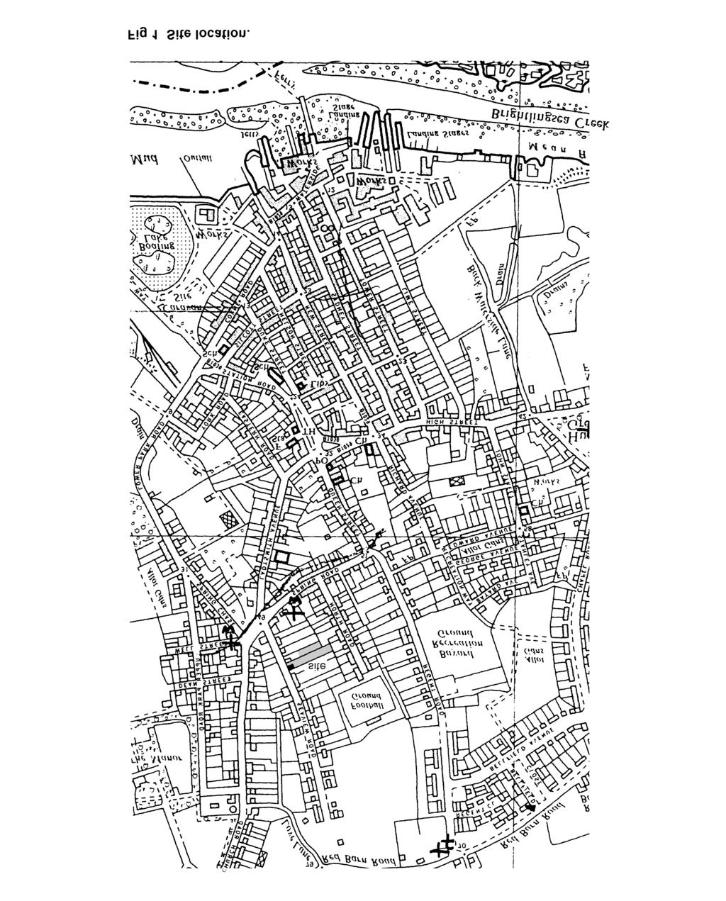
2 Contents 1 Summary 1 2 Introduction 1 3 Archaeological background 1 4 Aim 1 5 Methods 2 6 Results 2 7 Finds 3 8 Discussion 3 9 Acknowledgements 3 10 References 4 11 Glossary 4 12 Archive deposition 4 Figures after p 5 EHCR summary sheet List of figures Fig 1 Site location. Fig 2 Plan of trenches, showing features. Fig 3 Feature sections.
3 CAT Report 263: An archaeological evaluation at 16 Seaview Road, Brightlingsea, Essex: February Summary An evaluation was carried out in February 2004 on a plot of land to the rear of 16 Seaview Road, Brightlingsea, Essex. The three trenches did not produce any features or finds of archaeological significance. A linear feature, possibly an old field boundary of post-medieval date, was discovered, as well as two undated cut features. Several trees have been recently felled on the site which have left their mark as tree bowls and disturbance. The absence of features and significant finds in the topsoil indicate that the site is devoid of significant archaeological remains. 2 Introduction 2.1 This is the archive report on an evaluation carried out at 16 Seaview Road, Brightlingsea, Essex by the Colchester Archaeological Trust (CAT) on the 16th and 18th February Highfield Homes submitted a planning application for a residential development of eight houses (planning application no 03/02287/FUL). The archaeological evaluation was necessary in order to assess any surviving archaeological remains that may be affected by the development. 2.2 Brightlingsea is located 1.2 km south-east of Colchester, where Brightlingsea Creek flows into the River Colne (Fig 1). The evaluation site is situated to the north of Brightlingsea town centre, on the eastern side of Seaview Road (at NGR TM ). The site currently consists of the bungalow and the rear garden of 16 Seaview Road, as well as part of the garden of the adjacent no 14. The level of the site varies between 17.5m and 18.6m AOD. To the north, east and south, the site is bounded by fences, walls or hedges which separate the property from those adjacent to it. To the west is Seaview Road. 2.3 All fieldwork was done in accordance with a Written Scheme of Investigation agreed with the Heritage Advice Management and Promotion (HAMP) group officer of Essex County Council. 2.4 This report follows the IFA s Standard and guidance for an archaeological field evaluation (1999). 3 Archaeological background 3.1 Evidence of probable Bronze Age and later prehistoric activity can be seen on aerial photographs of the area. On the fringes of the town, cropmarks of a group of ringditches surrounding a rectilinear enclosure have been recorded (Essex Heritage Conservation Record or EHCR 2234). Another rectilinear enclosure with other cropmarks is visible on the northern side of the town (EHCR 2141). Finds of flint tools within the town indicate that this prehistoric activity may have extended further towards the development site (EHCR 2233; EHCR 2158). 3.2 Previous discoveries in the vicinity of the site include substantial quantities of Roman building material (tesserae, roof tiles and flue tiles), and Roman and Belgic pottery (EHCR 2132; EHCR 2133). Situated 500m to the west is the site of a Roman building. 4 Aim The aim of the fieldwork was to establish and record the character, extent, date, significance and condition of any archaeological remains likely to be affected by the development. 1
4 CAT Report 263: An archaeological evaluation at 16 Seaview Road, Brightlingsea, Essex: February Methods 5.1 Three trenches (T1-T3) were excavated, equating to nearly 5% of the 0.3 hectare area. All trenches were excavated using a mechanical excavator with a toothless 1.2m-wide ditching bucket, under archaeological supervision. The machine digging was stopped at the first archaeological features. Where there were no features, the trench was machine dug to natural level. 5.2 Individual records of layers and features were entered on CAT pro-forma record sheets. 5.3 Section drawings of features and layers were made at a scale of 1:10. Plans of features were made at 1: Finds were registered on CAT record sheets and assigned find numbers according to context. Finds were washed, marked and bagged according to context. 5.5 Colour photographs of features were taken with a digital camera and a 35mm slide camera. 6 Results (Figs 2-3) A similar soil profiled was observed In all three trenches. Mid to dark brown loose sandy loam topsoil with occasional stones (Layer or L1) overlaid a mid reddish brown silty sand subsoil (L2). At between 700m and 750mm below modern ground-level, natural ground was encountered (L3). 6.1 T1 An east to west-aligned trench (T1) was excavated along the northern side of the site, measuring 54m in length. One feature was recorded in this trench; F1, a 750mm-wide, long shallow linear cut. F1 was filled by mid brown sandy loam with rare to infrequent small stones. The feature contained peg-tile, post-medieval brick and post-medieval and modern pottery in its fill. It was cut into L3 and was aligned north-west to south-east. It was originally interpreted as being a sewer trench, but on excavation it was found to be void of any pipes. In the centre of T1 was a disturbed area with various amorphous features, probably tree bowls. These were cleaned but not excavated. Except for these features, the trench did not show signs of any disturbance. One fragment of possible Roman roof tile was retrieved from the topsoil as well as a few pieces of peg-tile and modern china. Tree-root activity was evident throughout. Natural ground consisted of loose, orange-coloured sand. 6.2 T2 The second trench (T2) was aligned north to south and placed at the eastern end of the garden, measuring 25.4m in length. It was placed in an area where 300mm of topsoil had already been scraped off by the house builder. A linear feature (F3), on the same alignment as F1 and probably a continuation of it, was recorded at the northern end of the trench. This feature had the same fill and was also sealed by L1 and L2. It is interpreted as having been a field boundary ditch. At the southern end of the trench, another linear feature was recorded, on a north to south alignment (F2). This was filled by mid brown sandy loam with common small stones but this produced no dating evidence. F2 was sealed by L1 and L2. It appeared to be cut into L3; however, it could be a natural dip. The feature extended beyond the limit of the trench so its width could not be established. Natural ground in T2 was clayey at the northern end of the trench. It then became sandy, with gravel patches appearing at the southern end. 6.3 T3 T3 was placed in the southern area of the plot (the former garden of 14 Seaview Road), in an area which had been stripped of 300mm of topsoil. It was 30m in length. After L2 subsoil had been stripped off, a pit (F4) was exposed at the southern end of the trench. This was filled by mid brown sandy loam with occasional small to medium stones. The feature, which cut natural sand L3, is undated. 2
5 CAT Report 263: An archaeological evaluation at 16 Seaview Road, Brightlingsea, Essex: February Finds Post-medieval and modern pottery was identified by Howard Brooks of CAT. Fabric codes refer to Cotter Table: list of finds by context. Find no Context Weight Description Date in g 1 L1, T1 136 Peg-tile medieval to modern 1 L1, T1 4 Modern ironstone pottery (Fabric 48d) 19th/20th century 2 L1/L2, T1 66 Tudor brick fragment 17th/18th century 2 L1/L2, T1 60 Either a modern ceramic pipe fragment or fragment of Roman modern or Roman imbrex (roof tile) 2 L1/L2,T1 6 Oyster-shell fragment undated 2 L1/L2,T1 2 Charcoal undated 3 L2 or F1, T1 70 Peg-tile medieval to modern 4 F1, T1 113 Peg-tile medieval to modern 4 F1, T1 406 Tudor brick fragments 17th/18th century 4 F1, T1 1 Modern ironstone pottery (Fabric 48d) 19th/20th century 4 F1, T1 2 Coal modern 4 F1, T1 19 Post-medieval earthenware pottery (Fabric 40bl) 17th century 8 Discussion The three trenches did not produce anything of archaeological interest. The linear features F1 and F3 appear to be the remains of a field boundary of possible postmedieval date, as prior to the land being developed for housing along Seaview Road it was an agricultural field. Several trees have been recently felled within the site which have left their mark as tree bowls and disturbance, observed in T1. F2 and F4 were not datable as they contained no finds. These were the only features. There was no evidence of Roman buildings, nor was there any Roman material in the topsoil which would indicate the presence on the site of such remains. The site was largely undisturbed, and therefore it is the opinion of the author that archaeological remains are absent rather than having been destroyed. 9 Acknowledgements CAT would like to thank Highfield Homes for funding the work and for assistance on site. The site work was carried out by the author and Chris Lister. The project was monitored by Pat Connell, the HAMP group officer. 3
6 CAT Report 263: An archaeological evaluation at 16 Seaview Road, Brightlingsea, Essex: February References Cotter, J 2000 Post-Roman pottery from excavations in Colchester, , Colchester Archaeological Report 7 IFA (Institute of Field Archaeologists) 1999 Standard and guidance for an archaeological field evaluation 11 Glossary Bronze Age the period between c 2500 BC and 700 BC context specific location on an archaeological site, especially one where finds are made cropmarks ancient features which show as lines and other marks in crops due to differential growth of plants according to presence or absence of archaeological features EHCR Essex Heritage Conservation Record, Essex County Council feature an identifiable thing like a pit, a wall, a drain, a floor; can contain contexts HAMP Heritage Advice Management and Promotion group, Essex County Council NGR National Grid Reference natural geological deposit undisturbed by human activity Roman the period from AD 43-AD Archive deposition The archive is held by the Colchester Archaeological Trust at 12 Lexden Road, Colchester, Essex CO3 3NF, but it will be permanently deposited with Colchester Museums under accession code Colchester Archaeological Trust 2004 Distribution list: Mark Glibbery, Highfield Homes Pat Connell of the ECC HAMP group Essex Heritage Conservation Record, Essex County Council 4
7 CAT Report 263: An archaeological evaluation at 16 Seaview Road, Brightlingsea, Essex: February 2004 Colchester Archaeological Trust 12 Lexden Road, Colchester, Essex CO3 3NF tel.: (01206) tel./fax: (01206) Checked by: Philip Crummy Date: Adams c:/reports04/seaviewroad/report263.doc 5
8
9 SITE F1 F3 F metres F2 Fig 2 Plan of trenches, showing features. Reproduced with permission of A & B Surveys.
10
11 Essex Heritage Conservation Record/ Essex Archaeology and History Summary sheet Site name/address: 16 Seaview Road, Brightlingsea, Essex Parish: Brightlingsea District: Tendring NGR: TM (c) ECC HAMP group site code: Type of work: Evaluation Site director/group: Colchester Archaeological Trust Date of work: Size of area investigated: 16th and 18th February hectares Location of finds/curating museum: Colchester Museums Further seasons anticipated? No Final report: CAT Report 263 Funding source: Developer Related EHCR nos: 2132, 2133, 2141, 2157, 2158, 2159, 2162, 2233, 2234, 2310 Periods represented: None Summary of fieldwork results: An evaluation was carried out in February 2004 on a plot of land to the rear of 16 Seaview Road, Brightlingsea, Essex. The three trenches did not produce any features or finds of archaeological significance. A linear feature, possibly an old field boundary of post-medieval date, was located as well as two undated cut features. Several trees have been recently felled on the site which have left their mark as tree bowls and disturbance. The absence of features and significant finds in the topsoil indicate that the site is devoid of archaeological remains. Previous summaries/reports: None Author of summary: K Orr Date of summary: March 2004
An archaeological watching brief and recording at Brightlingsea Quarry, Moverons Lane, Brightlingsea, Essex October 2003
 An archaeological watching brief and recording at Brightlingsea Quarry, Moverons Lane, Brightlingsea, Essex commissioned by Mineral Services Ltd on behalf of Alresford Sand & Ballast Co Ltd report prepared
An archaeological evaluation at the Blackwater Hotel, Church Road, West Mersea, Colchester, Essex March 2003
 An archaeological evaluation at the Blackwater Hotel, Church Road, West Mersea, Colchester, Essex report prepared by Laura Pooley on behalf of Dolphin Developments (U.K) Ltd NGR: TM 0082 1259 CAT project
An archaeological evaluation in the playground of Colchester Royal Grammar School, Lexden Road, Colchester, Essex
 An archaeological evaluation in the playground of Colchester Royal Grammar School, Lexden Road, Colchester, Essex February 2002 on behalf of Roff Marsh Partnership CAT project code: 02/2c Colchester Museum
An archaeological watching brief at Sheepen, Colchester, Essex November-December 2003
 An archaeological watching brief at Sheepen, Colchester, Essex November-December 2003 report prepared by Ben Holloway on behalf of Colchester Borough Council CAT project ref.: 03/11c Colchester Museums
An archaeological evaluation by trial-trenching at Playgolf, Bakers Lane, Westhouse Farm, Colchester, Essex
 An archaeological evaluation by trial-trenching at Playgolf, Bakers Lane, Westhouse Farm, Colchester, Essex commissioned by Mr Stephen Belchem on behalf of ADP Ltd. report prepared by Chris Lister Planning
An archaeological evaluation at the Lexden Wood Golf Club (Westhouse Farm), Lexden, Colchester, Essex
, Lexden, Colchester, Essex") An archaeological evaluation at the Lexden Wood Golf Club (Westhouse Farm), Lexden, Colchester, Essex January 2000 Archive report on behalf of Lexden Wood Golf Club Colchester Archaeological Trust 12 Lexden
An archaeological evaluation at the Lexden Wood Golf Club (Westhouse Farm), Lexden, Colchester, Essex January 2000 Archive report on behalf of Lexden Wood Golf Club Colchester Archaeological Trust 12 Lexden
Archaeological evaluation at the Onley Arms, The Street, Stisted, Essex
 Archaeological evaluation at the Onley Arms, The Street, Stisted, Essex November 2014 report by Pip Parmenter and Adam Wightman with a contribution from Stephen Benfield and illustrations by Emma Holloway
An archaeological watching brief on one section of an Anglian Water main Spring Lane, Lexden, Colchester
 An archaeological watching brief on one section of an Anglian Water main Spring Lane, Lexden, Colchester April-September 2001 on behalf of Breheny Contractors CAT project ref.: 01/4D Colchester Museum
An archaeological evaluation by trial-trenching at Scotts Farm, Lodge Lane, Purleigh, Essex October 2011
 An archaeological evaluation by trial-trenching at Scotts Farm, Lodge Lane, Purleigh, Essex October 2011 report prepared by Adam Wightman on behalf of Richard Emans CAT project ref.: 11/10a NGR: TL 582719
Archaeological trial-trenching evaluation at Chappel Farm, Little Totham, Essex. April 2013
 Archaeological trial-trenching evaluation at Chappel Farm, Little Totham, Essex April 2013 report prepared by Ben Holloway commissioned by Tim Harbord Associates on behalf of Mr Tom Howie Planning reference:
An archaeological watching brief and evaluation at Great Notley business park, near Braintree, Essex June-September 2005
 An archaeological watching brief and evaluation at Great Notley business park, near Braintree, Essex report prepared by Kate Orr commissioned by Andrew Martin Associates Ltd on behalf of Countryside Properties
An archaeological watching brief at St Leonard s church, Hythe Hill, Colchester, Essex
 An archaeological watching brief at St Leonard s church, Hythe Hill, Colchester, Essex report prepared by Adam Wightman on behalf of Dorvell Construction CAT project ref.: 10/5d Colchester and Ipswich
Essex Historic Environment Record/ Essex Archaeology and History
 Essex Historic Environment Record/ Essex Archaeology and History CAT Report 578 Summary sheet Address: Kingswode Hoe School, Sussex Road, Colchester, Essex Parish: Colchester NGR: TL 9835 2528 Type of
ARCHAEOLOGICAL MONITORING REPORT
 ARCHAEOLOGICAL MONITORING REPORT SCCAS REPORT No. 2009/324 Thorington Hall, Stoke by Nayland SBN 087 HER Information Date of Fieldwork: November 2009 - January 2010 Grid Reference: TM 0131 3546 Funding
New Composting Centre, Ashgrove Farm, Ardley, Oxfordshire
 New Composting Centre, Ashgrove Farm, Ardley, Oxfordshire An Archaeological Watching Brief For Agrivert Limited by Andrew Weale Thames Valley Archaeological Services Ltd Site Code AFA 09/20 August 2009
Colchester Archaeological Trust Ltd. A Fieldwalking Survey at Birch, Colchester for ARC Southern Ltd
 Colchester Archaeological Trust Ltd A Fieldwalking Survey at Birch, Colchester for ARC Southern Ltd November 1997 CONTENTS page Summary... 1 Background... 1 Methods... 1 Retrieval Policy... 2 Conditions...
An archaeological evaluation at Thistle Hall, Mope Lane, Wickham Bishops, Essex July 2009
 An archaeological evaluation at Thistle Hall, Mope Lane, Wickham Bishops, Essex July 2009 report prepared by Howard Brooks and Ben Holloway on behalf of Clarity Ecoworks Ltd CAT project ref.: 09/1f ECC
Archaeological trial-trenching evaluation at Dale Hall, Cox s Hill, Lawford, Essex
 Archaeological trial-trenching evaluation at Dale Hall, Cox s Hill, Lawford, Essex Fieldwork directed by Ben Holloway report prepared by Howard Brooks with a contribution by Stephen Benfield on behalf
An archaeological excavation of test-holes at St Barnabas Church, Alphamstone, Essex March and May 2007
 An archaeological excavation of test-holes at St Barnabas Church, Alphamstone, Essex March and May 2007 report prepared by Kate Orr commissioned by David Whymark Building Design and Conservation on behalf
Report on archaeological fieldwalking and metal-detecting survey on land adjacent to Breck Farm, Stody, Norfolk
 Report on archaeological fieldwalking and metal-detecting survey on land adjacent to Breck Farm, Stody, Norfolk report prepared by Howard Brooks and Ben Holloway with contributions by Emma Spurgeon and
Grim s Ditch, Starveall Farm, Wootton, Woodstock, Oxfordshire
 Grim s Ditch, Starveall Farm, Wootton, Woodstock, Oxfordshire An Archaeological Recording Action For Empire Homes by Steve Ford Thames Valley Archaeological Services Ltd Site Code SFW06/118 November 2006
Test-Pit 3: 31 Park Street (SK )
") -Pit 3: 31 Park Street (SK 40732 03178) -Pit 3 was excavated in a flower bed in the rear garden of 31 Park Street, on the northern side of the street and west of an alleyway leading to St Peter s Church,
-Pit 3: 31 Park Street (SK 40732 03178) -Pit 3 was excavated in a flower bed in the rear garden of 31 Park Street, on the northern side of the street and west of an alleyway leading to St Peter s Church,
Former Whitbread Training Centre Site, Abbey Street, Faversham, Kent Interim Archaeological Report Phase 1 November 2009
 Former Whitbread Training Centre Site, Abbey Street, Faversham, Kent Interim Archaeological Report Phase 1 November 2009 SWAT. Archaeology Swale and Thames Archaeological Survey Company School Farm Oast,
2 Saxon Way, Old Windsor, Berkshire
 2 Saxon Way, Old Windsor, Berkshire An Archaeological Watching Brief For Mrs J. McGillicuddy by Pamela Jenkins Thames Valley Archaeological Services Ltd Site Code SWO 05/67 August 2005 Summary Site name:
Archaeological. Monitoring & Recording Report. Fulbourn Primary School, Cambridgeshire. Archaeological Monitoring & Recording Report.
 Fulbourn Primary School, Cambridgeshire Archaeological Monitoring & Recording Report October 2014 Client: Cambridgeshire County Council OA East Report No: 1689 OASIS No: oxfordar3-192890 NGR: TL 5190 5613
Report on an archaeological trial-trenching evaluation: proposed reservoir site, land north of Redgate House, Wherstead, Suffolk.
 Report on an archaeological trial-trenching evaluation: proposed reservoir site, land north of Redgate House, Wherstead, Suffolk. August-September 2010 report prepared by Ben Holloway and Howard Brooks
Silwood Farm, Silwood Park, Cheapside Road, Ascot, Berkshire
 Silwood Farm, Silwood Park, Cheapside Road, Ascot, Berkshire An Archaeological Watching Brief For Imperial College London by Tim Dawson Thames Valley Archaeological Services Ltd Site Code SFA 09/10 April
ARCHAEOLOGICAL EVALUATION AT BRIGHTON POLYTECHNIC, NORTH FIELD SITE, VARLEY HALLS, COLDEAN LANE, BRIGHTON. by Ian Greig MA AIFA.
 ARCHAEOLOGICAL EVALUATION AT BRIGHTON POLYTECHNIC, NORTH FIELD SITE, VARLEY HALLS, COLDEAN LANE, BRIGHTON by Ian Greig MA AIFA May 1992 South Eastern Archaeological Services Field Archaeology Unit White
An archaeological evaluation by test-pitting on the putting green and in the nursery, Upper Castle Park, Colchester, Essex April 2007
 An archaeological evaluation by test-pitting on the putting green and in the nursery, Upper Castle Park, Colchester, Essex report prepared by Kate Orr on behalf of Colchester Borough Council CAT project
7. Prehistoric features and an early medieval enclosure at Coonagh West, Co. Limerick Kate Taylor
 7. Prehistoric features and an early medieval enclosure at Coonagh West, Co. Limerick Kate Taylor Illus. 1 Location of the site in Coonagh West, Co. Limerick (based on the Ordnance Survey Ireland map)
Archaeological evaluation by trial-trenching on land adjacent to 25 East Hill, Colchester, Essex, CO1 2QX September 2015
 Archaeological evaluation by trial-trenching on land adjacent to 25 East Hill, Colchester, Essex, CO1 2QX September 2015 by Laura Pooley with contributions by Stephen Benfield, illustrations by Chris Lister
39, Walnut Tree Lane, Sudbury (SUY 073) Planning Application No. B/04/02019/FUL Archaeological Monitoring Report No. 2005/112 OASIS ID no.
 Planning Application No. B/04/02019/FUL Archaeological Monitoring Report No. 2005/112 OASIS ID no.") 39, Walnut Tree Lane, Sudbury (SUY 073) Planning Application No. B/04/02019/FUL Archaeological Monitoring Report No. 2005/112 OASIS ID no. 9273 Summary Sudbury, 39, Walnut Tree Lane, Sudbury (TL/869412;
39, Walnut Tree Lane, Sudbury (SUY 073) Planning Application No. B/04/02019/FUL Archaeological Monitoring Report No. 2005/112 OASIS ID no. 9273 Summary Sudbury, 39, Walnut Tree Lane, Sudbury (TL/869412;
Greater London GREATER LONDON 3/606 (E ) TQ
 TQ") GREATER LONDON City of London 3/606 (E.01.6024) TQ 30358150 1 PLOUGH PLACE, CITY OF LONDON An Archaeological Watching Brief at 1 Plough Place, City of London, London EC4 Butler, J London : Pre-Construct
GREATER LONDON City of London 3/606 (E.01.6024) TQ 30358150 1 PLOUGH PLACE, CITY OF LONDON An Archaeological Watching Brief at 1 Plough Place, City of London, London EC4 Butler, J London : Pre-Construct
FURTHER MIDDLE SAXON EVIDENCE AT COOK STREET, SOUTHAMPTON (SOU 567)
") Roc. Hampshire Field Club Archaeol. Soc 52,1997, 77-87 (Hampshire Studies 1997) FURTHER MIDDLE SAXON EVIDENCE AT COOK STREET, SOUTHAMPTON (SOU 567) By M F GARNER andj VINCENT with a contribution byjacqueline
Roc. Hampshire Field Club Archaeol. Soc 52,1997, 77-87 (Hampshire Studies 1997) FURTHER MIDDLE SAXON EVIDENCE AT COOK STREET, SOUTHAMPTON (SOU 567) By M F GARNER andj VINCENT with a contribution byjacqueline
Church of St Peter and St Paul, Great Missenden, Buckinghamshire
 Church of St Peter and St Paul, Great Missenden, Buckinghamshire An Archaeological Watching Brief for the Parish of Great Missenden by Andrew Taylor Thames Valley Archaeological Services Ltd Site Code
Monitoring Report No. 99
 Monitoring Report No. 99 Enniskillen Castle Co. Fermanagh AE/06/23 Cormac McSparron Site Specific Information Site Name: Townland: Enniskillen Castle Enniskillen SMR No: FER 211:039 Grid Ref: County: Excavation
Neolithic and Roman remains on the Lufkins Farm reservoir site, Great Bentley, Essex October-November 2007
 Neolithic and Roman remains on the Lufkins Farm reservoir site, Great Bentley, Essex report prepared by Howard Brooks and Ben Holloway on behalf of A O Poole & Sons and George Wright Farms NGR: TM 0975
ARCHAEOLOGICAL EVALUATION REPORT. Home Farm, Woolverstone
 ARCHAEOLOGICAL EVALUATION REPORT Home Farm, Woolverstone WLV 047 A REPORT ON THE ARCHAEOLOGICAL EVALUATION, 2007 Kieron Heard Field Team Suffolk County Council Archaeological Service December 2007 Lucy
Grange Farm, Widmer End, Hughenden, Buckinghamshire
 Grange Farm, Widmer End, Hughenden, Buckinghamshire An Archaeological Evaluation for British Flora by Andy Taylor Thames Valley Archaeological Services Ltd Site Code GFH 05/63 July 2005 Summary Site name:
Archaeological Watching Brief (Phase 2) at Court Lodge Farm, Aldington, near Ashford, Kent December 2011
 at Court Lodge Farm, Aldington, near Ashford, Kent December 2011") Archaeological Watching Brief (Phase 2) at Court Lodge Farm, Aldington, near Ashford, Kent December 2011 SWAT. Archaeology Swale and Thames Archaeological Survey Company School Farm Oast, Graveney Road
Archaeological Watching Brief (Phase 2) at Court Lodge Farm, Aldington, near Ashford, Kent December 2011 SWAT. Archaeology Swale and Thames Archaeological Survey Company School Farm Oast, Graveney Road
Monitoring Report No Sacred Heart Church Aghamore Boho Co. Fermanagh AE/10/116E. Brian Sloan L/2009/1262/F
 Monitoring Report No. 202 Sacred Heart Church Aghamore Boho Co. Fermanagh AE/10/116E Brian Sloan L/2009/1262/F Site Specific Information Site Address: Sacred Heart Church, Aghamore, Boho, Co. Fermanagh
Whitton Church Lane (Recreation Ground) WHI 014
 WHI 014") ARCHAEOLOGICAL EVALUATION REPORT Whitton Church Lane (Recreation Ground) WHI 014 A REPORT ON THE ARCHAEOLOGICAL EVALUATION, 2008 (Planning app. no. 1362/05/FUL) Jezz Meredith Field Team Suffolk C.C. Archaeological
ARCHAEOLOGICAL EVALUATION REPORT Whitton Church Lane (Recreation Ground) WHI 014 A REPORT ON THE ARCHAEOLOGICAL EVALUATION, 2008 (Planning app. no. 1362/05/FUL) Jezz Meredith Field Team Suffolk C.C. Archaeological
Undley Hall, Lakenheath LKH 307
 ARCHAEOLOGICAL EVALUATION AND MONITORING REPORT SCCAS REPORT No. 2010/005 Undley Hall, Lakenheath LKH 307 E. Muldowney SCCAS January 2010 www.suffolkcc.gov.uk/e-and-t/archaeology Lucy Robinson, County
Archaeological sites and find spots in the parish of Burghclere - SMR no. OS Grid Ref. Site Name Classification Period
 Archaeological sites and find spots in the parish of Burghclere - SMR no. OS Grid Ref. Site Name Classification Period SU45NE 1A SU46880 59200 Ridgemoor Farm Inhumation Burial At Ridgemoor Farm, on the
Land North of Pesthouse Lane Barham Suffolk BRH 054
 Land North of Pesthouse Lane Barham Suffolk BRH 054 Archaeological Evaluation Report SCCAS Report No. 2012/142 Client: Barham Parish Council Author: Jezz Meredith September 2012 SCCAS Land North of Pesthouse
Wantage County Primary School, Garston Lane, Wantage, Oxfordshire
 Wantage County Primary School, Garston Lane, Wantage, Oxfordshire An Archaeological Evaluation for Oxfordshire County Council by Erlend Hindmarch Thames Valley Archaeological Services Ltd Site Code GLW
Excavations of Late Iron Age and Roman features and a Roman road north of Gosbecks Archaeological Park, Colchester, Essex
 Excavations of Late Iron Age and Roman features and a Roman road north of Gosbecks Archaeological Park, Colchester, Essex 1995-1996 report by Stephen Benfield with contributions from Justine Bailey, Peter
Fieldwalking at Cottam 1994 (COT94F)
") Fieldwalking at Cottam 1994 (COT94F) Tony Austin & Elizabeth Jelley (19 Jan 29) 1. Introduction During the winter of 1994 students from the Department of Archaeology at the University of York undertook
Fieldwalking at Cottam 1994 (COT94F) Tony Austin & Elizabeth Jelley (19 Jan 29) 1. Introduction During the winter of 1994 students from the Department of Archaeology at the University of York undertook
Cambridge Archaeology Field Group. Fieldwalking on the Childerley Estate Cambridgeshire
 Cambridge Archaeology Field Group Fieldwalking on the Childerley Estate Cambridgeshire 2009 to 2014 Summary Fieldwalking on the Childerley estate of Martin Jenkins and Family has revealed, up to March
Archaeological Evaluation Report
 16-18 Church Street Brill Buckinghamshire o a February 2008 Client: Stephen Moss Developments Issue N o : 1 OA Job N o : 3858 Planning Ref N o : 06/01304 NGR: SP 6553 1377 Client Name: Stephen Moss Developments
Excavation. Post-Medieval Ditches. Land off Norwich Common Road Wymondham Norfolk. Excavation. Client: November 2013
 Land off Norwich Common Road Wymondham Norfolk. Excavation November 2013 Client: OA East Report No: 1546 OASIS No: oxfordar3-163105 NGR: TG 12770 02684 Excavation Post-Medieval Ditches Post-Medieval Ditches
3. The new face of Bronze Age pottery Jacinta Kiely and Bruce Sutton
 3. The new face of Bronze Age pottery Jacinta Kiely and Bruce Sutton Illus. 1 Location map of Early Bronze Age site at Mitchelstown, Co. Cork (based on the Ordnance Survey Ireland map) A previously unknown
An archaeological evaluation at Dry Street, Basildon, Essex May-June 2006
 An archaeological evaluation at Dry Street, Basildon, Essex May-June 2006 report prepared by Howard Brooks commissioned by Entec on behalf of English Partnerships CAT project ref: 06/5c Site code: BADS
Cambridge Archaeology Field Group. Fieldwalking on the Childerley Estate, Cambridgeshire. Autumn 2014 to Spring Third interim report
 Cambridge Archaeology Field Group Fieldwalking on the Childerley Estate, Cambridgeshire Autumn 2014 to Spring 2015 Third interim report Summary Field walking on the Childerley estate of Martin Jenkins
Old Brewery Close and Walton Street, Aylesbury, Buckinghamshire
 Old Brewery Close and Walton Street, Aylesbury, Buckinghamshire An Archaeological Evaluation for Berkeley Homes (Oxford and Chiltern) Ltd by Sian Anthony Thames Valley Archaeological Services Ltd Site
Moated Site at Manor Farm, Islip, Oxfordshire
 Moated Site at Manor Farm, Islip, Oxfordshire An Archaeological Excavation By Jo Pine Site Code MFI05 December 2007 Summary Site name: Moated Site at Manor Farm, Islip, Oxfordshire Grid reference: SP 5298
M ereside, H anmer, Clwyd
 THE CLWYD-POWYS ARCHAEOLOGICAL TRUST M ereside, H anmer, Clwyd ARCHAEOLOGICAL EVALUATION CPAT Report No 81 CPAT Report No 81 Mereside, Hanmer, Clwyd ARCHAEOLOGICAL EVALUATION bywg Owen November 1993 Report
S E R V I C E S. St John the Baptist Church, Penshurst, Kent. Archaeological Watching Brief. by Daniel Bray and James McNicoll-Norbury
 T H A M E S V A L L E Y ARCHAEOLOGICAL S E R V I C E S St John the Baptist Church, Penshurst, Kent Archaeological Watching Brief by Daniel Bray and James McNicoll-Norbury Site Code: JPK11/25 (TQ 5273 4385)
THE RAVENSTONE BEAKER
 DISCOVERY THE RAVENSTONE BEAKER K. J. FIELD The discovery of the Ravenstone Beaker (Plate Xa Fig. 1) was made by members of the Wolverton and District Archaeological Society engaged on a routine field
E x cav atio n R e p o r t
 Medieval Trackway on land at Ivy Farm Royston, Hertfordshire Excavation Report E x cav atio n R e p o r t October 2011 Client: CgMs Consulting OA East Report No: 1305 OASIS No: oxfordar3-112012 NGR: TL
Archaeological Evaluation at Alconbury Weald Enterprise Zone
 Archaeological Evaluation at Alconbury Weald Enterprise Zone Archaeological Evaluation Report June 2015 Client: CgMS OA East Report No: 1768 OASIS No: oxfordar3-212519 NGR: TL 1975 7684 Archaeological
Oxfordshire. Wallingford. St Mary-le-More. Archaeological Watching Brief Report. Client: JBKS Architects and St Mary s Renewal Campaign.
 St Mary-le-More Wallingford Oxfordshire Archaeological Watching Brief Report February 2010 Client: JBKS Architects and St Mary s Renewal Campaign Issue No:1 OA Job No: 4432 NGR: SU 6071 8933 Archaeological
Archaeological trial-trenching evaluation on land west of Hams Farmhouse, Back Road, Trimley St Martin, Suffolk
 Archaeological trial-trenching evaluation on land west of Hams Farmhouse, Back Road, Trimley St Martin, Suffolk Fieldwork date: January 2014 report prepared by Ben Holloway and Howard Brooks with contributions
Archaeological Material From Spa Ghyll Farm, Aldfield
 Archaeological Material From Spa Ghyll Farm, Aldfield Introduction Following discussions with Linda Smith the Rural Archaeologist for North Yorkshire County Council, Robert Morgan of 3D Archaeological
Fort Arbeia and the Roman Empire in Britain 2012 FIELD REPORT
 Fort Arbeia and the Roman Empire in Britain 2012 FIELD REPORT Background Information Lead PI: Paul Bidwell Report completed by: Paul Bidwell Period Covered by this report: 17 June to 25 August 2012 Date
THE UNFOLDING ARCHAEOLOGY OF CHELTENHAM
 THE UNFOLDING ARCHAEOLOGY OF CHELTENHAM The archaeology collection of Cheltenham Art Gallery & Museum contains a rich quantity of material relating to the prehistoric and Roman occupation of the North
1 The East Oxford Archaeology and History Project
 1 The East Oxford Archaeology and History Project EXOP TEST PIT 72 Location: Bartlemas Chapel, Cowley Date of excavation: 6-8 November 2013. Area of excavation: 0.8m x 1.2m, at the eastern end of the chapel.
Moray Archaeology For All Project
 School children learning how to identify finds. (Above) A flint tool found at Clarkly Hill. Copyright: Leanne Demay Moray Archaeology For All Project ational Museums Scotland have been excavating in Moray
Erection of wind turbine, Mains of Loanhead, Old Rayne, AB52 6SX
 Erection of wind turbine, Mains of Loanhead, Old Rayne, AB52 6SX Ltd 23 November 2011 Erection of wind turbine, Mains of Loanhead, Old Rayne, AB52 6SX CONTENTS 1 INTRODUCTION 3 2 ARCHAEOLOGICAL BACKGROUND
SALVAGE EXCAVATIONS AT OLD DOWN FARM, EAST MEON
 Proc. Hants. Field Club Archaeol. Soc. 36, 1980, 153-160. 153 SALVAGE EXCAVATIONS AT OLD DOWN FARM, EAST MEON By RICHARD WHINNEY AND GEORGE WALKER INTRODUCTION The site was discovered by chance in December
Greater London Region GREATER LONDON 3/567 (E.01.K099) TQ BERMONDSEY STREET AND GIFCO BUILDING AND CAR PARK
 TQ BERMONDSEY STREET AND GIFCO BUILDING AND CAR PARK") GREATER LONDON 3/567 (E.01.K099) TQ 33307955 156-170 BERMONDSEY STREET AND GIFCO BUILDING AND CAR PARK Assessment of an Archaeological Excavation at 156-170 Bermondsey Street and GIFCO Building and Car
GREATER LONDON 3/567 (E.01.K099) TQ 33307955 156-170 BERMONDSEY STREET AND GIFCO BUILDING AND CAR PARK Assessment of an Archaeological Excavation at 156-170 Bermondsey Street and GIFCO Building and Car
ARCHAEOLOGICAL S E R V I C E S. St Nicholas' Church, Barrack Hill, Nether Winchendon, Buckinghamshire. Archaeological Watching Brief.
 T H A M E S V A L L E Y ARCHAEOLOGICAL S E R V I C E S St Nicholas' Church, Barrack Hill, Nether Winchendon, Buckinghamshire Archaeological Watching Brief by Steven Crabb Site Code: STW17/229 (SP 7735
CUMBRIA 2/635 (C ) NY
 NY") CUMBRIA Allerdale 2/635 (C.16.6017) NY 11803070 BRIDGE STREET, COCKERMOUTH Report on an Archaeological Evaluation at Bridge Street, Cockermouth, Cumbria (Report No. 5/00) Grahame, R Carlisle : Carlisle
CUMBRIA Allerdale 2/635 (C.16.6017) NY 11803070 BRIDGE STREET, COCKERMOUTH Report on an Archaeological Evaluation at Bridge Street, Cockermouth, Cumbria (Report No. 5/00) Grahame, R Carlisle : Carlisle
Earthworks at Glebe Farm, Tilshead
 Earthworks at Glebe Farm, Tilshead Site Code TL004 Archaeological Field Evaluation And Post-Excavation Assessment Report No. 167.0801 Report date November 2011 Authors R.Holley & L.Amadio 1 Earthworks
39 & 41 MEDINA AVENUE, NEWPORT, ISLE OF WIGHT AN ARCHAEOLOGICAL EVALUATION REPORT. Planning Application Ref: Pre-Application
 39 & 41 MEDINA AVENUE, NEWPORT, ISLE OF WIGHT AN ARCHAEOLOGICAL EVALUATION REPORT National Grid Reference: SZ 5025 8861 Planning Application Ref: Pre-Application By: AOC ARCHAEOLOGY GROUP Commissioned
Limited Archaeological Testing at the Sands House Annapolis, Maryland
 Limited Archaeological Testing at the Sands House Annapolis, Maryland Report Submitted to Four Rivers Heritage Area by John E. Kille, Ph.D., Shawn Sharpe, and Al Luckenbach, Ph.D February 10, 2012 In May-June
THE EXCAVATION OF A BURNT MOUND AT HARBRIDGE, HAMPSHIRE
 Proc Hampshire Field ClubArchaeolSoc5i, 1999,172-179 (Hampshire Studies 1999) THE EXCAVATION OF A BURNT MOUND AT HARBRIDGE, HAMPSHIRE by S J SHENNAN ABSTRACT A burnt mound of Late Brome Age date, as indicated
Centre for Archaeological Fieldwork,
 Centre for Archaeological Fieldwork, School of Geography, Archaeology and Palaeoecology, Queen s University Belfast Data Structure Report No. 70 (preliminary report) Archaeological Excavations at Carrickfergus
AN EARLY MEDIEVAL RUBBISH-PIT AT CATHERINGTON, HAMPSHIRE Bj>J. S. PILE and K. J. BARTON
 AN EARLY MEDIEVAL RUBBISH-PIT AT CATHERINGTON, HAMPSHIRE Bj>J. S. PILE and K. J. BARTON INTRODUCTION THE SITE (fig. 21) is situated in the village of Catherington, one mile north-west of Horndean and 200
Land at Ullswater Road, Campsea Ashe, Suffolk CAA 032. Archaeological Post-excavation Assessment DRAFT. Client: Flagship Housing Group
 DRAFT Land at Ullswater Road, Campsea Ashe, Suffolk CAA 032 Archaeological Post-excavation Assessment SCCAS Report No. 2013/131 Client: Flagship Housing Group Author: Mark Sommers March 2014 Suffolk County
The Swan Hotel, Lavenham LVM 080
 The Swan Hotel, Lavenham LVM 080 Post-Excavation Assessment Report v0.4 SCCAS Report No. 2013/148 Client: TA Hotel Collection Author: Rob Brooks December/2014 Suffolk County Council Archaeological Service
Burrell Orchard 2014: Cleveland Archaeological Society Internship Amanda Ponomarenko The Ohio State University June - August 2014
 1 Burrell Orchard 2014: Cleveland Archaeological Society Internship Amanda Ponomarenko The Ohio State University June - August 2014 Selected for the 2014 Cleveland Archaeological Society Internship in
Suburban life in Roman Durnovaria
 Suburban life in Roman Durnovaria Additional specialist report Finds Ceramic building material By Kayt Brown Ceramic building material (CBM) Kayt Brown A total of 16420 fragments (926743g) of Roman ceramic
BLEA TARN ROAD PIPELINE REPLACEMENT, LANCASTER, LANCASHIRE
 BLEA TARN ROAD PIPELINE REPLACEMENT, LANCASTER, LANCASHIRE Archaeological Watching Brief Report Oxford Archaeology North July 2006 RSK ENSR Environmental Ltd Issue No: 2006-7/538 OA North Job No: L9683
The archaeological investigation of a hexagonal feature at Star Hill, Bridge, near Canterbury, Kent
 Bridge Report/final 9/12/08 8:42 AM Page 1 The archaeological investigation of a hexagonal feature at Star Hill, Bridge, near Canterbury, Kent. 2003-6 The Kent Archaeological Field School Director, Paul
NOTE A THIRD CENTURY ROMAN BURIAL FROM MANOR FARM, HURSTBOURNE PRIORS. by. David Allen with contributions by Sue Anderson and Brenda Dickinson
 Proc. Hampsh. Field Club Archaeol. Soc. 47, 1991, 253-257 NOTE A THIRD CENTURY ROMAN BURIAL FROM MANOR FARM, HURSTBOURNE PRIORS Abstract by. David Allen with contributions by Sue Anderson and Brenda Dickinson
Forteviot, Perthshire: Excavations at the Entrance Avenue of the Neolithic Palisaded Enclosure Interim Report and Data Structure Report
 Forteviot, Perthshire: Excavations at the Entrance Avenue of the Neolithic Palisaded Enclosure 2007 Interim Report and Data Structure Report by Gordon Noble and Kenneth Brophy Table of Contents Summary
Land Adjacent 12 Stow Road, Ixworth IXW 063
 ARCHAEOLOGICAL MONITORING REPORT SCCAS REPORT No. 2010/128 Land Adjacent 12 Stow Road, Ixworth IXW 063 R. Brooks December 2010 www.suffolkcc.gov.uk/e-and-t/archaeology Lucy Robinson, County Director of
Chapter 2: Archaeological Description
 Chapter 2: Archaeological Description Phase 1 Late Neolithic, c 3000-2400 BC (Figs 6-9) Evidence of Neolithic activity was confined to pits dug across the southern half of the site (Fig. 6). Eighteen pits
A Fieldwalking Project At Sompting. West Sussex
 by John Funnell Introduction A Fieldwalking Project At Sompting. West Sussex During March -and April 1995 the Brighton and Hove Archaeological Society conducted fie1dwa1king in a field at Sompting West
An archaeological trial-trenching evaluation at St Helena School, Sheepen Road, Colchester, Essex April 2013
 An archaeological trial-trenching evaluation at St Helena School, Sheepen Road, Colchester, Essex April 2013 report prepared by Ben Holloway and Howard Brooks commissioned by Ingleton Wood on behalf of
Stage 2 archaeological excavation, Alienated Land Area L/N (Goojerat Barracks), Colchester Garrison, Colchester, Essex
, Colchester Garrison, Colchester, Essex") Stage 2 archaeological excavation, Alienated Land Area L/N (Goojerat Barracks), Colchester Garrison, Colchester, Essex June-July 2010 report prepared by Howard Brooks, Stephen Benfield, Ben Holloway (CAT),
Stage 2 archaeological excavation, Alienated Land Area L/N (Goojerat Barracks), Colchester Garrison, Colchester, Essex June-July 2010 report prepared by Howard Brooks, Stephen Benfield, Ben Holloway (CAT),
Archaeological excavation at the former Martello Caravan Park, Kirby Road, Walton-on-the-Naze, Essex, CO14 8QP
 Archaeological excavation at the former Martello Caravan Park, Kirby Road, Walton-on-the-Naze, Essex, CO14 8QP by Laura Pooley with contributions by Ben Holloway, Stephen Benfield, Adam Wightman and Val
16 members of the Fieldwalking Group met York Community Archaeologist Jon Kenny at Lou Howard s farm, Rose Cottage Farm, at
 Terrington History Group Fieldwalking Group Field 1 Final report 21 October 2011 - fieldwalking 16 members of the Fieldwalking Group met York Community Archaeologist Jon Kenny at Lou Howard s farm, Rose
The lithic assemblage from Kingsdale Head (KH09)
") 1 The lithic assemblage from Kingsdale Head (KH09) Hannah Russ Introduction During excavation the of potential Mesolithic features at Kingsdale Head in 2009 an assemblage of flint and chert artefacts were
1 The lithic assemblage from Kingsdale Head (KH09) Hannah Russ Introduction During excavation the of potential Mesolithic features at Kingsdale Head in 2009 an assemblage of flint and chert artefacts were
Former Filling Station, High Street, Dorchester-on-Thames, Oxfordshire
 Former Filling Station, High Street, Dorchester-on-Thames, Oxfordshire An Archaeological Evaluation for Country Visions OK Limited by Sarah Coles Thames Valley Archaeological Services Ltd Site Code HSD01/36
Lanton Lithic Assessment
 Lanton Lithic Assessment Dr Clive Waddington ARS Ltd The section headings in the following assessment report refer to those in the Management of Archaeological Projects (HBMC 1991), Appendix 4. 1. FACTUAL
MARSTON MICHAEL FARLEY
 MARSTON MICHAEL FARLEY On 9 March agricultural contractors, laying field drains for Bucks County Council Land Agent's Department, cut through a limestone structure at SP 75852301 in an area otherwise consistently
TA 04/15 OASIS ID
 River Tees Rediscovered Project Archaeological Excavations in Egglescliffe Stockton on Tees 2015 TA 04/15 OASIS ID 1-238455 River Tees Rediscovered Project Archaeological Excavations in Egglescliffe Stockton
Centre for Archaeological Fieldwork School of Geography, Archaeology and Palaeoecology Queen s University Belfast
 Centre for Archaeological Fieldwork School of Geography, Archaeology and Palaeoecology Queen s University Belfast Data Structure Report No. 73 (preliminary report) On behalf of # Queen s University Belfast